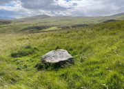
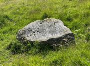
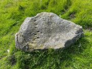
Snake Stone, Hawksworth, West Yorkshire

Cup-and-Ring Stone:  OS Grid Reference – SE 15078 43546

Getting Here

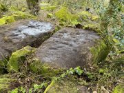
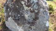
Snake Stone carving

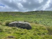
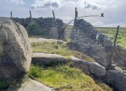
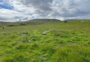
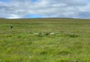
On the moorland road from Dick Hudson’s pub, head east along the Otley Road for more than 1½ miles, past the T-junction right-turn at Intake Gate (to Hawksworth) and just a quarter-mile further on park-up at the roadside (opposite Reva Reservoir). Walk (north) thru the gate into the field and after 300 yards through another gate into the next field.  From this gate, walk straight north to the Fraggle Rock cup-and-ring stone, then go down the slope NNW for nearly 50 yards and just above the old track you’ll see the edge of this stone peeking out!

Archaeology & History

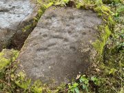
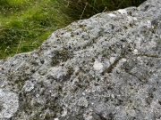
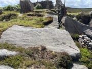
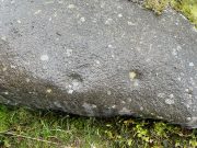
One of a number of previously unrecorded carvings in these fields, this is a pretty simplistic but unique design. The first thing you’ll notice is at the top-corner of the stone where, like many rocks on these moors, a nicely-worn cup stands out.  Erosion obviously…. or so it first seems. This cup-mark has another two by its side, along the top edge of the stone which, again, initially suggested them to be little more than natural.  But in rolling back the turf this assumption turns out to be wrong; for, along the west-side of the rock you’ll see a notable pecked groove running down to another cup-mark about twelve inches below, kinking slightly just before it reaches that cup. You can see this in the photo. Now, if we return to the prominent cup-mark at the top corner of the stone, in certain light there seems to be a very faint incomplete ring around it – but we can’t say for certain and it needs to be looked at again in better light.

Cups & line clearly visible
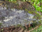
Main carved section

The name given to this carving (thanks to Collette Walsh) comes from the wavy lines that go into the middle of the stone from the long pecked line.  These wavy lines are natural, although one portion of them might have been artificially enhanced.  It’s difficult to tell one way or the other and we’ll have to wait for the computer boys to assess this particular ingredient.  Just above these “waves” is a single eroded cup-mark nearly 2-inch across.  And that’s that!

© Paul BennettThe Northern Antiquarian

Blarnaboard (3), Gartmore, Perthshire

Cup-and-Ring Stone:  OS Grid Reference – NS 51084 97979

Getting Here

Blarnaboard (3) carving

On the A81 road from Aberfoyle to Strathblane, about a mile south of Aberfoyle take the tiny right turn (keep your eyes peeled!) to Gartmore.  Along the tiny curving road for exactly 1km (0.61 miles), where the road has straightened out there’s a small dirt-track with a parking spot along it. A few hundred yards along there’s a crossroads of dirt-tracks: walk to your left (SW) for nearly a mile (or exactly 1.5km) keeping your eyes peeled for a small distinct footpath leading down-slope on your left. Walk along this undulating path for just over 200 yards till you go through the gate, then walk immediately to your right down the side of the fence in the field for about 20 yards.  Y’ can’t miss it!

Archaeology & History

Blarnaboard (3), NE-SW

Located on the land of the early bards of Gartmore, we could speculate that those early orators told tales of, and from this old stone—but that’s all it would be: dreamy speculation.  Instead, passing that aside, the petroglyph itself brings us a feast to drool over!

Made up of four distinct carved sections of almost interconnecting rock, this flat thin line of stone is covered with an impressive array of cups and multiple rings.  Running downhill in a northeast to southwest line, it would appear to have been written about for the first time by Lorna Main (1988) who subsequently described it in the usual archaeological shorthand, simply telling that,

“There are at last 28 cups, 3 cup and one ring, 4 cup and two rings, 2 cup and three rings, 1 cup and five rings and 1 cup and seven rings.”

Multiple ringed element
Section 1 overview

…But, as usual, there’s much more to be said of it than that.  Of the four sections, we’ll start at the uppermost northeastern section and work down the sloping ridge, looking at the respective symbols as we go.  Section 1 has the largest surface area, but isn’t the most decorated of the bunch.  Nonetheless, what we find here is impressive. About a dozen single cup-marks of various ages are scattered over the surface in what initially seems to be no recognizable order; these are accompanied by two single cup-and-rings: one of which could be said to be of standard size and form, whilst the other has a much larger and broken ring, near the middle of the rock, about 12 inches across.  This larger ring has two or three of the cup-marks incorporated into its outer edges.  The most impressive element of Section 1 is the large multiple-ringed design, five in all, radiating outwards or funneling inwards (depending on what was intended) around a central cup.  The outer ring of this is incomplete.

Impressive cup & 7 rings
Scatter of cups & rings

Section 2 is the most visually impressive of all the Blarnaboard (3) carvings: almost an evolutionary development of what we see on the first part.  A 2-dimensional panorama shows off a distinct cup-and-ring close to the edge of the soil, and there’s a somewhat wonky incomplete cup with double-ring below it.  A very clear cup-mark to the right of this has another faint incomplete double-ring round it—but this is hard to see. The same cannot be said of the cup with seven concentric rings surrounding it! (the outer two of these are incomplete)  As I walked round and round this section, drooling somewhat, it became obvious that a number of well-defined cup-marks had been carved around the outer edges of the rings, deliberately creating an eighth ring comprised purely of cup-marks.  It gave me the impression of it representing heavenly bodies revolving around the central Pole Star; but also of it defining the movement of the Moon through the heavens during a calendar year. (the astronomy of my youth still comes through at times!)

Section 3 carving
Faint double cup-and-ring

By comparison, the third and smallest section of Blarnaboard (3) almost pales into insignificance, possessing a mere cup-and-double-ring—and a  very faint one at that.  From a certain angle it looked like it possessed a third ring, but this was probably more to do with me wanting to see more than there is!  Just below this double-ring, a single cup has what might have once been another incomplete ring round it—but we’d need the computer graphic students among you to suss that bit out!  You can’t make it out on the photos here, sadly…

Section 4 carving
Faint double-arc, lower cup

The fourth section is the most visually unimpressive of the entire cluster and was probably carved much later than the rest.  The poor little fella has just five single cup-marks, with a sixth at the top-corner or northeastern part with what seems to be a small carved double-arc, or partial lozenge, that was started and never finished.

A couple of other exposed sections of stone running a few more yards further down the same line have no carvings on them—but there may well be more to this petroglyph hiding beneath the turf, which covers quite a large area.  I have no doubt that other unrecorded carvings exist in close by, but due to excessive forestry plantations all around here, they’ll either be covered over or will have been destroyed.  Don’t let this put you off looking for others though!

Cup-and-five-rings
Cup-and-seven rings

An interesting feature of this long line of stone is its potential alignment.  When we were photographing the site, a local man came over and got chatting with us.  He knew of the carving and had been here many times and told us that his wife had looked at this one and found it aligned with another cup-and-ring on the south-side of Blarnaboard farm and another one (officially unrecorded) even further along.  I checked this when I got home and found that this long line of petroglyphs did indeed line up with the Blarnaboard farm carving, perfectly.  Whether this was intentional and/or possesses an astronomical function, we might never know.  The third carving along the line has yet to be located.  I must emphasize however, that the relationship between earthfast petroglyphs and alignments is very rare and, where found, is little more than fortuitous.  But when we find cup-markings on alignments of standing stones and other prehistoric monuments, the relationship seems to be much more intentional and would have had a specific mythic function.

If y’ follow the fence-line from this carving down to the small burn, on the other side is the much less impressive Blarnaboard (2) cup-marked stone.

Folklore

Prior to Lorna Main’s (1988) short note on this petroglyph, local people had long known about the carving.  As late as the 20th century, people with fevers were brought to this stone in the early morning to be cured of the illness.  The idea was that medicinal herbs were collected and placed in some of the cup-marks, which were used like a mortar and pestle to prepare the plants.  This healing magick, spoken of by some of the old folk in Aberfoyle, was known to them as children, who’d been told of this by their elders and, of course, by the elders before them.

There is also a tradition that some of the stone that makes up the curious moondial (not sundial) that can be seen at the back of the church in Gartmore village nearly a mile to the southeast, originally came from here.

References:

  1. Main, L., “Blarnaboard (Aberfoyle parish), Cup and Ring Marked Outcrop,” in Discovery & Excavation Scotland, 1988.

Acknowledgements:  Huge thanks for use of the Ordnance Survey map in this site profile, reproduced with the kind permission of the National Library of Scotland

© Paul BennettThe Northern Antiquarian

Blarnaboard (2), Gartmore, Perthshire

Cup-Marked Stone:  OS Grid Reference – NS 50977 97972

Getting Here

Blarnaboard (2) site

Anyone who’s going to visit this carving will be doing so as a result of visiting the impressive Blarnaboard (3) cup-and-ring stone, 115 yards (105m) away.  From Blarnaboard (3), walk down the slope on your right (west), cross the tiny burn and go round to the other side of the small rocky hawthorn-topped hillock just a few yards in front of you.  Fumble about and you’ll find what you’re looking for!

Archaeology & History

It’s possible that there’s more to this carving than meets the eye.  On the west-side of this small rocky rise, along a thin elongated raised section in the stone, a gently meandering line of nine deep cups runs roughly northeast to southwest.  You can’t really miss them as they average some 2 inches across and 1 inch deep, strongly suggesting that they were cut and reworked over and over for a long period of time.

Line of cups, from above
Rough NE-SW alignment

It was first described in distinct brevity by L. Main (1988) who told that, “over a length of 60cm on a north-east facing outcrop are 9 cup marks.”  And, whilst all of the cups are clearly visible, one of them at the edge of the stone has been cut or worked into a natural curved hollow.  You’ll see what I mean when you visit the site (it’s pretty clear in the photos).

Beneath the roots and soil there may well be other cup-markings that are still hiding away on this rocky dome.  I have no doubt that other unrecorded carvings exist in this area, but due to the excessive forestry plantations all around here, they will be covered over or have been destroyed.

References:

  1. Main, L., “Blarnaboard (Drymen parish), Cup Marked Rock,” in Discovery & Excavation Scotland, 1988.

© Paul BennettThe Northern Antiquarian

West Cowden Farm, Comrie, Perthshire

Cup-Marked Stone:  OS Grid Reference – NN 77451 20648

Getting Here

Cowden Farm cup-marks

From Comrie take the B827 road (towards Braco) out of town and where the fields open up on both sides of you, 400 yards along the straight road you’ll see a large bulky stone right by the roadside (it’s the standing stone known as the Roman Stone). Stop here and look on the ground just a couple of yards past the monolith where, amidst the grasses and mosses, you’ll see this small smooth stone (you might have to roll some of the mosses back to see it properly).

Archaeology & History

More than a hundred years ago when John MacPherson (1896) wrote his essay on the history of this area, he described there being “three large stones, supposed to be the remains of a Druidical temple.”  He was talking about the Roman Stone here, with its two companions—although only the Roman Stone remains upright today. He noted that one of them, on the ground was “a round, flat boulder” which “bears upon its surface cup-marks arranged in irregular concentric circles.”

This seems to have been the first mention of the carving.  Fifteen years later when the great Fred Coles (1911) looked at the same standing stones, he found the adjacent petroglyph to still be in situ, stating that,

“The surface is covered with a group of twenty-two neatly made cups … the majority being about 2 inches in diameter, with a few much smaller. Two cups measure only 1 inch in diameter.”

R.M. Pullar’s 1914 photo
Fred Coles’ 1911 sketch

A few years after this, members of the Perthshire Natural History Society on an excursion to Glen Artney in May 1914, stopped here to have a look at the same standing stones and they also pointed out that one of the stones “lying on the ground…is remarkable for the numerous cup-marks on its surface.”  In truth, it’s not that remarkable compared to some of the other carvings, but it’s still worth checking out when visiting the other sites in the area. Many of the cups that were visible a hundred years back are difficult to make out unless the light is good; and it seems as if some of them have been chipped away, perhaps due to farming activity.

References:

  1. Barclay, W., “Winter Session, 1914-1915,” in Transactions & Proceedings Perthshire Society Natural Science, volume 6, 1919.
  2. Coles, Fred, “Report on Stone Circles in Perthshire, Principally Strathearn,” in Proceedings Society Antiquaries, Scotland, volume 45, 1911.
  3. Hunter, John, Chronicles of Strathearn, David Philips: Crieff 1896.
  4. Mac Pherson, John, “At the Head of Strathearn,” in Hunter’s Chronicles of Strathearn (David Philips: Crieff 1896).

© Paul BennettThe Northern Antiquarian

West Lamberkine (2), Aberdalgie, Perth, Perthshire

Cup-and-Ring Stone (lost):  OS Grid Reference – NO 0654 2296

Archaeology & History

All trace of this carving seems to have gone.  It was first recorded by the great Fred Coles (1903) who found it within a small group of stones, but no one has seen it since.  Unless it’s been shifted into one of the nearby walls, it may have been destroyed.  Coles told us it could be found,

Cole’s 1903 sketch of the carving
Stone ‘A’ is the culprit

“at a point 333 yards east of the farm-steadings, where two hedges meet at right angles.  Four stones…lie close together.  They appear to be all of bastard whinstone.  The middle stone, B, has its longer axis ESE and WNW.  It is only 3in inches thick.  The stones D and C are each 6 inches thick.  No marks are to be seen on any of these.  But on A is the very distinct sculpturing shown in the illustration…unfortunately not complete, owing to the flaking off of large strips of the weathered lower portion of the slab.  There is a strong suggestion of a cist-cover in the shape and size of this stone, which the close proximity of the two other squarer and thinner stones helps to enforce. Though these  stones have been known to the tenant for over thirty years, this is, I believe, the first record made of their position and features.”

The records at Canmore have suggested that this lost carving and the missing petroglyph of West Lamberkine (1) nearby are one and the same.  This is unlikely.  West Lamberkine (1) was described simply as a cup-marked stone, whereas this stone possessed clear identifiable cups and rings.  It would be difficult to make such an elementary mistake.

References:

  1. Coles, Fred,  “Notices of…Some Hitherto Undescribed Cup-and-ring-marked Stones…” in Proceedings Society Antiquaries Scotland, volume 37, 1903.

© Paul BennettThe Northern Antiquarian

St. Helen’s Well, Gosforth, Cumbria

Holy Well (lost):  OS Grid Reference – NY 0562 0303

Archaeology & History

Described as being “lost” in John Musther’s (2015) relatively recent survey, very little has been written about this site but, by the look of things, it may still exist—albeit in a boggy state of affairs!  It was mentioned in Parker’s (1926) classic history book of the area:

“Near to Newton is a very plentiful spring which is known to have been moved further from the house than it was.  Adam de Newton, son of Richard, mentions in one of his grants, “St. Helen’s Well, which is at the corner of my garden, the outfall going into Grucokesgile beck.”

Possible site of the Well

Parker found it to have been described in a local property charter in St Bee’s Register (Wilson 1915) as far back as 1220 CE.  On the earliest OS-map of the area, a “Spring” is shown just above Newton, which may mark the very spot!  Not far from the holy well was also a cross-marked stone called the Grey Stone (grey stones are usually boundary stones, but can also be standing stones—of which there were a lot in this neck o’ the woods).

Folklore

St. Helen’s Day was celebrated on August 18, but there seem to be no accounts of traditional customs recorded here.

References:

  1. Harte, Jeremy, English Holy Wells – volume 2, Heart of Albion press: Wymeswold 2008.
  2. Musther, John, Springs of Living Waters, privately printed: Keswick 2015.
  3. Page, Jim Taylor, Cumbrian Holy Wells, North West Catholic History Society: Ormskirk 1990.
  4. Parker, C.A. The Gosforth District: Its Antiquities and Places of Interest, Thomas Wilson: Kendal 1926.
  5. Wilson, James, The Register of the Priory of St. Bees, Surtees Society: Durham & London 1915.

© Paul BennettThe Northern Antiquarian

Cat Nab, Brotton, North Yorkshire

Tumulus (destroyed):  OS Grid Reference – NZ 6692 2154

Archaeology & History

Location on 1930 OS-map

This long lost burial mound was first located by the local antiquarian William Hornsby in the early 20th century.  It had been constructed close to the summit of the prominent rise  of Cat Nab, immediately east above Saltburn.  Its position was shown on the 1930 OS-map of the area.  Destroyed by quarrying, it was thankfully excavated by Hornsby in 1913; and although his finds were never published, he left notes which told us that,

“there were two cremations and the sherds of at least three vessels: a collared urn, a pygmy cup and a vessel with an everted rim.” (Crawford 1980)

Crawford (1980) told that these finds could been seen in the Middlesborough Collection.

References:

  1. Crawford, G.M., Bronze Age Burial Mounds in Cleveland, Cleveland County Council 1980.

Acknowledgements:  Huge thanks for use of the Ordnance Survey map in this site profile, reproduced with the kind permission of the National Library of Scotland

© Paul BennettThe Northern Antiquarian


St. Patrick’s Well, Old Kilpatrick, Dumbartonshire

Holy Well (destroyed):  OS Grid Reference – NS 4631 7307

Also Known as:

  1. Trees’ Well

Archaeology & History

Photo of the Well in 1893

Sadly there are no longer any remains of this holy well which was found, “beside the church dedicated to St Patrick — which was said to be built on soil brought from Ireland in honor of its patron,” wrote John Bruce in 1893.  He told that its waters had “been used until lately from time immemorial by the villagers, but now has been found unfit for use and consequently ordered to be closed up.”  Although its waters were used for baptisms, he made no mention of any medicinal repute, which it surely would have possessed.

Site of well on 1939 map

The original position of the well, according to Mr Bruce, was “adjoining the church” but, according to the Ordnance Survey lads, when they came here in 1963 they located a drinking fountain on the other side of the road about 80 yards to the west and designated that as being St Patrick’s Well.  The place had earlier been given a wooden sign saying “St Partrick’s Well.”  Local tradition attributes St. Patrick as originally coming from this village, whose saint’s day is March 17.

The place was also known as Trees’ Well, suggestive, perhaps, of a local person, although I can find no reference as to who or what that might have been.

References:

  1. Bruce, John, The History of the Parish of West or Old Kilpatrick,  John Smith: Glasgow 1893.

Acknowledgements:  Huge thanks for use of the Ordnance Survey map in this site profile, reproduced with the kind permission of the National Library of Scotland

© Paul BennettThe Northern Antiquarian

Holy Well, Allerton, Bradford, West Yorkshire

Holy Well (lost):  OS Grid Reference – SE 134 331 (approximation)

Archaeology & History

This site is both interesting and frustrating at the same time.  Interesting inasmuch that as early as 1258 CE, “the Knights Hospitallers of St. John of Jerusalem in England, had in Allerton a manor called the manor of Crosley.”  The Hospitallers, as some will know, were the immediate successors of the more famous Knights Templars.  As their name suggests, their patron saint was St John, whose festival date was summer solstice and had his name given to many holy wells.  But this one has left us with no name and its location has long since been lost.  In J.H. Bell’s (1888) essay on the early medical history of the area he told that local people with certain afflictions, “were wont to resort to them to drink their waters for their supposed medicinal virtues: there was one between Cemetery Bridge and Crossley Hall”.  But he doesn’t give its exact position.  In John James’ (1841) classic History of Bradford he thinks that near the place where the local stream known as the Hebble, “there was undoubtedly in former times a Holy well,” but is unable to cite a location.  No well is shown on the early maps between the old Hall and the cemetery and the only definitive reference to wells close by are in the early boundary perambulation record, which describe a Brock Well and a Cold Well.  Perhaps the the most probable contender and location is cited in Harry Speight’s (aka Johnnie Gray) Pleasant Walks (1890) where, taking a route between Great Horton and Allerton, he told us to,

“go through fields on to Necropolis Road, opposite Scholemoor cemetery, turn down lane left outside cemetery, ½ mile, descending steps, cross beck (here used to be the Spa Beck public gardens, now removed higher up) and ascend, at second field, leaving the forward path and turn left, following beck with Crosley Hall and trees to right.”

The location of the said Spa Beck gardens is very close to where Mr Bell described the medicinal spring and is/was the most likely position of what James (1841) thought to be a long lost holy well.  If we could get more information about the history of the Spa Well, we may be able to make more definitive statements about the place.

References:

  1. Bell, J.H., “Some Fragments of Local Medical History,” in Bradford Antiquary, volume 1, 1888.
  2. Gray, Johnnie, Where to Spend a Half-Holiday: One Hundred and Eighty Pleasant Walks around Bradford, Thomas Brear: Bradford 1890.
  3. James, John, History and Topography of Bradford, Charles Stanfield: Bradford 1841.
  4. Shepherd, Val, Historic Wells in and Around Bradford, HOAP: Wymeswold 1994.

© Paul BennettThe Northern Antiquarian

Brass Castle (1), West Morton, West Yorkshire

Cup-and-Ring Stone:  OS Grid Reference – SE 08119 44111

Also Known as:

  1. Carving no. 40 (Hedges)
  2. Carving no. 81 (Boughey & Vickerman)

Getting Here

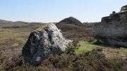
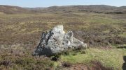
Brass Castle (1) Cup&Ring

From East Morton, head up the winding Street Lane for just over a mile until, on your right-hand side, you hit the long straight Roman Road, or Ilkley Road as it’s known.  Literally 690 yards (0.63km) up, on your left a footpath is signposted.  Take the path alongside the wall, through the first gate (note the pile of stones at this gate, which are the remains of the destroyed Bradup stone circle) then keeping on for ⅓-mile till you reach another gate, then 200 yards to the next one where you reach the moorland proper.  From here you need to walk through the heather, just over 300 yards southwest where you’ll reach this large rock. Y’ can’t miss it!

Archaeology & History

Looking down at the CnR

Considering the size of this stone, visitors might expect there to be more on it than there actually is; although a large section of it has been quarried off and there might have been more to it in earlier times.  A basic cup-and-ring with one or two single cup-marks elsewhere on its surface, the carving was first described by Stuart Feather (1964) following one of his many rambles hereby, when he was checking out the Rivock carvings a short distance to the west (calling it the Rivock 18 stone).  He wrote:

S. Feather’s 1964 sketch

“On the eastern edge of the Rivock plateau, about half-a-mile west of the stone circle at Bradup Bridge, is a cup-and-ring marked rock of a pronounced triangular shape.  This at present measures 10ft by 8ft and is 3ft high at its western side… At some time in the past it has been quarried, probably to build part of the adjacent gritstone walls.  The 8ft side of the rock has quite distinct drill marks visible…

Close-up of the CnR

The rock has…on its sloping surface a very fine cup-and-ring mark, the ring 6in in diameter around a cup 2in deep, all finely executed and well preserved.  Running south from this cup-and-ring mark is a level area 3ft long and 5in wide, which ends alongside the ring at one end and at the quarried edge of the rock at the other.  This is probably the former position of a fossil which has weathered out and its alignment onto the cup-and-ring may be due to the carving having been deliberately sited in juxtaposition to this very distinct natural feature.  Only one other 2in deep cup remains on the surviving original portion of the rock; others may have been quarried away.”

References:

  1. Boughey, Keith & Vickerman, E.A., Prehistoric Rock Art of the West Riding, WYAS: Wakefield 2003.
  2. Feather, Stuart, “Mid-Wharfedale Cup-and-Ring Markings – no.18, Rivock”,  in Bradford Cartwright Hall Archaeology Bulletin, 9:2, 1964.
  3. Hedges, John (ed.), The Carved Rocks on Rombalds Moor, WYMCC: Wakefield 1986.

© Paul BennettThe Northern Antiquarian