Skelpick Long, Strath Naver, Sutherland

Chambered Cairn: OS Grid Reference – NC 72245 56745

Also Known as:

  1. Canmore ID 6276
  2. Long Skelpick
  3. Skelpick Burn

Getting Here

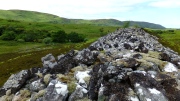
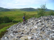
The huge cairn, looking east

The huge cairn, looking east

From the delightful village of Bettyhill, take the A836 road west. A mile out, just as the tiny road bridge crosses the sea-river, take the tiny road on your left. Go past the roadside lochan until you reach the first Skelpick house several miles down. Walk across the fields on your left (east) until you reach the wobbly wooden tidgy-widgy-bridgey that crosses the Skelpick Burn. Across on the other side – you can’t miss it!

Archaeology & History

The overgrown northern face

The overgrown northern face

As you wander down the poetic geoscapes of Strathnaver, meandering back and forth along the tributaries and Her tiny primal forest remains, on the edges of Her marshes, rivulets and rocky moorlands, tomb after tomb raise themselves to the eyes and feet of the wanderer.  They’re everywhere it seems!  But this one, above all others, hits the eyesight with an unexpected magnitude.  This is a giant–one helluva giant!–and typical of the structure and status of many of the immense prehistoric chambered tombs in this remote northern region of our entrancing heathen isles.

Rising out of the moorland heather to a height of sixteen feet in parts, tens of thousands of rocks make up this elongated artificial ridge, running like a spine NNW-SSE down the direction of the glen, pointing to the lowest dip in the distant southern horizon several miles away.  And although overgrown when we visited the site, at each extremity the elongated cairn has curious stretches of stones projecting out of its sides, like a pair of horns at each end.  Weird!

The long cairn, heading south

The long cairn, heading south

The giant cairn, heading north

The giant cairn, heading north

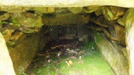
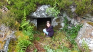
Once you get on top of the cairn, its northern end is the most impressive section. Wider than the rest of the monument, this is where, some ten feet below the top of the rock-pile, a large internal opening was covered over, hiding an impressive chamber (two birch trees mark the spot).  This is in incredibly good condition when you remember that you are looking at something that was built in the neolithic period some 6000 years ago!

Spider guards chamber of bones

Spider guards chamber of bones

Little Lara at the entrance

Little Lara at the entrance

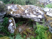
On my first visit, I sat inside the shelter of the chamber for around an hour, either inside the main ‘tomb’ section, or beneath a huge intact covering stone 12 feet outside the entrance (hiding from both rain and midges) that stretches from one side of the cairn to the other; noting, on its underside, two cup-marks: one is definitely crustacean in nature, whilst the other may be man-made (though we cannot discount it too having a crustacean origin). But we can safely say that this long stone was dragged some considerable distance from the coast to its present position and positioned into this giant cairn.  This covering stone rests precariously on a collection of many small well-placed rocks, themselves held up on two rigid solid standing stones, deeply embedded god-knows-how-deep in the solid Earth. They stand about 3 feet high in their present position above the ground.

Central stone in chamber

Central stone in chamber

Gordon gives idea of its size

Gordon gives idea of its size

The well-preserved ‘tomb’ section at the northern end of the cairn was opened sometime in the middle of the 19th century by James Horsburgh (1870)—although its description as a ‘tomb’ could be questionable here, as no funerary remains have ever been found inside it.  Horsburgh described the site as a,

“long cairn, 80 or 90 yards in length, which I opened and came upon a polygonal-shaped chamber, 11 feet in diameter, the sides consisting of large stones 6 feet high, one of them 7 feet by 4 and 1½ feet thick, placed at a distance from each other of 3 or 4 feet, the intervals being built up with long square stones.  The roof had been formed with very large flags overlaying each other.  The chamber had been opened from the top and the whole inside was filled with stones and rubbish, so that I only cleared it out.  Before I commenced operations, however, there was no appearance of it having been meddled with, and I dug it by chance where the cairn appeared to be highest.  Nothing whatever was found in it.”

This lack of funerary remains may simply be due to the collapse of stones destroying any evidences at the time Horsburgh dug into the cairn—or it may have had other functions instead.  Shortly after Horburgh’s analysis, John Stuart (1870) came to visit the site in his grand tour of the megaliths of the region, telling that,

“on the waterside is a long cairn with a chamber at its north end, of about 12 feet across, formed of six slabs, with the space between them carefully filled up with masonry.  Some of the slabs are of great size.  A passage leading to another chamber is blocked up.  The walls of the chamber begin to converge at a height of 6 feet, and were probably covered by flags.”

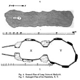
Stuart's 1874 ground plan

Stuart’s 1874 ground plan

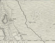
Skelpick Long on 1878 map

Long Skelpick on 1878 map

Highlighted on the first Ordnance Survey map in 1878, it was Mr Stuart (1874) who gave us our earliest ground-plan of Long Skelpick, as illustrated here.  But since then the site has been described by a number of antiquarians and archaeologists.  However, the most detailed account is given in the legendary Audrey Henshall’s (1995) updated site profile.  I make no apologies for reproducing her lengthy account of this cairn almost in its entirety, as it is an astonishing megalithic monument.  She wrote:

“…The cairn is 72m long overall, including the horns which define a forecourt at each end… The cairn is about 20m wide across the chamber, narrowing to 14m wide at a little south of centre, and expanding slightly to about 16m wide at the south end.  At the north end the forecourt is difficult to define, though the ends of the horn are clear.  Between them there is loose rubble which rises steeply to merge with the cairn material covering the passage, and which northwards merges into the downward slope of the ground.  The passage entrance is hidden beneath this stony material; presumably there is deliberate blocking immediately in front of the entrance…but this has been covered by cairn material removed from the chamber area when it was investigated. The forecourt is about 13.5m wide by about 7m deep.  The chamber is exposed in a deep hollow in the cairn, but south of it the cairn remains to a height of 3.4m (measured from the chamber floor), and from here to near the south end it continues as a ridge of bare irregular stones.  Except for a few superficial hollows, it appears to be undisturbed, neither robbed nor substantially distorted, and it retains the steep pitch of its long sides.  The cairn gradually diminishes in height southwards to about 2.8m high at about 12m north of the south forecourt.  At this point there is a transverse hollow across the cairn 2.7m wide and about 0.7m deep, which may be an original feature (though in this area a relatively recent deep hollow has been made into the cairn from the east side reaching almost to the median line).  The cairn has clearly been robbed from the south end to within 1.7m of the transverse hollow, presumably to build the square enclosure just to the south.  The southeast horn is clear and the southwest horn can just be traced though it has probably been truncated.  Between them, the edge of the forecourt is rather vague except for two laid slabs near the centre which appears to be part of an edging wall-face.  The south forecourt has been about 10m wide and probably about 3.5m deep.  The west edge of the cairn is clear though overgrown with heather, except for 20m at the north end where it is overlaid with bare stones evidently thrown down when the chamber was opened, and north of this the cairn merges into the natural slope.  All along the east side the cairn merges with the slope of the ridge and has deep heather growing almost to the crest, so that the cairn edge is difficult to trace.

“The axis of the passage and chamber is nearly NNW to SSE, skew by about 13° by the axis of the cairn.  The entrance can only be seen from the roofed passage.  A pair of transverse stones set 0.56m apart forms the portal at the outer end of the passage. They are over 0.7m and 0.4m long, 0.25m and 0.18m thick, and 0.7m and 0.65m high.  The original blocking, a neat stack of six horizontal slabs reaching to within 0.2m of the roof, is in place between them, with the south edges of the stones flush with the south faces of the portal stones.  To the north of the slabs there can just be seen loose stones, smaller than those of the cairn material.

“The passage os 1.8m long and 1.15m wide at the outer end increasing to 1.3m wide at the inner end.  A slab forms most of each wall.  The slabs are 1.36m and 1.31m long by 0.5m and 0.45m high with two or three courses of walling above them, though this is displaced inwards and in a precarious state.  Walling fills the short gaps at the ends of the stones, though missing from the NE corner.  At the inner end of the passage a pair of portal stones forms the entry into the ante-chamber.  They are 0.94m and 0.78m long by 0.26m and 0.44m thick, and 0.86m and 0.77m high, set 0.8m apart.  At the outer end of the passage a lintel rests on the east portal stone and passes a little above the west portal stone, and the north edge of the lintel projects a little north of their outer faces.  The lintel is 0.8m wide by 0.3m thick, 0.7m above the floor, tilted slightly down to the south.  The next tow lintels rise in inverted steps, each overlapping the upper surface of that to the north with the third lintel 1m above floor level.  The fourth lintel is missing and a gap of 0.5m is spanned by rubble; it is likely that a substantial stone at the top of each side wall is an end portion of this lintel, the centre part of which has broken away.  The innermost lintel is lower, 0.86m above the floor, resting directly on the east portal stone and on a corbel stone over the shorter west portal stone at the chamber entrance.  The lintel is over 2m long, 0.65m wide and 0.75m thick in the centre, and the face to the chamber is triangular.

“The chamber walls are constructed of spaced orthostats linked by panels of walling.  All the orthostats are intact.  The walling is of quite large quarried rectangular slabs, in general 0.07m to 0.02m thick, and where well-preserved can be seen to have been carefully built.  At a height of about 0.7m the walling changes to courses of large corbel stones, often 0.23m to 0.4m thick, up to 0.9m wide, and 1m or so long.  They are laid with their long axes running back into the cairn and their inner ends generally slightly oversailing; their appearance is rougher and heavier than the walling below.  There is a considerable amount of displaced stone on the chamber floor, but all vertical measurements are taken from approximately floor level.

“The ante-chamber is about 2.5m long by 2.5m wide at the south end.  The east wall consists of an orthostat 1.3m long by 0.36m thick, and 1.1m high, with a horizontal upper surface.  The spaces between it and the outer and inner east portal stones of the chamber are filled with walling about 1.15m high, and above this and the orthostat are two courses of corbel stones giving a total height of 1.7m with a considerable overhang, at the southeast corner as much as 0.5m though possibly there has been some displacement.  Only a short length at the south end of the west wall is visible.  An orthostat set close to the west outer portal stone was visible in the 19th century…but this is hidden by rubble.

“The entrance between the ante-chamber and main chamber has been spacious, 1.06m wide and probably about 1.4m high.  The portal stones are 0.85m and over 1.06m long, 0.42m and 0.25m to 0.4m wide, and 1.1m and 0.9m high, and their upper edges slope down into the cairn.  The lintel above them is somewhat displaced with its wider face tilted down from south to north.  Its east end rests on a corbel stone supported by displaced walling to the southeast of the portal stone, and its west end rests on displaced walling on the shoulder of the west portal stone and on the panel of walling to the southwest.  The lintel is about 3m long by 1m wide and 0.35m thick.

“The main chamber is 3.5m long by about 3.25m wide.  There are five orthostats in the wall.  That on the axis has a horizontal upper surface and the others are rounded and rather irregular in shape.  From the northeast, clockwise, they are 0.7m, 0.77m and 0.84m (at maximum 1.14m), over 1.3m and 0.86m long and, as far as can be seen, they vary from 0.1m to 0.4m thick.  They are all of similar height, between 1 and 1.22m; the tallest is the northwest orthostat.  Most of the linking walling remains.  Between the east portal stone and the east orthostat only the upper courses are visible; between the east and southeast orthostats there are six neat courses of walling and above them three courses of corbel stones oversailing by 0.3m at a height of 1.7m (though the lowest courses of walling at the north end have been pulled away and the upper part of the wall is in danger of collapse).  The walling between the southeast and the south orthostats has fallen away, but was intact in 1955… Between the south and southwest orthostats walling remains almost level with their tops and butts against the face of the latter, the south end of which is hidden.  The last two panels of walling on the west side of the chamber survive to half the height of the adjacent orthostats.

“Part of the chamber was evidently visible in 1800 (Cardonnel …) and subsequently it must have been filled in.  Horsburgh investigated the main chamber in 1866… His descriptions and measurements are fairly accurate except that he gave the height of the orthostats as 6ft and one as 7ft (1.8m and 2.1m); this seems to be an exaggeration as the present floor level, also extending down the passage, appears to be at approximately at the original level.  He estimated that the roof height of the main chamber had been 10ft (3m)…

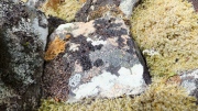
Old lichen upon the cairn-stones

Old lichen upon the cairn-stones

Of mosses and lichens hereon...

Of mosses and lichens hereon…

Much of the length of the cairn is very overgrown in a living repertoire of medicinal mosses and lichens which, of themselves, are centuries old in places.  Their profusion is a great indicator, not only of the cleanliness of the air betrayed in the cities of homo-profanus, but also a telling sign that visitors to this distant realm are few and far between.  Tis a beautiful site in a spectacular ancient arena…

…to be continued…

Folklore

There is great superstition amongst some locals even today that this immense cairn should not be tampered with and it is said to be haunted.

References:

  1. Gourley, Robert, Sutherland: An Archaeological Guide, Birlinn: Edinburgh 1996.
  2. Henshall, Audrey S., The Chambered Tombs of Scotland – volume 1, Edinburgh University Press 1963.
  3. Henshall, Audrey S., “The Distant Past,” in The Sutherland Book (edited by Donald Omand), Northern Times: Golspie 1991.
  4. Henshall, Audrey S., The Chambered Cairns of Sutherland, Edinburgh University Press 1995.
  5. Horsburgh, James, Notes of Cromlechs, Duns, Hut-circles, Chambered Cairns and other Remains, in the County of Sutherland“, in Proceedings Society of Antiquaries, Scotland, volume 7, 1870
  6. Lelong, Olivia C., “Writing People into the Landscape: Approaches to the Archaeology of Badenoch and Strathnaver,” University of Glasgow 2002.
  7. Mackie, Euan W., Scotland: An Archaeological Guide, Faber: London 1975.
  8. o’ Reilly, Kevin & Crockford, Ashley, What to See Around Bettyhill, privately printed 2009.
  9. Royal Commission on Ancient & Historical Monuments, Scotland, Second report and inventory of monuments and constructions in the county of Sutherland. HMSO: Edinburgh 1911.
  10. Stuart, John, “Report to the Committee of the Society of Antiquaries of Scotland, Appointed to Arrange for the Application of a Fund Left by the Late Mr A. Henry Rhind, for Excavating Early Remains,” in Proceedings Society of Antiquaries, Scotland, volume 7, 1870
  11. Stuart, John, “Notice of Excavations in Cairns in Strathnaver, Sutherlandshire,” in Proceedings Society of Antiquaries, Scotland, volume 10, 1874.

Acknowledgements:  Huge thanks to the beautiful Aisha Domleo for not only getting me up here, but also for the use of photos in this site profile.

© Paul BennettThe Northern Antiquarian

Achadh Thaibstil, Bettyhill, Farr, Sutherland

Chambered Cairn:  OS Grid Reference – NC 7398 5899

Also Known as:

  1. Canmore ID 6228
  2. Clachan Burn

Getting Here

Achadh Thaibstil cairn12

Achadh Thaibstil cairn, looking W

Along the A836 road a mile east of Bettyhill, a track goes south onto the moors just before Loch Salachaidh. Walk along here for several miles, past the windmills, past a small quarry on your left, and a hundred yards or so along, to the right of the track, you’ll notice a rounded hillock covered in stones and rock on the top (aswell as bracken in the summer and autumn).  That’s the spot!

Archaeology & History

Achadh Thaibstil cairn

Achadh Thaibstil cairn

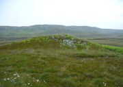
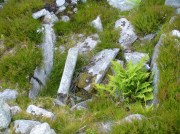
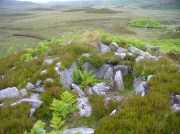
This little-known cairn, close to the prehistoric hut circles on the other side of the track, is a medium-sized Neolithic or Bronze Age monument.  Not included in Audrey Henshall’s (1995) survey of the region, the tomb was built upon a small natural rise with the usual thousands of small and medium-sized stones rising up 4-5 feet high.   Near its crown we find an exposed chamber, typical of chambered tombs, measuring more than a yard across and two yards long, with flat slabs defining its sides.  It appears that the inner ‘chamber’ may have been split into two sections, as an oblong slab of stone runs parallel down the central ‘chamber’ a third of the way across.  The Canmore account simply tells how the cairn is on low knoll and

“measures about 10.5m in diameter and 1.0m high. It has been opened and a centrally placed slab lined cist revealed, the southern side of which is missing. The cist measures 1.4m east-west, with the east and west slabs 1.2m long and 0.6m high.”

Looking down into the chamber

Looking down into the chamber

From the chamber, looking N

From the chamber, looking N

On the horizon to the far north, the peak of the giant tomb known as Fiscary 2 rises up, indicating the cardinal direction.  This may have had geomantic significance, as ‘north’ signifies Death and darkness: the symbolic point where light never emerges; the point linked to the North Star, Alpha Draconis in the neolithic era, or Polaris in our present Age: the point to and from which shamans travel into the Land of the Gods.  These elements may or may not have been relevant here.

References:

  1. Henshall, Audrey S. & Ritchie, J.N.G., The Chambered Cairns of Sutherland, Edinburgh University Press 2005.

© Paul BennettThe Northern Antiquarian 


The Binn (01), Burntisland, Fife

Cup-and-Ring Stone:  OS Grid Reference – NT 22741 86948

Also Known as:

  1. Binn House
  2. Canmore ID 269301
  3. Craigkelly 
  4. Silverbarton Farm

Getting Here

The Binn1-2

Penny pointing the way

From Burntisland, go up the Cowdenbeath road for just over half-a-mile, then turn right and walk into the woods up the footpath.  Go uphill, over the first stile until you reach the field less than 200 yards above.  Follow the line of the trees, right, along the edge of the field for about 100 yards, then walk uphill into the trees again until you reach a small rocky outcrop.  That’s the spot!

Archaeology & History

Rediscovered in the summer of 2003, this is one in a small cluster of little-known petroglyphs on the western slopes of the hill known as The Binn.  Found less than a yard away from another carving, this ornate-looking fella consists of a wide cup-mark with three very well-defined concentric rings around it.  A carved line runs out from the central cup, down the gentle slope of the rock and out of the rings entirely; whilst 60° left of this line, a second one runs from the central cup to the inner edge of the third concentric ring. To the left of the 3-rings is another concentric system, with one clear ring around a faint shallow inner-cup and what seems to be a faint outer secondary ring.  A possible third isolated cup-mark is to the top-left of the multiple rings.

The carving under the overhang

The carving under the overhang

Close-up of the multiple rings

Close-up of the multiple rings

This is one of two carvings that are right next to each other and it is curious inasmuch as the erosion on it seems negligible.  This may be due to the overhanging rock which shelters it considerably from normal weathering processes.  Indeed, if the carving was uncovered from beneath a covering layer soil, the lack of erosion on it makes complete sense.  However, I have to say that I was slightly skeptical about assigning any great age to this particular design—and until we get an assessment from a reputable geologist we should perhaps be cautious about giving it a definite prehistoric provenance.  It’s still very much worth seeing though.  The carving on the adjacent rock however, is a different kettle o’ fish altogether!

Acknowledgements:  Huge thanks to Penny Sinclair for guiding us to this little-known site. Cheers Pen. 🙂

© Paul BennettThe Northern Antiquarian


Kilry, Glen Isla, Angus

Standing Stone: OS Reference – NO 2432 5449

Also Known as:

  1. Canmore ID 31093

Getting Here

Take the B954 north from Alyth, and turn left onto the unclassified road at Craigisla House, turning right at Dykehead, then take the right fork at Faulds. Park up by the school about ¼ mile further on, and the stone is in a wooded glade on the opposite side of the road along a track to the left of ‘Standing Stone’ cottage.

Archaeology and History

Quoted in the Canmore database, A.J. Warden, writing in 1882, described the stone:

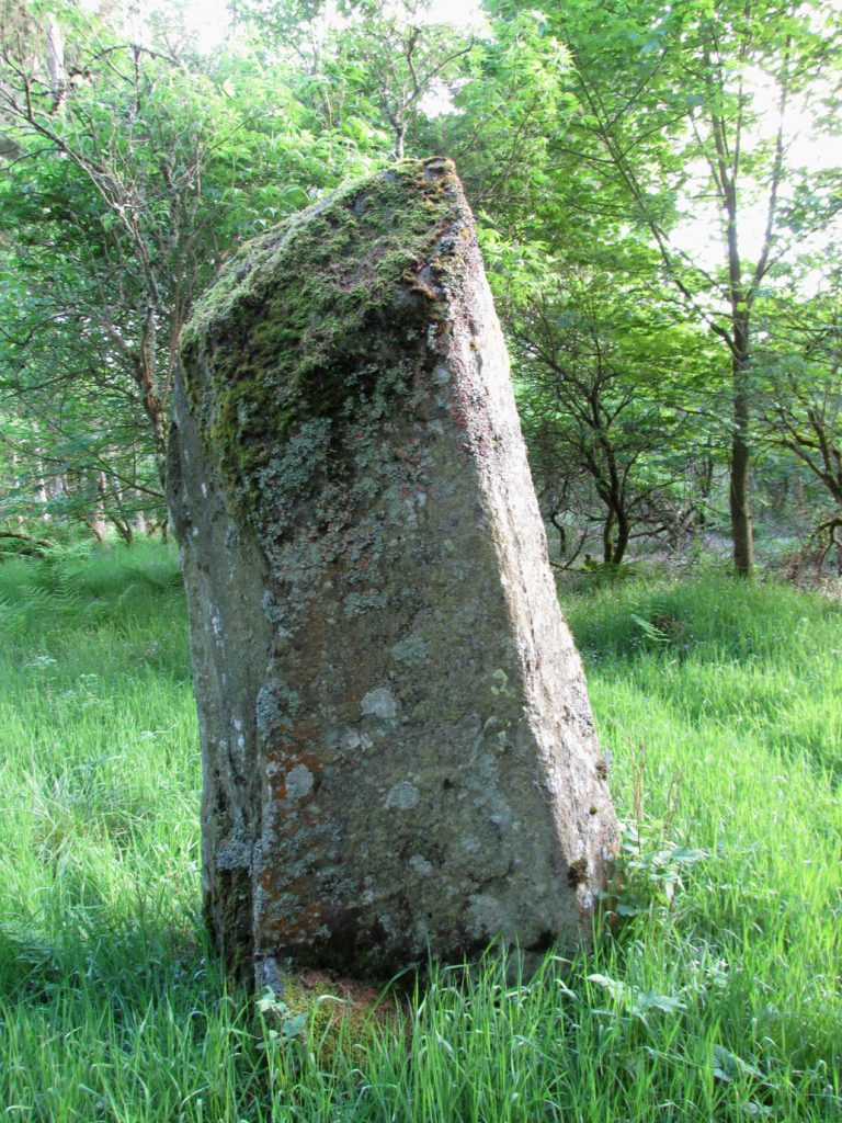
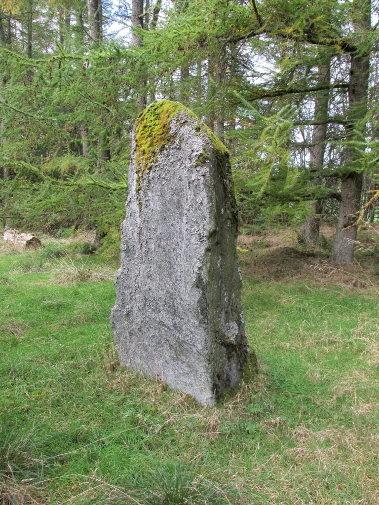
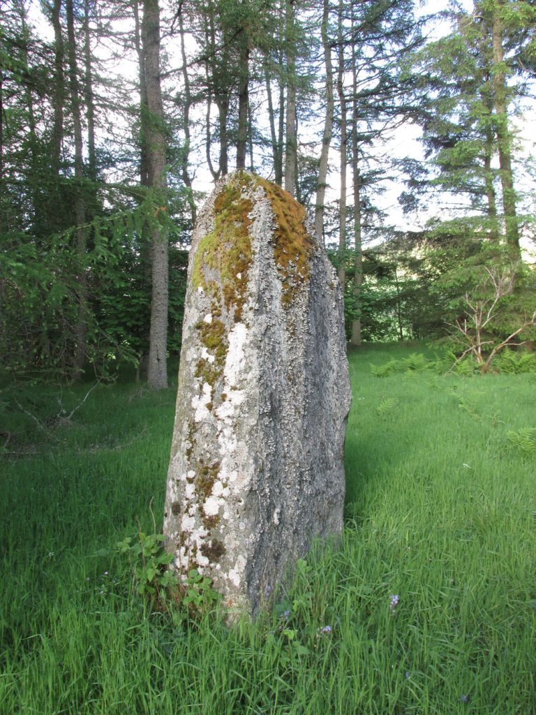
The standing stone on Broomhall estate is a large amorphous whinstone, standing in a small field near the confluence of the Kilry Burn and the River Isla.  It is c.7′ high and c. 10′ in circumference at the base. Tradition states that it commemorates a battle fought between the laird of Kilry and the Durwards of Peel.’

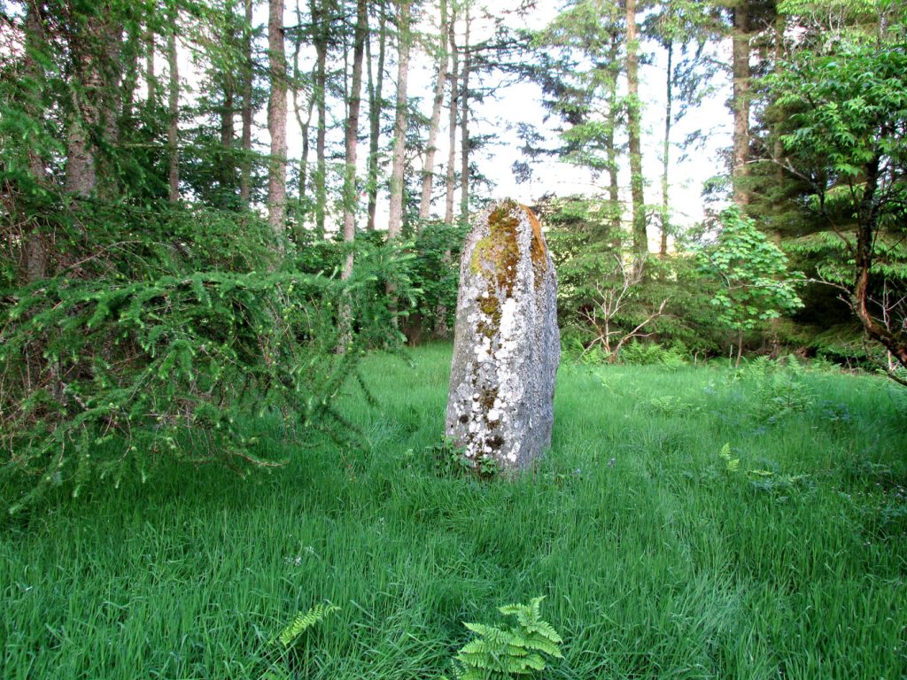
On the OS map the stone is aligned with the Pitmudie Stones and the Knowehead of Auldallan Stones to the north east.

References:

  1. Warden, A.J.,  Angus or Forfarshire: The Land and People, Descriptive and Historical – volume 3, Dundee 1880-5.

© Paul Hornby, The Northern Antiquarian


Balkello, Tealing, Angus

Standing Stone:  OS Grid Reference – NO 36332 38305

Also Known as:

  1. Canmore ID 31871
  2. The Standing Stone of Balkello

Getting Here

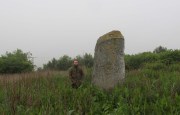
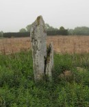
Balkello Stone, W of Tealing

From the little village of Kirkton of Auchterhouse, take the winding road uphill east as if you’re heading to Tealing.  About 1⅓ mile along, where the road has straightened out, keep your eyes peeled on your right (to the south) where—if the vegetation isn’t too high—you’ll see a tall upright stone in the field.  You’ll have to walk along the roadside until you find a gate into the overgrown field.  Good luck!

Archaeology & History

Not to be confused with the legendary Martin’s Stone of Balkello ⅘-mile to the southeast, this is a little-known standing stone hiding above a mass of boscage ‘pon a quiet ridge that fades focus away from the world.  It’s a bittova giant, all but forgotten it seems, and with little history to speak of in literary terms at least.  When we visited the place a short while ago, summer nettles and willowherbs obstructed our initial contact—but we got to the fella eventually.

This dood lives & sleeps at the stone!

Looking east

Standing more than nine feet high and about five feet across, it’s quite a slender monolith that has seen better days.  Its southern face is crumbling away and a large section of it is close to splitting off completely (surely a case for Historic Scotland to fix?).  As you can see in the photos, upper portions of the stone have fallen into the widening crack that promises to fell the stone at some time in the not-too-distant future.  Let’s get it sorted —before it collapses!

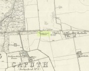
Balkello Stone on 1865 map

It was highlighted on the first OS-map in 1865 as the Standing Stone of Balkello, although without antiquated lettering.  But unless there is excellent reason to suggest this was erected in recent times (it wasn’t), its ‘prehistoric’ status needs activating—cos it’s surely prehistoric!  We all thought so anyhoo…  It’s well worth checking out when you’re in the area!

Folklore

When the Ordnance Survey lads first visited the site in 1861, local people informed them that the stone was said to be,

“in Connection with some others in the Parish (and) are supposed to have (been) used to point out the Roads as they were then, merely beaten paths.”

Alfred Watkins students take note!

Acknowledgements:  Huge thanks as always to Paul Hornby, Nina Harris & Frank Mercer for their assistance in our visit here.

© Paul BennettThe Northern Antiquarian


Barrow Hill Stone, Chastleton, Oxfordshire

Standing Stone (destroyed):  OS Grid Reference – SP 257 282

Archaeology & History

We have found only one reference to this lost standing stone that could once be seen adjacent to the very well-preserved Chastleton Barrow Camp to the east of the village. In her scarce little work on the history of Chastleton House, Margaret Dickins (1900) told that,

“the oldest thing to be seen at Chastleton is the prehistoric stone, which till lately served as a field gate post on the Barrow Hill.”

This monolith was one in a series of megalithic sites in and around the village that have been destroyed due to the actions of ill-informed land-owners. In this case, the standing stone was in close association with the subsequent Iron Age encampment (this missing stone should not be confused with the nearby Goose Stones, greatly damaged).

References:

  1. Bennett, P. & Chanter, James, The Complete Rollright Stones, forthcoming
  2. Dickins, Margaret, Chastleton House, Walker: Stratford 1900.

© Paul Bennett, The Northern Antiquarian

Down Farm, Basingstoke, Hampshire

Barrow (destroyed):  OS Grid Reference – SU 6018 5013

Archaeology & History

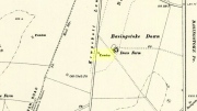
Downs Farm tumulus on 1897 map

Downs Farm tumulus on 1897 map

On the western edges of Basingstoke, at Kempshott, could once be found this ancient site—destroyed many decades ago.  It was one of number of similar prehistoric burial mounds in the area.  First described in a listing of tumuli by Mr Andrews (1898) who told us that it was “oval” in shape, the monument was completely destroyed in 1939 and according to the Royal Commission (1979) lads,

“its site now lies beneath a house at the southwest corner of Kempshott Lane and Homesteads Lane.”

When the house where it once stood was being constructed, a collared urn was recovered from the tomb, which the Royal Commission thought indicated “that the monument (was) likely to have been of early Bronze Age date”—but obviously we cannot be sure.  The site was listed in Leslie Grinsell’s (1979) extensive survey of prehistoric tombs in the area, in which he suggested it may have been a long barrow.

References:

  1. Andrews, S., “A Short List of Some Tumuli in North Hampshire,” in Proceedings of the Hampshire Field Club & Archaeological Society, volume 4, 1898.
  2. Grinsell, Leslie V., “Hampshire Barrows – part 3,” in Proceedings of the Hampshire Field Club & Archaeological Society, volume 14, 1940.
  3. Royal Commission on Historic Monuments, England, Long Barrows in Hampshire and the Isle of Wight, HMSO: London 1979.
  4. Willis, G.W., “Bronze Age Burials round Basingstoke,” in Proceedings of the Hampshire Field Club & Archaeological Society, volume 18, 1953.

© Paul Bennett, The Northern Antiquarian


Boxted Cross Henge, Colchester, Essex

Henge Monument:  OS Grid Reference – TM 0093 3277

Archaeology & History

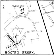
Boxted Henge plan (Colchester Archaeology Group)

Boxted Henge plan (Colchester Archaeology Group)

As with many sites in Southern England, intensive agriculture has taken its toll on the archaic monuments.  The Boxted Cross henge is no exception and hardly any elements of it remains today.  But it seems that it was an impressive fella in our more ancient heathen past.

The site was only rediscovered in the 1970s and was first described in Mrs Ida McMaster’s (1975) survey of crop-marks that had been revealed by aerial surveying in Essex and Suffolk counties.  Her brief account of the monument told it to be,

“A Class II henge with a wide somewhat ploughed out ditch. Various linear ditches are near, together with prolific variegated ‘field outlines’ of glacial subsoil cracking which extends into the next field southwards. The ditch terminals of the southwest entrance to the henge appear to be wider than the general run of the ditch, say 4-5 metres.”

When Harding & Lee (1987) examined the site, they were a little more cautious in their interpretation of it being a definite henge, citing that there was “insufficient information, but cannot be ruled out as henge-related,” adding that it “could also be a mill.”  This latter element seems unlikely, though a windmill may have been built onto the site at a later date.

More recently however the site has been categorized by Historic England as “a Late Neolithic henge.”  The monument itself was defined by a broad circular ditch with two large opposing entrances to the north and south.  The total diameter of the enclosure is 44 yards (40m) across; but with the surrounding ditch measuring 5½ yards (5m) across all around, the inner level of the henge was about 33 yards (30m) in diameter.  Plenty of room for partying old-style!

References:

  1. Harding, A.F. & Lee, G.E., Henge Monuments and Related Sites of Great Britain, BAR 175: Oxford 1987.
  2. McMaster, Ida, “Crop Marks Selected and Plotted,” in Colchester Archaeological Group Bulletin, volume 18, 1975.

© Paul Bennett, The Northern Antiquarian

Old Lane Carving, Cowling, North Yorkshire

Cup-and-Ring Stone:  OS Grid Reference – SD 97300 42625

Getting Here

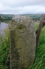
Old Lane Cup-and-Ring, Cowling

Old Lane Cup-and-Ring

This Stone is situated on Old Lane, Cowling, North Yorkshire. To get here coming from Crosshills, you come straight through the village and past the shops . About 250 yards after the shops you will come to a sharp left hand bend, as you have gone round this corner you will see a sign pointing to Oakworth (Old Lane). You need to turn left here (up by the cemetery) and continue for about half a mile up that lane till you come to a sharp left hand bend. Once you have gone round that left hand bend you will see a driveway on the right, the stone is situated opposite in the gateway. Hope you can find it and enjoy it like i do every time  i pass it.

Archaeology & History

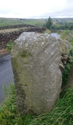
...and from another angle

…and from another angle

I’ve driven past this stone most days and never noticed the markings, then one particular day the weather was a bit miserable but the lighting was just right to illuminate this little gem. Was this lump of rock a standing stone or have modern day folk took advantage and moved it here to be used as a gatepost? I don’t think we ever will know.

(Editor’s Note – Somewhere at the back of my moss-infested mind, is some inkling that a carving on a gatepost similar to this was uncovered in the 1950s or ’60s by either Stuart Feather or Sidney Jackson.  I’ll trawl thru the old magazines in the coming months and see what I can find.  It’s bugging me!  It may well be a different carving (let’s hope it is!), and until then this has to be classified as a new discovery. PB)

© Chris Swales, The Northern Antiquarian

Robin Hood & Little John Stones, Whitby, North Yorkshire

Standing Stones (destroyed?):  OS Grid Reference – NZ 9171 0952

Also Known as:

  1. Robin Hood’s Pillars

Archaeology & History

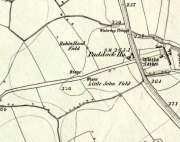
The 2 stones on 1853 map

The 2 stones on 1853 map

References to these old standing stones are scarce—at least in archaeology books anyway.  Even the usually diligent masters of Burl (1993) and Thom (1990) missed them!  But thankfully our folklorists and antiquarians with their keen interest in popular culture have written about these long lost monoliths, which could once be seen in fields just a mile or so south of Whitby town.

The earliest known account of the site is as the “Robyn-Hood-stone” in records dating from 1540 CE cited in the Cartularium Abbathiae de Whiteby (1881).  It was later described in land registers in 1713 and the fields in which they stood were—and still are—respectively known as Robin Hood’s Close and Little John’s Close.

These Whitby monoliths—like their namesakes in Northamptonshire— weren’t too big.  In Mr Young’s (1817) early description, when the stones were still visible, he told how Robin Hood’s stone was “a stone pillar about a foot square and four feet high”, and Little John’s Stone was “a similar pillar about two-and-a-half feet high.”  Mr J.C. Atkinson, the editor of the Cartularium (1881), also told that the two stones were “still in situ in the earlier part of the present century,” continuing:

“Both stones have now been removed, and are, I was informed, set up again near the enclosing fence of the field in which they stood. Almost beyond question , like the other monoliths of the district, they marked the site of ancient British interments.”

So—do the remains of these old stones still exist somewhere close by as J.C. Atkinson said, either in the walling, as a gatepost, or just pushed over and now covered in grass (like the long lost Thief Thorne standing stone near Addingham)?  Are any northern antiquarians living close by who might enable their rediscovery?

Folklore

A number of writers exploring the mythic histories of Robin Hood have included this site in their surveys, usually repeating the earlier creation myths about them that could be heard in popular culture.  The Whitby historian George Young (1817) told the tale:

“According to tradition, Robin Hood and his trusty mate, Little John, went to dine with one of the Abbots of Whitby, and, being desired by the Abbot to try how far each of them could shoot and arrow, they both shot from the top of the Abbey, and their arrows fell on the west side of Whitby Laithes, beside the lane leading from thence to Stainsacre; that of Robin Hood falling on the north side of the lane and that of Little John about a hundred feet further, on the south side of the lane.”

Whitby folklorist P.S. Jeffrey (1923) took this myth literally, saying how the distance of the arrows fired by the respective folk heroes was “scarcely credible, as the distance in each case is about a mile-and-a-half.”  However, the earlier historian Lionel Charlton (1779) thought the incredible feat quite credible!

The distance between the Abbey and the stones is 1.36 miles (2.2km); but it may be that the direction related in the tale was more important than the distance, as the alignment between the two sites runs northwest to southeast—or southeast to northwest, whichever you prefer!—and may relate to an early astro-archaeological alignment.  Might…..

References:

  1. Anonymous, “Robin Hood in Yorkshire“, in Yorkshire Folk-Lore Journal – volume 1, T.Harrison: Bingley 1888.
  2. Anonymous, “Whitby Arms,” in Yorkshire Folk-Lore Journal – volume 1, T.Harrison: Bingley 1888.
  3. Benedicti, Ordinis S., Cartularium Abbathiae de Whiteby – volume 2, Andrews: Durham 1881.
  4. Burl, Aubrey, From Carnac to Callanish, Yale University Press 1993.
  5. Charlton, Lionel, The History of Whitby and Whitby Abbey, T. Cadell: York 1779.
  6. Doel, Fran & Goeff, Robin Hood: Outlaw or Greenwood Myth, Tempus: Stroud 2000.
  7. Green, Barbara, The Outlaw Robin Hood – His Yorkshire Legend, KCS: Huddersfield 1992.
  8. Gutch, Mrs, County Folk-lore – volume 2: North Riding of Yorkshire, York and the Ainsty, David Nutt: London 1901.
  9. Jeffrey, P. Shaw, Whitby Lore and Legend, Whitby 1923.
  10. Mitchell, W.R., Exploring the Robin Hood Country, Dalesman: Clapham 1978.
  11. Parkinson, Thomas, Yorkshire Legends and Traditions – volume 2, Elliot Stock: London 1889.
  12. Thom, A., Thom, A.S. & Burl, Aubrey, Stone Rows and Standing Stones – 2 volumes, BAR: Oxford 1990.
  13. Young, George, The History of Whitby and Streoneshalh Abbey – volume 2, Clark & Medd: Whitby 1817.

© Paul Bennett, The Northern Antiquarian