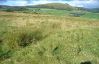
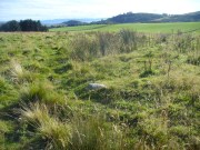
Ffynnon Rufeinig, Llandudno, Caernarvonshire

Healing Well:  OS Grid Reference – SH 76551 83858

Also Known as: 

  1. Ffynnon Llety Fadoc
  2. Roman Well

Archaeology & History

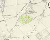
Ffynnon Rufeinig, 1901 OS-map

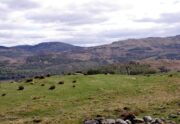
To be found on the legend-filled landscape known as the ‘Great Orme’, this ancient well was highlighted on the 1901 OS-map of the region, on the south side of the track.  Sadly,  despite an occasional puddle that fills the old trough when She rains, its waters are no longer running.  H.C. Jones (n.d.) informed us that this was a ‘Roman Well’, which tradition said was a place they used when they invaded this part of Wales, although Paul Davies (2003) thought this “to be wishful thinking”.

Despite this, in recent years the walling around the well has been rebuilt by the track-side and a stone plaque with the words ‘Roman Well’ has been mounted to tell you that you’re at the right place.

References:

  1. Davies, Paul, Sacred Springs, Blorenge: Llanfoist 2003.
  2. Jones, H. Clayton, “Welsh Place-Names in Llandudno and District” in Mountain Skylines and Place-Names in Llandudno and District, Modern Etchings: Llandudno n.d. (c.1950)

© Paul BennettThe Northern Antiquarian


Boskenna Cross, St Buryan, Cornwall

Wayside Cross:  OS Grid Reference – SW 42579 24266

Also Known as:

  1. Historic England Grade II Listed Building No. 1007955

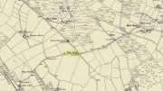
Boskenna Cross on 1887 map

Getting Here

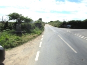
Travelling along the B3315 from Penzance to Lands End, the Cross is on the south side of the road at the junction with the minor road to St Buryan, past the Merry Maidens stone circle.

Archaeology & History

Arthur Langdon (1896), in his magnum opus on Cornish Crosses, describes this wheel-headed wayside cross:

Sketch from Langdon’s 1896 book

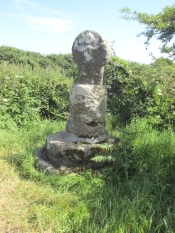
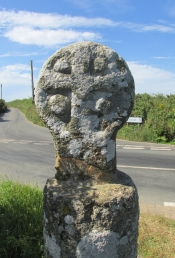
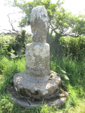
The only ancient part of the monument is the little cross at the top, which is mounted on a base made up of an extraordinary collection of apparently disused circular granite stones. Immediately beneath the cross is a cylindrical piece, the upper edge of which is roughly rounded off. Beneath this comes a short drum, about two inches wider than the piece above and nine inches deep. The next two stones are much wider but not so deep as the last, the bottom one consisting of the lower portion of an old cider-press, with its surrounding channel and lip !

Its roadside position.

There is a good deal to admire in the feeling which prompted this effort to once and for all preserve so ancient a relic, and the care bestowed in the erection of this curious substructure goes far to remove its incongruity.

Front — The figure of our Lord here sculptured is quite the best example in which He is represented wearing the tunic; the expanded sleeves are especially apparent, as well as the outline of the garment above the knees. The feet are very large, and turn outwards at right angles.

The Crucifixion face

Back — On the head is a cross with expanded limbs, flush with the surface of the stone. The four triangular sinkings, or recesses, which form the background are not of uniform size, the lower being considerably larger than those above, thus making the lower limb the longest. The inner portion of each sinking is raised, forming bosses in low relief.

Dimensions — Total height of the monument, 6 ft. 10 in; height of the cross, 2 ft. 4 in; width of head, 1 ft. 8 in; width of shaft, 12½ in.

The cross has had a chequered history. It is not known when it was demolished.  Langdon, once more, takes up the story:

The opposite face.

Mr. J. H. Johns, landlord of the “King’s Arms”, St. Buryan, informed me of the circumstances connected with the discovery of this cross. It appears that formerly one of the angles at the intersection of these roads was so sharp and awkward for traffic that, in 1869, the local authorities decided to ease this corner by rounding off the hedge, which was then about ten feet thick. Mr. Johns’ father was one of the men employed on this work, and shortly after commencing he found the cross buried in the hedge. By the advice of His Honour Charles Dacres Bevan, County Court Judge of Cornwall, and then residing at Boskenna Mansion House, the cross was erected on the triangular piece of grass in the middle of the roads, a spot on which it is extremely likely it originally stood.

Side view from the east.

In 1941 and 1942, the Cross was demolished by road vehicles, whereupon the council removed it to its present roadside position. It was again hit by a vehicle in 1992. And in 2002 there was another incident, reported by Meyn Mamvro:

..In February the top of the cross was found lying by the roadside. It is not known whether this was the result of deliberate vandalism or a road traffic accident, but local village witch Cassandra Latham acted quickly in alerting Cornwall Archaeological Unit, who took it away for repair and restoration…

References:

  1. Langdon, Arthur G., Old Cornish Crosses, Truro, Joseph Pollard, 1896.
  2. Langdon, Andrew, Stone Crosses in West Penwith, The Federation of Old Cornwall Societies, 1997.
  3. Meyn Mamvro, No 49, Autumn 2002, p. 4

© Paul T. Hornby 2018


Denoon Law, Glamis, Angus

Hill Fort: OS Grid Reference – NO 35464 44395

Also Known as:

  1. Canmore ID 32139
  2. Law of Denoon

Denoon Law on 1865 map

Getting Here

Travelling north through Balkeerie on the Newtyle/Glamis road, turn right onto the Denoon road and follow it to the T-junction.  Turn right and, a few hundred yards on to your left, the large hillfort of Denoon Law rises up to your left.  You can’t really miss it!

Archaeology & History

Denoon Law from Murleywell

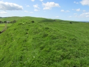
Denoon Law is an impressively lush and green hill fort hidden away in the Sidlaw Hills, in the Denoon Glen, parallel to the Vale of Strathmore. It can be entered froma gap in the ramparts on the north side. Be careful of the precipitous drop from the south east side!

In the County Angus survey by the Royal Commission on the Ancient & Historical Monuments of Scotland (1983), they describes it thus:

This fort crowns the summit of Denoon Law, a steep-sided volcanic plug on the NW side of Denoon Glen, a narrow valley at the N end of the Sidlaw Hills. The fort is roughly D-shaped on plan with the chord of the D formed by a long straight rampart that stands above the precipitous SE flank of the hill. It measures 105m from NE to SW by 55m transversely within a rampart that measures up to 17m in thickness and over 5m in external height but is clearly of more than one phase. Where the differentiation is clear, the latest phase of rampart measures about 6m in thickness and overlies the remains of a much thicker earlier rampart. Intermittently visible at the SW end of the fort is an outer face to the later rampart, comprising drystone walling that has, in places, been displaced downslope by the weight of core material behind. This outer face comprises no more than four or five courses of thin sandstone slabs and, although what is currently visible will only be the top of the surviving wall-face, a wall constructed of such material cannot have stoodto  any great height and what we see today is likely to be the remains of some form of comparatively low revetment. In both the earlier and later ramparts there is very little evidence of stone within the core and it appears that the material (boulder clay) for both has largely been derived from several large quarries within the interior of the fort. At the SW corner of the fort most of the rampart has been removed, leaving only the lower part of the outer talus. The fort, or at least its latest phase, had two entrances, one on the NE and another on the NW, both of which are crossed by the remains of a narrow, later, wall that runs around the entire circuit of the fort and may be associated with at least some of the buildings within the interior.

Outwith the main rampart there is a series of three outer ramparts, again with very little evidence for the use of stone in their construction, which run from the edge of the very steep slope at the NE end of the fort, around the N side to the entrance on the NW. All three lines of defence have been reduced to little more than terraces, though there is no evidence for them ever having been cultivated. At the entrance on the NW, the terminals of these ramparts (on both sides of the entrance) are obscured below outwash deposits from the slope above. To the SW of the entrance it is not at all clear what the relationship is between the defences of the fort and the enclosure that occupies the rocky and extremely uneven SW flank of the hill. This enclosure, which has an entrance on the W, could be some form of annexe or it could represent the SW end of an enclosure that once took in both this area and the rest of the summit.

Within the interior of the fort there are the remains of at least nine rectangular buildings, two of them large and open-ended and each overlain by a smaller, later structure. The freestanding buildings are represented by the footings of walls with inner and outer stone faces; close to the entrance on the NE, however, there are two buildings represented by simple rectangular platforms cut into the rear scarp of one of the prehistoric quarries in one case and the hollow of the entrance passage in another. On the N flank of the hill, overlying the outer defences, there are a number of structures, either taking the form of subrectangular structures with walls (and in one case an entrance) or simple scoops into the slope.’

Entrance from the NW

David Dorward’s definition of the name Denoon is from the Gaelic:

‘dun obhainn (+ Scots law) – [hill of the] fort of the streamlet.’

The streamlet is the Ewnie Burn flowing south-east of the Law.

The lush green centre

Folklore

James Cargill Guthrie, in his The Vale of Strathmore: Its Scenes And Legends, gives the following story from an,

early time, weird-like, a legend’s muffled chime ‘.

The Hill of Denoon was at that remote period accounted sacred or haunted ground. It was the mythical abode of the elfins and fairies, and formerly a fitting haunt for their midnight revelries.

When the silvery moonbeams lovingly slept in dreamy beauty on the green slopes of the enchanted Hill, and the blue bells and the purple heather were wet with the dew of angels’ tears, arrayed in gossamer robes of bespangled gold, with wands of dazzling sheen and lances of magical bright-ness, would the troops of elfins flauntingly dance to the music of the zephyrs, until the shrill cry of the chanticleer put an end for the time to their mystical enchantments.

Suddenly, as in blue clouds of vapour, they noiselessly vanished away, no sound remaining to break the oppressive stillness, save that of the mountain rivulet, as it fretfully leapt from crag to crag, as if piteously regretting the mysterious departure of its ethereal visitors.
South-east rampart

Having forsworn the presence and companionship of the terrestrial inhabitants of earth, it was a sacred dictum in the code of the fairies that no habitation for human beings should be permitted to be built within the hallowed precincts of the enchanted ground. Unable of themselves to guard against such sacrilegious encroachment, they had recourse to the aid of, and formed a secret compact with the demons, or evil spirits, whose sole avocation consisted in doing mischief, and bringing trouble and misfortune on those under the ban of their displeasure. By this compact these evil spirits became solemnly bound to prevent any human habitation whatever from being erected on the hill, and to blast in the bud any attempts whensoever and by whomsoever made to break this implacable, unalterable decree.

It was about this time the alarm-note was sounded, as the Queen of the Fairies, who, with an eye more observant than the rest of her compeers, observed one evening in the moon-light, certain indications of the commencement of a human habitation. Horror and dismay were instantly pictured on the fair countenances of the masquerading troops of merry dancers as the awful truth was ominously revealed to them by the recent workmanship of human hands.

The sheer slope to the south-east

A council of war was immediately held, when it was determined to summon at once the guardian spirits to their aid and protection.

“By our sacred compact,” cried the Queen, “I command the immediate attendance of all the demons and evil spirits of the air, to avenge the insult now offered to the legions of Fairyland, and to punish the sacrilegious usurpers who dare infringe the sanctity of their mystical domains.”

These demons instantly obeyed the haughty summons, and, in the presence of those they had sworn to protect, they in a twinkling demolished the structure, hurling the well-proportioned foundations over the steep rock into the vale beneath !

The builder, doubtless very much surprised and chagrined when he returned to his work in the early dawn of the following morning, was sorely puzzled to account for the entire disappearance of the solid foundations of the great castle he intended to be erected on the Hill. He did not, however, waste much time, or use much philosophic argument, on the matter, and gave orders to prepare new foundation of even a more durable character.

The demons, to show their invincible power, and for the sake of more effect, allowed the new foundations to rise a degree higher than the former, before they gave out their fiat of destruction. In an instant, however, they were again demolished, and the builder this time gravely assigning some fatal shock of Nature as the cause of the catastrophe quietly resolved to repair the damage by instantly preparing new and still more solid foundations.

Additional and more highly skilled workmen were engaged, and everything for a time went favourably on, the walls of the castle rising grandly to view in all the solidity and beauty of the favourite architecture of the period.

Biding their time, the demons again ruthlessly swept away as with a whirlwind every vestige of the spacious halls, razing the solid massy foundations so effectually that not one stone was left upon another !

Things were now assuming a rather serious aspect for the poor builder, who, thinking that he had at last hit upon the true cause of these successive disasters, attributed his misfortunes to the influence of evil spirits. A man of courage and a match, as he imagined, for all the evil spirits of Pandemonium, supposing they were let loose at once against him by the Prince of Darkness, he unhesitatingly resolved to keep watch and ward on the following night, and to defy all the hosts of hell to prevent him rebuilding the projected edifice. The night expected came ; but, alas, alas !

His courage failed when on the blast
A demon swift came howling past,
Loud screeching wild and fearfully,
This ominous, dark, prophetic cry
“Build not on this enchanted ground !
‘Tis sacred all these hills around ;
Go build the castle in a bog,
Where it will neither shake nor shog !”‘

So, if you are planning to visit Denoon Law – remember: RESPECT THE FAERIES!

References:

  1. Guthrie, James Cargill, The Vale of Strathmore: Its Scenes And Legends, Edinburgh, William Patterson, 1875.
  2. Royal Commission on the Ancient and Historical Monuments of Scotland. The archaeological sites and monuments of Central Angus, Angus District, Tayside Region, The archaeological sites and monuments of Scotland series no 18. Edinburgh, 1983.
  3. Dorward, David, The Sidlaw Hills, Forfar, The Pinkfoot Press, 2004.

©Paul T Hornby 2018

Tun Well, Eccleshill, Bradford, West Yorkshire

Healing Well:  OS Grid Reference – SE 1822 3593

Also Known as:

  1. Tunny Well

Archaeology & History

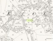
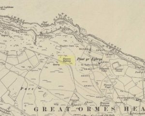
Tun Well, on 1893 map

First mentioned in local history accounts from 1618—as the Tunwells—it was highlighted on the first OS-map of Eccleshill in 1851.  Located on the aptly-named Tunwell Lane, it was a deep well covered by a large flat slab of stone, at the back-end the old Victorian mill.  The stone was put there to prevent children falling into it.  Some old locals thought the name of the place derived from a ‘tun’, or hundred, meaning it to be a hundred feet deep; although as A.H. Smith (1961) tells, tun could equally relate it to be one of Eccleshill’s town wells, of which there were several.  It used to be one of the principal drinking supplies for the village and was said to rarely run dry.  In William Ranger’s (1854) survey, he told this to be one of the sites to which local people relied in times of drought, where the land-owner allowed local folk to collect their supplies.

Folklore

The old cobbled Tunwell Lane was long ago supposed to be the haunt of a phantom black dog: a visionary precursor of death and Underworld guardian. Its spirit came and went into the deep well.  I remember hearing tales of this when I was a young lad, as the old women who worked in the adjacent mills spoke of it.  The ghost of a so-called ‘white lady’ was also said to walk along Tunwell Lane.

In more recent times, Val Shepherd (2002) included this in her short survey of wells in the area as being on “an alignment” with Eccleshill’s Moor Well and Holy Well.  She thought “it may be part of a ley line”, but her alignment is inaccurate and doesn’t hit the spots.

References:

  1. Crapp, H.C. & Whitehead, Thomas, History of the Congregational Church at Eccleshill, Watmoughs: Idle 1938.
  2. Ranger, William, Report to the General Board of Health on a Preliminary Inquiry into the Sewerage, Drainage, and Supply of Water, and the Sanitary Condition of the Inhabitants of the Township of Eccleshill, George Eyre: London 1854.
  3. Shepherd, Val, Holy Wells of West Yorkshire and the Dales, Lepus: Bradford 2002.
  4. Smith, A.H., The Place-Names of the West Riding of Yorkshire – volume 3, Cambridge University Press 1961.

© Paul BennettThe Northern Antiquarian


Swithins Well, Rothwell, West Yorkshire

Healing Well (destroyed):  OS Grid Reference – SE 3442 2686

Also Known as:

  1. St. Swithin’s Well

Archaeology & History

Swithins Well on 1854 map

Highlighted in the fields on the south-side of Rothwell village on the 1854 OS-map, Swithin’s Well was, according to historian Andrea Smith (1982), previously known as a holy well, dedicated to the obscure Saxon saint of the same name.  Although no ‘well’ relating to St Swithin comes from any early texts, the field and farmhouse of ‘Swithins’ were cited in records from the Cartulary of Nostell Priory in 1270 CE; then subsequently in a variety of records throughout the 14th, 15th and 16th centuries.  According to Miss Smith (1982),

“The first recording of St Swithin’s Well, Rothwell…was on an estate map of 1792 (‘Plan of St. Clement’s lands in the parish of Rothwell in the County of York, two-third part of the tithes of corn and grain of which belong to the King in right of His Ducky of Lancaster’, PB), and the field-names arising from it—Swithin’s, Swithin’s Barn, Swithin’s Lane Close—serve to give an indication of the well’s past importance as a local landmark.”

When she visited the site around 1980, she reported finding,

“several wet patches running in a line westwards downhill, but the farmer’s wife seemed certain that this was a broken drain and nothing else could be seen in that field or neighbouring ones, which could have been the well.”

Very recently, the Wakefield pagan and antiquarian Steve Jones went to see if the well or any remains of it could still be seen and told us:

“We went looking for the well down a footpath but it was obviously filled in when a colliery was nearby in the early 20th century and (there is) no trace of any spring now.”

Another one’s bitten the dust, as they say…..

But we must note that the grand place-name authority, A.H. Smith (1962) found no references to St. Swithin here and instead suggested the name derived from the old Norse word, sviðinn, ‘land cleared by burning’, which is echoed in the old local dialect word swithen, ‘moorland cleared by burning’ (Smith 1956), and similarly echoed in Joseph Wright’s (1905) magnum opus, where—along with meaning ‘crooked, warped’—it means “to burn, superficially, as heather, wool, etc.”   There is also a complete lack of any mention to the saintly aspects of this place in John Batty’s (1877) primary history book on Rothwell parish, and yet he cites numerous other springs and wells in the region that have fallen out of history.

References:

  1. Batty, John, The History of Rothwell, privately printed: Rothwell 1877.
  2. Jones, Steve, Personal communication, Facebook 27.08.2018.
  3. Rattue, James, “The Wells of St Swithun,” in Source, Summer 1995.
  4. Smith, Andrea, “Holy Wells Around Leeds, Bradford & Pontefract,” in Wakefield Historical Journal 9, 1982.
  5. Smith, A.H., The Place-Names of the West Riding of Yorkshire – volume 2, Cambridge University Press 1961.
  6. Smith, A.H., English Place-Name Elements – volume 2, Cambridge University Press 1956.
  7. Wright, Joseph, English Dialect Dictionary – volume 5, Henry Frowde: Oxford 1905.

Acknowledgements:  Many thanks to Steve Jones of Wakefield for his informing us about the status of this site.

© Paul BennettThe Northern Antiquarian


Jim Craven’s Well, Thornton, West Yorkshire

Sacred Well:  OS Grid Reference — SE 0967 3251?

Archaeology & History

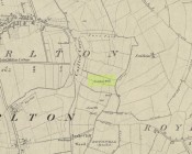
Is this the site of the lost Jim Cravens Well on the 1852 map?

Another well with considerable supernatural renown was this little-known site near the old village of Thornton, on the western outskirts of Bradford.  We’re not 100% sure about its exact location, but the grid-reference cited here is of an old ‘Well’ that was highlighted on the first Ordnance Survey map of the region, at the end of solitary path which led to it and nowhere else.  Our only documentary information comes from Elizabeth’s Southwart’s (1932) fine old book on the folk life of the old village, as it once was.  At a place once known as Bent Ing Bottom, just south of the old village, is where it used to be known.  The name of this Well is also curious, as no historian has yet worked out who the ‘Jim Craven’ was, nor what his relationship to the site might have been.  It’s the folklore of it, however, which brings it the attention it deserves.

Folklore

In Elizabeth Southwart’s (1923) work, she told us that the place once known as “Bent Ing Bottoms have lost their romance.” She continued:

“Whether the golfers have driven it away—for the fields now form part of the Thornton Golf Links—or whether the advance of modernity in other forms is to blame, it is difficult to say.  Once they were the haunts of “Peggy-Wi-T’-Lantern” and the Bloody-tongue.  Peggy, a dame in a white mob cap, kilted skirt and white stockings, walked about with a lantern, enticing the unwary traveller to his doom.  She was given to wandering, for, they say, Jim Craven Well, half a mile away, was a place to be avoided after nightfall.

“The Bloody-tongue was a great dog, with staring red eyes, a tail as big as the branch of a tree, and a lolling tongue that dripped blood.  When he drank from the beck (known as the Pinch Beck, PB) the water ran red right past the bridge, and away down—down—nearly to Bradford town.  As soon as it was quite dark he would lope up the narrow flagged causeway to the cottage at the top of Bent Ing on the north side, give one deep bark, then the woman who lived there would come out and feed him.  What he ate we never knew, but I can bear testimony to the delicious taste of the toffee she made.

“When the dark was coming we used to sit on the filled-in pit, which makes a hump in the middle of the field, and wait for him.  The sun would sink redly, through the arches of the viaduct, the trees that lined the beck would grow an ever darker green until they became black, the beck would begin to gurgle and gulp in a queer way; and down in the hollow we would hear a whimper, a whine, a moan, a snarl.  Then, with scalps and spines playing queer tricks, we would wait and wait.  But none of our little band ever saw him, except one girl, and she saw him every time.

“One Saturday a girl who lived at Headley came to a birthday party in the village, and was persuaded to stay to the end by her friends, who promised to see her ‘a-gaiterds’ if she would.  As soon as the party was over the brave little group started out.  But when they reached the end of the passage which leads to the fields, and gazed into the black well, at the bottom of which lurked the Bloody-tongue, one of them suggested that Mary should go alone, and they would wait there to see if anything happened to her.

“Mary was reluctant, but had no choice in the matter, for go home she must.  They waited, according to promise, listening to her footsteps on the path, and occasionally shouting into the darkness:

““Are you all right, Mary?”

““Ay!” would come the response.

“And well was it for Mary that the Gytrash had business elsewhere that night, for her friends confess now that at the first sound of a scream they would have fled back to lights and home.

“We wonder sometimes if the Booody-tongue were not better than his reputation, for he lived there many years and there was never a single case known of man, woman or child who got a bite from his teeth, or a scratch from his claws.  Now he is gone, nobody knows whither, though there have been rumours that he has been seen wandering disconsolately along Egypt Road, whimpering quietly to himself, creeping into the shadows when a human being approached, and, when a lantern was flashed on him, giving one sad, reproachful glance from his red eyes before he vanished from sight.”

Southwart later tells us that the ghostly dog travelled into the north and vanished.  From the description she gives of the children walking their friend to “the end of the passage which leads to the fields, and gazed into the black well, at the bottom of which lurked the Bloody-tongue,” I can only surmise that the solitary well shown on the very first OS-map of Thornton at the coordinate given above is the place in question.

The ‘Bloody Tongue’ is first mentioned in Yorkshire folklore, I think, by Roger Storrs, in his article on holy wells in 1888, where he tells it to be one of the mysterious beings that live, usually at the bottom of the waters and almost universally used “to deter children from playing in dangerous proximity to a well.”

From the description of the waters turning red when the ghostly dog drank from it, we have a mythic account of when the waters occasionally turned red from the iron-bearing waters (chalybeate) which, obviously, wasn’t like this at all times.  Whether this was a sporadic, unpredictable flow of iron in the waters, or a cyclical pattern of the water-flows, we are not told (which would imply, moreso, that it was sporadic).  The folklore about this ghost and its appearance with another elemental creature along an old straight track running north from Upper Headley Hall to Thornton is intriguing—as in many old pre-christian traditions, North is the airt, or direction, representing Death; and black dogs are traditionally guardians of underworld treasures in the land of the Dead.  With the plethora of other animistic folktales once known in this district (boggarts or goblins were known in nearby woods, wells and farms) it is likely that the origin of such folklore dates way back into antiquity.

References:

  1. Bennett, Paul, Ancient and Holy Wells of West Yorkshire, forthcoming
  2. Southwart, Elizabeth, Bronte Moors and Villages: From Thornton to Haworth, John Lane Bodley Head: London 1923.
  3. Storrs, Roger, ‘Legends and Traditions of Wells,’ in Yorkshire Folk-lore Journal – volume 1 (ed. J. Horsfall Turner) 1888.

© Paul BennettThe Northern Antiquarian


Caravan Park, Blair Drummond, Stirlingshire

Tumulus:  OS Grid Reference – NS 7253 9906

Also Known as:

  1. Canmore ID 46065
  2. Old Farm

Getting Here

Caravan Park burial mound

Caravan Park burial mound

Along the A84 Stirling-Doune road, watch out for the minor Cuthill Brae road to the caravan park. Go up and into Blair Drummond caravan park (ignore the old grumpy southern-type fella who tells you “this is private”), right into and through the walled area where the caravans are situated.  Out the other side is a children’s playground— and the very large mound to your left with a tree on top (and a children’s slide built on it) is the burial mound in question.

Archaeology & History

Tumulus from the southeast

Tumulus from the southeast

This comes as something of a surprise when you first set eyes on it.  It’s big! (bigger than I expected anyway!)  Seemingly on its own, rising from the level ground and surrounded by cultivated land, there were probably others of its kin close by, but the closest that we know about is 1.5km to the east; although the standing stone of Boreland Hill a few hundred yards west might have had some relevance….

This tumulus may be the one noted by Charles Roger (1853) in his visit to the area.  He spoke of the now denuded burial mound to the east (in the Safari Park), but also told that,

“Within the park are two other tumuli, one situated in the garden, of a conical form and measuring 92 yards in circumference and about 15 yards in height…”

Blair Drummund tumulus on 1866 OS-map

Blair Drummund tumulus on 1866 OS-map

This mound is more 15 feet in height than yards, but the other measurement is close—and it does seem to be in the right area.

There is much greater certainty in J.G. Callander’s (1929) account.  He was fortunate in being part of the excavations undertaken here by Sir Kay and Lady Muir in 1927-28 and gave a damn good account of what went on:

“The mound is not quite circular, as it measures about 75 feet in diameter from north to south and about 65 feet from east to west, its height being about 15 feet.  Before the excavations were started it seemed as if the monument consisted entirely of earth, but before the examination was completed it was found that it contained a small cairn of stones, heaped over a grave formed of large slabs arid boulders which undoubtedly was the primary interment.

“Commencing at the south-south-eastern edge of the mound, a trench driven in towards the centre, revealed the presence of a short cist which had apparently been disturbed at some previous time.  A large block of stone formed the northern end and a large slab the east side.  A smaller slab lay at the south end and another on the west side, but as the latter was too short to fill the space, a larger slab lay obliquely between it and the large stone at the north end.  There was no appearance of a cover stone.  The length of this grave was 3 feet 3inches, its breadth 3 feet, and its depth 2 feet 3 inches.  The longer axis lay practically north and south.  No traces of human remains or relics of any sort were found here.  This was evidently a secondary burial sunk into the mound as far as the original surface of the ground, and covered with about 4 feet of soil at the centre.

“As the trees interfered with further excavations at this part, another trench was cut in from the northern arc as far as the centre of the mound, where an undisturbed cist, formed of large rough slabs and a cover stone, was encountered.  Although this grave was considerably larger in length, breadth and depth than any of the numerous short cists that I have examined, I think it should be classed with them rather than with the large cist-like chambers sometimes found in long cairns.  It was formed of two side and two end slabs.  The sides were roughly parallel, but the slab at the southern end was placed obliquely so that the length of the grave was 4 feet 6 inches on the east side and 4 feet on the west side. The general breadth was 3 feet at the floor, and the depth 4 feet.  Both side slabs converged towards the top.  As the slabs on the east side and at the ends were not so high as that on the west, the spaces between them and the cover stone were carefully built up with smaller stones.  A slight vacancy between the slabs at the south-east corner was filled in a similar fashion.  A small cairn of clean stones without a mixture of soil had been heaped up over the cist, covering the lid to a depth of about 9 inches: the diameter of the cairn at the base was  not ascertained.  The depth of earth above the summit of the cairn was about 8 feet.  But for a layer of a few inches of earth on the floor the cist was empty.  Nothing was found except some small unburnt fragments of human bone, very much decayed, and a few teeth.  Some small fragments of charred wood were found in making the trench and in the grave, but whether it was charred by natural carbonisation or by burning was not determined.

“In making the trench just before the grave was reached, but at a higher level, a small portion of the cutting edge of a stone axe was found.  It had no evident connection with the cist, and may have happened to be lying about amongst the soil that was piled up over the grave.

“As there remained a space on the top of the mound which could be excavated without destroying any of the trees, it was examined.  About 1 foot under the surface a cinerary urn was found in an inverted position.  The base had been crushed in, and the wall was full of cracks into which tree roots had penetrated.  On taking it out the vessel was found to have originally been about half-filled with cremated human bones.  These after examination were reinterred in the mound.  No other relics were found in the urn.

“The vessel, which is formed of buff-coloured clay with a tinge of red in places, is a cinerary urn of the cordoned variety belonging to the Bronze Age.  It is encircled at the widest part, about 3½ inches below the lip, by a raised moulding or cordon, and about 3 inches lower down by another.  The greater part of the vessel was recovered, but as the basal portion was completely crushed, it is impossible to ascertain the height of the vessel or the width of the base when complete.  It measures 10¾ inches in external diameter at the mouth and 11 inches at the widest part: what remains of the wall is 13 inches in height.  The rim, which is unusually thin for a vessel of this class, is only ⅜-inch in thickness, and it is bevelled downwards towards the interior.  The space between the upper cordon and the rim is the only part which is decorated, and here there is a row of large triangles, alternately plain and filled, with a reticulated design, bordered above and below with a single marginal line, all formed by pressing a twisted cord on the clay before it was fired.”

Protected tumulus, damaged by slide

Protected tumulus, damaged by slide

The burial mound is still in a reasonably good state of preservation… on the whole…  There is however, a slightly worrying note: this tumulus is a protected scheduled monument but despite this it has, as of late, been quite deliberately built upon.  When Penny Sinclair and I visited the nearby Christ’s Well recently (out of season), an unhelpful grumpy man working or living there told us we were “not allowed on the site – it’s private.”  We thought he was joking and I laughed that, “This is Scotland!”  He repeated his words.  A week later, Paul Hornby and I revisited the Christ’s Well and then took to see this large burial mound – only to find that a children’s play area had been built right up to, and upon, the northwestern part of the monument. This is in contravention of legal regulations to build upon Scheduled Monuments, as:

“The area to be scheduled encompasses the mound and an area around it in which traces of associated activity may be expected to survive.”

This has been violated.

If you like your prehistoric burial mounds, this is well worth having a look at.

References:

  1. Callander, J. Graham, “A Bronze Age Burial Mound at Blair Drummond, Perthshire,” in Proceedings Society of Antiquaries Scotland, volume 63, 1929.
  2. Roger, Charles, A Week at Bridge of Allan, Adam & Charles: Edinburgh 1853.
  3. Royal Commission on the Ancient & Historical Monuments of Scotland, Archaeological Sites and Monuments of Stirling District, Central Region, Society of Antiquaries of Scotland 1979.

© Paul BennettThe Northern Antiquarian


Boreland Hill, Kincardine, Stirlingshire

Standing Stone:  OS Grid Reference – NS 72346 99409

Also Known as:

  1. Blair Drummond Stone
  2. Canmore ID 46064

The standing stone

The standing stone

Getting Here

Along the A84 Stirling-Doune road, watch out for the minor Cuthill Brae road to the caravan park.  A couple of hundred yards before reaching the entrance to the caravan park, note the copse of trees more than 200 yards north, on the left, across the field. Walk into the trees and, near the centre, you’ll see the upright stone.

Archaeology & History

Looking to the west

Looking to the west

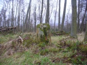
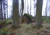
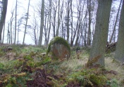
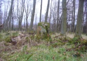
On the very top of this flattened tree-covered hill between Doune and Stirling, a single upright monolith more than 5½ feet tall quietly rests, seemingly forgotten by just about everyone.  The stone was marked on the earliest OS-maps in the 1860s, though in non-antiquated lettering, as if to question its archaic veracity—and this has continued to the present day, with the likes of Hutchison (1893) and Canmore upholding it as little more than a geological erratic.  Yet as our photos here show, this stone has much greater credibility as an authentic standing stone than Nature’s handiwork.

In Mr Hutchison’s (1893) article on the megalithic remains of the area he said of this stone:

“This is a very fine boulder of Highland grit, stranded on a gravel mound near the official residences on the Blair Drummond estate.  The knoll is wooded, leaving a clear space in the centre for the stone.  It would thus appear to have been thought worthy of preservation for some reason or other.  It has no appearance however, of having been erected as a standing stone.  It measures about 6 feet in height, and 12 feet at its widest circumference.”

Looking northwest-ish

Looking northwest-ish

Looking northeast-ish

Looking northeast-ish

The position of the stone is intriguing, giving a 360° view through the trees to a much greater vista all round, and this does seems to be quite deliberate.  In all honesty, this does look like an authentic standing stone, contrary to the earlier views cited.  A large prehistoric tumulus occurs only 400 yards to the south (recently damaged and built onto by the present land-owner) and other standing stones are in the area.

There are a number of scratch marks on the upright faces of the stone, no doubt caused by the forestry actions here over the last century.  No modern excavations have occurred here.

Folklore

A couple of centuries ago, the New Statistical Account told that,

“a very vague tradition represents it as having been a place of religious worship in superstitious times. There are no other remains near to confirm this opinion; but whether it be correct or not, it is evident that its site is a very important one, and may have been useful as a signal station, as it commands a view not only of the road across the Moss of Kincardine, but also of the line of Roman stations along the Forth and Teith in the direction of the camp at Ardoch.”

References:

  1. Bennett, Paul, The Standing Stones of Stirling and District, TNA: Stirling 2020.
  2. Hutchison, A.F., “The Standing Stones of Stirling District,” in The Stirling Antiquary, volume 1, 1893.

© Paul BennettThe Northern Antiquarian


Tombreck (08), Kenmore, Perthshire

Cup-Marked Stone:  OS Grid Reference – NN 64795 38648

Getting Here

Tombreck (8) on its mound

Along the A827 road between Killin and Kenmore, park at the entrance to the Tombreck track and cross the road, walking up the track heading up Ben Lawers.  Pass the sheep pens, through the gate and keep going for a few hundred yards until you hit the old straight line of walling which runs off east into the pine trees a few hundred yards away. Walk along here, keeping to the south side, for less than 100 yards, watching out for a small stone on a small rise on a small hillock – and make sure your eyes are in good condition!

Archaeology & History

The stone in question

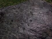
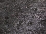
This is a seemingly unrecorded cup-marked stone, with very faint petroglyphic evidences just visible on the surface.  Set within the wider surrounds of more recent enclosure walling, this is a small slightly raised female (rounded, smooth) stone, roughly three feet in diameter, which has at least five cup-markings on its surface—mainly near the middle of the stone.  The rock itself is next to the western edge of a raised man-made feature, reminiscent of a collapsed denuded cairn or hut circle, which itself has not been archaeologically assessed.  It is one of a number of petroglyphs in relative proximity to each other on the geological ridge above Loch Tay (not visible from here).

Close-up of faint cups
Closer-up of faint cups

As you can see in the photos left and right, the cups are only truly visible when the stone has been wet.  Initially I thought that this carving may have been one that was mentioned briefly in George Currie’s (2009) notes—at NN 64736 38647, 62 (57m) yards to the east—but it doesn’t seem to be the case as the grid reference he cited differs from this.  There are going to be a number of other unrecorded carvings scattered about beneath the great shadow of Ben Lawers…

References:

  1. Currie, George, “Cup-and-Ring Marked Rocks,” in Discovery & Excavation, Scotland, volume 10, 2009.

Acknowledgements:  Huge thanks to Paul Hornby for the use of his photos in this site profile; and to Lisa Samson, for her landscape detective work at the site.

© Paul BennettThe Northern Antiquarian


Shealwalls Enclosure, Alyth, Perthshire

Enclosure:  OS Grid reference – NO 23922 51484  —  NEW FIND

Getting Here

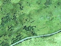
Aerial view of the oval, at centre

Aerial view of the oval, at centre

Take the B954 north out of the Alyth, up through the hills.  After just over 2 miles (3km), take the left turn up to Bamff.  Go along here and past the copse of trees on your right for literally three-quarters of a mile (1.2km), where a gate takes you into the overgrown meadows on your right.  Walk back on yourself for about 100 yards or more, across the boggy stream and up the slope.  The embankments of this enclosure are right under nose!

Archaeology & History

Some 70 yards west of the little four-poster ‘stone circle’ of Shealwalls, is this previously unrecorded enclosure.  Oval in shape and well-defined at ground level, the great majority of the inside of this enclosure is relatively even and flat.  Around its perimeter there are, at intervals, a number of small stones defining its edges along its internal embankment, but these are intermittent and seem to have no deliberate architectural regularity: they may simply be elements of an internal raised platform that have become visible due to erosion processes.

Northwest section of ditch

Northwest section of ditch

At its greatest width from the edges of the outer ditch to outer ditch, the enclosure measures more than 22 yards (20.3m) east-west, and at its longest it is 30 yards (27.3m) north-south.  The circumference of the enclosure is between 88-89 yards (80m).  The average width of the surrounding or enclosing ‘ditch’ is between 2 and 2½ yards (2m) and it has a depth of no more than 2 feet all round.  All along the southern side, very little remains of the ditch and in sections it has been eaten into by foraging rabbits and cattle.  The most conspicuous section of the surrounding ditch and embankment is along the eastern length (where it gives the impression of being hengi-form in nature); the more rounded northern section of the ditch is very distinct, but is overgrown in Juncus reeds; whilst the western section of the ditch is clear until reaching its southernmost part, where its outer edges become less visible.

SW edge of enclosure

SW edge of enclosure

NE arc of ditch, looking west

NE arc of ditch, looking west

There seemed to be no visible structures within the enclosure itself, which added to my thoughts that the site was hengi-form in nature, as defined in the surveys by A.F. Harding (1987) and Jan Harding (2006).  However, it is best to maintain a simple description regarding the nature of the site until archaeological evaluation can give us a more accurate assessment.  Without excavation it is obviously impossible to give an accurate idea of its age, but its architectural form and similarity with other enclosures would seem to place its construction in the late Bronze Age to early Iron Age period.

The monument proved very difficult to photograph with any success as it is much overgrown and the bright sun was in the wrong place! (serious) So, another visit is needed in the hope that we can get better images.  A fascinating little site!

References:

  1. Harding, A.F., Henge Monuments and Related Sites of Great Britain, BAR 175: Oxford 1987.
  2. Harding, Jan, The Henge Monuments of the British Isles, Tempus: Stroud 2006.

© Paul BennettThe Northern Antiquarian