Counter Hill, Addingham, West Yorkshire

Enclosure:  OS Grid Reference – SE 051 501
Getting Here

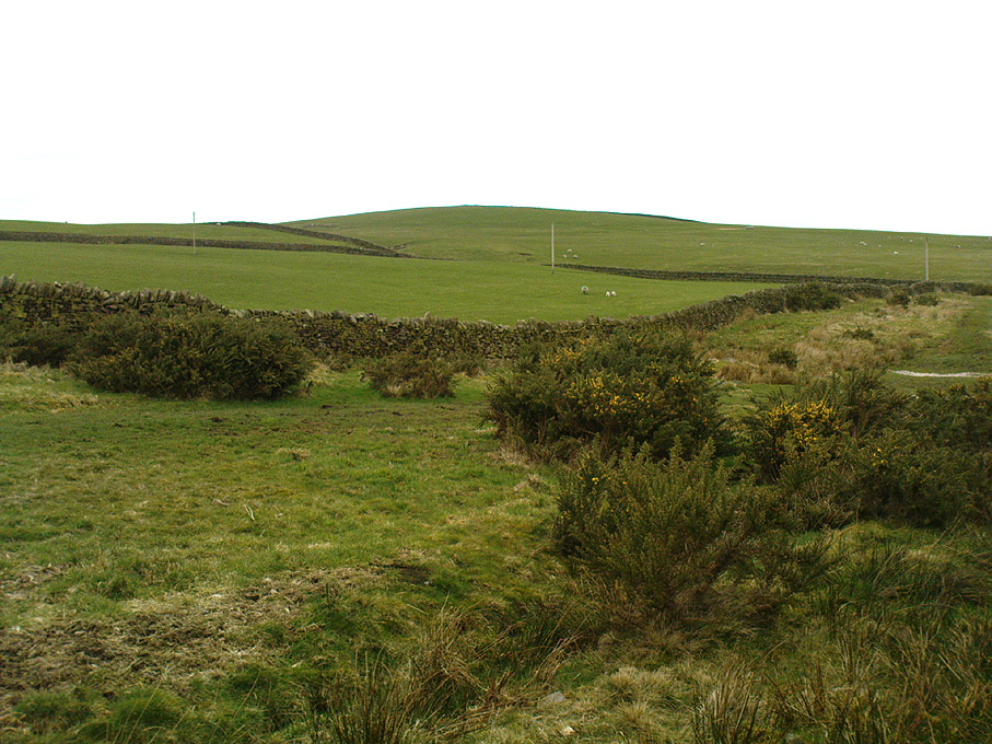
Counter Hill, looking north

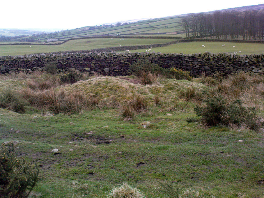
You can come from various angles to approach this site, but I reckon the best is from along the old trackway of Parson’s Lane, between Addingham and Marchup.  From Silsden go up the long hill (A6034) towards Addingham until the hill levels out, then turn left on Cringles Lane (keep your eyes peeled!) for about 500 yards until you reach the Millenium Way or Parson’s Lane track, to your right.  As you walk along this usually boggy old track, the rounded green hill ahead, to the left, if where you’re heading.  Less than 100 yards past the little tumulus of High Marchup there’s a stile on your left that takes you into the field.  You’ll notice the depression that runs across near the top, at an angle.  That’s part of the earthworks!

Archaeology & History

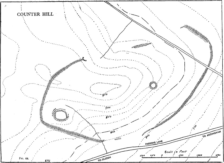
The Counter Hill earthworks just over the far western edge of Rombald’s Moor – thought to be Iron Age – are truly gigantic.   More than ¾-mile across along its longest NW-SE axis, and a half-mile from north-south at its widest point, this huge ellipse-shaped earthwork surrounds the rounded peaked hill that gives the site its name: Counter Hill.  And although Harry Speight (1900) thought the hill got its name from the old Celtic conaltradh, or Irish conaltra, as in the ‘hill of debate or conversation’ — a possibility — the place-name master Mr Smith (1961) reckoned its name comes from little other than ‘cow turd hill’!  We may never know for sure…
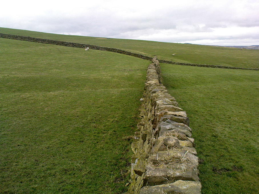
Earthworks south of Counter Hill
Cowling’s 1946 plan

The Lancashire historian Thomas Dunham Whitaker (1878) appears to have been one of the first people to describe the Counter Hill remains, though due to the sheer size of the encampment he thought that it was Roman in nature.  Within the huge enclosure we also find two large inner enclosures, known as the Round Dikes and the Marchup earthworks.  Whitaker’s description of Counter Hill told:

“There are two encampments, on different sides of the hill, about half a mile from each other: one in the township of Addingham, the other in the parish of Kildwick; the first commanding a direct view of Wharfedale, the second an oblique one of Airedale; but though invisible to each other, both look down aslant upon Castleburg (Nesfield) and Ilkley.  Within the camp on Addingham Moor are a tumulus and a perennial spring; but by a position very unusual in such encampments, it is commanded on the west by a higher ground, rising immediately from the foss.  The inconvenience, however, is remedied by an expedient altogether new, so far as I have observed, in Roman castramentation, which is a line of circumvallation, enclosing both camps, and surround the whole hill: an area, probably, of 200 acres.  A garrison calculated for the defence of such an outline must have been nothing less than an army.  But it would be of great use in confining the horses and other cattle necessary for the soldiers’ use, which, in the unenclosed state of the country at the time, might otherwise have wandered many miles without interruption.  The outlines of these remains is very irregular; it is well known, however, that in their summer encampments the Romans were far from confining themselves to a quadrangular figure, and when we consider their situation near the Street, and the anxious attention with which they have been placed, so as to be in view of Ilkley or Castleburg, there can be little danger of a mistake in ascribing them to that people.”
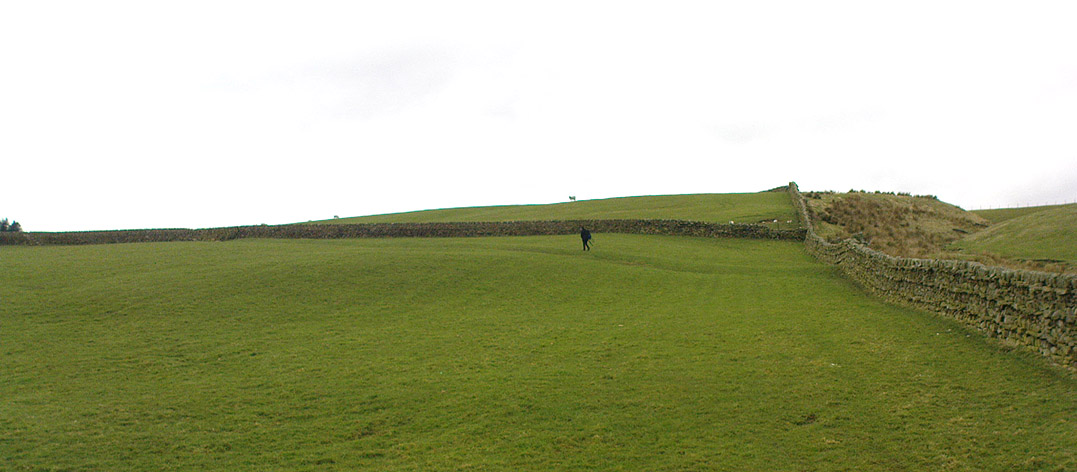
Counter Hill earthworks, looking west

And though Whitaker’s sincerity and carefully worded logic for the period is quite erudite (much moreso than the greater majority of historians in modern times), his proclamation of the Counter Hill earthworks as Roman is very probably wrong (soz Tom).  The embankments are much more probably Iron Age in nature and are very probably the result of indigenous tribal-folk than that of the incoming Romans.  Most modern archaeologists and historians tend to see the entrenchments as being from such a period and I have to concur.

Folklore

The old antiquarian Edmund Bogg (1904) wrote that the Counter Hill earthworks were built as a result “of the struggle between the Anglians and the Celt,” long ago.  The great Yorkshire historian Harry Speight (1900) narrated similar lore just a few years earlier, but told that the tradition was  “of how the Romans drove the natives from this commanding site of Counter Hill.”

References:

  1. Bogg, Edmund, Higher Wharfeland: The Dale of Romance, James Miles: Leeds 1904.
  2. Cowling, Eric T., Rombald’s Way, William Walker: Otley 1946.
  3. Fletcher, J.S., A Pictureseque History of Yorkshire – Part IX, J.M. Dent: London 1901.
  4. Smith, A.H., The Place-Names of the West Riding of Yorkshire – volume 6, Cambridge University Press 1961.
  5. Speight, Harry, Upper Wharfedale, Elliott Stock: London 1900.
  6. Whitaker, T.D., The History and Antiquities of the Deanery of Craven, 3rd edition, Joseph Dodgson: Leeds 1878.

© Paul Bennett, The Northern Antiquarian


High Marchup, Silsden, West Yorkshire

Tumulus:  OS Grid Reference – SE 0501 4949

Also Known as:

  1. Parson’s Lane Tumulus

Getting Here

High Marchup tumulus

From Silsden go up the long hill (A6034) towards Addingham until the hill levels out, then turn left on Cringles Lane (keep your eyes peeled!) for about 500 yards until you reach the Millenium Way footpath, or rather, green lane track, to your right.  Walk along this usually boggy old road for another 400 yards until you’re level with the small copse of trees below the field (about 100 yards away).  The slightly raised ditched mound on the left side of the track ahead of you is what you’re after!

Archaeology & History

Unless this old tomb was pointed out, you probably wouldn’t give the place a second glance.  It’s a seemingly isolated singular round tomb, subsided on top and surrounded by a small ditch, running into the edge of the walling.  Gorse bushes and a few rocks are around the edges of the site.  Harry Speight (1900) described this old tomb as a

“lonely isolated mound, to be seen in Parson Lane about a hundred yards west of the Celtic boundary, Black Beck, where some old dying chief has called his friends around him bidding them, “heap the stones of his renown that they may speak to other years.”  It is a tumulus 80 feet in circumference and does not seem to have been disturbed.”

In Faull and Moorhouse’s (1981) magnum opus they describe the site as “the denuded remains of a ditched round barrow,” but say little else.  It may have had some relationship with the settlement remains in and around the huge Counter Hill complex, immediately north.

References:

  1. Cowling, E.T., Rombald’s Way: A Prehistory of Mid-Wharfedale, William Walker: Otley 1946.
  2. Faull, M.L. & Moorhouse, S.A. (eds.), West Yorkshire: An Archaeological Guide to AD 1500 (4 volumes), WYMCC: Wakefield 1981.
  3. Speight, Harry, Upper Wharfedale, Elliott Stock: London 1900.

© Paul Bennett, The Northern Antiquarian


Counter Hill Carving, Silsden, West Yorkshire

Cup-Marked Stone:  OS Grid Reference – SE 0463 4995

Also Known as:

  1. Carving no.31 (Boughey & Vickerman)

Getting Here

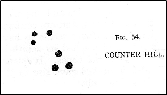
Cowling’s 1946 drawing

From Silsden go up the long hill (A6034) towards Addingham until the hill levels out, then turn left on Cringles Lane (keep your eyes peeled!) for a half-mile where you need to veer right along Banks Lane and go 100 yards past Moorcock Farm Hall where the footpath takes you into the fields on your right.  Walk down the line of the wallings, thru the gate, and keep following down until you reach a cluster of large rocks.  Stop here and look over the wall where you’ll see one of the boulders poking its head out on the other side.  That’s it!

Archaeology & History

First discovered by Eric Cowling in the late 1930s during one of his explorations of the immense Counter Hill earthworks (thought to be Iron Age), whose remains can still be seen encircling the peaked hill close by.  The stone is found in the edge of the walling halfway down the field towards the Marchup enclosure and is just inside the outer edge of the Counter Hill ditched enclosure surrounding the hill above you. (on the other side of the wall from the carving, you can make out the remains of the faint line of the ditch running pretty straight up towards the next wall)

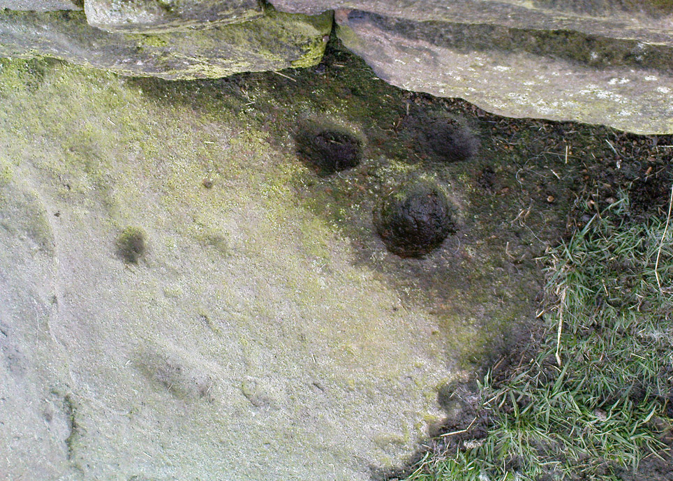
Cluster of cups by walling
Counter Hill carving from above

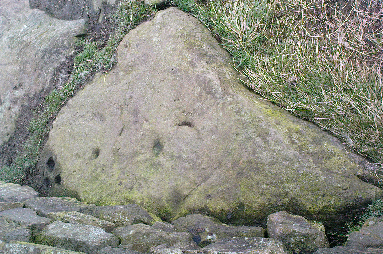
At the top eastern edge of the stone is a clear cluster of 3 cup-markings, just as the rock meets the walling.  A much more faint group is visible to the left.  Cowling (1946) suggesting that the three-cup-cluster “shows the final form of the fylfot symbol,” i.e., the three-armed swastika.  Boughey & Vickerman (2003) meanwhile suggest that one of the two clusters are “doubtful (possibly recent?).”

When we came to this site yesterday, the day was overcast and cloudy.  But it seemed there may be more to this carving than has previously been recorded.  What may be a faint ring seemed possible near the middle of the stone, with a natural crack running through it (you can just about make it out in the photo on the right).  There also seemed to be other faint lines on the rock, but until we’ve been here again with better lighting conditions, the two groups of 3-cups is the symbolic state of play for this stone!

References:

  1. Boughey, Keith & Vickerman, E.A., Prehistoric Rock Art of the West Riding, WYAS: Wakefield 2003.
  2. Cowling, E.T., Rombald’s Way: A Prehistory of Mid-Wharfedale, William Walker: Otley 1946.
  3. Hedges, John (ed.), The Carved Rocks on Rombalds Moor, WYMCC: Wakefield 1986.

© Paul Bennett, The Northern Antiquarian


Doubler Stones, Ilkley Moor, West Yorkshire

Cup-and-Ring Stones:  OS Grid Reference – SE 0723 4652

Also Known as:

  1. Carving Nos. 41 & 42 (Boughey & Vickerman)
  2. Carving Nos. 6 & 7 (Hedges survey)
  3. Doublestones
  4. The Fire Stones

Getting Here

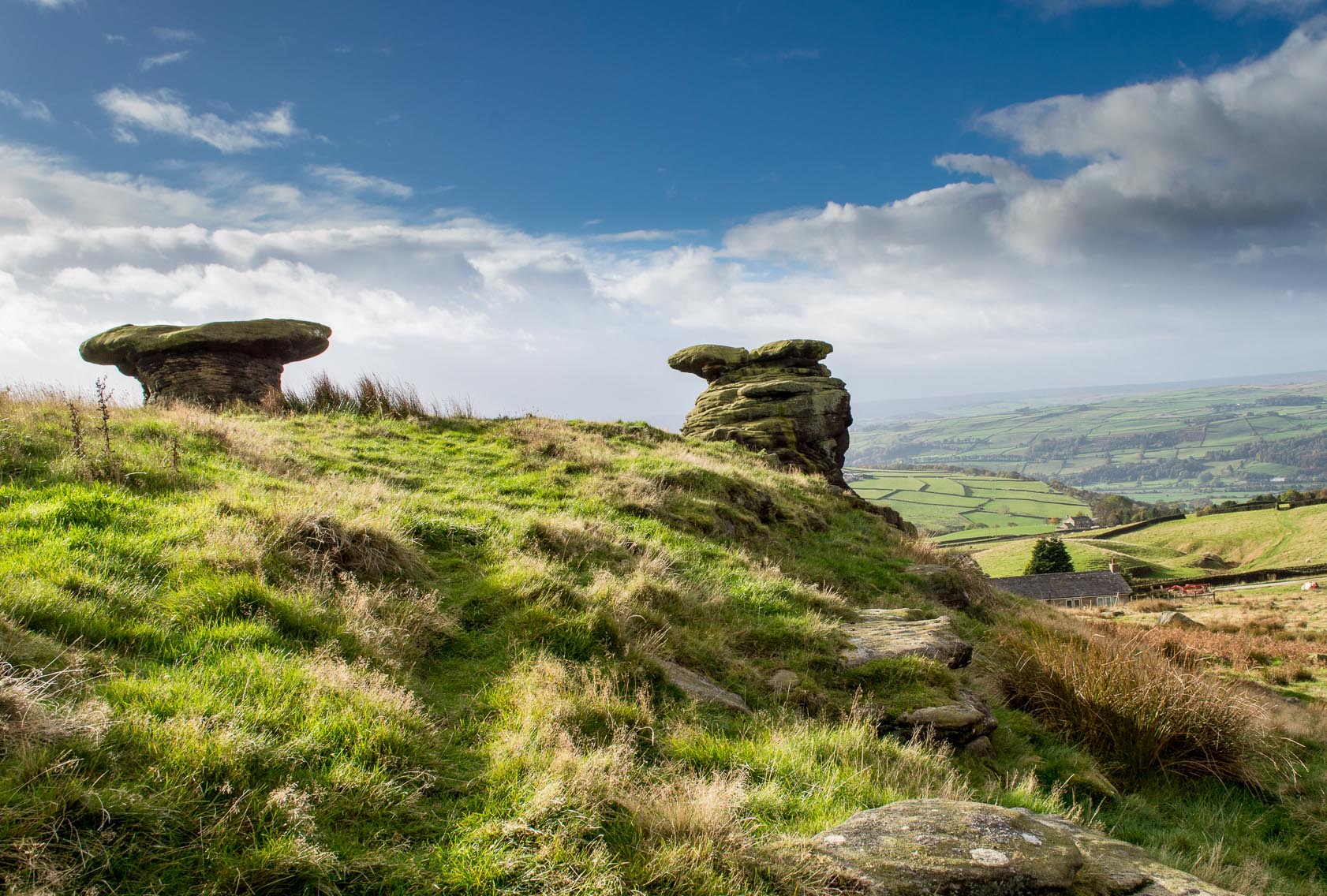
The great Doubler Stones (photo, James Elkington)

Various ways to get here, but the 2 most common are: (1) from Brunthwaite village, above Silsden, following the road uphill for a mile, then turning right (west) onto the moorland dirt-track to Doubler Stones Farm.  Just before here there’s a footpath uphill (north) for 200 yards to the stones.  (2) follow the Millenium Way footpath south up Addingham Moorside, onto Addingham High Moor.  Keep going on the same path another 500 yards and they’ll appear ahead of you.

Archaeology & History

First described as the ‘Doublestones’ in the local Addingham parish records of 1786, these great mushroom-shaped rocks were later brought to the attention of archaeologists by J. Romilly Allen in 1879 and they greatly intrigued numerous Victorian antiquarians, who puzzled as much about their exotic forms as the cup-marks on their tops!  Allen wrote of them:

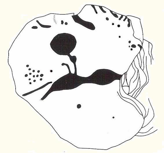
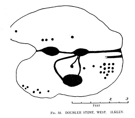
“These rocks are by far the most remarkable freaks of Nature to be seen in the district. They occupy a prominent position, perched on the extremity of a rocky knoll which juts out into the valley; and as seen from below, with their weird forms standing out clear and sharp against the background of blue sky, they present so extraordinary an appearance that they would at once attract the attention of even the most unobservant.  In general outline they resemble gigantic toadstools; and I presume that they are called Doubler Stones from the fact of their shapes being almost identical.  They may be appropriately described as Nature’s Twins.  The upper surface of the cap of one of these stones has three large basin-shaped cavities in it.  Two of these lie along the central axis of the stone, and measure respectively 1ft 3in by 2ft 9in deep, and 1ft 9in by 1ft 3in by 9in deep.  They are united by a deep groove, a continuation of which runs out over the edge of the stone at each end.  There is another basin lying to the west side of the two central ones, with one of which it is connected by grooves.  It measures 2ft by 1ft 9in and is 9in deep.  There is no direct evidence that these basins are artificial; but it is quite possible that they may have been so originally, and have been enlarged by natural agencies.  But in addition to the basins, are twenty-six cup-markings of distinctly artificial origin.  They vary in diameter from 2 to 4 in.  One group of cups appears to be arranged in parallel rows.”

Cup-marks on the right-hand Doubler Stone
Cup-marks on one of the Doublers (after Hedges 1986)
Cowling’s 1946 drawing

Although the writer thought there were no artificial cup-markings on the other Doubler Stone (the one on the left in the photo), John Hedges (1986) and Boughey & Vickerman (2003) cite there to be at least two cup-markings on this rock.  Other writers have given different numbers for the respective cup-marks thought to be on these rocks down the years.

If you’re into prehistoric rock-art, check this place out.  If you’re a geologist and aint been here, you’ll be even more impressed!

Folklore

Approaching the Doublers (photo – James Elkington)

In Nicholas Size’s Haunted Moor (1934) he described the Doubler Stones as being the abode of ghosts and a place of sacrificial rites in ancient days. While in Guy Ragland Phillips’ Brigantia, we find that the word ‘doubler’ itself “is a large shallow dish, bowl or plate” – which we find on top of the greater one of these two well-worn-weirdoes.  As well as being haunted, there is some other little-known, though not unexpected folklore here, which told these old stones to be the meeting place of witches in previous centuries.

In addition to this, we are told that the witches of Fewston valley to the west used to meet up with the more famous Pendle witches at these stones.  One historian proclaimed that this notion was spurious, as it would be too far for the Pendle witches to walk – which says more about the historian in question than the people of previous centuries.  The distance from Pendle to the Doublers can be traversed in a day and is an ideal meeting spot, away from the prying eyes of a wrathful Church, that sought war against the animistic practices of our ancestors.

References:

  1. Allen, J. Romilly, ‘The Prehistoric Rock Sculptures of Ilkley,’ in Journal of the British Archaeological Association, volume 35, 1879.
  2. Allen, J. Romilly, ‘Notice of Sculptured Rocks near Ilkley,’ ibid, volume 38, 1882.
  3. Bennett, Paul, The Old Stones of Elmet, Capall Bann: Chieveley 2001.
  4. Boughey & Vickerman, Prehistoric Rock Art of the West Riding, West Yorkshire Archaeology Service 2003.
  5. Cowling, Eric T., Rombald’s Way, William Walker: Otley 1946.
  6. Hedges, John, The Carved Rocks on Rombalds Moor, WYMCC: Wakefield 1986.
  7. Jennings, Hargrave, Archaic Rock Inscriptions, A. Reader: London 1891.
  8. Phillips, Guy Ragland, Brigantia: A Mysteriography, RKP: London 1976.
  9. Size, Nicholas, The Haunted Moor, William Walker: Otley 1934.

Acknowledgements:  Massive thanks to landscape photographer, James Elkington, for use of his images in this site profile.  Thanks mate! 

© Paul Bennett, The Northern Antiquarian


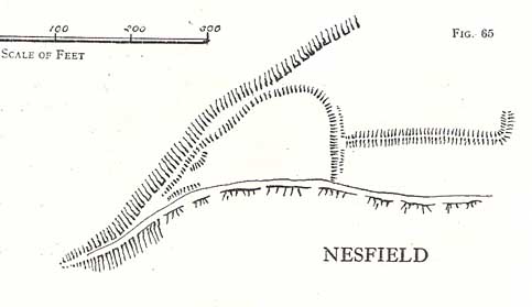
Castleberg, Nesfield, North Yorkshire

Hillfort:  OS Grid Reference – SE 0925 4947

Getting Here

Two main ways to get here.  Hmmmm….on second thoughts, one main way.  My preferred route would be from Addingham (east-side) where the foot-bridge crosses the Wharfe.  Walk up the path and, eventually, onto the tidgy road and bear left till you hit the trees.  On the right-hand side of the road you’ll see the trees covering the crop near the edge of the river. …Otherwise, come from Ilkley, cross the river, take the first left, on a few hundred yards and left again on Nesfield Road.  From here, keep walking about a mile and when you hit the village, you need to look into the field behind the first farmhouse on your left.

Archaeology & History

You’ll see the more visible embankments on the western edge of these old earthworks. But unless you’re a real archaeomaniac into depleted field remains, this might not tickle your neurons too much. However, it’s a gorgeous little hamlet is Nesfield – and I think that alone makes it worthy of a visit!

Cowling's 1946 plan
Cowling’s 1946 plan

Described variously over the years as an enclosure, a hillfort, a camp, a settlement – aswell as being ascribed to periods from the medieval, Roman, Iron Age and Bronze, the consensus opinion at the moment edges to it being late Bronze- to early Iron Age in origin.

The fortifications themselves seem to have been first mentioned by T.D. Whitaker in 1812, who said the following:

“Castleberg is in a commanding position, on the brink of a steep slope washed by the Wharfe, about two miles above Ilkley. This post is naturally strong, as the ground declines rapidly in every other direction. But it has been fortified on the more accessible sides by a deep trench, enclosing several acres of ground, of an irregular quadrangular form. At a small distance within the enclosure, an urn with ashes was lately found, but what seems to evince beyond a doubt, the Castleberg was a Roman work, is the discovery of a massy key of copper, nearly two feet in length, which,” he thought, “had probably been the key of the gates.”

This ‘key’ that Whitaker mentioned (if memory serves me right) has been lost and therefore its nature/function lost aswell.  E.T. Cowling (1946) thought the key “may refer to a bronze article of a size which must belong to the Late Bronze Age, when the metal became more plentiful”; thinking it perhaps to be part of a sword.  Twouldst be good to find this artifact and know for certain. Cowling also posited that the urn found here was of Bronze Age origin – an opinion echoed by later archaeologists.

The great Harry Speight (1900) meanwhile, told that the hamlet itself was locally called Castleberg and told us a bit more of the details of the finds, saying:

“I am disposed to think it was a winter-station of the old Britons of Howber, and afterwards of the Teutonic settlers.  An urn containing ashes has been found on the site, and Mr James Pickard, who has long occupied the adjoining farm, tells me he has excavated several parts of it and found human bones, but no relics.  This premises Anglo-Saxon interments and the urn late British…”

References:

  1. Cowling, E.T. Rombald’s Way, William Walker: Otley 1946.
  2. Howson, William, An Illustrated Guide to the Curiosities of Craven, Whittaker: Settle 1850.
  3. Keighley, J.J., ‘The Prehistoric Period,’ in Faull & Moorhouse’s, West Yorkshire, An Archaeological Guide, vol.1, Wakefield 1981.
  4. Speight, Harry, Upper Wharfedale, Elliott Stock: London 1900.
  5. Whitaker, T.D., History and Antiquities of the Deanery of Craven, J. Nichols: London 1812.

© Paul Bennett, The Northern Antiquarian