Backstone Circle, Ilkley Moor, West Yorkshire

Stone Circle:  OS Grid Reference – SE 12605 46130
Getting Here

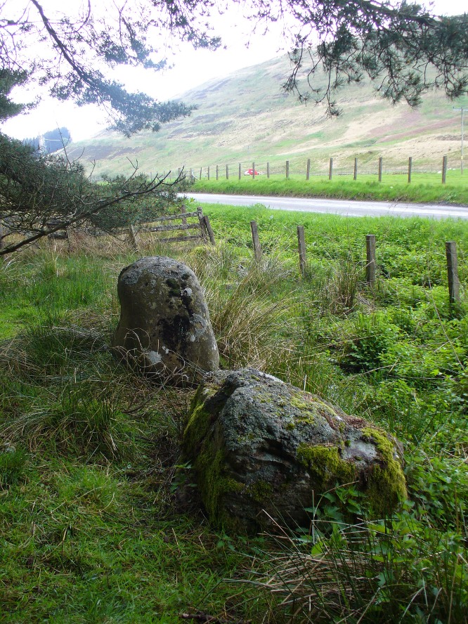
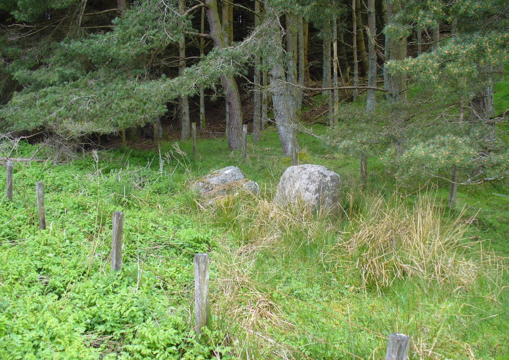
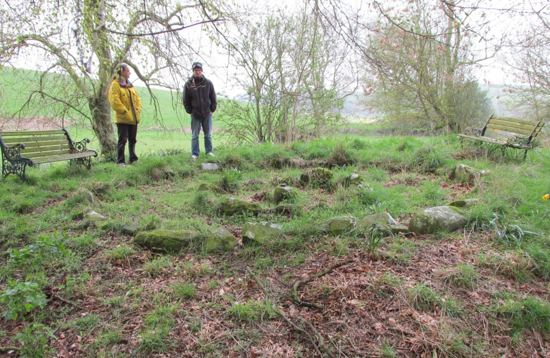
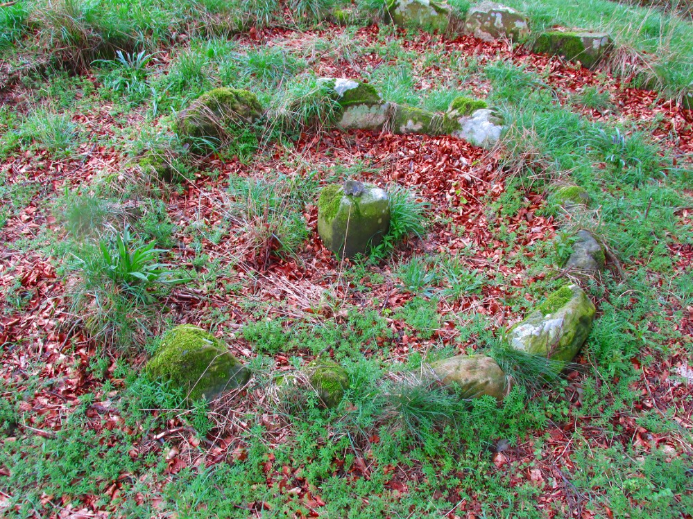
The ruins of Backstone Circle (photo, Richard Stroud)

There are many routes to get here, but this is the one I usually take. From Cow & Calf Rocks, walk up the steep hillside onto the first moorland plain, taking the path right, diagonally, across to the NW as if you’re heading to the Map Stone.  From here, looking down at the stream valley below, follow the valley edge up, past the settlement, and then veer down to Backstone Beck and up on the other side till you meet with a footpath and also up in the heather ahead of you, notice the jumbled walling less than 100 yards away.  That’s where you need to be!

Archaeology & History

A singular short sentence in Robert Collyer and J.H. Turner’s Ilkley, Ancient and Modern (1885) started it all off, where they told:

“There was still a rude circle of rocks on the reach beyond White Wells fifty years ago, tumbled into such confusion that you had to look once, and again, before you saw what lay under your eyes.”

…..And thankfully this is still what we see today – and in just the area they mentioned.

I’m intrigued to find there’s so much said about this site on the Net and feel I should put my recent feelings about the place to print at last (and after being badgered to gerrit done by James Elkington!).  The information about its make-up and the mess it’s in, hasn’t changed since we rediscovered the place on June 3, 1989.  Here, amidst the tall grasses and reeds of Juncus effusus and J. conglomeratus, our jumble of megaliths hides within a breakdown of fallen walls, that are thought to have been part of some sheep-fold or a similar animal enclosure (mebbe for the annual sheep-shagging contests that are held, quietly, on these moors each year!).

The name ‘backstone’ itself come from the adjacent beck (slowly depleting as the years pulse by) and is mentioned in the 18th century parish registers.  A.H. Smith (1961) informs us that it was the “stream where bakestones were got”, and this was probably a tradition going way way back.  The baking stones from the beck may even have been used by the people living in the prehistoric settlements close to the circle.
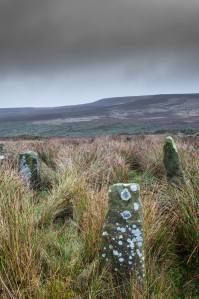
Stones amidst the reeds

In what looks today like a messy double-ring of stones, it’s likely there was originally just a single ring which has, subsequently, been knocked down and re-used for some form of sheep-fondling sessions—be it agricultural or otherwise!  But for the record at least: we have small inner ‘ring’ of four upright stones, re-worked in more recent centuries, between two-and-a-half to three-and-a-half feet tall.  Another stone is recumbent.  The outer ring is more conspicuous.  It consists of at least eight standing stones–seven of which are upright–between three and five feet tall, some of which have been re-worked in more recent times. There are several other stones either recumbent or partly covered by vegetation. The tallest of the stones is 4’11” tall. The outer circle has had at least one of the stones uprooted and used at the base of the dry-stone walling intruding the southwest side of the circle. What appears to be at least two original standing stones are embedded into earthworks on the other side of this wall, one of which was located through dowsing!

The best section of the ring can be seen on its eastern side, where an arc of upright stones between three and four feet high are still clearly in evidence, just inside a raised embankment like that found surrounding the Twelve Apostles stone circle less than a mile away.

A short while after finding the site, we contacted the Ilkley Head of Archaeology Studies, Gavin Edwards, about the circle and he subsequently included the site on one of the tourist-guides to the moors.

Alignments through this circle seem apparent in situ; and although such alignments are intriguing (to me anyhow), it’s the geometric relationship Backstone has with other circles on these moors that is rather notable. It’s position in the landscape plays an essential part in an isosceles triangle formation, 1180 yards [1.08km] from the Twelve Apostles stone circle which, as the centre point, is another 1180 yards from the Roms Law Circle.  Odd….

Immediately visible from our ruinous circle across the small valley to the slopes of Green Crag, the Ilkley Archaeology Group spent more than fifteen years excavating the remains of what was initially thought of as a Bronze Age village, but their work here has proved startling, pushing the date of human occupation here into the mesolithic period!  Local archaeologist Gavin Edwards opined that the Backstone circle would have been the religious site for the people who lived here.  I have to concur.  There are also more neolithic and Bronze Age walling, indicative of extended settlements and enclosures, less than 200 yards north of the Backstone Circle, structurally consistent with the remains across the valley at the excavated Green Crag Slack settlement.

Ten yards east of the circle is a small well which only runs following exceptional rainfall.  This was probably of some ritual importance to the people who practiced rites here.  Geological fault lines run not far away on three sides of the ring and an underground stream is present, quite close to the surface (as indicated by the presence of Juncus conglomeratus and J.effisus), encouraging the preponderance of regular electromagnetic variations: these in particular are likely to have some causative influence on the paranormal events described below….

Fortean History

Since rediscovering this site, a number of bizarre psychophysical anomalies have been experienced and described by more and more people — some of whom were previously very sceptical of such things.  Both day and night, no doubt when Moon and water speak their subtle electromagnetic accord, a gathering corpus of all-too-familiar events keep speaking of a most disturbing resident spirit

We begin on Wednesday, July 12, 1989, sometime around midnight, when an acquaintance and I were spending a few days here to record any possible electromagnetic anomalies at this disturbed ring of stones.  We weren’t to be disappointed, as something very untoward raised its peculiar head.

As I sat barely ten yards beyond the tumbled group of stones there suddenly appeared, from nowhere, a host of figures—a dozen at most—walking ever so slowly around the old site. I could discern no physical features other than their height and humanoid shape. It was just too dark to see any details about them—they were, effectively, silhouettes.  My acquaintance was terrified—although it was perhaps a minute or so before he even glanced at what I was pointing and exclaiming at, somewhat manically, stuttering and shaking my head in an attempt to make the things disappear back to my unconscious where they surely originated. Didn’t work though!

These were no psychic projections. I literally shook my head, closed my eyes and knocked my head against the walling; looked away, shook my head again, shouting at myself and looked back at the figures in front of us. It still didn’t do a damn thing! By now my friend was staring, aghast and scared shitless if the expression on his face was anything to go by.

“Wot a’ y’ seeing? Wot can y’ see?” I asked.

He murmured and mumbled something about some people he could see, walking round and round the old remains.

He was seeing exactly the same as what I could see. As the minutes passed by, this group of people, who were winding in and out of each and every stone and walking through the intrusive walling as it was not there, slowly but surely, ever so gradually, increased in speed. This was very slow and patient and went on for at least fifteen minutes — by which times they were barely visible as individual figures anymore. All we could see by now was a visual blur and a remarkable vortex that was created in the wake of their ‘dance’.

This spinning vortex of silhouettes seemed to get faster and faster until appearing to reach a sort of critical speed/energy state — and as this “critical state” occurred, what was by now a rapid spinning, energetic blur simply vanished right before our eyes!  It was as if someone, somewhere, had flicked a switch and they disappeared.  Yet, at the very same moment the blurred vortex vanished, several dead straight lines of orange-red appeared in their place.  These were as baffling as the dance we had just watched: very thin, wavering lines of what I can only describe as subtle light, bounced off several of the standing stones. These lines—perhaps four of them—did not originate from the circle but appeared to come from further afield. One in particular seemed to come from the direction of the great boulder known as the Idol Rock, 700 yards [650m] east and continued past our field of vision in the direction of the Swastika Stone.

To be honest these “lines of energy” perturbed me more than the spinning figures which had just disappeared. Not only were these lines two-dimensional [a real screw-up that one!], I was at a loss to explain what these lines really were. The first thought was, of course, leys – but my idea of leys did not, and still does not accord with what I was seeing. Eventually the lines faded back to wherever they came, leaving both of us wondering what the hell we had just experienced.

Several minutes after talking over what had just happened, I stood up and walked into the circle. At this point, please remember it was July 12 and the night was so warm that neither of us had taken sleeping bags or a tent onto the high moors with us. As I got to the circle and took my first step inside, a tremendous shiver hit right through my body, almost like I was walking into a freezer. But I moved another step forward, unperturbed if truth be had by the probable chill wind that made me shiver. As I did so, the chill became more manifest and intense. As I took my third step forward the cold became biting and I collapsed onto my knees. [This is not like me, honest. Give me camping in the Scottish mountains in mid-February with average temperatures of -6 degrees and that’s my idea of a good night out!]

Shivering like hell, I stumbled upright and back onto my feet and virtually ran out of the circle. That, more than anything else that night, truly perturbed me.

The following morning another volunteer joined us. We told him about the events of the previous night and he thought whatever he thought; but he’d brought two thermometers with him and set them on two of the rocks: one of them about 25 yards outside the circle, the other on a stone in the circle.  The two of them had the same reading: 73° F.  We left them without checking for a good hour or so and then began to take readings. What transpired was bizarre to say the least: the one outside the circle was 62° F, the one in the circle was 72° F.  A further reading fifteen minutes later, close to sunset, showed the temperature variations had come a little closer: the inner reading was 70° F, and outer reading still 62° F. Readings were then taken every fifteen minutes and the respective readings closed in on each other until both were the same, exactly when the sun was touching the horizon to set, at 9.05pm.  But this was not the end of the anomaly. While the temperature outside the circle dropped naturally with nightfall, finally resting at 57-58° F, the inner circle reading continued falling at nearly twice the background rate!  Our final reading after 11pm showed a deviation of nearly 7 degrees between the respective thermometers!

If these elements seem in anyway somewhat unbelievable, what occurred next bends the parameters of reality still further!

No further anomalous Fortean events happened at the circle that night—for us at least. However, a friend in Leeds—the internationally renowned ritual magician and author, Phil Hine—was at home with some friends, chatting.

“On the night in question,” he came to write sometime later, “I was talking to another magickian. He returned from the toilet and informed me that there was an “entity” lurking in the stairwell… This was unusual, but not sufficiently unusual to cause undue concern, and so, picking up my thunderbolt, I went out to see what was what. In the stairwell we both agreed on seeing a black amorphous shape. Since my friend had first noticed this, I asked him if he would be prepared to “open his mind” to it, so that I could question it, using him as an interface [which was one of his particular talents] and a fairly accepted procedure for questioning strange entities. “The entity declared,” I have come from the ancient hills.” It also stated that it had been “awakened” only recently due to activity around a sacred site. It said that it had come to give me “power” with which I could do something, but was reticent about the exact nature of this. When I asked what it would do if I rejected this, it said that it would return “screaming to the hills.” When I asked it to identify itself it gave the name Azathoth—which could well have sprung from the mind of my friend, although he had no particular knowledge of the Cthulu mythos entities.”

Phil continued:

“At the time I found it difficult to credit that such a powerful entity would be hanging politely about in the stairwell waiting to be noticed. Being unable to obtain a direct answer to my questions, I told it to go forth, which it apparently did. I later had to perform an intense banishing ritual on my friend who was suffering from symptoms such as feeling cold, a tight pressure on the chest, personality displacement, and motor spasms… Unbeknownst to me at the time, two friends of mine who were members of the West Yorkshire Earth Mysteries Group had experienced a strange encounter at the then newly-uncovered Backstone Circle on Ilkley Moor… It seems strange, on reflection, that the appearance of the entity claiming to originate from a newly disturbed site seems to relate to their experience.” [Hine 1994, 1997]

Other bizarre experiences at the circle itself have been reported by growing numbers of people—a lot of them quite unpleasant. One lady, Katy from Calderdale, whose interest in megaliths rarely stretched into the obscurities of their folklore or weird tales, will “probably never go there again. It terrified me. I don’t know why, there was nothing to be scared of, but the place just felt awful.”

There have been at least a dozen people who have related the same words to me—and I can empathise. On February 14, 1990, Mick N. and I went to the site for the night with intent to do a bit of sympathetic ritual magick.  The night was cold and a slight fall of snow glittered across the moors as far as we could see, invoking quite healthy feelings about the forthcoming rite.  But as we turned off the path and approached the stones, it was as if we had walked through an invisible gate or door just yards before the circle itself, screaming quite powerfully with gnarled teeth that we were not wanted there that night!  It was overwhelming!  We both acted accordingly and spent the night elsewhere, cold and querying over its genius loci.  The potency of Azathoth seemed inherent in its silent voice.

This particular feeling, almost of malevolance, has been described by many people at Backstone.  It occurs both day and night and is akin to what Prof Thomas Lethbridge (1961) described as ‘ghouls’: place-memories so to speak, or spirits of place.  Most of the time there is no such feeling, of course.  But when conditions are right, these potent subjective consumations can be quite overwhelming at some spots.  They are reported worldwide in the aboriginal traditions of all races and are felt, obviously, even today by explorers, mountaineers and visitors to ancient haunted places like the Backstone Circle.

Strange lights have also been seen over and around here by a number of witnesses. On one occasion a ritual invocation of its spirit-nature brought forth a number of glowing red spheres of light.  These were about the size of footballs, appearing for a minute or two, floating in front and around us, then vanishing—only to reappear yards away around the edges of the damaged ring of stones. These were very obviously living things and were examining us with equal bewilderment.  Other light-phenomena that people have seen here and on this moor appear to relate to the phases of the Moon.

Although the site is quite ruinous, it is a worthwhile place to visit – just respect, and beware the Old Hag who sometimes comes forth from time to time….

…to be continued…

References:

  1. Bennett, Paul., “The Backstone Circle,” Earth 15, 1990.
  2. Bennett, Paul, “Archaeological and Geometrical Applications of the Lost Stone Circle of Ilkley Moor,” Earth 15, 1990.
  3. Bennett, Paul, Circles, Standing Stones and Legendary Rocks of West Yorkshire, Heart of Albion Press: Wymeswold 1994.
  4. Bennett, Paul, “The Strange Case of Backstone Circle,” Right Times 1, 1998.
  5. Bennett, Paul, The Old Stones of Elmet, Capall Bann: Milverton 2001.
  6. Bennett, Paul, The Twelve Apostles Stone Circle, TNA Publications 2017.
  7. Collyer, Robert & Turner, J. Horsfall, Ilkley: Ancient and Modern, William Walker: Otley 1885.
  8. Devereux, Paul, Places of Power, Blandford: London 1990.
  9. Gyrus T., “An Interview with Phil Hine,” Towards 2012 volume 4, 1998.
  10. Hine, Phil, “The Physics of Evocation,” Chaos International 1990.
  11. Roberts, Andy, Ghosts and Legends of Yorkshire, Jarrold: Norwich 1997.
  12. Smith, A.H., The Place-Names of the West Riding of Yorkshire – volume 4, Cambridge University Press 1961.

AcknowledgementsMany thanks to Richard Stroud for his photo of Backstone at winter time; to James Elkington for saying, “Come on Paul – get yer finger out!” + his photos too…

Links:

  1. Backstone Circle on The Megalithic Portal

© Paul Bennett, The Northern Antiquarian


Glen Shurig, Kilbride, Arran

Stone Circle (destroyed):  OS Grid Reference – NR 99 36

Also Known as:

  1. Canmore ID 39685

Archaeology & History

Along the B880 glen road that cuts Arran roughly in half, known as The String, could once be seen a stone circle that one early writer told was quite impressive.  Today It seems that all trace of the circle has gone.  The earliest mention of it seems to be in James Headrick’s (1807) work, where, in discussing what he thought were “Druidical” remains of obelisks and cairns in the area,

“A more entire circle of this sort is seen on the rising ground at the mouth of Glen Shirreg, towards the west.”

But he tells us no more.  Shortly afterwards—according to reverend Allan McNaughton in the New Statistical Account of the 1830s—it was destroyed. He said that,

“about twenty-four years ago, a very complete circle at the mouth of Glensheraig was removed, in clearing the field in which it stood for the operations of the plough.”

Despite this short remark, eighty years later we had J.A. Balfour (1910) inform us that,

“On the right of the String Road going west in Glen Sherraig is a small ruined monument of which three small standing stones alone remain, so disposed as to suggest that the original structure was a double circle.”

However, Balfour’s site may be an altogether different one to that mentioned by Headrick and McNaughton.

Aubrey Burl (2000) lists it in his major work; but its ancient life was, once again, brought to end in these recent years by those of less sound minds than our ancestors.

References:

  1. Balfour, J.A., The Book of Arran – volume 1, Arran Society of Glasgow 1910.
  2. Bryce, James, “Account of excavations within the stone circle of Arran“, in Proceedings of the Society of Antiquaries, Scotland, volume 4, 1863.
  3. Burl, Aubrey, The Stone Circles of Britain, Ireland and Brittany, Yale University Press 2000.
  4. Headrick, James, View of the Mineralogy, Agriculture, Manufactures and Fisheries of the Islland of Arran, with Notices of Antiquities, D. Willison: Edinburgh 1807.

© Paul Bennett, The Northern Antiquarian
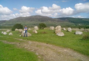

Fingal’s Cauldron Seat, Machrie Moor, Kilmory, Arran

Stone Circle:  OS Grid Reference – NR 90878 32353

Fingal's Cauldron, on 1864 OS map
Fingal’s Cauldron, on 1864 OS map

Also Known as:

  1. Canmore ID 39705
  2. Machrie Moor 5
  3. Moss Farm Stone Circle
  4. Suidhe Coire Fhionn
  5. Tormore Stones

Getting Here

The stone circle of Fingal's Cauldron Seat, Machrie Moor, Arran <c>(photo by Aisha Domleo)</c>
The stone circle of Fingal’s Cauldron Seat, Machrie Moor, Arran (photo by Aisha Domleo)

By whichever way you come (be it from Brodick on the east, Lochranza to the north) ask any local the way to Machrie and they’ll point you the road onto the west side of the island, roughly halfway.  You’re after the hamlets of Blackwaterfoot or Auchagallon. From either of these spots, take the road to Tormore.  From here, the dirt-track east close to the Machrie Water is where you need to walk.  About a mile along this well-defined track you’ll see the large barn ahead of you.  Hereabouts you’ll begin to notice some very tall standing stones. Keep walking on the track, and the first double-ring of smaller stones to your right is the place yer after!

Archaeology & History

Approaching the ring (photo by Aisha Domleo)

This is one well-preserved stone circle in a superb setting with other large megalithic rings all close by—at least 12 of them!—set upon the flat open moorlands on the west side of Arran, with views in all directions sending the enquiring nose tasting for more wherever the eyes gaze….  It has been written about by many many writers over the last few centuries—which aint surprising!  But it was in recent times that the place was said by Aubrey Burl (1981) to be “holy ground,” because although there are many prehistoric settlement sites and other remains scattered across this landscape,

“it is noticeable that the dozens of huts whose ruins litter the moor were built well away to the west, none of them near these powerful and lonely stones.”

1832 sketch of Fingal's Cauldron by James Skene
1832 sketch of Fingal’s Cauldron by James Skene

It’s a fair point.

Fingal’s Cauldron was first defined in an archaeological context by James Bryce in 1863, who named it the ‘Machrie Moor 5’ stone circle (MM5)—and it was he and several others who dug into the ring, to see what it might be hiding!

“Excavating at the centre we found a small cist at less than a foot in depth, and lying about north-east.  It was covered by a small lid, and the dimensions were 2 feet 2 inches in length, 10½ inches in depth, and 11 inches in width.  Inside there were several bone fragments and black earth.  A flint implement was found in the stony soil above, and three other flint fragments, but nothing of this kind in the cist itself.  This was of much ruder structure than any we had seen before (Ed. – i.e., in the other Machrie circles); it was cut out of the sold sandstone rock, but with little care or exactness; the sides however, were nearly perpendicular.  The difficulty of excavating without iron tools may account for the smaller size and ruder form of this cist.  No other cist was found, nor remains of any kind, though a trial was made at several points around the centre.  A deep opening was also made on both sides of the upright stone, but nothing was met with worthy of being recorded.”

A.E. Roy's 1967 site-plan
A.E. Roy’s 1967 site-plan

Described thereafter a number of times by different historians and antiquarians, Fingal’s Cauldron (and its associates) was then recounted in the Machrie Moor survey of Mr Balfour (1910) in his magnum opus on the Isle of Arran.  Although he gave more attention to the other stone circles in this multiple megalithic complex, he did thankfully make note that,

“upon higher ground free of peat, and immediately to the south of the farmhouse, is the celebrated double circle of granite blocks known popularly as Fingal’s Cauldron Seat. The inner ring consists of eight and the outer of fourteen blocks. The diameter of the inner circle is 36 feet and of the outer 57 feet. The largest stones are in the inner series; they are more or less round-topped blocks, about 4 feet high. One of the stones of the outer ring has a ledge which is perforated by a round hole, with the edges worn smooth.

“In the centre of the inner ring, only a foot from the surface, a ruined cist was laid bare. It had been previously disturbed, and was represented by two stones only, lying parallel to one another. There was no capstone, and no relics were discovered.”

More recently in the 1960s, another survey of Fingal’s Cauldron was undertaken by A.E. Roy and other archaeologists.  They found nothing new of any value, but gave us the ground-plan we see here (sadly it seems that Alexander Thom didn’t bless this site with his theodolite and survey).  Aubrey Burl re-examined the site again during his own survey in the 1980s.

An elemental called Lara sat seated on one of the uprights! (photo by Aisha Domleo)
Small section of inner & outer rings (photo by Aisha Domleo)

There are other curious features to this ring that aint generally talked about amongst the archaeo-fraternity, out of fear of sounding inspiring perhaps…  In the 1980s, a chap called Paul Devereux and a number of physicists organized volunteers from across the country to monitor electromagnetic anomalies at many megalithic rings, in order to explore the validity, or otherwise, of the idea that there were ‘energies’ at stone circles.  The study was called The Dragon Project and went on for many years.  The Machrie Moor complex was one of the places where examinations of electromagnetic fields were undertaken—Fingal’s Cauldron being one of them.  Devereux (1990) tells us a small part of the story:

“In May 1983 Dave and Lynn Patrick monitored several of the Machrie Moor circles, including MM5, with a geiger counter for the Gaia Programme.  They also took background control readings and monitored a non-megalithic ‘dummy site’ for comparisons.

“Five of the circles…gave average site readings 2 to 13 per cent higher than background, but MM5 gave a site average of 33 per cent above background.  A non-megalithic ‘dummy site’ was 5 per cent above background.  The Patricks had taken 20 readings within MM5—one hour of monitoring time—plotted onto the ground-plan.  There was no mystery about why the site gave a higher average than anywhere else, and a third higher than background—the stones are radioactive granite, and there are 23 of them.  But one stone, the tallest, and the most westerly of the upright stones in the inner ring, is particularly energetic, giving readings 16 per cent above the next most radioactive stone in the double ring, and more than that for the other 58 stones monitored in the Patrick’s study on Machrie Moor.

“I took measurements at the site myself in April 1988, using new equipment, and confirmed that the MM5 stone did indeed give a moderately high naturally radiation count (about 33 per cent above normal).”

This rather hot “Cauldron of Finn” certainly does throw off more heat than its compatriots nearby, as scientific analysis has shown!  It turned out to be the type of stone which our ancestors used in constructing the site.  Fascinating…

Folklore

1861 drawing of the site

Although this is one of the smallest of the megalithic rings on the moor, it’s the one that has the main legend.  In line with its folk-title, twas said to have been the place where the Irish giant and hero-figure, Finn, “assigning to the encircling stones the purpose of supporting the cauldron of the giant,” with the inner ring being where it was placed and he cooked. Finn also used another part of the circle, as James Bryce (1863) said:

“A block on the southeast side of the outer circle has a ledge perforated by a round hole, which is well worn on the edges, and said to have been formed for the purpose of fastening the favourite dog Bran.”

Shortly after this, John McArthur (1873) wrote his work on the ancient remains of the island, giving additional elements to the myths of this ring; firstly telling that the perforated hole which Bran was tied to,

“was probably associated with some old superstition or religious ceremony, now forgotten. The hole is sufficiently large to admit the two fingers, and runs perpendicularly through the side of the column…

“The perforated column of “Fiongal’s Cauldron Seat,” on the Mauchrie Moor, was believed to contain a fairy or brownie, who could only be propitiated by the pouring of milk through the hole bored in the side of the stone.”

The animistic tradition of pouring milk into stones is more usually found at bullauns and some cup-and-ring carvings, so we need to look closely in good weather conditions at the uprights in the circle just to make sure we aint missed anything here… Carvings are found on some of the other Machrie stones.

Regarding the small hole through the stone which Bran was tied to, Gareth Weston (2007), in his otherwise terrible book, tells that,

“The middle of the perforated stone and the geometric centre (of the ring) are in line with the sharp summit of Goat Fell, Arran’s loftiest peak and the highest point in southeast Scotland.”

Geomancy anyone…?

Forteana

Over the years I have slept at many prehistoric sites in Britain—stone circles, chambered tombs and cup-and-ring stones all—hundreds of times, in all weathers.  Sadly in recent years I’ve been neglecting this duty.  However, during the winter of 1986 I spent a few nights in the snow on the Machrie plain, between this circle and the taller uprights a short distance away.  On one dark freezing February night, shortly before we hit the sack,

“a bright orange glow was seen on the summit of the mountain (Ard Bheinn), three miles away.  A second or two later a ball of light rose up from the snow-clad hills and into the clouds, a hundred feet above.  A few minutes later we saw the same ball of light again; on both occasions the ball of light was visible for two seconds at the most.”

Several times when sleeping rough at Machrie I got talking with an old farmer who had grown up round here.  He told that he’d “seen strange lights around the moors a few times” down the years.  With the moorland scent and feel of the place round here, that surprises me not one bit!

…to be continued…

References:

  1. Armit, Ian, Scotland’s Hidden History, Tempus: Stroud 1998.
  2. Balfour, J.A., The Book of Arran – volume 1, Arran Society of Glasgow 1910.
  3. Bennett, Paul, “Events in the Annals of Arran,” in UFO Brigantia, March 1986.
  4. Bryce, James, “Account of excavations within the stone circle of Arran“, in Proceedings of the Society of Antiquaries, Scotland, volume 4, 1863.
  5. Burl, Aubrey, A Guide to the Stone Circles of Britain, Ireland and Brittany, New Haven & London 1995.
  6. Burl, Aubrey, The Stone Circles of Britain, Ireland and Brittany, Yale University Press 2000.
  7. Devereux, Paul, Places of Power, Blandford: London 1990.
  8. Ewart, G. & Sharman, P., “Moss Farm stone circle, Arran (Kilmory parish),” in Discovery & Excavation Scotland, 1997.
  9. Fairhurst, Horace, Exploring Arran’s Past, Kilbrannan: Brodick 1988.
  10. McArthur, John, The Antiquities of Arran, Adam & Charles Black: Edinburgh 1873 (2nd edition).
  11. MacLellan, Robert, The Ancient Monuments of Arran, HMSO: Edinburgh 1989.
  12. Roy, A.E., “A New Survey of the Tormore Circles,” in Transactions of the Glasgow Archaeological Society, 51, 1963.
  13. Weston, Garth, Monuments and Mountains, Ashridge Press: Bakewell 2007.

AcknowledgementsHUGE thanks to Aisha Domleo—and Her brilliant clan!—not only for kicking my arse to write this up, but for the photos of the site too!  More to come. 

© Paul Bennett, The Northern Antiquarian


Four Stanes, Glendevon, Perthshire

Stone Circle (destroyed?):  OS Grid Reference – NN 95294 05196

Getting Here

1860 OS-map of site location

Take the A823 road up from Gleneagles to Glendevon and at the top of the long hill, where the road starts to level out and slightly drop, where the two glens meet up, take the right turn (west) and park up by the cattle-grid.  Walk back onto the A823 and walk about 200 yards south towards Glendevon, to the small copse of trees past the cottage.  As you get to the trees, look by the fencing and you’ll see one archetypal rounded standing stone, with another one next to it. You’re here!

Archaeology & History

Remains of stones at Fourstanes
Stones by the roadside at Fourstanes

At long last my huge nose is twitching back to its authentic sniffing-out lost sites in the landscape.  During a visit to the St. Mungo’s Well a few days ago, on the way back to the car I kept saying to my fellow antiquarian Paul Hornby that “there’s something missing round here.”

“Wotcha mean?” he said.

“Summat missing Paul. It feels there should be a four-poster or summat like that here — where the two glens meet up.  I can smell it.  Summat should be here, or was here in the past.”

I said it several times as we walked back along the old track to the car.  We took the photos and he set off to give me a grateful lift back home.  But as we got back onto the road, we noticed a couple of upright stones just set back at the edge of a small copse of trees.  One was very rounded and about four-feet tall, with a smaller companion next to it.  But we didn’t stop to check them out as it was getting late.

A few days later Paul rang me to ask if I’d had a look at the old maps of the region where we’d visited and seen the old place-name where we’d been.

“No, why?”

“It’s known as the ‘Four Stanes’,” he said. “And right where those stones were standing by the trees!”

A few happy expletives came out, as usual for me.  So I sought out the map he was talking about and, as we can see above, the “Fourstanes” (or Stones) are right where my ‘feelings’ and the stones were seen.

Fourstanes02Fourstanes04On the 1860 Ordnance Survey map of the area, a small building is shown and named as ‘Fourstanes’ right by the roadside, on the south side.  It was also named as such in an earlier account of 1851 and was told to be inhabited by a Mrs Foote in 1866. Sometime after this the cottage appears to have been left to neglect and no trace of it now remains.  According to evidences of the place-name societies in England and Scotland and the studies of Smith (1956), Scott (2004) and others, unless the term derives from the Gaelic fuar, meaning cold or chilly, it is usually evidence of ‘four stones’ in relation to megalithic remains like those found from Shetland to the more southerly counties in England. Dr Aubrey Burl (1988) shows clearly in his textbook of the same name, that “four poster stone circles” are common megalithic architectural features in the Perthshire landscape — where this happens to be!  He also states that such place-names should be listed and checked as possible “sites of destroyed four posters.” So we did just that!

Although the stones look very good contenders in the photos and also when you first see them close up, there are some elements here that need highlighting that throw a more sceptical view of them as authentic megaliths.  The larger of the two stones—very rounded and worn, typical of other four-poster remains—is three feet high.  The lichen vegetation covering it on all sides is old—except on its back (northern) upright face, where there is almost no vegetation at all.  Indeed, this face is almost entirely clear of any natural plant growth, showing it was moved into this position from a lower horizontal level and pushed upright, I would say within the last century.  The smaller, lower stone next to this upright oddity, is laid down and covered on all sides by an excess of vegetation expected of a monolith that has been in this position for several centuries at least. The lichen growth on this stone is very old.

Both of these stones occur along the line of an old wall and may have originally been a part of such a structure, instead of any four poster megalithic feature.  However, the road that runs past here replaced the earlier track (which you can still walk along on the other side of the river 100 yards away) running through Glen Devon and into Glen Eagles.  This “new road” as it was then, was made sometime in the 19th century. It may be that, upon the construction of the new road, the ‘fourstanes’ themselves were “in the way of Progress” (as they like to say) and so were rolled down the side of the new road and into the position they now occupy.  It’s difficult to say.

There is one additional element that needs exploring. The hill immediately above Fourstanes is called ‘The Law.’  Although this word can be a simple “hill”, there are additional historical factors to a place-name.  In Laurence Gomme’s (1880: 260-77) excellent work on the subject, he illustrates time and again across Scotland that heathen gatherings, tribal meetings and early court sessions or ‘moots’ were held at places with this place-name element.  It should come as no surprise then, that at other megalithic sites in Britain called the Four Stones, ancient pagan moot were also held there. (Gomme 1880; Grinsell 1936, 1976)

We’re going back onto The Law itself in the next week or two, just to see if these ‘fourstanes’ are hiding away in the heather on the tops, where oh so many megalithic rings tend to be found….

…to be continued…

References:

  1. Burl, Aubrey, Four Posters: Bronze Age Stone Circles of Western Europe, BAR 195: Oxford 1988.
  2. Dwelly, Edward, The Illustrated Gaelic-English Dictionary, Gairm: Glasgow 1973.
  3. Gomme, Laurence, Primitive Folk Moots, Sampson Low: London 1880.
  4. Grinsell, Leslie V., The Ancient Burial Mounds of England, Methuen: London 1936.
  5. Grinsell, Leslie V., Folklore of Prehistoric Sites in Britain, David & Charles: London 1976.
  6. Scott, Margaret Rachel, The Germanic Toponymicon of Southern Scotland: Place-Name Elements, Glasgow University Press 2004.
  7. Smith, A.H., English Place-Name Elements – 2 volumes, Cambridge University Press 1956.
  8. Watson, Alexander, The Ochils – Placenames, History, Tradition, Perth & Kinross District Libraries 1995.

AcknowledgementsHuge thanks to Paul Hornby for considerable help in checking out the maps and helping in the rediscovery of this site.

© Paul Bennett, The Northern Antiquarian


Creich Manse, Brunton, Fife

Ring Cairn:  OS Grid Reference – NO 31894 21041

Also Known as:

  1. Canmore ID 31819

Getting Here

The small double-ring of Creich Circle

A variety of ways to get here, all depending on which directions you’re coming from, obviously! Simply get to the sleepy old hamlet of Brunton, SW of Creich Castle ruins, and at the north end of the village where the road hits a T-junction, turn left and stop at the next house (hidden amongst trees) a coupla hundred yards along on the right-hand side.  Knock on the door of The Manse (marked as such on the OS-maps) and ask. The fella who we met here, Liam, was very helpful and guided us to the site up the far end of his garden.

Archaeology & History

The small central ring

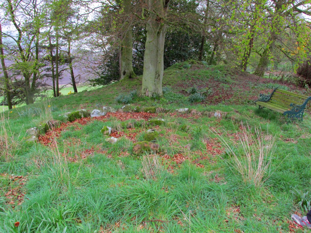
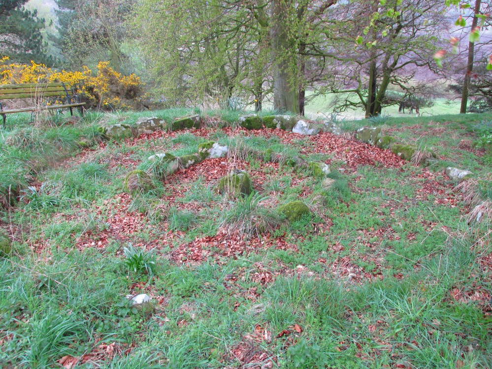
A truly fascinating and enigmatic arena for a host of reasons. The small and well-preserved ring of stones up the slope behind Creich Manse — looked after and recently cleared of covering vegetation by the present tenant — wasn’t born here, but originally lived more than a mile to the southwest, on the grounds of Luthrie House near the OS grid-reference NO 313 195.

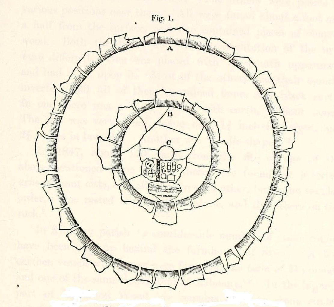
Curiously omitted from the giant surveys of Aubrey Burl (2000) and other modern academics, the place was first  mentioned in the New Statistical Account of the parish by Alexander Lawson.  It told that in 1816 “trenching operations” were being undertaken in Luthrie village when, at some point, the men came across a curious group of stones that seemed to have faint carvings upon them — in the centre of a ring of stones!  The land-owner and parish minister were called to the site and they found that a double stone circle had been unearthed.  The account told:

“In the centre was placed, in an upright position, a cylindrical sandstone, one foot two inches high, and having the diameter of its base one foot.  Around this stone, as a centre, at the distance of three feet, were sixteen other stones, placed also in an upright position, and in the form of a circle.  The stones of which it was composed were of various sizes, from fifteen to twenty inches in height; from eight to eighteen in breadth, and from four to nine in thickness.  Due south of the centre, and between it and the inner circle, there were placed in a horizontal position, two stones containing hieroglyphics in alto relievo, very entire.  The remaining space between the centre and the circle was laid with pavement.  At the distance of seven feet and a half from the same central pillar, there was another circle of stones, thirty-two in number, placed in an upright position, and very much resembling those of the inner circle.  The stones in both circles were placed close together.  Between the circles there was neither pavement nor stone of any description.  Neither were perfect circles, the diameter of one from north to south, being fifteen feet one inch, while its diameter from east to west was only fourteen feet nine inches; in the same manner, the diameter of the other, from east to west, was five feet ten inches, while from north to south it was it was six feet one inch.”

Ground-plan of the Creich ring
Creich ring, looking west

The account went on to describe there being a deposit of “burned human bones and charcoal” at the centre, below the larger of the two petroglyphs.  Additionally, one of those peculiarly common traits found at a number of megalithic remains related to the construction of the inner and outer circles of stone. The Royal Commission (1933) lads pointed it out, saying,

“It is remarkable that all the stones of the inner circle were of sandstone, which is not found nearer than Cupar, seven miles away, while those of the outer circle were of the local whinstone.”

Another description of the site was given in James Campbell’s (1899) updated and revised magnum opus on the parish of Balmerino, where some additional remarks were made about the petroglyphs.  He told:

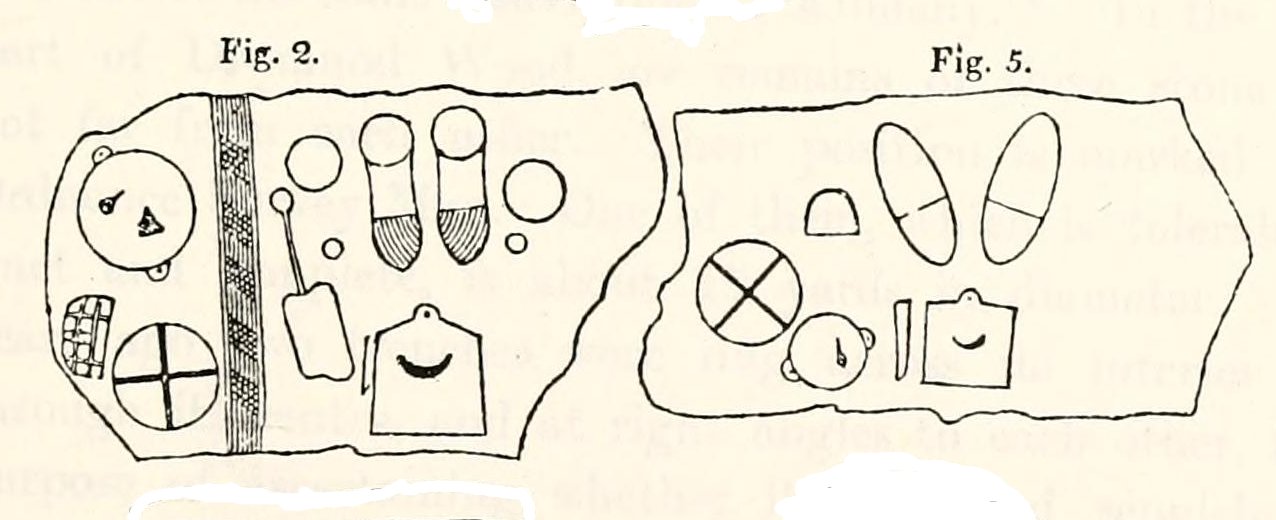
“Under one of the sculptured stones were found small burnt human bones and ashes. They were not enclosed in a cist, nor was there any building under the surface. Certain of the figures cut on one of the slabs of this monument are very similar to the figures on the sculptured slab of the one already mentioned. There are what appear to be representations of the soles of a pair of shoes, a circle with a cross within it — the limbs of the cross being: at right angles to each other — which may be intended to represent a wheel. On one of the stones is the figure of a spade. What the other figures represent is more uncertain. The sculptures raise difficult questions in regard to the time of the erection of these monuments. It is evident that cremation had been then practised at Creich, though the degree of culture and art indicated by the sculptures seems to point to a time subsequent to the abolition of this pagan custom elsewhere.”

Creich Circle petroglyphs
Creich Ring, looking east

The carvings illustrated here are pretty unique in terms of them being standard prehistoric petroglyphs, as they seem to comprise more of a mix of Iron Age and Romano-British designs – though potentially we must take into account that they could be a form of Pictish.  This region is littered with the remains of Picts, in place-names, folklore and archaeology.  As such, it would be very helpful if  someone qualified in Pictish studies could examine these designs.  We do find petroglyphs of similar forms to this in Bronze Age Scandinavia and Iberia − but not Fife!

Folklore

In the only account of any folklore relating to this site, James Campbell (1867) told that local people said the place was “supposed to have marked the tombs of distinguished chiefs.”

…to be continued…

References:

  1. Burl, Aubrey, The Stone Circles of Britain, Ireland and Brittany, Yale University Press 2000.
  2. Campbell, James, Balmerino and its Abbey – Volume 1, William Blackwood: Edinburgh 1899.
  3. Lawson, Alexander, “Ancient Circles of Stone Discovered Under Ground in the Parish of Creich,” in Edinburgh Magazine and Literary Miscellany, November 1817.
  4. Lawson, Alexander, “Notes of Urns and Sepulchral Monuments Discovered at Various Times in the Parish of Creich, Fifeshire,” in Proceedings of the Society of Antiquaries, Scotland, volume 7,
  5. Royal Commission on the Ancient & Historical Monuments of Scotland, Fife, Kinross and Clackmannan, HMSO: Edinburgh 1933.

© Paul Bennett, The Northern Antiquarian


Fancarl Top, Appletreewick, North Yorkshire

Stone Circle:  OS Grid Reference – SE 06432 63048

Also Known as:

  1. Appletreewick Stone Circle

Getting Here

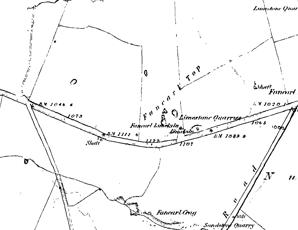
1st edition OS-map - the unmarked circle's near the middle
1st edition OS-map – the unmarked circle’s near the middle

Along the B6265 road between Grassington and Pateley bridge, heading east, past the hamlet of Hebden, a mile or so on where the road goes uphill, stop where it levels out a bit (before it goes further uphill to Stump Cross), a half-mile before the rocky outcrop of Nursery Knott on the left (north) side of the road.  A gate into the field on the same side is what yer after, with a small disused quarry therein.  Go up here to the quarry-top and then walk uphill for literally 100 yards and the curious small ring is right there.

Archaeology & History

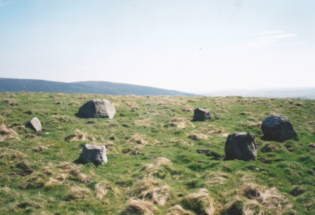
Appletreewick stone circle (courtesy Paul Daw)

This small stone circle sitting on the grassy ridge overlooking the ritual rocks of Simon’s Seat and central Wharfedale to the south and the Yorkshire heathlands east and west, is probably not what it once was.  Overcome by the excess of industrial workings in the fields and moors all round here, it is probable that its present condition is far from its original state.  Indeed, if we move back to the 18th century, we find that place-name and map evidences tell us the site was a tomb.  The 1771 Greenwood map names the site as the Fancairn — an etymological curiosity in itself, possibly deriving from the ‘Windy Cairn’, which makes sense.  The place-name fell into its present title of ‘Fancarl’ after the great Ordnance Survey chaps came, heard dialect and went on their way…

The largest rock in the ring (courtesy Paul Daw)

The circle doesn’t appear to have been noted by the great Yorkshire historians Harry Speight and Edmund Bogg in their literary rambles here (rather odd), but was brought to our attention first of all (in a literary sense anyway) by Arthur Raistrick. (1965) He first “surveyed” the site in 1950, but said little until a short remark was printed in the Yorkshire Archaeological Journal, where the notes told it to be one of “two stone circles, one with clear standing stones, 30ft in diameter, and the other a double circle of small recumbent stones, 12ft in diameter.”

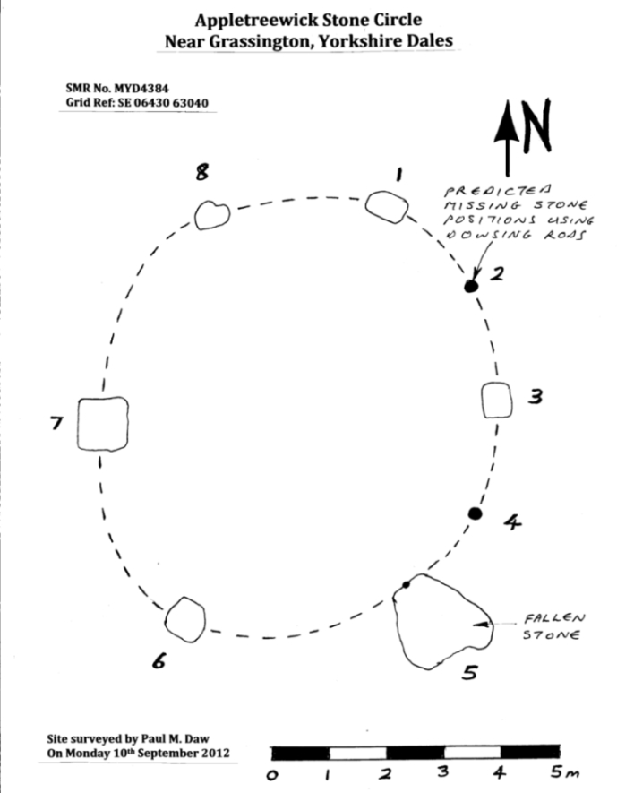
Ground-plan & missing stones (by Paul Daw)

The second, smaller double circle he mentions is probably a hut circle or cairn, faint traces of which are seen in the adjacent field.  Remains of a prehistoric enclosure were also once evident in the same field; and thankfully to the south (across the road) we can still find many examples of cup-and-rings at Skyreholme.

John Barnatt (1989) and Aubrey Burl (2000) include the site in their relative major surveys, with both of them citing the circle, of six small stones, to measure 8.5m by 7.5m.  The survey shown of this small stone ring was done by Paul Daw following his visit to the site on Monday 10th September 2012.

Folklore

Although we can only see six stones in this ring today, when the surveyor Paul Daw (2012) did a ground-plan of the place, he also did a dowsing survey of the site and found there were originally two extra stones on the eastern side of the circle. An archaeological dig would be interesting to see if post-holes or the remains of these two additional stones are under the turf.  He wrote:

My dowsing survey revealed that the stone circle measured 7.7 metres diameter (N-S) and 7.0 metres (E-W).  A reaction was received over the centres of stones 1, 3, 6, 7 and 8 indicating that they are still standing in their original positions, but stone number 5 to the south-south-east of the circle had a reaction at its northern end, which indicates that it was once standing but had fallen outwards. It is not therefore an earthfast stone, as speculated by A. Raistrick, when he visited the site.  The stone measures 1.65 m x 1.65 m x 800 mm and fans out like a shell from bottom to top. It would have been an impressive stone when standing, but was top heavy, and the most likely stone to fall.

Stones 1, 3, 6, and 8 are all of a similar size, are much more stable, and stand at about 500 mm high.  Stone 7 in the western sector is 800 mm high, and measures 950 mm x 850 mm, and looks like a rectangular block, with slightly rounded edges.

I also obtained a reaction at positions 2 and 4, indicating that there were once stones standing in these positions. To the north of the stone circle there are a number of stones lying on the surface.  A. Raistrick suggested that there may have been another small stone circle in this area, but my dowsing rods did not detect anything, and it is probable that these are random stones lying on the surface.

This entire region is bedevilled with faerie, goblin and giant lore, plus creation myths of our peasant ancestors (Sutcliffe 1929) — some still living if you’re lucky enough to talk with the old folk, who might tell you a thing or two, or might not, depending on how you smell.

References:

  1. Barnatt, John, The Stone Circles of Britain – 2 volumes, BAR: Oxford 1989.
  2. Burl, Aubrey, The Stone Circles of Britain, Ireland and Brittany, Yale University Press 2000.
  3. Daw, Paul M., “Appletreewick Stone Circle, Yorkshire Dales,” unpublished survey report 2012.
  4. Raistrick, Arthur, ‘Yorkshire Archaeological Register 1964: Appletreewick, W.R.,’ in Yorkshire Archaeology Journal, volume 41, 1965.
  5. Smith, A.H., The Place-Names of the West Riding of Yorkshire – volume 6, Cambridge University Press 1963.
  6. Sutcliffe, Halliwell, The Striding Dales, Frederick Warne: London 1929.

AcknowledgementsHuge thanks to Paul Daw for his photos and survey of the site, and for sharing details of his dowsing results here.

© Paul Bennett, The Northern Antiquarian


Ring Stones Hill, Catlow, Nelson, Lancashire

Stone Circle (destroyed?):  OS Grid Reference – SD 892 367

Archaeology & History

Set in good landscape with fine views in most directions, it seems that the only thing that remains of this site is a place-name on a map—but I have to say that our search here was only a short one, and so more may be found hiding away in field walls or beneath the ground.  However, if we listen to an early account of the place, it was said to have “completely gone by 1856.”  A pity, as it was described as being “a large circle of stones.”  The monument was used for repairing the nearby road and, in another account, we are told that the stones were added to the walls.  Whether this was a cairn circle or a free standing stone circle isn’t known.  The prevalence of tumuli close by at Catlow, Burwains, etc, would suggest a cairn circle, yet we have no accounts of human remains here… A puzzle.

References:

  1. Barnes, Bernard, Man and the Changing Landscape, Liverpool University 1982.

© Paul Bennett, The Northern Antiquarian


Calverley Woods Stone Circle, Leeds, West Yorkshire

Stone Circle:  OS Grid Reference — SE 20 37

Archaeology & History

Having lived close to these woods in the past, I have searched extensively for any remains of the stone circle described by a Miss Alice Wells in the very first issue of the Cartwright Hall Archaeology Group Bulletin, but to no avail.  A meeting to examine this site was supposed to have taken place in September 1953, “but as Miss Wells was unavoidably absent this was not seen.”  And still to this day it remains hidden [or non-existent, whatever the case may be].  There is ample evidence that prehistoric man roamed this region, as finds of cup-and-ring stones and iron age walling indicate.  A possible contender for this stone circle could be the small ring of rocks seen near the bottom of the wooded hill beneath the giant Hanging Stone, close to grid reference SE 2003 3748.  About 10 yards across, this looked like a smaller version of the Roms Law circle several miles west, but is much overgrown and not visible beneath the undergrowth of summer vegetation.

The presence of prehistoric cup-marked stones in this woodland clearly indicates Bronze Age activity here and—as such petroglyphs have a tendency in West Yorkshire to be associated with tombs and death in many cases—may indicate the lost site was indeed a cairn circle and not a true stone circle. Seems likely to me. If anyone has any photos of this site, or can ascertain its exact whereabouts, please let us know and all credits will be given for its rediscovery.

References:

  1. Bennett, Paul, The Old Stones of Elmet, Capall Bann: Milverton 2001.
  2. Jackson, Sidney (ed.), “Calverley Wood,”in Cartwright Hall Archaeology Group Bulletin, 1:1, July 1954.

© Paul Bennett, The Northern Antiquarian
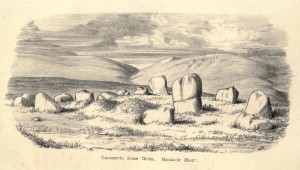

Dunmoid, Dalginross, Comrie, Perthshire

Stone Circle:  OS Grid Reference – NN 78030 21266

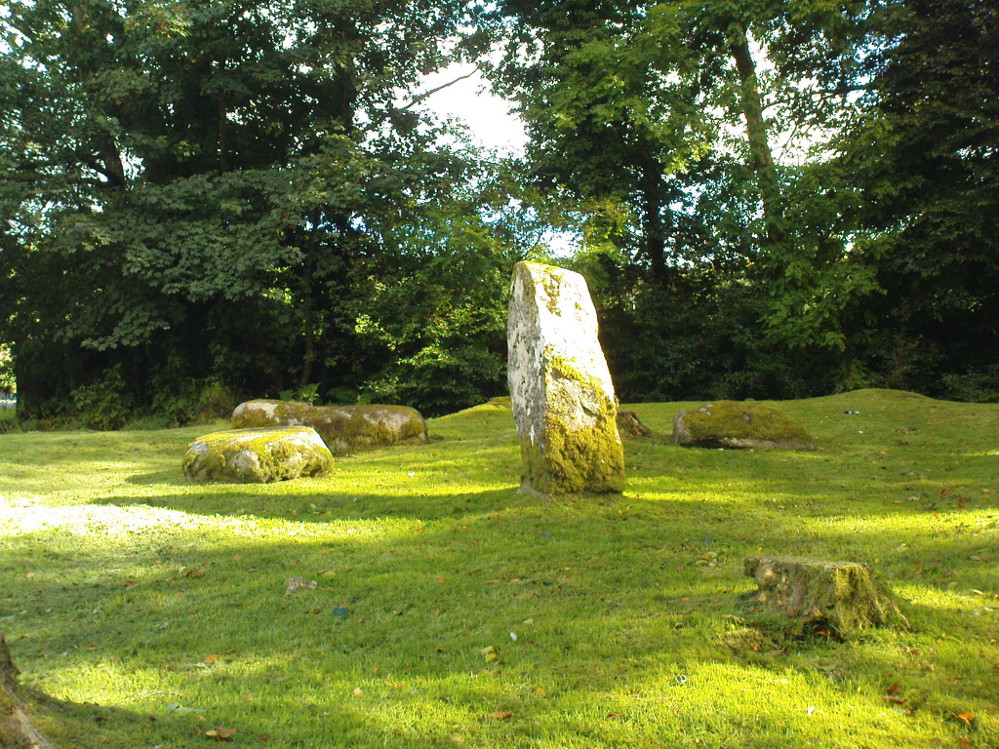
Dunmoid Circle, Comrie

Also Known as:

  1. Canmore ID 24857
  2. The Court Knoll
  3. Dalginross
  4. Dunmhoid
  5. Judgement Mound
  6. Muirend
  7. Roundel

Getting Here

From the main road running through lovely Comrie, take the south B827 road over the old river bridge.  Go dead straight for several hundred yards until the road bends right; but take the left turn here.  100 yards or so along note the trees on your right, and the road begins to swerve round here. Just round the corner in the trees, the stones are in the clearing right by the roadside. You can’t miss them! (if you hit the graveyard, you’ve gone past them)

Archaeology & History

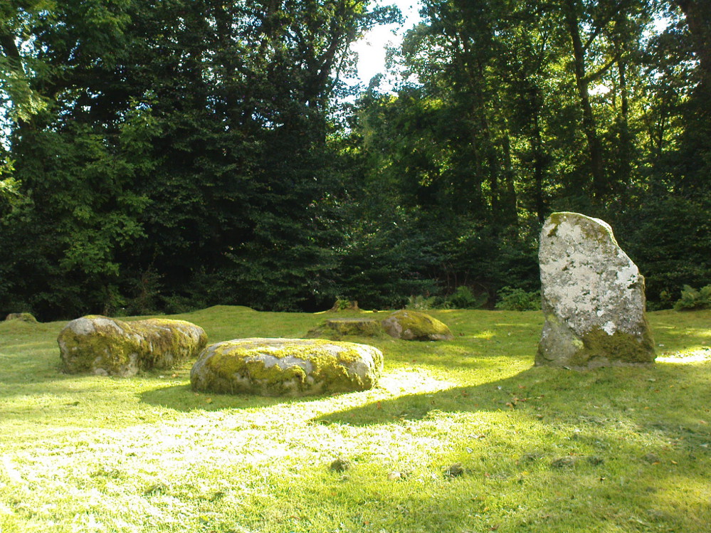
This is a truly lovely, almost warming enclosed megalithic site—albeit damaged by the ruin of centuries; but on the occasions I’ve been here it feels quite nurturing and elicits a quite natural meditative state.  Whether or not this is due to the surround of trees, or the natural electromagnetic field, or just me, I dunno….

Dunmoid Circle, looking SE
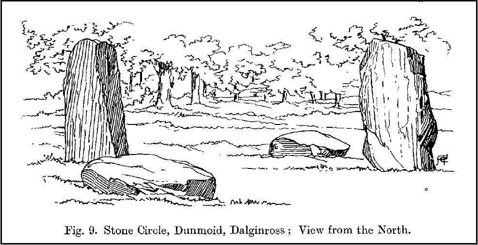
Dunmoid from the North (Coles 1911)

The ‘circle’ is constructed upon a flat rounded section of ground, surrounded by a ditch on two-thirds of its edges, very reminiscent of a typical henge monument—but there is no mention of this in modern surveys.  One of the earliest accounts of Dunmoid was written by John MacPherson (1896) who gave us as much of the known history of the site as is still known by any modern academic.  He wrote:

“At the west side of the new cemetery, close to the public road, there is a curious round knoll, which at one time must have been used as a place for the burial of the dead.  The attention of the writer of this was drawn to it about twenty years ago.  There were three large slabs of stone lying upon the ground, which apparently had been at some former period placed erect by some loving hands to mark the last resting-place of some departed friend or hero.  By the aid of some of the Comrie masons the stones were placed in a standing position.  Curious to know what lay beneath the surface, we dug up the earth in front of the largest slab, and came upon a stone cist placed north and south, 7 inches long, 1 foot 8 inches broad, and 1 foot 3 inches deep.  The only remains discovered was a thigh-bone, but whether it at one time formed a part of the leg of a Celt, a Roman, or a Saxon we could not tell. An old man who then lived in the village of Comrie told us that in his young days the same mound was dug up, when an urn filled with ashes was discovered.  This, perhaps, would indicate that it formed a place of burial for Romans rather than for Caledonians.  The spot is called Dunmoid, or ‘hill of judgment.'”

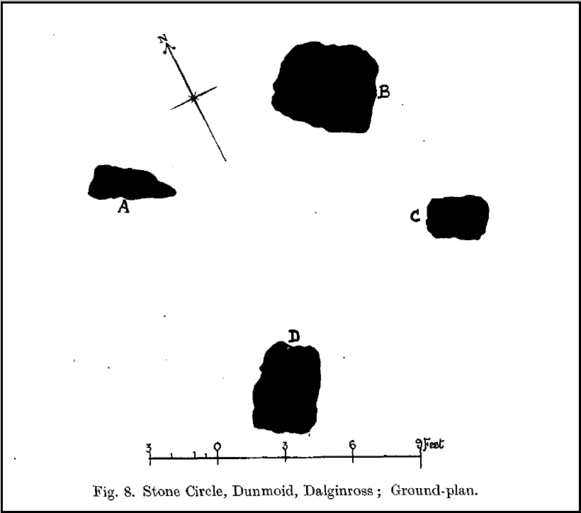
Fred Coles 1991 plan
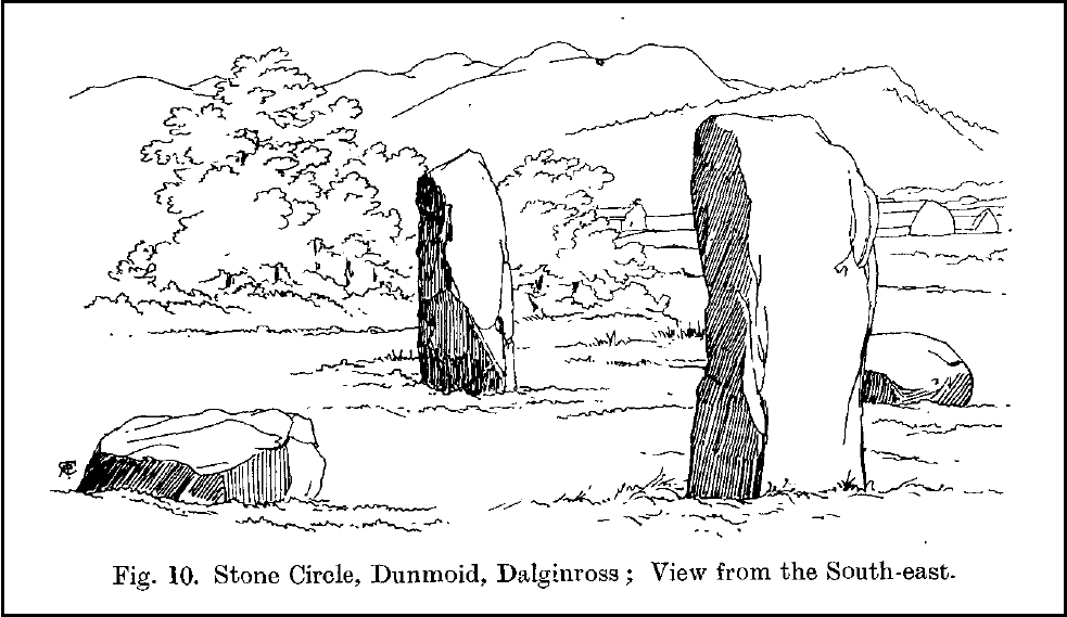
Dunmoid from SE (Coles 1911)

The circle gained the attention of the prolific Fred Coles (1911) in his Perthshire surveys, whose drawings and measurements are still repeated in the modern textbooks more than a century later.  When he visited the site, two of the stones were still upright, but today only one still stands.  In Aubrey Burl’s (1988) survey on ‘four-poster’ stone circles, he reiterated Coles’ words, telling:

“Originally four stone stood at the corners of a rectangle on a mound some 75ft (23m) across and 2ft (60cm) high.  Coles’ plan showed the NW stone standing 5ft 4ins (1.6m) high and the SE, opposite, 5ft 2ins (1.6m), with the thick NW stone prostrate, 4ft 6ins (1.4m) long, with the more slender SW pillar also supine and 4ft (1.2m) long.  The longer SE and NW sides of the oblong were roughly 9ft 6ins (2.9m) long and the others 9ft (2.7m) in length.  The circle on which the stones had been placed had a diameter 13ft 2ins (4m), of which the Megalithic Yard is not an integer.”

The circle is included in Andrew Finlayson’s (2010) modern survey of the region.

References:

  1. Burl, Aubrey, Four Posters: Bronze Age Stone Circles of Western Europe, BAR 195: Oxford 1988.
  2. Finlayson, Andrew, The Stones of Strathearn, One Tree Island: Comrie 2010.
  3. Hunter, John (Ed.), Chronicles of Strathearn, David Philips: Crieff 1896.
  4. Hutchison, A.F., “The Standing Stones of Stirling District,” in The Stirling Antiquary, volume 1, 1893.
  5. MacPherson, John, “At the Head of Strathearn,” in Chronicles of Strathearn, Crieff 1896.

© Paul Bennett, The Northern Antiquarian

Loupin Stanes, Eskdalemuir, Dumfriesshire

Stone Circle:  OS Grid Reference – NY 25706 96638

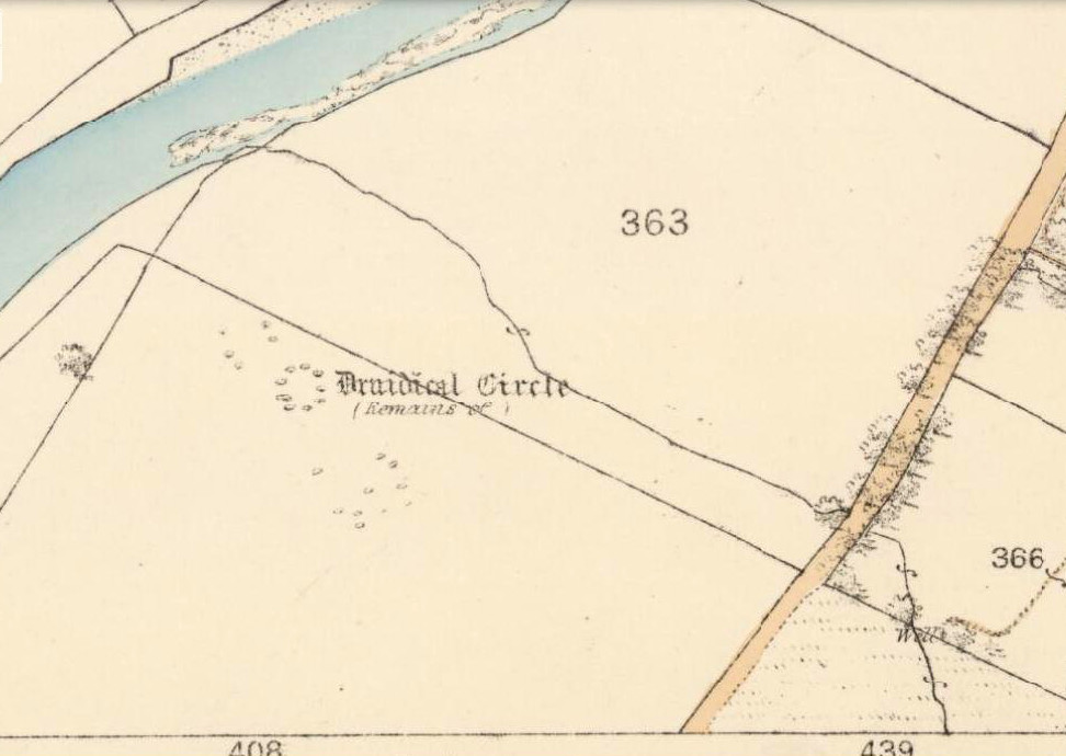
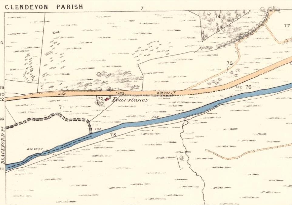
Loupin Stanes on 1862 map

Also Known as:

  1. Canmore ID 67232
  2. The Cote
  3. Hartmanor
  4. Loupin Stones

Getting Here

From the hamlet of Eskdalemuir, take the B709 road over the river bridge and keep going for about a mile, past the Hartmanor Hotel.  Keep your eyes peeled for the small parking spot on the left-hand side of the road soon after the hotel. Once here, cross the road and walk down the footpath towards the river, following the line of the fence, pass the superb apple trees.  You’ll walk straight to it!

Archaeology & History

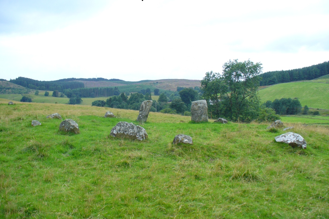
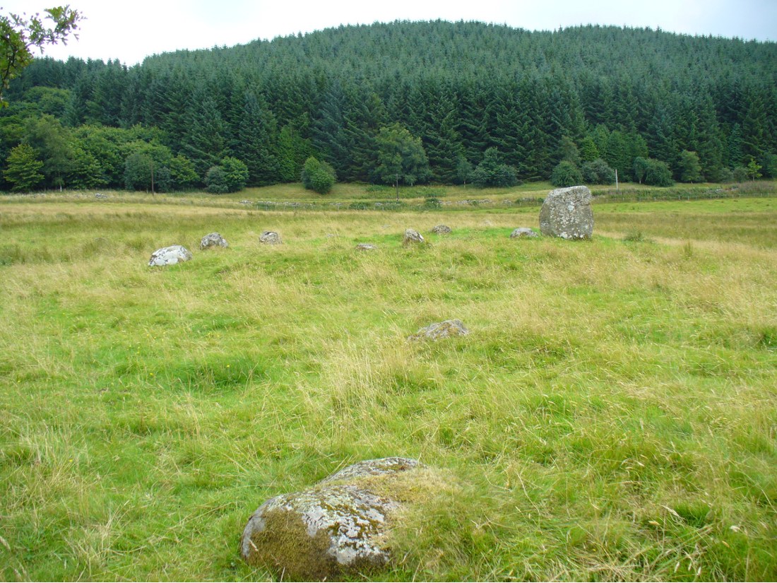
The Loupin Stanes, looking SW

A long distance from anywhere out here in the hills, my short foray here with fellow antiquarian Paul Hornby told that there was once much more here than presently meets the eye.  Aubrey Burl (1979) hinted at the same, as did our mathematical megalithic magus Alexander Thom. (1980)  There are curious stones near and not-so-near the circle you’re about to meet, many of them speaking of relationships just hiding beneath their historical surface.  Sadly we only spent a short time here at the Loupin Stanes. A full day or two would have been much better!
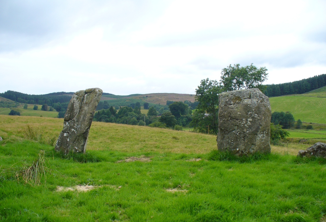
Despite this circle (and its nearby companion the Girdle Stanes) hiding miles away from anywhere out here, the legendary compilers of the 18th century Statistical Account of Scotland still managed to find it, telling us simply,

“On the farm of Coatt there are two circles of erect stones, the one entire measuring about 90 feet (i.e., in girth), and the other, having a part of it worn away by the Esk, measuring about 340 feet.”

The 'entrance stones'
The ‘entrance stones’
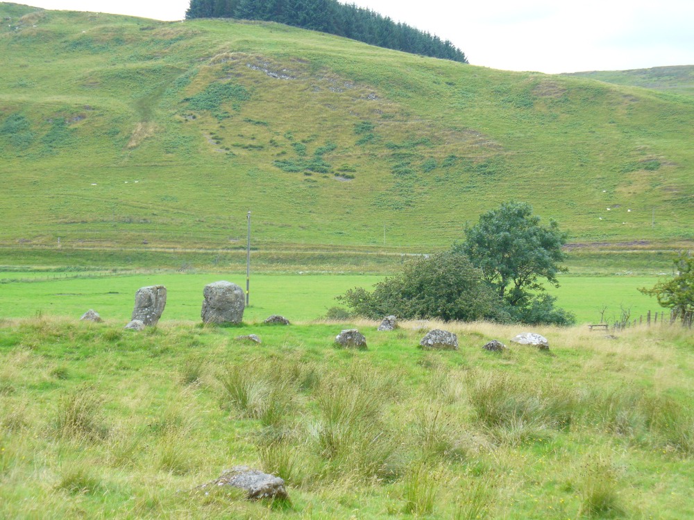
Loupin Stanes, looking WNW

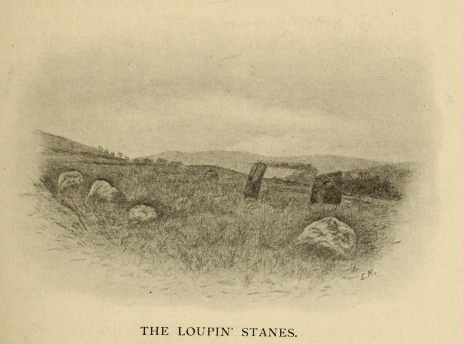
Another century was to pass by before anyone else came and wrote about these hidden stones, sitting upon a level man-made platform built by neolithic or Bronze Age ancestors.  In Dave Christison’s (1897) lengthy article for the Scottish Society of Antiquaries, he gave a pretty lengthy description of the Loupin Stanes, which is still as accurate today as when he wrote it 120 years ago. He told:

“The site of the smaller circle is at Hartmanor, retired about 80 yards from the river, in a gently undulating field, and it has been banked up nearly all round from a foot to 18 inches, perhaps with the object of making the interior level.  The circle consists of thirteen stones…not reckoning one which seems too small to be included, but from the inequality of the intervals it is likely that a number have been carried off, and this seems proved by one hollow…left in all probability by the removal of a stone, and – by another within the circle opposite a blank in it, probably caused by digging to uproot a second stone.  The developed view…shows this irregularity of the spacing.  But it also shows that two neighbouring stones greatly exceed the others in size, and alone can be considered truly standing, as they are pillar-like and set on end, whereas the smaller ones are so shaped that it does not much matter on which end they are placed.  The two large stones are about 5 feet 4 inches high, and are flat-topped.  One is a massive rectangular block, about twice the bulk of the other.  Few of the smaller stones stand a foot above ground, and the two highest do not exceed a couple of feet.  The large stones (in this ring) are known as ‘the loupin’ stanes…

“…In its present state the ‘circle’ is slightly oval, the cross diameters, measured from the inner faces of the stones, being about 35 and 31 feet.  The entrance, if we may call it so, between the two pillar-stones, looks out about E.S.E.”

Of course, Christison meant WSW, not ESE. Probably the best description of the Loupin Stanes (and the nearby Girdle Stanes) was done, not surprisingly, by a local historian.  In the superb work on the Langholm district, the brothers Hyslop (1912) gave commendable descriptions—including ingredients which, I’m pleased to say, the likes of Mr Hornby and myself wondered over in our short visit here.  Burl and Thom thankfully noted the very same elements.

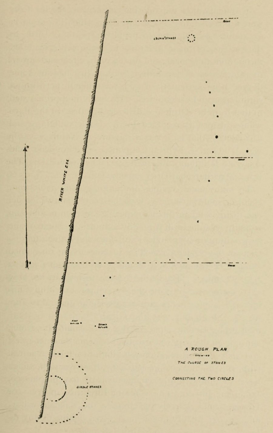
Loupin Stanes & stone avenue to the Girdle Stanes

The casual visitor here cannot fail to note the curious scatter of other stones close to this megalithic ring.  Before you actually reach the circle there is a scatter of small stones which have more of a ‘feel’ to them being related to the actual circle than proof has yet afforded.  Both Thom and Burl postulate this scatter of stones as the remains of another damaged stone circle. One of these stones has three cup-marks upon it.  But there are other stones reaching away up the slope of the field to the south.  Our impression here was that these had some relevance to the circle when it was first built, probably 4000 years ago.  Paul suggested the idea of an ‘avenue’ perhaps linking it with the Girdle Stanes circle about 600 yards away.  He wasn’t the first to do so.  John and Robert Hyslop (1912) talk of the likely relationship these two stone circles had with each, and much more:

“Though now forming separate circles 600 yards apart, that they were at one time, though possibly not originally, parts of one scheme is clearly indicated by their relative positions and especially by the irregular line of large stones stretching from one to the other. Only two of the stones of the first Circle are now standing. One stands 4 feet 9 inches above ground and measures 19 feet 5 inches in girth. The other is also 4 feet 9 inches high but is only 7 feet 8 inches in girth. It is quite possible that some of the other stones composing the Circle are in their original positions, though they are now greatly weathered and broken… This…Circle when built appears to have consisted of nine* large stones, and was nearly 36 feet in diameter, or some 113 feet in circumference by inside measurement.

“A little to the south-east of the Loupin’ Stanes there is what, to the casual observer, appears to have been, and probably was, another Circle also of nine stones, with a centre stone.  Some of these stones have been displaced, and the contour of the Circle is consequently broken.  Nearer the Esk, and almost touching the Loupin’ Stanes, are four single stones whose relation to the other members of the group it is very difficult even to guess. Fancy or guesswork might weave a simple theory which could neither be proved nor absolutely refuted — but it is wiser not to guess in questions like this! Reference has already been made to the “avenue,” or line of single stones stretching from the Loupin’ Stanes to the Girdle Stanes. Though the line is not a straight one, and is broken, it seems to afford fairly conclusive proof that all these stones at the Cote are parts of what must once have been a prehistoric monument of considerable importance, and, needless to add, of great antiquity.”

The ‘avenue’ between the two circles was later described with a bit more detail and the suggestion of an astronomical function arose. Again, the Hyslop’s (1912) told that the avenue was,

“a course of 11 stones placed at intervals between the two Circles, rudely joining them, but not in a straight line. The last four of these (nearest the Loupin’ Stanes) form very nearly a straight line in a direction S. 16 34′ E., but no satisfactory significance has been found for this line.

“…Whether there was a single or double line of stones in the “avenue” between these two Circles cannot be said until a careful survey has been made. The theodolite and the link-chain have a curious habit of settling these disputed points and spoiling many a charming theory — without regrets or apologies!  But this much may safely be said: if an “avenue” existed between the Loupin’ Stanes and the Girdle Stanes, as appearances suggest, it was probably for ceremonial rather than for astronomical purposes.”

Remains of possible avenue, from the Esk to the Stanes
Hyslop's old drawing of the Loupin Stanes
Hyslop’s old drawing of the Loupin Stanes

Very true indeed. But whether this alignment of weaving stones has actual relevance to the megalithic arena, only detailed excavations will tell for sure.  Yet on the western side of the Loupin Stanes, we see at least four stones (possibly six) which run down to the River Esk.  This also may be remains of an old avenue, taking us to an important water source.

No ‘avenues’ were mentioned in the survey by the Royal Commission (1920) lads, written several years after their visit here in July 1912.  They described the site as follows:

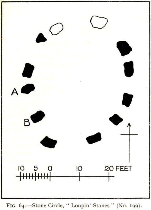
“The stone circle known as the Loupin Stanes…is situated at an elevation of 600 feet above sea-level, on an undulating meadow some 80 yards from the left bank of the White Esk and 600 yards north-east “of the Girdle Stanes circle…. It consists of twelve stones placed at irregular intervals, of which, on the west side, only two, standing 8 feet apart (A and B on plan, fig. 64), are true pillars, all the others being simply boulders.

“The setting does not form a true circle but is flattened on the western arc; it measures some 38 feet in diameter from north to south and 31 feet from east to west. The pillar stones, which are flat-topped, measure about 5 feet 4 inches in height, and the two highest of the smaller stones do not exceed 2 feet, while few of them reach 1 foot. The site has been banked up nearly all round from 1 foot to 1 foot 6 inches, perhaps with the object of making the interior level. There are numerous large stones adjacent, some of which may be the remains of other circles, but others are probably merely boulders naturally deposited or outcrop of rock. The field was in a hay crop at the date of visit, and the fallen stones were not easily seen.”

1920 Loupin Stanes plan (after RCAHMS )

When Alexander Thom (1980) came here and measured the site, he thought there was a ‘possible’ midsummer sunrise from the stones—but even he didn’t seem convinced.  Described as a Type A Flattened Circle, he did find units of his ‘megalithic yard’ in the construction of the site.

Folklore

In David Christison’s essay (1897) on this and its companion site—the Girdle Stanes—he told:

“The large stones are known as ‘the loupin’ stanes,’ because it is said that lads, and even a lass, were in the habit of jumping from the top of one to the other; but as the distance is 8 feet, the people of the district must be uncommonly good ‘loupers’ to accomplish the feat without breaking their legs. However it may be with their limbs, so little are the powers of observation of the natives cultivated that, although all know ‘the loupin’ stanes,’ they generally deny the existence of a circle.”

This narrative was repeated in the Hyslop’s (1912) work. Though it should be noted here that Mr Christison’s final remark about the local people denying the existence of any such circle is something I’ve encountered a few times, despite them knowing otherwise. But for good reason, it has to be said.

…to be continued…

References:

  1. Burl, Aubrey, Rings of Stone, Frances Lincoln: London 1979.
  2. Burl, Aubrey, A Guide to the Stone Circles of Britain, Ireland and Brittany, New Haven & London 1995.
  3. Burl, Aubrey, The Stone Circles of Britain, Ireland and Brittany, Yale University Press 2000.
  4. Christison, David, “‘The Girdlestanes’ and a neighbouring stone circle, in the parish of Eskdalemuir, Dumfriesshire”, in Proceedings of the Society of Antiquaries, Scotland, volume 31, 1897.
  5. Hyslop, John & Robert, Langholm As it Was, Hills & Company: Sunderland 1912.
  6. Macauley, Anne, Megalithic Measures and Rhythms, Floris: Edinburgh 2006.
  7. Royal Commission on the Ancient & Historical Monuments, Scotland, Inventory of Monuments and Constructions in the County of Dumfries, HMSO: Edinburgh 1920.
  8. Thom, Alexander, Megalithic Sites in Britain, Oxford University Press 1967.
  9. Thom, A., Thom, A.S. & Burl, H.A.W., Megalithic Rings, BAR: Oxford 1980.

© Paul Bennett, The Northern Antiquarian