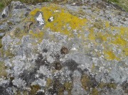
Beltane Well, Kenmore, Perthshire

Sacred Well:  OS Grid Reference – NN 7867 4725

Also Known as:

  1. An Tobar
  2. Holy Well of Inchadney

Getting Here

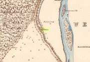
An Tobar, or Beltane Well, on the 1867 map

An Tobar, or Beltane Well, on the 1867 map

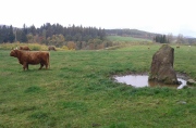
From Kenmore village on the north-side of the river, over the bridge, take the small road on your right towards Dull.  After a very short distance the road runs alongside the woodland for nearly 1½ miles until, on your left, you’ll reach Drummond Cottage.  Across from here a dirt-track takes you into the trees.  Barely 100 yards along, watch for the overgrown path that runs down the slope on your left.  At the bottom a small stream has several feeds – one of which is surrounded by a ring of bright quartz stones.

Archaeology & History

Shown on the early Ordnance Survey maps as An Tobar (meaing simply “a well”), this somewhat nondescript title betrays a much more colourful folk history, albeit dissolved by those common culprits of Church and disrespectful incomers (which shows little sign of diminishing).

Lara by the Well

Lara by the Well

Close-up of quartz surround

Close-up of quartz surround

In the field immediately south, back up the slope above the well and through the trees, was once an ancient church whose existence has all but vanished.  Hereby was held an ancient fair known as Feill nam Bann Naohm, or the Fair of the Holy Women, named after a group of nuns whose lived here, who William Gillies (1938) and others proclaim were the legendary Nine Maidens, whose dedications at wells, trees and other sites scatter Scotland. But the fair was ended in 1575 and moved to Kenmore; then, several years later in 1579, the church also moved onto Eilean nam Ban Naomh (NN 7664 4536) on Loch Tay.

The old well however, after being left by the descendants of the Holy Women or Nine Maidens, continued to be frequented by local people.  Gillies (1938) wrote:

“The Holy Well of Inchadney is situated at the foot of the terrace, about five hundred yards to the north of the churchyard… Up to the middle of last century the well used to be visited by great numbers of people on the morning of Bealtuinn, the first day of May.”

In Ruth & Frank Morris’ survey (1981) they told how the site had become much overgrown and,

“The well was cleaned out in 1914 and among articles found was a stone 21 inches by 16 inches, with a rude St Andrew’s cross scratched on it, a George III farthing among other copper coins, a rudely made stone cup 2½ inches high and 7 inches in diameter, three metal buttons, a glass bead and six pins.”

No such offerings seemed in evidence when we visited a few weeks ago; but we were told that people are still seen visiting the well.

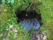
Looking down into the pure waters

Looking into the pure waters

A small stone-laid footpath runs towards the adjacent burn from the circular well, which is almost completely surrounded by large quartz rocks.  In the well itself was a small fish, showing how clean the waters are—or as would be deemed in times of olde: a ‘guardian’ of the waters.

We must also make note of the fact that, just two fields away to the north, according to the antiquarian Fred Coles (1910), a stone circle was once in evidence.  This old well sat neatly between the sites of megalithic ring and church.

Folklore

In the field in front of the well, Hilary Wheather (1982) told that there once lived a legendary water bull, but she lamented on his passing.  With the coming of the modern-folks and their unnatural ways,

“and having great timber lorries rumbling past your home every day is no fun for a peace-loving waterbull living in Poll Tairbh, the Bull’s Pool opposite the Holy Well.  Gone are the days when he was the revered Spirit of the Meadow, passed with trembling and fear by all the young maids of the Parish lest he should jump out and carry them off to his watery lair. Half the calves of the area were sired by him and it was always easily seen which cow had the attentions of the Great Waterbull.  Her calf was always the biggest and the best.  But he hasn’t been seen by his pool for many a year…”

The waters are cited by Geoff Holder (2006) to be good for toothache.

References:

  1. Coles, Fred, “Report on Stone Circles Surveyed in Perthshire (Aberfeldy District),” in Proceedings of the Society of Antiquaries, Scotland, volume 44, 1910.
  2. Gillies, William A., In Famed Breadalbane, Munro Press: Perth 1938.
  3. Holder, Geoff, The Guide to Mysterious Perthshire, History Press 2006.
  4. McHardy, Stuart, The Quest for the Nine Maidens, Luath Press: Edinburgh 2003.
  5. Miller, Joyce, Magic and Witchcraft in Scotland, Goblinshead: Musselburgh 2010.
  6. Morris, Ruth & Frank, Scottish Healing Wells, Alethea: Sandy 1982.
  7. Wheater, Hilary, Kenmore and Loch Tay, Appin Publications: Aberfeldy 1982.

Acknowledgements:  Big thanks to the bunch who got us here:  to Paul Hornby, Nina Harris, Aisha Domleo & Lara Domleo (ooh – and Leo too!).

© Paul BennettThe Northern Antiquarian


Balnabroich, Kirkmichael, Perthshire

Standing Stone:  OS Grid Reference – NO 09175 56752

Also Known as:

  1. Canmore ID 27267

Getting Here

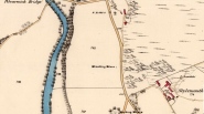
1867 OS-map showing the stone

1867 OS-map showing the stone

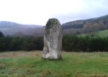
Take the A924 road north of Blairgowrie, between Pitlochry and Bridge of Cally and, about 4.6 miles (7.5km) along, roughly halfway between Ballintuim and Kirkmichael, in the field by the roadside immediately west, you’ll see this conspicuous upright stone standing all alone – unless the cattle are meandering slowly around it!

Archaeology & History

This single monolith that stands today as a cattle rubbing post, may at one time in its distant past have been related to the present pair of standing stones hiding in the small remain of trees 148 yards (135.5m) to the south; although neither Aubrey Burl (1993) nor Alexander Thom (1990) ascribe the stone such an association in their relative tomes on aligned stone rows.

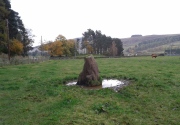
Balnabroich stone, looking south

Balnabroich stone, looking south

Balnabroich stone, looking west

Balnabroich stone, looking west

When the great standing stone lover Fred Coles (1908) came here, he was as reliable as ever in his subsequent exposition of the place – and despite getting his measurements slightly out he told us almost liltingly, like an antiquarian Uncle Monty stroking his megaliths, that

“At a point almost 176 yards due north of (the) two stones is a tallish and unshapely monolith standing but a few yards west of the main road.  Its most notable feature is the extreme irregularity of its shape.  If any proof were needed to show how uncritical were the people who raised such stones, how totally devoid of any regard for symmetry or neatness of contour in the monoliths they set up, surely the ground-plan of this block of rent and riven quartz-veined whinstone, fissured and uncouth in all its parts, would supply it.

“The contour here shown was measured by laying down an irregular rhomboidal figure, and from each of its sides measuring by offsets to the depths 0f the curves which are so prominent on the north, the northwest and the southeast sides.  The ground-plan this obtained shows that, taken between their prominent angles, the four sides measure almost exactly 3 feet each, and the main long axis of the stone which lies due east and west and measures 4 feet 6 inches.  The monolith stands 5 feet 8 inches above the ground and…appear to have been unconnected with circles, so far at least as it was possible to glean any information.”

References:

  1. Coles, Fred, “Report on Stone Circles Surveyed in Perthshire – Northeastern Section,” in Proceedings of the Society of Antiquaries of Scotland, volume 42, 1908.
  2. Royal Commission on the Ancient & Historical Monuments of Scotland, North-East Perth: An Archaeological Landscape, HMSO: Edinburgh 1990.

© Paul BennettThe Northern Antiquarian

Balnabroich stone

Conichan East, Glen Almond, Perthshire

Settlement:  OS Grid Reference – NN 84645 32074  —  NEW FIND

Getting Here

The setting of the remains

The setting of the remains

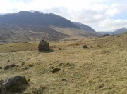
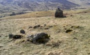
Park up and walk the long estate track up Glen Almond for nearly three miles until, on your left, you’ll see a small pond.  From here, walk up the slope and, about 100 yards above you, note the large solitary boulder ahead, above the dyke of a small walled stream, where the land levels out.  Just past the rock itself is the first of several remains.

Archaeology & History

First things first: the grid-reference cited here is centred upon the largest of several rings of stone found on this small grassy plateau, 150 yards north above the River Almond, just past the huge boulder.  It’s an impressive site – and a previously unrecorded one.

The raised ring of Conichan

The raised ring of Conichan

Looking southeast

Looking southeast

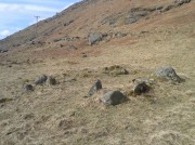
At least three large hut circles can be clearly seen on this small ridge, amidst a sea of prehistoric sites scattered all down this lonely Scottish glen.  When Paul Hornby, Lara Domleo and I meandered up here the other day (to visit the Clach na Tiompan megaliths), extensive prehistoric walling called my nose up the slopes to see if anything was hiding away—and a large prehistoric ring, more reminiscent of the Derbyshire stone circles and ring cairns than any hut circle, appeared before me.

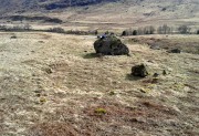
The first and largest that I came across is the one immediately north of the huge boulder (which may have slight traces of ancient walling running up to it).  The large ring is clearly raised onto a flat level platform, with an entrance on its southern edge.  The ring itself measures, from outer-wall to outer-wall some 12 yards wide (E-W) and 11 yards N-S.  The northernmost section of the walling or stone embanked structure is built into the sloping hill to the rear, with the east and western walls constructed simply onto the flat land.  The walling itself is typical of prehistoric structures, comprising the usual mass of small stones packed within a number of larger upright stones; although much of it is very overgrown with centuries of vegetation.  The walling that constitutes the ring itself is between 1-2 yards across and about two-feet high above the present ground-level.

Second circular remains

Second circular remains

...and from another angle

…and from another angle

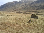
To the east of this is a smaller, roughly circular construction of similar form.  The rocks that make up this site are much more visible and may have been robbed and used in the more extensive walling above and the dykes below.  It is unclear whether the nature of this site is the same as that of the more defined circular enclosure we have just described.

The remains of a third structure was clearly evident a short distance to the east of this, but I didn’t have much time here and another visit is needed to make further assessments.  Iron Age walling and other undocumented prehistoric remains were also found close by.

Acknowledgements:  Many thanks to the noses of little Lara Domleo and Prof. Paul Hornby for their bimbling aid to relocate this site – and one or two others that have been off the radar for many-a-century.

© Paul BennettThe Northern Antiquarian


Dumgoyach Stones, Strathblane, Stirlingshire

Standing Stones:  OS Grid Reference – NS 53269 80727

Also Known as:

  1. Canmore ID 44605
  2. Dungoiach
  3. Duntreath

Getting Here

Approaching Dumgoyach Hill

Approaching Dumgoyach Hill

You can either find your way to Duntreath Castle on the western edges of Strathblane and walk SW straight up the steep grassy slope next to the wooded Dumgoyach Hill; or… From Carbeth, north along the A809, turn right up the B821 Ballachalairy Yett road for 1km and park where the path of the West Highland Way runs onto the hills. Follow this path for nearly ½-mile and where the path splits, bear left.  Keep walking downhill for a few hundred yards, then go off-track towards the copse of trees. Climb over the gate and onto the grassy plain between this copse and the huge rounded Dumgoyach Hill.  The stones are very close indeed…

Archaeology & History

This is a truly stunning site – not as much for the megaliths that are here, but for the setting in which they’re held.  “Magnificent” is the word that rolled out of my mouth a number of times; whilst respected activist and ‘Organic Scotland’ creator Nina Harris said, quite accurately, “it’s Caras Galadhon in Lothlorien!” (or words to that effect) – and she hit the nail much better than I did!

Royal Commission 1963 sketch

Royal Commission 1963 sketch

Dumgoyach Stones (by Nina Harris)

Dumgoyach Stones (by Nina Harris)

A short line of large standing stones remains here, both upright and leaning, running NE-SW for 7 yards: seemingly a part of some other much larger monument in times long past—although very little else remains.  The stones are set upon a rise of land, quite deliberately in front of Dumgoyach Hill (or Lothlorien, as Nina called it) almost as a temple or site of reverence.  You’ve gotta see it to appreciate what I’m saying!  Like some gigantic tree-covered Silbury Hill, the standing stones on this ridge possess an undoubted geomantic relationship with this rounded pyramid, all but lost in the sleep of local myths and land.  A few yards away from the line of stones there is a slight rise in the land, seemingly giving weight to the idea that something else was living here: an architectural feature that Aubrey Burl (1993) thinks might have been “the facade of a chambered tomb” (neolithic in origin) and not merely a megalithic alignment.  He may be right…

Close-up of the megaliths

Close-up of the megaliths

Described briefly in J.G. Smith’s (1886) magnum opus on the Strathblane parish, antiquarian accounts of this impressive site seem curiously rare.  One of the earliest recognised accounts was done by the Royal Commission (1963) lads who measured the site up with their usual diligence.  Although getting the alignment of the stones wrong, the rest of their survey seems pretty accurate. They told that,

“There are five standing stones (A-E) arranged in a straight line… Three of the stones (A, B and C) are earthfast, while the other two (D and E) are recumbent.  Stone A is of irregular shape and leans steeply towards the N.  The exposed portion measures 4ft in height, 2ft 6in in breadth and 1ft 2in in thickness.  Stone B stands upright, 6ft NE of A.  It is a pillar of roughly rectangular section with an irregularly pointed top, and measures 5ft in height by about 2ft 6in in thickness.  Stone C, also irregular in shape, 11ft 6in NE of B, is inclined so steeply to the NNE that it is almost recumbent.  It measures 4ft 4in in height, 2ft 6in in breadth and 1ft in thickness. The remaining two stones lie on the ground between B and C.  Stone D measures 5ft 5in in length, 3ft in breadth and 1ft 6in in thickness while stone E, which rests partly on D, measures 7ft 10in in length, 3ft 9in in breadth and 3ft in thickness.”

Aubrey Burl’s (1993) description of the site—which he called Blanefield—is another good synopsis of what is known historically and astronomically about the site.  Assessing them in his detailed work on megalithic alignments, he said that,

“At Blanefield near Strathblane in Stirling a big stone, its longer sides aligned east-west, stands at an angle amongst a southwest-northeast line of four others, fallen, of which one just off the line seems to have been added this century.  The setting has been presumed a collapsed four-stone row.  Known also as Duntreath and Dumgoyach, the setting is slightly concave.

“‘This ruinous alignment indicates notches to the northeast and these show approximately the midsummer rising sun.’ ‘The standing stone has a flat face exactly aligned on a hill notch to the east,’ quite neatly in line with the equinoctial sunrises.  These astronomical analyses would seem to confirm that Blanefield was undoubtedly a row set up by prehistoric observers to record two important solar events.

“Excavation in 1972 discovered signs of burning, flints and charcoal that yielded a C-14 assay of 2860±270 BC (GX-2781), c. 3650 BC, a time in the Middle Neolithic when chambered tombs were still in vogue, but an extremely early date for any stone row.  This, coupled with Blanefield’s isolated position for a row in central Scotland, raises doubts about its origins.

“It is a lonely megalithic line, those nearest to it being over forty miles (64km) to the west in Argyll.  Straddling a ridge overlooking the Blane Water it is arguable that the stones are relics of the crescent facade of a Clyde chambered long cairn with an entrance facing the southeast….”

Dumgoyach Stones, with Dumgoyne to the North

Dumgoyach Stones, with Dumgoyne to the North

However, there was once another stone row close by, known as the old Stones of Mugdock.  Burl then cites the proximity of four nearby neolithic long cairns not too far away, with the Auchneck tomb just 3½ miles (5.6km) to the west; although it seems that Nina Harris may have discovered another one, much closer still (TNA will have a preliminary report on this in the coming months).

Folklore

Local legend reputes that King Arthur was up and about in this part of the world, fighting in a battle nearby.  And in J.G. Smith’s (1886) excellent work on the parish of Strathblane, he told that,

“The standing stones to the south-east of Dungoyach probably mark the burial place of Cymric or Pictish warriors who fell in the bloody battle of Mugdock.”

References:

  1. Burl, Aubrey, From Carnac to Callanish, Yale University Press 1993.
  2. Feachem, Richard, Guide to Prehistoric Scotland, Batsford: London 1977.
  3. Heggie, Douglas C., Megalithic Science: Ancient Mathematics and Astronomy in Northwest Europe, Thames & Hudson: London 1981.
  4. MacKie, Euan W., Scotland: An Archaeological Guide, Faber: London 1975.
  5. Ritchie, J.N.G., “Archaeology and Astronomy,” in Heggie, D.C., Archaeoastronomy in the Old World, Cambridge University Press 1982.
  6. Royal Commission on the Ancient & Historical Monuments Scotland, Stirling – volume 1, HMSO: Edinburgh 1963.
  7. Smith, John G., The Parish of Strathblane, James Maclehose: Glasgow 1886.
  8. Thom, Alexander, Megalithic Sites in Britain, Oxford University Press 1967.
  9. Thom, A., Thom, A.S. & Burl, Aubrey, Stone Rows and Standing Stones – volume 1, BAR: Oxford 1990.

Acknowledgements:  A huge thanks to Nina Harris, of Organic Scotland, for both taking me to these stones and sharing her photos for this site profile.  Cheers Nina!

© Paul BennettThe Northern Antiquarian


Auchnafree, Glen Almond, Perthshire

Standing Stone:  OS Grid Reference – NN 8225 3336  —  NEW FIND

Getting Here

Auchnafree Stones, looking east

Auchnafree Stones, looking east

Walk up the long track of beautiful Glen Almond, past the East Conichan circle and past the giant tomb of Clach na Tiompan.  After about 4.2 miles (6.8km), the track diverges: take the one directly west, over the old bridge, and less than 100 yards past here, note the gate on your right.  Go into the field and start walking uphill until you’re at the highest point a few hundred yards up.  You’ll find the stones in front of you.

Archaeology & History

Auchnafree Stones, looking NW

Auchnafree Stones, looking NW

Somewhat reminiscent in style and form to the standing stones at Dumgoyach, north of Glasgow, this one upright monolith and its seemingly fallen companion have not previously been recorded by archaeologists—but it is quite a distance away from anywhere. The upright stone is about one metre tall and its lumbered companion about four feet long.  The remains of a small stone, probably broken from the larger mass, extended beyond the long stone.  Another unrecorded standing stone can be found on another hillock a few hundred yards from here.

© Paul BennettThe Northern Antiquarian


Auchingarroch, Muthill, Perthshire

Standing Stone:  OS Grid Reference – NN 78732 19579

Also Known as:

  1. Canmore ID 24795
  2. Roman Stone

Getting Here

Auchingarroch stone

The Auchingarroch stone

Take the B827 road south out of Comrie as if you’re heading towards Braco, and after a mile or so, as you start going uphill, turn left to go to the Wildlife Centre.  Go along the track and park up at the buildings.  The monolith is round the back of the first building (ask at the Centre, where the people there are very helpful).

Archaeology & History

F. Coles 19l1 sketch

F. Coles 19l1 sketch

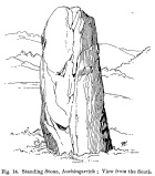
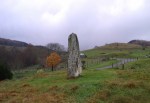
Shown on the earliest Ordnance Survey map of the region as one of several ‘Roman Stone’ sites, this prehistoric upright is similar in size and feel to the other standing stones in the highly impressive Dunruchan complex close by.  The big fella stands on a raised piece of ground more than 8½ feet tall and, said Fred Coles (1911) has “a basal girth of 12ft 8ins.”  Quite a big stone!  A dubious large cup-mark is visible on the thin western face and three faint ones on its east.

The monolith is surrounded all along the southern landscape arc with forested moorland and low mountains, with the primary extended views reaching mainly into the north and western arc.  Although a rounded hillock immediately southwest of the stone looks promising, no calendrical or astronomical alignments have been found here.

Folklore

Auchingarroch, looking SW

Auchingarroch, looking SW

As with the other standing stones in this region, legend ascribes it as marking the resting place of a Roman soldier who fell in a great battle close by with our local heathens, in what was known as “battle of Mons Grampius.”

References:

  1. Coles, F.R., “Report on stone circles in Perthshire principally Strathearn,” in Proceedings of the Society of Antiquaries, Scotland, volume 45, 1911.
  2. Finlayson, Andrew, The Stones of Strathearn, One Tree Island: Comrie 2010.
  3. Hunter, John, Chronicles of Strathearn, David Phillips: Crieff 1896.

Acknowledgements:  Thanks to Paul Hornby for the journey here; and more especially a different sorta thanks to Linzi Mitchell for her influence whilst the site profile of this megalithic erection was being written. Who sez that men can’t do two things at the same time?!

© Paul BennettThe Northern Antiquarian


Allt a’ Choire Chireinich (04), Ben Lawers, Kenmore, Perthshire

Cup-and-Ring Stone:  OS Grid Reference – NN 65306 39560

Also Known as:

  1. Canmore ID 238575

Getting Here

The petroglyph & its associates

The petroglyph & its associates

Along the A827 road between Killin and Kenmore, park-up at the Tombreck entrance and cross the road, taking the long track which eventually zigzags up the slope of Ben Lawers.  Keep your eyes on the copse of trees a few hundred yards east that runs up the slopes.  Head towards this, past the multiple-ringed Allt a’ Choire Chireinich stone, then AaCC 2 and AaCC3 carvings, then notice on the other side of the stream a couple of large boulders.  That’s the spot!

Archaeology & History

This faint but intricately carved petroglyph is one in a cluster of three carvings, right next to each other—and it’s the best of the bunch by a long way.  A single cup-marking is found on the flat stone beneath this one (AaCC5); whilst the large egg-shaped boulder in front has perhaps a half-dozen cups on it (AaCC6).

Alex Hale's sketch of the carving

Alex Hale’s sketch of the carving

Faint remains of concentric rings

Faint remains of concentric rings

The large flat-topped boulder of AaCC4 however, possesses at least seventeen plain cup markings, along with twenty-four cup-and-rings, six cup-and-double-rings, three cup-and-three rings, three cup-and-four rings, and one cup-and-five rings!  There are some carved lines that emerge from several of the cups, with all of the three cup-and-four rings having a carved pathway emerging from the central cup and going out of the concentric system.  It’s quite a beauty!  And it sits upon the ridge next to the clear drinking waters of the burn, gazing out over Loch Tay and the mountains all around in a quite beautiful landscape.

Immediately above and below the carvings are a number of settlement spots or shielings, known to have been used until recent centuries.  They were quite ideal living quarters and some of the old folk here, in bygone days, would have known old customs and stories of this petroglyph.

References:

  1. Hale, Alex, “Prehistoric Rock Carvings in Strathtay,” in Tayside and Fife Archaeological Journal, 2009.
  2. Yellowlees, Sonia, Cupmarked Stones in Strathtay, Scotland Magazine: Edinburgh 2004.

Acknowledgments: Huge thanks to Lisa Samson, Fraser Harrick and Paul Hornby for their help reaching this site and exploring still further.  Let’s do it again sometime before I vanish forever up into the far North!

© Paul BennettThe Northern Antiquarian


Allt a’ Choire Chireinich (03), Kenmore, Perthshire

Cup-Marked Stone:  OS Grid Reference – NN 65249 39579  –  NEW FIND

Getting Here

Allt a' Choire Chireinich 03 Stone

Allt a’ Choire Chireinich 03 Stone

Take the same directions to reach the large rounded Allt a’ Choire Chireinich 02 carving.  Walk 65 yards (60m) northwest diagonally uphill to another large rounded stone of similar size.  That’s the one!

Archaeology & History

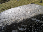
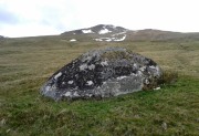
A large cup-marked boulder, not previously recognised, was rediscovered on the afternoon of May 15, 2015.  The great majority of the rock surface is covered in aged lichens, but at least three well-defined cup-markings were noted on the upper rounded surface of the stone: one near the middle of the stone; one near the centre-north; and another towards the top northwest section of the stone.  The cups are more than an inch in diameter and eighth-of-an-inch deep.  Others may be in evidence beneath the vegetation.

© Paul BennettThe Northern Antiquarian


Allt a’ Choire Chireinich (02), Kenmore, Perthshire

Cup-Marked Stone:  OS Grid Reference – NN 65218 39525

Also Known as:

  1. Canmore ID 291477

Getting Here

Allt a' Choire Chireinich 2 stone

Allt a’ Choire Chireinich 2 stone

Along the A827 road between Killin and Kenmore, park-up at the Tombreck entrance and cross the road, taking the long track which eventually zigzags up the slope of Ben Lawers.  Keep your eyes on the copse of trees a few hundred yards east that runs up the slopes and when you are level with the top of it, walk along the line of walling that heads to it.  Go past the top of the trees and the first big boulder you reach is the fella in question.

Archaeology & History

Adjacent to an ancient trackway that runs across the slopes of the mountain, this large glacial boulder sits proudly on the slopes calling out for attention — and attention it certainly received countless centuries ago, when local people (perhaps) decided to cut at least nine cup-markings onto the top of the rock.

Lichen-encrusted cups

Lichen-encrusted cups

Lichen-encrusted cups

Lichen-encrusted cups

The surface today is encrusted with olde lichens of colourful hues, beneath which may be other cup and ring carvings; but as I’m a great lover of such forgotten medicinal primers, I wasn’t about to scratch beneath their bodies to find out.  This petroglyph is worth looking at when you’re exploring the other, more impressive carvings in this Allt a’ Choire Chireinich cluster.

© Paul BennettThe Northern Antiquarian


Allt a’ Choire Chireinich, Kenmore, Perthshire

Cup-and-Ring Stone:  OS Grid Reference – NN 65096 39442  —  NEW FIND

Getting Here

The stone, uncovered

The stone, uncovered

Take the A827 road between Killin and Kenmore and park-up at the entrance to Tombreck. Cross the road and walk up the track that goes up Ben Lawers.  As it zigzags uphill, watch out for you being level with the top of the copse of trees several hundred yards west, where a straight long overgrown line of walling runs all the way to the top of the copse. Go along here, and just as you reach the trees, walk uphill for about 50 yards.  You’re damn close!

Archaeology & History

Whether you’re into prehistoric carvings or not, this is impressive!  It’s one of several with a very similar multiple-ring design to be found along the southern mountain slopes of Ben Lawers.  Rediscovered on May 13, 2015, several of us were in search of a known cup-and-ring stone just 260 yards (238m) to the northwest in this Allt a’ Choire Chireinich cluster, but one stone amongst many called my nose to have a closer sniff—and as you can see, the results were damn good!

Looking from above

Looking from above

Etched onto a large flat rock perhaps 5-6000 years ago, probably over at least two different seasons, the primary design here is of two sets of multiple-rings: in one case, seven concentric ones emerging from, or surrounding a central cup-marking (more than an inch across); and the other is of at least eight concentric rings emerging from a cup-marking, about half-an-inch across. The largest cup-and-seven-rings is the one near the centre of the stone.  Initially I thought this was simply two concentric seven-rings; but the more that I looked through the many photos we’d taken, the more obvious it became that the residue of an eighth ring (possibly more) exist in the smaller-sized concentric system.  It must however be pointed out that neither of the concentric carved rings seem to be complete – i.e., they were never finished, either purposefully or otherwise.  The largest cup-and-seven-rings is the one near the centre of the stone; with the outer smaller example being half the size of the one in the middle.  At first glance, neither of the concentric rings seem complete – and so it turned out when it was enhanced by rain and sun.

First photo of the double-rings

First photo of the double-rings

The large central cup-and-seven-rings has two additional cup-marks within it: one on the outer fifth ring to the southeast, and the other in the outer sixth ring to the west.  This western cup-mark is also crossed by a carved line that runs from the first ring outwards to the west and to the edge of the rock, crossing another cup-mark along the way.  This particular carved line might be the same one that integrates itself into the first ring, and then re-emerges on is northeastern side, to continue out of the multiple-rings themselves and curve over to the eastern side of the rock.  Running roughly north-south through the middle of this larger seven-ring element, a line scarred by Nature is visible which has been pecked by humans on its northern end, only slightly, and running into the covering soil eventually, with no additional features apparent.  Another possible carved line seems in evidence running from the centre to the southeastern edge – but this is by no means certain.

The carving, looking north

The carving, looking north

This large central seven-ringed symbol has been greatly eroded, mainly on its southern sides, where the rings are incomplete, as illustrated in the photos.  Yet when the light is right, we can see almost a complete concentric system, with perhaps only the second ring from the centre being incomplete on its eastern side.  On the southern sides, the visibility factor is equally troublesome unless lighting conditions are damn good.  The northernmost curves, from west to east, are the deepest and clearest of what remains, due to that section of the stone being covered in soil when it was first discovered, lessening the erosion.
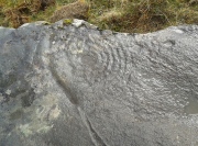
Smallest 7-ring section, with cups

Smallest 7-ring section, with cups

Multiple-ring complex & cups

Multiple-ring complex & cups

Moving onto the second, smaller concentric set of rings: this is roughly half the size of its counterpart in the middle of the stone.  Upon initial investigation you can clearly make out the seven rings, which have faded considerably due to weathering.  It seems that this section was never fully completed.  And the weathering on this smaller concentric system implies one of two things: either that it was left open to the elements much much longer than its larger seven-ring system, or it was carved much earlier than it.  In truth, my feeling on this, is the latter of the two reasons.  Adding to this probability is the fact that even more rings—or at least successive concentric carved ‘arcs’—are faintly visible around this more faint system: at least eight are evident, with perhaps as many as thirteen in all (which I think would put it in the record-books!).  But we need to visit it again under ideal lighting conditions to see whether there are any more than the definite eight.  It is also very obvious that the very edge of the rock here has been broken off at some time, and a section of the carving went with it—probably into the ancient walling below or the derelict village shielings on the mountains slopes above.

Just above the eroded eight-ring section are three archetypal cup-marks close to the very edge of the rock, one above each other in an arc.  Of these, the cup that is closest to the eight-rings possesses the faint remains of at least two other partial rings above it, elements of which may actually extend and move into the concentric rings themselves—but this is difficult to say with any certainty.  However, if this is the case, we can surmise that this small cup-and-two-rings was carved before its larger tree-ring-looking companion.

Below the smaller seven-ringer is the possibility of a wide cup-and-two-rings: very faint and incomplete.  This only seems visible in certain conditions and I’m not 100% convinced of its veracity as yet.
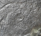
Curious 'eye'-like symbol

Curious ‘eye’-like symbol

'Eye' to the bottom-left

‘Eye’ to the bottom-left

We also found several other singular cup marks inscribed on the rock, all of them beneath the two concentrics, moving closer to the edge of the rock.  But a more curious puzzle is an eye-like symbol, or geological feature, on the more eastern side of the stone.  It gives the impression of being worked very slightly by humans, but as I’m not a geologist, I’ve gotta say that until it is looked at by someone more competent than me, I aint gonna commit myself to its precise nature.  What seems to be a carved line to the left (west) of this geological ‘eye’ may have possible interference patterns pecked towards it.  Tis hard to say with any certainty.

So – what is this complex double-seven-ringer?!  What does it represent?  Sadly we have no ethnological or folklore narratives that can be attributed to the stone since The Clearances occurred.  We only have the very similar concentric six- and seven-ringed petroglyphs further down the mountainside to draw comparisons with.  We could guess that the position of the stone halfway up Ben Lawers, giving us a superb view of the mountains all around Loch Tay might have some relevance to the carving; but this area was probably forested when these carvings were etched—which throws that one out of the window!  We could speculate that the two multiple rings represent the Moon and Sun, with the smaller one being the Moon. They could represent a mythic map of Ben Lawers itself, with the central cup being its peak and outer rings coming down the levels of the mountain.  Mountains are renowned in many old cultures as, literally, cosmic centres, from whence gods and supernal deities emerge and reside; and mountains in some parts of the world have been represented by cup-and-ring designs, so we may have a correlate here at Ben Lawers.  O.G.S. Crawford (1957) and Julian Cope (1998) would be bedfellows together in their view of it being their Eye Goddess.  But it’s all just guesswork.  We do know that people were living up here and were carving other petroglyphs along this ridge, some of which occur inside ancient settlements; but the traditions of the people who lived here were finally destroyed by the English in the 19th century, and so any real hope of hearing any old myths, or possible rites that our peasant ancestors with their animistic worldview possessed, has died with them.

Tis a fascinating carving nonetheless—and one worthy of seeking out amongst the many others all along this beautiful mountainside…

References:

  1. Bernbaum, Edwin, Sacred Mountains of the World, Sierra Club: San Francisco 1990.
  2. Cope, Julian, The Modern Antiquarian, Thorsons 1998.
  3. Crawford, O.G.S., The Eye Goddess, Phoenix House: London 1957.
  4. Eliade, Mircea & Sullivan, Lawrence E., “Center of the World,” in Encyclopedia of Religion – volume 3 (edited by M. Eliade), MacMillan: Farmington Hills 1987.
  5. Evans-Wentz, W.Y., Cuchuma and Sacred Mountains, Ohio University Press 1980.
  6. Gillies, William A., In Famed Breadalbane, Munro Press: Perth 1938.
  7. Michell, John, At the Centre of the World, Thames & Hudson: London 1994.
  8. Yellowlees, Sonia, Cupmarked Stones in Strathtay, Scotland Magazine: Edinburgh 2004.

Acknowledgements:  Huge thanks to Paul Hornby for the use of his photos in this site profile; to Lisa Samson, for her landscape detective work at the site; and to Fraser Harrick, for getting us there again.

© Paul BennettThe Northern Antiquarian