Lady Well, Tibbermore, Perthshire

Holy Well (destroyed):  OS Grid Reference – NO 05190 23479

Also Known as:

  1. Canmore ID 26862
  2. St Mary’s Well

Getting Here

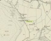
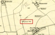
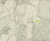
Lady Well on 1866 map

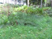
Approaching Tibbermore from Huntingtower, turn left in the village and the site of the Lady Well is visible in fields on the left, just to the north of a bush growing on the north-south boundary fence on the east side of the roadside paddock before you get to the church.

Archaeology & History

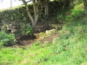
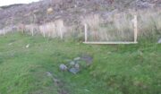
On the day of my site visit I wasn’t able to get close to the site, owing to the subdivision of the roadside paddock by wire fences and the presence of horses. Growing crops barred access from the east. But it appears that all physical traces of the well have been destroyed, and the actual site of the well as shown on old OS maps now shows no evidence of it, but a large bush a few yards south may indicate the present site of any vestigial spring.

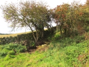
The site of the Well to the left of the bush

Hew Scott, in Fasti Ecclesiae Scoticanae wrote that the church at Tibbermore was dedicated to St Mary, and that there was a Well of St Mary. Tibbermore was a mensal parish of the Bishop of Dunkeld – i.e., its parish revenues etc, were accrued to the Bishop, who maintained a residence in the parish prior to the Reformation.  Pennant wrote in 1772 that the church of Tibbir-moor took its name from a holy well dedicated to the Virgin Mary.

John Inglis in the Old Statistical Account wrote that the name Tibbermore was understood to be compounded of two Gaelic words, tuber and more, which signify a large well—referring probably to a plentiful spring of water immediately adjoining to the church-yard.

Watson, in his Celtic Place Names writes:

Tibbermore or -muir near Perth is supposed to mean ‘big well’ from a fine spring near the churchyard, but as this used to be called “the lady well”, the meaning may be ‘Mary’s well’, tiobar Moire, like Tobar Mhoire, Tobermory in Mull.

Can it be inferred from this that the spring was historically of great importance; firstly to have given its name to the parish and village and secondly to have been named after the Virgin Mary rather than a ‘lesser’ saint, and to have been a pre-Christian place of veneration and pilgrimage? Adding to this speculation is the presence of several cup marked stones within a mile or so of the holy well, which may possibly indicate a very ancient sacred landscape.

References:

  1. Pennant, Thomas, A Tour In Scotland 1772, London, Benjamin White, 1776.
  2. Inglis, John, Old Statistical Account for Tibbermore, Perthshire, 1791-99.
  3. Scott, Hew, Fasti Ecclesiae Scoticanae, Vol. IV, Edinburgh, Oliver & Boyd, 1923.
  4. Watson, W.J., The Celtic Place-Names Of Scotland, Revised Edition, Edinburgh, Birlinn, 2004. (originally published 1926).

© Paul T. Hornby 2018


Chapel Well, Berryhill, Bankfoot, Perthshire

Holy Well (destroyed):  OS Grid Reference – NO 02179 34749

Also Known as:

  1. Beltane Well
  2. Canmore ID 27045

Getting Here

The reeds mark the spot

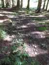
I accessed the site by parking up at Little Tullybelton, walking up the hill and crossing into the field on the left just north of the wood, then walking due west (crossing barbed wire fences) until dropping down into the valley of the Ordie Burn and following the track into the wood, then, noting where the burn crosses south of the old stone wall. The site of the well is marked by some tussocks of cotton grass. Don’t confuse with a patch of nettles and docks 2-300 hundred yards east where you enter the wood.

Archaeology & History

This well was destroyed about 170 years ago and the site of it is quite hard to find as the land has been turned over to forestry. It was near a chapel and burial ground that were also destroyed by the farmer of the time. The old wall formed part of the boundary of the detached portion or enclave of the neighbouring parish of Methven.

The Reverend Thomas Nelson, Minister of the Parish of Auchtergaven, has this to say in the New Statistical Account of 1845:

‘Superstition formerly invested St Bryde’s, and Chapel Well, and perhaps some others, with a sacred character, and made then places of resort for pious purposes.

‘On the south march of Berryhill Farm, in the same lands of Tullybeagles, there is the site of.. a chapel, where there was a burying-place, where human bones have been recently dug up; and, till of late, the people in the neighbourhood used, on the first Sabbath of May, to drink out of the Holy Well there. This sacred place is on the banks of the Ordie.’

The OS Name Book has the following entry regarding the Well:

‘The site of a Holy Well which has been traditionally associated with the adjacent chapel. The water of this well is now carried by a covered drain into the adjacent stream, and the well filled in‘.

And this regarding the Chapel:

‘The site of an ancient chapel on the north bank of the Ordie Burn, the chapel was demolished and the graveyard rooted up some years ago by the present tenant of the farm, who has pointed out the site, the dedicatory name is not known‘.

Site shown on 1867 map
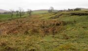
Ancient track to chapel & well

I could find no evidence of the culvert which discharges the waters of the Well into the Burn. What does seem to have been missed is the survival of part of the ancient sunken roadway or pilgrim path to the site, which is still clearly visible.  The fact that it was visited by locals on the first Sabbath in May would point to it having originally been a Beltane well, and therefore of pre-Christian origin.

References:

  1. The New Statistical Account for Auchtergaven, Perthshire, 1845
  2. Ordnance Survey Name Books for Perthshire, 1859-6

© Paul T Hornby 2018


Tammie Blair’s Well, Dunblane, Stirlingshire

Healing Well (destroyed):  OS Grid Reference – NN 780 010

Archaeology & History

Which one is Tammie Blair’s Well?

It’s difficult to work out the exact position of this lost well, even from Alexander Barty’s (1944) description of the place.  There are several unnamed ‘Wells’ on the early OS-maps very close to where this one was said to be, but in the end I’m relying on (sort of) educated guesswork regarding its precise location.  Please forgive my ineptitude here…

That aside, it’s another water source that has long since gone and is only remembered thanks to Mr Barty’s excellent local history research in the first-half of the 20th century.  He told us:

“This well stood beside the path which leads from the Bridgend up the right bank of the Allan to the Haugh.  A drawer of water at one time had to go down about 15 steps to the well.  It may have been constructed after the making of the railway, as previously a little burn flowed from the Bridgend west of the railway down to the Allan, the lower part of which is still open next Willowbank House.  This well may therefore have been made by the Railway Company to supply dwellings in Bridgend.  It took its name from a man, Blair, who had charge of the railway gates there prior to the erection of the iron footbridge over the railway line.”

It may be the ‘Well’ marked lower-centre on the above 1863 OS-map above.  But I aint sure.

References:

  1. Barty, Alexander B., The History of Dunblane, Eneas Mackay: Stirling 1944.

Acknowledgements:  Huge thanks to the staff at Dunblane Library for their help.

© Paul BennettThe Northern Antiquarian


St. Patrick’s Well (1), Dunruchan, Muthill, Perthshire

Holy Well:  OS Grid Reference – NN 77905 17365

Getting Here

St Patricks Well on 1863 map

Take the B827 road between Comrie and Braco. If you’re coming via Comrie, going uphill for 3.1 miles (5.1km); but if from Braco Roman Camp go along and eventually downhill for 6.6 miles (10.6km), watching out for the track to Middleton Farm by the roadside.  Walk along for 125 yards, keeping your eyes peeled for the boggy ground below on your left. You’re there!

Archaeology & History

Immediately east of the prodigious megalithic complex of Dunruchan, bubbling up amidst the usual Juncus conglomeratus reeds, are the boggy remnants of St. Patrick’s Well—one of two such sacred wells dedicated to the early Irish saint in Muthill parish. We’re at a loss as to why this Irish dood has such sites in his name in this area.  No doubt some transitional shamanic character was doing the rounds in this glorious landscape, muttering words of some neo-christian animism, eventually settling a mile from the great megalithic complex, perhaps hoping—and failing—to convert our healthy heathen populace into ways unwise.

The shallow boggy waters
The site of St Patricks Well

Whatever he may have been up to, a small stone chapel was built hereby and, it was said, even a christian graveyard, to tempt folk away from the ancient plain of cairns whence our ancestors had long since buried their dead.  But the christian’s chapel and graveyard has long since gone; and when historians before me had visited the place, St Patrick’s Well had also fallen back to Earth in the drier summers, taking the blood of the Earth back into Her body.  The heathen megaliths still remain however, standing proud on the moorland plain in clear sight from these once healing waters, whose mythic history, on the whole, has long since been disregarded….

Folklore

St Patrick’s day on March 17—”a date very near the Spring Equinox,” as Mrs Banks (1939) reminded us—may have been the dates when the waters here were deemed particularly efficacious, although we have nothing in written accounts to tell us for sure. But in the 19th century Statistical Account we find that the site was “much frequented once, as effectual in curing the hooping cough.”  E.J. Guthrie (1885) told of an ancient rite regarding the drinking of the waters for effect of the cure, saying:

“In the course of this century a family came from Edinburgh, a distance of nearly sixty miles, to have the benefit of the well. The water must be drunk before sunrise or immediately after it sets and that out of a “quick cow’s horn”, or a horn taken from a live cow, and probably dedicated to this saint.”

Also in Muthill parish, Guthrie told, St Patrick’s memory was held in such veneration that farmers and millers did not work on his day.

References:

  1. Banks, M. MacLeod, British Calendar Customs: Scotland – volume 2, Folk-lore Society: Glasgow 1939.
  2. Booth, C. Gordon, “St Patrick’s Well (Muthill Parish),” in Discovery & Excavation, Scotland, New Series volume 1, 2000.
  3. Guthrie, E.J., Old Scottish Customs, Thomas D. Morison: Glasgow 1885.
  4. MacKinlay, James M., Folklore of Scottish Lochs and Springs, William Hodge: Glasgow 1893.
  5. Morris, Ruth & Frank, Scottish Healing Wells, Alethea: Sandy 1982.

© Paul BennettThe Northern Antiquarian


St. Blane’s Well, Dunblane, Stirlingshire

Holy Well (lost):  OS Grid Reference – NN 781 015

Also Known as:

  1. Bruce’s Well

Archaeology & history

Very little is known about this long-lost site, mentioned just once in Alexander Barty’s (1944) standard history book on Dunblane.  Its exact location is difficult to cite with any certainty, although a ‘Well’ is marked on the 1862 OS-map not far from where Mr Barty proclaimed it to be:

“In the close known as Regent’s Square in Braeport, opposite the public school, was a well called Bruce’s Well and also St Blane’s Well, and probably water from this supplied a well in Cathedral Market Garden to the west.”

Position of St. Blane’s Well?

St Blane is a Celtic saint whom tradition says gave his name to the town and whose festival date is August 10.  In the area of the Allan Water St Blane was said to have set up his cell, which eventually became the prestigious ceremonial temple known as Dunblane Cathedral (although some evidence points to his original settlement being on the higher ground above the cathedral).  Originally born on the Isle of Bute around 565 CE, another St Blane’s Well can be found at Kingarth on his home island.

References:

  1. Armitage, Paul, The Holy Wells of Stirling and District, TNA 2019.
  2. Barty, Alexander B., The History of Dunblane, Eneas Mackay: Stirling 1944.
  3. Towill, Edwin Sprott, The Saints of Scotland, St Andrews Press 2012.

© Paul BennettThe Northern Antiquarian


St. Finglassin’s Well, Kinglassie, Fife

Holy Well: OS Grid Reference – NT 22797 98814

Also Known as:

  1. Canmore ID 52894
  2. St Finglassin’s Well 
  3. St Glass’s Well 

Finglassins Well on early OS-map

Getting Here

In Kinglassie village, from the Main Street follow Redwells Road and turn right where it forks and follow the track until you get to the derelict ground; then turn left up the slope, following the eastern (right hand) edge of the wall up to the well.

Archaeology & History

Under its bower of hawthorn & elder

Sheltered under its bower of hawthorn and elder bushes, at a distance it has the romantic look of an ancient holy well.  But close up, the spring issuing from Finglassins Well shows evidence of having been connected up to the public water supply, with ugly brickwork and pipes obliterating any previous structures that may or may not have existed there. There even seems to be doubt as to its name. Ordnance Survey and Nicolson Street Atlas show it as ‘Finglassins Well’. According to the Canmore citation, which lists it as ‘St Finglassin’s Well’ or ‘St. Glass’s Well’:

This spring is now piped into a trough. There are several boulders nearby but no dressed stone and it is doubtful if there was ever any structure here. It is known by both names.

A well of fine water…

Past industrial despoilation..

So who was the patronal saint, who is remembered variously as Finglassin, Glass, Glascianus, and Glastian? There seems to be some difference of opinion among the various sources, even as to whether any saint existed at all.  Alban Butler, in his Lives of the Saints, tells:

“St. Glastian, Bishop and Confessor in Scotland: HE was a native of the county of Fife, and discharged in the same, during many years, the duties of the episcopal character with which he was honoured. Amidst the desolation which was spread over the whole country, in the last bloody civil war between the Scots and Picts, in which the latter were entirely subdued, St. Glastian was the comforter, spiritual father, and most charitable protector of many thousands of both nations. He died in 830, at Kinglace in Fifeshire, and was particularly honoured in that country, and in Kyntire. According to the ancient custom of that country, his name is frequently written Mac-Glastian, the word Mac signifying son.”

Bishop Forbes of Brechin, writing of St Glascianus in Kalendars of Scottish Saints:

“Of the life of the saint we have no details. The collect in the Breviary runs in these terms – ‘Grant we beseech Thee, Almighty God, that we, who celebrate the anniversary of blessed Glascianus, Thy confessor and bishop, may by the intercession of his devout prayers, be deemed meet to attain to eternal joys through out Lord’ He is known in the parish of Kinglassie (or Kinglassin), near Kirkcaldy, of which frequent mention is made in the Register of Dunfermline.”

In the Old Statistical Account of 1792, Reverend James Reid, writing of the origins of Kinglassie:

“It is the opinion of some, that the name is originally Gaelic, and expressive of the situation; others trace it from a saint, whose name was Glass, and point out a well of fine water, called St. Glass’s well.”

Reverend J.M.Cunnynghame, in the New Statistical Account of 1845 wrote:

“While some have supposed that the village after which the parish is called, derives its appellation from a spring denominated St Glass’s Well, others, with apparently greater reason, have traced the name to Gaelic words signifying the ‘head of grey land’. This idea seems to be corroborated by the large extant of inundated, marshy, and mixed surface which….still stretches itself to the immediate vicinity of the village. The preferable conjecture concerning the the derivation of the name acquires additional support from the circumstance, that a locality, somewhat elevated above the channel, along which the water runs from the swamp alluded to, has received the appropriate designation of ‘Finglassie’ signifying the ‘termination of the gray land, or mixed bog.”

W.J.Watson, in The Celtic Place Names of Scotland gives the derivation of Kinglassie from the gaelic ‘cill glaise’ – ‘church of the brook’, and further:

“A well near the church is known as St Glass’s Well or St Finglassin’s Well. Here again, the stream ‘glais’ on which the church stands has been made into a saint; Findgassin is ‘find glaisín’ – ‘holy streamlet’. Near the church is an eminence called Finmont, for ‘finn monad’, later ‘fionn mhonadh’ – ‘white hill’, here probably ‘holy hill’. The real saint of Kinglassie is unknown.”

A closer view

I am inclined to discount Cunnynghame’s laboured interpretation in view of Watson’s later linguistic analysis, as well as bearing in mind he was a minister of a Kirk that went out of its way to deny and denigrate the native pre-Reformation saints. Because of its position and ambience despite past industrial despoilation, I am inclined to a saintly attribution to the well, which as in so many cases in Scotland has lost its true history owing to the depredations of the Reformation. If Watson’s interpretation of ‘Finmont’, ½ mile north-east of the well, is indeed ‘Holy Hill’ then Finglassins Well may have been a part of an ancient, perhaps heathen ritual landscape.

References:

  1. Reid, James, Parish of Kinglassie, Old Statistical Account, Fife, 1792.
  2. Cunnynghame, J.M. Parish of Kinglassie, New Statistical Account , Fife, 1845.
  3. Butler, Alban, The Lives of the Fathers,Martyrs and Other Principal Saints, James Duffy: Dublin 1866.
  4. Forbes, Bishop A.P., Kalendars of Scottish Saints, Edmiston & Douglas: Edinburgh 1872.
  5. Watson, W.J., The Celtic Place Names of Scotland, (revised edition), Birlinn, Edinburgh, 2004 (originally published 1926).

© Paul T. Hornby 2018


Lady Well, Airth, Stirlingshire

Holy Well (destroyed):  OS Grid Reference – NS 89801 86524

Also Known as:

  1. Canmore ID 46862
  2. Lady’s Well
  3. Spaw Well

Archaeology & History

Site of the Lady Well, Airth

Once to be seen flowing on the south-side of the Pow Burn below Airth Castle, all traces of this once sacred site has fallen prey to the usual advance of the so-called ‘civilized’.  In literary terms, the site was first described in church records from 1657—as Ladieswell—and the accounts we have of the place from then are most revealing in describing the traditional use of the place by local people.  It was a sacred site, obviously, chastised by the madness of the christian regime of the period, in their attempt to destroy indigenous customs and societal norms.  William Hone (1837) gave an extended account of what some people were up to here in his Everyday Book:

“In 1657, a mob of parishioners were summoned to the session, for believing in the powers of the well of Airth, a village about six miles north of Falkirk, on the banks of the Forth, and the whole were sentenced to be publicly rebuked for the sin. –

“”Feb. 3, 1757, Session convenit. Compeared Bessie Thomson, who declairit scho went to the well at Airth, and that schoe left money thairat, and after the can was fillat with water, they keepit it from touching the ground till they cam horm.”

“”Ffebruary 24. — Compeired Robert Fuird who declared he went to the well of Airth, and spoke nothing als he went, and that Margrat Walker went with him, and schoe said ye beleif about the well, and left money and ane napkin at the well, and all was done at her injunction.”

“”Compeared Bessie Thomson declarit schoe fetch it horn water from the said well and luit it not touch the ground in homcoming, spoke not as sha went, said the beleif at it, left money and ane nap-kin thair; and all was done at Margrat Walker’s command.”

“”Compeired Margrat Walker who denyit yat scho was at yat well befoir and yat scho gave any directions ”

“”March 10. Compeared Margrat Forsyth being demand it if scho went to the well of Airth, to fetch water thairfrom, spok not by ye waye, luit it not touch ye ground in homcoming? if scho said ye belief? left money and ane napkin at it? Answered affirmatively in every poynt, and yat Nans Brugh directit yem, and yat they had bread at ye well, with them, and yat Nans Burg said shoe wald not be affrayit to goe to yat well at midnight hir alon.”

“”Compeired Nans Burg, denyit yat ever scho had bein at yat well befoir.”

“”Compeired Robert Squir confest he went to yat well at Airth, fetchit hom water untouching ye ground, left money and said ye beleif at it.”

“”March 17. Compeired Robert Cochran, declairit, he went to the well at Airth and ane other well, bot did neither say ye beleif, nor leave money.”

“”Compeired Grissal Hutchin, declairit scho commandit the lasses yat went to yat well, say ye beleif, but dischargit hir dochter.”

“”March 21. Compeired Robert Ffuird who declairit yat Margrat Walker went to ye well of Airth to fetch water to Robert Cowie, and when schoe com thair, scho laid down money in Gods name, and ane napkin in Robert Cowie’s name.”

“”Compeired Jonet Robison who declairit yat when scho was seik, Jean Mathieson com to hir and told hir, that the water of the well of Airth was guid for seik people, and yat the said Jean hir guid sister desyrit hir fetch sum of it to hir guid man as he was seik, bot sho durst never tell him.”

“”These people were all 44 publicly admonishit for superstitious carriage.””

The practices continued.  In 1723, a Mr Johnstoun of Kirkland, writing about the parish of Airth, also told of the reputation of the well, saying,

“Upon the south side of the Pow of Airth, upon its very edge, is a spaw well famous in old times for severall cures, and at this day severalls gets good by it, either by drinking or bathing. Its commonly called by the name of Ladies well. Its about two pair of butts below Abbytown bridge.”

The fact that he told us it was “good for bathing” suggests a pool was adjacent, or at least the tiny tributary between it and the Pow Burn gave room for bathing and had a curative reputation. (there are many pools in the Scottish mountains with this repute – some are still used to this day!)

It was then described by Robert Ure in the first Statistical Account of 1792, where he told how the people were still using the waters, despite the crazy early attempts to stop them.  “There is a Well, near Abbeytown Bridge,” he told,

“called Lady-Well, which is thought to be medicinal.  Numbers have used it, and still use it as such.  It is supposed to have obtained that name, from the holy water, in the time of Popery, being taken from it, to supply the abbacy, or Catholic Church, then at Airth.”
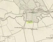
Lady Well on 1865 map

But we know that its origins as a celebrated well pre-date any christian overlay.  People were reported visiting the site from as far away as Edinburgh, such was its repute!

Much later when the Ordnance Survey lads came here, showing it on their first map of Airth, they made their own notes of the place, saying briefly,

“A small well close to the Pow Burn – it is supposed to have derived its name from the Custom of dedicating wells to the Virgin Mary – so Common prior to the Reformation. It is not a mineral well.”

Ugly plastic pipe is all that remains

But its demise was coming.  In the wake of the christian Industrialists and their myth, subsuming the necessary integral sacrality of the Earth, the waters of the well were eventually covered.  When the Royal Commission (1963) lads gave the site their attention in October 1954, they reported that “no structural remains” of any form could be seen here, and in recent years all trace of the well has vanished completely.  When we visited the site a few months ago, perhaps the very last remnant of it was a small plastic pipe sticking out of the muddy bankside, dripping dirty water into the equally dirty Pow Burn.

It would be good if local people could at least put a plaque hereby to remind people of the history and heritage that was once so integral to the way they lived their lives.

References:

  1. Bennett, Paul, Ancient and Holy Wells of Stirling, TNA 2018.
  2. Fraser, Alexander, Northern Folk-lore on Wells and Water, Advertiser Office: Invermess 1878.
  3. Frost, Thomas, “Saints and Holy Wells,” in Bygone Church Life in Scotland (W. Andrews: Hull 1899).
  4. Hone, William, The Every-day Book – volume 2, Thomas Tegg: London 1837.
  5. MacFarlane, Walter, Geographical Collections Relating to Scotland – volume 1, Edinburgh Universoty Press 1906.
  6. MacKinlay, James M., Folklore of Scottish Lochs and Springs, William Hodge: Glasgow 1893.
  7. Morris, Ruth & Frank, Scottish Healing Wells, Alethea: Sandy 1982.
  8. Murray, G.L., Records of Falkirk Parish – volume 1, Duncan & Murray, Falkirk 1887.
  9. Reid, John, The Place-Names of Falkirk and East Stirlingshire, Falkirk Local History Society 2009.
  10. Royal Commission on the Ancient & Historical Monuments Scotland, Stirling – volume 2, HMSO: Edinburgh 1963.

© Paul BennettThe Northern Antiquarian
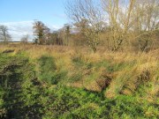

Gilfeilzie Well, Alyth, Perthshire

Sacred Well (destroyed):  OS Grid Reference – NO 2675 5071

Also Known as:

  1. Well of Gilfeilzie

Archaeology & History

Long lost, this was a sacred well whose history has all but fallen away.  Were it not for the historian James Meikle (1925), whose excellent survey of Alyth parish cites a record and brief narrative of the site, we’d no longer know it ever existed.

It was located 1¾ miles northeast of Alyth, roughly halfway between the giant and mightily impressive Barry Hill hillfort (NO 2623 5039) and the lost stone circle of Hell Hole (NO 2801 5066).  It is the name of the Well itself that invited scrutiny in Meikle’s place-name book which, he told, meant a hut, but also a “cell, shrine in a temple,” or “at the church.”  No church has ever been recorded here, although a small hamlet was in the adjacent field to the west—long since cleansed by the English in the genocide known as The Clearances.  The well was shown and named on an 18th century estate map by William Panton in 1772, as Meikle told us,

“near the south bank of the Slatenty Burn, known there are the Burn of Babylon.  The well is now drained, but it was evidently within what is the first cultivated field east of the heath-covered skirts of Barry Hill, and 40 or 50 yards from its north-east corner.  Above the well and above the old loan from Inverqueich, and mostly within the same field, were half a dozen scattered cottages, with a kiln…; and as baptisms in 1649 tend to show that there were more houses than one in Gilfeilzie, the whole group must have been so named.”

When Paul Hornby and I visited the place yesterday, we could find no trace whatsoever of the well.

References:

  1. Meikle, James, Places and Place-Names round Alyth, Alex Gardner: Paisley 1925.

© Paul BennettThe Northern Antiquarian


Devil’s Well, Abernethy, Perthshire

Sacred Well:  OS Grid Reference – NO 19430 14758

Also Known as:

  1. Canmore ID 28084

Getting Here

Devil’s Well on 1860 map

From Abernethy village, go west along the A913 road for half-a-mile, then turn left up the long and winding Glenfoot road up the Abernethy Glen.  About a mile up on your left-side is Craigden Farm and, just a bit past this, the forestry plantation.  Just before the trees, cut up the field and head uphill, passing the near forest of gorse, until you reach the huge detached house of Turflundie.  In the field immediately east, right up against the barbed-wire fence where it meets the depleted forestry, a very small trickle of water emerges beneath a small pile of rocks.  You’re here!

Archaeology & History

Long since thought to have been lost, the trickling remains of this old Well of the Devil are, in fact, still running beneath the pile of stones just over the barbed-wire fence on the edge of the forestry section.  A cluster of other worn rounded rocks scatter the ground just to the rear of where the water first comes out of the ground, suggesting, perhaps, that a small well-house covered the spring; but this is me being speculative, as there’s no mention of this in the early writings of the Ordnance Survey lads, nor is one shown on the first OS-map of the area in 1860.  And you’ll see on the OS-map how the well is slightly lower than where it presently trickles, but this is down to the fact that the source of it was piped-off at sometime in the not-too-distant past, as evidenced by remains of such piping laying just over the barbed-wire fence close to the source.  In truth, unless you’re hardcore, there’s very little to see.

Folklore

The trickling waters are on the other side of this fence

The dedication of this water-site to the christian ‘devil’ is obviously a corruption of its original traditional name, which may have simply been to the Bodach, or ‘Old Man’ in Gaelic and northern British lore.  The bodach‘s consort is the great prima Mater of the northern realms known as the Cailleach, but I can find no dedication to Her anywhere nearby.  The best we have are the ‘Witches Graves’ a half-mile to the northwest, below the edge of the geological ridge overlooking Abernethy, where folklore tells us 22 women were murdered and buried by the local christians several centuries ago.

In the Ordnance Name Book of 1859, they recorded that,

“A small Spring well on the farm of Turflundie, so called from the mark of a cloven hoof on a near, supposed to have been made by his Satanic majesty when he stopped to quench his thirst at this well during some of his midnight rambles.”

There’s no apt word that follows the word “near”, but assume it was meant to be a “stone,” although we could find no such stone close by and there are no known petroglyphs that could account for that ingredient.

References:

  1. Morris, Ruth & Frank, Scottish Healing Wells, Alethea: Sandy 1982.

© Paul BennettThe Northern Antiquarian


Ribigill Souterrain, Tongue, Sutherland

Souterrain (missing):  OS Grid Reference – NC 5821 5471

Also Known as:

  1. Canmore ID 5354

Archaeology & History

The Royal Commission (1911) lads paid a visit to this site in June, 1909, after an earlier report—allegedly by James Horsburgh—told there to have been one close to the right-hand side of the road, but it has long since been forgotten.  The Commission lads told us simply,

“In a park about ¼-mile north of Ribigil farm-house is the site of an earth-house which was closed up many years ago.”

When I asked a number of local people about the place, they knew nothing of it; so I wandered around in the hope that I might find something.  All that I came across, close to where it was described, were two large flat stones covering a hole in the ground on the other side of the fence from the road.  A number of reeds were in the same field and I thought it must have been a well, but when I laid my ear to it, could hear no running water whatsoever.

References:

  1. Horsburgh, James, Notes of Cromlechs, Duns, Hut-circles, Chambered Cairns and other Remains, in the County of Sutherland“, in Proceedings Society of Antiquaries, Scotland, volume 7, 1870.

© Paul BennettThe Northern Antiquarian