Holy Well, Auchtertool, Fife

Holy Well:  OS Grid Reference – NT 20813 90189

Also Known as:

  1. Canmore ID 52985

Getting Here

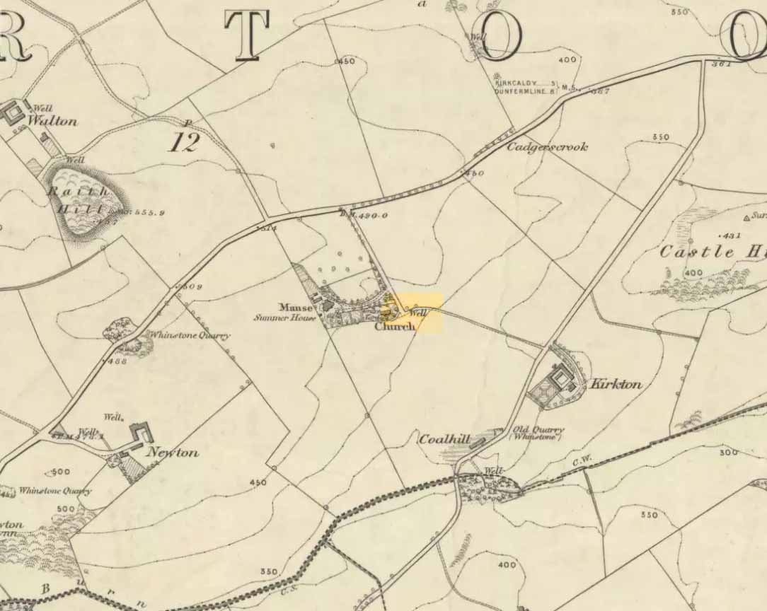
‘Well’ marked the spot in 1856

Along the B925 road between Dunfermline and Kirkcadly, ⅔ of a mile (1.07km) west of Auchtertool village, go down the small track leading down to the isolated church on the rise in some trees.  Walk through the churchyard and out the other side where a small footpath runs downhill.  50-60 yards along, by the walling, this holy well is/was said to be.

Archaeology & History

Both history and tradition are pretty shallow on this all-but-forgotten site, which Penny Sinclair guided us to see in the summer of 2016.  Sadly the entire area where the waters are reported to emerge were completely overgrown in nettles when we visited and, despite us trampling the Urtica down, we could find no remains of the spring. (the Church and its followers here should ensure that the well is properly maintained)

The greatest description of the site seems to be that given by William Stevenson (1908) in his rare work on the parish of Auchtertool.  He wrote:

“As you approach the Kirk of Auchtertool by the old road…you come upon a well by the wayside.  For many years it was the well that supplied the Manse with water, but it is now seldom used, even by the passing traveller.  There is a belief that at one time this well was what is known as a holy well.  Be that as it may, a friend of the late Rev. Walter Welsh, the late Dr Robert Wilson, caused a stone over the well to be inscribed with the following lines:

“Ye who the gently-winding path have trod,
To this fresh fount beside the house of God,
Taste the clear spring; and may each pilgrim know
The purer stream where living waters flow.””

The well was included in Ruth & Frank Morris’ (1982) survey, where they added that the waters from the well were “used in celebration of the mass.”

References:

  1. Morris, Ruth & Frank, Scottish Healing Wells, Alethea: Sandy 1982.
  2. Stevenson, William, The Kirk and Parish of Auchtertool, James Burt: Kirkcaldy 1908.

Acknowledgements:  Many thanks to Penny Sinclair for taking us to this locale.

© Paul Bennett, The Northern Antiquarian 

Sheep Well, Isle of May, Fife

Healing Well (lost):  OS Grid Reference – NT 654 993

Archaeology & History

Wells that are dedicated to sheep are none-too-common—and this one on the remote Isle of May between Edinburgh and Fife only received its commemoration, tradition tells, not too many centuries back.  It is described singularly in John Dickson’s (1899) fine work, where he informs us that,

“The Sheep Well lies to the west of the lighthouse.  Said to have got its name from a sheep having been drowned in it.  Its water is useless for household purposes, and it occasionally becomes dry during the hot season.”

Its present condition and precise location is unknown. If an islander chances upon this site and knows its present condition, please get some photos and let us know how it’s fairing.

References:

  1. Dickson, John, Emeralds Chased in Gold; or, The Isles of the Forth, Oliphant: Edinburgh 1899.

© Paul Bennett, The Northern Antiquarian 

Easter Nether Urquhart Circle, Gateside, Fife

Stone Circle (destroyed):  OS Grid Reference – NO 18873 08865

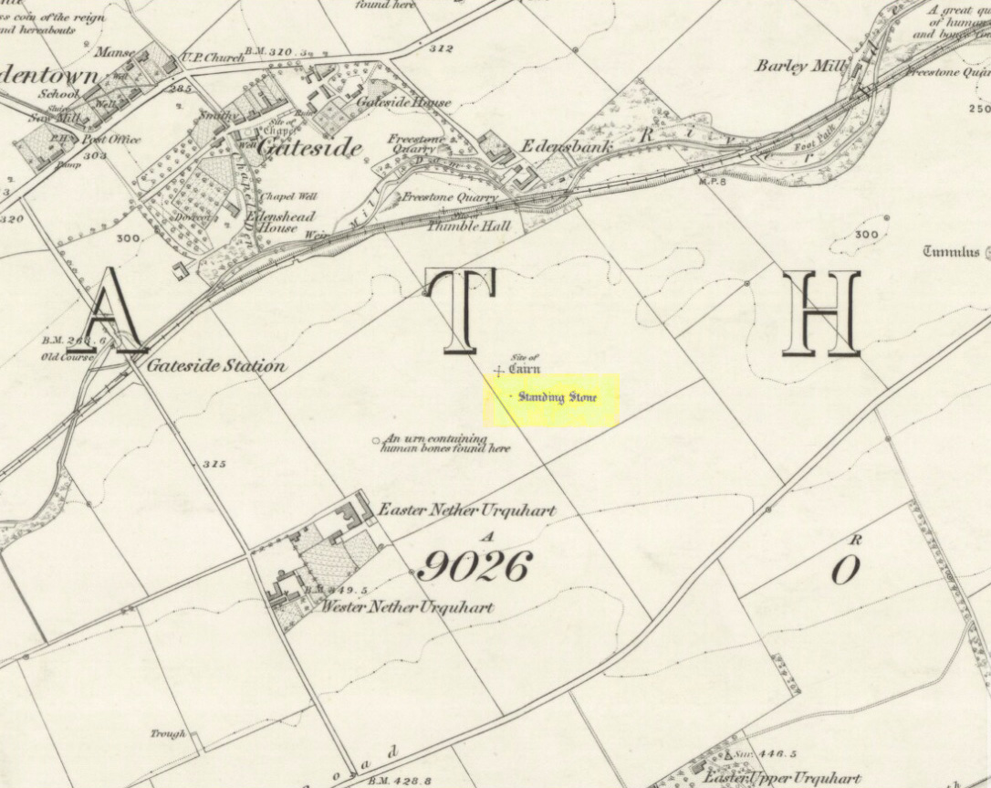
Remaining standing stone of Easter Nether Urqhart stone circle on 1856 map
1856 map showing stone of Easter Nether Urquhart circle

Also known as:

  1. Canmore ID 27809

Getting Here

Turn off the A91 road at Gateside and go down Station Road, crossing the old railway line at the bottom.  From here, cross the fields to your left and the site of the circle will be found in the field to the north east of Easter Nether Urquhart Farm.

Archaeology & History

65 years after last stone was removed, its position is evident in crop-growth
Position of the circle, evident in crop-growth

Marked on the 1856 6″ Ordnance Survey map as a “standing stone,” earlier references record this as being the survivor of a stone circle.  Not listed in Aubrey Burl’s (2000) magnum opus, this circle was on the edge of the site of a major battle between the Romans and the native defenders, and large amounts of human remains have been found in the vicinity.  Referring to an adjacent cairn, Lieutenant-Colonel Miller wrote in 1829:

“A very fine Druid’s Temple stood on the south side of it, consisting of seven very large stones. All these were blasted with powder and removed, except half the one of them, which still marks the spot.”

Of the same cairn, the Reverend Andrew Small wrote in 1823:

“This cairn stood a little north of an ancient Druids’ temple, only one stone now remaining, out of ten of which it formerly consisted.”

The Ordnance Survey Name Book for 1853-55 imparts the following:

“This standing Stone is about 13 chains on the South side of the River Eden opposite Edensbank but whether it is the remains of a druid’s temple or set up to mark something relative to the battle contested between the Romans and Caledonians according to Messrs. Miller & Small, it is difficult to determine. It stands about 4 feet 10 inches high and its sides are about 2 feet broad…many of the inhabitants consider it to have been a druid’s temple…”

A close-up of the site

J.S.Baird of Nether Urquhart informed an Ordnance Survey officer in 1956 that the remaining stone was broken up and removed around 1952, and measured 5 feet high with a girth of 9 feet at the base. Near the top of the stone, on the south-side were two slight cracks weathered to suggest a simple incised cross.

On the day of my November field-visit the winter barley was sprouting and it was interesting to see how much better it was growing at the place where the remaining stone had stood.

A standing stone at Wester Nether Urquhart, rediscovered by Maggie Overett in July 2020, can be seen a half-mile southwest.

References:

  1. Burl, Aubrey, The Stone Circles of Britain, Ireland and Brittany, Yale University Press 2000.
  2. Miller, Lieutenant-Colonel, “An Inquiry respecting the site of the battle of Mons Grampius (Read 27th April 1829 and 25th January 1830),” in Proceedings of the Society of Antiquaries of Scotland, Volume IV, 1857.
  3. Small, Reverend Andrew, Interesting Roman Antiquities Recently Discovered in Fife Ascertaining the site of the Great Battle fought betwixt Agricola and Galgacus, John Anderson & Co: Edinburgh 1823.

© Paul T. Hornby 2016 – The Northern Antiquarian 


Our Lady’s Well, Gateside, Fife

Holy Well: OS Grid Reference – NO 18505 09169

Also Known as:

  1. Chapel Well

Getting Here

Access to the field - ask at the pleasant house!
Access to the field – ask at the pleasant house!

Travelling from Milnathort on the A91, in Gateside village, turn right down Old Town, and after the left bend in the road, park up.  Access to the field where the Well is situated is through the gate on land next to the easternmost house on the south side of Old Town.  Ask at the house first.  Walk down the field towards the Chapel Den burn, and the ruins of the Well will be seen next to the burn just before the line of bushes that cross the field.

Archaeology and History

In his brief description of Strathmiglo parish, Hew Scott (1925) wrote:

“At Gateside…there was a chapel of St Mary, with Our Lady’s Well beside it.”

It was described in the nineteenth century Ordnance Survey Name Books by an informant:

“A small spring well on the north side of the Mill Dam.  Supposed to have been used in the days of Popery as holy water and for other purposes when the building supposed to have been St Mary’s Chapel was in existence.”

Another informant wrote:

“…a Romish chapel is supposed to have been erected in this village and is borne out in a great measure by names of objects adjoining, namely Chapel Den, Chapel Well.”

And further:

“According to Doctor Small…it is stated, ‘The ancient name of this village called in old papers the Chapelton of the Virgin, changing its name at the Reformation.'”

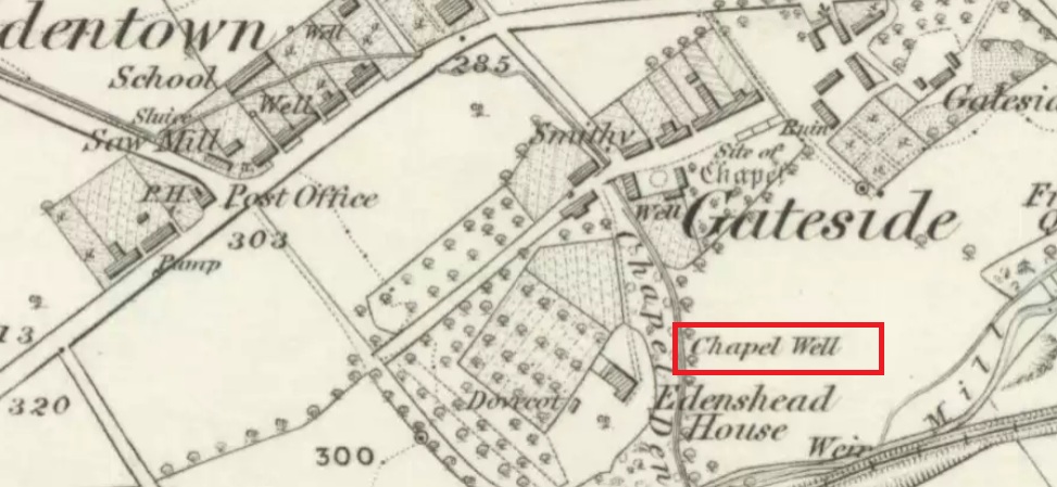
Shown as Chapel Well in 1856

This latter statement would seem to imply that the part of modern-day Gateside south of the main road (the north side was known as ‘Edentown’) was a pilgrimage centre of the Cult of the Virgin.  The chapel was erected by the monks of Balmerino to whom it was known as ‘Sanct Mary’s of Dungaitsyde’.  It was highlighted as the Chapel Well on the 1856 OS-map.

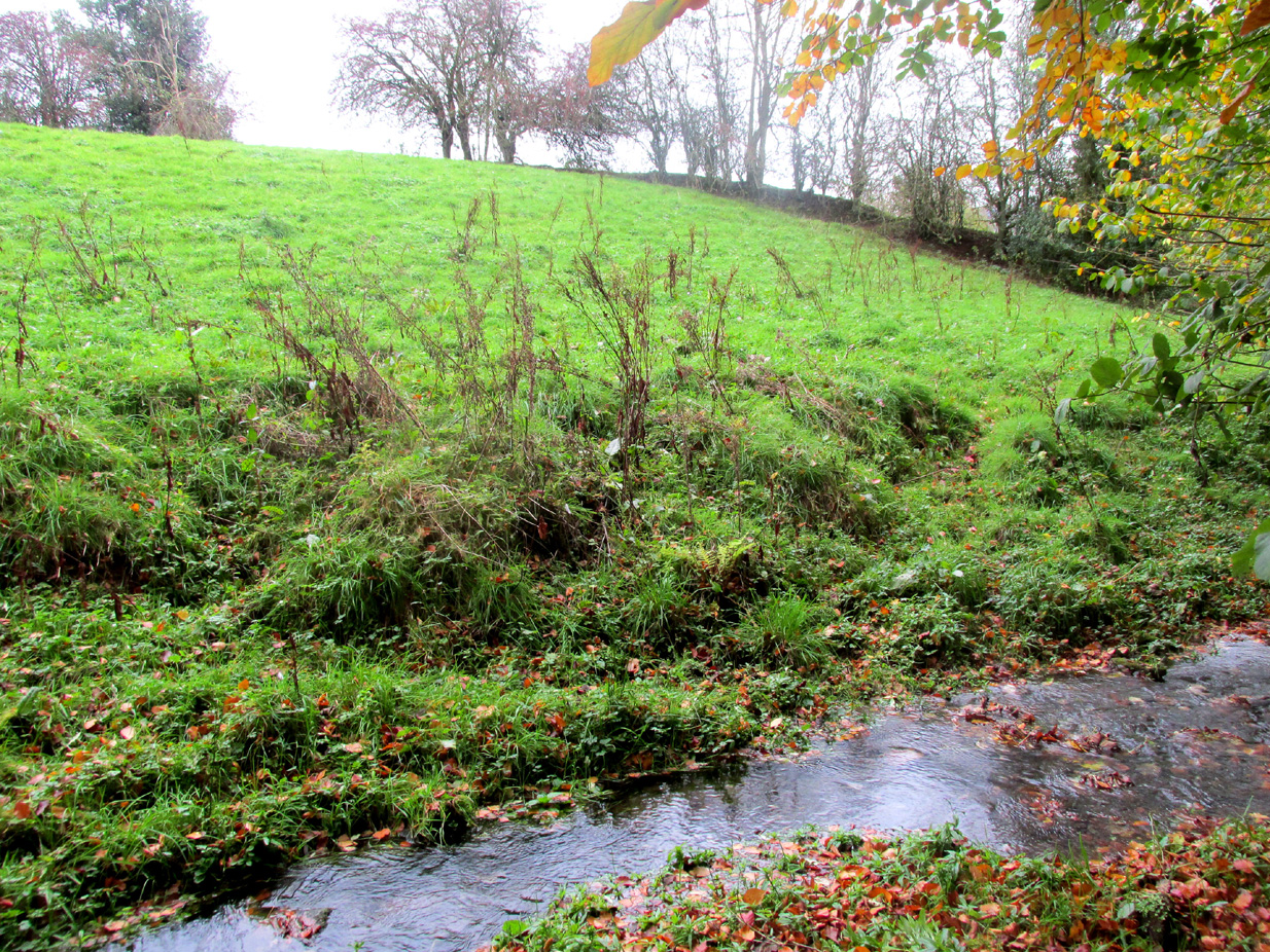
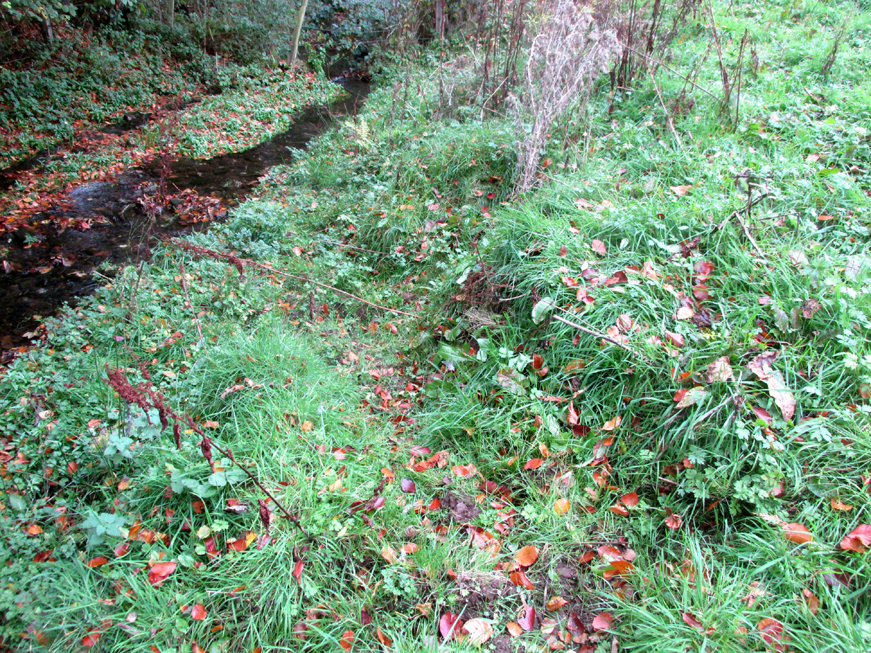
The ruined Well from across the burn
Nature takes back the ruined masonry at this magickal spot

While no trace of the chapel remains, the Well is evidenced by some low ruins of what had once been a red sandstone structure, and it was just possible to make out in the field the line of the pilgrim’s path to the well. But what a lovely serene place next to the burn! An ideal spot to meditate or daydream… The spring no longer flows, and a manhole in the field probably indicates the water supply has been diverted, perhaps to serve the long since closed Gateside Distillery?

References:

  1. Scott, Hew, Fasti Ecclesiae Scoticanae – Volume V, Oliver & Boyd: Edinburgh 1925.

Links:

  1. On Canmore

© Paul T. Hornby 2016 The Northern Antiquarian 


St Bunyan’s Well, Leuchars, Fife

Holy Well:  OS Grid Reference NO 45252 21483

Getting Here

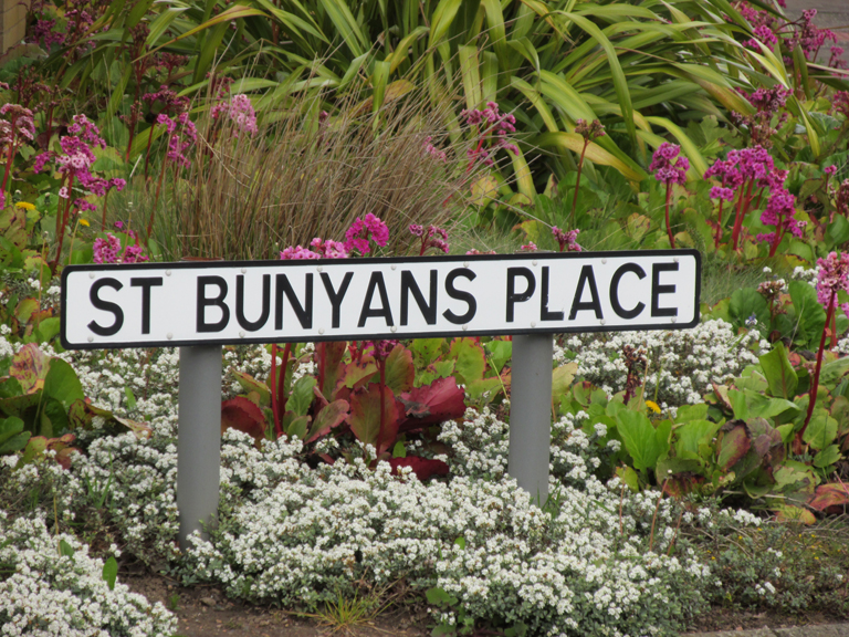
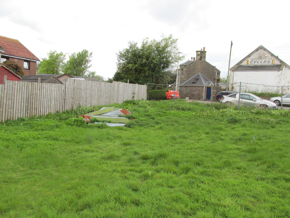
St Bunyan's PlaceIf travelling from Dundee or Newport, turn right into Meadow Road, the last turning before the roundabout in the middle of the town. On the right is a large white-painted building where bicycles are sold. The site of St Bunyan’s Well is on the patch of empty land opposite, to the left nearest the road.

Archaeology & History

Site of St Bunyan's Well
Site of St Bunyan’s Well

The Well is named in conjunction with the ninth century Culdee chapel of St Bunyan on the nearby Temple Hill, now known as School Hill.  St Bunyan has been remembered by various alternative names:  Bunoc, Bonac, Bonoc, Bonnoch, Bunan, Bernard and Bennett, and W. Reid noted in 1909,

“A crown charter of 1539 refers to a yearly market on St. Bonoc’s Day, and a further reference to the Chapel of St Bonach occurs in the confirmation of a charter by James VI.”

Forbes’ Kalendars of Scottish Saints records, under the entry for Saint Bonoc that one of the Endowments of Saint Fergus at St Andrews was the jawbone of Saint Bonoc, given by Bishop David Rhynd.

The mid nineteenth century Ordnance Survey Name Book correspondents Messrs. Pillans and Keddie described the well: “In the village of Leuchars. A excellent Spring Well in the village of Leuchars it is built round with cut stones, and is Kept in good repair by the inhabitants. the date when it was first Constructed is not known but it said to have been before the reformation, dedicated to St. Bunyan hence its name.”

The Reverend Kettle in the Old Statistical Account for Leuchars adds: “There is a most excellent well flowing with an abundant Stream of Soft water near the west en of the village (for the village is now extending westward) called by the name of the saint to whom the Chapel was no doubt consecrated.”

An elderly couple whom I met remembered a small well-house, but I didn’t ask them when it was demolished.  The Saint is remembered in Leuchars by the road name of a modern development in St Bunyan’s Place.  St Bunyan’s Well probably dried up as a result of the increased water demand following the establishment of RAF Leuchars in 1920. The Saint now has his waters extracted by Scottish Water’s Meadow Road Pumping Station.

References:

  1. Reid, William., “Notice of the Discovery of a Group of Full-Length Stone Cists at the School Hill, or Temple Hill, Leuchars“, in Proceedings Society of Antiquaries, Scotland, volume 43, 1909.
  2. Forbes, Alexander Penrose, Kalendars of Scottish Saints, Edmonston and Douglas, Edinburgh, 1872
  3. http://stat-acc-scot.edina.ac.uk/link/1791-99/Fife/Leuchars/18/585/

Link:

  1. Canmore

© Paul T. Hornby, The Northern Antiquarian


Lady’s Well, Leuchars, Fife

Holy Well :  OS Grid Reference NO 45573 21645

Also Known as:

  1. Lady Well

Getting Here

Lady's Well at Leuchars
Lady’s Well at Leuchars

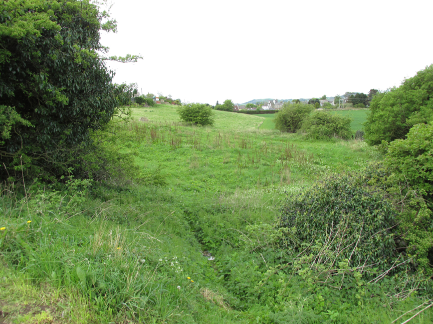
Entering Leuchars from Dundee or Newport go straight ahead through the roundabout; entering from Cupar or St.Andrews turn right at the roundabout, then up School Hill and bear left up the Pitlethie Road, then immediately past a long terrace of bungalows, turn left up an unmade road opposite the school, where you can park up.  Walk down the track, noting the Castle Knowe Motte across the fields ahead and follow the track to the right, and there at the bottom of the slope, below modern housing, is the site of the Lady’s Well.

Archaeology & History

There seems to be only minimal information about Lady’s Well. To the south lies the ancient church of St Athernase, described architecturally as the second finest Romanesque church in Britain (after Durham Cathedral) and apparently built by some of the same masons who built Durham.  Prior to the building of St Athernase, a ninth century Culdee church, dedicated to St Bonoc (also known as St. Bennet or St. Bonach or St.Bernard) stood on the School Hill which rises over Leuchars.  School Hill was anciently known as Temple Hill, perhaps indicating a connection with the Knights Templar.

Writing in the Old Statistical Account for Leuchars in the 1790s, the Reverend Kettle wrote:

“A little north of the east end of the village, to the convenience and comfort of the inhabitants, there is another well of equal excellence, called the Lady well, no doubt consecrated to the Blessed Virgin”

The mid nineteenth century Ordnance Survey name book has the following entry referring to the Lady’s Well, contributed by a Messrs Pillans and David Keddie:

“The site of a Spring Well in a small piece of open ground adjoining the Village of Leuchars. It ran dry before the year 1843 from some unaccountable reason. and in that year A New well was sunk and opened a short distance from it. which since supplys its place. This last was done by subscription by the inhabitants of the village the original well was sunk and opened for use by a Lady of the name of “Carnegie” who formerly Lived at “Leuchars Castle” hence the name “Lady’s Well” it was never resorted to as a holy Well.”

Despite this, we must bear in mind the Kirk’s powerful post Reformation antipathy to holy wells, which may be reflected in the story given by the above two correspondents.

While your writer was bimbling around Leuchars, a chance (?) meeting led to him being introduced to probably the oldest residents in the town (mid- to high-90s).  They only remember the Lady’s Well site being known as ‘The Well Green’ where the old Fife County Council waterworks were once situated, and there we may have the reason for the Well’s physical demise:  modern water extraction to serve Leuchars RAF Station and its ancillary barracks and housing has lowered the water table, leading to the spring drying up as it passes from living memory

Links:

  1. Canmore
  2. Leuchars St. Athernase, Church of Scotland
  3. http://www.scotlandsplaces.gov.uk/digital-volumes/ordnance-survey-name-books/fife-and-kinross-shire-os-name-books-1853-1855/fife-and-kinross-shire-volume-44/61
  4. http://stat-acc-scot.edina.ac.uk/link/1791-99/Fife/Leuchars/18/585/

© Paul T Hornby 2014-16, The Northern Antiquarian


Creich Manse, Brunton, Fife

Ring Cairn:  OS Grid Reference – NO 31894 21041

Also Known as:

  1. Canmore ID 31819

Getting Here

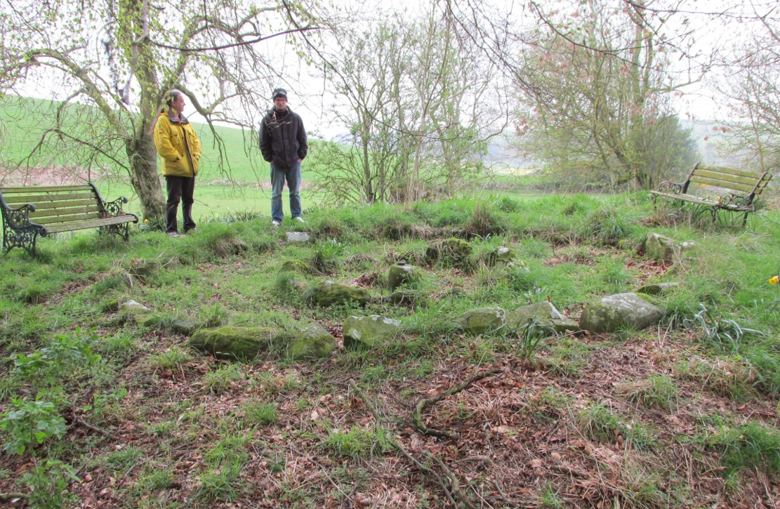
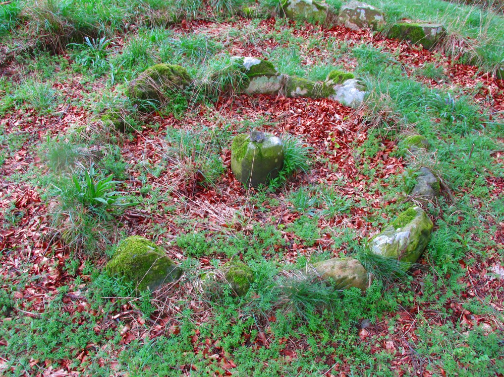
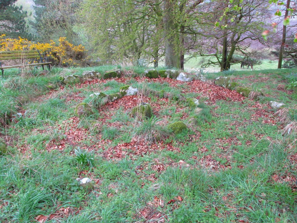
The small double-ring of Creich Circle

A variety of ways to get here, all depending on which directions you’re coming from, obviously! Simply get to the sleepy old hamlet of Brunton, SW of Creich Castle ruins, and at the north end of the village where the road hits a T-junction, turn left and stop at the next house (hidden amongst trees) a coupla hundred yards along on the right-hand side.  Knock on the door of The Manse (marked as such on the OS-maps) and ask. The fella who we met here, Liam, was very helpful and guided us to the site up the far end of his garden.

Archaeology & History

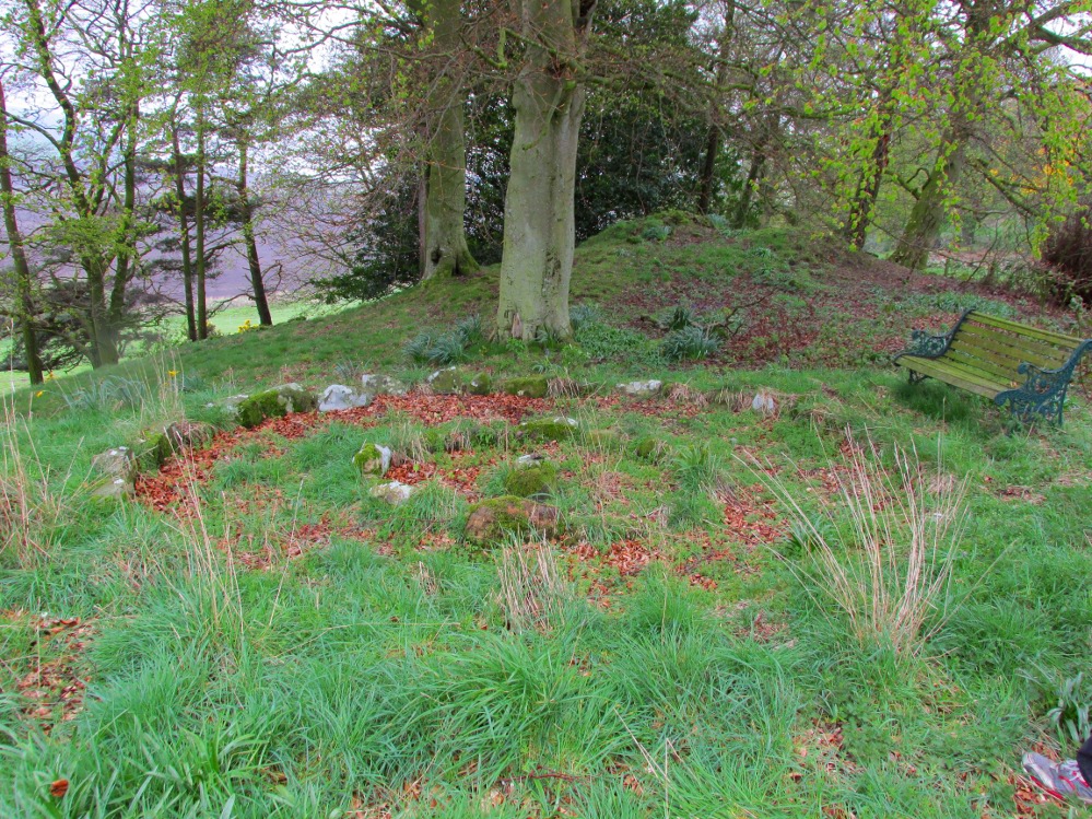
The small central ring

A truly fascinating and enigmatic arena for a host of reasons. The small and well-preserved ring of stones up the slope behind Creich Manse — looked after and recently cleared of covering vegetation by the present tenant — wasn’t born here, but originally lived more than a mile to the southwest, on the grounds of Luthrie House near the OS grid-reference NO 313 195.

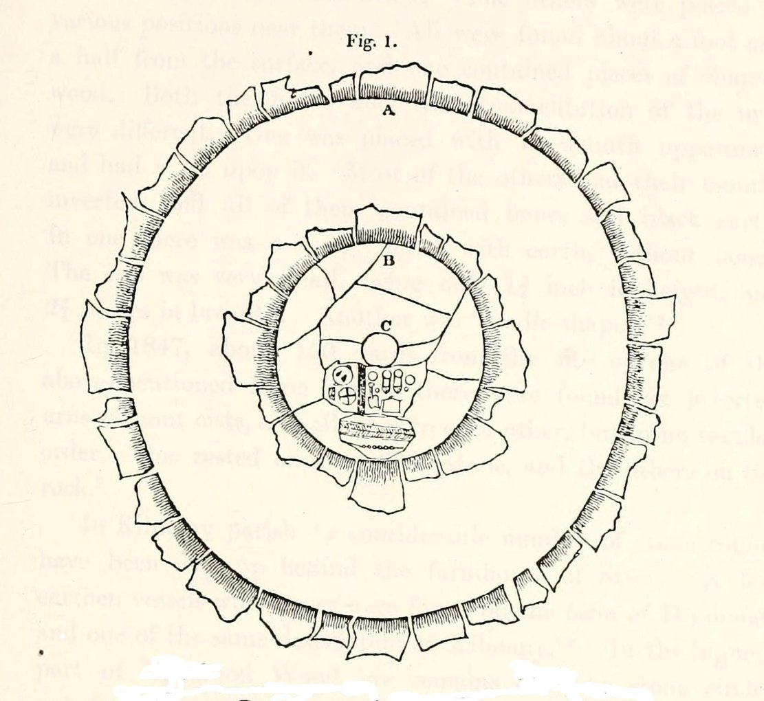
Curiously omitted from the giant surveys of Aubrey Burl (2000) and other modern academics, the place was first  mentioned in the New Statistical Account of the parish by Alexander Lawson.  It told that in 1816 “trenching operations” were being undertaken in Luthrie village when, at some point, the men came across a curious group of stones that seemed to have faint carvings upon them — in the centre of a ring of stones!  The land-owner and parish minister were called to the site and they found that a double stone circle had been unearthed.  The account told:

“In the centre was placed, in an upright position, a cylindrical sandstone, one foot two inches high, and having the diameter of its base one foot.  Around this stone, as a centre, at the distance of three feet, were sixteen other stones, placed also in an upright position, and in the form of a circle.  The stones of which it was composed were of various sizes, from fifteen to twenty inches in height; from eight to eighteen in breadth, and from four to nine in thickness.  Due south of the centre, and between it and the inner circle, there were placed in a horizontal position, two stones containing hieroglyphics in alto relievo, very entire.  The remaining space between the centre and the circle was laid with pavement.  At the distance of seven feet and a half from the same central pillar, there was another circle of stones, thirty-two in number, placed in an upright position, and very much resembling those of the inner circle.  The stones in both circles were placed close together.  Between the circles there was neither pavement nor stone of any description.  Neither were perfect circles, the diameter of one from north to south, being fifteen feet one inch, while its diameter from east to west was only fourteen feet nine inches; in the same manner, the diameter of the other, from east to west, was five feet ten inches, while from north to south it was it was six feet one inch.”

Ground-plan of the Creich ring
Creich ring, looking west

The account went on to describe there being a deposit of “burned human bones and charcoal” at the centre, below the larger of the two petroglyphs.  Additionally, one of those peculiarly common traits found at a number of megalithic remains related to the construction of the inner and outer circles of stone. The Royal Commission (1933) lads pointed it out, saying,

“It is remarkable that all the stones of the inner circle were of sandstone, which is not found nearer than Cupar, seven miles away, while those of the outer circle were of the local whinstone.”

Another description of the site was given in James Campbell’s (1899) updated and revised magnum opus on the parish of Balmerino, where some additional remarks were made about the petroglyphs.  He told:

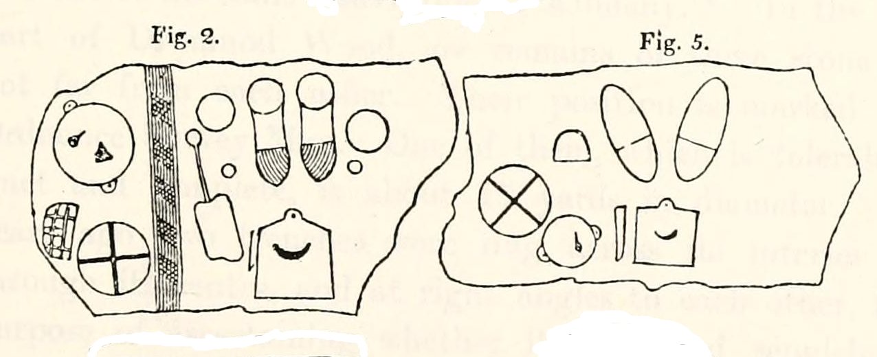
“Under one of the sculptured stones were found small burnt human bones and ashes. They were not enclosed in a cist, nor was there any building under the surface. Certain of the figures cut on one of the slabs of this monument are very similar to the figures on the sculptured slab of the one already mentioned. There are what appear to be representations of the soles of a pair of shoes, a circle with a cross within it — the limbs of the cross being: at right angles to each other — which may be intended to represent a wheel. On one of the stones is the figure of a spade. What the other figures represent is more uncertain. The sculptures raise difficult questions in regard to the time of the erection of these monuments. It is evident that cremation had been then practised at Creich, though the degree of culture and art indicated by the sculptures seems to point to a time subsequent to the abolition of this pagan custom elsewhere.”

Creich Circle petroglyphs
Creich Ring, looking east

The carvings illustrated here are pretty unique in terms of them being standard prehistoric petroglyphs, as they seem to comprise more of a mix of Iron Age and Romano-British designs – though potentially we must take into account that they could be a form of Pictish.  This region is littered with the remains of Picts, in place-names, folklore and archaeology.  As such, it would be very helpful if  someone qualified in Pictish studies could examine these designs.  We do find petroglyphs of similar forms to this in Bronze Age Scandinavia and Iberia − but not Fife!

Folklore

In the only account of any folklore relating to this site, James Campbell (1867) told that local people said the place was “supposed to have marked the tombs of distinguished chiefs.”

…to be continued…

References:

  1. Burl, Aubrey, The Stone Circles of Britain, Ireland and Brittany, Yale University Press 2000.
  2. Campbell, James, Balmerino and its Abbey – Volume 1, William Blackwood: Edinburgh 1899.
  3. Lawson, Alexander, “Ancient Circles of Stone Discovered Under Ground in the Parish of Creich,” in Edinburgh Magazine and Literary Miscellany, November 1817.
  4. Lawson, Alexander, “Notes of Urns and Sepulchral Monuments Discovered at Various Times in the Parish of Creich, Fifeshire,” in Proceedings of the Society of Antiquaries, Scotland, volume 7,
  5. Royal Commission on the Ancient & Historical Monuments of Scotland, Fife, Kinross and Clackmannan, HMSO: Edinburgh 1933.

© Paul Bennett, The Northern Antiquarian

Aithernie, Scoonie, Fife

Tumulus (destroyed):  Grid Reference – NO 3769 0339

Also Known as:

  1. Canmore ID 31344

Archaeology & History

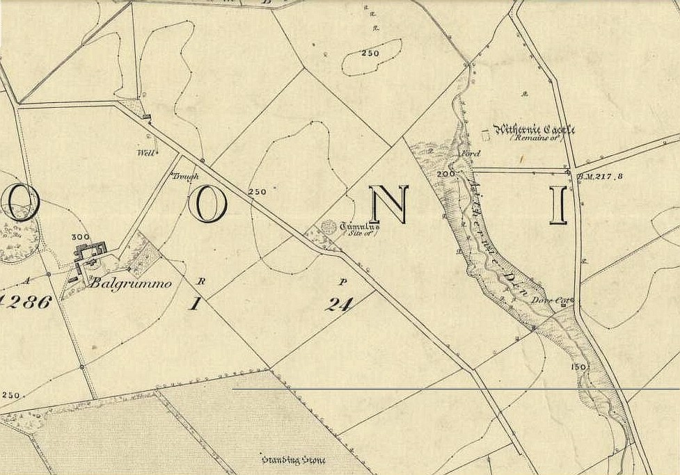
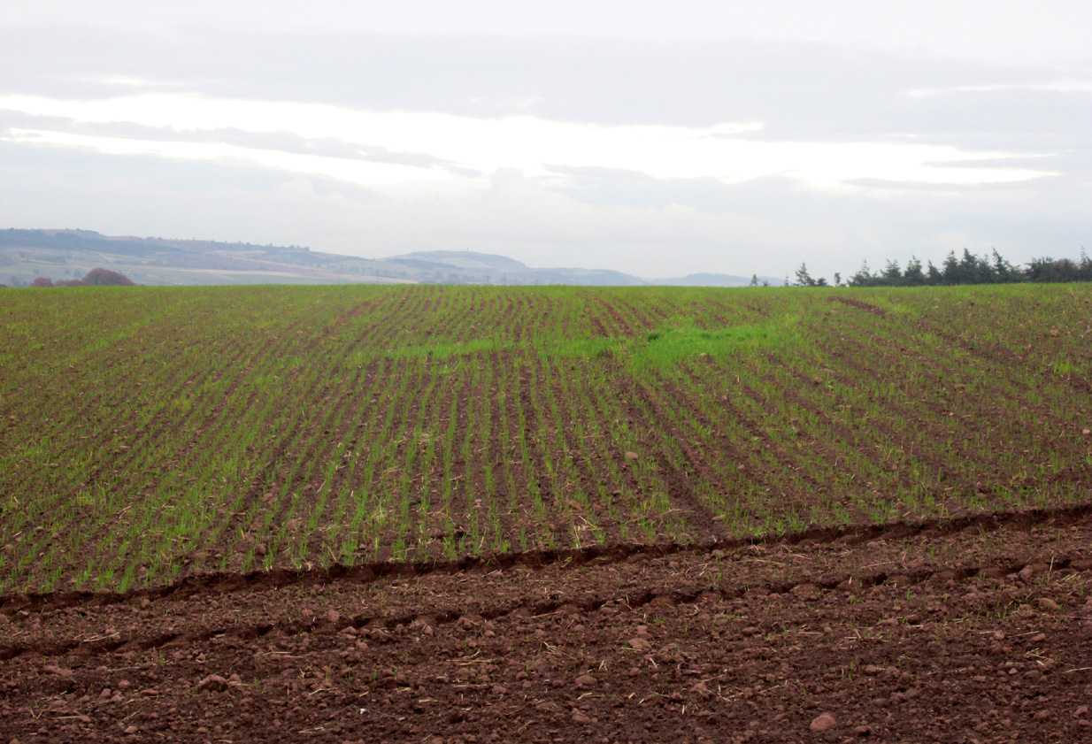
Aithernie tumulus on 1855 OS-map

A mile or so WNW of the fantastic standing stones of Lundin, and just a coupla hundred yards above where the lesser standing stone of Balgrummo lives, we could once see an impressive prehistoric burial mound on the small hilltop of Aithernie.  Sadly, like oh too many prehistoric sites in our landscape, it was vandalised and destroyed in the 19th century by the prevailing stupidity of the period.  Thankfully we have a couple of accounts describing the place.

The site had already passed into memory when the Ordnance Survey fellas got up here in 1854, but an account of it was made in the ‘Object Name Book’ of the parish a decade earlier.  Thankfully the story of the site was known locally and, along with the New Statistical Account describing the olde mound, A.S. Cunningham (1906) told the story of when it was “opened” and then of its subsequent demise. He wrote how,

“…in 1821 a much more interesting relic of antiquity…was opened in a field on the estate of Aithernie.  When digging moulding sand for Leven Foundry, the workmen struck right into the heart of an ancient tumulus.  This cemetery of prehistoric times contained as many as twenty rude stone cists.  These cists were typical of the prehistoric burial places found throughout the country.  They were constructed of slabs placed on edge, with a covering stone, and cemented with clay puddling.  Above the coffins was a covering of stones, the stones having hundreds of years before been so firmly cemented together with clay and sand that the workmen required the aid of picks to enable them to “rifle the tombs.”  Small urns were found in two of the coffins, and five of them contained larger urns, 14 inches in diameter and 24 inches in depth, and in another cist quantities of charred wood beads were discovered. All the coffins, except the five in which were the large urns, contained human bones, and innumerable bones were found outwith the mouths of the cists.”

When the Royal Commission (1933) lads visited the place in 1925, they reported “no existing indication of a tumulus” remained.  Gone!

References:

  1. Cunningham, A.S., Rambles in the Parishes of Scoonie and Wemyss, Purves & Cuningham: Leven 1906.
  2. Royal Commission on the Ancient & Historical Monuments, Scotland, Inventory of Monuments and Constructions in the Counties of Fife, Kinross and Clackmannan, HMSO: Edinburgh 1933.

© Paul Bennett, The Northern Antiquarian

Bandrum, Saline, Fife

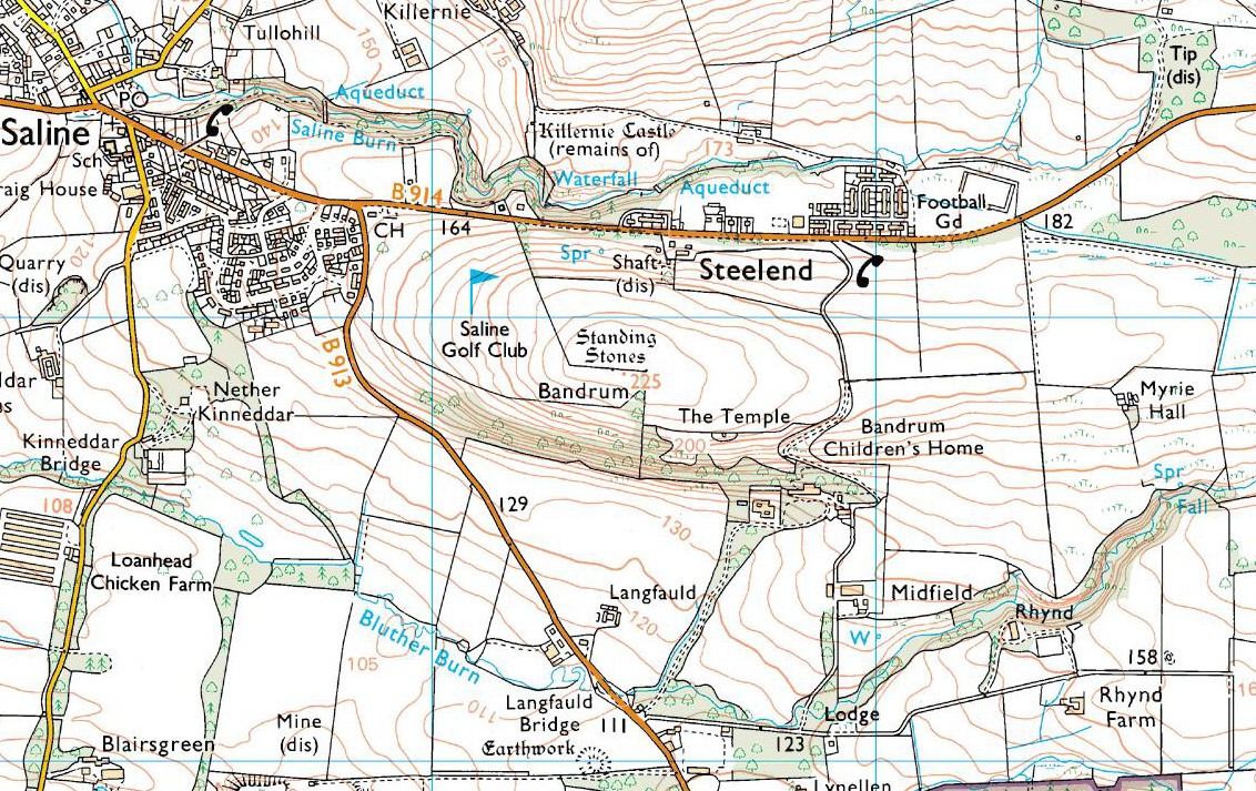
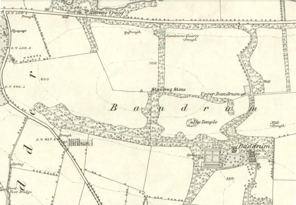
Bandrum OS-mapStanding Stones:  OS Grid Reference – NT 0348 9188

Also Known as:

  1. Canmore ID 49710

Getting Here

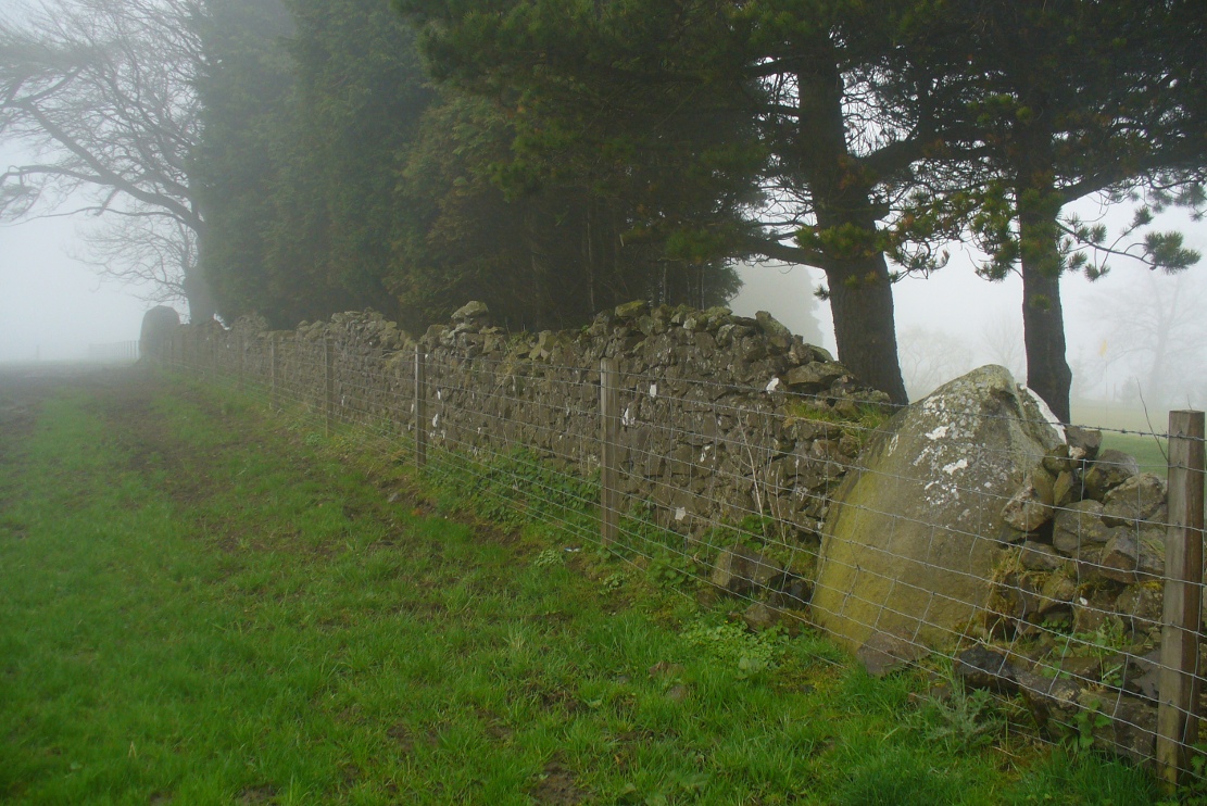
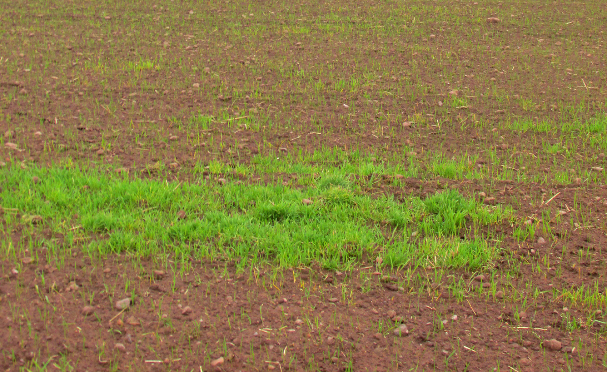
Go east on the B913 through Saline for a mile till you reach Steelend.  Across the road from the houses there’s a dirt-track running uphill (south) into the fields.  When you’re near the top, turn west into the fields, following the straight line of fencing towards the small clump of trees on the skyline.  Near the top, a few hundred yards along you’ll see the large fat stone up against the wall.  But keep walking east and another stone appears before your eyes!

Archaeology & History

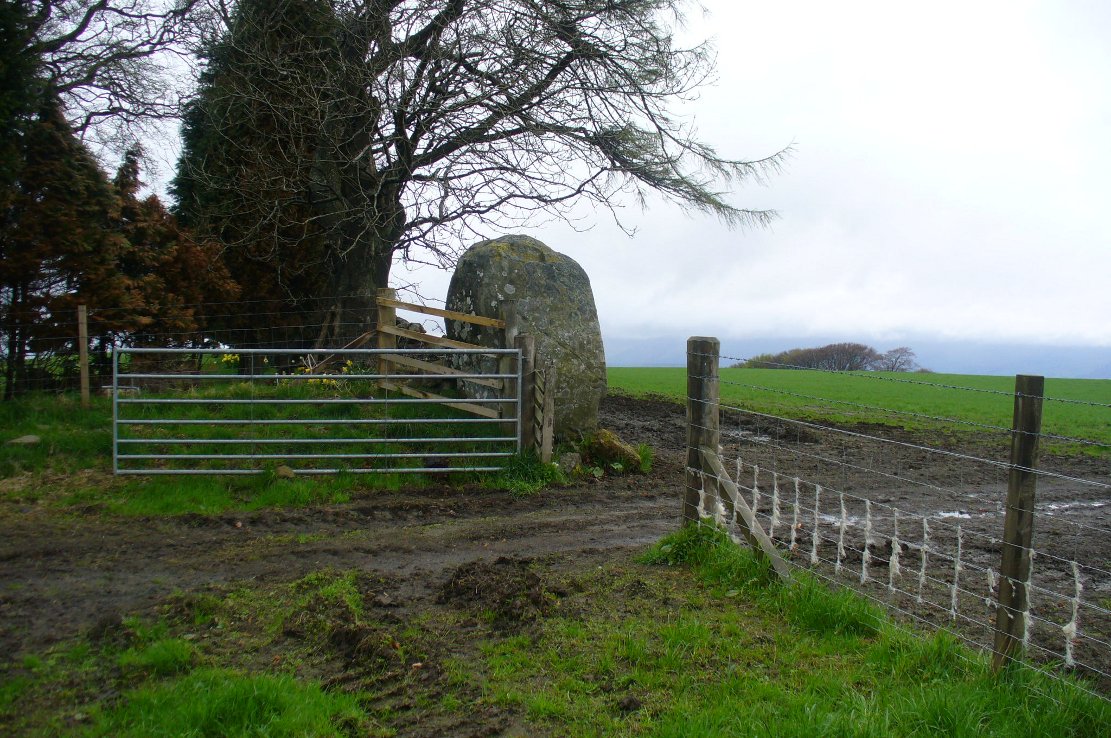
The big fella, by the gate

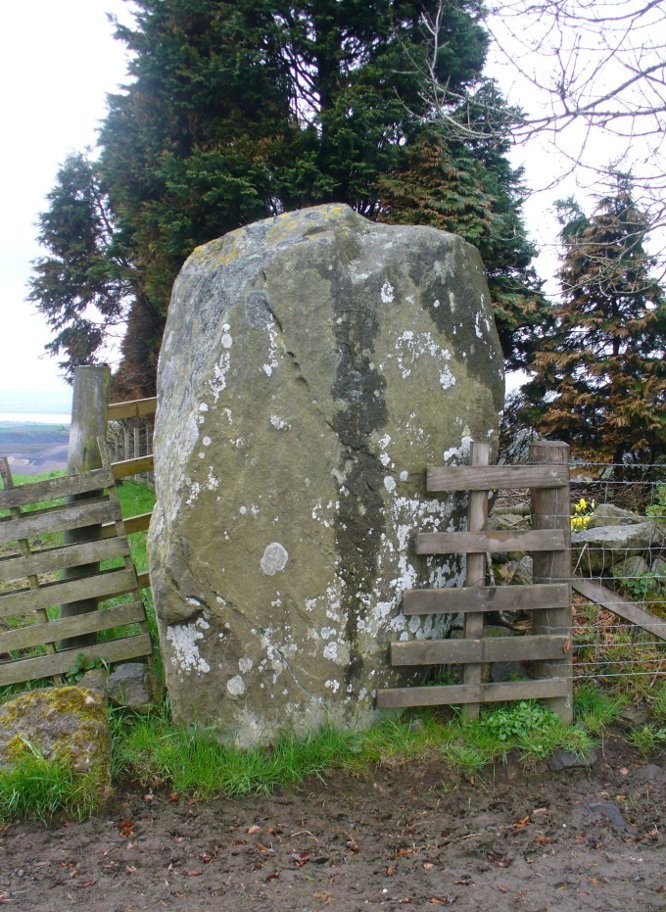
Near the very crown of this long hill, right by the gate separating the fields, you cannot miss this huge and very heavy-looking standing stone, whose position in the landscape was evidently of some importance to the people who put it here.  It’s in a gorgeous spot. You can see in all directions for some considerable distance particularly to the west, and the eye catches other points on the land where prehistoric monuments of other forms speak to each other. (that’s assuming you visit here on a clear bright day, as opposed to when Paul Hornby and I visited the spot when, for much of the afternoon we could barely see 100 yards as the land all around us was cloaked in fog!)

The big fella, face on
And through the fog, from the little fella to the big fella

The site was included in Alexander Thom’s (1990) magnum opus on megalithic stone rows, in which he cites it as a debatable 2-stone row monument.  For if we walk westwards, along the walling, we find another large, possibly prehistoric upright about 50 yards along.  In Aubrey Burl’s (1993) work on the same subject, he merely copies Thom’s earlier questioning of the second stone in his listings.  But in Mr Beveridge’s (1888) regional history work more than a century earlier, he told clearly that on “the ridge of the hill behind Bandrum House, there are built two standing stones.” Of their origin and purpose, Beveridge could find none; but a few years later, A.S. Cunningham (1902) thought simply that

“of the two standing stones on the march fence behind Bandrum House…it is questionable if they ever served any other purpose than a dividing line for properties.”

Bandrum Stone on 1854 map

The site was highlighted on the earliest OS-maps of the region in 1854—albeit with only the largest of the two stones marked, at the meeting of the gates—and then many decades later those other official doods, the Royal Commission (1933) lads, made their way up here and included the site in their inventory, where they told:

“On the crest of rising ground at an elevation of 700 feet above sea level, at the end of a dole near to the extreme east end of Saline golf course about a quarter of a mile due west of Bandrum farmhouse, stands a huge whinstone boulder of irregular form.  It measures 7 feet 10 inches in height to the highest point of a somewhat rounded top, and has a slight inclination towards the west.  Its girth at the base is 13 feet 7 inches and at the middle 14 feet 10 inches.  The broadest faces are to the north and south… At a distance of 162 feet due west, there is another large boulder measuring 3 feet 10 inches in height and approximately 10 feet in circumference at the middle, set with a marked inclination towards the east and built into a continuation of the same dike.  The two suggest the remains of a stone circle, the rest of which has been swept away by the cultivation of the neighbouring fields.  There is however, no record of other stones having been removed.”

Thom’s (1990) account of the site was simply put:  “Bandrum. NT 036 915. Huge whin boulder, 7ft 10 (2.4m) h. 162ft (49m) W another 3ft 10 (1.2m) h.”  He gave no indication of astroarchaeological alignments.

References:

  1. Beveridge, David, Between the Ochils and Forth, William Blackwood: Edinburgh 1888.
  2. Burl, Aubrey, From Carnac to Callanish, Yale University Press 1993.
  3. Cunningham, A.S., Romantic Culross, Torryburn, Carnock, Cairneyhill, Saline and Pitfirrane, W. Clarke: Dunfermline 1902.
  4. Royal Commission on the Ancient & Historical Monuments, Scotland, Inventory of Monuments and Constructions in the Counties of Fife, Kinross and Clackmannan, HMSO: Edinburgh 1933.
  5. Thom, A., Thom, A.S. & Burl, Aubrey, Stone Rows and Standing Stones – volume 2, BAR: Oxford 1990.

Acknowledgements: Huge thanks to Paul Hornby for his photos of these standing stones. Cheers Paul!

© Paul Bennett, The Northern Antiquarian
Craigkennockie, Burntisland, Fife

Tumulus (destroyed):  OS Grid Reference — NT 237 861

Archaeology & History

Very little is known about a prehistoric tomb that once existed near the coast at Craigkennockie.  Its existence was briefly described in Andrew Young’s (1913) fine history of the township where he told that it had been highlighted on an old Estate Map of the area and marked as, “an artificial cairn, probably a place of sepulture.”  On old maps just below the cited place we find the place-name of ‘Lammerlaws’, which may indicate a name once given to the site, as the element -law is commonly found relating to prehistoric cairns.

Although the modern place-name researchers in central Scotland have opted that the word ‘law’ is primarily “a rounded hill”, they have curiously forgotten or omitted its other derivation.  Throughout northern England and beyond, the English Place-Name Society finds that many ‘law’ place-names derive from the old English and Saxon word, hlaw, which is originally told to be “a mound, a hill.” This has been the reference cited throughout in Taylor & Markus’ (2006-2012) otherwise fine multi-volume analysis of Fife county.  But there’s much more to it than that.  I hope that readers will forgive me reciting A.H. Smith’s (1956) full entry about this simple term, as it can (and many times does) show our history is much richer than initially thought.  Prof Smith told that law, hlaw, hlæw, has the following etymological origin:

“(1) In OE (old English) the common meaning in literary contexts is ‘an artificial mound, a burial mound, a mound in which treasure is hidden’, as in Boethius Metr. 10.43, ‘in what hlæwa do the bones of Weland cover the ground?; Beowulf 2802, ‘Bid them make a hlæaw…on Hronesnæsse’; Guthlac 4 ‘there on the island was made a great hlæw, which through the lust for treasure had been dug up and broken into’; or Gnomic Verses 26, ‘a dragon shall be on hlæw’, an allusion (as in Beowulf 2773) to the Germanic tradition that mounds containing valuable grave-goods were guarded by dragons.  The word glosses Latin, agger, ‘something heaped up, a mound, a rampart’ (Wright’s Anglo-Saxon & Old English Vocabularies 355.4).  This meaning ‘tumulus, artificial mound, burial mound’ is well attested in place-names.  According to Grundy, it always denotes a tumulus in the OE charters and doubtless those place-names in which it is combined with personal names are the burial places of the men so named; at Taplow at least a remarkable burial treasure was discovered and Cuckhamsley, Berkshire, is named from Cwichelm, the West Saxon king who died in 593.  The majority of such places-names belong to the heathen period when this method of disposing of the dead was practised.  Particular compounds also suggest that it could be an artificial mound which formed the centre of a place of assembly; Oswaldslow Hundred (Place-names of Worcestershire, 87), for example, was created in 964 and it was to meet at a place to be henceforth called Oswaldeslaw in honour of Bishop Oswald (Cartularium Saxonica 1135).

“(2) The meaning ‘hill, a conical hill resembling a tumulus’ is also found in OE, as in Leechdoms Vol.3, 52, ‘they rode over the hlæw’, and local topography establishes this meaning as a common one in place-names and dialects in certain parts of the country; it survives as law in Durham and Northumberland and as low in northwest Midlands…

“(3) The two forms hlaw and hlæw are on record, the latter being better evidenced in literary use, especially in West Saxon texts, and the former in place-names; hlæw normally becomes low, north country law, whilst the i-mutated hlæw (found in place-names only in the south and south Midlands) later becomes lew, as in Lew, Oxfordshire, Lewes, Sussex and is more frequent in middle-english spellings; it is often later replaced by –low as in Dragley, Lancs, Cuckhamsley, Berkshire…”

Smith continues with many topographical evidences regarding a ‘burial-mound’ derivation for the place-name ‘law’, finally adding notes on relative linguistic similarities, like the “Gothic hlaiw, ‘grave’; old High German hleo, ‘grave mound, hill’; old Saxon hleo, ‘grave mound’…”  It seems pretty convincing, and so we need to take this into account in our walks over the hills if we are exploring ancient history.

As if to emphasize this derivation—’law’ as prehistoric tombs—we find it is cited in the massive Scottish National Dictionary (6,1:16) where—alongside the ’rounded hill’ aspect—Mr Grant (1962) tells it to be,

“An artificial mound or hillock, specif.: (1) a tumlus or barrow, grave-mound….”

thereafter giving a number of Scottish examples.  The same meaning is echoed again in the modern version of Concise Scots Dictionary (2005), along with the rounded-hill.  Jamieson’s (1885) Scottish Dictionary cites similarly, ‘law’ as both hill, aswell as “a tomb, grave or mound.”

This association of ‘law’ with ancient burial mounds in Scotland should not be that surprising.  Despite it having an Anglo-Saxon origin, we must remember that the Saxon kingdom is known to have stretched all the way up to the Firth of Forth (Edinburgh) and across to Glasgow. So if the linguistic roots have any credibility at all, it doesn’t take much stretch of the imagination to have this simple word travel further north amongst the people.  Perhaps this is why, more recently, Margaret Gelling (2000) has said that the association of hlaw with burial mounds up here lessens in Scotland.  Nonetheless, let us not presuppose one meaningful definition of the word above another, as it can, consciously or otherwise, be seen as more symptomatic of the all too common English attitude of papering over another country’s rich and ancient heritage by depleting its language—again…

(Law has another element attached which has all but fallen out of historical analysis.  Prof Smith touched briefly upon it, mentioning ‘law’ as being a meeting place—otherwise known ‘moots’.   Moots occurred everywhere in early times: in England, in Europe and in Scotland too.  They were originally where local tribal gatherings took place, for the purpose of what we might call council or political decisions, amongst other things.  Some of these moots occurred on burial mounds of great age, aswell as  stone circles—and evidence indicates that some of them originated way back in prehistoric times.  Although written accounts of many such moot spots have fallen from historical texts, the term law or low (and their variants) is again found in Scottish etymological and topographical lore.  Mr Grant again cites it to mean:

“Law cairns, or court cairns…the judicial sites of baronial court of justice…”

Thereafter giving numerous citations of its use in both the common tongue and sites where it is known.  As far north as the Shetland Isles, where such law-courts aer known from the Scandinavian ting of thing, the 18th century Statistical Account of Tingwall states there being “the Law Stone” at the cite of the parish court.)

Folklore

Also in Mr Young’s (1913) work, he told how this old tomb was a place that seemed cursed or should not be disturbed, saying,

“About 50 years ago, any illness in the neighbourhood of Craigholm was ascribed to the influence of this burial place…”

adding that an adjacent spring of water, of high esteem, was close by.

References:

  1. Grant, William (ed.), Scottish National Dictionary – volume 6, SNDA: Edinburgh 1962.
  2. Jamieson, John, Etymological Dictionary of the Scottish Language, W.P. Nimmo: Edinburgh 1885.
  3. Robinson, Mairi (ed.), Concise Scots Dictionary, Aberdeen University Press 2005.
  4. Smith, A.H., English Place-Name Elements – volume 1, Cambridge University Press 1956
  5. Young, Andrew, History of Burntisland, Fifeshire Advertiser: Kirkcaldy 1913.

© Paul Bennett, The Northern Antiquarian