Witch Tree, Aberuthven, Perthshire

Sacred Tree:  OS Grid Reference – NN 9621 1587

Getting Here

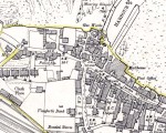
Witch Tree on 1901 OS-map

Witch Tree on 1901 OS-map

Just off the A9 between Stirling and Perth is Aberuthven village.  Down the Main Street and just south of the village, turn west along Mennieburn Road.  A half-mile on, just past Ballielands farm, you reach the woods.  Keep along the road for another half-mile, close to where the trees end and go through the gate where all the rocks are piled. Walk up to the tree-line 50 yards away and follow it along the line of the fence east, til it turns down the slope.  Naathen – over the barbed fence here, close to the corner, about 10 yards in, is the tree in question…

Archaeology & History

Witch Tree03

Looking along the fallen trunk

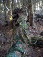
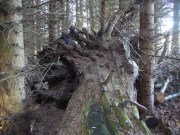
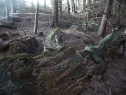
Laid down on the peaty earth, fallen perhaps fifty years ago or more, are the dying remains of this all-but forgotten Witch Tree.  To those of you who may strive to locate it—amidst the dense eye-poking branches of the surrounding Pinus monoculture—the curious feature on this dying tree are a number of old iron steps or pegs, from just above the large upturned roots.  About a dozen of them were hammered into the trunk some 100 years or more ago and, were it to stand upright again, reach perhaps 30 feet high or more.  These iron pegs give the impression of them being used to help someone climb the tree when it was upright; but their position on the trunk and the small distance between some of them shows that this was not their intention.  Their purpose on the tree is a puzzle to us (does anyone have any ideas?).

Embedded pieces or iron from roots...

Embedded iron from the roots

Embedded iron 30-40ft along

Embedded iron 30-40ft along

The fallen trunk has broken into two main sections, each with iron pegs in them.  The very top of the tree has almost completely been eaten back into the Earth.  Unfortunately too, all the bark has completely rotted away and so identifying the species of the tree is difficult (though I’m sure there are some hardcore botanists out there who’d be able to enlighten us).  The possibility that the early map-reference related to a Wych-elm (Ulmus glabra) cannot be discounted, although this would be most unusual for Ordnance officers to mistake such a tree species with a ‘witch’.  Local dialect, of course, may have been a contributing factor; but in Wilson’s (1915) detailed analysis of the regional dialect of this very area, “wych elm” for witches does not occur.  Added to this is the fact that the indigenous woodland that remains here is an almost glowing birchwood (Betula pendula) in which profusions of the shaman’s plant, Amanita muscaria, exceed.  There were no wych elms hereby.

The tree was noted by the Ordnance Survey team in 1899 and was published on their maps two years later, but we know nothing more about it.  Hence, we publish it here in the hope that someone might be able top throw some light on this historical site.

Folklore

Looking along the fallen trunk

Halfway along the fallen tree

We can find nothing specific to the tree; but all around the area there are a plethora of tales relating to witches (Hunter 1896; Reid 1899)—some with supposedly ‘factual’ written accounts (though much of them are make-believe projections of a very corrupt Church), whilst others are oral traditions with more realistic tendencies as they are rich in animistic content. One of them talks of the great mythical witch called Kate McNiven, generally of Monzie, nearly 8 miles northwest of here.  She came to possess a magickal ring which ended up being handed to the owners of Aberuthven House, not far from the Witch Tree, as their associates had tried to save her from the crazies in the Church.  This may have been one of the places where she and other witches met in bygone centuries, to avoid the psychiatric prying eyes of christendom.

Until the emergence of the Industrialists, trees possessed a truly fascinating and important history, integral to that of humans: not as ‘commodities’ in the modern depersonalized religion of Economics, but (amongst other things) as moot points—gathering places where tribal meetings, council meetings and courts were held. (Gomme 1880)  The practice occurred all over the world and trees were understood as living creatures, sacred and an integral part of society.  The Witch Tree of Aberuthven may have been just such a site—where the local farmers, peasants, wise women and village people held their traditional gatherings and rites.  It is now all but gone…

References:

  1. Gomme, Laurence, Primitive Folk-Moots, Sampson Lowe: London 1880.
  2. Hunter, John, Chronicles of Strathearn, David Philips: Crieff 1896.
  3. Reid, Alexander George, The Annals of Auchterarder and Memorials of Strathearn, Davdi Philips: Crieff 1899.
  4. Wilson, James, Lowland Scotch as Spoken in the Lower Strathearn District of Scotland, Oxford University Press 1915.

© Paul BennettThe Northern Antiquarian


Samson’s Stone, Crieff, Perthshire

Legendary Rock:  OS Grid Reference – NN 82519 22021

Also Known as:

  1. Canmore ID 96866

Getting Here

Samson Stone on 1866 map

Samson Stone on 1866 map

Tale the A85 road between Comrie and Crieff and, roughly halfway between the two towns, take the minor road south to Strowan (it’s easily missed, so be aware!).  A few hundred yards along, stop where the trees begin and walk into the fields immediately east.  Keep walking, below the line of the trees, and you’ll get to it within five minutes.

Archaeology & History

Samson's Stone, looking east

Samson’s Stone, looking east

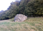
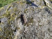
Mistakenly cited by some as a standing stone, the large boulder which rests here on the hillside just below the woodland is a glacial erratic.  Highlighted on the 1866 OS-map of the region, I hoped that we might find some rock art on the stone, but cup-and-rings there were none.  However, there is a curious ‘footprint’ on top of it, similar to the ones found at Dunnad, at Murlaganmore and other places (see Bord 2004); but I can find no previous reference to this carved footprint.

'Footprint' on top of stone

‘Footprint’ on top of stone

In 1863 the site was described in the local Name Book, where it was reported to be “a large oblong shaped stone lying on the surface, eight feet long, four wide, and three thick”; but, much like today, it was also reported that “There is no tradition respecting it in the neighbourhood. Supposed to have received the name in consequence of its great size.”

Most peculiar…..

References:

  1. Bord, Janet, Footprints in Stone, Heart of Albion Press 2004.

© Paul BennettThe Northern Antiquarian


Goose Oaks, St. Fillans, Comrie, Perthshire

Legendary Trees (lost):  OS Grid Reference – NN 693 242

Folklore

A fascinating story of this forgotten site is detailed in Alex Porteous’ (1912) history book on this tiny parish at the eastern end of Loch Earn.  It’s a peculiar tale—and unless the story was little more than the local people ripping the piss out of the patronising incomers, its nature remains a mystery.  Porteous wrote:

“What were known as the Goose Oaks grew by the loch-side about two or three hundred yards west from the hotel.  The story is told of a celebrated goose which attained to the great age of 160 years and finally gave up this life in 1818.  It is solemnly averred by Mr (John) Brown that the history of this goose was well authenticated and that the families and individuals who successively were owners of the goose were highly respectable, and that its history was preserved entire for the period back to 1658, while he naively adds—”How long it was in being prior to that date is uncertain.”  The goose was buried at the spot indicated, and the oaks trees, two in number, of which only one remains now, planted over its grave; but the story, as regards the age, must be looked upon as apocryphal.”

One wonders what on Earth Sir James Frazer might have made of this tale!

References:

  1. Porteous, Alexander, Annals of St. Fillans, Crieff 1912.
  2. Porteous, Alexander, Forest Folklore, Mythology and Romance, George Allen: London 1928.

© Paul BennettThe Northern Antiquarian


Bogle Bush, Collace, Perthshire

Legendary Tree:  OS Grid Reference – NO 19 32

Also Known as :

  1. Bogle Busk
  2. Bogle Buss

Archaeology & History

1867 Map Bogle Bush

The site on the 1867 OS Map

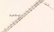
Perusal of a 25″ OS map of  1867 shows, in almost microscopic lettering, a feature marked ‘Bogle Bush’.  I transferred the approximate location onto a modern map and set off to make a field visit, honestly not expecting to find anything almost a century and a half later.

Bogle bush 1

The Bogle Bush

As I walked down the designated road I was drawn to an ancient multi branched or trunked tree, the trunks held together by a hefty iron band. The band had been placed there many years ago as it was being absorbed by the growth of the tree. Unlike the other trees in the road the foot of this tree had crocus and grape hyacinth in flower, as if deliberately planted.

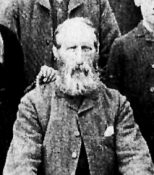
The band was forged and fitted by Kinrossie Blacksmith and Kirk Elder David Gray at the end of the nineteenth century, following the collapse of one of the three trunks then standing.

Bogle Bush 2

The band holding the tree together

The online Ordnance Survey Name Books for Perthshire, compiled prior to the survey of the 1867 map, list Robert Millar of Flowerdale, Mr James Stewart of Kinrossie and Mr Fraser of St Euchans as the informants that ‘This name is applied to a Birch Tree situated on the north side of the road leading from Saucher to Kinrossie. Mr Millar says that there is a superstitious tradition existing in the locality that Bogles have been seen &c at this tree’.

Whether Mr Millar and his co-informants were trying to mischievously mislead the (probably) English Ordnance Survey officials, we will never know, but the tree is in fact a Sycamore! And the 1901 25″ OS map shows the tree as the ‘Bogle Busk’.

Folklore

There has been speculation that the Bogle Bush may have long forgotten links with Macbeth whose fortess at nearby Dunsinnan Hill overlooks it, adding the rider that Sycamores only live 200 years or so before falling and then regenerating on the same spot, implying that a mother tree could have been on the same spot in Macbeth’s time.

David Gray, Blacksmith and Kirk Elder of Kinrossie.

David Gray, Blacksmith and Kirk Elder of Kinrossie.

Local folklore states that ‘a great calamity will befall Kinrossie’ should the Bush collapse. The tree is a local icon that’s ‘aye been there’ according to a local resident and it seems to be a local geo-caching site, judging by the small container of ‘stuff’ hidden in a plastic container underneath a couple of pieces of bark at the base of the trunk on my visits.

Please note that if you decide to visit, this is not a wishing tree, so do not hammer coins into the bark or suspend rags from the branches. Respect the Bush and the local people to whom this is an iconic tree.

My thanks to local resident Morag Hislop for leading me to further information on this site.

References:

  1. Scotland’s Place Names
  2. Collace Parish Millenium Committee, Off The Main Road, 2nd edition: Kinrossie District Recreation Club, 2010

 © Paul T. Hornby, The Northern Antiquarian


Bell Stane, Queensferry, Midlothian

Legendary Stone (destroyed):  OS Grid Reference – NT 1292 7840

Bell Stane on 1896 map

Bell Stane on 1896 map

Archaeology & History

An intriguing site that needs adding to the Northern Antiquarian due to the foraging research of the Edinburgh historian Stuart Harris (1996).  Although the Bell Stane has been ascribed by the Canmore researchers to be just,

“a stone near the Mercat Cross on which the hand bell was set (rung to herald the opening of the weekly market or annual fair),”

Mr Harris dug deeper and found other references which led him to think that the site was “a conspicuous boulder or standing stone.”  I have to agree with him.  In his outstanding work on the historical place-names of Edinburgh and district, Harris wrote:

“The Bellstane…is noted on Ordnance Survey 1854 as the name of an object just outwith the burgh boundary and in the southwest corner of the little square that now bears the name.  Whilst it has been surmised that it was a stone named for a handbell rung beside it on market days, in point of fact a burgh council meeting of 1642 (quoted in Morison’s Queensferry, p.131) records that a piece of ground hitherto waste and unused, within the burgh but near the bellstane, was to be set aside for markets and fairs in times coming; and the clear inference is that the name belonged to the stone before any markets were held near it.  In absence of a reliable description of the stone or of early forms of its name, the origin of the name can only be guessed at.  Similar names (of sites) in Kirknewton and Whitburn are no better documented, but the early forms of Belstane in Lanarkshire (BellitstaneBellistaneBelstane and Bellstane prior to 1329 and Beldstanein 1452) suggest that its first part may be Anglian ballede or early Scots bellit (from a Celtic root, ball, white), making the name ‘the stone with a white or pale patch or stripe on it’ — such as one with a band of quartz running through it.  A conspicuous boulder or standing stone of this sort on this spur of higher ground above the shore would have been a useful meith or landing mark for boats making for the narrow landing place at the Binks.”

If anyone uncovers additional evidence about this Bell Stane that can affirm it as a standing stone (or otherwise), we will amend its status.

References:

  1. Harris, Stuart, The Place-Names of Edinburgh: Their Origins and History, Gordon Wright: Edinburgh 1996.
  2. Morison, Alexander, Historical Notes on the Ancient and Royal Burgh of Queensferry, West Lothian Courier: Bathgate 1927.
  3. Orrock, Thomas, Fortha’s Lyrics and other Poems, privately printed: Edinburgh 1880.

© Paul Bennett,  The Northern Antiquarian 2016


Weeping Stone, Fladaigh Chuain, Skye

Legendary Rock: OS Grid Reference – NG 3638 8091

Getting Here

Unless you’ve got your own boat, forget it!  This one’s miles out on the isolated uninhabited island of Fladda-chuain about 5 miles off the northwest tip from Duntulm, Trotternish.  I wouldn’t mind a coupla weeks alone on the isle though – if anyone can get me there!

Archaeology & History

This little rocky island was allegedly another one of the many visiting places that St. Columba frequented in his copious ventures, trying to sell his new religion to local people wherever he went.  Here he came to the legendary clach known as the Weeping Stone: a place of reverence to the druids and indigenous people.  But St Columba came here to christianize the rituals that were had at the site; and, eventually, he was allowed to build a  small stone chapel close by.

Folklore

In Otta Swire’s (1961) excellent work on the folklore and history of the Isle of Skye, she wrote:

“In Duntulm Bay lies Tulm Island and beyond it, in clear weather, Fladdachuan, Fladda of the Ocean, can be seen. In olden times this was a sacred spot, held by many to be Tir-nan-Og, the Isle of Perpetual Youth, which lay in the west; here it is always summer and the sun never sets. The puffins recognized its sacred nature and never began any venture until they had circled the island three times sunwise; this they did also on arriving in Skye and before leaving it. It was held by some to be the reason why in Skye people used to turn three times sunwise before starting a new enterprise. The Druids held it in veneration and St. Columba caused a chapel to be built there. On its altar lay a black stone which some say was the original altar stone of the Druids and which was known as the Weeping Stone because it was always wet. Until fairly recently fishermen used to land on the island and pour three handfuls of seawater on the stone to procure favourable winds or to stop bad floods. The Weeping Stone no longer exists, or at least is no longer to be found where the altar once stood.”

I can’t find anything more about this place.  Does anyone know owt more about it?

References:

  1. Swire, Otta F., Skye: The Island and its Legends, Blackie & Son: Glasgow 1961.

© Paul BennettThe Northern Antiquarian


Beinn na Cailleach, Kylerhea, Skye

Sacred Mountain:  OS Grid Reference – NG 770 229

Also Known as:

  1. Beinn na Caillich

Getting Here

As you drive down the A87 road towards Broadford from the Kyle, just before Breakish there’s a small road on the left that runs down to Glen Arroch, where the forest lines the hill.  A couple of miles beyond the end of the forest, watch out for the TV mast on the slopes on the right-hand side of the road.  Stop here and go up the slopes on the left-side of the road (north), to the peak of Sgurr na Coinnich; and once here you’ll see the high rocky peak of Beinn na Cailleach a half-mile to your northeast.  

Folklore

The legend of this sacred mountain was described at some length in Otta Swire’s (1961) excellent work on the Isle of Syke.  She wrote:

“”As you drive down the road towards Broadford, three peaks can be seen to the north; the first two are Beinn na Greine (2,000 feet) and Scurr na Coinnich (2,401 feet); the third and most northerly is Beinn na Caillich (2, 396 feet). This last must not be confused with the Beinn na Caillich near Broadford, which is one of the Red Cuchullins although, just to make it more confusing, on the summit of our Beinn na Caillich, as on that of her larger sister, tradition has placed a woman’s grave. This time it is that of a giantess, one of the Fiennes: beneath her body is a large crock filled with gold and jewels, for she was a great lady, no less than Grainnhe herself, wife of Fionn, and at her burial every man of the Fiennes, for love of her and of their leader, cast their rarest jewels into the earthenware crock to do her honour. Her story, as is so usual in Celtic legend, is a sad one. Grainne is the daughter of the King of Morven and is reputed the fairest and truest princess in all Alban, so the Grey Magician, who hates all that is good, carries her off. One day, as Fionn and his men rest after hunting, an old, old woman, wrapped in the red mantle that denoted royal blood, comes to him, tells him of the theft of Grainnhe and begs him to rescue her. He agrees, whereupon she gives him a fir twig and three small pebbles, all highly magic; she then goes out of sight ‘on an eddy of the western wind, growing smaller as she went until she seemed no bigger than a butterfly, a honey bee, a red spider on a thin rope of its web, and a speck of dust in the sun’. Fionn sets out and after many adventures, during which he is assisted by several talking animals, he finds the Grey Magician’s palace and escapes with Grainnhe. Thanks to the old woman’s gifts, forests and mountains rise behind the fugitives, but before they can reach the Red river, to cross which is safety, the Magician overcomes the old woman’s charms. They reach the river bank only to find they cannot cross, and Fionn’s magic is exhausted. But Grainnhe has a jewel, a charm against death; as long as she wears it in her hair no evil can harm her; alternatively it will give her one wish and vanish. She takes it from her hair to wish for a boat and immediately sees, as in a vision, the fate to which she will condemn herself if she gives up her talisman. But Fionn is in peril through his efforts to save her, and already she loves him, so she lays the jewel on the water. A boat at once appears and takes them to safety.

Fionn and Grainnhe are married and live in great happiness until Grainnhe’s son is about to be born. Then come messengers to Fionn to tell him that sea-pirates are attacking his small dark-skinned allies, the Sons of Morna, who have sent to remind him of his pledge to assist them. Fionn longs to remain with Grainnhe but will not break his vow. He and his men spend three days defeating the sea-pirates and when he returns Grainnhe and her baby are gone, carried off by the Grey Magician. Fionn learns from his ‘tooth’ that she has been turned into a hind. He searches for her for many years, but she has been sent to run with the deer in lone Glen Affaric and he never finds her. Twelve years later, when the Fiennes are hunting, their hounds pick up a scent and follow it to a small copse; Bran, who is leading, is the first to enter it, whereupon, to the surprise of all, he turns at bay, teeth bared against the Fiennes and his fellow hounds of the pack and will allow no one but Fionn to pass him. Fionn finds him guarding a wild boy, with long hair and wild, beautiful, frightened eyes, who can make only such sounds as deer make. Fionn adopts him and teaches him human speech. Needless to say, he is Grainnhe’s son, but Grainnhe, the beautiful white hind of whom her son talks, is never found. After her death the Grey Magician permits her son to take her body, once more that of a woman, for burial, and the Fiennes make her grave on the summit of Beinn na Caillich, where she once ran as a hind.

It is recounted of this boy that he had in the centre of his forehead a tuft of deer’s fur where his mother’s tongue had licked him, and that it was from her that he got his gift of poetry. Once he was shipwrecked on Fladda and a party of hunters on the island offered him a share of their venison stew, to whom he made indignant reply: ‘When everyone picks his mother’s shank-bone, I will pick my mother’s slender shank-bone.’  The boy was Ossian.”

References:

  1. Bernbaum, Edwin, Sacred Mountains of the World, Sierra Club: San Francisco 1990.
  2. Swire, Otta F., Skye: The Island and its Legends, Blackie & Sons: Glasgow 1961.

© Paul BennettThe Northern Antiquarian 


Beinn na Cailleach, Broadford, Skye

Sacred Mountain:  OS Grid Reference – NG 601 232

Getting Here

Seems rather daft giving directions for a mountain, but… For incomers, cross the bridge onto the island and keep on the A87 road to Broadford.  A couple of mile the other side of the village westwards, take the small left turn in the trees and go to the dead-end.  The hill reaching up above you (west) is the legendary mountain to walk up!

Folklore

Beinn na Cailleach

This giant old mountain has been associated with the primal female creation figure, the cailleach, for many a moon. And strangely – for me anyway – I’ve not ventured to sleep with this old place in my passings here as I usually do wherever the cailleach resides.

It doubtless has many more tales than the one A.A. MacGregor (1937) mentions in his superb Peat-Fire Flame.  Here he tells the story of,

“the cairn situated on the summit of Beinn na Cailleach, not far from Broadford… This cairn is believed to mark the site of burial of a Norse princess who died at Ord. On her deathbed this princess commanded her attendants to convey her, when dead to the top of Beinn na Cailleach, and to bury her there, in order that she might lie in the wake of the winds from Norway.”

MacGregor then follows the tale with a lovely note on some boring old dood he obviously had little respect for, saying:

“It is the traditions associated with this cairn that MacCulloch, the geologist, in his Description of the Western Isles of Scotland, asks to be excused from repeating, since he considers them, one and all, to be unworthy of regard. But, then, MacCulloch was a most tiresome fellow; and he seems to have imbued most of his writings with something of the same tiresomeness”!

On the lower northeastern slopes of this great mountain we find another of the old woman’s abodes, the ‘Lochain Beinn na Cailleach’, where this great hag would no doubt wash her linen, as many old myths tell she did at other pools of the same name.

A slightly different version of the folktale was told by Archibald Geikie in his Note-book of a Field Geologist from 1858:

“The top of Beinn na Cailleaich is flat and smooth, surmounted in the centre by a cairn. Tradition tells that beneath these stones there rest the bones of the nurse of a Norwegian princess. She had accompanied her mistress to “the misty hills of Skye,” and eventually died there. But the love of home continued strong with her to the end, for it was her last request that she might be buried on the top of Beinn na Cailleaich, that the clear northern breezes, coming fresh from the land of her childhood, might blow over her grave.”

An early essay in the Gentleman’s Magazine in 1841 tells the grave atop of the mountain to have been the resting place of the Norwegian King Haco’s wife or his nurse. Derek Cooper (1970) meanwhile told us that whilst the cairn was “erected as a memorial to a Skye chieftain,” the cailleach of the mountain, or “the old woman is reputedly Saucy Mary, who laid a chain between Kyle and Kyleakin to exact toll from passing ships.”

There are other mythic place-names scattered around the edges of this mountain with hints of ancient female deities, or pagan goddesses — whichever way one cares to see them.

References:

  1. Cooper, Roy, Skye, Routledge: London 1970.
  2. Geikie, Archibald, The Story of a Boulder, MacMillan: London 1858.
  3. MacGregor, Alisdair Alpin, The Peat-Fire Flame: Folk-Tales and Traditions of the Highlands and Islands, Ettrick Press: Edinburgh 1937.
  4. o’ Crualaoich, Gearoid, The Book of the Cailleach, Cork University Press 2003.
  5. Swire, Otta F., Skye: The Island and its Legends, Blackie & Sons: London 1961.

© Paul BennettThe Northern Antiquarian


Stone of Mannan, Clackmannan, Clackmannanshire

Legendary Stone:  OD Grid Reference – NS 91114 91891

Also Known as:

  1. Canmore ID 48321
  2. Clackmannan Stone
  3. King Robert’s Stone

Getting Here

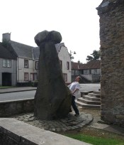
The Stone of Mannan

The Stone of Mannan

Take the A907 road between Alloa and Kincardine, and up the B910 into Clackmannan.  To get into the village, depending on which route you’re coming in, go up the Kirk Wynd or the Cattle Market—both of which lead you to the Main Street where, beneath the old clock tower, you’ll see the Market Cross and its companion erection just to the side. You can’t really miss it!

Archaeology & History
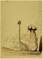
The phallic upright!

The phallic upright!

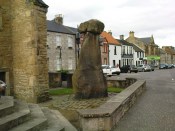
The history of this curious-looking giant phallic stone, sat quietly on the Main Street of sleepy Clackmannan village, isn’t as heathen as you’d expect when first seeing the huge upright—but there are mysteries and myths gathered about it.  The county of Clackmannan itself takes its name from this stone—but not the entire stone that we see today; merely the rounded, smaller element on top.  For it’s this that’s the real Mannan Stone. The rest of it, the tall upright pillar, was only attached to the smaller rounded stone—the Stone of Mannan— in the first-half of the 19th century.

First mentioned as a place-name in 12th century writings, the story of the stone was best told by Peter Miller (1889), who wrote:

“The old ‘clack’ or stone that forms the prefix to the name-word Clackmananmust be of considerable antiquity.  Its form and appearance have nothing to excite remark. The two larger portions of the stone are battened together with iron, and the portion forming the cleft appears to be detached from the larger one.  It is only the legend or tradition respecting its history and its association with the name-word Clackmanan that makes it interesting to the antiquary. Its dimensions are as follows: —It is over 3 feet in length, 2 in breadth, and about the same in thickness.  Its form is oval, and it has a deep cleft on its upper side.  The stone has nothing peculiar about it to indicate what it may have been originally, or the uses it was made to serve in early times.  There is no appearance of its ever having had an inscription or any ornamentation upon it.  It is simply a boulder-stone stone of whinstone, such as are found in abundance at the Abbey Craig near Cambuskenneth.  It was placed on the tall boulder slab on which it now stands, brought from the Abbey Craig in the year 1833 by the late Robert Bruce of Kennet, and the late Professor Fleming, who was then minister of the parish.  Previous to that time it lay on the ground alongside of the old jail and court-house of Clackmannan, close by the old cross of the town…”
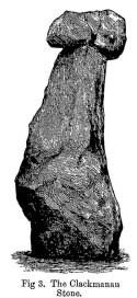
Clackmannan Stone (after Miller)
Clackmannan Stone (after Miller)

The old stone & its upright

The old stone & its upright

Mr Miller then went on at some length to show the derivation of ‘Clackmannan’ to be from the old Irish, meaning “the stone of the monks.”  It seems a plausible theory too.  Despite this, Watson (1926) deemed it to be the ‘Stone of Manau’, being deemed vaguely as the people of the land north of the Forth.  The great Celtic scholar John Rhys (1888) declared Clackmannan to derive from the Irish deity or hero-figure, Manannan, as have other academic authorities since then.  But it’s all just a bit vague if we’re wanting ‘certainty’…

When T.C. Crouther (1936) wrote about this, he said how the Stone of Mannan had originally come from a position only a few hundred yards south of its present spot, at a place known as Lookabootye Brae  (NS 912 911), just above where the land begins to drop down closer to sea level.  This doesn’t seems too improbable.  Close to this spot could once be seen the sacred site of the Lady Well.

At the turn of the 21st century the stone was caged by the local council as it was beginning to crumble and was in danger of collapse; and so, the local council repaired the great upright and its sacred top-stone—albeit at the staggering cost of £160,000!!!  As the local people and other masons know to this day, the job could have been done for a fraction of that cost with equal efficiency.

Folklore

Said by T.C. Crouther (1936), the local council, and others to have got its name from the sea god Mannan, other legends have grown around this fascinating old rock.  When Edwin Adams (1863) wrote about it, these were the tales that local people gave him:

“Its legendary history is curious. When King Robert Bruce was residing in Clackmannan tower, and before there was a town attached to that regal mansion, he happened, in passing one day near this way on a journey, to stop awhile at the stone and, on going away, left his glove upon it.  Not discovering his loss till he had proceeded about half-a-mile towards the south, he desired his servant to go back to the clack (for King Robert seems to have usually spoken his native Carrick Gaelic), and bring his mannan, or glove. The servant said, ‘If ye’ll just look about ye here, I’ll be back wi’t directly,’ and accordingly soon returned with the missing article.

£From this trivial circumstance arose the name of the town which was subsequently reared about the stone, as also that of a farm at which the King stopped, about half-a-mile from the south, on the way to Kincardine, which took its name from what the servant said, namely, ‘Look about ye,’ and is so called to this day.”

But as the various dates in this tale simply don’t add up, it seems that the writer had been easily fooled.

References:

  1. Adams, Edwin, Geography Classified, Chapman Hall: London 1863.
  2. Drummond, James, Scottish Market-Crosses, Neill & Co.: Edinburgh 1861.
  3. Drummond, James,”Notice of Some Stone Crosses, with Especial Reference to the Market Crosses of Scotland,” in Proceedings Society of Antiquaries, Scotland, volume 4, 1862.
  4. Gordon, T Crouther, The History of Clackmannan, Civic Press: Glasgow 1936.
  5. Miller, Peter, “Notices of the Standing Stones of Alloa and Clackmannan,” in Proceedings of the Society of Antiquaries, Scotland, volume 23, 1889.
  6. Rhys, John, Lectures on the Origin and Growth of Religion as Illustrated by Celtic Heathendom, Williams & Norgate London 1888.
  7. Royal Commission on the Ancient & Historical Monuments, Scotland, Inventory of Monuments and Constructions in the Counties of Fife, Kinross and Clackmannan, HMSO: Edinburgh 1933.
  8. Royal Commission on the Ancient & Historical Monuments, Scotland, The Archaeological Sites and Monuments of Clackmannan District and Falkirk District, Society of Antiquaries of Scotland 1978.
  9. Simpkins, John Ewart, County Folklore – volume VII: Examples of Printed Folk-Lore Concerning Fife, with some Notes on Clackmannan and Kinross-Shires, Folk-Lore Society: London 1914.
  10. Small, John W., Scottish Market Crosses, Eneas Mackay: Stirling 1900.
  11. Watson, W.J., The History of the Celtic Place-names of Scotland, Edinburgh 1926.

Links:

  1. Nataraja’s Foot – Skullduggery

Acknowledgements:  Big thanks to author Marion Grace Woolley for use of her photo in this site profile. 🙂

© Paul BennettThe Northern Antiquarian


Clach na h-ealea, Clachan, Lismore, Argyll

Legendary Stone:  OS Grid Reference – NM 861 435

Also Known as:

  1. Clach na h-eala
  2. Stone of the Swan
  3. Swan Stone

Archaeology & History

Although the lads at the Scottish Royal Commission (1974) initially described this site as a ‘Standing Stone’, it is in fact,

“an erratic boulder of granite roughly shaped in the form of a cross… It measures 0.8m in height, 0.6m in width at base, and 0.4m in width at the top…(and) the stone is supposed to have marked a boundary.”

The site was evidently of some mythic importance, as the great Cathedral of St. Moluag was built next to the stone — unless the giant cairn of Cnoc Aingil, 500 yards away, was to blame. A holy well of this saint’s name (an obvious heathen site beforehand) is also nearby.

Folklore

Although this stone was dedicated to swans, I’ve not found the story behind the name.  There were no buried swans here, but local tradition told that this old boulder could give sanctuary to anyone who touched it, or ran round it sunwise.  The Hebridean folklorist Otta Swire (1964) told that,

“anyone who claimed such sanctuary had his case considered by ‘the Elders.’ If they considered his plea justified, they ‘came out and walked sun-wise round the Swan Stone.’ If they did not approve of his right to sanctuary, they walked round it anti-clockwise and the man was then given over, not to his enemies, but ‘to Authority’ to be tried.”

This old tradition derives from well known pre-christian rites. Swire also reported that even in the 1960s here, “at funerals the coffin is always carried round the grave sun-wise before being laid in it.” An old cross placed in the Field of the Cross next to the stone was an attempt to tease folk away from heathen rites of the stone, but failed.

References:

  1. Royal Commission on the Ancient & Historical Monuments of Scotland, Argyll – volume 2: Lorn, RCAHMS: Edinburgh 1974.
  2. Swire, O.F., The Inner Hebrides and their Legends, Collins: London 1964.

© Paul BennettThe Northern Antiquarian