St. Bennet’s Well, Cromarty, Ross & Cromarty

Holy Well:  OS Grid Reference – NH 7923 6502

Archaeology & History

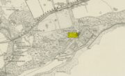
St Bennets Well 1880 map

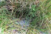
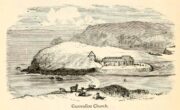
An old church dedicated to St Bennet once existed on the hill above where this spring of water emerges, but little is now left of the building.  Thankfully the holy well hasn’t quite followed in the footsteps of the church.  Miss Riley (1935) told us that it can be found “near the high-water mark…situated at the foot of a beautiful little glen which runs inland from the coast” – and from all accounts it is still there.

Shown on the 1880 OS-map of the region, the dedication to St Bennet is obscure.  Mr Pullan (1927) suggested it derived from the 6th century St Benedict of Nursia, but this is improbable.  The Royal Commission lads thought it more likely derived from “a Celtic foundation.”

Folklore

The earliest description I’ve found regarding the traditions surrounding this well are by Hugh Miller (1835).  He wrote:

“It is not yet twenty years since a thorn-bush, which formed a little canopy over the spring of St. Bennet, used to be covered anew every season with little pieces of rag, left on it as offerings to the saint, by sick people who came to drink of the water.”

But the tradition didn’t die out, as evidenced by a short article by Miss M.D. Riley (1935) in Antiquity journal where she gave us further valuable information about its folk history, saying:

“In order to insure the fulfilment of the wish it is essential that the wisher should drink the water and leave something of his personal attire.  When the writer visited the spot there was a heterogeneous collection of ‘rags’ hanging on the branches.

“Mr Francis Scott tells me that the site is locally supposed to be the place of judgement.  It is close to the ruins of St Bennet’s Chapel and the ground is said to be cursed as it was stoeln by the Church. Even at the present day the owner has to provide each year at Christmas-tide 8 cwt of oatmeal free for the poor of the parish.  This has been operative since 1630 and though the owner has tested the matter in the highest court of law in Scotland, his appeal was not allowed.”

The tradition of giving offerings to the spirit of this well was still recorded in 1966.

References:

  1. Hiley, M.D., “Rag-Wells,” in Antiquity, volume 9:4, December 1935.
  2. Innies, Cosmo, Origines Parochiales – volume 2:2, W.H. Lizars: Edinburgh 1855.
  3. Miller, Hugh, Scenes and Legends of the North of Scotland; the Traditional History of Cromarty, William Nimmo: Edinburgh 1835.
  4. Morris, Ruth & Frank, Scottish Healing Wells, Alethea: Sandy 1982.
  5. Pullan, L., The Banner of St Boniface, London 1927.

© Paul BennettThe Northern Antiquarian

St. Serf’s Well, Crieff, Perthshire

Holy Well (lost):  OS Grid Reference – NN 8457 2323

Archaeology & History

St Serfs Well on 1866 map

A mile to the west side of Crieff, in the grounds of the 18th century mansion known as Ochtertyre House, could once be seen the little-known sacred well of St Serf.  Sadly its waters seem to have disappeared beneath the rising waters of the loch known as St Serf’s Waters—which is a pity, as the place was of importance in the annual traditions of the local people, who left offerings to the spirit of the place, as was common in days of olde.  It was described in Mr Porteous’ (1822) account of Monzievaird parish, in which he told that,

“Nigh to this place is St Serf’s Well, and the moor whereon St Serf’s market is held.  He was the tutelary saint of the parish of Monivaird.  This well is a plentiful spring of water.  About sixty years ago, our people were wont, on Lammas day, to go and drink it, leaving white stones, spoons, or rags, which they brought with them; but nothing except the white stones now appear, this superstitious practice being quite in oblivion.  It has been useful in a strangury, as any other very cold water would be; for a patient, taking a tub full of it immediately from the well, plunging his arms into it, which were bare to the elbows, was cured.

“St Serf’s fair is still kept on the 11th of July, where Highland horses, linen cloth, etc., both from the south and north, are sold.”

Although the well is deemed to be ‘lost’, it is possible that its waters might be seen after a good drought.  Please let us know if that happens.

Folklore

St. Serf was said to have been a hermit and tutor of the more renowned St. Mungo.

References:

  1. Morris, Ruth & Frank, Scottish Healing Wells, Alethea: Sandy 1982.
  2. Porteous, A., “Extracts from a History of the Parishes of Monivaird and Strowan“, in Archaeologia Scotica, volume 2, 1822.

Acknowledgements:  Big thanks for use of the 1st edition OS-map in this site profile, Reproduced with the kind permission of the National Library of Scotland

© Paul BennettThe Northern Antiquarian


St. Dunstan’s Well, York, North Yorkshire

Holy Well (lost):  OS Grid Reference – SE 607 511

Archaeology & History

An entry in George Benson’s huge work on the history (mainly) of York, describes the holy well of St Dunstan “near the Glass Works”, which used to be at the south-side of the city on Fishergate.  I can find no other reference to this site and it’s not on the early OS-maps, so we must presume it is long gone.

Other wells in his name can be found in Kent, Somerset, Sussex and Tottenham.

Folklore

The fable relating Dunstan to wells was his ability to make springs miraculously appear.  Tradition relates him to have been born in Wessex in the 10th century.  His festival date is May 19.

References:

  1. Benson, George, An Account of the City and County of York – volume 3, Cooper & Swans: Micklegate 1925.

© Paul BennettThe Northern Antiquarian

St Ellen’s Well, Harrisend Fell, Scorton, Lancashire

Holy Well: OS Reference – SD 53683 50975

Also Known as:

  1. St Ellin’s Well

Getting Here

The Well on the 1846 Map

Approaching the site from the north, walk along the Lane Head track, and along the path south-eastwards, then turn right onto the main footpath until coming to the stream. Follow the stream up the fell to the large clump of reeds, then follow your ears until you locate the spring! Or you can approach it along the main footpath from the Oakenclough – Galgate road. The well and the path to it
are on access land.

Archaeology & History

Fortunately recorded by the Ordnance Survey on their 1846 6″ map Lancashire XL, the story of St Ellen’s Well was taken up sixty years later by local holy wells historian Henry Taylor (1906):

Listen for the spring in the reeds

“The site of this holy well is marked on the ordnance map at a lonely spot on Harris Fell, five hundred feet above the sea-level, four and a half miles in a north-easterly direction from the town of Garstang.

“Mr. A. King has kindly examined the site.  He writes, 4th August, 1902: “We had no difficulty in locating the spot…. There is no outward indication of the place being used for curative means, and there is no stonework at all. It is a beautifully cold spring which is at the side of ‘Bonny Pad’, a pathway leading across the moor from Harris End, and it was grown around with rushes….  All I can glean about it is that one of the oldest inhabitants, when asked if he knew of it, replied, ‘It will be th’ holy well, you mean.'”

The original dedication of this remote holy well was clearly to St. Helen, and its presence next to the Bonny Pad or path may indicate a pre-Christian dedication to a local cognate of the Celtic Elen Luyddog, Elen of the hosts or ways.  The Bonny Pad is shown but not not named on the 1846 map, and follows a broadly southwest to northeast direction from Harris End (again not named on the 1846 map) up to Grizedale Head on the southern edge of the Catshaw Vaccary.  It was perhaps an ancient route used by farmers to take their animals up onto the fell for the summer, and return them to the lowlands in the autumn.

Bubbling away at source

The western portion of Bonny Pad is not shown on the modern map and St Ellen’s Well is not marked, and both have it seems passed out of local memory.  An elderly farmer I encountered on my way up to the fell had never heard of the Well.

It is certainly worth the walk if only for the delightful sound of this powerfully flowing spring, the water is pure and cold, and it commands a fine view over the Lancashire plain to the coast.

References:

  1. Taylor, Henry, The Ancient Crosses and Holy Wells of Lancashire, Sherratt & Hughes: Manchester 1906.
  2. Wise, Caroline, “Elen of the Roads of Country and Town”, in Finding Elen – The Quest for Elen of the Ways, edited by Caroline Wise, Eala Press: London 2015.

© Paul T. Hornby, 2020

Holy Well, Holwell, Hertfordshire

Holy Well (lost):  OS Grid Reference – TL 16 33

Archaeology & History

The exact location of this site seems to have been lost.  One possible candidate is on the south-side of the village where remains of a large moat exists, meaning that there was a good water supply here to maintain its existence.  But this is pure guesswork on my part.  The well was mentioned briefly in R.C. Hope’s (1893) classic book where he told us:

“There was a holy well or spring in the village of Holwell, on the borders of Bedford and Hertfordshire; unfortunately both history and site have been forgotten by the villagers at Holywell.”

The site was mentioned as far back as 1086 CE in the Domesday Book as ‘Holewelle’.  The place-name authorities Gover, Mawer & Stenton (1938) tell us this derives from a “spring in the hollow” and not a holy well as subsequent writers profess.  The only thing that could perhaps fortify the ‘holy’ element is that in some instances early citations of holy wells are written as holi- wells, which this may have been.  As all historians know, early spellings of sites are far from accurate.

References:

  1. Gover, J.E.B., Mawer, Allen & Stenton, F.M., The Place-Names of Hertfordshire, Cambridge University Press 1938.
  2. Hope, Robert Charles, Legendary Lore of the Holy Wells of England, Elliott Stock: London 1893.
  3. Smith, A.H., English Place-Name Elements – volume 1, Cambridge University Press 1956.

© Paul BennettThe Northern Antiquarian


Holy Well, Gunwalloe, Cornwall

Holy Well (lost):  OS Grid Reference – SW 6602 2053

Archaeology & History

The old church at this headland just above the sea was, said Padel (1988), dedicated to Saint Gunwalloe or Winwalloe in 1332 and is thought to have been the character (a hermit by all accounts) who deemed this well to be ‘holy’.  In Alfred Cummings (1875) history of Gunwalloe parish, he devotes a short but singular chapter to this holy well which, according to most accounts, has fallen back to Earth.  It was found, said Cummings, “close to the church porch, only a few feet over the precipitous rock…and (was) doubtless the resort in former days of many a lad and maiden.”

Yet even in his day, he lamented its loss, telling that.

“The spring that once bubbled up in its rocky basin is no longer there; sand and stones fill up the well at each high tide, and though occasionally cleaned out for the satisfaction of the wayfarer’s curiosity is yet only an imperfect semblance of its former self.”

Yet remnants of practices and traditions of the well were thankfully remembered:

Gunwalloe church in 1885

“That Gunwalloe was considered by the country folk a well of some importance there can be little doubt, for one day in the year, which was called Gunwalloe Day, was set apart for cleaning out this holy well — it was quite at a different time of year to this parish feast — and now only remembered by two old men out of the whole population of the place.

“They fix the time in their memories as the period of tilling barley, for they recollect that on this Gunwalloe Day it was the custom for the men to mend all the cliff roads (doubtless these were useful in days of smuggling when a successful run was a desirable thing), and so strictly was it kept that, if any were found labouring in the fields, a party would go and take them by force, and press them into the service of the holiday makers, who, having mended the roads and cleared the holy well at Gunwalloe, wound up the day with merriment and revelry.”

Such practices are long since gone of course and, so most modern accounts would tell us, the holy well with it.  But when J. Meyrick (1982) came looking for the site on the summer solstice of 1980, he seemed a little more fortunate than his predecessors.  Located just a few yards from the detached church tower, he spoke with a

“Mrs Wilson, a churchwarden (who) told me that in heavy rain the tower continues to be flooded so the spring is still somewhere about, and curiously enough by the stile to the beach is a small granite trough with rainwater put there by someone no doubt in lieu of the Well and who is to say that the water is not holy!  The stream across the dune still meanders a few feet beneath the tower and into this the water from the well would have run, but there seems now no sign of an originating spring in the rocks around.”

Folklore

The church itself possesses a folktale found up and down the land.  “It is said,” wrote Blight (1885),

“that the builders intended to erect the church on higher ground, nearer the centre of the parish, at Hingey; but as fast as materials were brought to the place they were, by some mysterious agency, removed during the night to the present site.  And here the church was built, it being found useless to contend with a supernatural power.”

The supernatural agencies that are nearly always responsible for such actions tend to be the devil, fairies or other types of little-people.

References:

  1. Blight, J.T., Churches of West Cornwall, Parker: London 1885.
  2. Cummings, Alfred H., The Churches and Antiquities of Cury and Gunwalloe, W. Lake: Truro 1875.
  3. Meyrick, J., A Pilgrim’s Guide to the Holy Wells of Cornwall, J. Meyrick: Falmouth 1982.
  4. Padel, O.J., Cornish Place-Names, Alison Hodge: Penzance 1988.
  5. Quiller-Couch, M. & L., Ancient and Holy Wells of Cornwall, C.J. Clark: London 1894.

© Paul BennettThe Northern Antiquarian

Bishop’s Well, Tottenham, Middlesex

Holy Well (destroyed):  OS Grid Reference – TQ 332 911

Also Known as:

  1. My Lady’s Hole

Archaeology & History

Long since gone after drainage operations on Tottenham Cemetery made the waters dry-up, this was one of several holy wells in the Tottenham area.  Its history has been described in various old tomes, but the most definitive is found in William Robinson’s (1840) classic on the parish of Tottenham, when the well was still visible.  He told us:

“There is a spring which issues from the side of a small hillock on the south side of the Moselle, nearly opposite the Vicarage, leading thence to the Church, called Bishop’s Well.  This spring was formerly considered famous for many strange and wonderful cures performed on the diseased by the use of this water.  It has been for some years neglected, but of late the owner of the field in which this well is, had it cleansed, and planted some trees round it, and put up posts and rails to prevent the cattle treading down the sides of it.  It is said that the water of this well never freezes.  In former times this well was in great repute from the purity of its water.  The ladies in the vicinity of it were accustomed to send their servants in the morning and evening for water for their tea, from which circumstance it was for many years known by the name of “My Lady’s Hole.”  The water of this well is not only esteemed for its medicinal qualities, but particularly for curing disorders of the eye.

“There were formerly many other springs about the village, especially one which issued out of the hill on which the Church stands; and another in Spottons Wood otherwise Spottons Grove, on the north side of Lordship Lane, which in the fifteenth century was of considerable notoriety; but none of which have in former times been so much frequented and held in such repute as Bishop’s Well.”

(Please note: the grid-reference for this site is an approximation)

References:

  1. Foord, Alfred Stanley, Springs, Streams and Spas of London: History and Association, T. Fisher Unwin: London 1910.
  2. Hope, Robert Charles, Legendary Lore of the Holy Wells of England, Elliott Stock: London 1893.
  3. Robinson, William, The History and Antiquities of the Parish of Tottenham, Nichols & Sons: London 1840.
  4. Sunderland, Septimus, Old London Spas, Baths and Wells, John Bale: London 1915.
  5. Thornbury, Walter & Walford, Edward, Old and New London – volume 5, Cassell: London 1878.

© Paul BennettThe Northern Antiquarian


St. Bride’s Well, Avondale, Lanarkshire

Holy Well (destroyed):  OS Grid Reference – NS 6983 4138

Archaeology & History

St Brides Chapel & Well on the 1864 OS-map

Shown on the 1864 OS map of the area as a ‘Well’ just at the front of St Bride’s Chapel—now a very pleasant old cottage—peasants and pilgrims would stop for both refreshment and ritual here as they walked down High Kype Road.  Although the chapel was described in church records of January 1542 as being on the lands of Little Kype, close to the settlement of St Bride, there seems to be very little known about the history or traditions of the well.  If anyone has further information on this site, please let us know.

Folklore

Bride or Brigit has her origins in early British myth and legend, primarily from Scotland and Ireland.  Her saint’s day is February 1, or the heathen Imbolc (also known as Candlemas).  Although in christian lore St. Bride was born around 450 AD in Ireland and her father a Prince of Ulster, legend tells that her step-father (more probably a teacher) was a druid and her ‘saintly’ abilities as they were later described are simply attributes from this shamanic pantheon. Legends—christian and otherwise—describe Her as the friend of animals; possessor of a magickal cloak; a magickian and a healer; and whose ‘spirit’ or genius loci became attached to ‘sacred sites’ in the natural world, not the christian renunciation of it.  St Bride was one of the primal faces of the great prima Mater known as the Cailleach: the greater Gaelic deity of Earth’s natural cycles, whose changing seasons would also alter Her names, faces and clothes, as Her body moved annually through the rhythms of the year.  Bride was (and is) ostensibly an ecological deity, with humans intrinsically a part of such a model, not a part from it, in contrast to the flawed judaeo-christian theology.

References:

  1. Paul, J.B. & Thomson, J.M., Registrum Magni Sigilli Regum Scotorum: The Register of the Great Seal of Scotland AD 1513 – 1546, HMGRH: Edinburgh 1883.

© Paul BennettThe Northern Antiquarian


Ellen’s Well, Angle, Pembrokeshire

Holy Well (lost):  OS Grid Reference – SM 86913 03483

Archaeology & History

Ellen’s Well on 1869 map

Very little seems to be known about this apparently lost site, deemed to be an authentic holy well in Francis Jones’ (1954) fine survey: the ‘Ellen’ in question here being the legendary St Helen.  It was highlighted on the first OS-map of the area in 1869 and subsequently included in the Royal Commission’s huge Pembrokeshire (1925) tome, but when they came to visit the site they reported that “it could not be traced, nor any information obtained about it.”  Has it truly fallen back to Earth, or do any local historians and antiquarians know where it is…?

References:

  1. Jones, Francis, The Holy Wells of Wales, University of Wales 1954.
  2. Royal Commission Ancient & Historical Monuments, Wales, An Inventory of the Ancient Monuments in Wales & Monmouthshire: VII – County of Pembroke, HMSO: London 1925.

© Paul BennettThe Northern Antiquarian


Low Well, Bradford, West Yorkshire

Sacred Well (destroyed):  OS Grid Reference – SE 1589 3132

Archaeology & History

Low Well on 1852 map

Along the now-lost Low Well Road between Little Horton and West Bowling, could once be found this innocuous-sounding water source.   Shown on the 1st OS-map of the area in 1852, the site was deemed to be little other than a ‘public well’.  At the end of the 19th century, a small well-house was built over the waters; and the years following that saw its complete demise.  Its name you would think relates to a position in the land, but the dialect word low, or lowe can mean “a flame, blaze, light, glow”, it can also refer to a prehistoric tomb.  However in this case it most likely derives from “a pond or standing pool”.

…And if some of you wonder why I have given this so-called Public Well the provenance of being a “sacred well”, please keep reading…

Folklore

Although it was deemed a simple ‘public well’ by historians and the public water authority, local folk knew there was much more to it than that!  In the Bradford area, this innocuously-named Well is the most promiscuously supernatural of all water sources, with a hidden history of magickians, ghosts and black dogs haunting its once ancient flow.  It was a site remembered as having oracular powers, where local people used it in scrying the future.  For such powers to work here, one had to gaze into the waters as they stilled at 6 o’ clock in the morning – a common time used by ritual magickians for the invocations of spirits.

The Bradford historian William Scrotum (1889) told us that in the 1860s, local people reported that the phantom black dog—or Bharguest as it was known—with its glowing red eyes, was seen coming out of the well after dark and scaring people half out of their wits.  Very soon people would not even venture out after dark for fear of encountering this great harbinger of Death.  Several years passed before local people called upon the abilities of a ritual magickian in the hope that he could lay the ghostly hound and bring peace and stability back to the hearts and minds of those living hereabouts.  Eventually, after much work, the magickian exorcised the waters and cast the black dog back into the depths of the Earth from whence it had come and, to this day, sightings of the spectral hound have stopped.

Water sources that possess ingredients of hauntings, magic and oracular properties are universally ascribed as ‘sacred’ in one way or the other.  In pre-industrial times I have little doubt that, amongst the animistic pantheon of local Bradfordians, this was no exception.

References:

  1. Scruton, William, Pen and Pencil Pictures of Old Bradford, Thomas Brear: Bradford 1889.
  2. Wright, Joseph, The English Dialect Dictionary – volume 3, Henry Frowde: London 1902.

© Paul BennettThe Northern Antiquarian