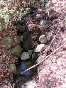
St. Aidan’s Well, Kirkton in Menmuir, Angus

Holy Well:  OS Grid Reference — NO 5339 6413

Also Known as:

  1. St. Iten’s Well 
  2. Canmore ID 35137

Getting Here

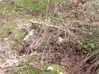
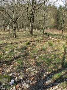
The spring seems to be on a modern property boundary

The spring seems to be on a modern property boundary

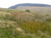
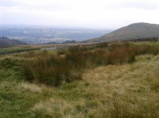
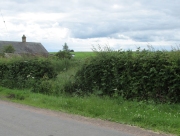
Just before entering Kirkton from Fearn, turn right down the minor road to Lochty. Park up just beyond the southern boundary of the woodland on the left and enter the field on the left, and follow the line of woodland on your left until you come to a break in the barbed wire protected by a tube of sponge rubber. Cross here into the old woodland and keep walking until you reach the top of a slope. Turn 45° to your left and walk down the slope among recently planted trees, and the spring will be seen at the bottom, bubbling into a pond.

 Archaeology and History

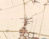
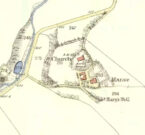
The Well shown on the 1865 6" OS Map

The Well shown on the 1865 6″ OS Map

The well was named after St. Aidan, the first Bishop of Lindisfarne, who died in 651, and whose Saint’s Day is 31st August. It was possibly named by his successor, St. Colman of Lindisfarne, who is believed to have sojourned in the area following the Synod of Whitby in 664

According to Jervise’s Land of the Lindsays, quoted on the Scotland’s Places website:

A fountain near the church, now lost by drainage, long preserved his (St. Aidan’s) name in the metamorphosed form of St. Iten, and was believed to perform miraculous cures on such as were afflicted with asthma and cutaneous diseases’.

The OS Name Book notes;

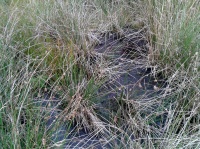
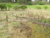
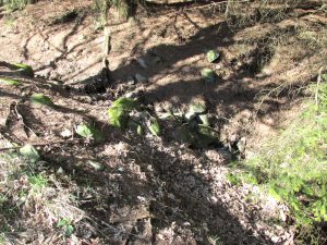
The spring was bubbling vigorously on the day of my visit

The spring was bubbling vigorously on the day of my visit

‘The place where the well was can be seen in the hollow which it has left. The water issues from a spout at the roadside, of which some care seems to have been taken as it is built around’.

Since that was written in the mid nineteenth century, the topography of the vicinity of the well has changed, and no trace of any previous building was visible to me. Prior to my locating the well, I enquired about it from a local who said it had ‘gone’ and no-one knew where it had been.

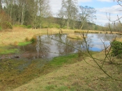
The spring now issues into a recently constructed pond

The spring now issues into a recently constructed pond

On my late winter field visit, the spring was bubbling away strongly, and was deliciously clean tasting.  I felt it had a spirit of its own, which of course it did before the Christian times.  I noticed that the barbed wire surrounding the area of the well had been broken down in a couple of places, and sponge rubber protection put over it. Maybe it is not just Northern Antiquaries who visit, and there are local people who still celebrate the old well….

References:

  1. Forbes, Alexander Penrose, Kalendars of Scottish Saints, Edmonston and Douglas, Edinburgh 1872.
  2. Cardinal Patrick Moran, Irish Saints in Great Britain, M.H.Gill and Son & Browne and Nolan, Dublin, 1879
  3. http://www.scotlandsplaces.gov.uk

© Paul T. Hornby 2016 The Northern Antiquarian


St. Ouret’s Well, Brechin, Angus

Holy Well:  OS Grid Reference – NO 5869 5904

Getting Here

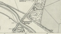
‘Spring’ shown on 1865 map

Travel north towards Brechin on the B9134, and cross the River South Esk at Stannochy Bridge.  Immediately after crossing the bridge, go through the double tubular steel gates to your right, descend the steep slope and walk along the boundary fence dividing the riverside field from the sloping woodland until you reach a tubular steel pedestrian gate. Go through this gate, over the burn and keep walking 150 yards or so to the right and St. Ouret’s Well is seen near the top of the slope.

Archaeology & History

Alexander Penrose Forbes, Bishop of Brechin wrote in 1872 :

Ouret – Close to Brechin, on the north bank of the Esk, near the Stannochy Bridge, is S.Ouret’s Well.”

The spring flows south into a burn then into the river South Esk

Perusal of the 25″ OS map of 1865 shows an enclosure marked ‘spring’ with a short pathway to the north-east, as the only water feature answering the written description. My field visit just over a century and a half later found a spring issuing at that point from the embankment, with the remains of old rough stone walling on either side of the spring. There was no sign of the pathway. The walling around an otherwise unremarkable spring located away from habitation would imply to me that this is the Saint’s Well.

As the good Bishop mentions the Well as the last entry in the Auctaria of his 1872 book—an afterthought as you will—it seems reasonable that the knowledge of St. Ouret and his well may have been at that time on the point of oblivion. The well is not noted as such by the earlier Ordnance Survey map,  nor can I find his name in any other of the hagiographies at my disposal.

Old walling still visible low down

Intriguingly, ‘Ouret’ is a modern Basque surname, and while it is tempting to think of a Basque Holy Man walking the Pictland, the name is more likely a transliteration into Scots from a now lost Pictish or Gaelic name.  There is a mysterious ‘Uoret’ named in the inscription (as interpreted by Elisabeth Okasha) ‘DROSTEN : IRE UORET [E]TT FORCUS’  on the Drosten Stone at St Vigeans, who may be our saint, but this Uoret has been interpreted by Thomas Clancy as the Pictish King Uurad, son of Bargoit, who ruled from 839 to 842.  I know of no reference as to where Forbes obtained his information on Ouret or his well, but is it reasonable to hypothesise that the information was passed to him orally and what he wrote down as ‘Ouret’ may have been meant to be the very similar sounding ‘Uoret’? Or alternately was King Uurad  subjected to local canonisation as St Uoret/Ouret after his death? Can anyone add more?

A mile or so south of here is the holy well of St. Murdoch.

References:

  1. Forbes, Alexander Penrose, Kalendars of Scottish Saints, Edmonston and Douglas: Edinburgh 1872.
  2. Dwelly, Edward, Gaelic – English Dictionary, Garmin Publications: Glasgow 1988

© Paul T. Hornby,  The Northern Antiquarian 2016


Lady Well, Menmuir, Angus

Holy Well:  OS Grid Reference – NO 5835 6623

Also Known as:

  1. Canmore 34976
  2. The Lady’s Well, Chapelton of Dunlappie
  3. The Ladywell, Chapelton of Dunlappie

Getting Here

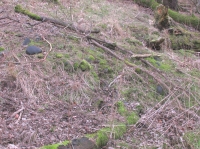
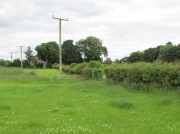
Original position of Lady Well, near the gate

Travelling north along the minor Little Brechin to Reidhall road, take the left fork at the Drumchapel Estate Company sign towards Chapelton Farm, take a sharp left then right turn and the site of the well is through the green metal gate on the left of the road behind the cottage.

Archaeology and History

Andrew Jervise, in 1853 describing the ‘Hermitage of the Chapel of the Blessed Virgin Mary of the Forest of Kilgery’ quotes in his The History and Traditions of the Land of the Lindseys:

“This old chaplainry stood in a field near the farmhouse of Chapelton of Dunlappie. The stones of the chapel were taken to build the farm-steading, and a fine spring, about a hundred and fifty yards south east of the site of the chapel, still bears the name of Ladywell, in honour of the Virgin.”

William Fraser, writing about the Chapel in 1867 wrote:

“The ruins of the Forest Chapel of the Virgin existed till lately in the vicinity of a fine spring, still known as the Lady’s Well.”

This chapel was subsidiary to the Hermitage Notre Domine Maria de Kilgery, situated almost 1½ miles due west on the southern slope of the Brown Caterthun hill-fort.

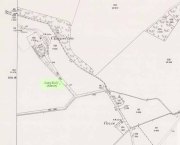
Lady Well on 1865 map

Lady Well now runs into a cistern in front of the gap

The Lady Well is shown on the 1868 Ordnance Survey map as being in the field, with the spring issuing at the roadside as a ‘spout’. Where the Lady Well stood, there is now just a lush patch of grass by the metal gates. On my field visit, I met the farmer, who was totally unaware that there had ever been a holy well. He said that a brick cistern with a wooden lid had been built on the site of the ‘spout’, and that the water was pumped from there to supply the adjoining cottage. He said the water flowed into the cistern from a pre-existing pipe, and never dried up, but he had no idea where the supply originated. So perhaps the flow from the spring was diverted from the site shown on the map when the ruins of the chapel were taken down.

There is now nothing to see above ground of the Chapel or the original Holy Well, and while the nineteenth century quotation above refers to the Well being at Chapelton of Dunlappie, it is now known as Chapelton of Menmuir.

References:

  1. Andrew Jervise, The History and Traditions of the Land of The Lindsays in Angus and Mearns, 2nd Edition, Edinburgh, David Douglas, 1882.
  2. William Fraser, History of The Carnegies, Earls of Southesk, and of Their Kindred,Volume One, Edinburgh, Privately Printed, 1867.
  3. Jervise, A, Notices of the Localities of the Sculptured Stone Monuments at St Vigeans, Inchbrayoch, Pitmuies, and Menmuir, in Angus, and of Fordoun in the Mearns. Part IV. (pp 458-66), Proceedings of the Society of Antiquaries of Scotland, Volume 2, 1855-56.

© Paul T. Hornby 2016, The Northern Antiquarian


Holy Well, Balmossie Den, Broughty Ferry, Angus

Holy Well:  OS Grid Reference – NO 47217 32714

Also Known as:

  1. Cat Craig Well
  2. Cauld Water Wellie
  3. Wishing Well

Archaeology & History

The old Wishing Well or Holy Well of Monifieth, c.1900

This little-known site is thought to be the ‘Well’ that is still marked on modern OS-maps at the grid-reference given here, on the north side of the A92 at Balmossie Bridge, although no names are cited on any of the official maps to confirm this.  When Brotchie & Herd (1980) described the old well in their photo-history of the area, they told that it was found “at Balmossie Den,” adding that

“the area is much overgrown now, but the well still exists.  It is inscribed, ‘Whosoever drinketh of this water shall thirst again T.E. 1847.’  These initials are of Thomas Erskine of Linlathen who had the stone erected on the supposed site of a medieval holy well.”

Just below here used to be the remains of an ancient chapel, which Tom Erskine thought gave this well holy sanctity.  In the late 19th and early 20th century, the site gained repute as a wishing well, where people left offerings for the spirit of the waters in exchange for health and other good deeds.  The area of Broughty Ferry and Monifieth was a seat of the Culdees, with ancient trees and land hereby dedicated to St Bridget and Our Lady, although there remain no extant traditions indicating that this site had any direct associations with such mythic figures.

References:

  1. Brotchie, A.W. & Herd, J.J., Old Broughty Ferry and Monifieth, N.B. Traction: Keighley 1980.

© Paul BennettThe Northern Antiquarian


Come’s Well, Kirkton in Menmuir, Angus

Holy Well:  OS Grid Reference — NO 5302 6479

Also Known as:

  1. St. Colman’s Well

Getting Here

2 low lines of stones mark route of possible pilgrim route to Well

Park up at the Menmuir Village Hall, walk west along the road and after crossing the burn, turn north into the field, following the line of fencing until you reach a stile.  Cross the stile and continue following the fencing until you reach an east-west fence, whereupon turn right and follow that fence until you reach a gap. Come’s Well is on the other side of the fence, issuing into the East Burn of Balfour.

Archaeology and History

Forbes’ Kalendars of Scottish Saints notes, under the entry for St. Aidan, that the church at Menmuir is dedicated to that Saint, adding “In the immediate vicinity is Come’s Well, no doubt named after St. Colman”.

The Well is at the edge of a pine plantation

Apart from this one entry I was unable to find any other reference to this well, so recourse was made to the Ordnance Survey map, which shows one well other than St. Iten’s (Aidan’s) Well at Kirkton. At the site of this well marked on the map there is a modern circular concrete housing. But at the time of my winter field visit, I noticed two lines of stones running north of this well housing, parallel to the burn. They led to what had been a stone lined spring that issued into the burn. Unless anyone can show otherwise, I assume this to be the long lost Come’s Well, originally dedicated to St. Colman, with the lines of stones bordering what had once been the pilgrim path to the well.

Collapsed stone walling around the well

St Colman, whose Saint’s Day is accepted in Scotland as the 18th February, was Irish and was for three years Bishop of Lindisfarne, a near successor of St Aidan. Following his refusal to abandon the Celtic Paschal computation at the Synod of Whitby in 664, Colman resigned the episcopate and retired to Iona. At around this time he seems to have been active in Forfarshire, and is reputed to have founded the church at Fearn (near Kirkton in Menmuir), which he dedicated to St Aidan, placing there some of St. Aidan’s relics that he had transported from Lindisfarne. Colman later returned to Ireland and died in 676.

References:

  1. Forbes, Alexander Penrose, Kalendars of Scottish Saints, Edmonston and Douglas, Edinburgh 1872.
  2. Dom Michael Barrett, A Calendar of Scottish Saints, The Abbey Press, Fort Augustus, 1919
  3. Cardinal Patrick Moran, Irish Saints in Great Britain, M.H.Gill and Son & Browne and Nolan, Dublin, 1879

© Paul T. Hornby 2016 The Northern Antiquarian


Holy Well, Longthorpe, Peterborough, Northamptonshire

Holy Well:  OS Grid-Reference – TL 1678 9815

Also known as:

  1. St. Cloud’s Well

Getting Here

From Thorpe Green, Longthorpe, then take the Larklands road.  Once a copse of trees appears at the front near a T-junction, the well can be accessed to the side of this wood.

Archaeology & History

The well was enclosed in grounds belonging to St John family, an estate laid out in a style similar to the pleasure gardens of Vauxhall. Within these grounds was an 18th century summerhouse, which has now vanished. A distillery was established here by a Doctor Skirmshire, who lived at Longthorpe, for making ‘considerable quantities of lavender and peppermint, cultivated in adjacent fields..’ (Arrowsmith n.d.).

Sadly, there appear to be no ancient records which justify ascribing an ancient date to the Holy Well complex. Indeed, it would appear to be contemporary with the summerhouse. Perhaps it was built to provide a folly-hermitage to support the legend? It is said that the summerhouse was demolished in the mid-ninteenth century because of the disorderly proceedings undertaken in it by visitors from Peterborough! According to Thompson (1913), the dressed stone was used for the kitchen floor of the nearby Manor House.

Thompson gives a plan of the well along with an accurate description, which luckily does not differ from the sight which greets the visitor today (although there is now an ugly metal gate on the structure):

‘The subterranean chambers constitute a medley of design and structure; they are not caves, although now underground, but were apparently first built….

The walls and domed roofs consist of undressed stone. The passage from the pool runs in a direction of N 60 W, and is some six feet long. The entrance being two feet four inches wide by five feet high. The first chamber or antechamber is mostly to the left and nearly at right angles to the passage; it is approximately ten feet by eight feet. In this there is a window high up, evidently a more recent introduction, for the frame is of dressed stone, and the rough stone roof cuts across it, so that external appearance rather than internal use would appear to have been the dominating factor in its design. On the opposite wall of the window is a doorway, and at one time evidently a door, for one stone jamb of dressed stone is left. This doorway opens into the very irregular second or main chamber, roughly twenty feet long, by fifteen feet wide near the widest part. Immediately within the doorway is a well, with dressed stone curb, of three feet internal diameter, and exactly above, in the roof is another smaller circular opening lined with dressed stone as though arranged to draw water from the well from the mound above without going into the chamber, but this is not now open. The well is now choked with stones, but the water used to overflow from the well and run down the passage way to the pool outside, it now flows out oat a lower level leaving the passage way dry. Immediately on the right, after entering the large chamber is am opening leading to a third chamber, smaller, crudely oval, but an indescribable shape, approximately eight to nine feet one way by twelve feet another.

Comparing Thompson’s description and the photograph, one can note a few differences, the main one being that the site in general has become noticeably overgrown. The wall which appears to run along one side has become overgrown and derelict, the pool overgrown, and rubbish-strewn. Within the structure, the curbed well has gone and now one can see the water bubbling from the rock.

Folklore

One side of this is the opening, now blocked up, to a supposed underground passage to Peterborough Cathedral, by which the monks of the Abbey of Burgh, were said to come and bathe in the pool….

To the left of this large chamber, on entering the latter, is a recess some fifteen feet wide and nine feet deep, with a floor consisting essentially of two steps, both apparently of ‘live’ rock, i.e. rock in situ; the upper step being the wider and more like a dais. There is a rather small opening high up on the outer wall of this recess, some five feet from the dais, and is about seventeen inches wide by twenty two feet high, but goes four feet or more in the thickness of the wall or mound without providing an external opening.’

OLYMPUS DIGITAL CAMERAThe site’s greatest fame stems from the tunnel mentioned above by Thompson, which is said to run from the Holy Well to the Abbey at Peterborough. A blocked-up doorway in the third chamber is described as the entrance to this tunnel, although one can imagine that the nature of the whole edifice would lend to such a belief. Certainly records show that the Abbey was supplied by a conduit at the Infirmary end of the Chapel of St Lawrence. However, it is more likely that this took its waters from the St Leonard’s Well at Spital, whose water also filled the Boroughbury Pools and Swan’s Pool.

Yet records show that the Abbey was interested in the site. During Abbot Godfreys tenure, in 1130s the following document states:

Amos ejus viii inclusat porceum Burgi Sumptus iiij I lb: xv sol. Item feat fossutum salveunium inter Thorpe fen et le Dom Sumptus xx sol‘.

Anon 1904-6

OLYMPUS DIGITAL CAMERA OLYMPUS DIGITAL CAMERA OLYMPUS DIGITAL CAMERA


This enclosure cost four pounds and fifteen shillings. Under Abbot Gyerge another document notes the extent of this land (Halywelle), of four acres, three rood and twenty pearches, which until the building of the estate remained the same (Anon 1904-1906). Yet neither of these documents explicitly refers to the laying of a conduit.

The only possible justification for this belief came in November 6th 1964, when workmen, excavating to set up telephone kiosks beside the old Guildhall on Cathedral square, unearthed an underground passage. This continued for twenty five feet under church street, and ran parallel to land belonging to the Almoner’s Garden that was exchanged in the 1194-1200 agreement between the Abbot and the Vicar of Burgh and Longthorpe.  Unfortunately, the underground passage turned out to be some kind of eighteenth century fire precautions.

OLYMPUS DIGITAL CAMERA OLYMPUS DIGITAL CAMERA OLYMPUS DIGITAL CAMERA

Much of the site’s folklore and history derives from a story entitled The Knight of the Red Cross, a story based in the twelfth century, in Richard I’s reign. There is some confusion about the place where this work is published. Thompson (1913)  in his Peculiarities of water and wells states that it is contained within a work called Wild flowers gathered: original pieces in prose and rhyme, printed by J. S. Clarke, with no author or date; whereas  Arrowsmith (n.d) states it comes from a similarly titled, A list of wild flowers found in the neighbourhood of Peterborough, by F. A. Paley. Arrowsmith further notes that the work is advertised on the back of the same author’s Notes on twenty Parish churches round Peterborough, published in 1859. Unfortunately, I have been unable to trace either of these to confirm which is the right source. How much the story is based on any ancient account is unclear. It may be ‘faction’ or fiction, a problem of course with many sites. The applicable parts are produced below as Thompson (1913) notes:

“There is a beautiful spot, called Holywell, in the neighbourhood of Peterborough, well known, and much frequented by the inhabitants. The road lies through a pleasant park, where stands an ancient edifice belonging to the Fitzwilliam family, called Thorpe Hall… After passing the front of this mansion, turn to the left, by the stables and outer buildings will lead, through a white gate, to a small green field from whence this picturesque little spot is seen, with its ivy clad walls, and its dark cypress and yew trees, casting their gloomy shadows around. Passing some broken steps which form the entrance, a shady path conducts to a modern niche, supported by two pilasters, over a slab pavement to a stone basin about six feet in depth and thirty in circumference. This is constantly supplied with clear water, running from the mouth of a subterraneous passage which connects Holywell with the cathedral of Peterborough. An artificial mound of earth is thrown up above this cavity, which is covered with creepers, ground-ivy and a few wild flowers.

Contiguous to the basin are some small fish ponds, partially shaded by beautiful trees; and the green rushes which grow at their bank form undisturbed retreat in which the moor-hen builds her solitary nest. A little further on is a piece of an old pillar, which is gracefully overhung with a wreath of ivy… An old wall surrounding Holywell on two sides, in which traces of windows and doorways are still discernible, is the last feature we shall mention.”

Arrowsmith (n.d) states that these pools have been called ‘Monk’s Stew Ponds’ or ‘Paradise Ponds’, although Arrowsmith considers that the long distance from the Abbey makes it unlikely, as the Abbey was close to good fishing waters  He continues, ‘The waters of this well were formerly in high repute, and were much frequented by those who came on pilgrimages’

Its waters, according to Thompson (1913), are said to be slightly ferruginous, though he detected no sign of it, and nor did I. It was also thought to be efficacious for gout, rheumatism, skin diseases, and good for eyes.

It was believed that a Hermit, called St Cloud, lived at the site. Thompson (1913) continues, quoting J. S. Clarke, that he was ‘of great celebrity, whose pious councils and paternosters were generally in request amongst all pilgrims who visited the spot.’

Some authorities, such as Arrowsmith, have identified this hermit as St Botolph, who is said to have lived within a mile of his chapel during its construction on the Thorpe Avenue site. He is associated with other wells, such as that at Hadstock, Essex, so it is not impossible.

References:

  1. Anonymous, “Holywell,” in Fenland Notes and Queries6, pp.22-4, 1904-6
  2. Arrowsmith, A. L., Longthorpe and its Environs: Microcosm of a Village, privately published: no date.
  3. Bord, J. and C., Sacred Waters, Granada: London 1985.
  4. Thompson, B., “The Peculiarities of Water and Wells,” in Journal of Northants Natural History Society and Field Club18(135), 1913.

Extracted and edited from the original post – Holy & Healing Wells

© R.B. Parish, The Northern Antiquarian


Haly Garden Spring, Burham, Kent

Holy Well:  OS Grid Reference – TQ 731 614

Also known as:

  1. Pilgrim Spring (possibly?)

Getting Here

To find the Pilgrim Spring, the probable site see below, take the road to Blue Bell Hill out of Aylesford and after passing a footpath sign and red house, you will soon come across a farm road. (not signposted with a white gate). Drive or walk up here and the spring heads will be obvious, one beside the drive, one below the derelict farm buildings and a large one above them further along the footpath. An alternative route is via the Coffin Stone off the Burham road past Kits Coty.

Archaeology & History

The location of the Haly Well of Haley Garden, has caused a fair amount of confusion from Kent historians being some discussion has occurred regarding its exact location, although Hale Farm may have taken its name from it. Harris (1719) in his work on Kent Topography notes that a well, that had many virtues, in particular cleansing sin:

“Under Boreham (Burham, Burgham) formerly there was a fountain in this Parish (South Philipot) at a place called Haly or Holy Garden, which was accounted mighty sacred by common people, and had very uncommon virtues ascribed to it, and in the 17th year of King Richard II, The Friars Carmelites of Aylesford obtained a grant by letters Pateill to bring the water from to their monastery.”

Hunter (1811) refers to the friars building an aqueduct from the site.  Finch (1925) believes that the well lay eleven hundred yards due west of the Kewland Wheel Well house. Although, he also states that other authorities believed that this wheel well itself was the site. This belief was discredited, however, when its well shaft was explored: no chambers or tunnels were found to lead off of from it. Sadly, there is no evidence of Great Kewland house, although some house debris down a nearby wooded quarry can be located, although being tightly fenced in, one is unable to find any remains of a well or local knowledge.

Folklore

The possible location for the spring is Pilgrim’s Spring, (TQ 731 614) in the old community of Tottington. Finch (1925) in his a Tramp in Kentish Pilgrim Land describes a pool surrounded by sarsens believed to be of ancient origin:

“Spread around this beautiful spring head in plenteous disorder is a large number of huge stones, some thrown into the bed of the stream, others supporting its margins. Some half buried and peep through the ground. With Cromlech and altar thrown down and heaped around the spring, it is left to our imagination to picture this site of ancient water worship in the dim and distant past. The stone circle appears to have completely encircled the principal spring; hence there are reasonable grounds for concluding that too was devoted to water worship.”

Of course, the description is perhaps tainted by the ‘Druid’ obsession of Victorian antiquarians, so perhaps the stones are natural, although close to recognised ancient monuments. This spring would appear to be a likely watering hole for those visiting the nearby lost shrine of St. Stephen and maybe Halygarden Springs as the stream does travel towards Aylesford. Finch (1925) notes that five springs fed the moat that surrounded the ancient manor, and were according to Dr. Thorpe (1788) quoted by Finch, of petrifying quality so that sticks become encrusted in it. Today one can still trace both the manor and moat despite its dereliction. The springs still exist too, but the number of sarsens associated with them appears to have been reduced, and one would suggest that a number have been dragged from their position and placed on the Coffin Stone.

Another possible site is  a Roman or Ancient Draw Well, (TQ 741 809) According to Finch (1925), there is a legend connecting the well with another that of Kewland by a secret tunnel. Finch (1925) notes that there is:

“…an elm tree and some stones of various sizes, beneath which is a well only some two feet in diameter, but tested to be 113 feet deep. This doubtlessly was sunk for a water supply for the Roman occupants hereabouts.”

Finch (1925) expected that this well was a local myth but was fortunate to find a sixty year old man, who as a boy, used to drop flints down it. He notes that:

“The elm tree is bowed over with age and its sinuous roots have all but closed the entrance to the well, leaving but a tiny aperture through which one could see the rough coping stones. With a little dexterity, one could drop a stone, time its fall, and hear the thus as it fell upon the accumulated debris on the bottom no casual visitor could find the well, even though accurately marked upon a plan, without a guide.”

Certainly, it is unmarked on the present maps, and attempting to uncover its location I was hindered by considerable ivy cover and rubbish. I did locate a large amount of brick and stone debris at one site and possibly remains of a dead elm, but conclusively.

(taken from the forthcoming Holy Wells and Healing Springs of Kent)

Links:  http://www.insearchofholyandhealingwells.wordpress.com

© R.B. Parish, The Northern Antiquarian and Pixyledpublications


Black Prince’s Well, Harbledown, Kent

Holy Well: OS Grid Reference – TR 129 582

Also known as:

  1. Leper Well
  2. St. Thomas’s Well

Getting Here

The Black Prince’s Well is found to the right of a path that curves around past the Leper Hospital / almshouses, and through the forecourt of a house.

Archaeology & History

Black Princes Well

Black Princes Well

Behind the old leper hospital, and to the west of the Church, is the Black Prince’s Well, a holy well of some renown and interest. For Canterbury pilgrims, the well was a significant watering hole before they made the last steps to that great Shrine of St. Thomas. According to Watt (1917) this was the seventh St. Thomas’s Watering at Harbledown. It still bears the alternative name of St. Thomas’s Well, a dedication unlike other sites would seem to be related to be a direct relationship, for it is recorded that he drunk from the well, accidentally leaving a shoe. Understandably, after the martyrdom, this became an important relic, and was held by the Hospital.

The spring emerges at the foot of the hill, enclosed in a six foot high semicircular domed well head made from rag stone. Most interesting a carved stone, in its central apse, depicts the Black Prince’s coat of arms, three feathers taken from the King of Bohemia at Crecy. This stone appears to havebeen possibly derived from another structure rather than being carved especially for the well head, as do the fluted stones shown in earlier photos (cf Goodsall (1968) in his Kentish Patchwork), which are now apparently missing. Either side of the well head are two courses of rag stone walling. The well is reached by a series of stone steps between two courses of stone walling. The water emerges, as a small trickle, through a five inch diameter red clay pipe, flowing to fill a circular basin.

Folklore

The well was noted as being able to cure leprous ailments, and presumably this is why the leper hospital was built in 1084 by Archbishop Lanfranc to exploit its properties. Among its many early pilgrims looking for a cure for this complaint was Edward the Black Prince, who patronised the well twice: the first on his last journey to Canterbury, when he was cured, and then finally, on his death bed in 1376. Unfortunately in this latter case the waters were obviously of no use, being unable to rid him of his syphilis, of which he died. The well subsequently named after the knight. For those unable to drink straight from the well, water was often administered to those living far from it. Evidence for this being the discovery of a leather pouch found near the well. Indeed, even the early part of this century the water was still used, especially by those from afar, for Snowdon Ward (1904) remarks that:

“the water is still in some repute for its curative powers. The sub-prior of the hospital told us that he still occasionally receives small remittances from various parts of the continent…”

Cartwright (1911) illustrates that its local reputation was still current before the Great War. He records that it was:

‘still believed by Country folks to be of great benefit to the eyes.’

Certainly the well is one of the most interesting and enchanting of Kent wells.

(taken from the forthcoming Holy Wells and Healing Springs of Kent)

Links:  http://www.insearchofholyandhealingwells.wordpress.com

© R.B. Parish, The Northern Antiquarian and Pixyledpublications


Gorrick’s Spring, Calverton, Buckinghamshire

Healing Well:  OS Grid Reference – SP 7880 3930

Getting Here

Take the Calverton Road out of Stoney Statford, then take the left hand road to Calverton and look for layby on the right near a copse.

Archaeology & History

Gorrick’s spring is an interesting site and perhaps the best of the county’s holy wells. The water flows from a rather worn lion’s head beneath a stone arch under the steps, and pours into a stone lined chamber repaired with concrete slabs. It is reached by a series of steps from the layby and beside the spring is a narrow and as Rattue (2003) states an uncomfortable seat.

Folklore

It is unclear where the name comes from but a local legend tells how a witch’s pupil gave the sight back to a Gypsy tinker. A rhyme states in Romance around Stoney Stratford quoted by Rattue (2003):

“When Gorrick’s Spring flows fast and clear,
Stoop down and drink, for health is here,
If Gorrick’s Spring shuld e’er run dry,
Beware, for pestilence is nigh.”

Interestingly it did run dry in 1996 as noted in the local Herald of 8th November 1996:

“It’s a mystery,” confessed Calverton resident Lucinda Lourie. She said she realised water levels were currently low, but older residents of the village remembered the spring running through the drought of 1976. She said one wag at Anglian Water had suggested the source of the spring may have been a burst pipe which the Anglian Water work had cured – unlikely since the spring is reputed to have been used by monks in the 13th century!”

An author named Bartley (1928) mentioned by Rattue (2003) in his Holy Wells of Buckinghamshire notes:

 “the monks of old….deemed the delicious waters of this wayside spring as sacred, possessing healing properties for all humans. Daily the holy Friar would hie to the mossy bank and reach the water with his ancient pitcher, and bear it homeward to his suffering flock”

As Rattue (2003) notes it appears unlikely that a friar would have visited the site as there  is no record of any religious institutions connected with the site.

Extracted and amended from the below post (which also discusses St Rumbold’s Well)

http://insearchofholywellsandhealingsprings.wordpress.com/2012/01/12/a-buckinghamshire-field-trip-gorricks-spring-and-st-rumbolds-well/

References:

    1. James Rattue (2003) Holy Wells of Buckinghamshire


St. Peter’s Well, York Minster, North Yorkshire

Holy Well:  OS Grid Reference – SE 6038 5219

Also Known as:

  1. Holy Well, York Minster

Archaeology & History

Old photo of the well

For people who like to visit the sacred sites that determined a cross-over from Earth-based animism to one which ceased sanctifying the Earth, this ancient water source in the cellars beneath York Minster would be a good example.  Sadly, the church has closed off access to this ancient heritage and you can no longer see it.  Yet despite the fact that the modern-day christians have closed off your encounter with this important heritage site (York Minster’s website doesn’t even mention its existence!), we should not forget its mythic history…

As you walk into the building (at some great expense, it has to be said), the location of the holy well is said to be at its more western end, albeit in the crypt underground—although there does seems to be some confusion with some authors about exactly where the well is positioned.

1850 sketch of well

The earliest account we hear of the place relates to when the northern tribal King Edwin, along with his sons Osfrid and Esfrid, came here to be “baptized” in the waters of this clear spring “on Easter day, April 12, 627” CE.  Immediately thereafter a small wooden chapel was constructed next to or above the well.  From then on, as the centuries passed, the renown of the well grew and eventually the magnificent ritual temple of York Minster was eventually built.  The waters eventually became dedicated to St. Peter and an annual festival occurred here soon after the Midsummer solstice on what became known as St. Peter’s Day (June 29).  After the year 1462, a secondary festival date was also given to the site by the Church and another annual celebration occurred here on October 1 too.  Its waters remained accessible to people for drinking, healing and rites throughout the centuries.  It is only now, in the 21st century, that its sacrality and spirit has been closed-off.  This is a situation that must be remedied!


In Mr Goole’s (1850) survey of York Minster, his architectural illustration of the building showed that the water from the well had been brought up onto the ground floor, on the southeast side of the inner cathedral building in the easternmost vestry, and named as St Peter’s Pump.  This is illustrated in the 1850 drawing above-left.

A whole series of early writers mention the well in earlier centuries—of whom a brief sample is given here.  When Celia Feinnes came here in the 17th century, she said that,

“In the vestry of York Minster there is a well of sweet spring water called St Peter’s Well ye saint of ye Church, so it is called St Peter’s Cathedral.” (Smith 1923)

Mr Torre (1719) gave it equal brevity, saying simply that,

“at the south-west corner thereof is a draw-well (called St. Peter’s Well) of very wholesome clear water much drunk by the common people.”

In R.C. Hope’s (1893) national survey of sacred wells, he told that

“There is a draw well with a stone cistern in the eastern part of the crypt of York Minster… The Crypt is about 40 feet by 35 feet.”

The well was even included in Murray’s Handbook to Yorkshire (1892) as being “in the southwest corner of the Minster.” William Smith (1923) included the site in his fine survey, telling his readers that,

“The water is excellent in quality, which in measure, so chemists say, is due to the lime washed into it by the rain from the walls of the Minster.  The water has for centuries been used for baptisms, and is so used today.  The well has now for some years been covered with a pump.”

Folklore

In Geoffrey of Monmouth’s famous early History, we find that King Arthur visited here. …And one final note, about which we know not for certain whether it was relevant to the holy well hiding in the crypt, but a fascinating heathen custom was enacted here in bygone days, almost above the spring.  Mistletoe, as Christina Hole (1950) told,

“was ceremonially carried to the cathedral on Christmas Eve and laid upon the high altar, after which a universal pardon and liberty for all was proclaimed at the four gates of the city for as long as the branch lay upon the altar.”

Mistletoe is one element that is known to have been sacred to the druids (not the present-day druids!) and was sacred to the ancient Scandinavians (who came here), and also possessed the powers of life and death in its prodigious folklore and phytochemistry.  Fascinating…

…to be continued…

References:

  1. Bord, Janet, Cures and Curses: Ritual and Cult at Holy Wells, HOAP: Wymeswold 2006.
  2. Gutch, Mrs, County Folk-lore volume 2 – North Riding of Yorkshire, York and the Ainsty, David Nutt: London 1901.
  3. Hole, Christina, English Custom and Usage, Batsford: London 1950.
  4. Hole, Christina, English Shrines and Sanctuaries, Batsford: London 1954.
  5. Hope, Robert Charles, Legendary Lore of the Holy Wells of England, Elliott Stock: London 1893.
  6. Murray, John, Handbook for Travellers in Yorkshire, J.Murray: London 1874.
  7. Parkinson, Thomas, Yorkshire Legends and Traditions, Elliot Stock: London 1888.
  8. Poole, G.A., An Historical and Descriptive Guide to York Cathedral and its Antiquities, R. Sunter: York 1850.
  9. Purey-Cust, A.P., York Minster, Isbister: London 1898.
  10. Rattue, James, The Living Stream: Holy Wells in Historical Context, Boydell: Woodbridge 1995.
  11. Smith, William, Ancient Springs and Streams of the East Riding of Yorkshire, A. Brown: Hull 1923.
  12. Torre, James, The Antiquities of York, York 1719.
  13. Whelan, Edna, “Holy Wells in Yorkshire – part 1,” in Source, No.3, November 1985.
  14. Whelan, Edna, The Magic and Mystery of Holy Wells, Capall Bann: Chieveley 2001.
  15. Whelan, Edna & Taylor, Ian, Yorkshire Holy Wells and Sacred Springs, Northern Lights: Dunnington 1989.

© Paul Bennett, The Northern Antiquarian