Stock Well, Glasgow, Lanarkshire

Healing Well (lost):  OS Grid Reference – NS 593 648

Also Known as:

  1. Ratten Well

Archaeology & History

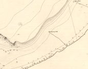
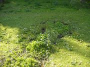
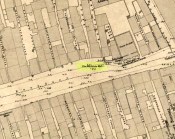
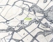
This long lost well near the middle of Glasgow was known by this name as early as 1345.  Close to the River Clyde, a wooden structure was built around the well—a stock—and its waters were used by local fishermen.  A local fair used to be held hereby.  It has long since been built over and its original position no longer seems to be known.

Folklore

The old traditional tale behind this site was written in a short piece in the Scottish Journal of Topography oh so long ago now… One pseudonymous “R.M.S.” said that:

“Stockwell Street in the city of Glasgow, is pretty well-known, and everybody in the locality is aware of the ‘Ratten Well’ with its impure waters.  It is said that, in days of yore, when Sir William Wallace had occasion to be in that quarter, he and his party met a band of englishmen at the well.  A battle ensued, and the bodies of the englishmen, who were defeated, were thrown by the incensed Scots into the well.  “Stock it well! Stock it well” exclaimed Wallace, from which expression the street received its name.  So says tradition; and it is even yet believed that the bad quality of the water is owing to the putrefaction of the dead bodies of the englishmen.”

The one thing we can be certain about in this story, is that the Scots wouldn’t be stupid enough to dump dead bodies into their own fresh water supplies.  We must assume some englishman or dodgy corporation was responsible for that bit!

References:

  1. Bennett, Paul, Ancient and Holy Wells of Glasgow, TNA 2017.
  2. Brotchie, T.C.F., “Holy Wells in and Around Glasgow,” in Old Glasgow Club Transactions, volume 4, 1920.
  3. MacKenzie, Peter, Reminiscences of Glasgow and the West of Scotland – volume 1, John Tweed: Glasgow 1865.
  4. “R.M.S.”, “Stockwell Street, Glasgow,” in Scottish Journal of Topography, Antiquities & Traditions, volume 2, July 8, 1848.

© Paul BennettThe Northern Antiquarian


St. Anne’s Well, Strathaven, Lanarkshire

Holy Well:  OS Grid Reference – NS 7039 4438

Archaeology & History

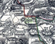
St Anne's Well on 1865 map

St Anne’s Well on 1865 map

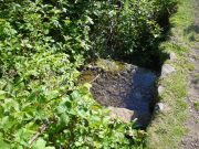
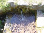
Long since lost it would seem, in a search for this legendary site over the weekend with Gordon, Aisha and Lara, I’m still not certain of the actual status of the site.  Although we found a very fresh water supply still running not far from where the old OS-map showed the original holy well to be, it may be a completely different water source.

There are hardly any references to the spring and those that exist are scant.  In the early 1860s, St. Ane’s Well was mentioned briefly in the Object Name Book of the area:

“This is a good spring well in the southern part of the town of Strathaven.  It is commonly called Tun’s (Tan’s?) Well, but this is an abbreviation of the name.”

Lara plays at a nearby well

Lara plays at a nearby well

Looking down on the waters

Looking down on the waters

More recently, thanks to a communication from the local historian Robert Currie, more information has come to light about the well.  It was described in the local history work by Mary Gebbie (1880).  Mr Currie told me:

“In her Sketches of Avondale and Strathaven…we read: “In a lane off Tod’s Hill was the famous Tann’s Well – obviously a corruption of the celebrated water saint, St. Anne. This spring has within a few years completely dried up. Access was easily had from the castle to it, over the draw-bridge, which is said to have rested on the ledge of the ground and rock on which the fifth house is built south of the bridge. Before this aperture was built up, the inhabitants around took advantage of the pathway for drawing water from the Pomillion, at a place called the Fairy Pool. A little above this comes the Dove Castle; and a half a mile further out is the Gallow Hill.”

He continued:

“That said, the current siting of St. Anne’s Well is located on Lesmahagow Road with (the) site being almost opposite the Council houses bordering on Station Road (there is currently a mini-roundabout near the locus). In recent years the site has become obscured but in my own living memory there was once a plaque authenticating the site and with a garden seat thereby.”

In searching through their own library, Mr Currie and his wife came across more about the site in William Downie’s (1979) book on Strathaven, in which he wrote:

“A small lane off Todshill went down to a cluster of houses called St. Anne’s Well nestling on the sloping ground beside the mill dam. In 1911 these houses were acquired and demolished by the Town Improvement Committee. A row of houses backing backing on to Powmillon Burn were also demolished at the same time and a retaining wall with railings erected, so opening up a very fine view of the castle and burn etc.”

The dedication here to the mythic figure of St. Anne (mother of the Virgin Mary and grandmother of Jesus) is isolated and mysterious.  No church is dedicated to her in the area, nor other relative christian remains.  Her appearance in Strathaven is something of an oddity.  There was a Duchess ‘Ann’ Hamilton of Strathaven Castle who lived 200 yards away at Strathaven Castle on the other side of the river that might have given her name to the well, but this is very unlikely.  More probable is that St. Anne was used as the mythic figure who covered an earlier dedication to the prima mater, or Cailleach—although there are no remains that relate to Her either.  However, the existence of St Mary’s church and an associated well to the north, along with a burn dedicated to a “maiden” in the same parish to the northwest add to the cailleach’s potential…..but all tales of Her have seemingly been forgotten.

…So it seems that the spring of water that Lara, Aisha, Gordon and I came across was obviously not the same place, but exists just below the roadside where the disused railway line is.  It’s close to St Anne’s Well – but is not the same water source.

References:

  1. Downie, Fleming, A History of Avondale and Strathaven, Eric Moore: Glasgow 1979.
  2. Gebbie, Mary, Sketches of the Town of Strathavon and Parish of Avondale: Historical & Traditional, John Menzies: Edinburgh 1880.

Links:

  1. Strathaven Past & Present

Acknowledgements:  Considerable thanks must be given to Robert Currie, BA Hons, who sent us additional information enabling a more informative and accurate site profile for this holy well.  Thanks Bob! Also huge thanks again to Aisha Domleo, Lara Domleo, Unabel Gordon and their frobbling Leonidus!

© Paul BennettThe Northern Antiquarian


Lady Well, Glasgow, Lanarkshire

Holy Well:  OS Grid Reference – NS 60376 65323

Also Known as:

  1. Canmore ID 45037

Getting Here

Lady Well on 1865 OS-map

Lady Well on 1865 OS-map

Get yourself to Glasgow Cathedral—wherein you’ll find St. Mungo’s Well—and walk down John Know Street.  A coupla hundred yards down, across the road is a small street called Ladywell Lane (there’s no signpost for it though), running below the cemetery and leading to the back entrance of the giant Tennent’s Brewery.  At the bottom of this, up against the wall on your left, is the Lady Well.

Archaeology & History

The origins and early traditional history of this once famous sacred well are sadly lost due to the intrusion of industrialism.  It was obviously a place of some considerable repute and lent its name to local quarries and fields hereby.  Used extensively by local people for countless centuries, things were to change in 1715 when the waters of this and other wells were to be kept clean by one John Black, “at a salary of 400 merks yearly.”  The Glasgow historian Eyre-Todd (1934) told that,

“Black was to furnish them with chains, buckets, sheaves, ladles, and other necessary graith, aswell as with locks and iron bands.  He was ‘to cleanse, muck and keep them clean,’ and to lock and open them in due time, evening and morning.  In case of failure he was liable to a penalty of £100 Scots.”

Lady Well in 2015

Lady Well in 2015

Lady Well in 1883

Lady Well in 1883

That’s a helluva lot of money in those days!  Even when M’Ure (1736) described it, only in passing, he had nothing to say about its curative properties or local rites.  Once the Industrialists take control, the ways of local people are sanitized, sterilized and ‘progress’ outlaws tradition.  The only reference to an earlier sacrality is in Mr Russel’s (1883) article, where he said simply, that the Lady Well was “so called after a fountain at the bottom of the Craigs…sacred in Popish times to the Virgin.”

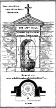
The construction that we see today—of the well in its little enclave—was first built in 1835-6.  The waters became polluted after they were redirected below the Necropolis and have not been used since (although they still flow out of the wall a couple of yards to the right, stinking!).  The architectural feature was cleaned up and restored by the local brewery in 1983.

The site may have gained its name from one Lady Lochow, who lived nearby and built a hospital at the old Gorbels in the 14th century—but we might never know the real truth about the origin of its dedication.  However, an intriguing ingredient relating to the dedication of the Lady Well is the incidence of a St. Anne’s Street that used to exist immediately to the east, as seen on the 1865 OS-map above.  St. Anne may well be the mythic character behind the naming of this Lady Well, although I can find no literature to prove this.  In the christian mythos, St. Anne was a very important character indeed: the mother of the Virgin Mary no less!  However, as hagiographers from Attwater (1965), to Baring-Gould (1898) and Butler (1866) all tell, her biography is piecemeal—which is most surprising considering she was JC’s granny!  Anne’s festival date was July 26 (a couple of days after Sirius enters the northern hemisphere); she was the patron saint of midwives, grandmothers and also miners, who invoked her as the deity who produced gold and silverakin to the Earth Mother Herself!  It’s obvious that Anne’s original mythic nature was subdued, as she represented an archaic root of matriarchal triplicity of the Virgin, the Lady and Old Woman and not the patriarchal triplicity of the incoming christian cult.  The christian mythos at this Lady Well (as elsewhere) replaced one facet of the indigenous prima mater in Glasgow, known as the Cailleach—as shown in her attributes of midwife, grandmother and the deep Earth.  If local historians can find field-names or wells dedicated to the Maiden, the Lady and the Carlin (or their variant titles) nearby, the lost layers of archaic Glasgow’s indigenous animistic folk memories could be mapped out once again…

References:

  1. Attwater, Donald, The Penguin Dictionary of Saints, Penguin: Harmondsworth 1965.
  2. Baring-Gould, S., The Lives of the Saints – volume 8, J.C. Nimmo: London 1898.
  3. Bennett, Paul, Ancient and Holy Wells of Glasgow, TNA 2017.
  4. Brotchie, T.C.F., “Holy Wells in and Around Glasgow,” in Old Glasgow Club Transactions, volume 4, 1920.
  5. Butler, Alba, The Lives of the Fathers, Martyrs and other Principal Saints – volume 7, James Duffy: Dublin 1866.
  6. Eyre-Todd, George, History of Glasgow – volume 3, Jackson: Glasgow 1934.
  7. Greene, E.A., Saints and their Symbols, Sampson Low: London 1897.
  8. MacIntosh, Hugh, The Origin and History of Glasgow Streets, James Hedderwick: Glasgow 1902.
  9. M’Ure, John, History of Glasgow, D. MacVean: Glasgow 1736.
  10. Walker, J. Russel, “‘Holy Wells’ in Scotland,” in Proceedings of the Society of Antiquaries of Scotland, vol.17 (New Series, volume 5), 1883.

© Paul BennettThe Northern Antiquarian


Lady’s Well, Blythborough, Suffolk

Healing Well:  OS Grid Reference – TM 450 762

Also Known as:

  1. Wishing Well
  2. Queen Ann’s Well
  3. Lady’s Fountain

Getting Here

The site is found down Spring Lane at the south end of Henham Park. The current A145 meeting the A12.

Archaeology & History

A large structure is a brick and stone arch and which has two low seats inside, giving the alternative name of Tramp’s or Traveller’s Rest having also brass cups attached to the structure for anyone wishing to drink there. The age of the fabric has said to be mainly 1780, although one view was that it was erected by the first Countess of Stradbrooke in the 19th century and may be that recorded in 1833 in the poem ‘Lady’s Fountain’ poem by Agnes Strickland (the alternative name Lady coming from the Lady Strickland).  Another view is that some of the fabric is 13th century in origin.   The structure is now dry and overgrown, apparently last having water in the 1900s.

ladyswell1

Folklore

The spring is said to be near the reputed to be the place of King Onna’s death (654 AD). This was the battle of Bulcamp where Onna was chased by the Pagan Penda along Kings Lane, a lane which cuts through nearby parishes of Sotherton, Henham and Blyford to here were they stood their ground and he and his son Firminus were killed and buried. The well being erected where the king’s body fell. The legend clearly explains the site’s other alternative name of Queen Anne’s well…Anne being close enough to Onna to be semantically changed over time, and misrepresented as a Queen rather than a King!

References:

  1. R.B. Parish, Holy wells and healing springs of Suffolk (in publication)

Links:

  1. Holy & Healing Wells – A Suffolk Field Trip


Priest’s Well, Tullibody, Clackmannanshire

Holy Well:  OS Grid Reference – NS 86069 95324

Also Known as:

  1. Canmore ID 47056

Getting Here

Priest Well on 1866 map

Priest Well on 1866 map

Along the A907 Stirling to Alloa road, turn onto the B9096 through Tullibody, turning up Menstrie Road until, on your right, you reach the old graveyard.  Walk along the track past the old section and go into the new graveyard. The second pathway down, keep your eyes peeled on the floor and you’ll see it.

Archaeology & History

Just a flat carved stone laid in the expanded graveyard is all that remains to mark the site of this once sacred well.  On it, the inscribed slab reads, “Site of the old Priest’s Well – 1905.”

In the 19th century when the waters were still used by local villagers, Robert Kirk (1890) wrote the following,

Site of the Priests Well

Site of the old well

Carved commemorative stone

Carved commemorative stone

“Like the trees, we will now keep outside the dyke (round the old graveyard) and come to the Priest’s Well.  This well, an adjunct of the ancient building, appears to be coeval with the Old Church, and lay a few yards south of the Parsonage, which was demolished at the Reformation.  A small piece of ground in the immediate vicinity is known as the ‘Priest’s Croft’, and the adjacent field, tradition imagines to be the site of the original hamlet. When this well, from its proximity to the Churchyard, was condemned as unfit for human use, one old wife was heard to exclaim, “Na, na, I aye like a drink o’ the guid sweet priest.”

Despite being cited in the various Scottish holy wells reports, all mythic history of the site seems to have been forgotten.

References:

  1. Morris, Ruth & Frank, Scottish Healing Wells, Alethea Press: Sandy 1982.
  2. Kirk, Robert, Historical Sketch of Tullibody, Alloa 1890.
  3. Royal Commission on the Ancient & Historical Monuments, Scotland, Inventory of Monuments and Constructions in the Counties of Fife, Kinross and Clackmannan, HMSO: Edinburgh 1933.
  4. Simpkins, John Ewart, County Folklore – volume VII: Examples of Printed Folk-Lore Concerning Fife, with some Notes on Clackmannan and Kinross-Shires, Folk-Lore Society: London 1914.
  5. Walker, J. Russel, “Holy Wells in Scotland,” in Proceedings Society Antiquaries Scotland, volume 17, 1883.

© Paul BennettThe Northern Antiquarian


Butter Well, Dollar, Clackmannanshire

Sacred Well:  OS Grid Reference – NN 9610 0018

Getting Here

The marshland of the Butter Well

The marshland of the Butter Well

Take the long uphill road to Castle Campbell and park up at the top.  From here, bear to your right and walk up the footpath onto the hills.  A few hundred yards along you’ll reach a gate and you have the choice of continuing along the path, or dropping down into the small glen and up the other side, towards the ruins of an old settlement called Craiginnin, whose walls you can see from here.  Head there, keeping to the path that leads you to it, going through the first couple of gates and out the other side.  Just above the burn, some very overgrown walling is evident (possibly Iron Age in nature), where excessive Juncus reeds are growing. Amidst this is a boggy pool.  Unless the boggy-land across the burn is the place in question, this is probably the spot!

Archaeology & History

The boggy waters of the well

The boggy waters of the well

There’s very little to see here today other than a murky boggy pool, indicating it hasn’t been used for a long time; although when we visited the place there were several animal tracks into the edge of the pool, indicating that they still drink here.  This implies it has/had some medicinal virtues, but even I wasn’t going to try drinking this!  If there was ever a stone trough here, it too has gone (probably nabbed by a farmer in bygone years) and there seems to be no archaeocentric reference to the place.  The well was described in place-name and folklore accounts, where its waters were used by the people living at this settlement to clean and prepare the butter made by the farmer.

Folklore

The hills, glens and burns of the Ochil range were well-known haunts of fairy folk—and Craiginnan was no exception.  In an early article in the Scottish Journal of Topography, a pseudonymous “J.C.” of “13 Dalrymple Place” (who was it?) told of several dying traditions and, amidst it all, the story behind the Butter Well above Castle Campbell:

“The meadow of Craiginnan, in the vicinity of these hills, was (and still is) famous for the quantities of hay it yearly produces.  Nearly seventy years ago, David Wright rented the farm of Craiginnan.  His servants on cutting the grass of the meadow, were in the custom of leaving it to the management of the fairies.  These aerial beings came from Blackford, Gleneagles, Buckieburn, etc., and assembling on the summit of the Saddlehill descended to their work among the hay.  From morning till evening they toiled assiduously.  After spreading it out before the sun, they put it into coils, then into ricks, when it was conveyed into the adjacent farm-yard, where they built it into stacks.  This kindness of the fairies David Wright never forgot to repay, for, when the sheep-shearing came round, he always gave them a few of the best fleeces of his flock.  He flourished wonderfully, but finding his health daily declining, and seeing death would soon overtake him, he imparted to his eldest son the secret of his success and told him ever to be in friendship with the “gude neebors.”

“The old man died and was succeeded by his son, who was at once hard, grasping and inhospitable.  The kind advices and injunctions given him by his father were either forgotten or unattended to.  Hay-making came round, but young Wright, instead of allowing the “green-goons” to perform what they had so long done (thinking thereby to save a few fleeces), ordered his servants to the work.  Things went on very pleasantly the first day, but on going next morning to resume their labour, what was their surprise to find the hay scattered in every direction.  Morning after morning this was continued, until the hay was unfit for use.  In revenge for this, he destroyed the whole of their rings, ploughed up their green knolls, and committed a thousand other offences.  He had soon reason, however, to repent of these ongoings.

“One day the dairymaid having completed the operation of churning, carried the butter, as was her wont, to the butter well on the east side of the house, to undergo the process of washing, preparatory to its being sent away to the market.  No sooner had she thrown it into the well, than a small hand was laid upon it, and in a second the bright golden treasure disappeared beneath the crystal waters!  The servant tried to snatch it; but alas! it was lost—irrecoverably lost forever! and as she left the place a voice said:

“Your butter’s away’
To feat our band
In the fairy ha’.”

“The horses, cows and sheep sickened and died; and to complete all, Wright, on returning from a Glendevon market, night overtook him in the wild pass of Glenqueich.  He wandered here and there, and at last sunk into a “well-e’e”, in which he perished.  After his death the farmhouse went gradually to demolition and its bare walls are now only to be seen.”

Butter Well site, looking west

Butter Well site, looking west

The place-name ‘Craiginnan’ is thought to derive from the somewhat banal “crags by the anvil-shaped land”, which is grasping at some desperate straws if you ask me!  But it’s also been suggested by Angus Watson (1995) to possibly derive from the “Gaelic Creag Ingheann, maiden crag”, which would acquaint it with the nearby Maiden’s Well and Maiden’s Castle a mile northeast of here—both of which are possessed of their own fairy-lore.  Makes a lot more sense too!

References:

  1. “J.C.”, “Rhymes and Superstitions of Clackmannanshire,” in Scottish Journal of Topography, Antiquities & Traditions, volume 2, Jul 1, 1848.
  2. Simpkins, John Ewart, County Folklore – volume VII: Examples of Printed Folk-Lore Concerning Fife, with some Notes on Clackmannan and Kinross-Shires, Folk-Lore Society: London 1914. p.312
  3. Watson, Angus, The Ochils: Placenames, History, Tradition, PKDC: Perth 1995.

© Paul BennettThe Northern Antiquarian


St. Murdoch’s Well, Brechin, Angus

Holy Well:  OS Grid Reference – NO 5840 5682

Also Known as:

  1. Canmore ID 34760

Location of the Well

Location of the Well

Getting Here

The well is situated at the roadside on a grassed area at West Drum Cottages, to the east of the minor road from Hillhead of Burghill to Westerton of Aldbar, south of Brechin. The spring issues into a small circular pool, which drains as a burn southwards.

Archaeology & History

James Murray Mackinlay wrote in 1904:

“Murdoch – probably the St Mordouch invoked among the martyrs of the Dunkeld Litany……if we may believe Dempster [Thomas Dempster, 1579-1625 – Historia Ecclesiastica Gentis Scotarum, “Ecclesiastical History of the Scottish Nation.” Bologna 1627], who says that he was a hermit, and had a humble cell near a certain lake in Argyll, his cell being called Kilmurdah. Dempster further says that there was a life of the saint in nine lections, and that the events narrated in it were depicted on the walls of his cell. He is described as the last of the bards, and is said to have lived about 800 a.d.”

Dom Michael Barrett described Murdoch as a bishop, and wrote further in 1919 :

“No very reliable particulars can be ascertained as to the life of this saint. Traces of the honour shown to him are to be found in Forfarshire, the district which seems to have been the scene of his missionary labours. At Ethie, in the parish of Inverkeilor, in that county, are the remains of an ancient church and burial-ground which bear his name.”

Near Ethiebeaton, in the parish of Monifieth, are traces of an old church which goes by the name of ‘Chapel Dockie’. This is believed to be another dedication in honour of St. Murdoch.”

Murdoch may be an anglicisation of either Muireadhach, now Murray, or Muircheartach, which is now Murtough.  Murdoch’s Saint’s day is 2nd September, but 5th October and 23rd December have also been given. And Barrett also writes of a Saint Moroc, who, if what Mackinlay writes is correct, may be the same person as St Murdoch.

Looking into the waters

Looking into the waters

The small run-off from the well

The clear waters of the well

The spring was flowing strongly on the sunny February day of my visit, but its neat appearance gives no idea of it being a Saint’s Well to the passing traveller, who would probably think it to be just a pleasant water feature of the garden of the adjacent house. Perhaps there should be some representations made to the local tourist office for a sign to be placed by the well.

A mile or so to the north, hiding at the edge of a small copse of trees, is the little known holy well of St. Ouret.

References:

  1. Barrett, Dom Michael, A Calendar of Scottish Saints, Abbey Press, Fort Augustus 1919.
  2. Forbes, Alexander Penrose, Kalendars of Scottish Saints, Edmonston and Douglas, Edinburgh 1872.
  3. Mackinlay, James Murray, Influence of the Pre-Reformation Church on Scottish Place-Names, William Blackwood and Sons, Edinburgh & London 1904.

© Paul T. Hornby, The Northern Antiquarian 2016


St. Mary’s Well, Lethnot, Edzell, Angus

Holy Well:  OS Grid Reference — NO 5425 6814

Also Known as:

  1. Canmore ID 35005

Getting Here

General view of the site

Turn left in Kirkton of Menmuir towards Bridgend past the giant hillfort and rock art of White Caterthun, cross the Bridge of Lethnot, and continue to the holiday caravan park at Drumcairn, where you can park up.  Walk along the farm track on the south side of the caravan park and enter the field through the steel gate, and keep walking along the edge of the field  until you come to the spring below the old manse.

Archaeology and History

In the Ordnance Survey’s Name Book of 1857, the well is described as:

 ‘…a spring emitting from the foot of a natural bank. There is no built-up well about it.’

Andrew Jervise (1882) writes in his History and Traditions of the Land of the Lindsays,

…the Blessed Virgin was patron of Lethnot, and, during the incumbency of the late Mr Symers, several votive offerings, consisting of pieces of silver money, were found in the fountain near the church, which still bears the name of St.Mary’s Well…”

W.J Watson in his classic The Celtic Place Names of Scotland:

“..in Forfarshire is Navar, now Lethnot and Navar (the parish in which the Well stands)..the first part is doubtless nemed…”

Watson defines ‘nemed‘ as a derivative of nemeton – “a sacred place”, or “an institution originally pagan, taken over by the Church.”

C.P. Will, writes of the parish of Lethnot and Navar, in which the well stands:

Heifers drinking the holy waters
Site on the 1865 map

“..they record the existence here of an early settlement of the Celtic Christian church…Lethnot means Half-churchland, one portion of it, or as we might now say, one of two glebes…while Navar is Churchland-head, the top or extreme part of it, or Glebe-land. The two are complementary as to situation… Ultimately each had its parish church, the buildings being less than a mile apart and in full view one from the other, The “nemet” appearing in both names was a pagan shrine and, as such spots were commonly taken over by the Church on the advent of Christianity, the subsequent Gaelic neimheadh and neimhead came to mean a church site with the lands belonging to the church, latterly accepted as equivalent to glebe.”

On the day of my field visit, the field in which the spring flows was occupied by skittish cattle who spent their time drinking, so I didn’t get close up to it, but it appears that any housing to the spring has been removed.

Visible to the south are the hillforts of White and Brown Caterthun; and 1¾ miles south east of St Mary’s Well, on the southern slope of the Brown Caterthun is the site of the Hermitage Notre Domine Maria de Kilgery, while its sub chapel and adjoining Lady Well of Chapelton in Menmuir are 2¾ miles away to the south-east, which may suggest a pre-Christian ritual landscape dedicated to one of the Earth goddesses.

References:

  1. Jervise, Andrew,  The History and Traditions of the Land of The Lindsays in Angus and Mearns, David Douglas: Edinburgh 1882
  2. Jervise, Andrew, “Notices of the Localities of the Sculptured Stone Monuments at St Vigeans, Inchbrayoch, Pitmuies, and Menmuir, in Angus and of Fordoun in the Mearns – part IV,” in Proceedings Society of Antiquaries of Scotland, volume 2, 1855-56.
  3. Watson, William J., The History of the Celtic Place Names of Scotland, Birlinn: Edinburgh 2004.
  4. Will, C.P., Place Names of Northeast Angus, privately printed: Edzell 1963.

© Paul T. Hornby 2016, The Northern Antiquarian


St. Aidan’s Well, Kirkton in Menmuir, Angus

Holy Well:  OS Grid Reference — NO 5339 6413

Also Known as:

  1. St. Iten’s Well 
  2. Canmore ID 35137

Getting Here

The spring seems to be on a modern property boundary

The spring seems to be on a modern property boundary

Just before entering Kirkton from Fearn, turn right down the minor road to Lochty. Park up just beyond the southern boundary of the woodland on the left and enter the field on the left, and follow the line of woodland on your left until you come to a break in the barbed wire protected by a tube of sponge rubber. Cross here into the old woodland and keep walking until you reach the top of a slope. Turn 45° to your left and walk down the slope among recently planted trees, and the spring will be seen at the bottom, bubbling into a pond.

 Archaeology and History

The Well shown on the 1865 6" OS Map

The Well shown on the 1865 6″ OS Map

The well was named after St. Aidan, the first Bishop of Lindisfarne, who died in 651, and whose Saint’s Day is 31st August. It was possibly named by his successor, St. Colman of Lindisfarne, who is believed to have sojourned in the area following the Synod of Whitby in 664

According to Jervise’s Land of the Lindsays, quoted on the Scotland’s Places website:

A fountain near the church, now lost by drainage, long preserved his (St. Aidan’s) name in the metamorphosed form of St. Iten, and was believed to perform miraculous cures on such as were afflicted with asthma and cutaneous diseases’.

The OS Name Book notes;

The spring was bubbling vigorously on the day of my visit

The spring was bubbling vigorously on the day of my visit

‘The place where the well was can be seen in the hollow which it has left. The water issues from a spout at the roadside, of which some care seems to have been taken as it is built around’.

Since that was written in the mid nineteenth century, the topography of the vicinity of the well has changed, and no trace of any previous building was visible to me. Prior to my locating the well, I enquired about it from a local who said it had ‘gone’ and no-one knew where it had been.

The spring now issues into a recently constructed pond

The spring now issues into a recently constructed pond

On my late winter field visit, the spring was bubbling away strongly, and was deliciously clean tasting.  I felt it had a spirit of its own, which of course it did before the Christian times.  I noticed that the barbed wire surrounding the area of the well had been broken down in a couple of places, and sponge rubber protection put over it. Maybe it is not just Northern Antiquaries who visit, and there are local people who still celebrate the old well….

References:

  1. Forbes, Alexander Penrose, Kalendars of Scottish Saints, Edmonston and Douglas, Edinburgh 1872.
  2. Cardinal Patrick Moran, Irish Saints in Great Britain, M.H.Gill and Son & Browne and Nolan, Dublin, 1879
  3. http://www.scotlandsplaces.gov.uk

© Paul T. Hornby 2016 The Northern Antiquarian


St. Ouret’s Well, Brechin, Angus

Holy Well:  OS Grid Reference – NO 5869 5904

Getting Here

‘Spring’ shown on 1865 map

Travel north towards Brechin on the B9134, and cross the River South Esk at Stannochy Bridge.  Immediately after crossing the bridge, go through the double tubular steel gates to your right, descend the steep slope and walk along the boundary fence dividing the riverside field from the sloping woodland until you reach a tubular steel pedestrian gate. Go through this gate, over the burn and keep walking 150 yards or so to the right and St. Ouret’s Well is seen near the top of the slope.

Archaeology & History

Alexander Penrose Forbes, Bishop of Brechin wrote in 1872 :

Ouret – Close to Brechin, on the north bank of the Esk, near the Stannochy Bridge, is S.Ouret’s Well.”

The spring flows south into a burn then into the river South Esk

Perusal of the 25″ OS map of 1865 shows an enclosure marked ‘spring’ with a short pathway to the north-east, as the only water feature answering the written description. My field visit just over a century and a half later found a spring issuing at that point from the embankment, with the remains of old rough stone walling on either side of the spring. There was no sign of the pathway. The walling around an otherwise unremarkable spring located away from habitation would imply to me that this is the Saint’s Well.

As the good Bishop mentions the Well as the last entry in the Auctaria of his 1872 book—an afterthought as you will—it seems reasonable that the knowledge of St. Ouret and his well may have been at that time on the point of oblivion. The well is not noted as such by the earlier Ordnance Survey map,  nor can I find his name in any other of the hagiographies at my disposal.

Old walling still visible low down

Intriguingly, ‘Ouret’ is a modern Basque surname, and while it is tempting to think of a Basque Holy Man walking the Pictland, the name is more likely a transliteration into Scots from a now lost Pictish or Gaelic name.  There is a mysterious ‘Uoret’ named in the inscription (as interpreted by Elisabeth Okasha) ‘DROSTEN : IRE UORET [E]TT FORCUS’  on the Drosten Stone at St Vigeans, who may be our saint, but this Uoret has been interpreted by Thomas Clancy as the Pictish King Uurad, son of Bargoit, who ruled from 839 to 842.  I know of no reference as to where Forbes obtained his information on Ouret or his well, but is it reasonable to hypothesise that the information was passed to him orally and what he wrote down as ‘Ouret’ may have been meant to be the very similar sounding ‘Uoret’? Or alternately was King Uurad  subjected to local canonisation as St Uoret/Ouret after his death? Can anyone add more?

A mile or so south of here is the holy well of St. Murdoch.

References:

  1. Forbes, Alexander Penrose, Kalendars of Scottish Saints, Edmonston and Douglas: Edinburgh 1872.
  2. Dwelly, Edward, Gaelic – English Dictionary, Garmin Publications: Glasgow 1988

© Paul T. Hornby,  The Northern Antiquarian 2016