Chapel Well, Berryhill, Bankfoot, Perthshire

Holy Well (destroyed):  OS Grid Reference – NO 02179 34749

Also Known as:

  1. Beltane Well
  2. Canmore ID 27045

Getting Here

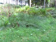
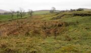
The reeds mark the spot

I accessed the site by parking up at Little Tullybelton, walking up the hill and crossing into the field on the left just north of the wood, then walking due west (crossing barbed wire fences) until dropping down into the valley of the Ordie Burn and following the track into the wood, then, noting where the burn crosses south of the old stone wall. The site of the well is marked by some tussocks of cotton grass. Don’t confuse with a patch of nettles and docks 2-300 hundred yards east where you enter the wood.

Archaeology & History

This well was destroyed about 170 years ago and the site of it is quite hard to find as the land has been turned over to forestry. It was near a chapel and burial ground that were also destroyed by the farmer of the time. The old wall formed part of the boundary of the detached portion or enclave of the neighbouring parish of Methven.

The Reverend Thomas Nelson, Minister of the Parish of Auchtergaven, has this to say in the New Statistical Account of 1845:

‘Superstition formerly invested St Bryde’s, and Chapel Well, and perhaps some others, with a sacred character, and made then places of resort for pious purposes.

‘On the south march of Berryhill Farm, in the same lands of Tullybeagles, there is the site of.. a chapel, where there was a burying-place, where human bones have been recently dug up; and, till of late, the people in the neighbourhood used, on the first Sabbath of May, to drink out of the Holy Well there. This sacred place is on the banks of the Ordie.’

The OS Name Book has the following entry regarding the Well:

‘The site of a Holy Well which has been traditionally associated with the adjacent chapel. The water of this well is now carried by a covered drain into the adjacent stream, and the well filled in‘.

And this regarding the Chapel:

‘The site of an ancient chapel on the north bank of the Ordie Burn, the chapel was demolished and the graveyard rooted up some years ago by the present tenant of the farm, who has pointed out the site, the dedicatory name is not known‘.

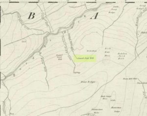
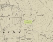
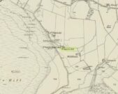
Site shown on 1867 map
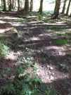
Ancient track to chapel & well

I could find no evidence of the culvert which discharges the waters of the Well into the Burn. What does seem to have been missed is the survival of part of the ancient sunken roadway or pilgrim path to the site, which is still clearly visible.  The fact that it was visited by locals on the first Sabbath in May would point to it having originally been a Beltane well, and therefore of pre-Christian origin.

References:

  1. The New Statistical Account for Auchtergaven, Perthshire, 1845
  2. Ordnance Survey Name Books for Perthshire, 1859-6

© Paul T Hornby 2018


Tun Well, Eccleshill, Bradford, West Yorkshire

Healing Well:  OS Grid Reference – SE 1822 3593

Also Known as:

  1. Tunny Well

Archaeology & History

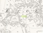
Tun Well, on 1893 map

First mentioned in local history accounts from 1618—as the Tunwells—it was highlighted on the first OS-map of Eccleshill in 1851.  Located on the aptly-named Tunwell Lane, it was a deep well covered by a large flat slab of stone, at the back-end the old Victorian mill.  The stone was put there to prevent children falling into it.  Some old locals thought the name of the place derived from a ‘tun’, or hundred, meaning it to be a hundred feet deep; although as A.H. Smith (1961) tells, tun could equally relate it to be one of Eccleshill’s town wells, of which there were several.  It used to be one of the principal drinking supplies for the village and was said to rarely run dry.  In William Ranger’s (1854) survey, he told this to be one of the sites to which local people relied in times of drought, where the land-owner allowed local folk to collect their supplies.

Folklore

The old cobbled Tunwell Lane was long ago supposed to be the haunt of a phantom black dog: a visionary precursor of death and Underworld guardian. Its spirit came and went into the deep well.  I remember hearing tales of this when I was a young lad, as the old women who worked in the adjacent mills spoke of it.  The ghost of a so-called ‘white lady’ was also said to walk along Tunwell Lane.

In more recent times, Val Shepherd (2002) included this in her short survey of wells in the area as being on “an alignment” with Eccleshill’s Moor Well and Holy Well.  She thought “it may be part of a ley line”, but her alignment is inaccurate and doesn’t hit the spots.

References:

  1. Crapp, H.C. & Whitehead, Thomas, History of the Congregational Church at Eccleshill, Watmoughs: Idle 1938.
  2. Ranger, William, Report to the General Board of Health on a Preliminary Inquiry into the Sewerage, Drainage, and Supply of Water, and the Sanitary Condition of the Inhabitants of the Township of Eccleshill, George Eyre: London 1854.
  3. Shepherd, Val, Holy Wells of West Yorkshire and the Dales, Lepus: Bradford 2002.
  4. Smith, A.H., The Place-Names of the West Riding of Yorkshire – volume 3, Cambridge University Press 1961.

© Paul BennettThe Northern Antiquarian


Tammie Blair’s Well, Dunblane, Stirlingshire

Healing Well (destroyed):  OS Grid Reference – NN 780 010

Archaeology & History

Which one is Tammie Blair’s Well?

It’s difficult to work out the exact position of this lost well, even from Alexander Barty’s (1944) description of the place.  There are several unnamed ‘Wells’ on the early OS-maps very close to where this one was said to be, but in the end I’m relying on (sort of) educated guesswork regarding its precise location.  Please forgive my ineptitude here…

That aside, it’s another water source that has long since gone and is only remembered thanks to Mr Barty’s excellent local history research in the first-half of the 20th century.  He told us:

“This well stood beside the path which leads from the Bridgend up the right bank of the Allan to the Haugh.  A drawer of water at one time had to go down about 15 steps to the well.  It may have been constructed after the making of the railway, as previously a little burn flowed from the Bridgend west of the railway down to the Allan, the lower part of which is still open next Willowbank House.  This well may therefore have been made by the Railway Company to supply dwellings in Bridgend.  It took its name from a man, Blair, who had charge of the railway gates there prior to the erection of the iron footbridge over the railway line.”

It may be the ‘Well’ marked lower-centre on the above 1863 OS-map above.  But I aint sure.

References:

  1. Barty, Alexander B., The History of Dunblane, Eneas Mackay: Stirling 1944.

Acknowledgements:  Huge thanks to the staff at Dunblane Library for their help.

© Paul BennettThe Northern Antiquarian


Swithins Well, Rothwell, West Yorkshire

Healing Well (destroyed):  OS Grid Reference – SE 3442 2686

Also Known as:

  1. St. Swithin’s Well

Archaeology & History

Swithins Well on 1854 map

Highlighted in the fields on the south-side of Rothwell village on the 1854 OS-map, Swithin’s Well was, according to historian Andrea Smith (1982), previously known as a holy well, dedicated to the obscure Saxon saint of the same name.  Although no ‘well’ relating to St Swithin comes from any early texts, the field and farmhouse of ‘Swithins’ were cited in records from the Cartulary of Nostell Priory in 1270 CE; then subsequently in a variety of records throughout the 14th, 15th and 16th centuries.  According to Miss Smith (1982),

“The first recording of St Swithin’s Well, Rothwell…was on an estate map of 1792 (‘Plan of St. Clement’s lands in the parish of Rothwell in the County of York, two-third part of the tithes of corn and grain of which belong to the King in right of His Ducky of Lancaster’, PB), and the field-names arising from it—Swithin’s, Swithin’s Barn, Swithin’s Lane Close—serve to give an indication of the well’s past importance as a local landmark.”

When she visited the site around 1980, she reported finding,

“several wet patches running in a line westwards downhill, but the farmer’s wife seemed certain that this was a broken drain and nothing else could be seen in that field or neighbouring ones, which could have been the well.”

Very recently, the Wakefield pagan and antiquarian Steve Jones went to see if the well or any remains of it could still be seen and told us:

“We went looking for the well down a footpath but it was obviously filled in when a colliery was nearby in the early 20th century and (there is) no trace of any spring now.”

Another one’s bitten the dust, as they say…..

But we must note that the grand place-name authority, A.H. Smith (1962) found no references to St. Swithin here and instead suggested the name derived from the old Norse word, sviðinn, ‘land cleared by burning’, which is echoed in the old local dialect word swithen, ‘moorland cleared by burning’ (Smith 1956), and similarly echoed in Joseph Wright’s (1905) magnum opus, where—along with meaning ‘crooked, warped’—it means “to burn, superficially, as heather, wool, etc.”   There is also a complete lack of any mention to the saintly aspects of this place in John Batty’s (1877) primary history book on Rothwell parish, and yet he cites numerous other springs and wells in the region that have fallen out of history.

References:

  1. Batty, John, The History of Rothwell, privately printed: Rothwell 1877.
  2. Jones, Steve, Personal communication, Facebook 27.08.2018.
  3. Rattue, James, “The Wells of St Swithun,” in Source, Summer 1995.
  4. Smith, Andrea, “Holy Wells Around Leeds, Bradford & Pontefract,” in Wakefield Historical Journal 9, 1982.
  5. Smith, A.H., The Place-Names of the West Riding of Yorkshire – volume 2, Cambridge University Press 1961.
  6. Smith, A.H., English Place-Name Elements – volume 2, Cambridge University Press 1956.
  7. Wright, Joseph, English Dialect Dictionary – volume 5, Henry Frowde: Oxford 1905.

Acknowledgements:  Many thanks to Steve Jones of Wakefield for his informing us about the status of this site.

© Paul BennettThe Northern Antiquarian


St. Patrick’s Well (1), Dunruchan, Muthill, Perthshire

Holy Well:  OS Grid Reference – NN 77905 17365

Getting Here

St Patricks Well on 1863 map

Take the B827 road between Comrie and Braco. If you’re coming via Comrie, going uphill for 3.1 miles (5.1km); but if from Braco Roman Camp go along and eventually downhill for 6.6 miles (10.6km), watching out for the track to Middleton Farm by the roadside.  Walk along for 125 yards, keeping your eyes peeled for the boggy ground below on your left. You’re there!

Archaeology & History

Immediately east of the prodigious megalithic complex of Dunruchan, bubbling up amidst the usual Juncus conglomeratus reeds, are the boggy remnants of St. Patrick’s Well—one of two such sacred wells dedicated to the early Irish saint in Muthill parish. We’re at a loss as to why this Irish dood has such sites in his name in this area.  No doubt some transitional shamanic character was doing the rounds in this glorious landscape, muttering words of some neo-christian animism, eventually settling a mile from the great megalithic complex, perhaps hoping—and failing—to convert our healthy heathen populace into ways unwise.

The shallow boggy waters
The site of St Patricks Well

Whatever he may have been up to, a small stone chapel was built hereby and, it was said, even a christian graveyard, to tempt folk away from the ancient plain of cairns whence our ancestors had long since buried their dead.  But the christian’s chapel and graveyard has long since gone; and when historians before me had visited the place, St Patrick’s Well had also fallen back to Earth in the drier summers, taking the blood of the Earth back into Her body.  The heathen megaliths still remain however, standing proud on the moorland plain in clear sight from these once healing waters, whose mythic history, on the whole, has long since been disregarded….

Folklore

St Patrick’s day on March 17—”a date very near the Spring Equinox,” as Mrs Banks (1939) reminded us—may have been the dates when the waters here were deemed particularly efficacious, although we have nothing in written accounts to tell us for sure. But in the 19th century Statistical Account we find that the site was “much frequented once, as effectual in curing the hooping cough.”  E.J. Guthrie (1885) told of an ancient rite regarding the drinking of the waters for effect of the cure, saying:

“In the course of this century a family came from Edinburgh, a distance of nearly sixty miles, to have the benefit of the well. The water must be drunk before sunrise or immediately after it sets and that out of a “quick cow’s horn”, or a horn taken from a live cow, and probably dedicated to this saint.”

Also in Muthill parish, Guthrie told, St Patrick’s memory was held in such veneration that farmers and millers did not work on his day.

References:

  1. Banks, M. MacLeod, British Calendar Customs: Scotland – volume 2, Folk-lore Society: Glasgow 1939.
  2. Booth, C. Gordon, “St Patrick’s Well (Muthill Parish),” in Discovery & Excavation, Scotland, New Series volume 1, 2000.
  3. Guthrie, E.J., Old Scottish Customs, Thomas D. Morison: Glasgow 1885.
  4. MacKinlay, James M., Folklore of Scottish Lochs and Springs, William Hodge: Glasgow 1893.
  5. Morris, Ruth & Frank, Scottish Healing Wells, Alethea: Sandy 1982.

© Paul BennettThe Northern Antiquarian


St. Bride’s Well, London, Middlesex

Holy Well (covered):  OS Grid Reference – TQ 3157 8111

Archaeology & History

St Brides Well on 1896 map

Close to the centre of that corporate money-laundering place of homo-profanus that is the City of London, was once a site that represents the antithesis of what it has become.  Tacked onto the southeastern side of St. Bride’s church along the appropriately-named Bride Lane, the historian Michael Harrison (1971) thought the Holy Well here had Roman origins.  It “was almost certainly,” he thought,

“in Roman times, the horrea Braduales, named after the man who probably ordered their construction: Marcus Appius Bradua, Legate of Britain under Hadrian, and the British Governer in whose term of office the total walling of London was, in all likelihood, begun.”

This ‘Roman marketplace of Bradua’ that Harrison describes isn’t the general idea of the place though.  Prior to the church being built, in the times of King John and Henry III, the sovereigns of England were lodged at the Bridewell Palace, as it was known.  Mentioned in John Stow’s (1720) Survey of London, he told:

“This house of St. Bride’s of later time, being left, and not used by the Kings, fell to ruin… and only a fayre well remained here.”

The palace was eventually usurped by the building of St. Bride’s church.  The most detailed account we have of St. Bride’s Well is Alfred Foord’s (1910) magnum opus on London’s water supplies.  He told:

“The well was near the church dedicated to St. Bridget (of which Bride is a corruption; a Scottish or Irish saint who flourished in the 6th century), and was one of the holy wells or springs so numerous in London, the waters of which were supposed to possess peculiar virtues if taken at particular times.  Whether the Well of St. Bride was so called after the church, or whether, being already there, it gave its name to it, is uncertain, more especially as the date of the erection of the first church of St. Bride is not known and no mention of it has been discovered prior to the year 1222.  The position of the ancient well is said to have been identical with that of the pump in a niche in the eastern wall of the churchyard overhanging Bride Lane.  William Hone, in his Every-Day Book for 1831, thus relates how the well became exhausted: ‘The last public use of the water of St. Bride’s well drained it so much that the inhabitants of the parish could not get their usual supply.  This exhaustion was caused by a sudden demand on the occasion of King George IV being crowned at Westminster in July 1821.  Mr Walker, of the hotel No.10 Bridge Street, Blackfriars, engaged a number of men in filling thousands of bottles with the sanctified fluid from the cast-iron pump over St. Bride’s Well, in Bride Lane.”  Beyond this there is little else to tell about the well itself, but the spot is hallowed by the poet Milton, who, as his nephew, Edward Philips records, lodged in the churchyard on his return from Italy, about August 1640, “at the house of one Russel a taylor.”

In Mr Sunderland’s (1915) survey, he reported that “the spring had a sweet flavour.”

Sadly the waters here have long since been covered over.  A pity… We know how allergic the city-minds of officials in London are to Nature (especially fresh water springs), but it would be good if they could restore this sacred water site and bring it back to life.

Folklore

Bride or Brigit has her origins in early British myth and legend, primarily from Scotland and Ireland.  Her saint’s day is February 1, or the heathen Imbolc (also known as Candlemas).  Although in christian lore St. Bride was born around 450 AD in Ireland and her father a Prince of Ulster, legend tells that her step-father (more probably a teacher) was a druid and her ‘saintly’ abilities as they were later described are simply attributes from this shamanic pantheon. Legends—christian and otherwise—describe Her as the friend of animals; possessor of a magickal cloak; a magickian and a healer; and whose ‘spirit’ or genius loci became attached to ‘sacred sites’ in the natural world, not the christian renunciation of it.  St Bride was one of the primal faces of the great prima Materknown as the Cailleach: the Gaelic deity of Earth’s natural cycles, whose changing seasons would also alter her names, faces and clothes, as Her body moved annually through the rhythms of the year.  Bride was (and is) ostensibly an ecological deity, with humans intrinsically a part of such a model, not a part from it, in contrast to the flawed judaeo-christian theology.

References:

  1. Foord, Alfred Stanley, Springs, Streams and Spas of London: History and Association, T. Fisher Unwin: London 1910.
  2. Gregory, Lady, A Book of Saints and Wonders, Colin Smythe: Gerrards Cross 1971.
  3. Harrison, Michael, The London that was Rome, Allen & Unwin: London 1971.
  4. McNeill, F. Marian, The Silver Bough – volume 2, William MacLellan: Glasgow 1959.
  5. Morgan, Dewi, St Bride’s Church, Fleet Street, in the City of London, Blackfriars: Leicester 1973.
  6. o’ Hanlon, John, Life of St. Brigid, Joseph Dollard: Dublin 1877.
  7. Sunderland, Septimus, Old London Spas, Baths and Wells, John Bale: London 1915.

© Paul BennettThe Northern Antiquarian


St. Botolph’s Well, Hadstock, Essex

Holy Well: OS Grid Reference — TL 559 448

Getting Here

Hadstock lies along the A1052 north of Saffron Walden. Once in the village, a fenced pond will be apparent on the left below the church.  Just above the pond is the well that feeds it – yet there seems some confusion regarding the exact location of the site.

Archaeology & History

John Wilson in his Imperial Gazetteer, III (1872) describes it as:

“A well set round with stones, and called St. Botolph’s Well, is in the churchyard.”

However, by the time of An Inventory of the Historical Monuments in Essex, I (1916) it was:

“In the churchyard—a well, known as St. Botolph’s well, now covered.”

St Botolph's Well

St Botolph’s Well

Indeed there would be some confusion regarding the exact location of this well.  The church guide describes a pump to the west end of the churchyard as the well (but the only pump apparent was that across the road), however I was informed that this well was the one picturesquely situated by the road beneath the church. This is a brick-lined square well whose spring percolates into a pool covered in duckweed.  No evidence of any material earlier than Victorian is apparent, suggesting it may date from when the pump was established.  A wooden fence has been erected around it to prevent people falling in, but apparently the well itself has been covered.

Folklore

The village has a St. Botolph’s Well although there is no direct link recorded between it and the saint of that name, but local tradition believes that he was interred in this church. This view was supported by the discovery of an empty Saxon grave in the east wall of the South Transept. Greater credence being lent by the fact that this had previously been exhumed, which is in accordance with the knowledge that the relics were removed in 970, and then distributed around East Anglia.

Its waters have had a mixed reputation. Tradition records their ability to cure scrofula. Until recently the well was the important source of drinking water for the village. One tradition suggests that if a ring was dropped into it by a lovelorn girl she would find her true love. This tradition was supported by the finding of two rings recently in the cleaning of the well.  Wilson (1970) notes a strange activity was practiced within living memory by the white witch: to keep the water pure, dead cats were placed down the well.  Obviously, this was not continued for on one occasion the water was the harbinger of a typhoid outbreak, and forty percent of the population—or 40 people—died (although there is no evidence for either). The contamination was the result of the Rev F. E. Smith using the spring as an outlet for his lavatory. If this was not bad enough, one of his staff was a typhoid carrier! This is also notwithstanding, that it was commonly believed that the spring water drains from the graveyard above it: and hence it has earned the name ‘bone gravy’. Despite all these traditions, this did not deter the locals, who vouched for its goodness. Even when piped water was brought to the village in the 1930s, many locals could not see the point as the well water was good enough.

References:

  1. Parish, R.B., Holy Wells and Healing Springs of Essex, Pixy Led Publications 2008.
  2. Royal Commission on Historic Monuments, An Inventory of the Historical Monuments in Essex – volume 1, HMSO: London 1916.
  3. Wilson, John M., The Imperial Gazetteer of England and Wales – volume 3, A. Fullarton: Edinburgh 1872.

Extracted from the R.B. Parish Holy Wells and healing springs of Essex (2008)

Links:

  1. Holy & Healing Wells

© R.B. Parish, The Northern Antiquarian

St. Blane’s Well, Dunblane, Stirlingshire

Holy Well (lost):  OS Grid Reference – NN 781 015

Also Known as:

  1. Bruce’s Well

Archaeology & history

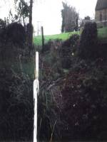
Very little is known about this long-lost site, mentioned just once in Alexander Barty’s (1944) standard history book on Dunblane.  Its exact location is difficult to cite with any certainty, although a ‘Well’ is marked on the 1862 OS-map not far from where Mr Barty proclaimed it to be:

“In the close known as Regent’s Square in Braeport, opposite the public school, was a well called Bruce’s Well and also St Blane’s Well, and probably water from this supplied a well in Cathedral Market Garden to the west.”

Position of St. Blane’s Well?

St Blane is a Celtic saint whom tradition says gave his name to the town and whose festival date is August 10.  In the area of the Allan Water St Blane was said to have set up his cell, which eventually became the prestigious ceremonial temple known as Dunblane Cathedral (although some evidence points to his original settlement being on the higher ground above the cathedral).  Originally born on the Isle of Bute around 565 CE, another St Blane’s Well can be found at Kingarth on his home island.

References:

  1. Armitage, Paul, The Holy Wells of Stirling and District, TNA 2019.
  2. Barty, Alexander B., The History of Dunblane, Eneas Mackay: Stirling 1944.
  3. Towill, Edwin Sprott, The Saints of Scotland, St Andrews Press 2012.

© Paul BennettThe Northern Antiquarian


St. Finglassin’s Well, Kinglassie, Fife

Holy Well: OS Grid Reference – NT 22797 98814

Also Known as:

  1. Canmore ID 52894
  2. St Finglassin’s Well 
  3. St Glass’s Well 

Finglassins Well on early OS-map

Getting Here

In Kinglassie village, from the Main Street follow Redwells Road and turn right where it forks and follow the track until you get to the derelict ground; then turn left up the slope, following the eastern (right hand) edge of the wall up to the well.

Archaeology & History

Under its bower of hawthorn & elder

Sheltered under its bower of hawthorn and elder bushes, at a distance it has the romantic look of an ancient holy well.  But close up, the spring issuing from Finglassins Well shows evidence of having been connected up to the public water supply, with ugly brickwork and pipes obliterating any previous structures that may or may not have existed there. There even seems to be doubt as to its name. Ordnance Survey and Nicolson Street Atlas show it as ‘Finglassins Well’. According to the Canmore citation, which lists it as ‘St Finglassin’s Well’ or ‘St. Glass’s Well’:

This spring is now piped into a trough. There are several boulders nearby but no dressed stone and it is doubtful if there was ever any structure here. It is known by both names.

A well of fine water…

Past industrial despoilation..

So who was the patronal saint, who is remembered variously as Finglassin, Glass, Glascianus, and Glastian? There seems to be some difference of opinion among the various sources, even as to whether any saint existed at all.  Alban Butler, in his Lives of the Saints, tells:

“St. Glastian, Bishop and Confessor in Scotland: HE was a native of the county of Fife, and discharged in the same, during many years, the duties of the episcopal character with which he was honoured. Amidst the desolation which was spread over the whole country, in the last bloody civil war between the Scots and Picts, in which the latter were entirely subdued, St. Glastian was the comforter, spiritual father, and most charitable protector of many thousands of both nations. He died in 830, at Kinglace in Fifeshire, and was particularly honoured in that country, and in Kyntire. According to the ancient custom of that country, his name is frequently written Mac-Glastian, the word Mac signifying son.”

Bishop Forbes of Brechin, writing of St Glascianus in Kalendars of Scottish Saints:

“Of the life of the saint we have no details. The collect in the Breviary runs in these terms – ‘Grant we beseech Thee, Almighty God, that we, who celebrate the anniversary of blessed Glascianus, Thy confessor and bishop, may by the intercession of his devout prayers, be deemed meet to attain to eternal joys through out Lord’ He is known in the parish of Kinglassie (or Kinglassin), near Kirkcaldy, of which frequent mention is made in the Register of Dunfermline.”

In the Old Statistical Account of 1792, Reverend James Reid, writing of the origins of Kinglassie:

“It is the opinion of some, that the name is originally Gaelic, and expressive of the situation; others trace it from a saint, whose name was Glass, and point out a well of fine water, called St. Glass’s well.”

Reverend J.M.Cunnynghame, in the New Statistical Account of 1845 wrote:

“While some have supposed that the village after which the parish is called, derives its appellation from a spring denominated St Glass’s Well, others, with apparently greater reason, have traced the name to Gaelic words signifying the ‘head of grey land’. This idea seems to be corroborated by the large extant of inundated, marshy, and mixed surface which….still stretches itself to the immediate vicinity of the village. The preferable conjecture concerning the the derivation of the name acquires additional support from the circumstance, that a locality, somewhat elevated above the channel, along which the water runs from the swamp alluded to, has received the appropriate designation of ‘Finglassie’ signifying the ‘termination of the gray land, or mixed bog.”

W.J.Watson, in The Celtic Place Names of Scotland gives the derivation of Kinglassie from the gaelic ‘cill glaise’ – ‘church of the brook’, and further:

“A well near the church is known as St Glass’s Well or St Finglassin’s Well. Here again, the stream ‘glais’ on which the church stands has been made into a saint; Findgassin is ‘find glaisín’ – ‘holy streamlet’. Near the church is an eminence called Finmont, for ‘finn monad’, later ‘fionn mhonadh’ – ‘white hill’, here probably ‘holy hill’. The real saint of Kinglassie is unknown.”

A closer view

I am inclined to discount Cunnynghame’s laboured interpretation in view of Watson’s later linguistic analysis, as well as bearing in mind he was a minister of a Kirk that went out of its way to deny and denigrate the native pre-Reformation saints. Because of its position and ambience despite past industrial despoilation, I am inclined to a saintly attribution to the well, which as in so many cases in Scotland has lost its true history owing to the depredations of the Reformation. If Watson’s interpretation of ‘Finmont’, ½ mile north-east of the well, is indeed ‘Holy Hill’ then Finglassins Well may have been a part of an ancient, perhaps heathen ritual landscape.

References:

  1. Reid, James, Parish of Kinglassie, Old Statistical Account, Fife, 1792.
  2. Cunnynghame, J.M. Parish of Kinglassie, New Statistical Account , Fife, 1845.
  3. Butler, Alban, The Lives of the Fathers,Martyrs and Other Principal Saints, James Duffy: Dublin 1866.
  4. Forbes, Bishop A.P., Kalendars of Scottish Saints, Edmiston & Douglas: Edinburgh 1872.
  5. Watson, W.J., The Celtic Place Names of Scotland, (revised edition), Birlinn, Edinburgh, 2004 (originally published 1926).

© Paul T. Hornby 2018


Old Red Well, Knapwell, Huntingdonshire

Healing Well:  OS Grid Reference – TL 3381 6300

Also Known as:

  1. Red Well

Getting Here

If you wish to find it park the car at the church and follow the footpath beside the church and after crossing the stream and style turn right and continue along the woods passing the information centre (where a wooden box holds maps) and then after a few feet one reaches a small clearing and a path leads to the right into the woods. Take this and this will lead to the well.

Archaeology & History

The origin of the name ‘Knapwell’ is unclear: Cnapa may be the name of the first settler, or simply ‘boy’ ‘moneylender’ or even ‘mound’ referring to the earthworks to the end of the present village.  The site is doubtless ancient and probably pre-Christian origin. Interestingly, one wonders whether the boy meaning is the correct one considering another Cambridgeshire site, the Barnwell on the outskirts of Cambridge has the same suggested origin. It may suggest that the local tribes here perhaps washed their infants in its water in a ritual fashion. There is some evidence of wells associated with ritual washing in other locales so it is possible. Knapwell is first mentioned in a will by A.D. 1000, and the settlement is noted in the Domesday Book of 1086 as Chenewelle, being held by Abbot of St Benedict of Ramsey.  However, this was the estate not the well so nothing should be implied from Ramsey Abbey’s ownership.

The spring produces copious but sluggish red water and is protected  by a red brick domed or arched well house similar to those of Holywell and Longstanton. When I visited the well is in fear of collapsing, and had deteriorated over a number of years, but recent pictures suggest it is in better condition.

Folklore

The well was the sole source of freshwater for both Boxgrove and Knapwell parishes and footpaths still lead from both communities to the well. Knapwell was also known as Little Wellesworth indicating the importance of this and The Victoria County History notes for Knapwell:

‘..named from the chalybeate Red Well, supposedly medicinal, in Boxworth Wood just east of the village.’

Like many Chalybeate springs, healing traditions are attached to it but curiously no details are recorded.

The water was well thought of well into the 20th century, for the Parish guidebook, KNAPWELL VILLAGE And The Parish Church of All Saints (1978) notes:

“Within living memory a drinking cup used to hang on the small brick arch over the spot where the spring rises.”

Copyright © Pixyledpublications

Re-posted from the following blog

http://insearchofholywellsandhealingsprings.wordpress.com/2014/08/19/one-for-the-children-or-the-moneylenders-the-old-red-well-of-knapwell/

Forthcoming from Holy Wells and healing springs of Huntingdonshire