Holy Well, Nether Heyford, Northamptonshire

Holy Well (lost):  OS Grid Reference – SP 66 59 (approximate)

Archaeology & History

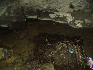
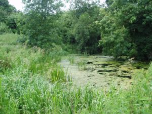
In George Baker’s (1822) massive regional history work he spoke of the village being “well supplied with springs, one of which, called Holywell, is medicinal.”  But it would seem to have fallen foul of that thing called progress, as no one has spoken of it since then.  When the Northampton historian, Beeby Thompson, looked for the site early in the 20th century, his enquiries drew a blank and he reported simply that “at the present time no one in the village appears to know of such a well.”  A field-name survey of the area may prove worthwhile…

References:

  1. Baker, George, The History and Antiquities of the County of Northampton, J.B. Nichols: London 1822.
  2. Harte, Jeremy, English Holy Wells – volume 2, HOAP: Wymeswold 2008.
  3. Thompson, Beeby, “Peculiarities of Waters and Wells,” in Journal Northamptonshire Natural History Society, volume 17, 1914.

© Paul BennettThe Northern Antiquarian

Holy Well, Sulgrave, Northamptonshire

Holy Well (destroyed?):  OS Grid Reference – SP 5549 4574

Also Known as:

  1. Stock Well

Archaeology & History

This seemingly lost holy well was first mentioned by John Morton (1712), who told us that it was the source of the River Tove.  About eighty years later, John Bridges (1791) wrote that,

“In this town was formerly a grange to the monastery of St Andrews in Northampton; and a spring which riseth near the place where this house stood, still retains the name of Halywell Spring.”

Little else was written of the site until H.C. Smith’s (1933) in-depth overview of the famous Washington family (some dood called George apparently) of Sulgrave, where he echoed John Morton’s words that the River Tove “rises from the spring of Holy Well, near the site of the old Grange of St. Andrew’s Priory.”  He told that it was located up Stockwell Lane where an old water-mill was located and “the water for the mill is provided by a large mill-pool fed by a spring known in former times as Holy Well Spring.”  Local historian Beeby Thompson (1914) identified the Stock Well as being the later alternative name for our holy one.

References:

  1. Bridges, John, The History and Antiquities of Northamptonshire, D. Price: Oxford 1791.
  2. Hart, Jeremy, English Holy Wells – volume 2, HOAP: Wymeswold 2008.
  3. Morton, John, The Natural History of Northamptonshire, R. Knaplock: London 1712.
  4. Smith, H. Clifford, Sulgrave Manor and the Washingtons, MacMillan: New York 1933.
  5. Thompson, Beeby, “Peculiarities of Waters and Well,” in Journal Northamptonshire Natural History Society, volume 17, 1914.

© Paul BennettThe Northern Antiquarian

Holy Well, Kislingbury, Northamptonshire

Holy Well (lost):  OS Grid Reference – SP 698 575

Archaeology & History

Hollowell Farm on 1885 map

A mile south of Kislingbury village, just by the roadside is the old Hill Farm.  In times gone by—as the early OS-maps show—a trackway led from here, westwards, for just a few hundred yards, until it reached the old farm of Hollowell Hill, all trace of which has long since gone.  The farm owed its name to the existence of a holy well mentioned briefly in 14th century records in the Cartulary of St. Andrews, Northampton, where it was described as Halywellhille, or the Holy Well on a hill.  All trace of it seems to have been lost.  A ‘Spring’ that is shown on the 1885 map, a few hundred yards south of the old farm, seems to be the closest contender, but it seems more likely that the well was adjacent to, or beneath the farm-building.

References:

  1. Gover, J.E.B., Mawer, A. & Stenton, F.M., The Place-Names of Northamptonshire, Cambridge University Press 1975.

© Paul BennettThe Northern Antiquarian

Market Cross, Aynho, Northamptonshire

Cross (destroyed):  OS Grid Reference – SP 514 332

Archaeology & History

In John Bridges’ (1791) account of the parish of Aynho, he made mention of an old market cross that stood in the village, but even in his day it had been removed and so we know little about it.    Chris Markham (1901) included it in his inventory of crosses, but could find no additional details to those provided by Mr Bridges.  He told us:

“In the seventeenth year of Edward II (1323-4) John de Clavering was lord of the manor of Eynho, and obtained the King’s charter for a weekly mercate, or market, to be held every Tuesday, and a yearly fair on the vigil and day of St. Michael and two days following.  This market was continued until the twentieth year of James I (1622-3), when Richard Cartwright obtained a new charter for holding the market and fair, with the addition of another yearly fair on the Monday and Tuesday after Pentecost.  Bridges, however, writing about 1700, says that the market had been discontinued for some sixty years, and that the market cross had been then long since taken down. Since then the fairs have also sunk into desuetude.”

References:

  1. Bridges, John, The History and Antiquities of Northamptonshire – volume 1, T. Payne: Oxford 1791.
  2. Markham, Christopher A., The Stone Crosses of the County of Northampton, Simpkin Marshall: London 1901.

© Paul BennettThe Northern Antiquarian

Petrifying Well, Guilsborough, Northamptonshire

Sacred Well (lost):  OS Grid Reference – SP 664 733

Archaeology & History

It’s difficult to know precisely which category this site should come under: sacred well or just a healing well.  I’ve opted for ‘sacred’, due to its peculiar and rare properties, i.e., turning things into stone.  For a spring to do such a thing would have been seen by our ancestors as it having some sort of magickal or supernatural ability.  Sadly however, it seems that all trace of this well has long since gone.

It was described only in passing in Peter Hill’s (2005) folklore survey of Northamptonshire, to which he gave no reference. He told us simply,

“Guilsborough had a petrifyiong spring near the Grange, which was ‘good for several diseases.”

None of the early OS-maps of the area show any such ‘well’ immediately in or around Guilsborough’s Grange and so I surmise (perhaps in error) that one of the two ponds to the south of the Grange is fed by the spring in question.  It would be good to know for certain!

References:

  1. Hill, Peter, Folklore of Northamptonshire, Tempus: Stroud 2005.

© Paul BennettThe Northern Antiquarian


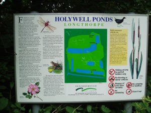
Holy Well, Longthorpe, Peterborough, Northamptonshire

Holy Well:  OS Grid-Reference – TL 1678 9815

Also known as:

  1. St. Cloud’s Well

Getting Here

From Thorpe Green, Longthorpe, then take the Larklands road.  Once a copse of trees appears at the front near a T-junction, the well can be accessed to the side of this wood.

Archaeology & History

The well was enclosed in grounds belonging to St John family, an estate laid out in a style similar to the pleasure gardens of Vauxhall. Within these grounds was an 18th century summerhouse, which has now vanished. A distillery was established here by a Doctor Skirmshire, who lived at Longthorpe, for making ‘considerable quantities of lavender and peppermint, cultivated in adjacent fields..’ (Arrowsmith n.d.).

Sadly, there appear to be no ancient records which justify ascribing an ancient date to the Holy Well complex. Indeed, it would appear to be contemporary with the summerhouse. Perhaps it was built to provide a folly-hermitage to support the legend? It is said that the summerhouse was demolished in the mid-ninteenth century because of the disorderly proceedings undertaken in it by visitors from Peterborough! According to Thompson (1913), the dressed stone was used for the kitchen floor of the nearby Manor House.

Thompson gives a plan of the well along with an accurate description, which luckily does not differ from the sight which greets the visitor today (although there is now an ugly metal gate on the structure):

‘The subterranean chambers constitute a medley of design and structure; they are not caves, although now underground, but were apparently first built….

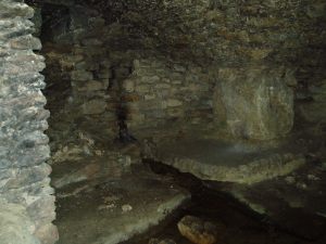
The walls and domed roofs consist of undressed stone. The passage from the pool runs in a direction of N 60 W, and is some six feet long. The entrance being two feet four inches wide by five feet high. The first chamber or antechamber is mostly to the left and nearly at right angles to the passage; it is approximately ten feet by eight feet. In this there is a window high up, evidently a more recent introduction, for the frame is of dressed stone, and the rough stone roof cuts across it, so that external appearance rather than internal use would appear to have been the dominating factor in its design. On the opposite wall of the window is a doorway, and at one time evidently a door, for one stone jamb of dressed stone is left. This doorway opens into the very irregular second or main chamber, roughly twenty feet long, by fifteen feet wide near the widest part. Immediately within the doorway is a well, with dressed stone curb, of three feet internal diameter, and exactly above, in the roof is another smaller circular opening lined with dressed stone as though arranged to draw water from the well from the mound above without going into the chamber, but this is not now open. The well is now choked with stones, but the water used to overflow from the well and run down the passage way to the pool outside, it now flows out oat a lower level leaving the passage way dry. Immediately on the right, after entering the large chamber is am opening leading to a third chamber, smaller, crudely oval, but an indescribable shape, approximately eight to nine feet one way by twelve feet another.

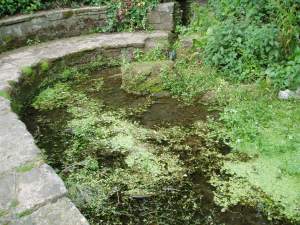
Comparing Thompson’s description and the photograph, one can note a few differences, the main one being that the site in general has become noticeably overgrown. The wall which appears to run along one side has become overgrown and derelict, the pool overgrown, and rubbish-strewn. Within the structure, the curbed well has gone and now one can see the water bubbling from the rock.

Folklore

One side of this is the opening, now blocked up, to a supposed underground passage to Peterborough Cathedral, by which the monks of the Abbey of Burgh, were said to come and bathe in the pool….

To the left of this large chamber, on entering the latter, is a recess some fifteen feet wide and nine feet deep, with a floor consisting essentially of two steps, both apparently of ‘live’ rock, i.e. rock in situ; the upper step being the wider and more like a dais. There is a rather small opening high up on the outer wall of this recess, some five feet from the dais, and is about seventeen inches wide by twenty two feet high, but goes four feet or more in the thickness of the wall or mound without providing an external opening.’
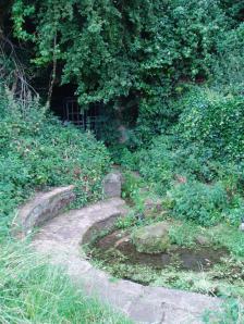
OLYMPUS DIGITAL CAMERAThe site’s greatest fame stems from the tunnel mentioned above by Thompson, which is said to run from the Holy Well to the Abbey at Peterborough. A blocked-up doorway in the third chamber is described as the entrance to this tunnel, although one can imagine that the nature of the whole edifice would lend to such a belief. Certainly records show that the Abbey was supplied by a conduit at the Infirmary end of the Chapel of St Lawrence. However, it is more likely that this took its waters from the St Leonard’s Well at Spital, whose water also filled the Boroughbury Pools and Swan’s Pool.

Yet records show that the Abbey was interested in the site. During Abbot Godfreys tenure, in 1130s the following document states:

Amos ejus viii inclusat porceum Burgi Sumptus iiij I lb: xv sol. Item feat fossutum salveunium inter Thorpe fen et le Dom Sumptus xx sol‘.

Anon 1904-6
OLYMPUS DIGITAL CAMERA OLYMPUS DIGITAL CAMERA OLYMPUS DIGITAL CAMERA


This enclosure cost four pounds and fifteen shillings. Under Abbot Gyerge another document notes the extent of this land (Halywelle), of four acres, three rood and twenty pearches, which until the building of the estate remained the same (Anon 1904-1906). Yet neither of these documents explicitly refers to the laying of a conduit.

The only possible justification for this belief came in November 6th 1964, when workmen, excavating to set up telephone kiosks beside the old Guildhall on Cathedral square, unearthed an underground passage. This continued for twenty five feet under church street, and ran parallel to land belonging to the Almoner’s Garden that was exchanged in the 1194-1200 agreement between the Abbot and the Vicar of Burgh and Longthorpe.  Unfortunately, the underground passage turned out to be some kind of eighteenth century fire precautions.
OLYMPUS DIGITAL CAMERA OLYMPUS DIGITAL CAMERA OLYMPUS DIGITAL CAMERA

Much of the site’s folklore and history derives from a story entitled The Knight of the Red Cross, a story based in the twelfth century, in Richard I’s reign. There is some confusion about the place where this work is published. Thompson (1913)  in his Peculiarities of water and wells states that it is contained within a work called Wild flowers gathered: original pieces in prose and rhyme, printed by J. S. Clarke, with no author or date; whereas  Arrowsmith (n.d) states it comes from a similarly titled, A list of wild flowers found in the neighbourhood of Peterborough, by F. A. Paley. Arrowsmith further notes that the work is advertised on the back of the same author’s Notes on twenty Parish churches round Peterborough, published in 1859. Unfortunately, I have been unable to trace either of these to confirm which is the right source. How much the story is based on any ancient account is unclear. It may be ‘faction’ or fiction, a problem of course with many sites. The applicable parts are produced below as Thompson (1913) notes:

“There is a beautiful spot, called Holywell, in the neighbourhood of Peterborough, well known, and much frequented by the inhabitants. The road lies through a pleasant park, where stands an ancient edifice belonging to the Fitzwilliam family, called Thorpe Hall… After passing the front of this mansion, turn to the left, by the stables and outer buildings will lead, through a white gate, to a small green field from whence this picturesque little spot is seen, with its ivy clad walls, and its dark cypress and yew trees, casting their gloomy shadows around. Passing some broken steps which form the entrance, a shady path conducts to a modern niche, supported by two pilasters, over a slab pavement to a stone basin about six feet in depth and thirty in circumference. This is constantly supplied with clear water, running from the mouth of a subterraneous passage which connects Holywell with the cathedral of Peterborough. An artificial mound of earth is thrown up above this cavity, which is covered with creepers, ground-ivy and a few wild flowers.

Contiguous to the basin are some small fish ponds, partially shaded by beautiful trees; and the green rushes which grow at their bank form undisturbed retreat in which the moor-hen builds her solitary nest. A little further on is a piece of an old pillar, which is gracefully overhung with a wreath of ivy… An old wall surrounding Holywell on two sides, in which traces of windows and doorways are still discernible, is the last feature we shall mention.”

Arrowsmith (n.d) states that these pools have been called ‘Monk’s Stew Ponds’ or ‘Paradise Ponds’, although Arrowsmith considers that the long distance from the Abbey makes it unlikely, as the Abbey was close to good fishing waters  He continues, ‘The waters of this well were formerly in high repute, and were much frequented by those who came on pilgrimages’

Its waters, according to Thompson (1913), are said to be slightly ferruginous, though he detected no sign of it, and nor did I. It was also thought to be efficacious for gout, rheumatism, skin diseases, and good for eyes.

It was believed that a Hermit, called St Cloud, lived at the site. Thompson (1913) continues, quoting J. S. Clarke, that he was ‘of great celebrity, whose pious councils and paternosters were generally in request amongst all pilgrims who visited the spot.’

Some authorities, such as Arrowsmith, have identified this hermit as St Botolph, who is said to have lived within a mile of his chapel during its construction on the Thorpe Avenue site. He is associated with other wells, such as that at Hadstock, Essex, so it is not impossible.

References:

  1. Anonymous, “Holywell,” in Fenland Notes and Queries6, pp.22-4, 1904-6
  2. Arrowsmith, A. L., Longthorpe and its Environs: Microcosm of a Village, privately published: no date.
  3. Bord, J. and C., Sacred Waters, Granada: London 1985.
  4. Thompson, B., “The Peculiarities of Water and Wells,” in Journal of Northants Natural History Society and Field Club18(135), 1913.

Extracted and edited from the original post – Holy & Healing Wells

© R.B. Parish, The Northern Antiquarian


Robin Hood & Little John, Castor, Cambridgeshire

‘Standing Stones’:  OS Grid Reference — TL 1395 9839

Also Known as:

  1. St. Edmund’s Stones

Archaeology & History

1885 OS-map of the site

1885 OS-map of the site

A curious and intriguing site with as many questions about its nature as there is its folklore.  Moved around by the conniving fuckwit politicians from Huntingdonshire, to Northants to Cambridge nowadays, one wonders where those fools will place it next!  Listed by a number of archaeologists as prehistoric standing stones, it seems pretty obvious from photos and the descriptions of many amateur students that—unless some original monoliths have been reworked a few centuries back—the narrative given by local historian W.H.B. Saunders (1888) outlines their more probable origin and history.  That’s not to say that the stones aren’t old—just not that olde…. Mr Saunders reasoned that they were dug and transported from more than 5 miles northwest of their present spot, telling that:

“Nothing can rob the stones of their undoubted antiquity.  The Barnack quarries have been exhausted for the last 600 years at least.  It is evident therefore, that the stones were placed in their present position at a time when the Barnack quarries were being worked.  That would be in the days of Robin Hood, and also when the Abbey of St. Edmund’s Bury, built of Barnack stone, was being erected.”

His words make sense when you look at the stature of the monoliths in question.  They’re cut and squared to the edges, with Robin Hood being the taller of the two stones, about 30 feet southwest of the Little John stone.  They have been written about quite extensively by historians down the centuries, from William Camden onwards.  One early account of the stones was written by Symon Gunton (1686) who told:

“I find in the charter of King Edward the confessor…that the abbot of Ramsey should give to the abbot and convent of Peterburgh 4000 eeles in the time of Lent, and in consideration thereof the abbot of Peterburgh should give to the abbot of Ramsey as much freestone from his pitts in Bernack, and as much ragstone from his pitts in Peterburgh as he should need.

“Nor did the abbot of Peterburgh from these pits furnish only that but other abbies also, as that of St. Edmunds-Bury: in memory whereof there are two long stones yet standing upon a balk in Castor-field, near unto Gunwade ferry; which erroneous tradition hath given out to be draughts of arrows from Alwalton church-yard thither; the one of Robin Hood, and the other of Little John; but the truth is, they were set up for witnesses, that the carriages of stone from Bernack to Gunwade-ferry, to be conveyed to S. Edmunds-Bury, might pass that way without paying toll; and in some old terriars they are called St. Edmund’s stones.  These stones are nicked in their tops after the manner of arrows, probably enough in memory of S. Edmund, who was shot to death with arrows by the Danes.  The balk they stand upon is still call’d St Edmund’s Balk.  They are supposed to be the petrify’d arrows of those two famous archers.”

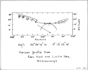
Thom's sketch showing his midwinter alignment

Thom’s sketch showing his midwinter alignment

These traditions have subsequently been copied by all local historians.  So it is something of a curiosity to find our archaeologists—from Clarke (1960) and F.M. Pryor (1972) to Aubrey Burl (1993)—to cite these as prehistoric monoliths.  My suspicions as to their reasons relates to the folklore of the stones which are echoed at many truly prehistoric places like the Devil’s Arrows, etc.  The nature of the tale is an aboriginal creation myth, relating to the formation of sites as understood in animistic mythic structures.  But this archaeological misunderstanding brought the more scientific mathematical mind of Alexander Thom (1990:1) here in the 1980s where coincidence showed a common astronomical alignment.  Thom wrote:

“Clearly visible from the site, at an azimuth of 229°.22 is the lowest point of a low saddle on the horizon.  The col, Fig.1 (above), subtends an arc of about 0°.67 of azimuth, observed minimum altitude 0°.21.  For an estimated temperature of 44°F, correction for refraction at sunset is about 0°.54, and for solar and semi-diameter and parallax of respectively 0°.27 and 0°.002, the ‘observed’ declination is found to be -23°.92, which indicates a date of about 1860 BC.

“No presently obvious horizon marker was evident upon inspection of the open fields forming the horizon, but this does not mean that a foresight was never erected.  Without the evidence of a foresight it cannot be claimed that the two stones were placed for accurate calendrical reasons, but undoubtedly they indicate by themselves the winter solstice.”

The folklore may indicate the possibility that these two medieval standing stones replaced earlier ones, but no remains of such relics exist today.

References:

  1. Burl, Aubrey, From Carnac to Callanish, Yale University Press 1993.
  2. Clarke, R. Rainbird, East Anglia: Ancient Peoples and Places, Thames & Hudson: London 1960.
  3. Gover, J.E.B., Mawer, A. & Stenton, F.M., The Place-Names of Northamptonshire, Cambridge University Press 1975.
  4. Grinsell, Leslie V., Folklore of Prehistoric Sites in Britain, David & Charles: London 1976.
  5. Gunton, Symon, The History of the Church of Peterburgh, Richard Chiswell: London 1686.
  6. Mee, Arthur, Bedfordshire and Huntingdonshire, Hodder & Stoughton: London 1973.
  7. Morton, John, The Natural History of Northampton-shire; with Some Account of the Antiquities – 2 volumes, R. Knaplock: London 1712.
  8. Pryor, F.M., Prehistoric Man in the Nene Valley, Nene Valley Research: Peterborough 1972.
  9. Saunders, W.H.B., Legends and Traditions of Huntingdonshire, Simpkin Marshall: London 1888.
  10. Serjeantson, R.M. (ed.), The Victoria County History of Northamptonshire – volume 2, London 1906.
  11. Thom, Alexander, Thom, A.S. & Burl, Aubrey, Stone Rows and Standing Stones – volume 1, BAR: Oxford 1990.
  12. Thom, A.S., “A Solstitial Site near Peterborough,” in Journal of the History of Astronomy, 11, 1980.

© Paul Bennett, The Northern Antiquarian


Limekiln Field, Pytchley, Northamptonshire

Tumulus (destroyed):  OS Grid Reference – SP 8601 7510

Archaeology & History

According to a Mr Abner Brown (1846), this was one of two prehistoric cemeteries that once existed in Pytchley village, but very little seems to have been written about it.  Found on the north side of the village in the field where an old limekiln once stood, this “apparently pagan” site was “about 350 yards northwards of the church.”  From his brief description it seems that a large barrow here was accompanied by other smaller ones of the same period.  They have all been destroyed.

References:

  1. Brown, Abner W., “On Some British Kistvaens…under the Present Churchyard of Pytchley, Northamptonshire,” in Archaeological Journal, volume 3, 1846.
  2. Royal Commission Ancient & Historical Monuments, An Inventory of the Historic Monuments in the County of Northamptonshire – volume 2, HMSO: London 1979.

© Paul Bennett, The Northern Antiquarian 


Ostor Hill, West Haddon, Northamptonshire

Tumulus (destroyed):  OS Grid Reference – SP 641 715

Also Known as:

  1. Oster Hill

Archaeology & History

At the northeastern edge of Torkington Lodge, nearly a mile east of West Haddon, the antiquarian John Bridge (1791) told of the existence of prehistoric barrow that was still visible here around the year 1720.  Described by the Royal Commission lads (1981), when they visited the site they found that “no trace of a mound exists.” Just a few years earlier the place-name analysts, Gover, Mawer & Stenton (1975)  told that:

“There is a tumulus here and it would seem most likely that the name goes back to Old Scandinavian austr, ‘east’, and haugr, hence “eastern barrow.”

Folklore

Mr J. Bridge (1791) reported how the local people said, “according to vulgar tradition, are buried several officers who fell in battle” within the tumulus.  He also suggested the name of the mound derived from “the tumulus of Publius Ostorius”: a Roman statesman and general who governed Britain from 47-52 AD.

References:

  1. Bridge, John, The History and Antiquities of Northamptonshire – volume 1, Thomas Payne: Oxford 1791.
  2. Gover, J.E.B., Mawer, A. & Stenton, F.M., The Place-Names of Northamptonshire, Cambridge University Press 1975.
  3. Royal Commission on Historical Monuments, England, An Inventory of the Historical Monuments in the County of Northamptonshire – Volume III: Archaeological Sites in North-West Northamptonshire, HMSO: London 1981.

© Paul Bennett, The Northern Antiquarian