Legendary Stone: OS Grid Reference – SU 89745 85392
Also Known as:
- Cookham Stone
- Tarrystone

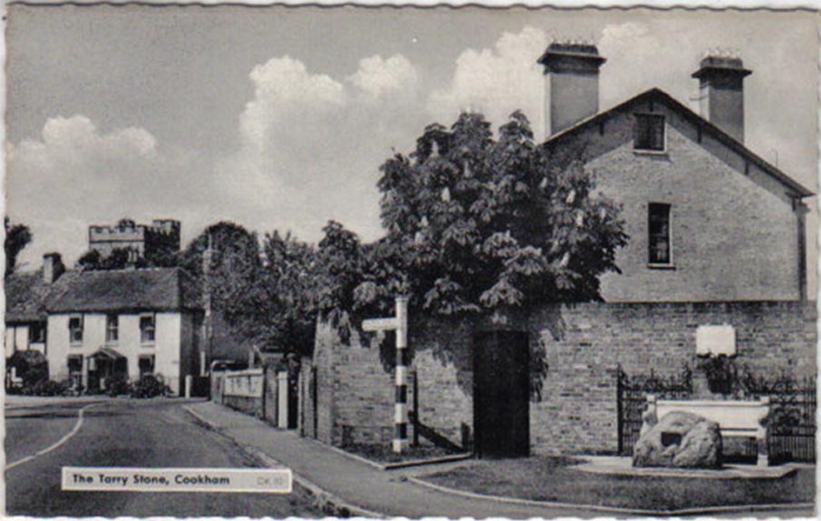
Dead easy! Just about in the middle of the village, by the side of the road where a seat allows the weary walker a chance to sit and rest, the Tarry Stone stands before it, with a plaque on the wall above the seat. The old postcard here shows its situation clear enough!
Archaeology & History
The history of this large rock near the middle of Cookham village is important in the history of the old village, though there is no direct evidence to give it a prehistoric pedigree. It was known to be an ancient boundary stone and is included in perambulation records of the area, where local people would annually walk and redefine the landscape of Cookham: a pastime known across the land, but which fell into disuse in Victorian times. Such perambulations are thought to trace way back into the mythic lands of prehistory — so the Tarry Stone here may well have an archaic provenance.
The known history of the stone was gathered and described in Stephen Darby’s (1899) rare work on the place-name history of Cookham. He wrote:
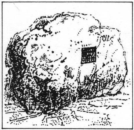
“A stone 3½ ft high, by 4 ft long, and 2½ ft thick. This formerly stood in Cookham village, about two feet from Dodson’s fence, where the roads parted to the church and the ferry. It is now in the Mill Garden at Cookham, where it was removed by the late George Venables when he was church-warden. This stone was formerly known as Cookham Stone.
“A.D. 1506: The tithing man presents that the Warrener ought to hold sports at Cookham Stone on the day of Assumption; and he has not done so (Cookham Manor Court Rolls).
“The stone was originally a boundary stone to the property of the Abbot of Cirencester, whose house was close by, as is shown in the will of John Luffenham, A.D. 1423.”
An old plaque that was once attached to the rock told, “The Tarry Stone at which sports were held before 1507 AD, stood formerly 50 yards NNE and was replaced here AD 1909 by order of the parish council.” The position described “50 yards away” was next to an old pub with the fascinating legendary name of ‘Bel and the Old Dragon’!
Folklore

One of the main reasons this site has been included here is the legendary attachments. When the stone was moved from its original position in 1839 by a certain George Venables, to nearby Mill House Gardens, local people told how the Venable family thereafter were cursed. It was thereafter moved back to its earlier site!
The stone has been suggested as a meteorite — a theme that was echoed in Peter Ackroyd’s Thames (2007), but the Tarry Stone is a regional sarsen rock, albeit peppered with erosion holes, giving a more ‘foreign’ look to it!
Cookham was also the village where the spirit of the god Herne “winds his horn and the music of his hounds can be heard from across the common.” (Yarrow 1974) The stone was also the focal point of village games in earlier centuries.
References:
- Ackroyd, Peter, The Thames: Sacred River, Chatto & Windus: London 2007.
- Darby, Stephen, Place and Field-Names of Cookham, Berkshire, privately printed: London 1899.
- Hallam, Elizabeth, Domesday Heritage, Arrow: London 1986.
- Yarrow, Ian, Berkshire, Hale: London 1974.
© Paul Bennett, The Northern Antiquarian
The map could not be loaded. Please contact the site owner.
