Roms Law, Burley Moor, West Yorkshire

Ring Cairn: OS Grid Reference – SE 13648 44719

Also known as:

  1. Grubstones Circle
  2. Rumbles Law
  3. Rums Law

Getting Here

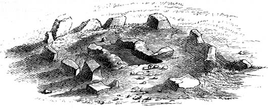
Early drawing of 'Grubstones'
Early drawing of ‘Grubstones’

Get to the Twelve Apostles stone circle, then walk just 100 yards down the main footpath south, towards Bingley, and watch out for a small footpath immediately to your left.  Walk on here and head for the rocky outcrop a half-mile ahead of you.  Once past the outcrop, take the first footpath right and walk down for another 100 yards.  Stop! – and walk into the heather.  The circle’s about 50 yards away!  You can of course come from the Menston side of the moor, following the same directions for the Great Skirtful of Stones, but keep walking on for another 200 yards, towards the rocky outcrop again, turning left down the path for 100 yards, before stopping and walking 50 yards into the heath again!

Archaeology & History
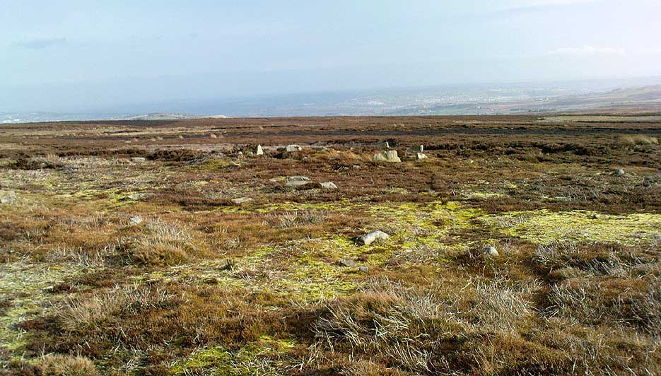
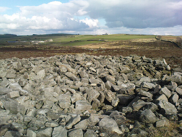
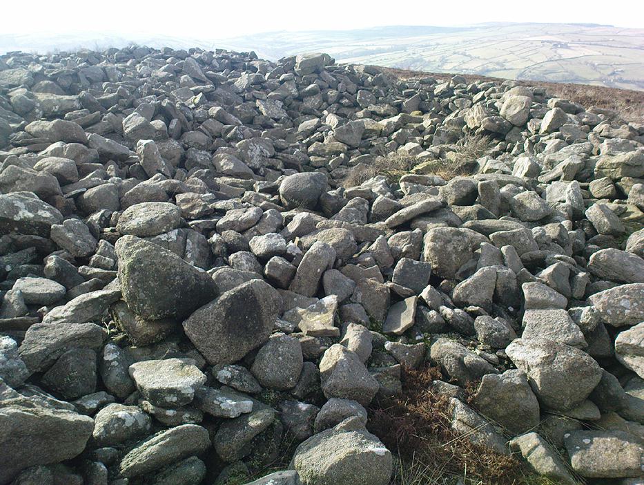
Roms Law circle
Roms Law circle

This is one of my favourite sites on these moors. I’m not 100% sure why – but there’s always been something a bit odd about the place. And I don’t quite know what I mean, exactly, when I say “odd.” There’s just something about it… But it’s probably just me.  Though I assume that me sleeping rough here numerous times in the past might have summat to do with it, playing with the lizards, and of course…the sheep… AHEM!!! Soz about that – let’s just get back to what’s known about the place!

Grubstones is an intriguing place and, I recommend, recovers its original name of Roms or Rums Law.  It was described as such in the earliest records and only seems to have acquired the title ‘Grubstones’ following the Ordnance Survey assessment in the 1850s.  The name derives from two compound words, rum, ‘room, space, an open space, a clearing’; and hlaw, a ‘tumulus, or hill’ – literally meaning here the ‘clearing or place of the dead,’ or variations thereof.  But an additional variant on the word law also needs consideration here, as it can also be used to mean a ‘moot or meeting place’; and considering that local folklore, aswell as local boundary records tell of this site being one of the gathering places, here is the distinct possibility of it possessing another meaning: literally, ‘a meeting place of the dead’, or variations on this theme.

The present title of Grubstones was a mistranslation of local dialect by the Ordnance Survey recorders, misconstruing the guttural speaking of Rum stones as ‘grub stones.’  If you wanna try it yourself, talk in old Yorkshire tone, then imagine some Oxford or London dood coming along and asking us the name of the ring of stones!  It works – believe me….

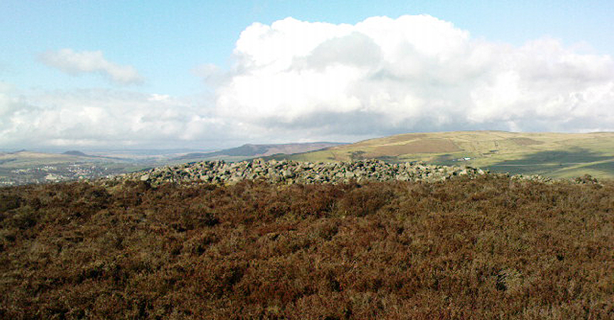
The site has little visual appeal, almost always overgrown with heather, but its history is considerable for such a small and insignificant-looking site.  First described in land records of 1273 CE, Roms Law was one of the sites listed in the local boundary perambulations records which was enacted each year on Rogation Day (movable feast day in Spring).  However in 1733 there was a local boundary dispute which, despite the evidence of written history, proclaimed the Roms Law circle to be beyond the manor of Hawksworth, in which it had always resided.  But the boundary was changed – and local people thenceforth made their way to the Great Skirtful of Stones on their annual ritual walk: a giant cairn several hundred yards east to which, archaeologically, there is some considerable relationship.  For at the northern edge of the Roms Law circle is the denuded remnants of a prehistoric trackway in parts marked out with fallen standing stones and which leads to the very edge of the great cairn.  This trackway or avenue, like that at Avebury (though not as big), consists of “male” and “female” stones and begins – as far as modern observations can tell – several hundred yards to the west, close to a peculiar morass of rocks and a seeming man-made embankment (which I can’t make head or tail of it!).  From here it goes past Roms Law and continues east towards the Great Skirtful, until it veers slightly round the southern side of the huge old tomb, then keeps going eastwards again into the remnants of a prehistoric graveyard close by.

In my opinion, it is very likely that this trackway was an avenue along which our ancestors carried their dead. Equally probable, the Roms Law Circle was where the body of the deceased was rested, or a ritual of some form occurred, before taken on its way to wherever.  It seems very probable that this avenue had a ceremonial aspect of some form attached to it. However, due to the lack of decent archaeological attention, this assertion is difficult to prove.

A previously unrecognised small single tomb is in evidence to the immediate southeast (5 yards) of the circle.  There is also another previously unrecognised prehistoric trackway that runs up along the eastern side of the circle, roughly north-south, making its way here from Hawksworth Moor to the south.  The old legend that Roms Law was a meeting place may relate to it being a site where the dead were rested, along with it being an important point along the old boundary line. Records tell us that the chant, “This is Rumbles Law” occurred here at the end of the perambulation – which, after the boundary change, was uttered at the Great Skirtful.  This continued till at least 1901.

Northern section of the Ring

Modern archaeological analysis of the site is undecided as regards the actual nature of Roms Law.  Ordnance Survey maps show it as an “enclosure” (which is vague); Faull & Moorhouse’s survey (1981) erroneously tell us it had no funerary nature, contrary to Eric Cowling’s (1946) report of finding bones and ashes from the small hole in near the centre of the ring, aswell as the 1880 drawing of the site in Collyer & Turner’s survey (above).  And we find the single cairn on the south-eastern edge of the ring indicating burial rites of sorts definitely occurred here.  Described variously by previous archaeologists as a stone circle, a ring cairn, cairn circle, an enclosure, aswell as “a rubble-fill wall of a circular house” (by some anonymous member of the West Yorkshire Archaeology Service, who didn’t respond to my queries about this curious assumption), the real nature of Roms Law leans more to a cairn circle site.  A fine example of a cup-and-ring stone — the Comet Stone — was found very close to the circle, somewhere along the Grubstones Ridge more than a hundred years ago, and it may have had some relevance to Roms Law.

This denuded ring of stones is a place that has to be seen quite blatantly in a much wider context, with other outlying sites having considerable relationship to it.  Simple as! (If you wanna know more about this, check out my short work, Roms Law, due out shortly!)

Describing the status and dimensions here, our great Yorkshire historian Arthur Raistrick (1929) told that:

“The larger stones still standing number about twenty, but the spaces between them are filled with stones of many intermediate sizes, so that one could with only considerable detail of size, etc, number the original peristalith.”

…Meaning that we’re unsure exactly how many stones stood in the ring when it was first built!  Although a little wider, the Roms Law is similar in form to the newly discovered ‘Hazell Circle‘ not far from here.  The site has changed little since Raistrick’s survey, though some halfwits nicked some of the stones on the southwestern edge of the site in the 1960s to build a stupid effing grouse-butt, from which to shoot the birds up here! (would the local council or local archaeologist have been consulted about such destruction by building the grouse-butt here? – anyone know?)  Thankfully, this has all but disappeared and the moorland has taken it back to Earth.

There is still a lot more to be told of Roms Law and its relationship with a number of uncatalogued sites scattered hereby.  Although it’s only a small scruffy-looking thing (a bit like misself!), its archaeology and mythic history is very rich indeed.  “Watch This Space” – as they say!

Folklore

Alleged to be haunted, this site has been used by authentic ritual magickians in bygone years. It was described by Collyer & Turner (1885) “to have been a Council or Moot Assembly place” — and we find this confirmed to a great extent via the township perambulation records.  Considerable evidence points to an early masonic group convening here in medieval times and we are certain from historical records that members of the legendary Grand Lodge of All England (said to be ordained in the tenth century by King Athelstan) met here, or at the adjacent Great Skirtful of Stones giant cairn 400 yards east.

The boundary perambulations which occurred here on Rogation Day relate to events just before or around Beltane, Mayday.  Elizabeth Wright (1913) said of this date:

“These days are marked in the popular mind by the ancient and well-known custom of beating the parish bounds, whence arose the now obsolete name of Gang-days, and the name Rammalation-day, i.e., perambulation-day, for Rogation-Monday.  The practice is also called Processioning and Possessioning… The reason why this perambulation of the parish boundaries takes place at Rogationtide seems to be that originally it was a purely religious observance, a procession of priest and people through the fields to pray for a fruitful Spring-time and harvest.  In the course of time the secular object of familiarizing the growing generation with their parish landmarks gained the upper hand, but the date remained as testimony to the primary devotional character of the custom.”

And the calling of, “This is Rumbles Law” maintained this ancient custom when it used to be uttered here.

…to be continued…

References:

  1. Bennett, Paul, The Old Stones of Elmet, Capall Bann: Milverton 2001.
  2. Bennett, Paul, The Roms Law Circle, Ilkley Moor, Heathen Earth: Keighley 2009.
  3. Bennett, Paul, The Twelve Apostles Stone Circle, TNA Publications 2017.
  4. Collyer, Robert & Turner, J. Horsfall, Ilkley: Ancient and Modern, William Walker: Otley 1885.
  5. Colls, J.N.M., ‘Letter upon some Early Remains Discovered in Yorkshire,’ in Archaeologia 31, 1846.
  6. Cowling, E.T., Rombald’s Way, William Walker: Otley 1946.
  7. Devereux, Paul, Places of Power, Blandford: London 1989.
  8. Faull & Moorhouse, West Yorkshire: An Archaeological Survey – volume 1, WYMCC: Wakefield 1981.
  9. Gelling, Margaret, Signposts to the Past, Phillimore: Chichester 1988.
  10. Gelling, Margaret, Place-Names in the Landscape, Phoenix: London 2000.
  11. Gomme, G.L., Primitive Folk-Moots; or Open-Air Assemblies in Britain, Sampson Low: London 1880.
  12. Raistrick, Arthur, ‘The Bronze Age in West Yorkshire,’ in YAJ, 1929.
  13. Smith, A.H., English Place-Names Elements – volume 2, Cambridge University Press 1956.
  14. Smith, A.H., The Place-Names of the West Riding of Yorkshire – volume 4, Cambridge University Press 1963.
  15. Speight, Harry, Chronicles and Stories of Old Bingley, Elliott Stock: London 1898.
  16. Wardell, James, Historical Notices on Ilkley, Rombald’s Moor, Baildon Common, etc., Leeds 1869.
  17. Wright, Elizabeth Mary, Rustic Speech and Folk-Lore, Oxford University Press 1913.

© Paul Bennett, The Northern Antiquarian

Ardminish, Gigha, Argyll

Cist:  OS Grid Reference – NR 6495 4890

Also Known as:

  1. Canmore ID 38528

Archaeology & History

When the Scottish Royal Commission lads came here in 1963, they reported seeing

“the remains of a short cist…set into the west side of a small turf-covered knoll some 18 metres north of the schoolhouse at Ardminish.”

It was first found during quarrying operations here, and was thankfully kept pretty well preserved, apart from the western slab, which was dislodged and fell to the foot of the knoll. The cist aligns roughly north-south (the airt, or cardinal virtue of ‘death’ is north) and measured about 3 feet long by 2 feet wide.

References:

  1. Royal Commission on the Ancient & Historical Monuments, Scotland, Argyll: volume 1 – Kintyre,  HMSO: Edinburgh 1971.

© Paul Bennett, The Northern Antiquarian
Stoodley Pike Circle, Mankinholes, West Yorkshire

Ring Cairn (destroyed):  OS Grid Reference – SD 9730 2418

Getting Here

Stoodley Pike is unmissable! Get to either Hebden Bridge or Todmorden – ask someone – then get to it! Nice climb – nice view – excellent moors all round!

Archaeology & History

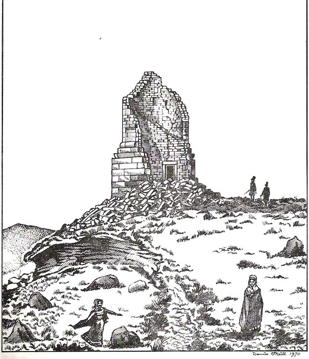
Artist’s impression of Stoodley Pike Circle (bottom left of ruin)

All traces of this site have gone, but local gossip still tells there was once something here. When building work commenced on the huge folly in 1814, in clearing the ground “an accumulation of stones (and)…a quantity of bones” were unearthed. After the huge folly had been built, a curious ritual was made by local Freemasons, from here to the nearby Slake Well. The circle was only a small one, but ideal for the spirit of the ancestor to both look-out from, and fly across the landscape.  In another description of the place from 1832 — wrote E.M. Savage (1974) — local writer and poet, William Law, told how “a rude heap of stones had stood on the site from time immemorial.”

Folklore

Suggested by earlier writers to have been an old beacon site, though evidence for this is uncertain.  The site was said to be a meeting place of the “gude grannies,” who met here and told old stories.  E.M. Savage (1974) told us:

“Another story was that the cairn marked the grave of an old chietain and that the bones of a human skeleton had been found… A contemporary of (William) Law, called Holt…stated that this was so.  Another story was that someone had been murdered and buried there.  Many years later, Law quizzed the workmen.  Bones had been found but no one knew whose bones, or their age, so the mystery remained.

“Yet another story had it that the occupant, presumably owner, of Stoodley, had to keep the original Pike, the cairn, in neat and good order.  If a single stone was out of place, no one could sleep.  The banging of doors and other noises started up, to remind the owner to tidy up the stones.  Elusive flames were to be seen playing round the stones. Sor the stories went.”

As can be seen in the artist’s drawing above, done more than a century after the cairn had been destroyed, a ring of stones is shown just below the remains of the earlier of the Peace Monuments, which today carries the old name of Stoodley Pike.

References:

  1. Booth, Thomas, Ancient Grave Mounds on the Slopes of the Pennine Range, R. Chambers: Todmorden 1899.
  2. Savage, E.M., Stoodley Pike, Todmorden Antiquarian Society 1974.

© Paul Bennett, The Northern Antiquarian

Skirtful of Stones, Horton-in-Ribblesdale, North Yorkshire

Cairn (destroyed):  OS Grid Reference – SD 785 747

Getting Here

Although apparently long gone, we could find this giant prehistoric tomb on the eastern side of the great Ingleborough and was one of many with this name once scattering the mid-Pennines. It was found less than a mile south of the hamlet of Selside, a few miles above Horton-in-Ribblesdale, on the west side of the B6479 and its existence is thankfully preserved in the place-name, ‘Borrens’, where the giant tomb was once found, 200 yards south of Gill Garth Farm.  If you look on the OS-map, you’ll notice an ancient settlement site close by.

Archaeology & History

In 1892, the great Yorkshire historian Harry Speight told us:

“We have no proper account of it, but it was doubtless ransacked and removed in the expectation of finding treasure. It is mentioned…in the Gentleman’s Magazine for 1761, as follows:

‘In the valley above Horton, near the base of this mountain (Ingleborough), I observed a large heap or pile of greet-stones all thrown promiscuously together, without any appearance of building or workmanship, which yet cannot be reasonably thought to be the work of Nature. Few stones are found near it, though ’tis computed to contain 400 of that country cart-loads of stones, or upwards. There is likewise another at the base north-east, in resemblance much the same, but scarce so large.'”

Speight speculated that it may have been raised to commemorate “some dire conflict between the Romans and the native hill tribes, as it lay on the old Roman thoroughfare across Ribblehead to the camp under Smearside.” We may never know this for sure, but there are plenty of Iron- and Bronze Age remains scattering this region – and just a few hundred yards south of this lost cairn are the old remnants of an ancient settlement…whose pages and images (it is hoped) will appear on TNA in the near future…

References:

  1. Smith, A.H., English Place-Name Elements, volume 1, Cambridge University Press 1956.
  2. Smith, A.H., Place-Names of the West Riding, volume 6, Cambridge University Press 1961.
  3. Speight, Harry, The Craven and Northwest Yorkshire Highlands, Elliott Stock: London 1892.

© Paul BennettThe Northern Antiquarian 


Scale House, Rylstone, North Yorkshire

Tumulus:  OS Grid Reference – SD 97088 56870

Getting Here

Pretty simple really.  Go up the B6265 Skipton-Rylstone road for about 3 miles, past the Nettlehole Ridge woodland on your right.  The next turn along to your right, up the track, is Scale House.  Go past this until you get to Scale House Farm.  The remains of the burial mound is in the field to your left, just before the farm.  Knock on the door and ask!

Archaeology & History

This ‘tumulus’ (as it’s marked on the OS-map) was one of the many explored by the legendary reverend William Greenwell (1864) in the middle to latter-half of the 19th century.  His description of the finds at Scale House were considerable; thankfully our old Yorkshire antiquarian Edmund Bogg (1904) shortened it and told us the following:

“The tumulus was 31 feet in diameter and about 7 feet high; it opened from the southeast; the soil immediately under the sod consisting of yellow clay to a considerable depth; then layers of blue clay… Exactly in the centre…at a depth of 7 feet, and on a level with the plane of the field, was found an oak coffin, formed out of a tree, split and hollowed-out, and placed due north and south, the head being placed to the south, as that as the larger part of the tree. After being exposed to the air for about 2 minutes, the bared coffin parted at the sides, and could not be moved except by detached pieces. The body had been wrapped in a cloth or shroud of texture resembling wool and coarsely-woven, of which there was a considerable quantity remaining; but the body itself was dissolved… The interment was considered to be that of an ancient Briton… The learned antiquary said it was the only instance (except the one at Gristhorpe, near Scarborough) where an interment in an oak tree hollowed out had a tumulus placed over it. It was more than 6 feet in length inside and about 7 feet 6 inches outside. The remains were carefully replaced and the mound restored to its former shape; a small leaden tablet being placed within, stating that it had been opened in AD 1864.”

Folklore

Jessica Lofthouse (1976) listed this as one of the places reputed to be an old fairy haunt, wherein “the folk of Scale House discovered a fairy kist or chest.”

References:

  1. Bogg, Edmund, Higher Wharfeland, James Miles: Leeds 1904.
  2. Greenwell, William, British Barrows, Clarendon Press: Oxford 1877.
  3. Lofthouse, Jessica, North Country Folklore, Hale: London 1976.

Links:

  1. Out of Oblivion: Archaeology and Notes – Directions and notices on this once giant tomb.

© Paul Bennett, The Northern Antiquarian

Nixon’s Station, Ilkley Moor, West Yorkshire

Cairn:  OS Grid Reference – SE 11468 45224

Getting Here

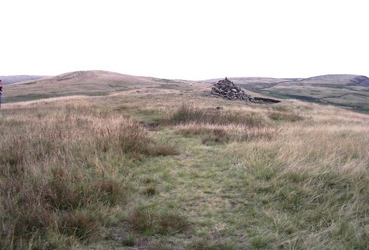
The denuded remains of a once giant tomb

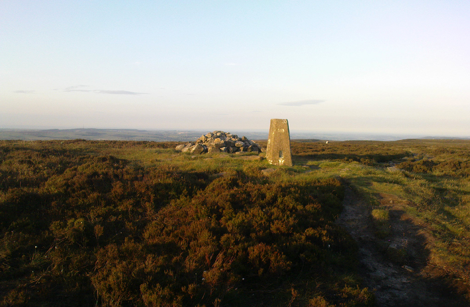
This is the highest point of the moors, 1320 feet up. There’s various ways of getting there: I’d favour the wander up to Twelve Apostles then taking the 15 minute walk west to the triangulation point which marks the spot.  If you reach the large rocky outcrop of the Thimble Stones, you’ve gone too far; although you can walk past the Thimbles, if you’ve started your walk from the two radio masts atop of the moor where the old Roman road hits the dirt-track.  Either way, unless you’re damn stupid, this is an easy spot to find!

Archaeology & History

Although today there’s little to be seen, when Collyer & Turner (1885) described the place it was 175 yards in circumference! Bloody huge! When Harry Speight got here in 1900, it had shrunk slightly to 150 yards. Now however, almost all the stones have been robbed.  I first came here when I was just 11 years old and remember it was a decent size even then – at least as large as the Little Skirtful and Great Skirtful of Stones more than a mile to the east.  Today however, unless you knew it was once a giant cairn, you wouldn’t give it a second look.

It’s quite appalling what’s happened to this site thanks to the sheer ignorance and neglect of the local archaeologist in tandem with his paymasters at Bradford Council: 90% of the site has been utterly vandalised and destroyed as a result of these incompetent idiots in the last 20 years.  Nowadays, all you can make out here is the raised earth for about 10 yards surrounding the trig-point.  It seems that most of the stones that comprised this giant cairn have been taken for use in walling, and to prop up the stupid paved footpaths which the local Council and its affiliated halfwits are slowly building o’er these hills.*  Morons!

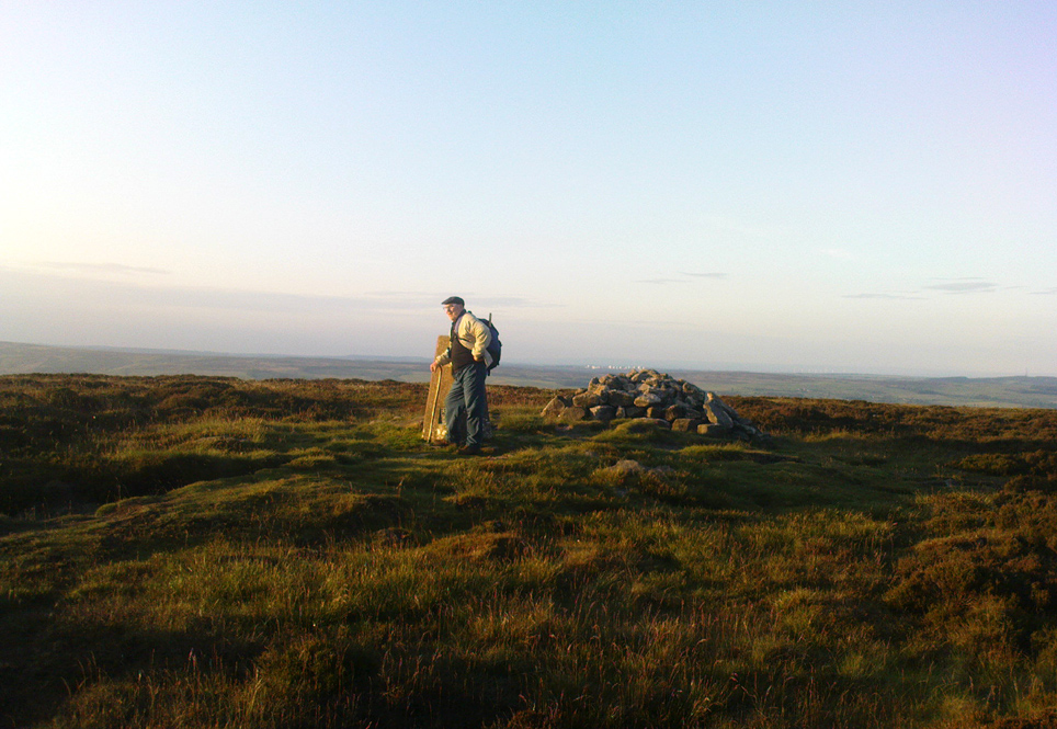
Aar Dave on top o’ t’ moors

I’m not quite sure why it was called Nixon’s Station.  It was J. Atkinson Busfield (1875) who mentioned this name, quite casually in his fine local history work, as if local folk had known it as such for sometime.  There was also an inference of it being the resting place of some old general, but I’ve found nor heard anything more along such lines — though worra superb place for your spirit to roam free…..

If anyone has any old photos of this once giant prehistoric site, it would be good to see it in its old glory once again.  When I wandered up here as a kid, I never carried things like a camera about (being a Luddite by nature!).

References:

  1. Busfield, J.A., Fragments Relating to the History of Bingley Parish, Bradford 1875.
  2. Collyer, R. & Turner, J.H., Ilkley, Ancient & Modern, Otley 1885.
  3. Speight, Harry, Upper Wharfedale, London 1900.

© Paul Bennett, The Northern Antiquarian
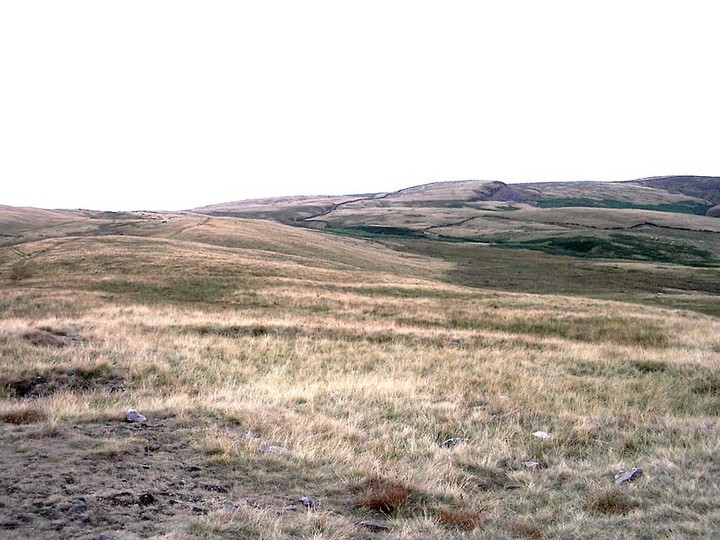
* Anyone know exactly which idiots are responsible for the stone footpaths being laid over the moors here? They’re damn stupid and cause even more erosion and damage to the environment and prehistoric heritage up here, as anyone with an ounce of common sense can see. Can someone please get them stopped!?


Lower Apronful of Stones, Pendle Hill, Lancashire

‘Cairn’:  OS Grid Reference – SD 778 390

Getting Here

Park up at the Nick of Pendle and follow directions to the Devil’s Apronful of Stones, but about halfway along the path, bear to the right along a swerving footpath which eventually takes you to another guiding cairn. On the OS-maps there’s the Chartist’s Well 100 yards due west of this old overgrown tomb.

Archaeology & History

The much-overgrown Lower Apronful, with modern cairn on top
The much-overgrown Lower Apronful cairn

Seemingly excluded from all previous archaeological surveys, this is a very large structure indeed.  Crowned with a small modern cairn on its top marking a small footpath crossing the site, this very large cairn-like structure is about four feet tall at the highest.  I first came across it at the end of August, 2006, after going through some folklore records which then led to exploring the area in the hope that there might be some archaeological ruins in the region — and we weren’t to be disappointed!

Outline of extended monument

This giant cairn structure is larger than the denuded remains of the Devil’s Apronful cairn that can be seen a few hundred yards further uphill, but is almost entirely overgrown with grasses.  It measures at least 31 yards (east-west) by 29 yards (north-south) and is just like an overgrown Little Skirtful of Stones on Burley Moor. Parts of its eastern side have been dislodged and the main rock structure is plainly visible where the vegetation has come away.  A ringed embankment is also very clear, mainly on the north and eastern sides of this large structure (as one of the photos here shows), but on the whole it is overgrown and ruinous.  It’s a brilliant spot though and sorely needs some proper archaeological attention.  In the event that this site aint a prehistoric cairn, please lemme know so I can delete it from TNA.

© Paul Bennett, The Northern Antiquarian

Black Hill Long Cairn, Low Bradley, Skipton, North Yorkshire

Cairn:  OS Grid Reference – SE 0092 4756

Also Known as:

  1. Black Hill Long Barrow
  2. Bradley Moor Long Barrow
  3. Bradley Moor Long Cairn
  4. King’s Cairn

Getting Here

Follow the same directions for getting to the Black Hill Round Cairn.  It’s less than 100 yards away – you can’t miss it!

Archaeology & History

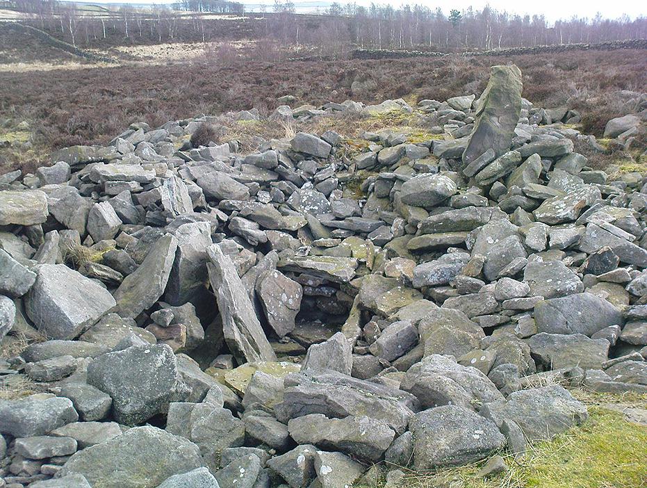
This is a superb archaeological site — and it’s bloody huge! It’s big and it’s long and it sticks out a bit – which is pretty unique in this part of the Pennines, as most other giant cairns tend to be of the large round variety.  Although the site was originally defined by Arthur Raistrick (1931) as a long barrow, J.J. Keighley (1981) told how, “it was found to be a round cairn imposed on a long cairn.”  And it’s an old one aswell…

Near the SE end of the giant cairn
Close-up of the main cist

More than 220 feet long and 80 feet in diameter at its widest southeastern end, as we walk along the length of the cairn to its northwestern edge, its main body averages (only!) 45 feet in diameter.  Made up of tens of thousands of rocks and reported by Butterfield (1939) to have had an upright stone along its major axis, the “height varies from 4-8ft, but the cairn has been much despoiled and disturbed,” said Cowling in 1946. He also told how,

“Excavation revealed that almost in the centre of the mound were the remains of a cist made of roughly dressed stone flags and dry walling, covered by a large stone. Under a stone slab, laid on the floor of the cist, were fragments of (burnt and unburnt) bone and a small flint chipping.”

This is a very impressive site and deserving of more modern analysis. The alignment of the tomb, SE-NW, was of obvious importance to the builders, believed to be late-neolithic in character.  The tomb aligns to two large hills in the far distance in the Forest of Bowland which we were unable to identity for certain.  If anyone knows their names, please let us know!

Folklore

The older folk of Bradley village below here, tell of the danger of disturbing this old tomb. In a tale well-known to folklorists, it was said that when the first people went up to open this tomb for the very first time, it was a lovely day. But despite being warned, as the archaeologists began their dig, a great storm of thunder, lightning and hailstones erupted from a previously peaceful sky and disturbed them that much that they took off and left the old tomb alone. (I must check this up in the archaeo-records to see if owt’s mentioned about it.)

References:

  1. Ashbee, Paul, The Earthen Long Barrow in Britain, Geo Books: Norwick 1984.
  2. Butterfield, A., ‘Structural Details of a Long Barrow on Black Hill, Bradley Moor,’ in YAJ 34, 1939.
  3. Cowling, E.T., Rombald’s Way, William Walker: Otley 1946.
  4. Keighley, J.J., ‘The Prehistoric Period,’ in Faull & Moorhouse’s West Yorkshire: An Archaeological Survey, I, WYMCC: Wakefield 1981.
  5. Raistrick, Arthur, ‘Prehistoric Burials at Waddington and Bradley,’ in YAJ 30, 1931.

© Paul Bennett, The Northern Antiquarian

Black Hill Round Cairn, Low Bradley Moor, Skipton, North Yorkshire

Cairn:  OS Grid Reference – SE 0087 4753

Also Known as:

  1. Black Hill Cairn
  2. Bradley Moor Round Cairn
  3. Queen’s Cairn
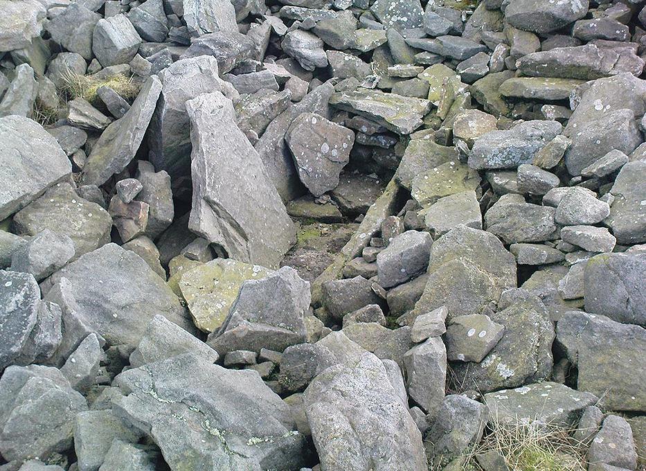
The Black Hill Round Cairn, Bradley Moor - looking north
The Black Hill Round Cairn, Bradley Moor – looking north

Getting Here

Various ways here.  Best is probably taking the footpath onto Farnhill Moor a few hundred yards east of Kildwick Hall.  Head for the cross-bearing Jubilee Tower (supposedly built upon an ancient cairn), NW, keep going past it uphill until you reach the walling 350 yards north, where a seat let’s you have a rest.  Climb over the wall! Alternatively, walk eastwards and up through the steep but gorgeous birch-wooded slopes of Farnhill Wood; and as the moortop opens up before you, the great pile of rocks surmounts the skyline ahead. You can’t miss it! (NB: the spot cited on the OS-map as the cairn is in fact another site, 100 yards NW)

Archaeology & History

Its an awesome place in an awesome setting. You can see 360-degrees all round from this giant mass of rocks — something which was of obvious importance to the people who built it. If it had been placed 20-30 yards either side of here, that characteristic would not occur. Indeed, this is the only place anywhere on these moors where such a great view was possible. Important geomancy, as they say (or whatever modern term they give it these days).

Bradley Moor Cairn - looking down to the Long Cairn
Bradley Moor Cairn – looking down to the Long Cairn
Small section of the old cairn

Although the tomb is still of considerable size (at least 100 feet across) and made up of thousands of stones, it has been severely robbed of stone in years passed, for walling and other building materials.  A number of other small cairns scatter the heathlands a few hundred yards roundabout this central giant (though are hard to find in the deep heather); and there is a distinct cairn circle about 100 yards to the northwest, which has yet to be excavated.  This cairn circle can be made out quite easily if you stand on the ridge about 30 yards west of here, looking down the slope.  An then of course we have the equally huge  Black Hill Long Cairn, less than 100 away, aligned northwest-southeast, which obviously had an important archaeological relationship with this giant round cairn.  Also around this and the adjacent long cairn, numerous flints and scrapers have been found, showing humans have been here since at least the early neolithic period.

This site in particular gives me the distinct impression that it was the most important of the various sites upon these moors. It’s got a distinctly female flavour to it – and it’s old name of the Queen’s Cairn seems just right.  Maybe it’s the fact that when I first visited the place, a great thunderstorm broke through the previously perfect skies, scattering lightning bolts all round for perhaps thirty minutes — so I stripped down and held my arms outwards, screaming to the skies in the pouring rain!  Thereafter, no clouds appeared in the skies for the rest of the day.  It was a brilliant welcome to the place!

References:

  1. Cowling, E.T., Rombald’s Way, William Walker: Otley 1946.
  2. Keighley, J.J., ‘The Prehistoric Period,’ in Faull & Moorhouse’s West Yorkshire: An Archaeological Survey, I, WYMCC: Wakefield 1981.
  3. Raistrick, Arthur, ‘Prehistoric Burials at Waddington and Bradley,’ in YAJ 119, 1936.

© Paul Bennett, The Northern Antiquarian

High Street Barrow, Towthorpe, East Yorkshire

Tumulus:  OS Grid Reference – SE 881 637

Also Known as:

  1. Towthorpe Barrow 1

Getting Here

Mortimer’s sketch of Towthorpe-1 barrow

The faded remains of this old burial mound can vaguely be seen just off the right-hand (east) side of the B1248, across the road from the track which leads down to Burdale North Wold farmhouse, between Fimber and Wharram-le-Street.

Archaeology & History

Known as Towthorpe Barrow No.1 in the Mortimer survey (1905), there are a number of prehistoric tombs and other remains close to this site (which will be described on TNA as time goes by).  Some of you might think the lengthy description here a little unworthy, but I believe the extensive archaeological notes on this site by an archaeological legend, J.R. Mortimer, is a good indicator of the dedication and interest to which he gave each and every tomb that he opened (this’ll be the first of many). His slightly edited account told:

“This mound is situated near the centre of the (Towthorpe) group, close to High Towthorpe. Here the green lane…is crossed by the high road from Malton (B1248), through Wharram-le-Street… Part of this road, for some distance south and north of the barrow, is called ‘High Street’ by the old inhabitants of the neighbourhood…

“On 4 May, 1863, the writer, with the assistance of R. Mortimer and two workmen, commenced to open this mound. It was the first British barrow he had the pleasure of examining. A trench 10 feet wide was cut across its centre from the northern to the southern margin…

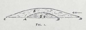
“The upper portion E, to a depth of 16 inches, consisted chiefly of the surface soil of the neighbourhood, the bottom part of which was reddened as if by the action of fire. Close below this was a stratum of wood and ashes and other dark matter, 2-3 inches in thickness; and then a lenticular bed of tough drab-coloured clay, 29 feet in diameter, and 12-14 inches thick in the centre, gradually thinning towards the circumference. The upper part of this bed of clay, which was in contact with the stratum of wood ashes, was reddened by fire; its under surface had a similar appearance and rested upon what seemed to be a second stratum of burnt and decayed matter, 2-3 inches in thickness, similar to that already described. The clay forming this lenticular bed contained numerous small fragments of grey flint, characteristic of the chalk of the neighbourhood. It must have been obtained from one of the valley bottoms (either Burdale, Wharram-le-Street or Duggleby), in which are exposures of the Kimeridge clay. In these places, angular pieces of flint and chalk crumble from the hillside, and mix with the clay, imparting a greyish colour to it. This is especially the case at Burdale, where there is a fine spring at the base of the chalk, and a small pond resting on the Kimeridge; and it is probably from this place that most of the clay for the construction of this barrow was obtained. It is not easy to explain the method by which the clay was transported, but several tons had evidently been used in this case. Many other instances in which material from a distance has been used in the erection of the barrows of this neighbourhood are recorded in (the Yorkshire Wolds).

“In the centre of the mound, at the base of the lenticular bed of clay and below the ashes (which probably represent the residue of a funeral pyre) stood two food vases, close together, and near to these, decayed bones (the remains of a human body) and a chipped flint. The smaller and more ornamented vase was situated to the south of its fellow. It measures 4.5 inches in neight, 5.5. inches in diameter at the top, and about the same across the shoulders. The ornamentation had been impressed on the plastic clay by a thin square-ended tool, about half-an-inch in length, which showed in the impression of a fine notched structure, and was equally divided into ten ridges about the size of the indentations on the milled edge of a shilling, and almost as truly cut. In the lower groove which runs round the vase are four pierced projections.

“The other vase is about 5 inches high and about 6 inches in diameter at the top and across the shoulders. Three encircling lines of short vertical cuts, rudely and apparently hastily made, previous to baking the vase, represent its entire ornamentation.

“During the excavation we collected from the material of the mound a dozen hand-struck flint flakes of various sizes, and a small splinter from the cutting-edge of a green-stone celt.”

Mr Mortimer returned to do further excavations here on Christmas Eve and Christmas Day in 1865, with the hope of finding more — but apart from a finely-cut knife made of black flint, nothing else was located. This was the first of Mortimer’s hundreds of diggings into the tombs and dykes of East and North Yorkshire.

References:

  1. Marsden, Barry M., The Early Barrow Diggers, Tempus: Stroud 1999.
  2. Mortimer, J.R., Forty Years Researches in British and Saxon Burial Mounds of East Yorkshire, A. Brown: London 1905.

© Paul Bennett, The Northern Antiquarian