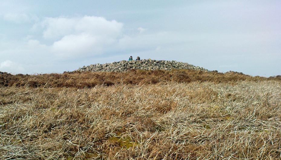
Little Skirtful of Stones, Burley Moor, West Yorkshire

Cairn:  OS Grid Reference – SE 13829 45186

Also Known as:

  1. Little Apronful of Stones

Getting Here

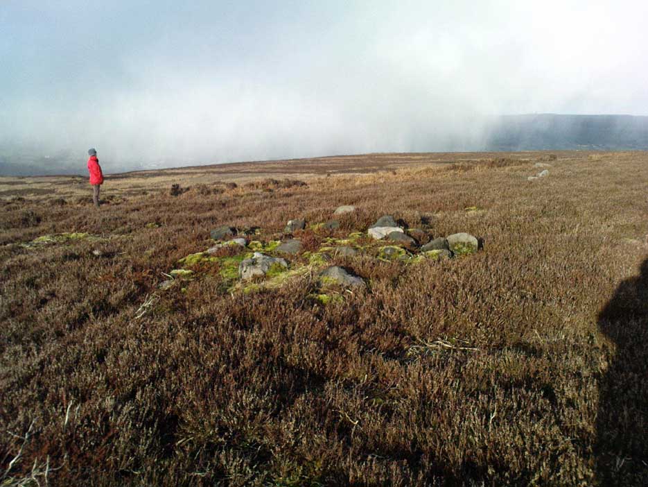
Little Skirtful of Stones, looking north

Probably the easiest way to get here is by starting on the Moor Road above Burley Woodhead, where the road crosses the Rushy Beck stream.  Looking upstream, follow the footpath up the right-hand side of the waters, nearly all the way to the top.  Where it crosses a footpath near where the moor begins to level out, look up to your right and you’ll see the raised crown of stones a coupla hundred yards off path, NNW.  That’s it!

Archaeology & History

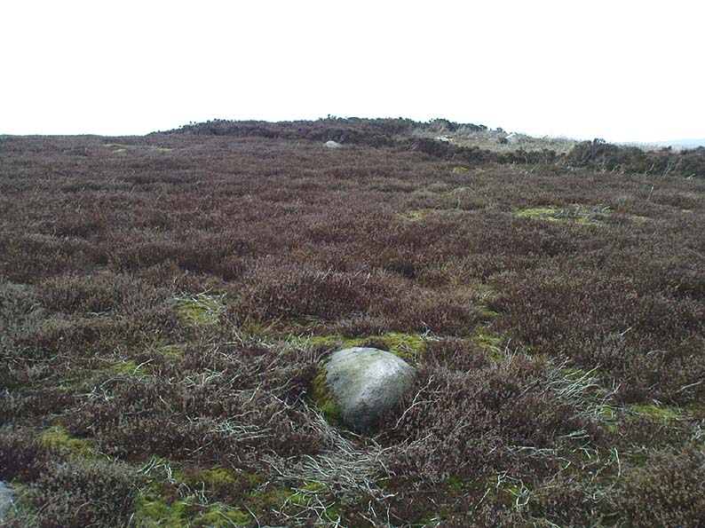
This very large Bronze Age cairn was reported by Faull & Moorhouse (1981) to have been surrounded by a multiple stone circle, citing it to have been shown as such on an estate map of Hawksworth Common in 1734. When I contacted the Yorkshire Archaeology Society to enquire about this map, it could not be located. (This needs to be found!) No evidence of such a stone circle presently remains, though there were at least two standing stones once to be seen at the edge of this tomb, though only one of them — now laid more than five-feet long in the heather — is still evident on the western side of this giant tomb.  But anyone who might know anything about the 1734 Estate Map – pleeeeez gerrit copied or take a photo of it! Then stick it on TNA so everyone can see whether the circle surrounded this, or the Great Skirtful of Stones, 500 yards to the south.
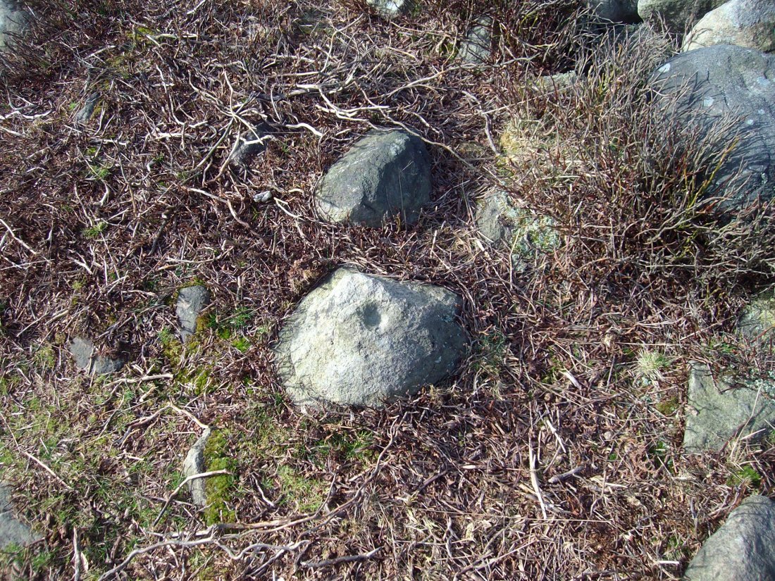
Single cup-marked stone on outer edge of Little Skirtful

The Little Skirtful is in better condition than its big brother on the hill to the south and — unlike the Great Skirtful — there are said to be at least five cup-marked stones amidst the great mass or rocks constituting this site.  There could be more.  The carvings are just single cup-markings etched onto small portable stones, typical of sites like this.  They are found near the centre above a small cist and outwardly towards the northern edges of the cairn (for more info about them, see the main entry for the Little Skirtful Carvings).

It’s been said by Stan Beckensall (1999, 2002) that no cup-marked rocks “are known near…the really large cairns” on the moor—meaning the Little Skirtful and her allies—but this isn’t true as there are at least 4 definite carvings (a possible fifth seems likely) on the moorland immediately around the Little Skirtful.  Though to give Beckensall his due, if he got his data from the Ilkley archaeologists, his information isn’t gonna be too accurate, as they’re quite unaware of many sites on these moors!  A good number of local people have a much greater knowledge-base on such matters than those in paid offices, as this and other websites clearly shows.  The times they are a-changin’, as one dood said, not so long ago…!

Folklore
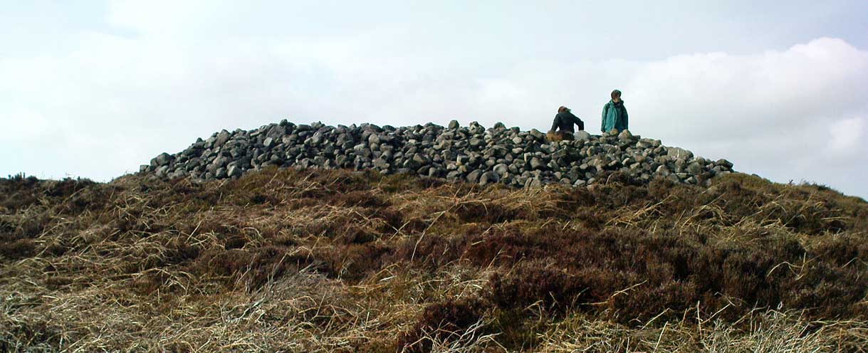
Paul Bowers & Mikki on top for scale!

The creation myth of this place tells that the giant Rombald (who gives his name to the moor) was in trouble with his wife and when he stepped over to Almscliffe Crags from here, his giant wife – who is never named – dropped a small bundle of stones she was carrying in her apron. (In traditional societies elsewhere in the world where this motif is also found, it tends to relate to the site being created by women.) Harry Speight (1900) tells us of a variation of the tale,

“which tradition says was let fall by the aforementioned giant Rumbalds, while hastening to build a bridge over the Wharfe.”

Variations on this story have said it was the devil who made the site, but this is a denigrated christian variant on the earlier, and probably healthier, creation tale. Similar tales are told of the Great Skirtful of Stones, 500 yards south.

References:

  1. Beckensall, Stan, British Prehistoric Rock Art, Tempus: Stroud 1999.
  2. Beckensall, Stan, “British Prehistoric Rock Art in the Landscape,” in G. Nash & C. Chippindale’s European Landscapes of Rock Art, Routledge: London 2002.
  3. Bennett, Paul, The Old Stones of Elmet, Capall Bann: Chieveley 2001.
  4. Boughey, Keith & Vickerman, E.A., Prehistoric Rock Art of the West Riding, WYAA 2003.
  5. Collyer, Robert & Turner, J. Horsfall, Ilkley: Ancient and Modern, William Walker: Otley 1885.
  6. Colls, J.N.M., ‘Letter upon some Early Remains Discovered in Yorkshire,’ in Archaeologia 31, 1846.
  7. Cowling, E.T., Rombald’s Way, William Walker: Otley 1946.
  8. Faull & Moorhouse, West Yorkshire: An Archaeological Survey – volume 3, WYMCC: Wakefield 1981.
  9. Hedges, John (ed.), The Carved Rocks on Rombalds Moor, WYMCC: Wakefield 1986.
  10. Speight, Harry, Upper Wharfedale, Elliott Stock: London 1900.
  11. Wood, Butler, ‘Prehistoric Antiquities of the Bradford District,’ in Bradford Antiquary, volume 2, 1901.

© Paul Bennett, The Northern Antiquarian

Cock Hill, Wadsworth Moor, West Yorkshire

Cist:  OS Grid Reference – SE 009 275

Also Known as:

  1. Mount Skip tomb

Getting Here

OK – OK – stop laughing at the title!  If you wanna check the hill out for yourselves, get to Hebden Bridge, then go up the long and very steep Birchcliffe Road.  Keep going all the way to the very top (a couple of miles uphill).  When you reach here, the building in front of you was the Mount Skip pub.  From here, walk up over the golf course and you’ll hit the disused quarries on the moor edge.

Archaeology & History

The grid reference given above is an approximation.  The tomb (long gone) was within 100 yards of the coordinate.  But don’t let that put you off having a good bimble around the moors here, cos there are several sites to see.

This long-lost burial was located in May, 1897, when quarrying operations were being undertaken behind the Mount Skip Inn, on the edge of Wadsworth Moor.  Ling Roth (1906) told that

“the first indications were the rolling down of pieces of urns which the delvers called flower pots.  Then in digging a hole to fix the leg of a crane, human bones were discovered.”

Geoffrey Watson (1952) later echoing Mr Roth’s comments wrote that,

“a grave containing a skeleton was discovered at a quarry about Mount Skip Inn.  The grave was about 6ft long, 14-18 in wide, and about 2ft deep.  The bones, which were exceedingly brittle, crumbled on handling.  Within the grave, and mainly at the ends, there appeared to be about 6 in of mixed charred wood and bones.  The larger portion of a small earthenware vessel was picked up and retained by one of the quarrymen.”

According to Mr Roth, the “earthware vessel picked up…by one of the quarrymen” was “picked up by a man named Thomas Greenwood, of Shawcroft Hill.”   What became of it, I do not know! If anyone knows, please let us know!

The description telling that “the grave was about 6ft long, 14-18 in wide, and about 2ft deep,” implies it to have been a stone cist – although this is quite long.  The nearest of any similar form would be the giant cairns at Low Bradley, 12½ miles (20km) to the north  This may have been the last remnants of a giant cairn (its landscape position would allow for this).

References:

  1. Roth, H. Ling, The Yorkshire Coiners…and Notes on Old and Prehistoric Haifax, F. King: Halifax 1906.
  2. Watson, Geoffrey G., Early Man in the Halifax District, Halifax Scientific Society 1952.

© Paul Bennett, The Northern Antiquarian


Gariob Cottage, Achnamara, Knapdale, Argyll

Cairn:  OS Grid References – NR 7801 8910

Getting Here

From Lochgilphead go north up the A816 for just over a mile, turning left going through Cairnbaan to Bellanoch, where the road bends left up the B8025 into the trees. Keep along here for a mile and when the small road appears on your left, follow it for just over a mile till you see the cottage on the roadside with the loch at tha far end of the garden. There’s a small path besides the cottage. Walk along here for 100 yards until you see the small cairn on your left.

Archaeology & History

This is a beautiful quite place with only a small pile of stones here, about 100 yards west of Gariob Cottage on the ridge overlooking Loch Sween.  The remains of the cairn here are about 20 feet across (or were when I last came here nearly 20 years ago!).   Excavations here in 1977 and 1978 found a small cist split into 2 sections, just off-centre, aligned northwest.  The lower part of the cist was filled with small stones and charcoal; whlst the larger section had the same with additional quartz stones in it.

References:

  1. Royal Commission on the Ancient & Historic Monuments of Scotland, Argyll – volume 6, HMSO: Edinburgh 1988.

© Paul Bennett, The Northern Antiquarian
Balloch, Alyth, Perthshire

Cairn (destroyed):  OS Grid Reference – NO 2738 4885

Archaeology & History

Unfortunately we can no longer see the large prehistoric tomb that was once visible in the fields here, close to the bottom corner of the field below the old Bridge of Ruim, a couple of hundred yards north of the A926 road to Ruthven. The site was destroyed around 1863, but records show that there were several burials found here containing human bones, along with an urn.  Described in an early PSAS article, the Scottish Royal Commission chaps seemed to think that “its position may be indicated by a low swelling in the field”, about 30 yards southeast of the position shown on the first OS-map.  Anyone know owt more about this place?

References:

  1. Royal Commission on the Ancient & Historical Monuments of Scotland, North-East Perth: An Archaeological Landscape, HMSO: Edinburgh 1990.

© Paul BennettThe Northern Antiquarian


Mini-Skirtful of Stones, Ilkley Moor, West Yorkshire

Cairn:  OS Grid Reference – SE 1346 4606

Getting Here

Follow directions to get to the Pancake Stone.  From here walk SE on the footpath that runs on the edge of the moor.  After about 200 yards you’ll hit a small footpath which heads into the moor (south).  Walk on here for about 200 yards and notice the small rise in the land to your right (if you cross the small stream where the land dips into a very small valley, you’ve gone past).  That’s it!  The Little Haystack Rock is less than 100 yards away down the slope from here.

Mini-Skirtful of Stones, looking north

Archaeology & History

Of approximately eighty prehistoric cairns that have been alleged to exist along the Green Crag Slack ridge on Ilkley Moor, this site in particular is worthy of note, due mainly to its size. As independent archaeological researcher Paul Bowers said of it when he first saw this cairn-spoil, “it seemed too big to have not been discovered in the past.”  Too right!

Mini-Skirtful, looking west

When we tracked across Green Crag Plain a few days ago, it was Michala Potts that called our attention to it.  Half-covered in full heather growth, only the eastern edge was exposed.  At first it seemed that it was loose prehistoric walling, but then I realised it was on the edge of small knoll and the stone work was deeper and wider than walling.  As we explored through the heather atop of the knoll, it was obvious that there was a more extensive gathering of stones scattered all over the top of this small rise, and it seemed that we were looking at the remains of a reasonable sized cairn. Its extent carries about ten yards down the slope from the small hillock, but only a few yards either side of it.  It seems likely that the extended loose stones have, over the centuries, simply slipped further down the slope.  However, not until a decent excavation occurs will we know anything certain.  It is possibile that this is simply the scattered remains of damaged neolithic or Bronze Age walling, but only a more detailed exploration of the site will tell us for sure.

Cowling (1946) mentioned the numerous cairns and scattered walling reaching across this part of Ilkley Moor, but gave no specific information relating to this mini-skirt full of stones! (blame Mikki for the title!)

References:

  1. Cowling, E.T., Rombald’s Way, William Walker: Otley 1946.

© Paul Bennett, The Northern Antiquarian


Green Crag Top Cairns, Ilkley Moor, West Yorkshire

Cairns:  OS Grid Reference – SE 131 458

green-crag-top-cairn02-sm
Larger of the Green Crag Top cairns – with blizzard in background!

Getting Here

Follow directions for getting to the Haystack Rock.  Once here, walk dead straight south onto the moor and go up the slope you see a few hundred yards ahead of you.  Once you’re at the top of the slope, a few yards onto the ridge itself, look around!  If there’s deep heather growth when you arrive, you’ve no chance!

Archaeology & History

To my limited knowledge, it appears there’s no previous references to the cairns here.  We found at least two of them, with a probable third not far away; but we were lucky inasmuch that the heather had all been burnt away, allowing a clearer inspection of the sites.  The larger of the two is nearly four yards across and nearly a yard high.  It’s somewhat larger than the majority of what are thought to be single-person cairns along Green Crag Slack ridge, down the slope.

Much denuded cairn
Much denuded cairn

A smaller cairn less than 100 yards west on the same ridge (near the large boulder with a couple of cup-markings on top) looks as if it was robbed of stone sometime in the past.  About six-feet across, this one is more typical of the cairns found on the Ridge below.

There are what seems to be other remains along this ridge, including a very distinct thin, six-foot-long stone, which looks very much as if it could have stood upright in the not-too-distant past.  We could do with more heather-burning on this part of the moor to help us out!

© Paul Bennett, The Northern Antiquarian

Cat Heaps, Swanston, Edinburgh, Midlothian

Cairns (destroyed):  OS Grid Reference – NT 2447 6828

Archaeology & History

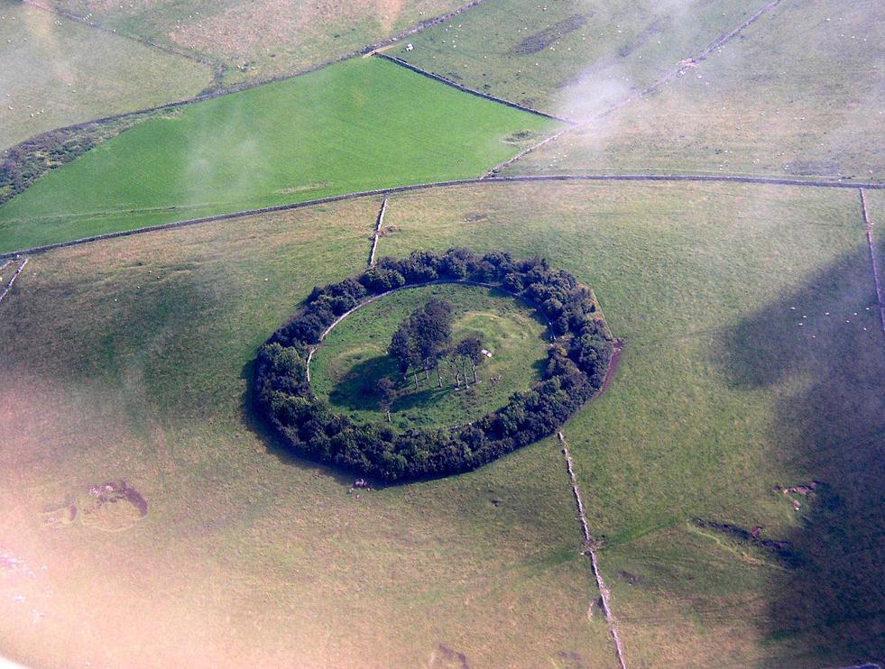
Not far from the giant cup-marked Caiy Stone, there used to be two very large prehistoric cairns, which local historian Daviid Shankie told us “were foolishly broken up by some sacriligious hand and used for road metal”!  Not good…  Remains of human bones and several fragments of old weapons were found in them.  Fred Coles (1903) told us that:

“In the neighbourhood of this [i.e. Morton Hall], but further southwest, on the grounds of Comiston, were found, in forming the public road, under large heaps of stones, various sepulchral stone enclosures, in which were deposited urns with dead men’s ashes, and divers warlike weapons.” And again, when speaking of the levelling of a part of the ground close to the old (so-called Roman) road, by Sir John Clerk of Pennycuick, the same writer adds, there ” were discovered several stone coffins with human bones.”

Folklore

According to Shankie (1902), these two great cairns were built upon lands previously known as the Templelands of Swanston and commemorated a great battle that was fought “between the ancient Picts and Scots.”

References:

  1. Coles, Fred, ‘Notice of…Cairns and Standing Stones in Midlothian and Fife,’ in PSAS 37, 1903.
  2. Harris, Stuart, The Place-Names of Edinburgh, Gordon Wright: Edinburgh 1996.
  3. Royal Commission for the Ancient & Historical Monuments of Scotland, Midlothian and West Lothian, HMSO: Edinburgh 1929.
  4. Shankie, David, The Parish of Colinton, John Wilson: Edinburgh 1902.

© Paul Bennett, The Northern Antiquarian


Harlaw, Fairnington, Roxburghshire

Stone Circle (destroyed):  OS Grid Reference – NT 666 286

Archaeology & History

One of those site place-names with a familiar ring to it: Har, boundary; law, tumulus (though it can also be used to mean ‘a meeting place’).  Nevertheless, whatever the precise origin of the name, the site here seems to have been destroyed.

Although listed by the Royal Commission in 1956 as a stone circle, John Barnatt thinks it may have been a tomb of sorts – which is what the place-name infers if we’re puritanical about it.  Alexander Jeffrey (1864) told us the most, saying that:

“A field to the east of Fairnington village is called Harlaw, from a circle of large stones which stood within it, but which have been removed to serve farm purposes.”

Its exact location is unknown, though the Royal Commission lads thought it probably “stood somewhere near the present Harelaw Plantation,” about a mile east of the village.  Any more info on this lost site would be most welcome!

References:

  1. Burl, Aubrey, The Stone Circles of Britain, Ireland and Brittany, Yale University Press 2000.
  2. Gelling, Margaret, Place-Names in the Landscape, Phoenix: London 2000.
  3. Jeffrey, Alexander, The History and Antiquities of Roxburghshire – volume 3, Seton & MacKenzie: Edinburgh 1864.
  4. Royal Commission on the Ancient & Historical Monuments of Scotland, Roxburghshire – volume 2, HMSO: Edinburgh 1956.

© Paul Bennett, The Northern Antiquarian 


Minning Low, Ballidon, Derbyshire

Cairns:  OS Grid Reference – SK 2091 5731

Also Known as:

  1. Minninglow
  2. Roystone Cairn

Getting Here

Minning Low from the air, looking NE (photo © Pete Glastonbury)

You can see the copse of trees here from all directions it seems, and there seem various ways in.  Don’t think there’s a direct footpath, but from all accounts the locals are friendly and you can cross the fields from various directions.  From either Pikehall to the north, Aldwark to the east, or Brassington from the south, head towards the distinct wooded copse atop of the hill and you’ll get there!

Archaeology & History

This superb-looking view catches the remains of at least two prehistoric tombs.  In Marsden’s (1977) brief notes of the site he describes,

“Disturbed mound in plantation with exposed limestone cist.  Primary cist rifled.  Secondary cremation.  A second barrow had been raised against the earlier cairn, containing a primary cremation in situ., with a burnt bronze razor, 2 flint knives and a bone tool.”

Barnatt & Collis (1986) give more detailed descriptions of the respective tombs.  The first is categorized as a passage grave chambered cairn:

“This large but mutilated barrow measures c.45 x 38m and in parts is over 2m high.  It had been much robbed for stone before the site was first recorded in the late 18th century.  The ruined remains of four chambers can be seen.  In 1843 Bateman located a fifth partially-collapsed chamber passage, now lost somewhere within the mound.  Rooke recorded a further one of two structures to the north and possibly west sides of the mound (Douglas 1793), that had gone or been reburied in Bateman’s day.  Small excavations by Marsden in 1973-4 clarified the design of the four visible chambers.  Each originally had tall portals, back stone, side slabs, low septal slabs and short entrance passages.  Drystone walling had been used to fill gaps between orthostats and in places to increase the heights of the sides.”

Although human remains were found here, the authors tell how the site was initially plundered as far back as the Romano-British period.  It had once been a long cairn, aligned ENE-WSW, but they give no notice of any potential astronomical orientation (does anyone know?).

References:

  1. Barnatt, John & Collis, John, Barrows in the Peak District, J.R. Collis: Sheffield 1986.
  2. Bateman, Thomas, Vestiges of the Antiquities of Derbyshire, London 1848.
  3. Douglas, J., Naenia Britannica, London 1793.
  4. Marsden, Barry M., The Burial Mounds of Derbyshire, privately printed: Bingley 1977.

© Paul Bennett, The Northern Antiquarian


Haulgh, Bolton, Lancashire

Tumulus (destroyed):  OS Grid Reference – SD 7242 0899

Archaeology & History

This single-grave burial — described by Barnes (1982) as a kerbed or revetted cairn — close to the very centre of modern-day Bolton, was once an impressive prehistoric tomb.  It was described by a local historian, Matthew Dawes, amidst a variety of prehistoric remains in and around Bolton, most of which have long-since been forgotten.

“Near Haulgh, about a quarter of a mile south-east from Bolton Parish Church, on a piece of high flat land, on the east bank of the Croal, and about fifty feet above the river, was a tumulus, about thirty feet in diameter, and four feet deep, consisting of small boulders… It was discovered in September, 1826, in forming a branch of the new road leading from Bolton to Bury. It was probably much depressed in its formation and was covered with a few inches of mound. The cop or fence crossed it in a north and south direction. About the centre of this tumulus was a cist-vaen, about four feet six inches long and one foot deep, formed of four upright stones and a coverer, and its length was nearly north and south. In this cist-vaen was a skeleton, with the legs doubled up, and the head to the north. Near the head, and on the west side, was found an urn, inverted, four and a half inches in the widest diameter, and three and a quarter inches high, and perforated by four small holes in the widest part. On the other side of the head was a bronze spear-head, four and three-eighths inches long, and one and three-eighths inch wide, of which the point was bent back, and a piece of the side chipped away. The urn and spear-head were taken to the Countess of Bradford, the Earl of Bradford being the owner of the land.”

Intriguingly, if you’re from the Bolton region, Mr Dawes also told that, “A man in the employ of the Earl of Bradford, the superintendent of the work, who made the discovery, informs me (1862) that two other tumuli were found shortly after the one just described, a few yards to the south of it, in the same fence.”  As yet I have no more information about these other tombs (gimme time though!)

References:

  1. Barnes, Bernard, Man and the Changing Landscape, Unversity of Liverpool 1982.
  2. Dawes, M., ‘British Burial Places near Bolton,’ in Trans. Hist. Soc. Lancs & Cheshire, volume 4, 1852.
  3. Scholes, James C., History of Bolton, Daily Chronicle: Bolton 1892.

© Paul Bennett, The Northern Antiquarian