High Marchup, Silsden, West Yorkshire

Tumulus:  OS Grid Reference – SE 0501 4949

Also Known as:

  1. Parson’s Lane Tumulus

Getting Here

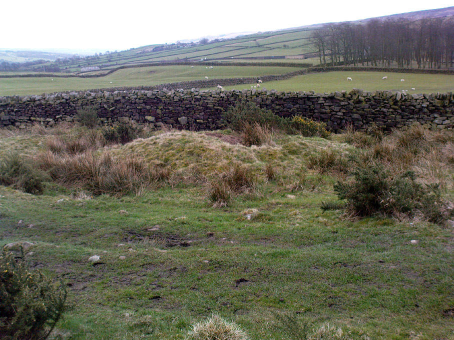
High Marchup tumulus

From Silsden go up the long hill (A6034) towards Addingham until the hill levels out, then turn left on Cringles Lane (keep your eyes peeled!) for about 500 yards until you reach the Millenium Way footpath, or rather, green lane track, to your right.  Walk along this usually boggy old road for another 400 yards until you’re level with the small copse of trees below the field (about 100 yards away).  The slightly raised ditched mound on the left side of the track ahead of you is what you’re after!

Archaeology & History

Unless this old tomb was pointed out, you probably wouldn’t give the place a second glance.  It’s a seemingly isolated singular round tomb, subsided on top and surrounded by a small ditch, running into the edge of the walling.  Gorse bushes and a few rocks are around the edges of the site.  Harry Speight (1900) described this old tomb as a

“lonely isolated mound, to be seen in Parson Lane about a hundred yards west of the Celtic boundary, Black Beck, where some old dying chief has called his friends around him bidding them, “heap the stones of his renown that they may speak to other years.”  It is a tumulus 80 feet in circumference and does not seem to have been disturbed.”

In Faull and Moorhouse’s (1981) magnum opus they describe the site as “the denuded remains of a ditched round barrow,” but say little else.  It may have had some relationship with the settlement remains in and around the huge Counter Hill complex, immediately north.

References:

  1. Cowling, E.T., Rombald’s Way: A Prehistory of Mid-Wharfedale, William Walker: Otley 1946.
  2. Faull, M.L. & Moorhouse, S.A. (eds.), West Yorkshire: An Archaeological Guide to AD 1500 (4 volumes), WYMCC: Wakefield 1981.
  3. Speight, Harry, Upper Wharfedale, Elliott Stock: London 1900.

© Paul Bennett, The Northern Antiquarian

Harden Moor Cairnfield, Bingley, West Yorkshire

Cairns:  OS Grid Reference – SE 0757 3869

Getting Here

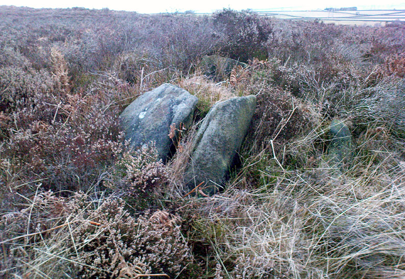
Overgrown cairn, looking north

Follow the same directions to reach the Harden Moor circle.  From here, walk down the footpath at its side down the slope for 100 yards and take the first little footpath on your left for 25 yards, then left again for 25 yards, watching for a small footpath on your right.  Walk on here for another 100 yards or so, keeping your eyes peeled for the image in the photo just off-path on your left, almost overgrown with heather. 

Archaeology & History

This is just one of several cairns in and around this area (I’ll probably add more and give ’em their own titles and profiles as time goes by), but it’s in a pretty good state of preservation.  Nothing specific has previously been written about it, though it seems to have been recorded and given the National Monument number of 31489, with the comment “Cairn 330m north of Woodhead, Harden Moor.” (anyone able to confirm or correct this for me?)

It’s a good, seemingly undisturbed tomb, very overgrown on its north and eastern sides.  Three pretty large upright stones, a couple of feet high, remain in position with an infill of smaller stones and overgrowth (apart from removing a little vegetation from the edges to see it clearer, we didn’t try disturbing it when we found it).  It gives the impression of being a tomb for just one, perhaps two people and is more structured than the simple pile-of-stone cairns on the moors north of here above Ilkley and Bingley.  Indeed, the upright stones initially gave the impression of it once being a small cromlech of sorts!  Other cairns exist close by, but until we get heather-burning done up here, they’re difficult to find – or at least get any decent images of them!

© Paul Bennett, The Northern Antiquarian

Carlowrie, Kirkliston, Midlothian

Cup-and-Ring Stone (destroyed):  OS Grid Reference – NT 138 746

Archaeology & History

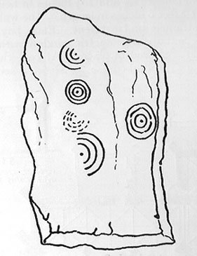
Lost carving of Carlowrie

Two-thirds of a mile west of the Cat Stane, on land immediately north of the River Almond by Edinburgh Airport in an area that was reported in 1780 to be “filled with the skeletons of human bodies,” this old petroglyph could once be found.  The Scottish Royal Commission (1929) described it as being a covering stone for a short prehistoric tomb near the OS-grid reference cited here, “but when discovered it was much broken by the plough that it does not appear to have been preserved.”  They refer instead to the last report of the site in the Scottish Society of Antiquaries journal, where we were informed that the cover stone was,

“marked with three series at least of concentric circles… The widest diameters of the sets of rings cut on the inside of the lid is about five inches, and each set is composed of five concentric circles.”

All trace of this carving appears to have been lost.  Other carvings reported nearby in the 19th century also appear to have been lost or destroyed.

References:

  1. Morris, Ronald W.B., The Prehistoric Rock Art of Southern Scotland, BAR 86: Oxford 1981.
  2. Royal Commission on Ancient & Historical Monuments, Scotland, Midlothian and Westlothian, HMSO: Edinburgh 1929.
  3. Simpson, J.Y., The Cat-Stane, Edinburghshire, Neill & Co: Edinburgh 1862.
  4. Simpson, J.Y., “On Ancient Sculpturings of Cups and Concentric Rings,” in Proceedings of the Society of Antiquaries, Scotland, volume 6, 1864-66.

© Paul Bennett, The Northern Antiquarian

Leathad Carnaich, Dalhalvaig, Caithness

Cairn:  OS Grid Reference – NC 89044 55882

Archaeology & History

An unexcavated ring cairn in a very good state of preservation can be seen in the field immediately west of the River Halladale.  Measuring more than 14 yards across east-west and 15 yards north-south, the site stands in association with several other unexcavated cairns.

Folklore

Although some of the cairns here have been found with prehistoric burials in them, tradition tells that the cairns here were the result of “a great battle between the native Pictish inhabitants and the invading Norsemen.” So wrote George Sutherland, many moons ago. He continued:

“The Norsemen were defeated in that battle, and Halladha, their leader, was slain. It is from him that the river and the dale take their name. The battle was fought on a hillside, on the east side of the river and that hillside is covered with cairns which are supposed to mark the graves of those slain in this battle, but the body of Halladha, the norse leader, was interred on the west side of the river, and his sword was laid in the grave beside his body. Near the circular trench where he is said to have been buried there are several heaps of stones which are supposed to mark the graves of other Norsemen of note who fell in the battle.”

References:

  1. Sutherland, G., Folklore Gleanings and Character Sketches from the Far North, John o’ Groats Journal: Wick 1937.

© Paul Bennett, The Northern Antiquarian
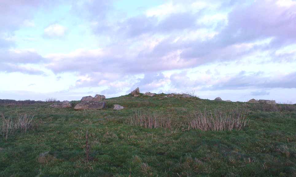

Serpent Mound, Scallasaig, Glen More, Inverness-shire

Cairn:  OS Grid Reference – NG 848 202

Folklore

I’m presuming that this burial site is the right one, described in the fine Mr MacGregor’s Peat Fire Flame (1937) as being “by the roadside up near Scallasaig.”  There certainly doesn’t appear to be another alternative site close by (though if I’ve got it wrong, someone please lemme know!).  This place was, said MacGregor, a site “where the people in olden times used to worship the serpent.”

MacGregor spoke with a local man about the myths here and asked how long it had been associated with serpents.

“Och, about two thousand years,” said Mr John MacRae. “The mound was in the shape of a serpent, and when the chief of the people would die, he would be buried in the head of the serpent..”

He continued, saying, “One from London, that was going about searching things like that, opened the mound, and they found in the mound a big stone coffin with a big stone slab on the top. And there the bowl was found with the ashes of the chief of the people at that time. The bowl was taken to the Manse. That’s about fifty years ago. It was there for a few months; and they took it to Edinburgh, to some museum or something. They were saying that there was a funny noise in the Manse when the bowl was lying there. If there was any treasure in the bowl, or in the grave along with the bowl, it was taken out before. You see, had he any treasure – the chief like – guns and money and the like – I’m sure they wouldn’t be putting much money in the grave. It would be going into the grave with the dead man, so, when he would rise in the next world, he would be ready to start at the same game as he was carrying on here on Earth.”

This sounds a little like the folk-memory of an idea of a heathen afterlife – and of course it’d make sense finding such lore here at a tomb.

I’ve come across references to several other serpent mounds scattering the western side of Scotland, but their exact locations have proven hard to pin down. It makes y’ wonder how many more there once were before the christian paradigm became entangled in the myths of the country people.

References:

  1. MacGregor, Alisdair Alpin, The Peat-Fire Flame: Folk-Tales and Traditions of the Highlands and Islands, Ettrick Press: Edinburgh 1937.

© Paul Bennett, The Northern Antiquarian
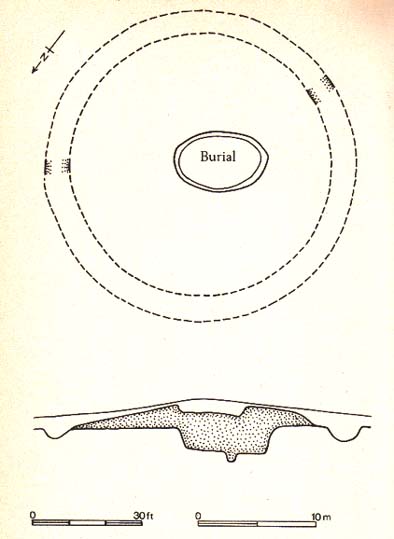

Mill Hill, Eastburn, Driffield, East Yorkshire

Tumulus:  OS Grid Reference – SE 986 553

Also Known as:

  1. Barrow no.268 (Mortimer)

Archaeology & History

Once located on the south side of the stream between the ‘lost’ village of Eastburn and the cottages at Battleburn, this burial mound was one of many explored by the great J.R. Mortimer (1905), who told that:

“On June 24th, 1884, it measured about 40 feet in diameter and 4½ in elevation, and had a depression in the centre, which might have been caused by a former opening.  By the old inhabitants of the neighbourhood it is known — like several other similar mounds near settlements — by the name of Mill Hill.  A 15-feet square was cut from the centre and the natural ground beneath was found to consist of 3 feet of clay, resting upon chalk gravel.  Through this clay and into the chalk gravel beneath was a roughly-cut trench, 3½ feet deep by about 3 feet wide, running north and south the whole width of our excavation and beyond, and from about the centre of the mound a similarly roughly-formed trench was observed to run east and west…”

In the sections that Mortimer and his fellows excavated, they uncovered various intriguing deposits, including the remains of ox, goats and horses.  Later deposits were also located in and around the mound, showing it had been used in more recent centuries.

Folklore

Mortimer suggested this site was once an old moot site; comparing it to a place of the same name a short distance west at Kirkburn.

References:

  1. Mortimer, J.R., Forty Years Researches in British and Saxon Burial Mounds of East Yorkshire, A. Brown & Sons: London 1905.

© Paul Bennett, The Northern Antiquarian
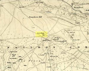

Overton Down Tomb, West Overton, Wiltshire

Cairn:  OS Grid Reference – SU 1305 7052

Getting Here

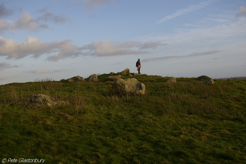
Overton Down cairn (image © Pete Glastonbury*)

From the Avebury stone circle, walk out eastwards and straight up the ancient Ridgeway for about a mile until it levels out and meets up with the adjoining track upon the hilltop. Instead of going left or right, go straight across and onto the footpath that crosses Overton Down, until you reach the wide horse-racing track lookalike called ‘the Gallops.’  Stop – don’t go on it – and follow the fence down for a coupla hundred yards till you’ll see the fenced-off rise with a modern ‘barrow’ enclosed within. You’re very close! From here, go another 100 yards or so down and keep your eyes on the rise of land with rocks scattered around it.  That’s it!

Archaeology & History

From all accounts, there’s been nowt of any consequence written about this site — which is bloody incredible to be honest!!  We came here on a fine day (that’s Mikki, Geoff and June) in the company of the local Avebury magus, Pete Glastonbury.  Crossing Overton Down towards an experimental “barrow” that some archaeo’s have knocked-up, the rise in the land here stands out quite clearly, saying (at the very least), “look at me!”  But until Pete Fowler (2000) first described this “unrecorded kerbed round barrow” a few years back, it had escaped the noses of all previous archaeological surveys!  How!?

What the hell do archaeologists in the Avebury area do with themselves if they can’t pick this sorta monument out!?  But anyway…

Overton Down cairn – looking NW

This is quite a large rounded cairn structure by the look of it.  At least 30-feet across, probably kerbed from the initial look (only for a few minutes, sadly).  Local writer Terence Meaden has apparently found the site of some importance in his studies (not yet published).  Its position here in the landscape was what caught my attention more than anything: it stands on the crest of the hill and has superb uninterrupted views far across the Avebury landscape.  This siting was obviously quite deliberate. Less than 100 yards due north of here are two curiously placed stones which may ‘frame’ the cairn for a southern lunar alignment.  I had no time to look at this really, so it would be good if some local Avebury dood could check this out.  The outlying stones may be merely fortuitous, but it’d be good to know for sure!

The site has been plotted amidst a mass of landscape changes dating from the neolithic to medieval periods.  It seems probable, on first impression, that the ‘cairn’ is of Bronze Age in character (though could be earlier), but until detailed analysis has been made we obviously won’t know for sure. A short distance to the south we have the much-denuded Overton Down site X1: another Bronze Age burial that yielded three beaker graves when Fowler excavated the place in the 1960s.

For those of you into geomancy, meditation and the subjective realms of genius loci, this one really grabbed me.  Give it a go and lemme know what you get.  But please, no stupid pagan or New Age offerings — the site doesn’t need that sorta thing.

References:

  1. Fowler, Peter, Landscape Plotted and Pierced: Landscape History and Local Archaeology in Fyfield and Overton, Wiltshire, Society of Antiquaries: London 2000.

* Pete Glastonbury is a Wiltshire-based photographer specialising in Landscapes, Astronomy, Archaeology, Infra-Red, Experimental Digital Photography and High Dynamic Range Panoramic photography.

© Paul Bennett, The Northern Antiquarian
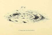

Barrow Field, Bushy Park, Teddington, Middlesex

Tumulus (destroyed):  OS Grid Reference – TQ 163 703

Archaeology & History

This is one of very few prehistoric tombs that are known about from the London region and — surprise, surprise! — very little is left of the place.  No surprise really.  It appears to have first been explored soon after Queen Victoria came to the throne

“A barrow on the south side of Sandy Lane was excavated in 1854.  It revealed some much disturbed burials, some flint tools and part of a bronze dagger.” (Ching & Howe 1980)

There were in fact the remains of three people found here: one at base level; the other just below the top; and the third body comprised remains that appear to have been buried just beneath the surface.  The tomb was a big thing aswell — being nearly 100 feet across and more than 10 feet high.  Pity there’s little to be seen of it today…

References:

  1. Ching, Paddy & Howe, Ken, Teddington – As it Was, Hendon: Nelson 1980.
  2. Gordon, E.O., Prehistoric London – Its Mounds and Circles, Covenant: London 1946.
  3. Merriman, Nicholas, Prehistoric London, London Museum 1990.
  4. Spence, Lewis, Legendary London, Hale: London 1937.

© Paul Bennett, The Northern Antiquarian

Lexden Tumulus, Colchester, Essex

Tumulus:  OS Grid Reference – TL 975 247

Getting Here

Fortunately for the person who lives here, this much overgrown and denuded remains of a fabled tumulus is in their garden!  The mound is divided by a hedge in the back garden, up near the bend of where Fitzwalter Road meets St. Clare Road and the school field backs onto them.  I’ve no idea whether the people who own the gardens are OK with you visiting the site or not. If you wanna look at it, I s’ppose the only thing to do is knock on their door and ask!

Archaeology & History

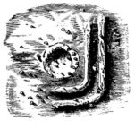
Plan of the Lexden tumulus (Laver, Archaeologia 1927)

Ascribed as late Iron Age, some of the finds here are distinctly Romano-British.  Indeed, excavations here by P.G. Laver in 1924 uncovered rich Belgic remains akin to the chariot burials found in East Yorkshire! (though not quite as good as them)  There was a considerable collection of gold, silver and other metalwork remains here, along with considerable remains of pottery aswell.  It seems there was a tradition of burials here, with some evidence dating from the Bronze Age — but the majority of remains found in the excavations were from the much later period.  One account attributes the burial mound to have held the body of Cunobelin; the other, the body of Addedomaros of the Trinovante tribe.

Folklore

Quoting from an earlier source (A.H. Verrill’s Secret Treasure, 1931), in Leslie Grinsell’s (1936) fine early survey on British prehistoric tombs, he described the legend of there being hidden treasure here, saying that locally there was

“a belief that it was the burial place of a king in golden armour, with weapons and a gold table.”

But was this legend described anywhere before P.G. Laver’s excavation of the site in 1924…?  It would be very intriguing if we could find this out!

References:

  1. Grinsell, Leslie V., Ancient Burial Mounds of England, Methuen: London 1936.
  2. Laver, P.G., ‘The excavation of a Tumulus at Lexden, Colchester,’ in Archaeologia journal, no.76, 1927.

Links:

  1. Unlocking Essex’s Past: The Lexden Tumulus & Associated Cemetery

© Paul Bennett, The Northern Antiquarian


Acrehowe Circle, Baildon Moor, West Yorkshire

Ring Cairn:  OS Grid Reference – SE 14245 40686

Also Known as:

  1. Coll’s Burial Mound
  2. Rerehowe

Getting Here

Acrehowe site on 1852 map

Go up through Baildon centre and head onto the moors. Crossing the cattle-grid, a coupla hundred yards further up, turn left. Past the small reservoirs on your left, another 100 yards or so and you reach the brow of the hill.  As you begin going down the road, there’s a small car-park right by the roadside.  The curious remains of the earthworks at the side of the old circle are discernible in the grassland right to its side.

Archaeology & History

Illustrated on the 6-inch OS-map of 1852 as “Site of a Barrow” (similar to how it appears in the image drawn here by Mr. C.N.M. Colls) a short distance below Pennythorn Hill top, there are still considerable traces of the earthworks surrounding the east and southern sides of what was once some form of ring cairn or tumulus that was once at this prominent place in the landscape.

Aerial view of siteThe site was first explored by Mr Colls in 1843 (his results were reported a few years later), who found a loose double-ring of stones, fifty feet across, surrounded by a shallow trench which was most notable on the south and east sides. Two urns were also uncovered near the centre of the ring, nearly two feet down, containing the cremated remains of people.  A few years later, the Leeds historian James Wardell (1869) told a most fascinating note about what happened during their excavation, saying:

“This…examination was attended by a circumstance not soon to be forgotten by the persons engaged therein (on the excavation). They had almost reached the place where the broken urn and bones were deposited when, at once, such a fearful storm of thunder, lightning and rain came on, that they were not only considerably alarmed, but driven from the Common to seek shelter in the village.”

Colls’ 1846 sketch

We hear this sorta thing at many of our ancient places!

Colls 1846 plan

One anonymous writer in 1955 described the site as a ‘stone circle’, and a number of subsequent archaeologists copied this without question; but in all probability this site was more typical of an old cairn circle or ring-cairn, similar in size and design to the Roms Law circle two miles north of here.  However, the earthworks at its side give the impression of some sort of exaggerated hengiform enclosure.

The place-name element howe strongly indicates a burial site and is a suffix found at many prehistoric tombs across northern England.  The prefix ‘acre’ may relate to “a plot of arable or cultivated land, a measure of land (an acre) which a yoke of oxen could plough in a day” (Smith 1956), or may be a corrupted form of the Old English word, ‘acen’, relating to oak trees.  Early literary examples of the place-name would enable a clearer understanding of the prefix element here.

References:

  1. Anonymous, Colls’ Burial Mound Stone Circle, Baildon Moor, Museum Leaflets: Bradford 1955.
  2. Baildon, W. Paley, Baildon and the Baildons (parts 1-15), St. Catherines: Adelphi 1913-26.
  3. Barnes, Bernard, Man and the Changing Landscape, Eaton: Merseyside 1982.
  4. Bennett, Paul, The Old Stones of Elmet, Capall Bann: Milverton 2001.
  5. Colls, J.N.M., ‘Letter upon some Early Remains Discovered in Yorkshire,’ in Archaeologia, 31, 1846.
  6. Collyer, Robert & Turner, J.H., Ilkley: Ancient and Modern, William Walker: Otley 1885.
  7. Smith, A.H., English Place-Name Elements – volume 1, Cambridge University Press 1956.
  8. Wardell, James, Historical Notes of Ilkley, Rombald’s Moor, Baildon Common, and other Matters of the British and Roman Periods, Joseph Dodgson: Leeds 1869. (2nd edition 1881)

© Paul Bennett, The Northern Antiquarian