Kirkmoor Beck Farm, Fylingthorpe, North Yorkshire

Cairn Circle:  OS Grid Reference – NZ 9253 0306

Also Known as:

  1. Kirk Moor Beck Farm
  2. Kirkmoorbeck Farm

Archaeology & History
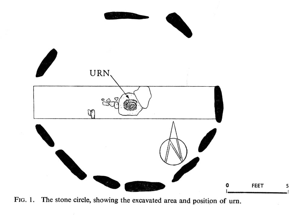
Plan of Kirkmoorbeck circle (after Radley 1969)

Although originally classed as a stone circle, this site should more accurately be described as a form of cairn circle, as burial remains were found in the middle.  This is noted by both Aubrey Burl (2000) and John Barnatt (1989), who thought it to be a kerbed cairn.  It’s only a small circle aswell, about 5 yards across and is found not far from other burial cairns in the neighbourhood.

First discovered around Easter in 1965 by the then owners of the farm, Mr & Mrs K. Jarman, parts of the circle were dug into by their children, who subsequently informed Sheffield City Museum of their finds.  Subsequently, the circle was then described in a short article by J. Radley (1969) in ‘Notes on Archaeological Finds’ for the Yorkshire archaeology group.  He wrote:

“The circle is 15ft in diameter and is made of ten stones which protrude a few inches above the turf cover.  Inside the circle the ground is slightly concave.  A two-feet wide trench was dug across the circle and a large stone was revealed at the centre. On the stone was a fragmented urn, remains of a cremation, and one fragment of flint. There are signs of burning on the stone, and also under the stone, but no other burial has been discovered.  The whole burial was so shallow that it was in the root zone of the overlying grass.  The survival of many pieces of bone in such a wet location suggests that the area must have been protected by a mound until quite recent times…

“The urn is too fragmentary to be restored.  Of the hundreds of fragments, only a few retain both faces, and these are generally one centimetre thick.  The urn appears to have been made of a fine clay with large grits and has a smooth brown surface marked in places with impressions of blades of grass. The urn may have been biconical in form with bands of horizontal grooves around the upper part, with vertical grooves below them.”

References:

  1. Barnatt, John, The Stone Circles of Britain – volume 2, British Archaeological Reports: Oxford 1989.
  2. Burl, Aubrey, The Stone Circles of Britain, Ireland and Brittany, Yale University Press 2000.
  3. Radley, J., “A Stone Circle on Kirkmoor Beck Farm, Fylingdales,” in Yorkshire Archaeological Journal, part 167, volume 42, 1969.

© Paul Bennett, The Northern Antiquarian

Sheep Scar Enclosure, Giggleswick, North Yorkshire

Enclosure:  OS Grid Reference – SD 80648 66374

Getting Here

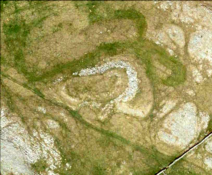
Aerial view of enclosure

To reach here, follow the same directions to get to the Apronful of Stones giant cairn.  Walk on the footpath past the cairn for about 200 yards until you reach a large gap where the old walling has collapsed.  Go through this and walk across the limestone rocks, towards the small rocky hillock rising up 100 hundred yards in front to your east (not the more rounded one to the north).  That’s it!

Archaeology & History

This is a most intriguing find, and one to which I can find no other literary reference (though I aint checked Brayshaw’s Giggleswick).  An undeniably large natural hillock has been modified and added to by people at some considerable time long ago and at some considerable effort!  Measuring more than 47 yards (43m) roughly east-west, and 21 yards (19m) north-south, the most definable man-made remains here is the length of elliptical walling on the southern and western edges.  The internal circumference of the enclosure measures roughly 113 yards (103m) all round the edges.  The northern and eastern sides of the hill would appear to be mainly natural, but seem to have been modified a little — not unlike the mass of settlements and enclosures a few miles to the east, like Torlery Edge, Lantern Holes and others around Malham Moor and district.

The site needs professional assessment: first to ascertain its period (which seems Iron Age on first impression, but could be much later), and second to ascertain its nature.  On the ridges close by we find a veritable mass of archaeological remains, ranging between Bronze Age to Medieval in nature.  The giant Apronful of Stones is only 172 yards (158m) south; the Sheep Scar cairn circle 156 yards (143m) northwest; and one of the remaining Sheep Scar cairns only 58 yards (53m) away.  And hopefully when we return to the place next week (fingers crossed!), we’ll be able to get some more photos of the walling you can see that define some edges of the site…

…to be continued…

References:

  1. Brayshaw, Thomas & Robinson, Ralph M., A History of the Ancient Parish of Giggleswick, Halton & Co.: London 1932.

© Paul Bennett, The Northern Antiquarian

Feizor Thwaite, Lawkland, North Yorkshire

Ring Cairn:  OS Grid Reference – SD 79798 67473

Getting Here

Feizor Thwaite circle (after ‘QDanT’)

From Feizor village, take the dirt-track south that cuts up between the two cottages and walk onto the level.  From here, the walling bends round and a small cut runs up the slope on your left.  Go up here and onto the top, bearing left again when you reach the footpath near the top of the slope.  Walk along here until the hills open up before you and less than 100 yards along, just on the right-hand side of the path, you’ll notice the overgrown outline of a ring just by the side.  Don’t miss it (like I did!).

Archaeology & History

Danny, Paul and I visited here a few weeks back on a fine sunny day and, my attention caught by some nearby rocks that got mi nose twitching, I just about walked past the place until Danny called me back and said, “Oy – ‘ave y’ not seen this?”  Right under my nose no less!

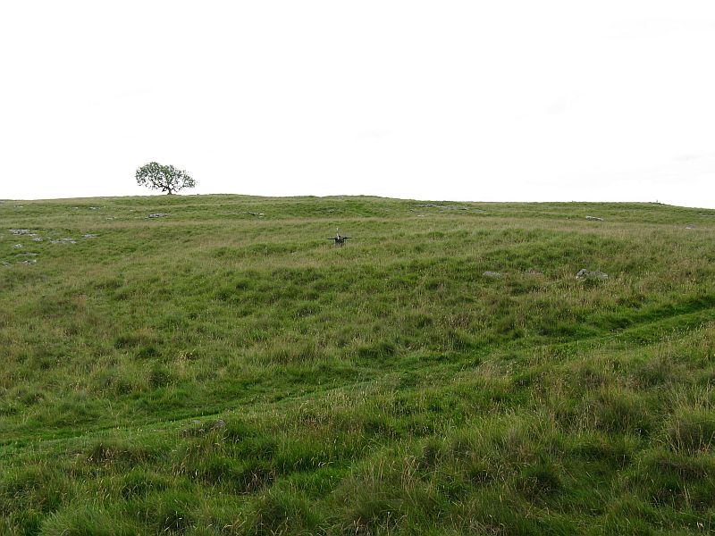
Feizor Thwaite circle, looking northwest

The site’s a little known circular monument east of Feizor village, less than a mile northwest of the cairnfield above Stackhouse (where lives the Apronful of Stones and other prehistoric friends).  Marked on modern OS-maps as an ‘enclosure,’ the site here is in fact an overgrown cairn circle, typical in size and form of the ones found at nearby Borrins Top, Burley Moor, Askwith Moor and elsewhere in the Pennines.  Measuring (from outer edge to outer edge) 66 feet 6 inches east-west and 59 feet north-south, the remains here consist of a raised embankment of stones, encircling an inner flatter region consisting of many smaller stones beneath the overgrowth of grasses and vegetation.  Locals told me that the some of the cairns up here were explored early in the 20th century by a local man called Tot Lord, but I’m unsure whether he looked at this one.

There are a couple of other smaller circular remains on the same grassland plain, clearly visible from aerial imagery, along with other crop-marks of human activity on this part of the Feizor Thwaite landscape.  More antiquarian analysis could do with focussing here to see what can be found!

Links:

  1. Feizor Thwaite & other nearby prehistoric sites
  2. Feizor Thwaite Computer Art

© Paul Bennett, The Northern Antiquarian

Feizor, Lawkland, North Yorkshire

Standing Stone (destroyed):  OS Grid Reference – SD 78570 67177

Archaeology & History

Feizor on 1851 map
Feizor on 1851 map

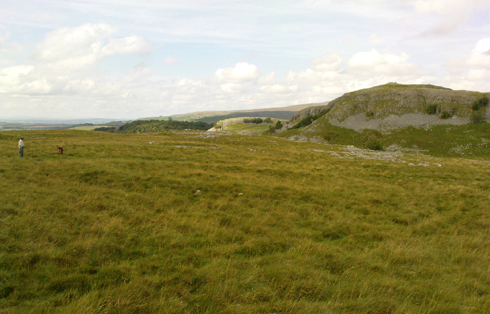
There have been no previous archaeological reference to this site (until now), which was included in early place-names records (Smith 1961) and was also highlighted on the first Ordnance Survey map of the region around 1851.  Probably as a result of the archaeological lacking, the upright stone has finally succumbed to the destructive actions of modern man. When we asked the farmer if he knew owt about any standing stone here, he said he knew “nowt abaat that.”

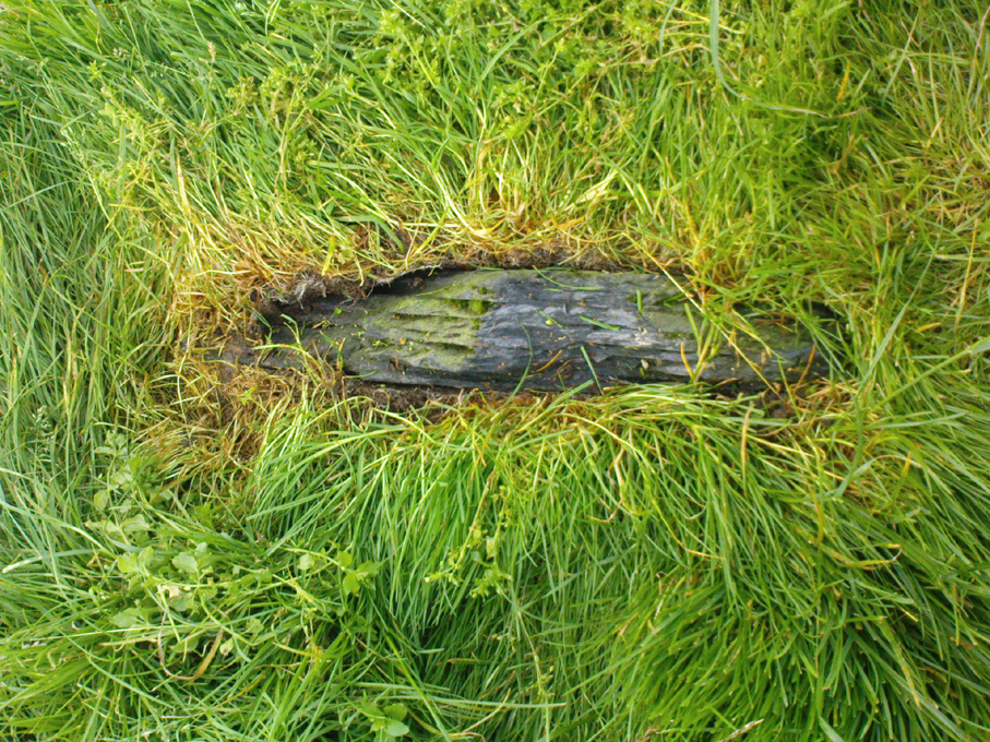
Feizor stone stump
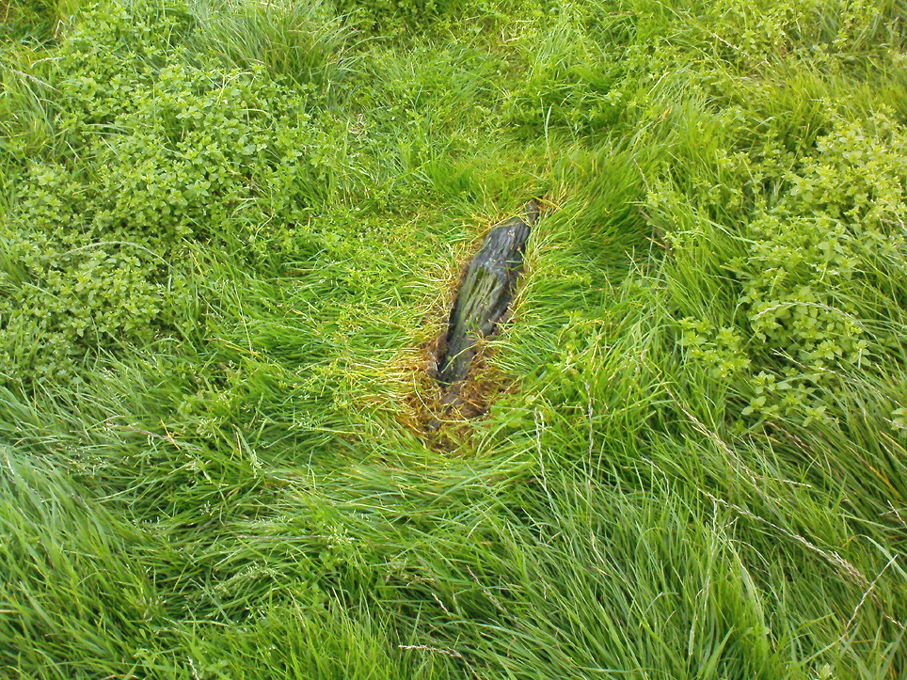
and from another angle

All that can be seen today is the very small stump of stone, just visible above ground level, in the middle of the field.  It’s not easy to spot either, as the grasses grow over what’s left.  But we found the slim remnant of the stump embedded in exactly the spot marked on old and modern maps, measuring 24 inches in length and just 4 inches across at the widest, with what seemed like worn rounded edges at either end.  We were unable to ascertain the depth of the remaining stone in the ground. The stone looks simply as if it’s been snapped at the base.  We have no idea how tall this standing stone was.

If any local people know anything more about this stone, or have any old photos, we’d love to hear from you — and would obviously give due credit for any help on this matter.

References:

  1. Smith, A.H., The Place-Names of the West Riding of Yorkshire – volume 6, Cambridge University Press 1961.

Links:

  1. Feizor stone remnants & walks to nearby prehistoric sites

© Paul Bennett, The Northern Antiquarian 

Eller Edge (429), Pock Stones Moor, Thruscross, North Yorkshire

Cup-Marked Stone:  OS Grid Reference – SE 0902 6150

Also Known as:

  1. Carving no.429 (Boughey & Vickerman)
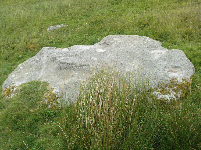
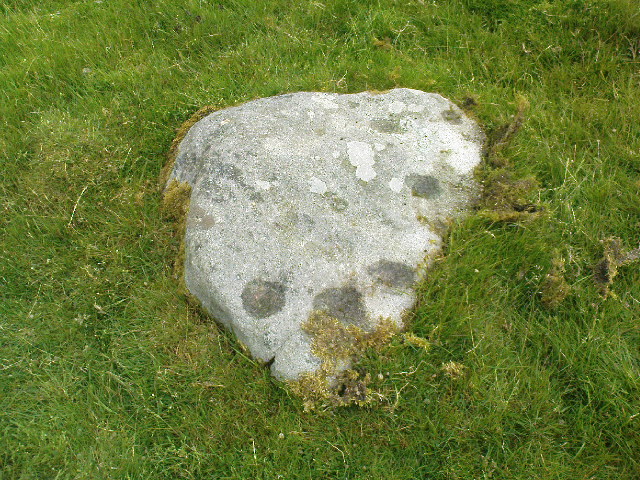
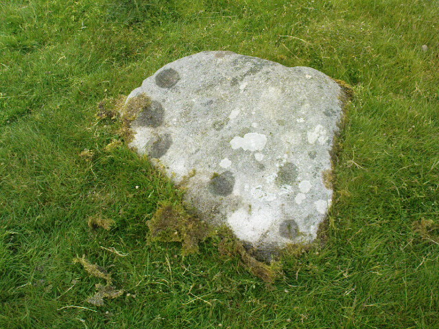
Eller Edge stone 429

Getting Here

A slight walk to get here.  Follow the same directions as if you’re going to the Eller Edge 431 carving.  Once here, walk west as if you’re going into the middle of the field, keeping your eyes peeled about 20 yards along for a small-ish rounded stone with nice colours of lichen amidst the grasses.  If you’re patient, you’ll find it soon enough!

Archaeology & History

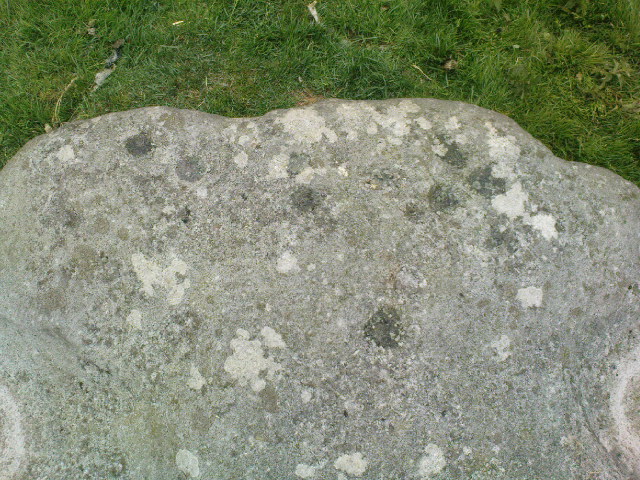
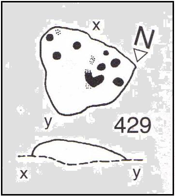
This is another simple cup-marked stone on the grassland ridge overlooking higher Wharfedale.  The carving here is a little clearer and more well-defined than that of its close neighbours, with a number of simple cups visible on its rounded surface.  We counted seven such cups on our cloudy-day visit, but Boughey & Vickerman (2003) thought there might be a little more, describing the stone simply:

from another angle
B & V’s drawing

“Small lichen-covered rough grit rock.  About eight cups and two depressions.”

A rubbing of this small stone (as practiced by English Heritage and rock art students alike) would prove useful in bringing out any other ingredients in the ancient design.  And whilst you’re in this field, have a look at the curious Spiral Stone and some of the other cup-markings close by.

References:

  1. Boughey, Keith & Vickerman, E.A., Prehistoric Rock Art of the West Riding, WYAS: Wakefield 2003.

Links:

  1. Eller Edge Rock Art – more notes & images

© Paul Bennett, The Northern Antiquarian

Eller Edge (424), Pock Stones Moor, Thruscross, North Yorkshire

Cup-Marked Stone:  OS Grid Reference – SE 08973 61487

Also Known as:

  1. Carving no.424 (Boughey & Vickerman)
Eller Edge carving 424

Archaeology & History

A slight walk to get here, but well worth it once you arrive!  Follow the same directions as if you’re going to the Eller Edge 426 carving.  Once you reach this stone, notice the larger rounded rock about 20 yards to your west, a bit further down the field.  You can’t really miss it!

Archaeology & History

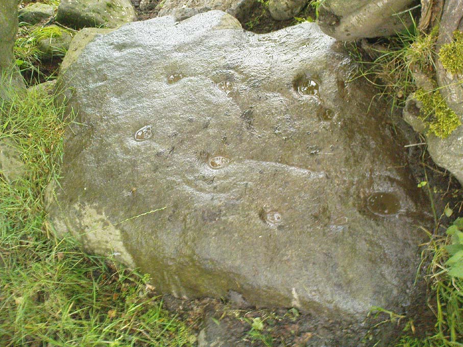
A large rounded stone just on the meadows before it begins to slope more steeply downhill, there are several of those large natural ‘bowls’ that we see on a lot of cup-marked and not-so-cup-marked stones in our northern hills.  These basins or bowls may, at times, may have had significance for our ancestors, but it’s the cluster of cup-markings on this stone which are of importance to us here.  There are perhaps as many as a dozen cup-marks here, all very well worn, and mostly to be seen on the eastern sides of the rock.  When I came here with Paul Hornby and QDanT a few months back, the cloud cover stayed with us all day, so I didn’t get any decent images of the carving.  Ne’er mind…

Close-up of faint cups

The stone was described by Boughey & Vickerman (2003) simply as:

“Very large, uneven, rough grit rock with face with scooped-out areas sloping down to grass.  Eleven possible cups and six basins.”

A plain carving, perhaps only of interest to the fanatics amongst you.  But if you do visit here, check out carving 432, 431, and others in the same field.

References:

  1. Boughey, Keith & Vickerman, E.A., Prehistoric Rock Art of the West Riding, WYAS: Wakefield 2003.

Links:

  1. Eller Edge Rock Art – more notes & images

© Paul Bennett, The Northern Antiquarian

Eller Edge (432), Pock Stones Moor, Thruscross, North Yorkshire

Cup-and-Ring Stone:  OS Grid Reference – SE 09078 61479

Also Known as:

  1. Carving no.432 (Boughey & Vickerman)
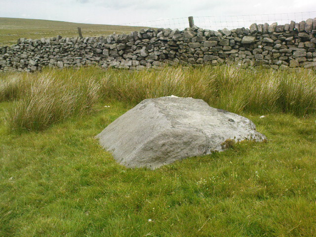
Carving 432, close to the wall

Getting Here

A slight walk to get here.  Follow the same directions as if you’re going to the Eller Edge 426 carving, but as you reach the field edge, walk up the slope (in the field itself) along the side of the wall.  You’ll pass rudimentary Carving 431 and about 30 yards further uphill this little fella will catch your eye!  You can’t really miss it.

Archaeology & History

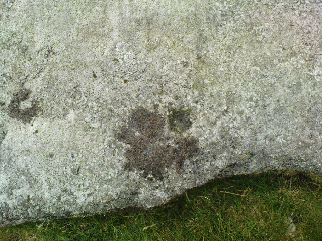
Another basic cup-marked stone that’s probably only gonna be of interest to the purists amongst you.  A single cup-marking sits on the edge of a small patch of old dark lichen, although the rock art students Boughey & Vickerman (2003) reckon there could be another two on here—but I aint so sure misself.  The stone was described by them simply as:

“Medium-sized rectanguar rock of medium gritstone, with vertical edges except for finely striated sloping W side.  One cup near possibly quarried edge and perhaps two more.”

Single faint cup-mark

Another single cup-marked stone of the same size, type and quality as this one can be found on another stone not far from this stone, which aint in the Boughey & Vickerman survey.  There’s also evidence of ancient lines of walling close by, but with little surface clues as to its age.

References:

  1. Boughey, Keith & Vickerman, E.A., Prehistoric Rock Art of the West Riding, WYAS: Wakefield 2003.

Links:

  1. Eller Edge Rock Art – more notes & images

© Paul Bennett, The Northern Antiquarian

Guisecliff Wood (629), Bewerley, North Yorkshire

Cup-and-Ring Stone:  OS Grid Reference – SE 16415 63565

Also Known as:

  1. Carving no.629 (Boughey & Vickerman)

Getting Here

A box of cup-and-rings!

Takes a bitta finding this one – especially a this time of year when the bracken’s high – but it’s worth the walk.  You’re probably best finding your way to the open-air carving on the slopes above Westcliff Farm, the Guisecliff Wood 626 carving (it’s pretty easy to find).  From here, walk eastwards across the top of the two fields until you hit the old gate that take you back into the woods.  Now it gets difficult!  Walk less than 100 yards in the same direction, if you’re lucky, along the small footpath that runs pretty level through the trees, keeping your eyes peeled for a large sloping rock above you.  I’d say that it’s probably best to start checking the relevant rocks (large ones) after 50 yards in the trees, just to be on the safe side.  If you aint been here before it’s probably best to check it out at the end of Winter or during Spring time.  Good luck!

Archaeology & History

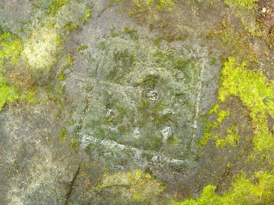
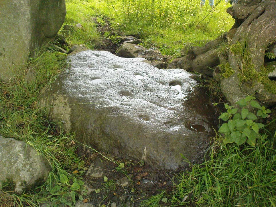
As noted by several people in our visit here the other day, some aspects of this carving are similar in design to the Tree of Life Stone on the eastern edge of Askwith Moor, 10 miles south of here.  But the features on this large carved rock have intriguing elements of their own here: not least of which is the large square ‘box’ into which a cluster of otherwise normal cup-and-rings are enclosed.  It’s a unique feature in prehistoric carvings in this part of the world — although such ‘box’ motifs can be seen further north at Dod Law in Northumberland.

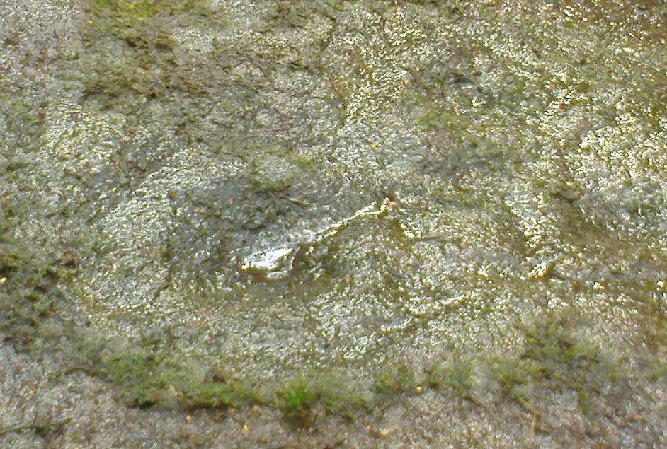
The fainter cup-and-rings
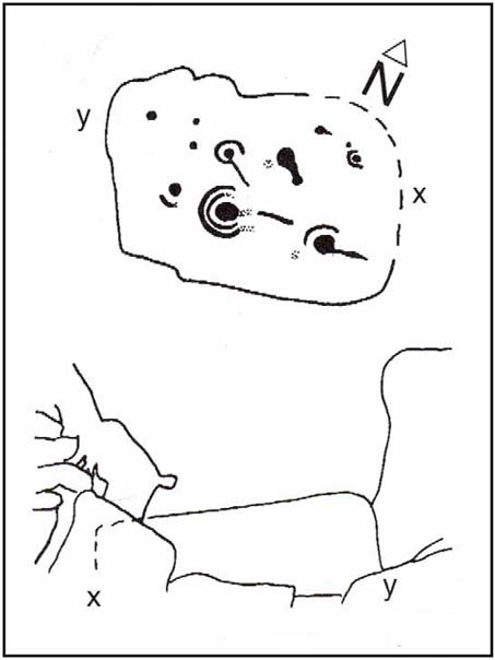
Boughey & Vickerman’s 2003 drawing

There are two distinct sections of carvings on the stone, both of which have a similar tree-motif patterns, but the boxed one grabs your attention more once you’ve sat with the stone for a while. The other small cluster of cups are a little more difficult to notice, but once you see them they almost grow into life!  You can just make out the surrounding rings and lines around some of these fainter cups, which I tried to capture in the photos (but without much success).

Our visit here didn’t pass without some voicing the thought that ‘box’ section could have been added at a much later date — perhaps a Victorian addition?  But we could be way off the mark with that one!

There’s every likelihood of other carvings being found in and above the woodlands here, though any further exploratory excursions here can wait till winter time, as the Nature’s summer growth here is considerable and covers most of the rocks in green.  The carving was first described in Boughey & Vickerman’s (2003) text as a

“Very large rock with extensive flat surface on which there seems to be two separate designs.  Seven cups are joined in a branch-like pattern, the whole within a square groove from which the ‘stem’ of the branch just protrudes; away from this is an approximately linear feature with three cups enclosed by linked rings at one end and then six more cups with a partial ring.”

If you’re a rock art enthusiast, or a real healthy heathen, this site is well worth checking out!

References:

  1. Boughey, Keith & Vickerman, E.A., Prehistoric Rock Art of the West Riding, WYAS 2003.

Links:

  1. More images of Guisecliff Wood carvings

© Paul Bennett, The Northern Antiquarian

Fertility Stone, Dacre, North Yorkshire

Cup-and-Ring Stone:  OS Grid Reference – SE 18552 62228

Also Known as:

  1. Carving no.638 (Boughey & Vickerman)

Getting Here

Fertility Stone carving

Take the same directions as if you’re visiting the Eastwoods Cross base and cup-marked stone, but at Eastwoods Farm itself, walk downhill following the field-wall, past the large house, then through the first gate you come to. (it’s got a ‘private’ sign on it and has some handy bulls in the field – but ask at the house and the folks there are friendly)  Following the footpath along the top of the field, cross the small stream, then head across the next field to the gap in the wall.  You’re here!

Archaeology & History

Boughey & Vickerman’s 2003 sketch

One of a cluster of cup-and-ring stones around the Bryan’s Wood and Eastwoods area, this carving is well worth a visit, but can be covered in shit and muck as the bulls pass through the gap here on their daily amble.  If the daylight isn’t good here, it can be difficult to see the carving – and when we visited the place the other day, the cloud was low and the heavens were ready to open, so our luck was out for a change!  There are a number of cup-and-rings plus a double-ring, fading their ways around the more defined cup-markings.  The stone appears to have been found in the 1990s, but records of it are scant.  Boughey & Vickerman (2003) fail to tell the origin of the name, nor when or who rediscovered the site.  Their description of the carving tells simply:

“Large flat smooth rock sloping slightly to E.  Thirteen possible cups, one with partial double ring and four with partial single-rings; three ringed cups have grooves leading from them.”

Several other excellent cup-and-ring carvings can be found around here.  The hugely impressive Morphing Stone and a prehistoric lightning-carving can be found three fields away to the south, past the trees on the other side of the stream.

Folklore

Close-up of the stone

The title of ‘fertility stone’ seems a modern one, although word has it that it relates to Beltane fertility rites.  However, I can find no documentary information relating to this, and the people at Eastwoods Farm and adjacent house know nothing to account for it.

References:

  1. Boughey, Keith & Vickerman, E.A., Prehistoric Rock Art of the West Riding, WYAS 2003.

Links:

  1. Graeme Chappell on the Fertility Stone
  2. Guidecliff Woods & Fertility Stone images

© Paul Bennett, The Northern Antiquarian

Guisecliff Wood (626), Bewerley, North Yorkshire

Cup-and-Ring Stone:  OS Grid Reference – SE 16078 63641

Also Known as:

  1. Carving no.626
  2. Hogback Stone
  3. Lower Intake carving
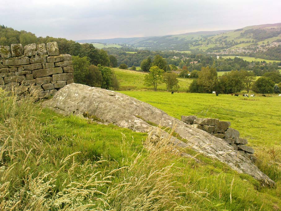
Carving 626, looking NNW

Getting Here

From Pateley Bridge take the B6265 road towards Grassington, turning left just a coupla hundred yards over the river bridge, towards Bewerley.  Go through the hamlet and take the second on the right, up the steep zigzagging lane.  A half-mile up the hill, watch out for the track onto Westcliff Farm.  Go along here and onto the footpath, then as you walk through the field, look uphill where the long wall runs into the trees, and you’ll see a rock in the walling near the top.  That’s it!

Archaeology & History

Just over the edge of the northern section of The Intakes at the western end of Guisecliff Wood, on a large rock in the walling near the very top of the field above Westcliff Farm, we find this little-known but very impressive cup-and-ring stone.

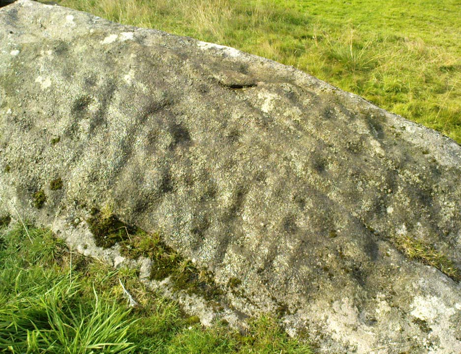
Close-up of some cups
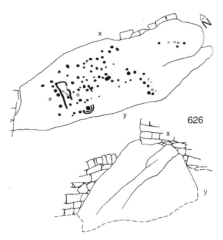
Boughey & Vickerman’s drawing

Upon first sight the rock was aptly described by Danny Tierney as being like a Viking Hogback Stone with cup-markings along the sloping side of the long rock as it grew into the drystone walling.  He had a point!  It’s a curious carving (how many times do I say that!?), with the majority of the cup-marks and lines etched into the south-sloping face of the rock.  Other cups found further down the stone stretch along the eastern side towards ground level; and we have a small line of cups etched onto the normal horizontal face halfway along the stone.

The carving was rediscovered by Stuart Feather in the ‘Sixties and was all-but-forgotten until Boughey & Vickerman (2003) rejuvenated it in their catalogue.  They told it to be:

“Large rock of coarse grit lying with long uneven surface E to W, at ground level to S and E, but with high N and W faces.  Up to eighty cups but some may be due to pebbles or other natural causes; one cup has two half-rings which, like some grooves visible, suggest a now incomplete design.”

The fascinating ‘boxed’ cup-and-ring stone of Guisecliff Woods 629 can be found less than 200 yards east of here, in the trees, and is certainly worth seeking out!

References:

  1. Boughey, Keith & Vickerman, E.A., Prehistoric Rock Art of the West Riding, WYAS 2003.
  2. Feather, Stuart & Hartley, C.E., “The Yorkshire Archaeological Register, 1964: Bewerley. W.R.”, in Yorkshire Archaeological Journal,  volume 41, 1965.

Links:

  1. More images of Guisecliff Wood carvings

© Paul Bennett, The Northern Antiquarian