Thor’s Stone, Thurstaston, Cheshire

Legendary Rock:  OS Grid Reference – SJ 24474 84933

Also Known as:

  1. Thor’s Rocks

Archaeology & History

Thor’s Rock (after J.Picton)

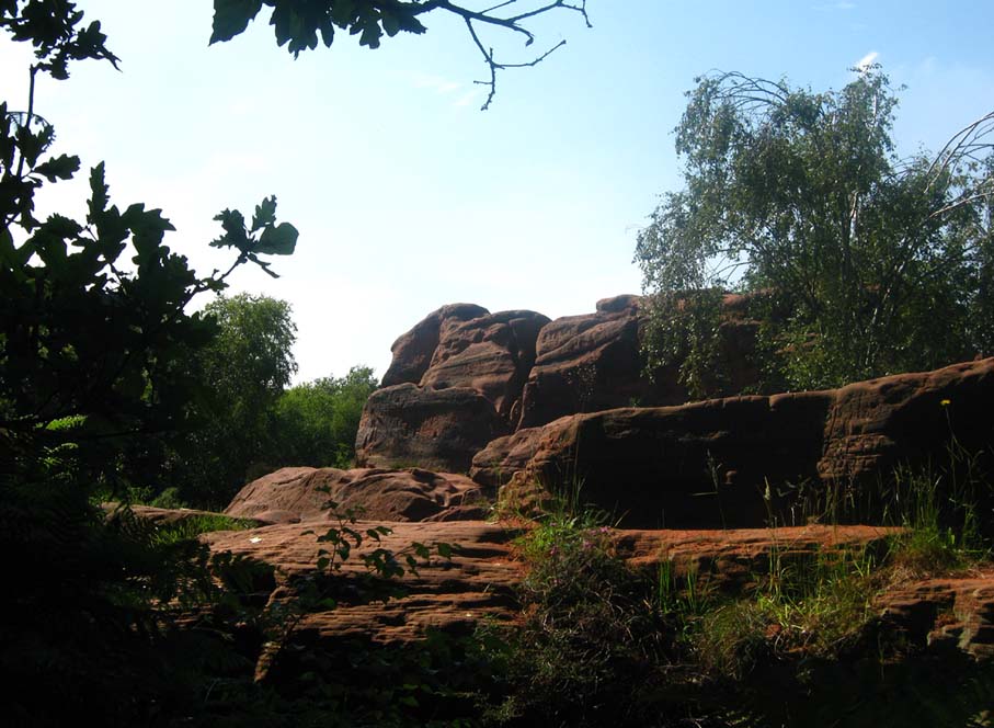
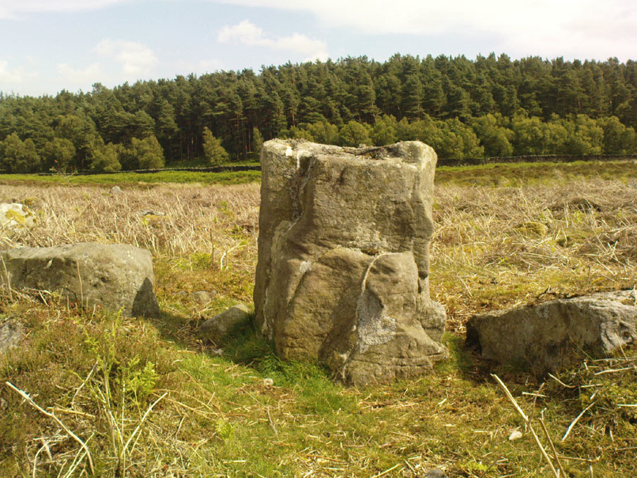
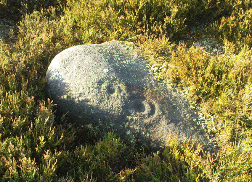
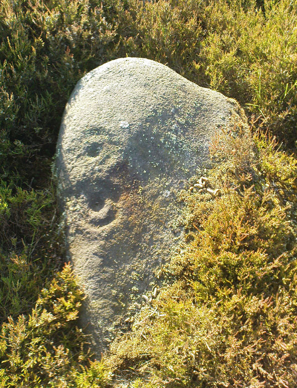
On Thurstaston Common a 298 foot high hill has a large red sandstone outcrop, on the landward side, known as Thor’s Stone. One large rectangular block of stone that is 50 feet in length, 30 feet wide by 25 foot high has been eroded over thousands of years. Described by J.A. Picton in 1877 as “the Great Stone of Thor,” the village itself seemed to have gained its name from this prominent mass of rocks.  It was described first of all in the Domesday book, as Turstanetone, and both village and rocks have been written as variants on the original ever since.  The place-names writers Mills & Room (1998) ascribe the name to being a “farmstead or village of a man called Thorstein”; but it’s just as likely to derive from “a farmstead of/at Thor’s Stone.” (Harrison 1898)  As early landscape features were traditionally equated with animistic and mythic lore, the Viking god Thor is more probable than some unlikely chap called Thorstein.

More than 100 miles southeast of here, we find another Thor Stone in the village of Taston, showing similar megalithic etymology.

Folklore

Local folklore tells that the rock is named after the Norse god Thor – he who causes thunder and lightning.  Viking settlers from Thingwell apparently settled here in the 10th century AD and, according to legend, these settlers used the stone as a pagan altar with blood sacrifices taking place here.  A creation myth of the site tells that Thor tossed the large stone here in anger; and yet another says that the stone was raised here to commemorate the battle of Brunanburh in 937 AD.  In modern more times, Morris dancers meet here and enact their rites on Mayday mornings.

The outcrop has been eroded away over thousands of years by the weather, post glacial erosion and even quarrying, leaving strange shapes, features and projections in the soft sandstone. There is much recent graffiti to be seen all over the rock, especially on the summit and sides including one set of graffiti carved by Professor Taylor in 1879.  There used to be a “fairy well” near the stone but this disappeared long ago.  Children took flowers to the well to decorate it, while adults visited it to receive a cure for various ailments of the body.  At nearby Thurstaston Hall, Christina Hole (1937) reported there lived the ghost of a troubled woman.

References:

  1. Harrison, Henry, The Place-Names of Liverpool, Elliot Stock: London 1898.
  2. Hole, Christina, Traditions and Customs of Cheshire, Williams & Norgate: 1937.
  3. Mills, A.D. & Room, Adrian, A Dictionary of English Place-Names, Oxford University Press 1998.

© Ray Spencer, The Northern Antiquarian

Weston Moor (543), North Yorkshire

Cup-and-Ring Stone:  OS Grid Reference – SE 18521 49406

Getting Here

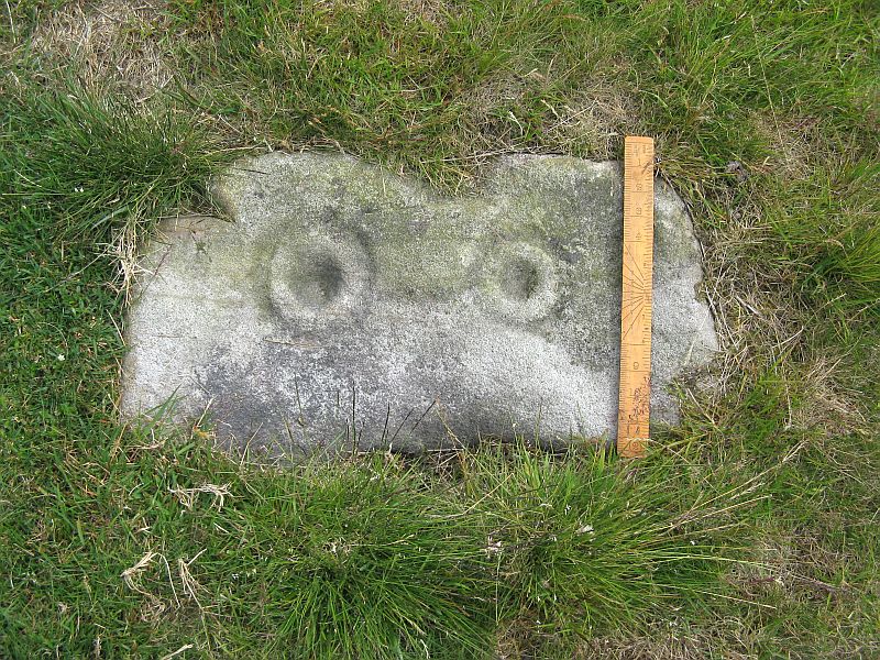
Weston Moor cup-and-rings (after ‘QDanT’)

Get yourself to the impressive multi-ringed Greystone Allotment carving, then walk to the copse of trees close by and bear left, following the edge of the fence along and following it when it turns down at right-angles, until you hit the bottom corner of the trees, where a path cuts in front of you.  From the bottom corner of the trees walk 25-30 yards diagonally away from the trees.  It’s under your nose somewhere damn close!

Archaeology & History

This is another archetypal cup-and-ring stone, similar in size and design to the recently discovered Slade (02) carving on Blubberhouses Moor, just over 4 miles (6.5 km) northwest (followers of Alexander Thom’s megalithic inch theory might be interested in assessing the measure of these two).   It is one of number clustered in and around this small grass ‘moorland’ region, where a number of carvings perished in the 19th century.  Thankfully this one survived.  Boughey & Vickerman’s (2003) brief notes on the stone tell:

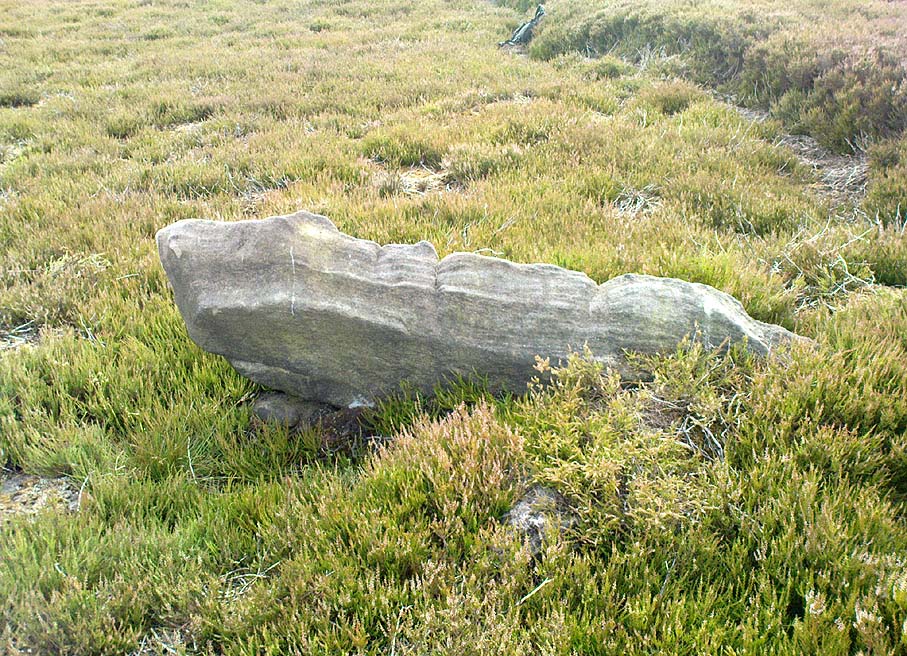
“Small, rough grit rough of regular oblong shape set very low in turf.  Two cups, each with a ring, and connected by a groove.”

On a recent visit to see this carving, Danny Tiernan, Paul Hornby, James Elkington and I were unable to locate it.  The carving may well have been destroyed, or moved.  If anyone is aware of what has happened to this petroglyph, please let us know.  We will be contacting the local authorities to see if any explanation is forthcoming from them.

References:

  1. Boughey, Keith & Vickerman, E.A., Prehistoric Rock Art of the West Riding, West Yorkshire Archaeology Service 2003.

Links:

  1. Weston Moor Rock Art – more notes & images


© Paul Bennett, The Northern Antiquarian
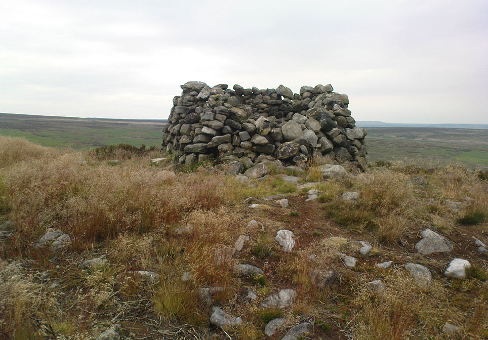
Old Wife Ridge, Heyshaw Moor, Dacre, North Yorkshire

Sacred Hill:  OS Grid Reference – SE 159 626

Getting Here

Long worn stone on Old Wife Ridge

From the bottom of Pateley Bridge, just out of town take the left turn to Bewerley and go through the village; or from Glasshouses follow the road over the River Nidd and round.  Both ways take you to meet the steep and winding Nought Bank Road, which you should follow all the way to the top of the moorland hill.  You can just park up by the footpath taking you east.  Then cross the road and walk west on the dirt-track to Rowan Tree Crags.  100 yards along, the gentle sloping moor on your left is the Old Wife’s Ridge.

Archaeology & History

The academic history of this moorland is poor, save occasional notes about lead mining and quarrying (Jennings 1967).  Speight (1894) describes the finding of large pieces of lead-worked Roman inscriptions nearby that were found in January 1735 — one of which had the letters ‘BRIG’ cut into it, thought to be a referral to the land or deity, Brigantia.  Examples of prehistoric rock art occur at nearby Guisecliff Woods, due east, but there are no specific notices about the archaeology of this hillside.

Long overgrown stone at Old Wife Ridge

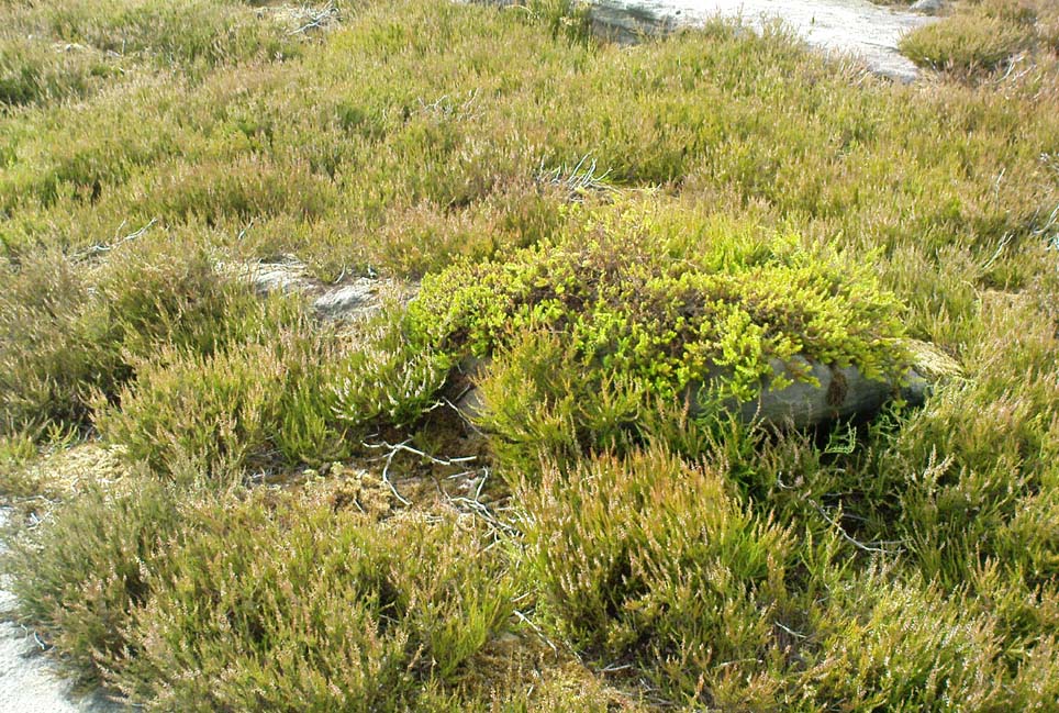
When we visited the place yesterday, much of the heather had been burned (the previous year) and we found two stones which looked suspiciously as if they had stood upright in the past, and may have had played some part in the naming and myth of the Old Wife on this part of the moors.  I can find no other records of any remains here.

Folklore

References to the Old Wife scatter our northern lands and invariably refer to an aspect of the heathen Earth Mother of our peasant ancestors, particularly in Her aspects of winter and early spring.  In Scotland and Ireland She was commonly known as the cailleach.  Sadly I can find no extant lore relating to Her mythic aspects in the landscape on these hills.  A field-name to the south, Nanny Black Hill, may have related to the Old Wife.

References:

  1. Jennings, Bernard (ed.), A History of Nidderdale, Advertiser Press: Huddersfield 1967.
  2. o’ Crualaoich, Gearoid, The Book of the Cailleach, Cork University Press 2003.
  3. Speight, Harry, Nidderdale, Elliot Stock: London 1894.

© Paul Bennett, The Northern Antiquarian

Nussey Green (404), Appletreewick, North Yorkshire

Cup-Marked Stone:  OS Grid Reference – SE 0739 6254

Getting Here

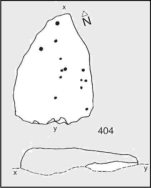
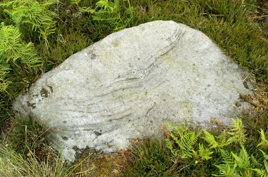
Nussey Green CR404 (after ‘QDanT’)

Park at Stump Cross Caverns on the B6265 road, then walk down the road for 200 yards till you reach the track on your left running over the fields in the direction towards Simon’s Seat.  Walk on the track for about 600 yards until there’s a change of direction in the adjacent walling and then watch out for the dirt-track on your right, curving towards the small valley (if you hit the Skyreholme Wall carving (413), you’ve gone 100 yards past the turn-off). Go on here until you see the overgrown track on your left into a small disused quarry, and head right, down the grassy slope, checking out the few stones ion front of you 20 yards down.  You’re damn close!

Archaeology & History

Carving no.404 (after Boughey & Vickerman)

A simplistic carving that was first described by fellow antiquarian Stuart Feather (1964), this is one of at least four cup-marked stones in a small group here, above the valley of Skyreholme Beck — better known at this part of the valley as the Troller’s Ghyll, haunt of various heathen lore.  Although some of the carving has now been covered by the growing Earth, you can still see the majority of the design.

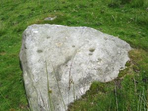
It is a flat, roughly triangular stone described by rock art students Boughey & Vickerman (2003) and having 13 cup-markings on it.  To get a full look at the entire carving, you may have to roll a bit of the turf away from one side of the rock.

Folklore

Although we have no lore relating to this specific carving, the small valley over which this carving looks was long known as the abode of the legendary bharguests, or black dogs: underworld creatures of earlier heathen myths.  Faerie lore can also be found a short distance further up the same stream.

References:

  1. Boughey, Keith & Vickerman, E.A., Prehistoric Rock Art of the West Riding, WYAS: Wakefield 2003.
  2. Feather, Stuart, “Yorkshire Archaeological Register 1963: Appletreewick, W.R.,” in Yorkshire Archaeological Journal, volume 41, 1964.

Links:

  1. Nussey Green Rock Art – more notes & images

© Paul Bennett, The Northern Antiquarian

Green Plain, Blubberhouses Moor, North Yorkshire

Settlement:  OS Grid Reference – SE 1492 5378

Getting Here

Cowling’s 1946 ground-plan of a portion of the settlement

From Blubberhouses church by the crossroads, walk up the slope (south) as if you’re going to Askwith, for 100 yards or so, taking the track and footpath past the Manor House and onto the moor.  Once you hit the moorland proper, take the footpath that bears left going down into heather and keep going till you hit the dead straight Roman Road path running west onto Blubberhouses Moor.  Go on here for nearly a mile until you hit the valley stream with its Eagle Stone down on your left.  Walk downstream, past the Eagle Stone, and cross over 100 yards down until you’re back on the level ground with the scatter of bracken and heather.  You’re here!

Archaeology & History

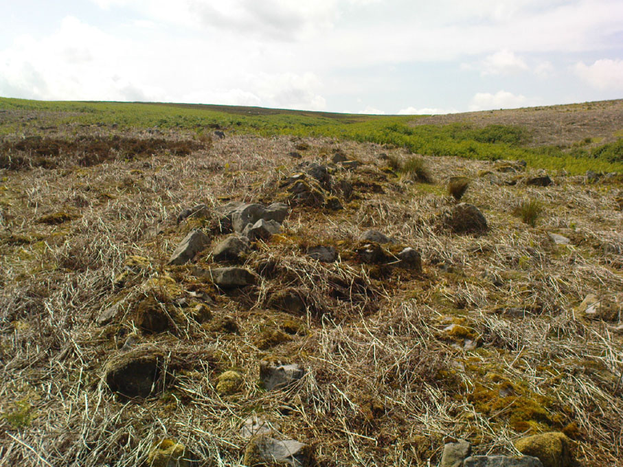
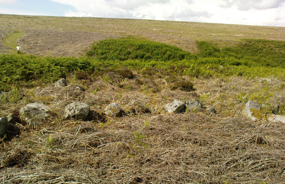
On the other side of the stream a short distance southeast of the large cup-marked Eagle Stone is a curious site, first described by Eric Cowling (1946) as “a series of enclosures of varying size and roughly circular shape” which he ascribed as a Bronze Age settlement.  Certainly we have a rather extensive scattered group of walled structures just as he described, but not all of the walling here seems typical of local Bronze Age constructions.  Cowling suggested the remains to be “useful for protection, herding and for shelter,” though admitted archaeological excavation would be the best way to ascertain their specific nature.  Such undertakings have yet to be done — and I wouldn’t hold your breath either.

Large section of walling
Walls of large circular structure

Although he described some of the walls here as nearly four-feet tall, when Graeme Chappell and I first ventured here in the winter of 1990, the walling wasn’t quite as high.  There are a number of individual tall stones sat in the walls that stand three-feet tall, with some that have been cut and dressed in more historic times.  Who did this and when is unknown.  However, if we visited this place when all the vegetation has been cut and burnt back at the end of winter and early months of Spring — a fact not lost on Cowling when he first found this place — we would gain a much clearer picture of things here.

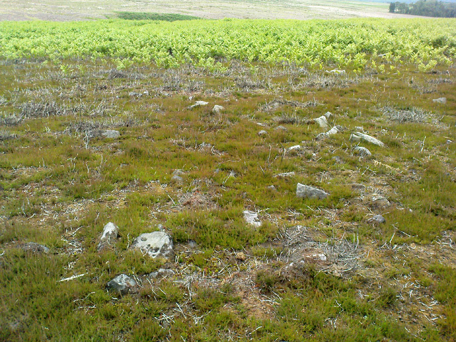
Some sections of lower walling above the streamside appear to be prehistoric in nature, but many other parts of the walled structures across this flatland plain have a much later look and feel about them, illustrating that the site may have been used well into post-medieval periods.  This seems increasingly obvious where we find a number of the stones cut at sharp angles, with some having distinctive quarried grooves in them.  However, I can find no historical records to verify this at present.

Hut circle remains
Medieval cut upright stone?

If we walk up the slight slope westwards however (before bracken and heath grow) there are more distinct prehistoric remains in the form of typical hut circles with low walls emerging from deep peatlands — although even these have been cut in one or two places by metal tools.  My view of this little-known but large settlement arena is that we’re looking at a site initially built in the Bronze Age period, continuing to be used by local tribespeople throughout the Iron Age and, as the cut stones clearly show, was a village that was certainly made use of in the last millenium.  But until someone comes along here and gives the site the attention it deserves, we’re not gonna know…

On the southern fringe of the copious walled structures we also find a very curious medicinal chalybeate spring that may have been of some importance to those who once lived hereby.  A ‘standing stone’ and prehistoric cairn can also be seen close by.

References:

  1. Cowling, E.T., Rombald’s Way: A Prehistory of Mid-Wharfedale, William Walker: Otley 1946.

© Paul Bennett, The Northern Antiquarian

Slade Carving (02), Blubberhouses Moor, North Yorkshire

Cup-Marked Stone:  OS Grid Reference – SE 1411 5431

Also Known as:

  1. Owl Stone
  2. Sunset Stone

Getting Here

Cup-and-rings, looking NE

Same directions as the Slade 01 carving.  But once you reach the upstanding stone cairn on the rocky hill, walk 220 yards (less than 200m) WSW and look around.  You’re damn close!  If you find the large cup-marked Slade 03 carving,  walk back east about 10-20 yards and you can’t really miss it!

Archaeology & History

This is just one of at least seven previously undiscovered carvings on this section of moorland – and it’s worth looking for!  The two other names we gave it — ‘owl’ and ‘sunset’ — come from the very notable design: owl thanks to it having the appearance of large owl-like eyes, and sunset as the two cup-and-rings are etched on the western edge of the rock and, when we found it yesterday, the sun was setting (albeit to the NW) and the image prompted talks of setting suns, the land of the Dead and other such worldwide indigenous religious myths (Harvey 2000) — for without recourse to such ingredients, these carvings are vacuous archaeocentric museum pieces and nothing more.  And this carving at least deserves much more than mere cataloguing!  The internationally renowned archaeologist, O.G.S. Crawford (1957) would have entered this carving into his ‘eye’ and ‘owl’ motif, representative of goddesses or spirit-forms, as would Gimbutas. (1989)

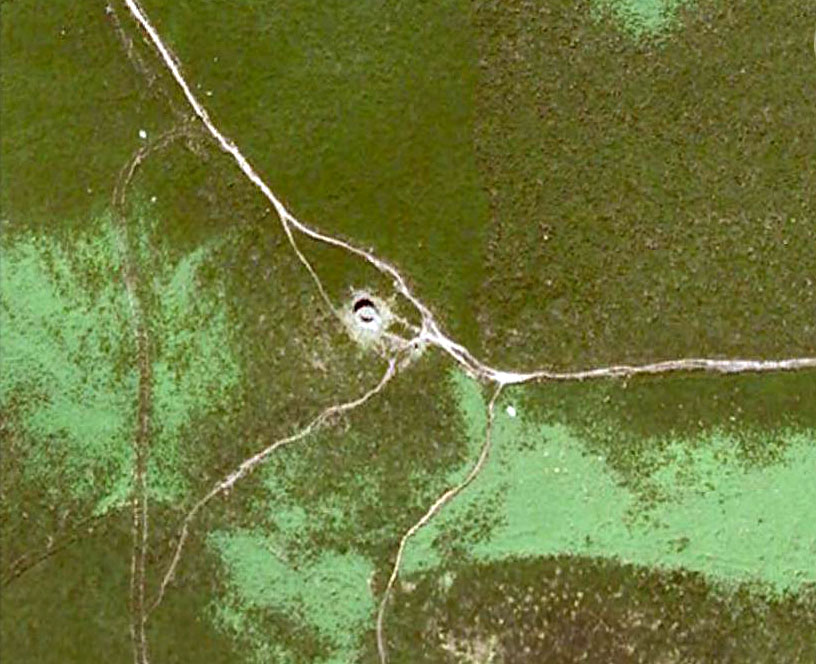
…and from above

But this carving is archetypal, as we can see, though would appear to have no other etched features on the stone’s surface.  It is very close (if not within) the prehistoric graveyard that is plainly evident 30-40 yards south in the burnt heather and would very likely have had some mythic relationship with the dead (a symbiosis we have found in many cup-and-rings).  We plan further ventures here in the coming weeks in the hope that we can unearth other prehistoric remains.

References:

  1. Crawford, O.G.S., The Eye Goddess, Phoenix House: London 1957.
  2. Gimbutas, Marija, The Language of the Goddess, Harper Collins: New York 1989.
  3. Harvey, Graham (ed.), Indigenous Religions, Cassell: London 2000.

© Paul Bennett, The Northern Antiquarian


Slade Carving (01), Blubberhouses Moor, North Yorkshire

Cup-Marked Stone:  OS Grid Reference – SE 1421 5440

Getting Here

Simple cup-marked stone

From Blubberhouses church by the crossroads, walk up the slope (south) as if you’re going to Askwith, for 100 yards or so, taking the track and footpath past the Manor House and onto the moor.  Once you hit the moorland proper, take the footpath that bears left going down into heather and keep going till you hit the dead straight Roman Road path running west onto Blubberhouses Moor.  Go on here for nearly a mile until you hit the stream and nearby Eagle Stone boulder.  Walk upstream from here, on its eastern (right-hand) side for 100 yards, then walk up onto the level moor, scattered with rushes.  Keep up here, heading towards the upright cairn open the skyline to the north.  Once here, walk 80 yards (73m) WNW and you’ll note a number of flat stones embedded in the heather around you.  You’re damn close!

Archaeology & History

Off-path and takes some finding and will all-but disappear when the heather grows back, so this one’s probably only for the purists amongst you.  But I like it anyway!  This is one of at least seven newly-discovered cup-marked stones hereby, including the nearby ‘Owl Stone’ with it’s big eyes!  There are just two cup-marks on the flat surface: one an archetypal large cup 3 inches across and a half-inch deep; the other, a small faint cup less than 2 inches wide and very shallow which is easily missed if you pay little attention.  On the photo here, the fainter cup is slightly above right of the centre.  The carving appears to be on the far eastern edges of the Slade Cairnfield.  Other undiscovered remains are likely to be found here.

© Paul Bennett, The Northern Antiquarian


Lippersley Pike, Denton Moor, North Yorkshire

Cairn:  OS Grid Reference – SE 14335 52478

Getting Here

Follow the directions to reach the Lippersley Pike cup-marked stone, then keep walking westwards, but go up the slope immediately on your right (north) and walk upwards along the path to the notable stone structure at the top-end of the ridge a coupla hundred yards ahead.  Once there, you’re standing on it!

Archaeology & History

Lippersley Pike & shooter’s butt

A little known site with some excellent 360° views all round, reaching as far west as Pendle Hill, north past Simon’s Seat, and east onto the far reaches of the North York Moors.  The landscape here is truly superb!  And humans have been here since, it would seem, mesolithic periods at least, if Cowling’s finds are owt to go by! For although he described the much denuded tomb that we can still see under the herbage and recently-built shelter, there was also, “on the northern slope…a small occupation immediately below the summit on the northern side.”  We found remains of it on our visit here the other day.  But of the tomb itself — which Mr Cowling thought was neolithic in age — he wrote:

“The highest point of Lippersley Pike, on Denton Moor, is crowned by a stone cairn 1083 feet above sea level, and overlooks, on the northern side, a small site which appears to have been occupied by the ‘Broad Blade’ people, for there occur several pieces of patinated flint, along with scrapers and worked blades.”

Aerial view of Lippersley Pike

Cowling then describes a number of flints and other prehistoric working utensils that he found all round here.  The remains of the cairn measure some 25 feet east-west and 23 feet north-south.  There has been no excavation here, although the fella’s who dug out much of the stone to build the shooter’s butt on its top may have found summat, but have kept it quiet!

The cairn is an ancient marker along the boundary line marking the townships of Denton and Great Timble and was visited in perambulation walks in previous centuries.  Grainge (1871) describes the extensive perambulation in his Knaresborough Forest work.  ‘Lippersley’ itself first appears in records from 1576, although A.H. Smith (1963:5) does not suggest an etymology.  The place is worth visiting as a good starting point to explore the other little-known prehistoric remains on these moors, including the Crow Well settlement, the Heligar Pike tomb, etc, etc.

References:

  1. Cowling, E.T., Rombald’s Way: A Prehistory of Mid-Wharfedale, William Walker: Otley 1946.
  2. Grainge, William, The History and Topography of Harrogate and the Forest of Knaresborough, John Russell Smith: London 1871.
  3. Grainge, William, The History and Topography of the Townships of Little Timble, Great Timble and the Hamlet of Snowden, William Walker: Otley 1895.
  4. Smith, A.H., The Place-Names of the West Riding of Yorkshire – volume 5, Cambridge University Press 1963.

© Paul Bennett, The Northern Antiquarian


Snowden Carr (597), Askwith Moor, North Yorkshire

Cup-Marked Stone:  OS Grid Reference – SE 17965 51158

Getting Here

Find your way to the excellent Tree of Life cup-and-ring stone, then walk about 10-15 yards west.  It’s under your nose!

Archaeology & History

Single cup-marked stone

Another stone for the rock art purists amongst us: a singular cup-marking near the edge of the rock.  Although the photo here seems to show three cup-markings close to each other, only one of the three is in fact real.  The other two are simple geological creations.  But this fact seemed to go over the heads of some English Heritage archaeologists who reported to Boughey & Vickerman (2003) that this was a stone “with three cup markings” on it.  I’m not sure who trains EH rock-art enthusiasts, but they seem to have a tendency to mistake natural features with artificial cup-markings and their evaluations should be treated with considerable caution (you’ve gotta wonder who the students are that are teaching them).

The rock itself is found in close association with other prehistoric remains and may have been a part of enclosure walling.  Very close by are numerous well-preserved settlement remains, cairns and other cup-and-ring stones.

References:

  1. Boughey, Keith & Vickerman, E.A., Prehistoric Rock Art of the West Riding, WYAS: Wakefield 2003.

© Paul Bennett, The Northern Antiquarian


Eller Edge (431), Pock Stones Moor, Thruscross, North Yorkshire

Cup-Marked Stone:  OS Grid Reference – SE 09059 61506

Getting Here

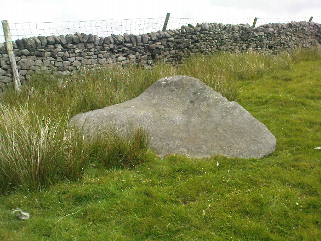
From Appletreewick take the road east through Skyreholme and up Skyreholme Bank, bearing right at the fork in the tracks along the ancient Forest Road.  Keep going till you cross the Larnshaw Beck and keep walking along the track until it runs wallside.  Look over the wall and you’ll see this sloping-chair-shaped rock .  You’re here!

Cup-Marked stone 431

Archaeology & History

Worth looking at if you’re visiting the Spiral Stone of Eller Edge field and its large associate, but otherwise this cup-marked stone is probably only for the purist rock-art mad-folk amongst us!  There are what seem to be three decent cup-marks upon the sloping face of the rock here, with a possible pecked line to the side of two of them — though we have to consider the possibility that a geological condition is responsible for the easternmost cup.  Described in the Boughey & Vickerman (2003) survey simply as:

“Large triangular rock of smooth gritstone, quarried at SE and sloping into ground at W and N.  Three cups on top sloping face.”

Thirty yards up the slope along the wall-side you’ll find carving 432 with its single cup-marking.


References:

  1. Boughey, Keith & Vickerman, E.A., Prehistoric Rock Art of the West Riding, WYAS: Wakefield 2003.

Links:

  1. Eller Edge Rock Art – more notes & images

© Paul Bennett, The Northern Antiquarian