Egg Well, Ashenhurst, Leek, Staffordshire

Healing Well:  OS Grid Reference — SK 005 540

Getting Here

Egg Well, Ashenhurst

Just outside of Leek a right-hand lane leads to the small hamlet of Ashenhurst, turning left pass the gated road and on the right hand side at the next fork is the The egg well on the right in a small brick building.

Archaeology & History

The Egg Well is a curious site.  No evidence appears to record it as a holy well, nor a spa— but it appears to be a secular healing well.  Local tradition believes that the site was used by the Roman, but the older fabric was set in place by William Stanley, the owner of Ashenhurst Hall bewteen 1744 and 1752.  The present house was erected in the 19th century.


Waters of the well

The name of the well is curious; it could refer to the shape of the basin, but could also refer to sulphurous waters although I could not detect a smell.  Today, a rather ugly 19th century brick-built structure surrounds this stone lined bath-shaped structure, which was roofed at a later date.

Folklore

The site was used by the Romans, but there is no evidence.  Its properties are recorded on the basin is this monogram and an interesting Latin inscription which reads:

“Renibus, et splenui cordi, jecorique medatur, Mille maelsi prodest ista salubris aqua.”

The translation being:

“The liver, kidneys, heart’s disease these waters remedy. And by their healing powers assuage full many a malady.”

References:

  1. Parish, R.B., Holy Wells and Healing Springs of Staffordshire – in publication.

Links:

  1. Holy Wells & Healing Springs – Staffordshire

© R.B. Parish, The Northern Antiquarian


St. Mary’s Well, Wallingwells, Nottinghamshire

Holy Well:  OS Grid Reference – SK 572 840

Archaeology & History

Old photo of St Mary's Well

Old photo of St Mary’s Well

First mentioned in Pipe Rolls and referred to by the founder of Wallingwells Benedictine Priory (founded around 1150 CE) as ‘juxta fonts et rivum fontium’, the site Wallingwell or originally Waldon-by-the-Wells, may be significant.  The name refers to ‘bubbling wells’, but whether these wells were dedicated appears to be unknown, although it does seem likely.  Indeed, an anonymous article from the Worksop Guardian dated 1929 on the Wallingwell Estate, shows the well arising under a rough stone work arch beside the site of a lake.  Close by, appears to be a grotto of a similar construction. The article states that the grotto was built 250 years (from 1929 this suggests a date of 1679 which appears a little too early for this folly, a date in the 18th century being more likely). This was done by Thomas White using stone from petrified springs in Derbyshire. No reference is made of the well, but one assumes that it was built at the same time, but whether White was constructing a folly around an existing traditional site again is unknown.

Baker (2000) refers to the castle folly but fails to reference these sites suggesting that it had vanished. However, grotto and well still exist in the overgrown and forlorn garden to the back of the house.  The grotto is well-preserved, although signs of ruination are evident and the urn within has gone.

The internal brickwork

The internal brickwork

The overgrown well

The overgrown well

St. Mary’s Well is the most ruined. The archway appears to have fallen or been knocked down but the channel or basin the spring flows into still exists. Observation underneath a flattened stone covering the channel show that the spring flows from a pipe further up and under a series of neat brick arches. It is clear that the well structure was never accessible as it abutts onto the Lake, but was designed to be seen from the other side of the Lake. This view now is difficult due to the considerable plant growth obscuring the sites. It is good to see that the well still exists and hopefully the garden could be restored.

Extracted from R. B. Parish (2009) Holy Wells and Healing Springs of Nottinghamshire

Links:

  1. Holy & Healing Wells

© R.B. Parish, The Northern Antiquarian


Hawklemass Well, Whittingham, Northumberland

Healing Well:  OS Grid Reference – NU 0683 1228

Archaeology & History

Hawklemass Well on 1866 map

Hawklemass Well on 1866 map

References to this site seem very scarce.  A well is highlighted on the 1866 OS-map of the region close to the spot which D.D. Dixon (1895) said it was found, “near to the Howbalk Lane end, where is also the Hawklemass Stile and Hawklemass Well.”  A stone trough could once be seen here, but its presence today needs to be confirmed by local researchers.  The site is listed in Binnall & Dodds (1943) survey, but with no additional comments to those made by Mr Dixon.

Folklore

The historian D.D. Dixon (1895) told that the village of Whittingham only had one ghost, but it was known as the “Hawklemass Ghost” and was occasionally encountered at the Hawklemass Well:

“This was a place never passed after nightfall by the youth of the village without feeling an eerie, creepy sensation, and with many a furtive glance on either side.  This unearthly visitant, in its gambols and uncanny pranks, was said to rattle the chain by which it was supposed to be bound in a fearsome manner.  It was usually seen or heard by persons who, having lingered long at the village inn, could say with Tam o’ Shanter,

“While we sit bousing at the nappy,
An gettin’ fou and unco happy,
We think na on the lang Scots miles,
The mosses, waters, slaps and styles,
That lie between us and our hame.”

One Saturday night many years ago—perhaps fifty—a poor fellow on his way from Whittingham to Glanton fel into the roadside at Hawklemass, where he was found, quite dead, the next morning by some persons on their way to Glanton meeting.  This sad affair may have given rise to the tradition of the Hawklemass Ghost.”

The name of the old lane at whose junction the Hawklemass Well once flowed, ‘Howbalk Lane’, may derive from a lost tumulus, as the word how (and its variants) regularly relate to prehistoric mounds in our more northern climes.  Such an ancient tomb, close to the well, may be the origin of the ghost story.

References:

  1. Binnall, P.B.G. & Dodds, M.H., “Holy Wells in Northumberland and Durham – part 2”, in Proceedings of the Society of Antiquaries Newcastle-upon-Tyne, 10:2, 1943.
  2. Dixon, David Dippie, Whittingham Vale, Northumberland, Robert Redpath: Newcastle 1895.

Acknowledgements:  With thanks to Gill Rutherford for prompting me to finish this; and to Claire Heron for the OS-map reference.

© Paul BennettThe Northern Antiquarian


St. Helen’s Well, Hemswell, Lincolnshire

Holy Well:  OS Grid Reference – SK 932 911

Also Known as:

  1. Seven Springs

Getting Here

From the village lane at the east end of Brook Street, take the footpath through the first gate and then over the stile into the woods on your left (north).  Soon a clearing will appear on the left hand side as you climb the hill.  Careful as you scramble down (look for a swing set up by local children) on the left hand side will be the Devil’s Pulpit.

Archaeology & History

The village name deriving from ‘Helmes’, the genitive singjular of the Old English masculine name Helm, or from helmes, the genitive singular of OE helm ‘a helmet, the summit of a hill, a shelter’, so that the name is either ‘Helm’s spring’ or ‘spring at the summit or shelter’—which does rather neatly defines its topography.  However, other authorities suggest its gets its name from elm trees which once grew around the wells.

The site has an eerie but not unquiet atmosphere this is possibly due to the stone called the Devil’s Pulpit, a large approximately six-foot high piece of sandstone under which a small spring arises.

Folklore

This Thompson (1999) in his Lincolnshire Wells and Springs notes local opinion thought was St. Helen’s, he said it tasted sweeten than the other waters (a fact that I cannot testify as the spring has appeared to have almost dried up the year I went).  Binnall (1845) notes that the spring wells were regarded as possessing curative powers and rags were hung on the surrounding bushes.

The dedication of St Helen is an interesting one and can be seen as an outlier from those found widely distributed in Yorkshire (Whelan & Taylor, 1989), but rare in the adjoining counties of  Derbyshire and Nottinghamshire.  Harte (2008) in his English Holy Wells suggests that the name is spurious; and Rudkin’s (1936) Lincolnshire Folklore does not refer to it as such.  However, in support of the view, I had no problem locally detecting the well using this name in the village (incidentally Harte makes an error referring to the springs as Aisthorpe Springs, these are clearly another site).  There was supposed to be a chapel or church associated with the site, of which there is no trace or record.

Taken from R. B. Parish (2012) Holy Wells and healing springs of Lincolnshire

References:

  1. Cameron, Kenneth, The Place-Names of Lincolnshire – volume 6, EPNS: Nottingham 2001.
  2. Harte, Jeremy, English Holy Wells, Heart of Albion: Loughborough 2008.
  3. o’ Neill, Susanna, Folklore of Lincolnshire, History Press: Stroud 2012.
  4. Rudkin, Ethel, Lincolnshire Folklore, 1936.
  5. Thompson, Ian, Lincolnshire Springs and Wells: A Descriptive Catalogue, Bluestone: Scunthorpe 1999.
  6. Whelan, Edna & Taylor, Ian, Yorkshire Holy Wells and Sacred Springs, Northern Lights: Dunnington 1989.

Links:

  1. Holy & Healing Wells

© R.B. Parish, The Northern Antiquarian


Ragged Spring, Healing, Lincolnshire

Healing Well:  OS Grid Reference — TA 199 096

Also Known as:

  1.  Ragged Well

Getting Here

The site can be found along Wells road, just after the turning for Healing wells farm and after the mirror.  One may need to beat through the thickets to reach it.

Archaeology & History

The Ragged Spring

The Ragged Spring

Some confusion exists over the relationship between the wells and the parish name. This is possibly an ancient site, as the earliest name for the parish is ‘Heghelinge’ and perhaps derive from the springs.  However, this is at variance to the view of Kenneth Cameron (1997) in his Place-Names of Lincolnshire, where it is noted that ‘Hægelingas’ is derived from “the sons or followers of a man named Hægel” rather than healing, although it is of course a strange coincidence!

The springs are still marked on the current OS map, as Healing Wells, in a small plantation, but they are, as the photo shows, only marked by circular indentations in the ground.  The first spring is the easier one to trace and it appears to have holes, although these may be made by animals.  The springs are now quite dry, perhaps that the clogging of the springs noted above continued as the waters were forgotten, resulting in the current situation. There is no clear lining around the well or other structures. Lying around the springs are a range of metal buckets in various stages of decay and some metal pieces which may be remains of a metal fence around it. Sadly, I was unable to find any sign of rags although the man I asked in the whereabouts referred to them as “the ragged springs.”

Folklore

The Ragged Springs fed a stream where people paddled or hung garments on bushes to acquire good health strangely rather than the wells themselves. Gutch and Peacock  (1908) in their County Folklore note that a,

“Mr. Cordeaux visited them not long since for the purpose of discovering whether pins are ever dropped into them, but the bottom of the water in both cases was too muddy and full of leaves to allow accurate examination.”

According to Gutch and Peacock (1908) each well had a different use, one spring being a chalybeate one was done for eye problems, whereas the other was for skin problems. They continue to note that a:

F S, a middle-aged man, who grew up in an adjoining parish, states that when he was a lad, one spring was used for bathing, and the second for drinking. The latter was considered good against consumption, among other forms of sickness. . . . What the special gift of the bathing well was F S cannot say. He often plunged his feet into it when a boy, but he does not venture to assert that it had any great power in reality, although ‘folks used to come for miles,’ and the gipsies, who called the place Ragged Spring or Ragged Well, frequently visited it. A Gentleman who hunts with the Yarborough pack every winter, says that he notices the rags fluttering on the shrubs and briars each season as he rides past. There is always a supply of these tatters, whether used superstitiously or not, and always has been since his father first knew the district some seventy years ago.”

This would appear to be the site recorded as below under Great Cotes by R.C. Hope (1893) in his Legendary Lore of Holy Wells:

“there is a spring celebrated locally for its healing properties. It rises from the side of a bank in a plantation, and is overshadowed by an ancient thorn, on the branches of which hang innumerable rags, fastened there by those who have drunk it waters.”

The custom apparently continued until the 1940s.  Indeed a visitor in the 1920s noted that even the trunks were covered with longer pieces of rag.  A picture in the 1995 edition of Lincolnshire Past and Present journal shows a number of rags on the bushes. It is worth noting that perhaps the presence of a large thorn perhaps suggests a great antiquity to the site.

References:

  1. Cameron, Kenneth, The Place-Names of Lincolnshire – volume 5, EPNS: Nottingham 1997.
  2. Gutch, Mrs & Peacock, Mabel, County Folk-lore – volume v: Examples of Printed Folk-lore Concerning Lincolnshire, David Nutt: Folk-lore Society 1908.
  3. Hope, Robert Charles, Legendary Lore of the Holy Wells of England, Elliott Stock: London 1893.
  4. Parish, R.B., Holy Wells and Healing Springs of Lincolnshire. Pixyled Publications 2013

Links:

  1. Holy & Healing Wells

© R.B. Parish, The Northern Antiquarian


Bede’s Well, Hebburn, Jarrow, County Durham

Holy Well:  OS Grid-Reference – NZ 31987 64158

Getting Here

Bedes Well, Hebburn 1898

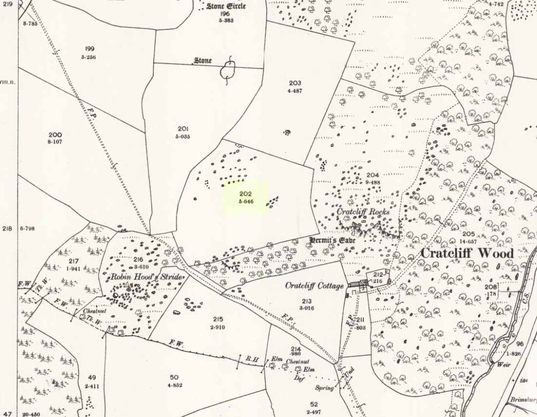
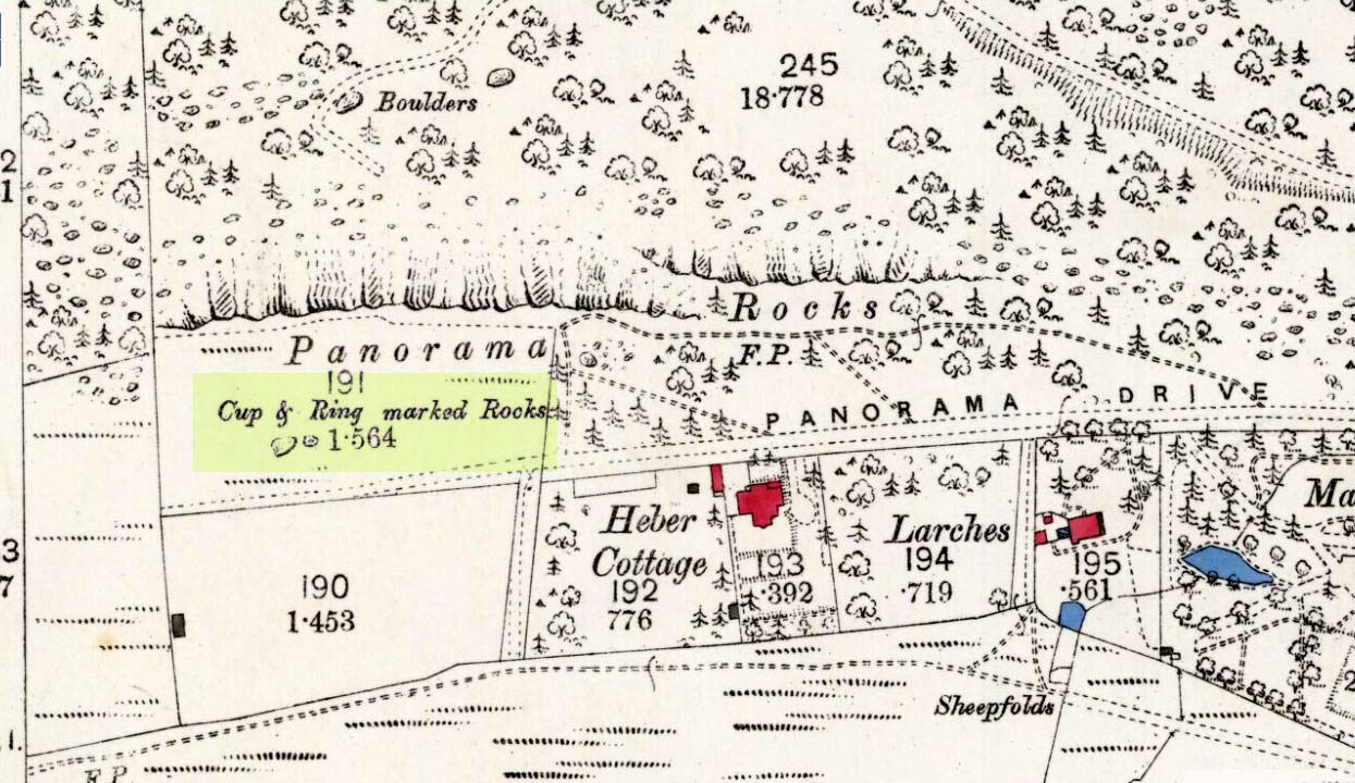
Bede’s Well on 1898 map

Gone down Adair Way and drive down as far as you can. Park and find the path back into the path this leads to the natural amphitheater down steps where the well is.

Archaeology & History

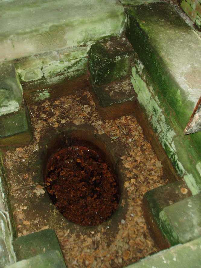
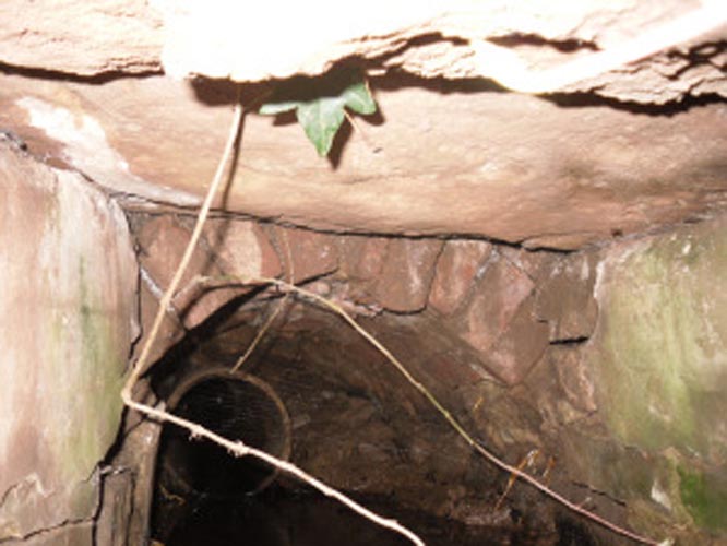
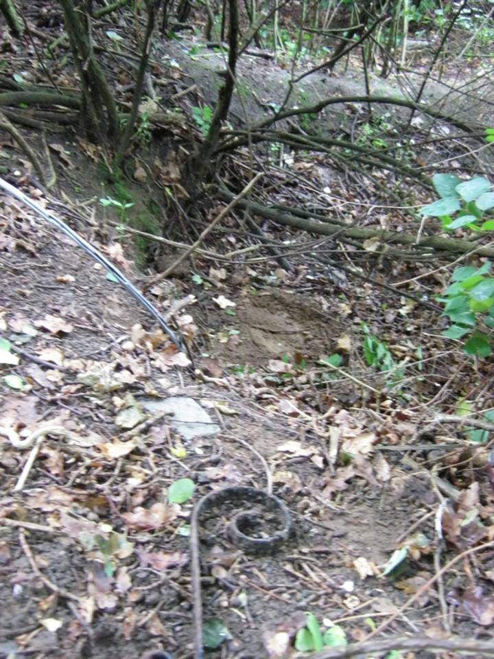
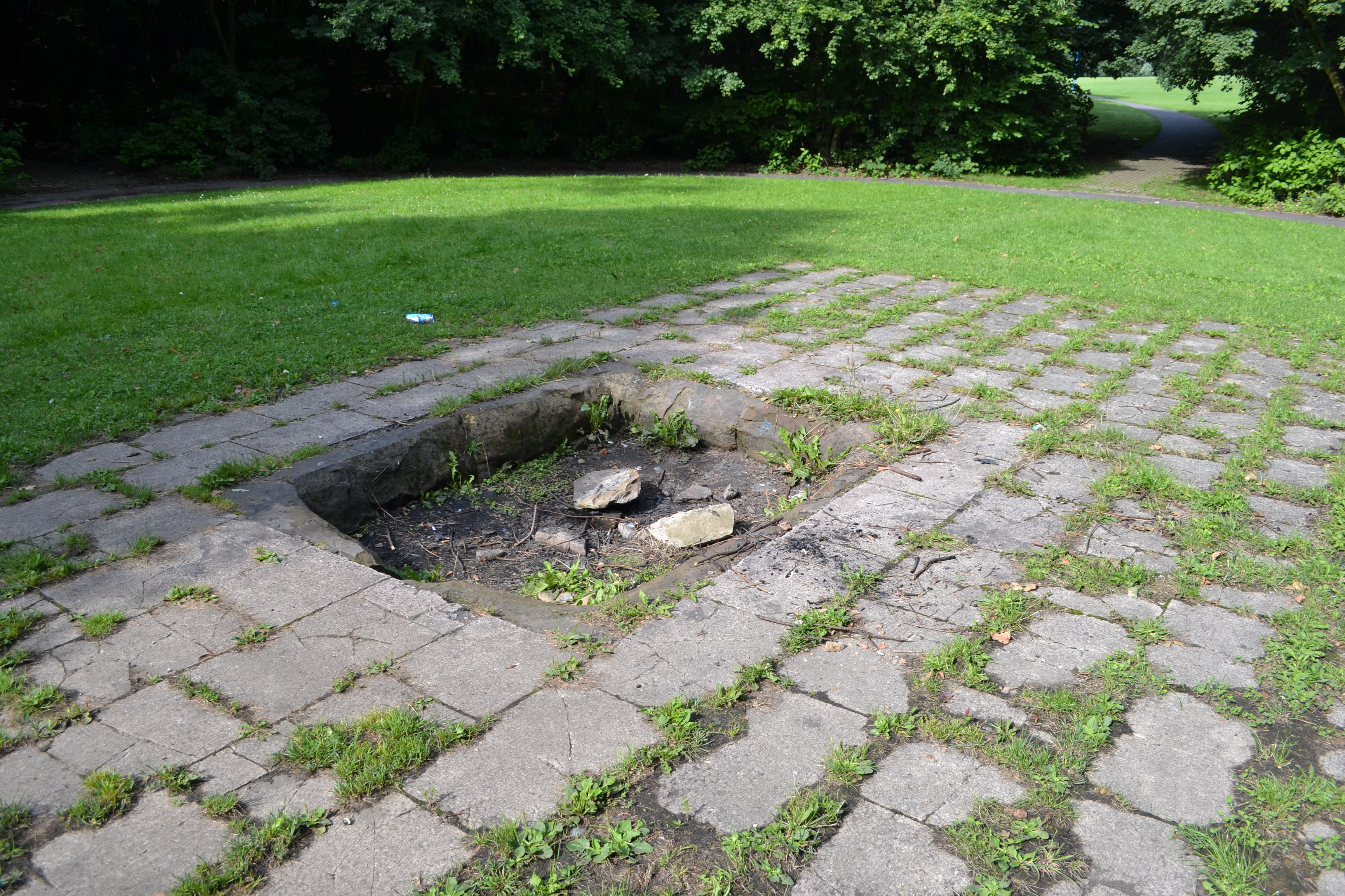
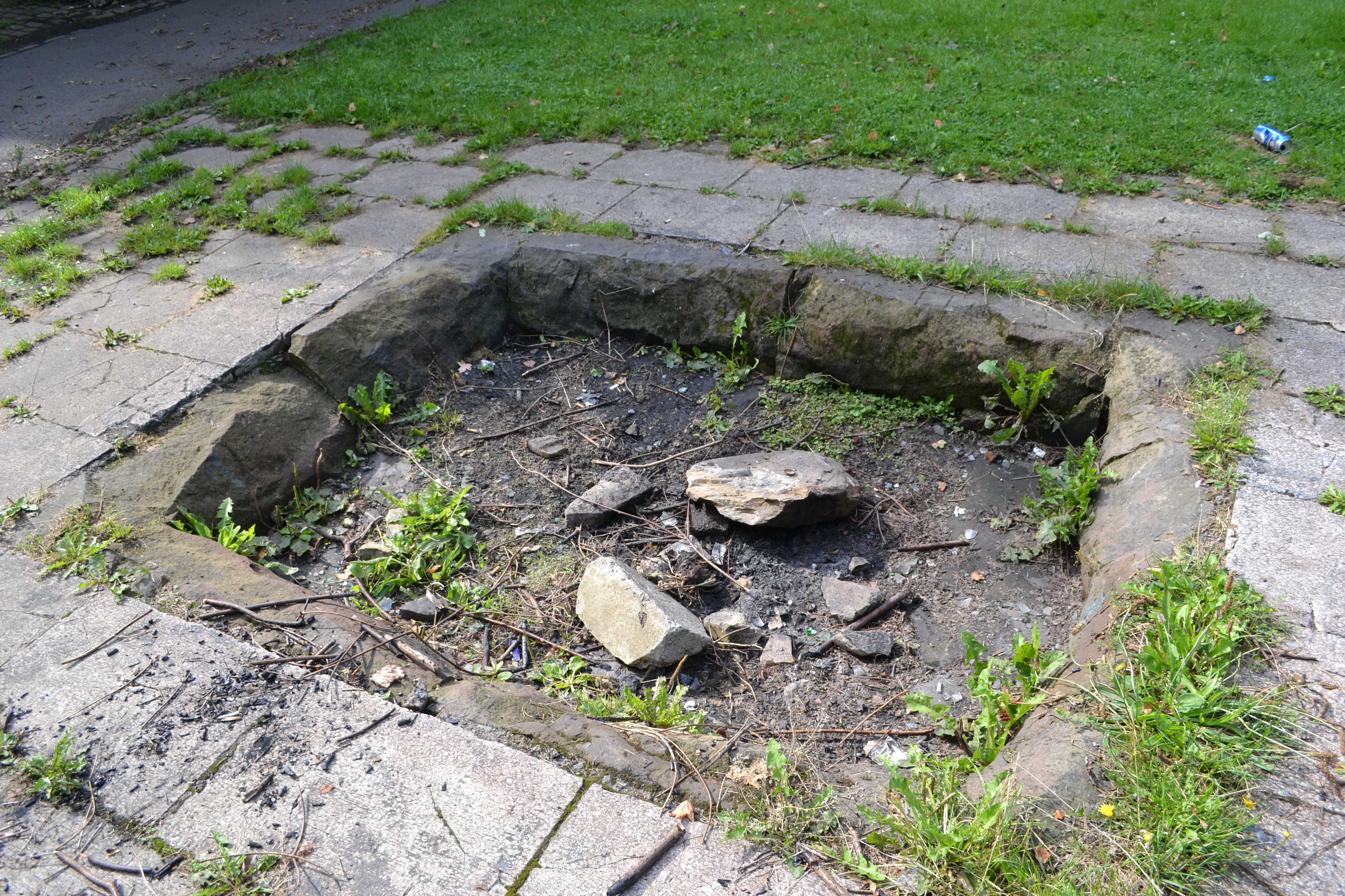
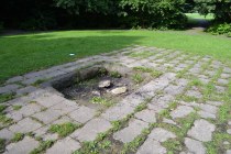
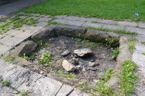
Surrounded by worn paving slabs in a small amphitheatre. It is reached by steps and surrounded by trees. The well is very dry, with broken stone work. Nearly lost under Victorian industrial growth, local people in the early 1900s became concerned with its plight and money was raised via an appeal in the Jarrow Guardian. Although some money was forthcoming, nothing appears to have happened until 1932 when it was enclosed in a railed enclosure with its name carved into the stone work either side of a gate way. When  Palmer’s shipyard slag heap was consolidated sadly spring was diverted leaving the well dry.

Bede's Well, Jarrow (6)St Bede has a long association with Jarrow but whether he knew of this well is unproved. The legend locally says that when living at St. Paul’s Monastery he would send the monks out to collect water from this well. However, it has been questioned why? Especially as the well is some distance away, a well was found enclosed in the site and in fact the river nearby would have been clean enough to drink. It is possible that the site derives its name from the Anglo-Saxon word baed meaning bathing place and as such perhaps the site was dug to provide a healing bath. Perhaps we shall never know, but what is clear is that the site is slowly disappearing into obscurity.

St. Bede's Well in 1908Folklore

The earliest reference to this site is Floyer in 1702 which notes that

“Nothing is more Common in this Country… for the preventing or curing of Rickets, than to send Children of a Year old and upwards, to St Bede’s… Well”

Bede's Well, Jarrow (2)

Brand (1789) says that:

“about a mile to the west of Jarrow there is a well, still called Bede’s Well, to which, as late as the year 1740, it was a prevailing custom to bring children troubled with any disease or infirmity; a crooked pin was put in, and the well laved dry between each dipping. My informant has seen twenty children brought together on a Sunday, to be dipped in this well; at which also, on Midsummer-eve, there was a great resort of neighbouring people, with bonfires, musick, &c”.

A report in the Sunderland Times quoted by Hope (1893) notes that:

“Still, when the well is occasionally cleared out, a number of crooked pins (a few years ago a pint) are always found among the mud. These have been thrown into the sacred fount for some purpose or other, either in the general way as charms for luck, or to promote and secure true love, or for the benefit of sick babies… In days when the ague was common in this country, the usual offering… was a bit of rag tied to the branch of an overhanging tree or bush”

A visitor reported an early morning journey to the well, where ‘he seated himself on a rail to enjoy the singing of the birds. Before long an Irishman came up, who had been walking very fast, and was panting for breath. He took a bottle out of his pocket, stooped down and filled it from the well, put it to his mouth, and took a copious draught. “A fine morning, sir”, said our friend. “Sure and it is”, replied the man, “and what a holy man St Bede must have been! You see, when I left Jarrow, I was as blind as a bat with the headache, but as soon as I had taken a drink just now, I was as well as ever I was in my life”. So he filled his bottle once more with the precious liquid, and walked away.


St John’s Well, Dronfield, Derbyshire

Holy Well:  OS Grid-Reference  SK 353 783

Getting Here

St Johns Well, Dronfield

St Johns Well, Dronfield

In Dronfield, St. John’s Well is to be found off Church street in the Forge in the courtyard adjacent to the glass roofed atrium on the left hand side.

Archaeology & History

J.C. Cox (1875–9) in his Churches of Derbyshire appears to the sole reference although he quotes a lost 1710 reference.  He notes a St. John’s Well cited by Francis Bassano, c.1710, saying:

“…a well, close to the churchyard in St John’s Lane, called St John’s Well, from which “they usually fetch water now for baptising infants””.

Looking down the well...

Looking down the well…

...and into the waters

…and into the waters

Despite only this slight mention, the site still survive.  According to local historian Mr. Ken Ward, the well is that now found in the courtyard of the forge: a 16th century building now developed into a small shopping complex.  He states it is 80 metres from the south porch of the church supporting Bassano’s location.  The site is along Church Street (previously Church Lane) which he believes was once called St. John’s Lane. The well is a circular one with modern stonework on the top.  However, this encloses a much older ring of six layers with a grill apparently opening out into a larger chamber below.  It appears to be a deeper well than would be expected, but it is spring-fed and was presumably deepened for use in the forge.

References:

  1. Cox, J. Charles, Notes on the Churches of Derbyshire – volume 1, Palmer & Edmonds: Chesterfield 1875.

Cratcliff West Enclosure, Harthill, Derbyshire

Enclosure:  OS Grid Reference – SK 2259 6238

Getting Here

Site of Cratcliff West enclosure

Site of Cratcliff West enclosure

Taking the roughly north-south road betwixt the village of Elton and the town of Youlgreave, rising up to see the great rock outcrop of Robin Hood’s Stride, park-up by the roadside and walk down the path towards the impressive rocky rise of Robin Hood’s Stride.  Keep to the fields below the Rise on its north side and head for the next wooded rise 2-300 yards west.  In the field you’ll cross (field number 202 in on the map, right) before this wooded crag [Cratcliffe Rocks], the outline of the enclosure is beneath your very feet.

Archaeology & History

Aerial image of the Ninestone Ring enclosure

Aerial image of the Ninestone Ring enclosure

This blatantly obvious oval-shaped enclosure or settlement ring has had very little said of it in archaeological circles as far as I can tell. (please correct me if it has!)  I found it quite fortuitously during aerial surveys of the nearby Nine Stones circle.  It’s certainly quite large.  With a general circumference of roughly 285 yards (260.5m), the relative diameters of this enclosure are—from north to south—91 yards (83m) and—east to west—80 yards (73.25m).  The ditch alone is quite wide all the way around, almost giving it a ‘henge’ quality.  Its southern section is nearly 10 yards across at one point!

The northwest section of the enclosure has been built into, or upon a small natural outcrop of rocks.  But also at this point—as seen clearly in the aerial photo—on the other side of the wall just past the raised natural outcrop, is a long straight parallel linear feature, very probably man-made, running away to the northwest for at least 174 yards (159m).  It too is quite large, averaging  more than 13 yards (12m) across all along the length of this “trackway”: twice as wide as the nearest road and similar in form to the smaller cursus monuments that scattered neolithic Britain.

The site seems to be typical in form and structure to general Iron Age, or perhaps late Bronze Age settlements – but without a proper ground appraisal, this is a purely speculative appraisal.  Any further information or images of this site to enable a clearer picture of its nature would be most welcome.

Acknowledgements:  With thanks in various way to Pete Woolf, Dave Williams, Geoff Watson & Martin Burroughs.

© Paul BennettThe Northern Antiquarian 


Panorama Woods (228), Ilkley, West Yorkshire

Cup-and-Ring Stone:  OS Grid Reference – SE 11468 47288

Also Known as:

  1. Carving no.100 (Hedges)
  2. Carving no.228 (Boughey & Vickerman)

Getting Here

Panorama Stone 228, with cups highlighted (after James Elkington)

Come out of Ilkley/bus train station and turn right for less than 50 yards, turning left up towards White Wells.  Go up here for less than 100 yards, taking your first right and walk 300 yards up Queens Road until you reach the St. Margaret’s church on the left-hand side.  On the other side of the road, as well as a bench to sit on, surrounded by trees is a small enclosed bit with spiky railings with Panorama Stones 227, 228 and 229 all therein: the one in the centre being the one we’re dealing with here.

Archaeology & History

Originally located ¾-miles (1.2km) WSW of its present position in Panorama Woods (at roughly SE 10272 46995), along with its petroglyphic compatriots in this cage, the carving was moved here in 1890 when a Dr. Little—medical officer at Ben Rhydding Hydro—bought the stones for £10 from the owner of the land at Panorama Rocks, as the area in which the stones lived was due to be vandalized and destroyed. Thankfully the said Dr Little was thoughtful and as a result of his payment he had some of the stones saved and moved into their present position.  However, this carving is but a fragment of its former self.

John Hedges 1986 sketch
Close-up of cups (James Elkington)

It was originally to be seen within a large prehistoric enclosure—which was completely destroyed when rich houses were built hereby, without any evaluation of the site ever being made.  But particularly impressive is the fact that this now enclosed sedated stone carving was originally the large rocky base for a small rocking stone, which also had cup-markings on it and a faint cup-and-ring.  This is very unusual indeed – and perhaps unique in Britain?  Thankfully, several Victorian antiquarians visited and made notes and a sketch of the site before it was uprooted and a large section of it destroyed.  In J. Romilly Allen’s article (1879) he told that, just a couple of yards from the more famous and ornate Panorama Stone (229), a

“second stone is of irregular shape, measuring 15ft by 12ft, and supporting a smaller stone of triangular shape 6ft long by 4ft broad.  Both upper and under stone are covered with cups and rings, but the sculptures have suffered much from exposure.  The superimposed rock has eleven cups, two of which are surrounded by rings.  The under stone has 42 cups, nine of which have rings.  Amongst these are two unusually fine examples, one has an oval cup 5in by 4in, surrounded by two rings, the diameter of the outer ring being 1ft 3in.  Another has a circular cup 3in diameter, and five concentric rings, the outer ring being 1ft 5in across.”

J.T Dales 1878 sketch, with CR227 on top of it
Original location of stone

In a sketch of the site by J. Thornton Dale done about the same time as Allen’s visit, and reproduced here (apologies for the poor quality), the “five concentric rings” that Mr Allen mentioned are not shown, but clearly a spiral design had been seen by Mr Dale’s eyes.  Fascinating…. The large mass of carvings immediately left of the spiral is in fact the smaller upper stone known by modern archaeologists as carving 227.

Today, all we can see of this petroglyph are two cup-and-rings, and one faint double-cup-and-ring; several incomplete rings or arcs, and at least another 30 single cup-marks, some of which have short limes running to or from them.  The rest of original stone base with its other multiple rings or spiral design were obviously destroyed.

As with many of the Ilkley carvings, Boughey & Vickerman’s (2003) description barely does the stone justice.  They described it simply:

“Large rock, now set in concrete base, the surface rapidly deteriorating.  Over forty cups, three with single rings, one showing traces of a second, grooves.”

The mightily impressive Panorama 229 carving sits next to this one and is truly worth checking out!

References:

  1. Allen, J. Romilly, “The Prehistoric Rock Sculptures of Ilkley,” in Journal of British Archaeological Association, volume 35, 1879.
  2. Bennett, Paul, The Panorama Stones, Ilkley, TNA: Yorkshire 2012.
  3. Bennett, Paul, Aboriginal Rock Carvings of Ilkley and District, forthcoming.
  4. Boughey, Keith & Vickerman, E.A., Prehistoric Rock Art of the West Riding, WYAS: Leeds 2003.
  5. Cowling, Eric T., Rombald’s Way, William Walker: Otley 1946.
  6. Downer, A.C., “Yorkshire Archaeological and Topographical Association,” in Leeds Mercury, August 28, 1884.
  7. Hadingham, Evan, Ancient Carvings in Britain, Souvenir Press: London 1974.
  8. Hedges, John, The Carved Rocks on Rombald’s Moor, WYMCC: Wakefield 1986.
  9. Heywood, Nathan, “The Cup and Ring Stones of the Panorama Rocks”, in Transactions Lancashire & Cheshire Antiquarian Society, Manchester 1889.
  10. Speight, Harry, Upper Wharfedale, Elliott Stock: London 1900.

Acknowledgements With huge thanks to both Dr Stefan Maeder for help in cleaning up the stones; and to James Elkington for taking the photos and allowing ’em for use them in this site profile.

© Paul Bennett, The Northern Antiquarian


Bury Lane (east), East Morton, West Yorkshire

Cup-Marked Stone:  OS Grid Reference – SE 09373 42410

Also Known as:

  1. Carving 51 (Hedges)
  2. Carving 91 (Boughey & Vickerman)

Getting Here

Cup-marked stone, East Morton (photo thanks, Sue Patchett)

From the expanding village of East Morton, by the school at the west-end of the village, walk up the narrow Street Lane for nearly 600 yards, past the houses, until you reach a footpath on your left that takes you across the fields.  Walk along here (following the line of walling) for 250 yards, then, take a sharp left and down the field for 55 yards (50m) until, right beneath the power lines, you’ll find the rock in question.

Archaeology & History

This is one in a small, little-known cluster of  petroglyphs on the western outskirts of East Morton.  It is located at the base of what are thought to be remnants of Iron Age walling.  Carved onto an elongated earthfast stone are a number of very well-preserved cup-marks, with what seems to be a faint carved pecked line running out from one of the southernmost cup-marks and curving back on itself (we could do with a good sketch artist getting us a good drawing of this).  You can see this faint line on the far-left side of the stone in Sue’s photo above.

Hedges 1986 sketch

The petroglyph was rediscovered by the northern antiquarian Stuart Feather (1959) in one of his many sojourns exploring the prehistoric remains of the area.  In John Hedges’ (1986) survey, the carving was described simply as:

“Triangular smooth grit rock with fairly flat top on which are twenty cups, not all clear, some large and oval, a few grooves.”

Boughey & Vickerman’s survey (2003) made no note of any  additional features on the petroglyph.

References:

  1. Boughey, Keith & Vickerman, E.A., Prehistoric Rock Art of the West Riding, WYAS: Wakefield 2003.
  2. Feather, Stuart, “Bronze Age Rock Carvings,” in Keighley News, March 7, 1959.
  3. Hedges, John (ed.), The Carved Rocks on Rombalds Moor, WYMCC: Wakefield 1986.
  4. Jackson, Sidney, “Massive Walling at East Morton,” in Cartwright Hall Archaeology Group Bulletin, 5:9, 1960.
  5. Jackson, Sidney, “East Morton Ancient Walls,” in Cartwright Hall Archaeology Group Bulletin, 6:9, 1961.

Acknowledgements:  Huge thanks to Sue Patchett for use of her photo.  

© Paul Bennett, The Northern Antiquarian