Old Wife’s Stone, Batley, West Yorkshire

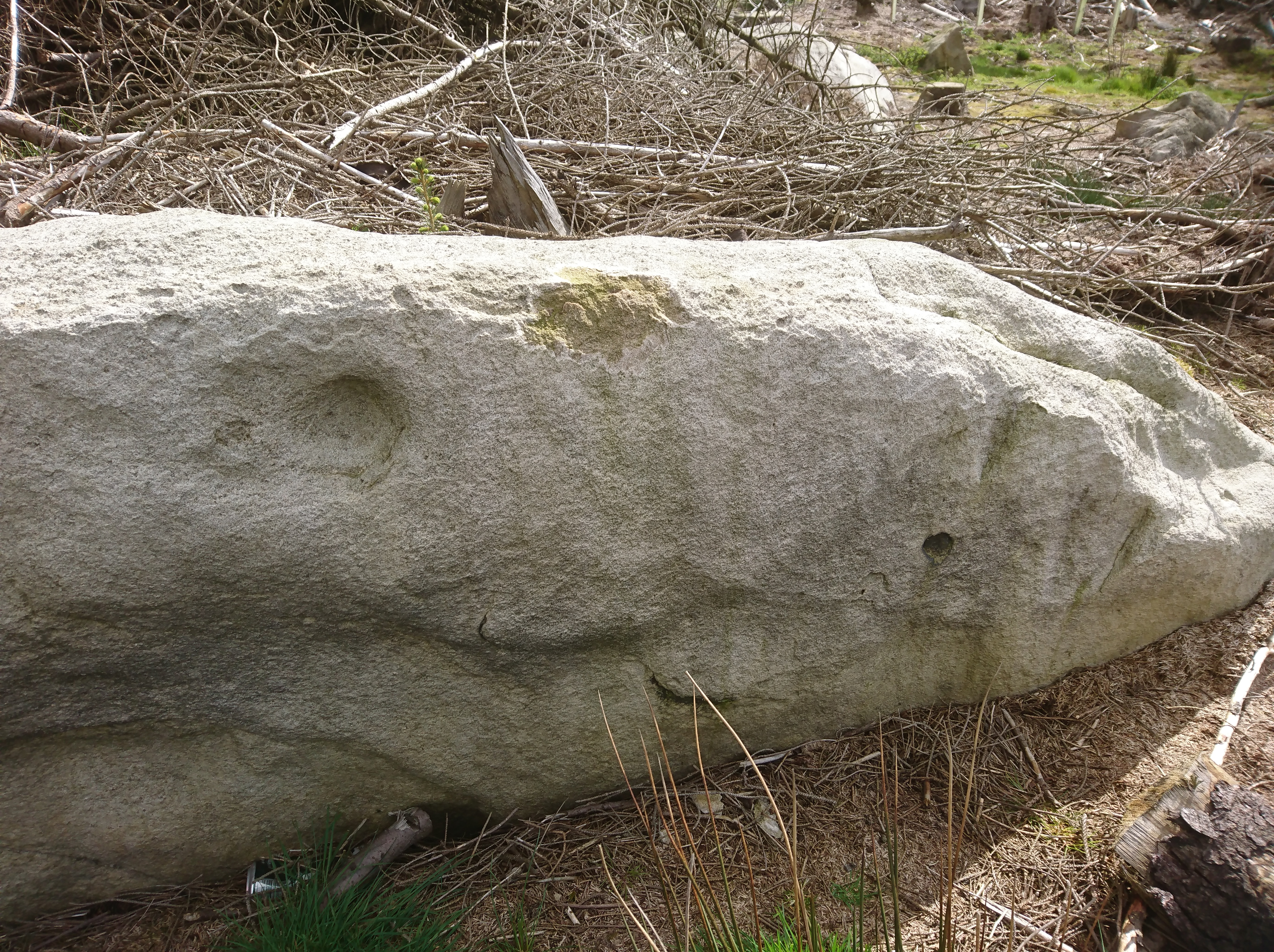
Standing Stone? (destroyed):  OS Grid Reference – SE 2428 2329

Archaeology & History

Old Wifes Stone on 1854 map

My first hint at the existence of this once valuable archaeological relic came as a result of me seeking out the history and folklore of some hitherto unknown, forgotten holy wells in the Batley and Dewsbury area.  I located the material I was looking for on the old wells, but my fortuitous discovery of this site, the Old Wife’s Stone, blew me away!

It was the place-name of ‘Carlinghow’ about one mile northwest of the grid-reference above that initially caught my attention.  From an antiquarian or occultist’s viewpoint, it’s intriguing on two counts: the first is the element ‘how‘ in Carlinghow, which can mean a variety of things, but across the Pennines tends to relate to either an ancient tribal or council meeting place, or a prehistoric burial cairn: an element that wasn’t lost in the giant archaeology survey of West Yorkshire by Faull & Moorhouse (1981).  But the first part of this place-name, ‘carling‘, was the exciting element to me; for it means ‘old woman,’ ‘old hag,’ ‘witch’ or cailleach!  The cailleach (to those who don’t know) was the prima mater: the Great Mother deity of our pre-christian British ancestors.  Meaning that Carlinghow hill was a hugely important sacred site no less—right in the heart of industrial West Yorkshire!  What is even more intriguing—or perhaps surprising—is that we have no record of such a powerful mythic creature anywhere in local folklore… Or so it first seemed…

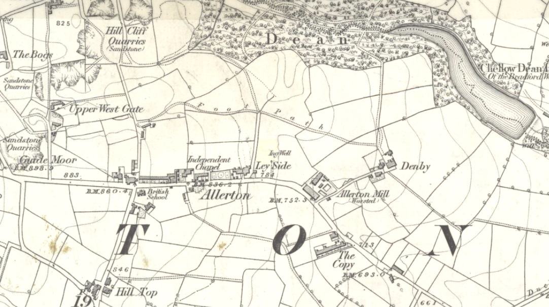
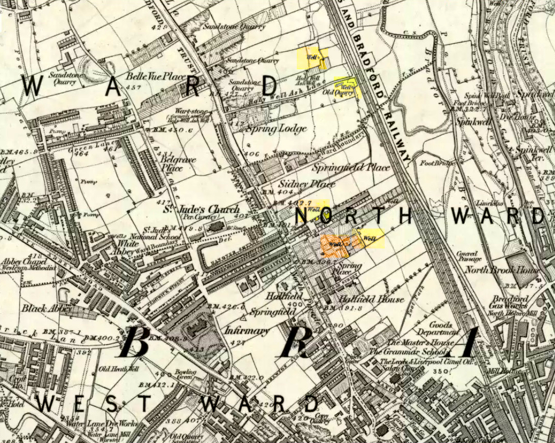
Memory told me that no such prehistoric remains were recorded anywhere in that area—and certainly no prehistoric tombs.  I scoured through my library just to triple-check, and found the archaeological records as silent as I first thought.  Just to make sure I spent a day at the Central Library, where again I found nothing… So then I explored the region on the modern OS-maps, only to find that much of the area where the Carlinghow place-name existed was, surprisingly, still untouched by housing and similar modern pollutants. This was a great surprise to say the least.  And so to check for any potential archaeological sites which might once have been in the Carlinghow area, I turned to the large-scale 1850 OS-maps (6-inch to the mile).

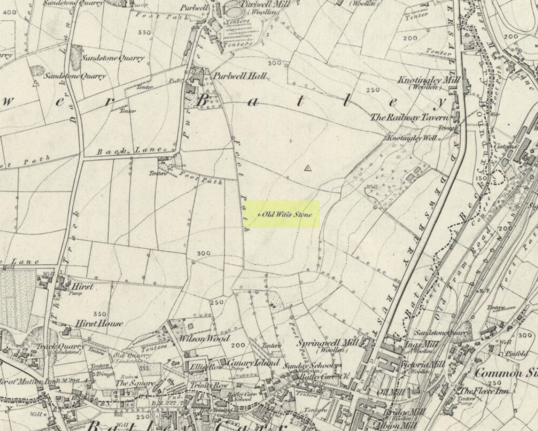
This is when I came across the Old Wife’s Stone, marked in the middle of fields on the outskirts of old Batley.  There was no notice of it being a standing stone, or a simple boulder, or archaeological relic—nothing.  But its place-name compatriot of ‘Carlinghow’ was the rising hill about a mile to the northwest.  In days of olde, if Carlinghow was indeed the ‘burial tomb of the Old Woman’ or ‘meeting place of the cailleach’ (or whatever variants on the theme it may have been), it may have marked the setting sun on the longest day of the year if you had been standing at the Old Wife’s Stone – a midsummer sunset marker no less. (There are other ancient and legendary sites scattering northern England and beyond that are dedicated to the Cailleach, like the Old Woman Stone in Derbyshire, the Old Wife’s Neck in North Yorkshire, the Carlin Stone in Stirlingshire, the Old Woman Stone at Todmorden, Carlin Stone of Loch Elrig and many more.)

As if these curious ingredients weren’t enough to imply something existed in the heathen pantheon of Batley before the Industrialists swept away our indigenous history, we find echoes of the ‘Old Woman’ yet again, immediately east; this time where the animism of water and trees enfolded Her mythos in local rites and traditions, thankfully captured by the pens of several writers, and transmuted into another guise—but undeniably Her!  But that, as they say, is for another day and another site profile…

Position of stone in 1894

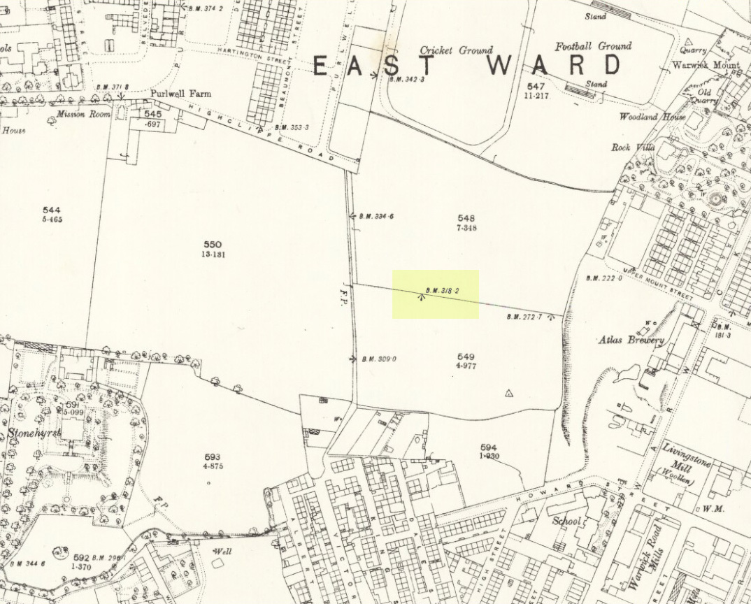
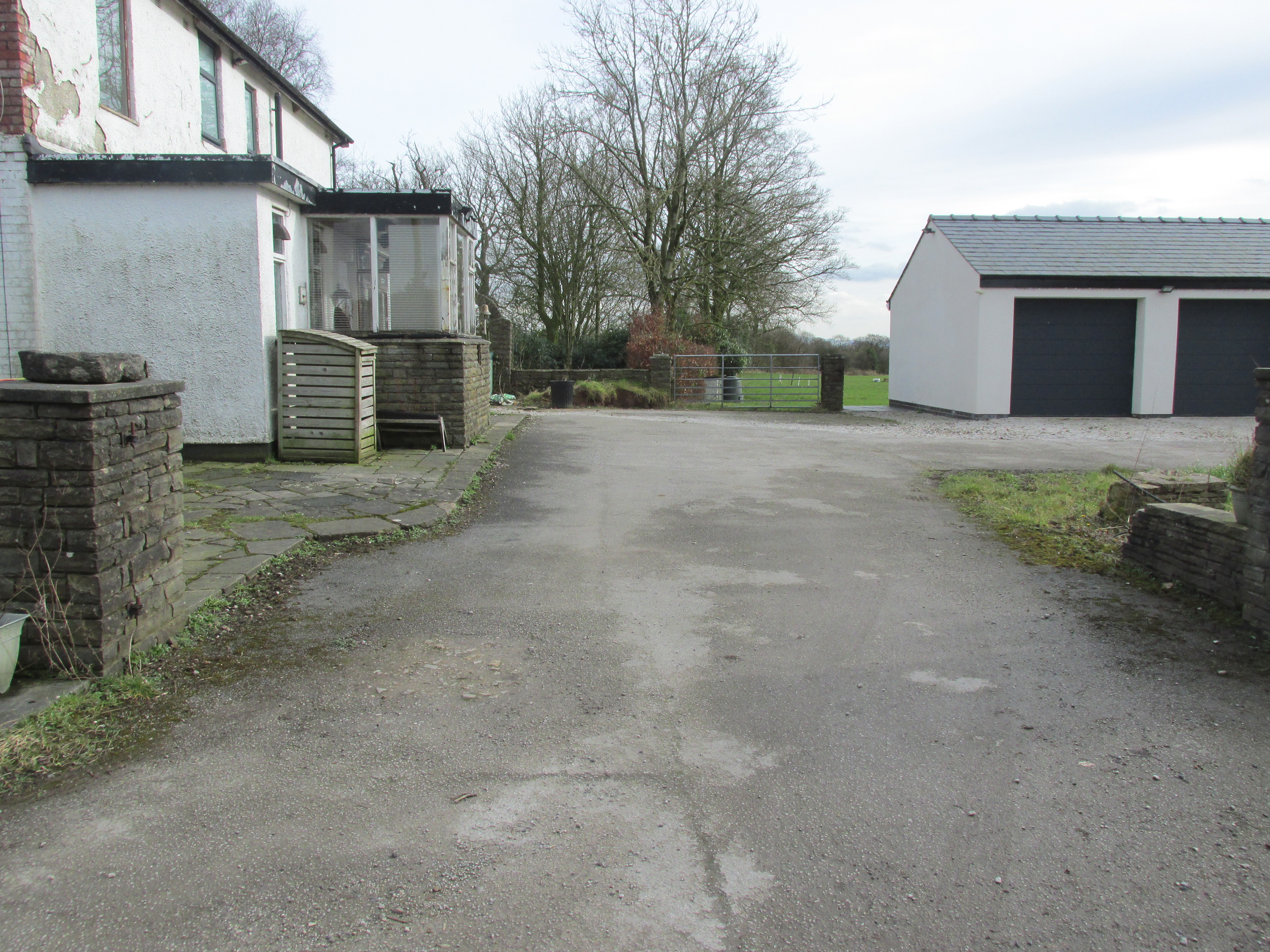
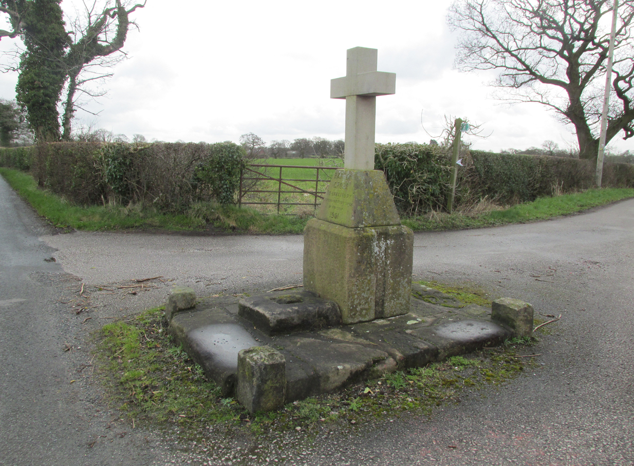
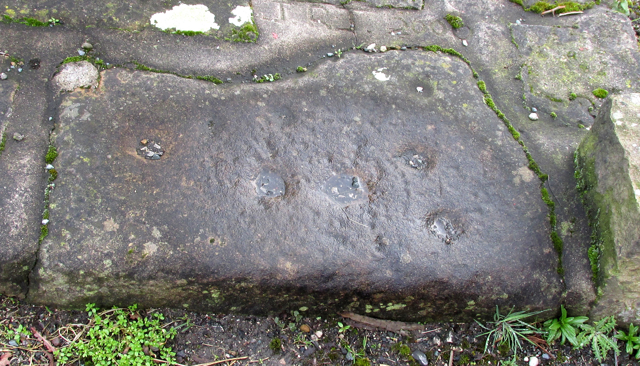
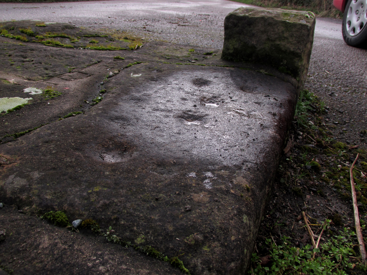
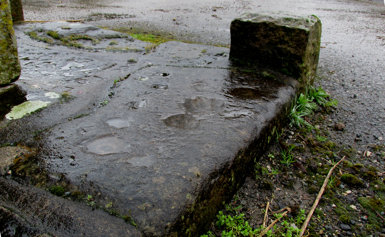
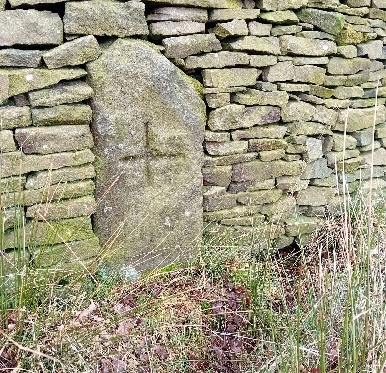
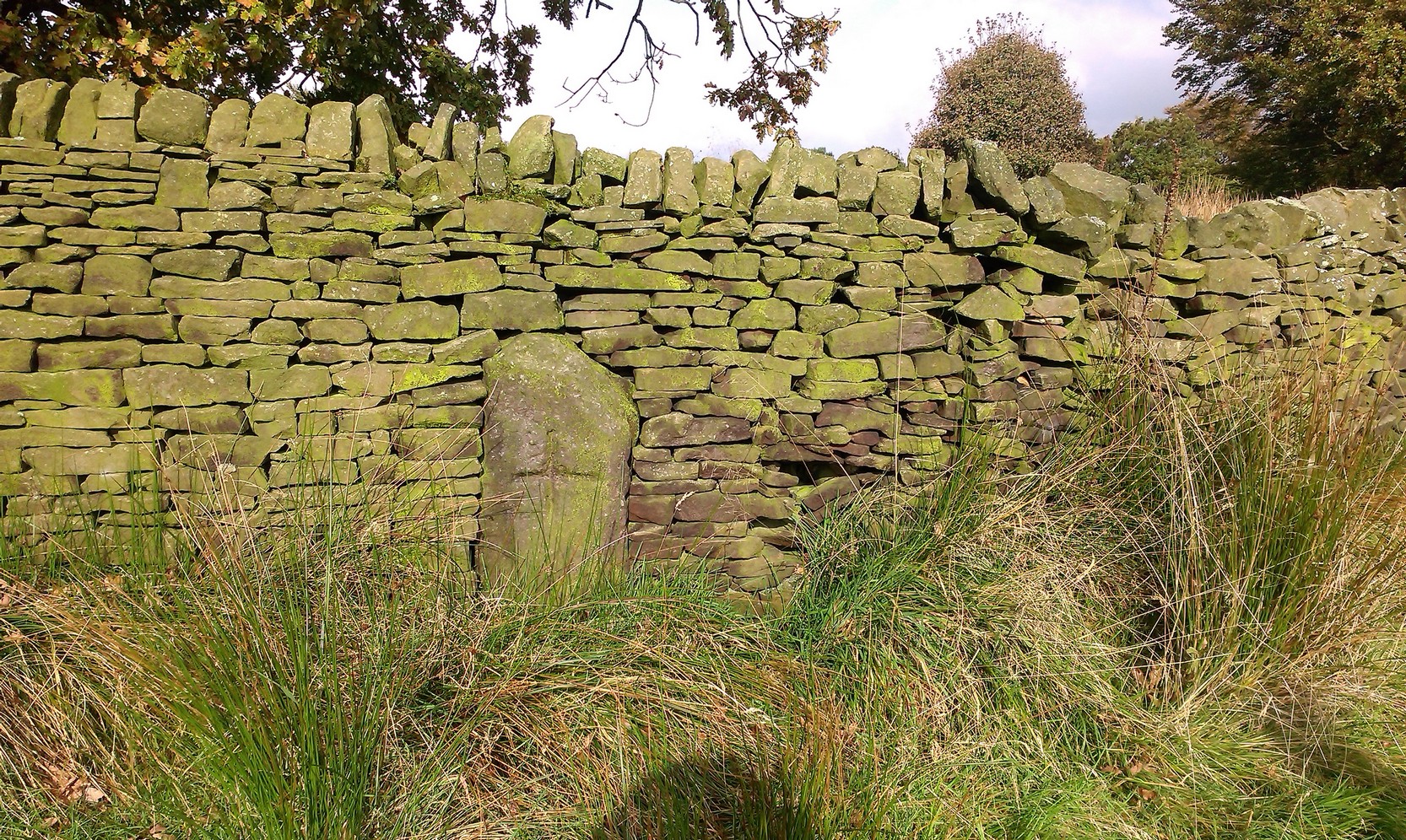
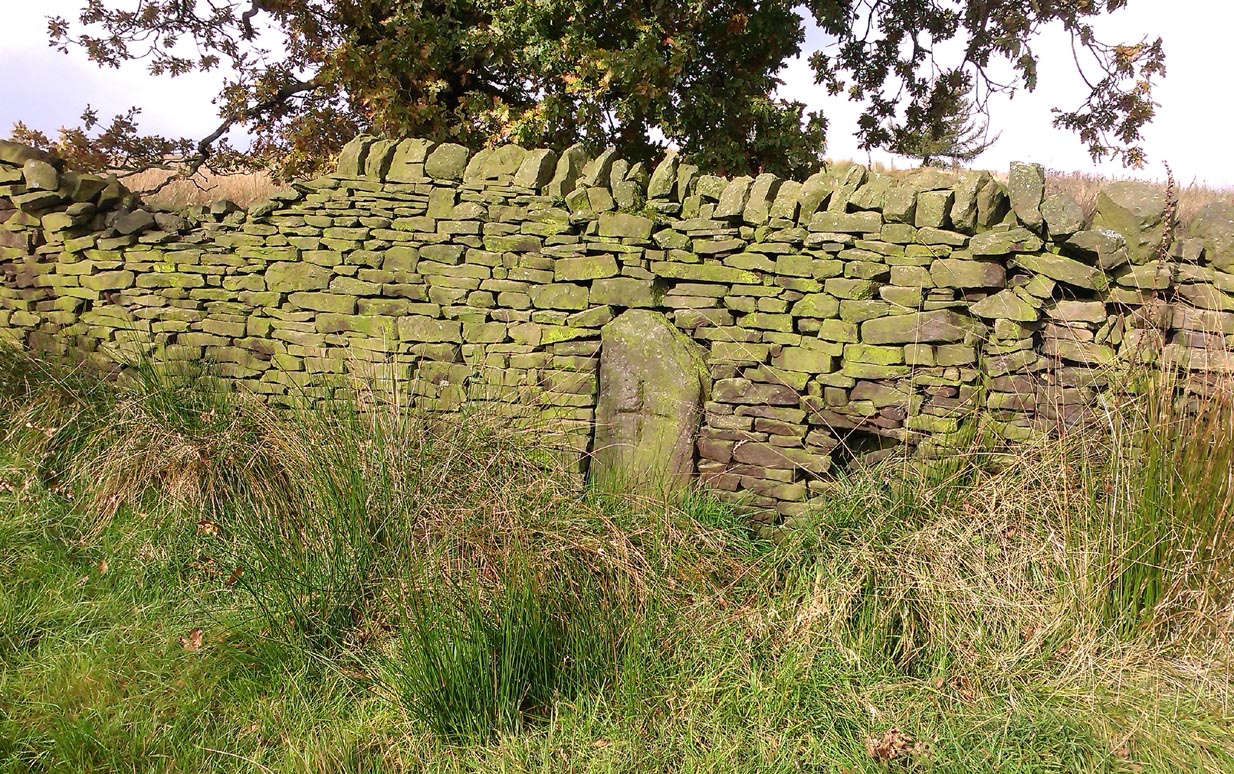
So is our Old Wife’s Stone (or for that matter, Carlinghow’s old tomb) still in evidence?  A school has been built where it was highlighted on the 1854 OS-map and, from the accounts of local people, seems to have long since disappeared.  The stone looks to have been incorporated into a length of walling, sometime between 1854 and 1888, and a bench-mark of “BM 318.2” carved onto it.  But when the Ordnance Survey lads re-surveyed the area in 1905, this had gone.  I have been unable to find any more information about this site and hope that, one day, a fellow antiquarian or occult historian might be able to unravel more of its forgotten mythic history.

References:

  1. Faull, M.L. & Moorhouse, S.A. (eds), West Yorkshire: An Archaeological Survey to 1500 AD – volume 1, WYMCC: Wakefield 1981.
  2. Goodall, Armitage, Place-Names of South-west Yorkshire, Cambridge University Press 1914.
  3. Keighley, J.J., ‘The Prehistoric Period’, in Faull & Moorhouse, 1981.
  4. o’ Crualaoich, Gearoid,  The Book of the Cailleach, Cork University Press 2004.
  5. Smith, A.H., English Place-Name Elements – volume 2, Cambridge University Press 1956.
  6. Smith, A.H., The Place-Names of the West Riding of Yorkshire – volume 2, Cambridge University Press 1961.
  7. Wright, Joseph, English Dialect Dictionary – volume 1, Henry Frowde: London 1898.

Acknowledgements:  Many thanks for the assistance of Simon Roadnight and Julia King in the Batley History Group.

© Paul Bennett, The Northern Antiquarian

The map could not be loaded. Please contact the site owner.


Cock Lakes, Blubberhouses Moor, North Yorkshire

Cup-Marked Stone:  OS Grid Reference – SE 1524 5469

Getting Here

Faint cups highlighted by water

Follow the same directions as if you’re visiting the James Stone monolith.  From here, walk about 60 yards southeast and zigzag about in the heather until you find a small squarish-shaped earthfast rock, barely 6 inches above ground-level (might be hard to find when the heather’s fully grown).  If you’ve got a petroglyphic nose, you’ll find it!

Archaeology & History

A simple faded cup-marked stone, roughly 2½ feet by 2 feet across, can be found about 65 feet southeast of the James Stone and 40 yards west of the Benty Gate prehistoric enclosure.  Sadly when we visited the place a few days ago, the sky was grey and the conditions for good photos were poor.

Line of faint cups from centre
Extra faint cup near centre left

At least five cup-marks have been etched onto the stone, with the main element being a row a three cups in a straight line from the centre of the stone to its SE edge.  The central cup-mark has been carved where a natural crack in the rock, running from the edge of the stone, terminates.  There also seemed to be a carved faded line running along the bottom edge of the stone—but it was unclear and another visit is needed in better light to see if there’s more on the stone.

© Paul Bennett, The Northern Antiquarian

The map could not be loaded. Please contact the site owner.


James Stone, Blubberhouses Moor, North Yorkshire

Standing Stone: OS Grid reference – SE 15196 54722

Getting Here

James Stone, looking SW

From Blubberhouses church by the crossroads, walk up the slope (south) as if you’re going to Askwith, for 100 yards or so, taking the track and footpath past the Manor House and onto the moor.  Once you hit the moorland proper, take the footpath that bears left going down into heather and keep going till you hit the dead straight Roman Road path running west onto Blubberhouses Moor. Carry along the Roman Road for about 200 yards as though you are going towards the Eagle Stone, and looking right (if you squint) you can just make out a small pimple on the top of the moors about a quarter of a mile away. That is where you are heading (be warned – it is boggy getting there).

Archaeology and History

James Stone, looking NE

Discovered (or rather ‘noticed’) by James Turner and James Elkington in July 2016 (hence the name James Stone), this standing stone is of an indeterminable age – although it does look ancient.  Standing more than 5 feet tall, and in the middle of nowhere, it is fairly difficult to get to unless you want to get wet feet.  It is situated very close to a small and unexcavated prehistoric settlement and we could find no physical evidence of any tracks nearby (although Google Earth does show what looks like one or two very short, faint tracks near the stone, which is the old ‘Benty Gate’ track).

It could be a boundary stone, although doubtful – it has a feel to it that says it is prehistoric, although this is just guesswork on our part.  I can find no reference to it in Cowlings Rombalds Way (1946) and there seems nothing about it in either of William Grainge’s (1871; 1895) detailed history works of the region.

Mr Turner gazing at the stone

At first we thought it unlikely to be a new find, however the stone is difficult to see from the Roman Road (I had been up here dozens of times before I noticed it) and seeing that people rarely go up here anyway, and it is relatively difficult terrain getting to it, it is not surprising that no one has bothered visiting it. It would take someone who is quite keen on megaliths to want to examine it and it is well off any tracks.

Having said that, it is a nice find and it could be linked in some way with the small unexcavated settlement nearby, or possibly the large Green Plain settlement nearly a mile away.  Well worth a visit…bring your wellies!

References:

  1. Cowling, Eric T., Rombald’s Way, William Walker: Otley 1946.
  2. Grainge, William, The History and Topography of Harrogate and the Forest of Knaresborough, John Russell Smith: London 1871.
  3. Grainge, William, The History and Topography of the Townships of Little Timble, Great Timble and the Hamlet of Snowden, William Walker: Otley 1895.

© James Elkington, The Northern Antiquarian

The map could not be loaded. Please contact the site owner.


Lower Rivock, Keighley, West Yorkshire

Cup-and-Ring Stone:  OS Grid Reference – SE 0717 4471

Getting Here

Faint Lower Rivock cup-and-ring

From the B6265 valley road between Bingley and Keighley, just near Riddlesden Hall, take the road up and over the canal into Riddlesden, bearing left up past West Riddlesden Hall and up Banks Lane. As you reach the T-junction at the top, where you hit the Silsden Road that goes round the moors, park up. Cross the road and follow the footpath up the field, go over a stile and continue up the track to the next gate. Once through this gate, go across the field to another gate which leads to a narrow track. The stone is situated on the left hand side about 75 yards from the gate.

Archaeology & History

Not previously recorded, this carving comprises of a large cup on the vertical surface of the stone with a faint surrounding ring mark.

© Chris Swales, The Northern Antiquarian

The map could not be loaded. Please contact the site owner.


Ing Well, Allerton, Bradford, West Yorkshire

Healing Well (destroyed): OS Grid Reference – SE 1174 3443

Archaeology & History

Ing Well on 1852 map

This ‘Well of the Meadow”, or Ing Well, is one of countless springs in and around the Bradford metropolis that have been destroyed by that thing they call ‘development’.  It was one of the main water sources for the villagers of Allerton village in the 19th century and earlier.  Highlighted on the 1852 OS-map of the region, a singular footpath once led to the waters and no further.  There appear to be no antiquarian or historical references detailing its traditions or medicinal qualities—unless of course, you know different.

The name Ing Wells is one of the most common of all titles given to water supplies in England, meaning having the same meaning and general history just about everywhere it occurs.  The place-name itself was given extensive attention in two separate studies by Eilert Ekwall (1962) and Sigurd Karlstrom (1927).

References:

  1. Ekwall, Eilert, English Place-Names in -Ing, Lund: Uppsala 1962.
  2. Karlstrom, Sigurd, Old English Compound Place-Names in -Ing, Lund: Uppsala 1927.

© Paul Bennett, The Northern Antiquarian

The map could not be loaded. Please contact the site owner.


Eaves Green Cross, near Goosnargh, Lancashire

Cross (ruins):  OS Grid Reference – SD 56770 37765

Also Known as:

  1. Historic England Monument No. 42651
Just visible in the hedge…

Getting Here

Travelling east out of Goosnargh on the B5269, go straight ahead onto Camforth Hall Lane, follow it northwards and take the left fork at Stump Cross onto Eaves Green Lane, and a lane will be seen on the left signposted Eaves Green. Walk along this lane and a white Snowcemmed house, ‘Bridle Mount’ will be seen on the left. The cross base will be found deep in the holly hedge opposite the driveway to the house.

Archaeology & History

This cross was not mentioned in the 1906 edition of Henry Taylor’s Ancient Crosses and Holy Wells of Lancashire, but was nevertheless marked on the 1910 25″ OS map (the earliest at my disposal) as “Cross (Remains of)”

The 1910 25″ OS Map

In 1958, the Ministry of Works Field Investigator commented: “The socket stone of a probable way-side cross situated on rising ground in a pasture field adjoining a lane. It measures 0.8m by 0.7m and is 0.9m high with a socket 0.2m by 0.15m and 0.2m deep. There are no traces of a cross or shaft.”

To locate the Cross, turn round 180º from this spot.

The current official description describes the remains as “Now missing”…

Well, no! – the intrepid TNA investigator has located it, buried deep in the boscage of a holly and ivy hedge, but he was lucky that the hedge had been very recently trimmed and he made his visit in late winter…

The Cross is registered on the Milestone Society Repository under reference: LAPR_GOO02.

©Paul T. Hornby 2017 The Northern Antiquarian

The map could not be loaded. Please contact the site owner.


Barton Cross Stone, Barton, Lancashire

Cup Marked Stone:  OS Grid Reference – SD 53500 37332  —  NEW FIND

In this view, the carving is right of the Cross surround

Getting Here

At the roadside, on the south side of Barton Lane, where it crosses the minor road joining Cross House Farm and Barton House, you’ll see the Barton Cross standing upright. You can’t miss it!.

Archaeology & History

Carved stone cut to shape

Apparently never before described, this stone has very likely been removed from another locality and cut to shape to form part of the surrounding platform base to Barton Cross, where it is at the southwest corner.  It has ten cup marks.

Until or unless more such stones are located, it is a unique example of rock art in this part of Lancashire.

Nine cups visible here
10th cup nr camera, after rain

Henry Taylor, in his 1906 work The Ancient Crosses and Holy Wells of Lancashire writes inter alia about the Barton Cross that it had been demolished sometime after 1848, and that the base and part of of the Cross shaft had been ‘lately restored to the old site‘.  Thus the cup-marked stone may or not be in its original position as part of the Cross surround, and may have just been a conveniently available slab of stone that was used, rather than a deliberate use of a pre-existing sacred stone.

References:

  1. Taylor, Henry, The Ancient Crosses and Holy Wells of Lancashire, Sherratt & Hughes, Manchester, 1906.

© Paul T. Hornby 2017, The Northern Antiquarian 

The map could not be loaded. Please contact the site owner.


Cruckles Well, Manningham, Bradford, West Yorkshire

Sacred Well (lost):  OS Grid Reference – SE 160 339

Archaeology & History

Which one is the Cruckleswell?

In an essay by great regional historian Harry Speight (1912) on the ancient tracks of Bradford and district, he mentions this “Cruckleswell” which was first described in 1602.  Mentioned again in 1612 land deeds and several times thereafter, the site has long gone (been built over), but may have been a place where local people ascribed there being water spirits, or naiads.

Although the local historian W.E. Preston (1932) described the place as being in fields between Manningham Stoop (an old boundary stone, now lost) and Hallfield Cross (perhaps an old stone cross site, also lost), a more detailed article appeared a few years later by Wilfrid Robertshaw (1935), telling of its approximate location.  He wrote:

“The interesting field-name of Cruckleswell occurs in 1664.  Cruckleswell was situated between Manningham Stoope and Hallfield Cross.  The latter name is here applied to some closes of land near the Bradford-Manningham boundary and not to a monument; but from this qualifying statement must not be inferred the opinion that a stone or wooden cross of the name never existed.  From Manningham Stoope, whose location I have not traced, a lane led to Fair Gapp, which was just within the town of Bradford; but in 1686 there was a close called the Stoope, which adjoined Manningham Lower Lane on the left-hand side from Bradford to Manningham.  The occupiers of Cruckleswells were ordered by the jurors of the Bradford Manor Court to take in the water which ran by their premises.  The occurrence of a water-course thereabouts, together with the name, Cruckleswell, suggests that here, as in the Panewell Feilde, was a holy well of a kind.  Perhaps the derivation of the name may be found in the Yorkshire dialect word ‘crukle,’ meaning to make crooked, or to bend or twist.  In a sense, therefore, Cruckleswell was another pin well, into which bent of ‘cruckled’ pins were cast.  Cruckleswells, or Crookewells, as the three closes of land were called in a deed of 1658, were then granted by Tempest Brighouse, of Bilbie in the county of Nottingham, to James Mitchell of Bradford, yeoman.  But…I have found a deed of sale by Christopher Pighells of Bradford, yeoman, to John Nicholls of Horton, clerk, of the close of land called Cruckleswell… Nicholls purchased Cruckleswell in 1612, the year before Saxton produced his plan, on which the small field is shown adjoining others belonging to Pighells.  Thus the plan fixes the location of Cruckleswell; it adjoined the east side of the highway leading from Bradford to Frizinghall and was just within the Manningham township.”

This would put it close to the Holy Well Ash well and its long-lost standing stone.  The 1852 OS-map of this area shows an unnamed well between the Holy Well Ash and the boundary line, as highlighted above; but another unnamed well is to the north of the holy well.  If we cross over the boundary line south and out of Manningham, three other wells existed less than 200 yards away.  Anyone of these may have been the Cruckleswell.

Mr Robertson’s idea on the word ‘cruckle’ is echoed in A.H. Smith’s (1961) place-name analysis of the site, where he relates how the word is “possibly connected with the obsolete crookle, ‘to crook, bed.'”  This is shown to be the case in Thomas Wright’s (1898) gigantic tome. And as “cruckling” pins was a common animistic practice in earlier centuries, this derivation of it—as being a well where offerings were given to the spirit of the waters—is not unlikely.

References:

  1. Preston, W.E., ‘Some Local Holy Wells,’ in Bradford Antiquary, June 1932.
  2. Robertshaw, Wilfrid (ed.), West Yorkshire Deeds (2 volumes), Bradford Historical & Antiquarian Society 1936.
  3. Shepherd, Val, Historic Wells of Bradford, Heart of Albion: Wymeswold 1995.
  4. Smith, A.H., The Place-Names of the West Riding of Yorkshire – volume 3, Cambridge University Press 1961.
  5. Speight, Harry, ‘Ancient Streets and Lanes of Bradford as Portrayed in the Manor Court Rolls,’ in Bradford Antiquary, New Series 3, 1912.
  6. Wright, Thomas, English Dialect Dictionary – volume 1, Henry Frowde: Oxford 1898.

© Paul Bennett, The Northern Antiquarian 

The map could not be loaded. Please contact the site owner.


Staniston Hill, Stainburn, North Yorkshire

Standing Stone (lost):  OS Grid Reference – SE 2522 5010

Archaeology & History

Staniston Hill on 1851 map

This long-lost standing stone gave its name to the small hill between the geological giants of Little Almscliffe and Almscliffe Crags, ‘Staniston Hill.’  Described as early as the 13th century in the Cartulary of Fountains Abbey as ‘Standandestan’, its precise whereabouts is unknown—but it’s damn close to the grid-reference cited here.  As the early OS-map shows, a small rounded hill occurs a short distance northwest of the small copse of trees now growing.  The monolith may have been felled by some grumpy christian, or it could be standing in some nearby walling.  Local antiquarians, dowsers or archaeologists may or may not find a search for it worthwhile…

Its position between the two Almscliffe Crags makes it very close to marking the midway point of a natural solstice marker: the Winter sunrise from Little Almscliffe and summer sunset from the greater Almscliffe.

References:

  1. Bennett, Paul, The Old Stones of Elmet, Capall Bann: Milverton 2001.
  2. Smith, A.H., The Place-Names of the West Riding of Yorkshire – volume 5, Cambridge University Press 1961.

© Paul Bennett, The Northern Antiquarian

The map could not be loaded. Please contact the site owner.


Tom Cross, Colne, Lancashire

Cross:  OS Grid Reference – SD 92102 43175

Also Known as:

  1. Copy House Cross

Getting Here

Tom Cross on 1892 map

Follow the same directions as if you’re visiting the Dissenter’s Well.  The cross stands right next to it!

Archaeology & History

This is one of two old stone crosses with the same name within a mile of each other (the other could be found in the walling along Warley Wise Lane).  Included in Taylor’s (1906) stunning magnum opus on the wells and crosses of Lancashire, the site was mentioned in a boundary dispute in the year 1592.  He told how a local man called Mr Carr said,

“John Parkinson, ‘of the age of ffour score and thirtiene year or thereabouts’ stated that Tom Cross and the Graystone were by credible report the boundaries, as well of Lancashire and Yorkshire, as of the manors of Colne and Cowling.”

Years later when Clifford Byrne (1974) surveyed the crosses of East Lancashire, he gave us more details about the site, saying:

Photo by Phil Waterworth
Tom Cross, looking N

“Tom Cross is built into the wall hard by Copy House Farm… At the foot of the Copy House Cross is a well, carved out of a solid block of stone.  The water apparently trickles into the well from a spring at the back of the wall , and the overflow spills into the field.  The top section of the cross is missing, probably it was vandalized at the time of the Reformation or some time afterwards.  It appears that the well was used and probably laid down by the Congregational Church dissenters from the late 17th century.  At that time, a law was passed, soon to be repealed, which decreed that every man should attend his Parish Church.  This meant that those who wished freedom to practise religion in their own form had to firstly attend the Parish Church and then hold a meeting privately afterwards.  At that time, and under those circumstances, it was obviously sensible to meet far away from the Parish Church, and apparently Tom Cross was chosen to meet this need.  The children of the Dissenters would be privately baptised in this well at the foot of the monolith into which, a cross was deeply incised.

Tom Cross is mentioned in a lawsuit in the year 1592 and a map exists dated slightly earlier which shows another cross in the area on Greystone Moor near Blacko…”

Tom Cross stone
Tom Cross stone

Byrne suggested that the name ‘Tom Cross’ relates to a boundary cross, but this is not substantiated in local dialect or place-name surveys (who say nothing!).  Instead, Joseph Wright (1905) gives us the possibility of Tom being simply, “a kind of rock”; although a variety of other associations relate it children’s games, customs and goblins. The word may derive from the Gaelic ‘tom’, relating to a mound, or clump, or knoll in the landscape (Watson 1926).  I’d go for one of these misself.  Makes sense.

References:

  1. Byrne, Clifford H., “A Survey of the Ancient Wayside Crosses in North East Lancashire,” unpublished manuscript, 1974.
  2. Taylor, Henry, The Ancient Crosses and Holy Wells of Lancashire, Sherratt & Hughes: Manchester 1906.
  3. Watson, W.J., The Celtic Placenames of Scotland, Edinburgh 1926.
  4. Wright, Joseph (ed.), English Dialect Dictionary – volume 6, Henry Frowde: Oxford 1905.

Acknowledegments:  Big thanks to Chris Swales for guiding me to the site; and to the old Teddy Man, Danny Tiernan.

© Paul Bennett, The Northern Antiquarian 

The map could not be loaded. Please contact the site owner.