Table Stone, Ilkley Moor, West Yorkshire

Cup-and-Ring Stone:  OS Grid Reference – SE 12233 46342

Also Known as:

  1. Carving no.114 (Hedges)
  2. Carving no.267 (Boughey & Vickerman)

Getting Here

Table Stone carving (photo by Jonathan Warrenberg)

From Ilkley walk up to the White Wells and follow the footpath behind it up to the cliffs, up the stone steps and onto the moor itself.  Once you’ve climbed the steps, walk uphill onto the moor for 100 yards, then turn right up a small path for another 80 yards until you reach the large Coronation Cairn with its faint cup-and-ring stone.  From here there are two paths heading west: take the higher of the two for just 30 yards where a small group of rocks are by the path-side on your right.  The curiously-shaped ‘upright’ one is the stone in question.  You’ll see it.

Archaeology & History

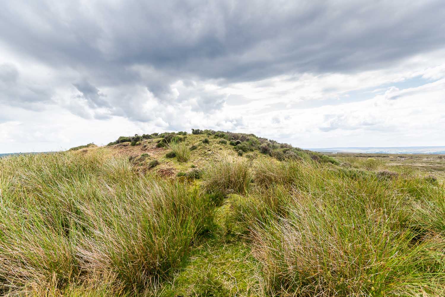
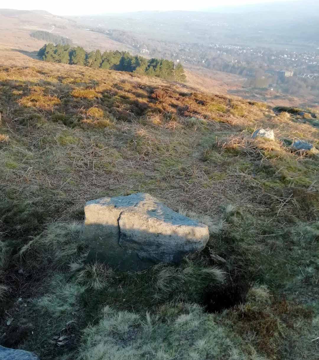
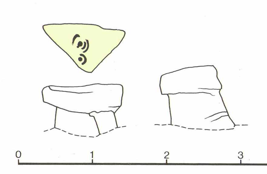
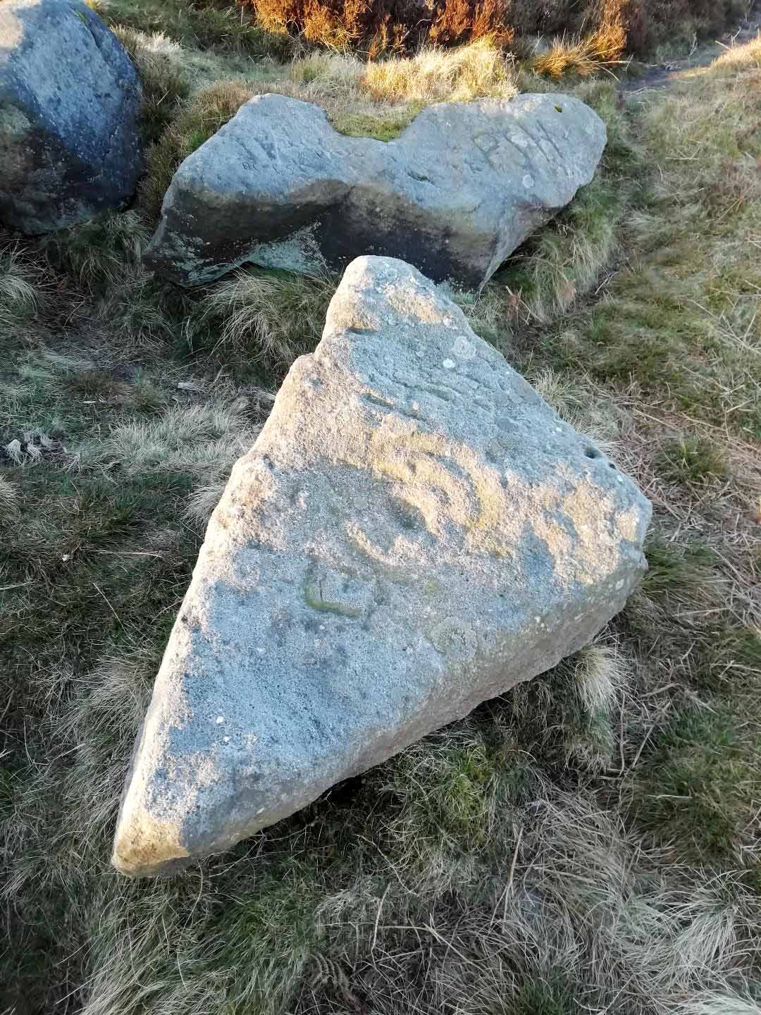
Found high up on top of an oddly-shaped stone, somewhat like an anvil or small table (hence the name, courtesy of Jonathan Warrenberg), is carved a slightly worn, incomplete cup-and-double-ring.  This aspect of the design is the one that stands out the most; but you’ll also see a cup-and-half-ring there too.

The carving seems to have been described for the first time in John Hedges (1986) survey (though I may be wrong), who described an additional feature to the design, saying:

“Small grit rock in possible cairn material, cut all round as if one pedestal, top surface triangular, sloping slightly SW to NE, overlooking Wharfe Valley, in grass and crowberry.  Large cup with two vestigial rings, second large cup with vestigial ring.  Possible third ring of corner edge (hewn off).  Recent carving of initials spoils original carving.”

John Hedges 1986 sketch
Looking from above (photo – Jonathan Warrenberg)

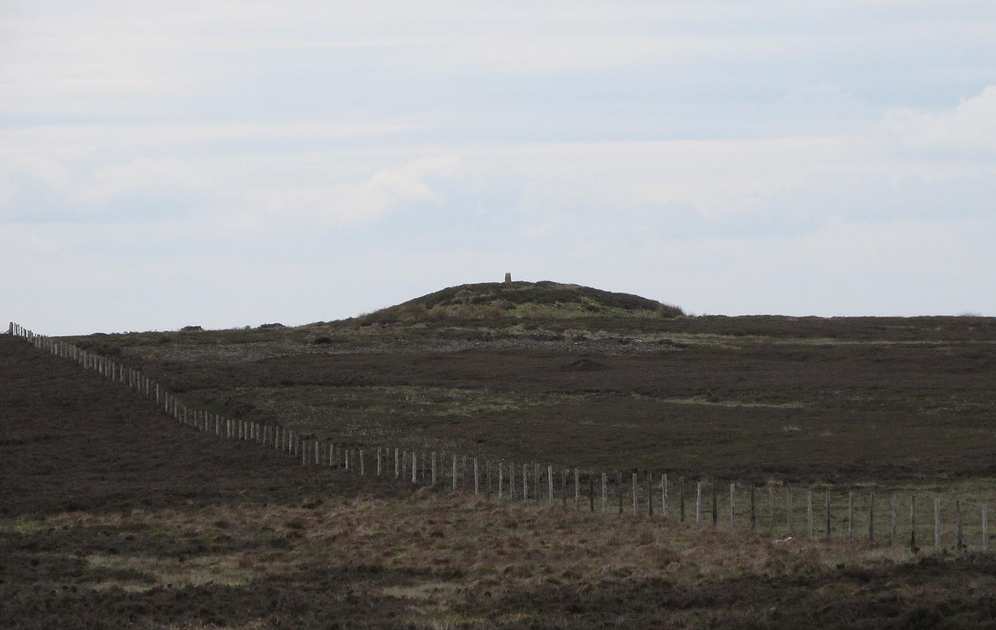
His description of the stone being “in possible cairn material” doesn’t seem true – although a number of petroglyphs are associated with cairns of varying sizes.  Several other carvings can be found close to this one.

In Boughey & Vickerman’s (2003) later survey, they copy Mr Hedges earlier description, but with less detail.

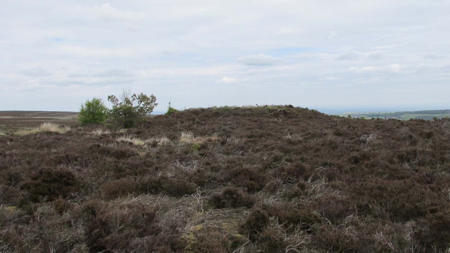
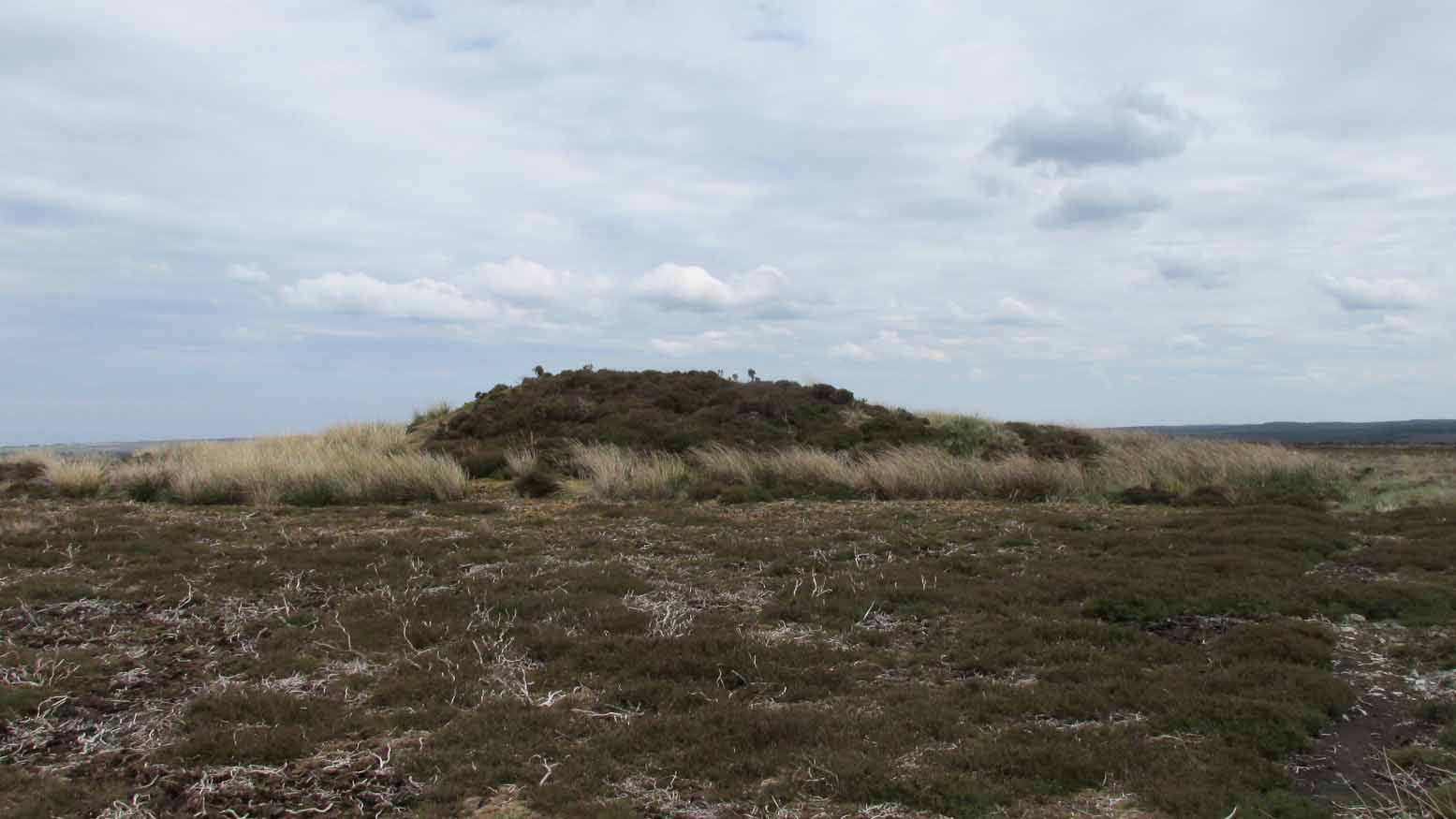
The view from this stone is quite impressive.  Even with the minor tree cover that would have existed when this carving was done, you’d still have clear views up and down the winding wooded valley that was carved by the River Wharfe.  The moors to the north at Denton and Middleton with their own petroglyphic abundance could be chanted at with ease from here when the winds sleep.  Tis a good spot to sit… if you’re lucky enough to get some silence…

References:

  1. Boughey, Keith & Vickerman, E.A., Prehistoric Rock Art of the West Riding, WYAS: Wakefield 2003.
  2. Hedges, John (ed.), The Carved Rocks on Rombalds Moor, WYMCC: Wakefield 1986.

LinksThe Table Stone carving on The Megalithic Portal

Acknowledgments:  Huge thanks to Jonathan Warrenberg for the use of his photos in this site profile – and also due credit for giving the stone its modern title. 🙂

© Paul BennettThe Northern Antiquarian

The map could not be loaded. Please contact the site owner.


Holy Well, Somersby, Lincolnshire

Holy Well:  OS Grid Reference – TF 3417 7303

Also Known as:

  1. Halliwell

Archaeology & History

Holy Well on 1887 map

Curiously missing from Thompson’s (1999) Lincolnshire survey, this old watering place can apparently still be found in the appropriately named Holywell Wood, just north of this lovely little hamlet.  Shown on the 1887 OS-map of the area, it’s first literary reference seems to be in George Weir’s (1820) early survey of Horncastle district where he gives it a brief mention, saying:

“In a woody dell in this parish is a spring, gently bursting from the rock, called Holy-well, but the name of the saint to whom it was dedicated is not preserved.”

…Like oh so many others.  But its ‘holiness’ may devive from other more archaic origins, in the spirit of the woods from whence the waters emerge.  Certainly that’s what the poet laureate Alfred Lord Tennyson would have had us believe.  He grew up in Somersby village and this old well was one of his places of inspiration.  When the local writer H.D. Rawnsley (1900) described Tennyson’s affection for this site, he told us that,

“Alfred peopled that Holywell Wood with forms of fairies, and made the whole surrounding circle of the hills, a theatre for enchantment and chivalry.”

J.C. Walters 1890 sketch

Nature can certainly do that to anyone who wanders Her body with open reverence.

Although the place is now quite overgrown, it wasn’t always this way.  There used to be a well-trodden path with a gateway at the entrance that took you into the woods and up to the well.  Above the gateway there used to be a Latin inscription that read, Intus aquae dulces, vivoque sedilia saxo, Et paulum silvae superest. His utere mecum. (meaning something akin to, “At these sweet waters, by this living seat of stone and small forest remains, Make use of me.”)

When J.C. Walters wrote about it, he told that a “local student” gave him the following particulars:

“A series of steps led down into the well, a post was fixed in front of it, and a cross-bar extended thence to the rock.  On the cross-bar was a ring with a rope attached, so that the bather might safely descend into the well and enjoy the healing virtues of the stream which rushed from the rock.  Geologists say that the wold villages are so closely placed on account of the superior quality of the water which springs up wherever the Spilsby sandstone meets the Kimmeridge clay.  Susan Epton (Mrs. Thompson), Miss Emily Tennyson’s maid, tells me that she can remember the time when visitors came in scores to “take the waters.””

Some of this was later echoed in Rawnsley’s (1900) biographical account of Tennyson.  He talked with a local sexton about the folklore of the area who told him of his memories:

“Halliwell wasn’t growed up then; there was a bath-house with steps down to the watter, and fwoaks in carriages came from far and near to drink it.  Wonderful watter! it was nobbut a bit sen, that our owd nebbur was liggin’ adying and he axed for a cup o’ watter from the Holy Well, and they sent and fetched it, and he took it and went off upon his feet.  Why, i’ my time theer was a school-house down in Halliwell Wood, and a skittle halley close by the well, but all them things is changed now, excep the snowdrops, and they coomes oop reg’lar, a sight on ’em i’ Halliwell.”

References:

  1. Harte, Jeremy, English Holy Wells – volume 2, Heart of Albion Press: Wymeswold 2008.
  2. Howitt, William, Homes and Haunts of the Most Eminent British Poets – volume 2, Richard Bentley: London 1849.
  3. Rawnsley, H.D., Memories of the Tennysons, James MacLehose: Glasgow 1900.
  4. Thompson, Ian, Lincolnshire Springs and Wells, Bluestone: Scunthorpe 1999.
  5. Walter, J. Conway, Records of Woodhall Spa and Neighbourhood, W.K. Morton: Horncastle 1899.
  6. Walters, John Cuming, In Tennyson Land, George Redway: London 1890.
  7. Weir, George, Historical and Descriptive Sketches of the Town and Soke of Horncastle, Sherwood, Neely & Jones 1820.

© Paul BennettThe Northern Antiquarian

The map could not be loaded. Please contact the site owner.


Pen Howe (2), Sleights Moor, Sleights, North Yorkshire

Tumulus:  OS Grid Reference – NZ 8566 0369

Archaeology & History

The low rise of Pen Howe-2

Prehistoric companion to the more pronounced Pen Howe (1) Bronze Age cairn just 20 yards to the west, this overgrown tumulus is hardly noticeable when the heather’s deep and is probably only of interest to dedicated antiquarians and geomancers.  Its position in the landscape, whilst not as prominent as its companion and the nearby Breckon Howe, would still have been important to its builders and the relative proximity of the two tombs may imply a continuity of tribal companionship in the Land of the Dead.  But hey! – that’s just a silly idea of mine! 🙂

Rising barely three feet above ground level, this is slightly smaller than Pen Howe (1), being just 13 yards across; and there is no indication that it has ever been dug into.

References:

  1. Elgee, Frank, Early Man in Northeast Yorkshire, Frank Bellows: Gloucester 1930.

Acknowledgements:  Big huge thanks to my Lindsay Mitchell for getting us up to see this old tomb (which is nearly as old as Linzi 🙂).

© Paul BennettThe Northern Antiquarian

The map could not be loaded. Please contact the site owner.


Pen Howe (1), Sleights Moor, Sleights, North Yorkshire

Tumulus:  OS Grid Reference – NZ 85638 03722

Getting Here

Pen Howe from the north

Along the A169 road between Sleights and Pickering, some two miles south of Sleights turn right as if you’re going to the tombs of Flat Howe and the Bride Stones, but just park up 80 yards along by the cattle grid.  From here, a fence runs southeast and the mound is on the near skyline, just over 100 yards away.  Just walk through the heather to reach it.

Archaeology & History

Shown on the first OS map of the area in 1853, this somewhat overgrown prehistoric tomb is one of two in close attendance to each other (see Pen Howe 2); and is some 435 yards (398m) away from the more prominent Breckon Howe tomb to the southwest.  Like others on Sleights Moor, no real archaeological attention has been paid here, with Frank Elgee (1930) only giving it the slightest mention in passing.

Pen Howe on 1853 map
Pen Howe, looking SE

Smaller than its nearby companions of Flat and Breckon Howe, the overgrown cairn raises about four feet above ground level and about 20 yards across.  Probably Bronze Age in origin, it has a slightly concave top that gives the impression that someone at sometime in the not-too-distant past has had a bittova dig here to see if there’s owt inside.  But we have no record of such a thing.

surmounted by a relatively recent boundary stone, sits at the highest point on the moors in these parts.  Despite this (as with others on these moors), very little has been written about the place and it has received only minimal attention in archaeology tomes.  Even the renowned pen of Frank Elgee (1912; 1930) gave it only passing mention.  Perhaps it aint a bad thing to be honest.

References:

  1. Elgee, Frank, Early Man in Northeast Yorkshire, Frank Bellows: Gloucester 1930.

Acknowledgements:  Big huge thanks to my Lindsay Mitchell for getting us up to see this old tomb and its companion.  (which is nearly as old as Linzi 🙂 )

© Paul BennettThe Northern Antiquarian

The map could not be loaded. Please contact the site owner.


Holland’s Well, Smalley, Derbyshire

Healing Well:  OS Grid Reference – SK 4077 4436

Also Known as:  

  1. Holly Well

Archaeology & History

Hollands Well on 1881 map

Once visible near the middle of the village, references to this local water supply seem pretty scant.  According to Kenneth Cameron (1950) it gained its name from a local man called Robert Holland.  This may be the case; but there is a curious entry found in a notice regarding the Land Enclosures of Smalley from November 6, 1784.  In it we read that the land here was at that time owned by one Samuel Kerry (well known in the village as he built The Rose and Crown pub in 1768) who was living “upon the Common” and had “part of a croft” here.  Therein was mentioned a water source named the ‘Holly Well’ instead of the Holland Well.  I can only assume that the two are the same, as the proximity of them are very close indeed.  The account told that,

“a disused well in the triangular croft at the back of the sixth milestone in the village marks the site of (Samuel Kerry’s) original home, and he is said to have dug the “Holly Well” close by for brewing purposes, which has long supplied the vicinity with good water.”

The name ‘Holly’ may infer that a holly tree grew by the side of the well, and that the title ‘Holland’ was a corruption later grafted onto the site.  Are there any local historians out there who know more…?

References:

  1. Cameron, Kenneth, The Place-Names of Derbyshire – volume 2, Cambridge University Press 1950.
  2. Kerry, Charles, Smalley in the County of Derby, Bemrose: London 1905.

© Paul BennettThe Northern Antiquarian

The map could not be loaded. Please contact the site owner.


Breckon Howe, Sleights Moor, Sleights, North Yorkshire

Tumulus:  OS Grid Reference – NZ 85374 03406

Also Known as:

  1. Brakken Howe
Breckon Howe on 1853 map

Getting Here

Along the A169 road between Sleights and Pickering, some two miles south of Sleights at the highest point on the moors just above the west side of the road, you’ll see a large mound with what looks like a standing stone on top of it.  A minor road turns off the A169 at this point, heading southeast, and the large mound is 150 yards from the roadside. You can’t really miss it!

Archaeology & History

Shown on the first OS map of the area in 1853, this conspicuous prehistoric tomb surmounted by a relatively recent boundary stone, sits at the highest point on the moors in these parts.  Despite this (as with others on these moors), very little has been written about the place and it has received only minimal attention in archaeology tomes.  Even the renowned pen of Frank Elgee (1912; 1930) gave it only passing mention.  Perhaps it aint a bad thing to be honest.

Breckon Howe, from the south

As well as being conspicuous, it’s large.  Rising some six feet above the natural ground level, it measures 26 yards across its east-west axis, and 29 yards north-south, with a rough circumference of 88 yards.  The boundary stone that surmounts its crown sits in a hollow that looks like it was opened up a century or two ago by antiquarians (much like ourselves).  But its position of the tomb in the landscape that is most striking.  The view from here is considerable, having a clear 360º view for many miles around.  Other prehistoric tombs can be seen from here, but more importantly this tomb can be seen on the skyline from many others.  This was probably a deliberate feature intended by its builders–and it’s not uncommon, as many of our upland regions are crowned with ancient tombs like Breckon Howe.  In all likelihood this would have been the resting place of some important ancestral figure: a tribal elder or a shaman, whose spirit after death could view and travel across the landscape they inhabited in life.

Although the tomb presently sits amidst an endless sea of heather (Calluna vulgaris) typical of moorland across our northern lands, the name of the site ‘breckon’, according to George Young (1817) derives from the dialect word meaning ferns or bracken.  This is echoed in Francis Kildale’s (1855) local dialect study and subsequently in Joseph Wright’s (1898) unequalled magnum opus.

Folklore

In the early 19th century, one George Calvert who lived in the area, collected as much folklore as he could, as it was dying off with the coming of the Church.  One such piece told that there was once a hob who lived by this old tomb.  A hob is generally known as a supernatural creature, but in this area it can also be a medicine man.  Some hobs were good, others were malicious.  We know not what type of hob lived lived here, but Calvert simply told us there used to be “T’ Hob of Brackken Howe”.  Nowt more!  It would be good to find the story behind this old character, if it hasn’t been lost entirely…

References:

  1. Elgee, Frank, Early Man in Northeast Yorkshire, Frank Bellows: Gloucester 1930.
  2. Elgee, Frank, The Moorlands of North-Eastern Yorkshire, A. Brown: London 1912.
  3. Kildale, Francis, A Glossary of Yorkshire Words and Phrases Collected in Whitby and the Nieghbourhood, J.R. Smith: London 1855.
  4. Home, Gordon, The Evolution of an English Town, J.M. Dent: London 1905.
  5. Wright, Joseph, English Dialect Dictionary – volume 1, .Henry Frowde: London 1898.
  6. Young, George, A History of Whitby and Streoneshalh Abbey – volume 2, Clarke & Medd: Whitby 1817.

Acknowledgements:  A huge thanks to Lindsay Mitchell for getting us up to see this great tomb and its companion.

© Paul BennettThe Northern Antiquarian

The map could not be loaded. Please contact the site owner.


Wood Well, Shipley Glen, Gilstead, West Yorkshire

Healing Well:  OS Grid Reference – SE 12797 39277

Getting Here

Wood Well on 1852 map

Best reached by going up Shipley Glen, to the Brackenhall Circle enclosure; keep going for a couple of hundred yards and then drop down into the trees, taking the directions directly to the Cloven Hoof Well.  Just past the well, a small footpath leads you downhill towards the large stream at the bottom, where there’s a rocky crossing (an old ford).  Go over here and, barely 50 yards upstream to your right, a large singular moss-covered boulder is set back, just a few yards above the stream with a small pool in front of it.  That’s it!

Archaeology & History

The ‘directions’ to find this might seem a little confusing to locals at first.  This is because the whereabouts of the Wood Well is on the eastern boundary edge of Gilstead – which is down at the bottom of Shipley Glen.  The steep muddy hill above it is almost always slippy and wet through, so it’s easiest to approach from the Baildon side.

The shallow muddy waters in a hot summer

The site is shown on the 1852 map of the area, but I can find no written material telling of its qualities.  If it ever had any medicinal virtues, they have long since been forgotten.  Whilst the water here is fresh and drinkable, in times of drought and low rainfall the water subsides and leaves only a muddy pool – just as it was when I last visited, making it quite undrinkable.  But to me, the main aspect of this site is its natural spirit, its locale, as it’s surrounded by unerring hues of rich greens, cast out by the landscape of mosses prevalent in a region almost bereft of such voices.  If you like y’ wells – check it out!

© Paul Bennett, The Northern Antiquarian

The map could not be loaded. Please contact the site owner.

Flat Howe (2), Sleights Moor, Sleights, North Yorkshire

Cairn:  OS Grid Reference – NZ 85510 04614

Also Known as:

  1. Flat Howe (south)

Getting Here

Flat Howe-2 on 1853 map

Along the A169 road that runs may miles from Whitby to Pickering, as you go through the small town of Sleights, the road gets steep for a mile or so, until you reach the moorland tops, where the road runs dead straight.  After 1.2 miles (1.93km) along the straight road, a small minor road is to your right.  Go along here for literally half-a-mile (0.8km) where you’ll see a small dirt-track on your right, with a locked gate.  There’s room to park here.  Walk straight onto the moor towards the large rounded mound about 200 yards northeast.  That’s it!

Archaeology & History

Highlighted as a blip on the 1853 OS-map (see above) 250 yards south of Flat Howe (1), this is the slightly smaller of the two prehistoric cairns on this flat piece of moorland (which covered in scattered woodland at the time of its construction).  It has been severely robbed of stones by some land-owning fuckwits in the 19th century, who saw fit to build a shooting hut into the tomb itself!  Knob-heads!   As a result, much of the content of the cairn has been severely depleted, with only its western side having any real height to it.

Flat Howe 2 looking south (photo, James Elkington)
Flat Howe 2, looking east

Just like Flat Howe 1, it seems that it’s never been excavated, so we can only guess about how old it is; though it is very probably Bronze Age.  The cairn is roughly 25 yards across and oval in form, but was probably more circular before those morons built their hunting lodge into it.  Its western side stands some 4-5 feet tall, which was probably the uniform height all round it before it was vandalized.  A few yards to the south is what may be a cup-marking on one of the flat earthfast rocks, although I’m slightly sceptical of it.

The position of the site in the landscape is a fine one: living on a large flat open expanse of land, which was probably cleared of some trees when it was first built, allowing for a very wide view in all directions, just like its companion 250 yards to the north.  Well worth checking out.

Folklore

It’s worth repeating the myth we have of a place on Sleights Moor that I’ve also cited in the Flat Howe 1 site profile.  Although we have nothing specific relating to this tomb, an olde creation myth tells us that the local giants, Wade and his wife Bel, left their young son (whose name seems to have been forgotten) somewhere on Sleights Moor (which aint a big place).  The story was first written down by George Young (1817) in his magnum opus on Whitby and the tale was subsequently re-told by many others – Mrs Gutch (1901) for one:

“Young Wade, even when an infant, could throw a rock several tons weight to a vast distance; for one day when his mother was milking her cow near Swarthoue, the child, whom she had left on Sleights moor, became impatient for the breast, and seizing a stone of vast size, heaved it across the valley in wrath, and hit his mother with such violence, that though she was not materially hurt, her body made an impression on the stone which remained indelible, till the stone itself was broken up, a few years ago, to mend the highways!”

This rock was Bel’s Rock, whose exact location seems to have been lost.

References:

  1. Elgee, Frank, Early Man in Northeast Yorkshire, Frank Bellows: Gloucester 1930.
  2. Elgee, Frank, The Moorlands of North-Eastern Yorkshire, A. Brown: London 1912.
  3. Grinsell, Leslie V., The Ancient Burial Mounds of England, Methuen: London 1936.
  4. Gutch, Mrs, County Folk Lore – volume 2: Examples of Printed Folk-lore Concerning the North Riding of Yorkshire, York and the Ainsty, David Nutt: London 1901.
  5. Jeffrey, P. Shaw, Whitby Lore and Legend, Home: Whitby 1923.
  6. Roberts, Anthony, Sowers of Thunder, Rider: London 1978.
  7. Smith, A.H., The Place-Names of the North Riding of Yorkshire, Cambridge University Press 1928.
  8. Young, George, A History of Whitby and Streoneshalh Abbey – volume 2, Clarke & Medd: Whitby 1817.

Acknowledgements:  A huge thanks to Lindsay Mitchell for getting us up to see this great tomb and its companion; and to James Elkington for use of the photograph.

Links:  Flat Howe on The Megalithic Portal

© Paul BennettThe Northern Antiquarian

The map could not be loaded. Please contact the site owner.


Lady Well, Aldborough, North Yorkshire

Holy Well:  OS Grid Reference – SE 400 662

Archaeology & History

Ladywell Lane is shown on the 1855 OS-map (right).

At present we have no information or images about this site. Be the first person to contribute material by emailing us with info or images to the usual address – megalithix@yandex.com

The map could not be loaded. Please contact the site owner.


Robin Hood’s Well, Allerston High Moor, North Yorkshire

Site shown on 1854 map

Sacred Well:  OS Grid Reference – SE 8831 9559

Also Known as: 

  1. Robin Hood’s Spring

Archaeology & History

At present we have no information or images about this site. Be the first person to contribute material by emailing us with info or images to the usual address – megalithix@yandex.com

The map could not be loaded. Please contact the site owner.