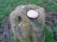
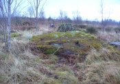
Lady Betty’s Well, Leckie, Gargunnock, Stirlingshire

Holy Well:  OS Grid Reference – NS 69441 94687

Getting Here

Lady Bettys Well, nr Leckie

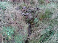
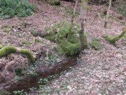
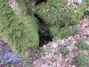
From Gargunnock village, take the road west towards Leckie, and then just before the right-angled bend in the road down towards the A811, bear sharp left, and then immediate right below the farmhouse along what looks like a private road taking you onto the Watson House mansion.  About 500 yards along, with trees either side of you, look down the small steep slope where a small burn (stream) is visible. Get down there and, where the waters bend away changing direction to head north, look carefully for a small spring of water emerging, just a few yards south of the stream itself, beneath a young tree.

Archaeology & History

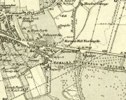
Lady Bettys Well on 1860 map

This all-but-forgotten water source is, thankfully, still running with clear waters below the wooded slopes.  It is highlighted on the first OS-map of the region in 1860, 50-60 yards east of a small but once-picturesque waterfall (now spoiled by a mass of industrial waste, dumped hereby).  Little seems to be known about its mythic history and, quite possibly, may have had something to do with our old cailleach.  May have…. I say this purely in relation to what was said about the site by the Ordnance Survey lads at the end of the 1850s when they visited the site and enquired as to its name and nature.  They told:

“A Small Spring issuing from under a rock like the mouth of a drain having no appearance of a Well.  It took its name (Betty) from an old woman who lived adjacent some two hundred years ago; there is no tradition or Antiquity connected with it – nothing more nor less than an Old woman’s well, but is well known in the neighbourhood by the name. Situated at the base of Craigmakessoch and about 10 chains north west of Leckie house.”

Water emerging by the roots

Although ‘Betty’ is obviously a shortening of Elizabeth, it’s the Old Woman’s bit that brings up the cailleach element, which may or may not be valid.  The small crag beneath which the spring still rises is known as ‘Craigmakessoch’, which Prof Paul Hornby thought might derive from a forgotten attribution to the little-known St. Makessog or Kessog. (are there any local folk who can clarify things?)

Were it not for the pollution due to the dumping here (in an otherwise beautiful place), it looks like the waters would still be drinkable – but we all decided to give it a miss…

© Paul BennettThe Northern Antiquarian


Machar Stones, Fintry, Stirlingshire

Standing Stones:  OS Grid Reference – NS 65705 83932

Also Known as:

  1. Canmore ID 45311
  2. Waterhead Stones

Getting Here

The Machar Stones

The Machar Stones

Of the 2 ways to reach here: one via the Crow Road, up to Waterhead Farm and then meandering through the forest—we took the other one!  From the car park at the western end of Carron Reservoir, take the track into the forest. Stick to the track closest to the loch until, after crossing the small river bridge, veer right at the next junction 200 yards on.  Another 600 yards (0.5km) along, take the right turn and walk all along this track to the very end.  From here, take your feet down into the opening along the small burn and stick to this gap in the trees for 100 yards or so, where the gap in the trees veers left.  Keep walking for another 200 yards.

Archaeology & History

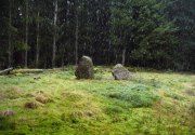
These stones might take some finding, but they’re worth the effort if you like your megaliths.  When Nina, Paul and I visited them yesterday, the meander turned into what have become known as Barmy Bennett Bimbles as we ventured off-path and into the forest, wading through marshland and getting our eyes poked out in the dense trees!  And then the snow came. Twas gorgeous to be honest…

Machar Stones, looking SE

Machar Stones, looking SE

Machar Stones, looking west

Machar Stones, looking west

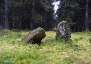
Probably neolithic in origin, the Machar Stones are set upon an elevated rise above the confluence of the Bin Burn and the River Carron on what seems to be an enhanced artificial platform, akin to those which some stone circles and ring cairns are mounted upon. Around the edges of the stones themselves, the earth has been dug into at some point in the past, as evidenced by the distinct oval dip in the ground surrounding the stones; although I can find no antiquarian accounts describing such a dig.  There is the possibility that these stones may once have marked the site of a prehistoric tomb.

Once you walk ten yards away from the stones in any direction, you begin to walk downhill.  Sadly the trees presently obscure any view from the stones, completely silencing the panorama that quite intentionally awoke from here in centuries gone by, disabling any immediate visual landscape analysis or geomancy.  The proximity of the two rivers was probably relevant in the construction of the stones; as may be the ridge between the Little and Meikle Bin to the southeast.

First described in Nimmo’s Stirlingshire (1817) as “a druidical remain…in the parish of Fintry, about the middle of the moor towards Campsie and northwest of the Meikle Bin”, another early account of these megaliths was in H.G. Smith’s (1896) work on the parish of Strathendrick, before the imposition of the modern ‘forest’ occurred and the views from the stones were unrestricted.  After describing their geographical position, he told:

“On a comparatively level part of the muirland between the two rivers and under Meikle Bin, there are two old standing stones known locally as the Machar Stones, this name being derived from the Gaelic magh, a plain.  The more northerly stones measures 8 feet in height, and the other is 5 feet 7 inches high.  Little…is known of the origin of these standing stones… They were apparently in some way connected with the religious worship of the prehistoric inhabitants of the land.  The general uniform direction in which they point, which is to the north of east, looking as nearly as possible to the quarter of sunrise at the summer solstice, seems to point to their having been erected by a race of sun worshippers.”

Machar Stones, looking NW

Machar Stones, looking NW

Around the same time, A.F. Hutchison (1893) gave a lecture on these and other Stirlingshire megaliths, giving slight variants on the heights of the monoliths, adding that “the two stones are standing in a line pointing to 220°.”  Sadly, even the great authorities of Aubrey Burl (1993) and Alexander Thom (1990), in their respective tomes on the subject, were unable to define any astronomical alignments here.  Hutchison puzzled about the seeming artificiality of the platform upon which the stones appear to have been set, though wrote how “geological authority pronounces it to be a quite natural formation.”

As to the name of the site, William Grant (1963) ascribes the word ‘Machar’ and its variants to mean “a stretch of low-lying land adjacent to the sand” or “low-lying fertile plain”—which doesn’t seem relevant here, unless it was so named by people living on the higher grounds.  It seems odd… As does the alignment of the stones.  When Nina Harris stood between the stones with a compass to work out the cardinal points, the stone that was leaning was due north of the upright stone.  When she walked several yards away from them, the compass deviated and we were given a more northeast-southwest alignment from stone to stone.  This isn’t too unusual as we find similar magnetic anomalies at other megalithic sites in Britain (see Devereux 1989), due to a variety of geophysical ingredients.

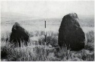
Royal Commission 1954 photo

Royal Commission 1954 photo

Not that your bog standard archaeo-tomes ever mention magnetic anomalies, as basic physics is too complex a subject for your standard archaeo-types!  Instead however, we just get the usual measurements and data-sets, much as the Royal Commission (1963) lads gave us after their visit here in 1954—but at least there was no forest when they came here!  They were fortunate.  “These two stones,” they told us,

“stand on a slight eminence in open moorland, half a mile ENE of Waterhead farmhouse and at an elevation of 850ft… Described by Nimmo’s editor as “a Druidical remain”, they have also been nown as the Machar Stones.  The more northerly stone, a four-sided pillar of irregular section, has fallen almost prostrate and its whole length, 7ft 6in, is revealed.  At the centre it measures 3ft in width by 2ft 6in in breadth.  The other stone stands 4ft 6in further S.  It is a slab…standing to a height of 5ft and measuring about 2ft in thickness.  Its width is 2ft 8in at ground level, 3ft 8in at a point 2ft above this, and 2ft at the top.”

They posit the idea that the reason the taller stone is leaning at such an angle was due to there being a prehistoric cist nearby which had been ‘excavated’ by peoples unknown, who then took it upon themselves to explore the Machar Stones with similar venture.

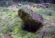
The 'cup-marked' stone

The ‘cup-marked’ stone

In recent years it has been said that there are cup-markings on the leaning stone, seven of them apparently.  When we visited yesterday they were difficult to make out.  There were a number of ‘cups’ on the stone, but these were debatable and seemed more the result of conglomerate disintegration than man-made.  A couple of them were perhaps ‘possibles’.  However, the light was poor and I’d prefer another visit before making my mind up!

The Machar Stones are quite evocative megaliths, despite their lack of grandeur.  Maybe it was the snow.  Maybe it was the trees.  Maybe it was me.  Or probably a mix of all three and more; but this had a real feel to the place.  Well hidden, miles from human touch or visits, awaiting just the occasional visitor—and in this weather (of floods, downpours, cold and snow) saturated humans would be the only sorts of crazy people whose spirits would risk getting completely lost to find them.  And my god were they worth the effort!  Paul, Nina and I thought so anyway!

References:

  1. Burl, Aubrey, From Carnac to Callanish, Yale University Press 1993.
  2. Devereux, Paul, Places of Power, Blandford: London 1990.
  3. Feachem, Richard, Guide to Prehistoric Scotland, Batsford: London 1977.
  4. Grant, William (ed.), Scottish National Dictionary – volume 6, SNDA: Edinburgh 1963.
  5. Hutchison, A.F., “The Standing Stones of Stirling District,” in The Stirling Antiquary, volume 1, 1893.
  6. Nimmo. William, History of Stirlingshire, Andrew Bean: Stirling 1817.
  7. Royal Commission on the Ancient & Historical Monuments Scotland, Stirlingshire – volume 1, HMSO: Edinburgh 1963.
  8. Royal Commission on the Ancient & Historical Monuments of Scotland, Archaeological Sites and Monuments of Stirling District, Central Region, Society of Antiquaries of Scotland 1979.
  9. Smith, H. Guthrie, Strathendrick and its Inhabitants from Early Times, James Maclehose: Glasgow 1896.
  10. Thom, A., Thom, A.S. & Burl, Aubrey, Stone Rows and Standing Stones – 2 volumes, BAR: Oxford 1990.

Acknowledgements:  Huge thanks to Nina Harris and Paul Hornby for their endurance and endeavor in locating these great old stones, in attendance with the great rain, snow and deep muddy bogs!

© Paul BennettThe Northern Antiquarian


Marion’s Well, Falkirk, Stirlingshire

Healing Well (destroyed):  OS Grid Reference – NS 8926 7977

Archaeology & History

Marion's Well on 1864 map

Marion’s Well on 1864 map

Recorded in 1860 by the Ordnance Survey and highlighted several years later, this Marionesque potential of a holy well is not thought to derive its name from the usual Catholic pantheon—but it’s close!  It was obviously an important water source for the people of Falkirk in early times and its clear waters were used to supply an early washing house close by (as shown on the map).  Now completely built over where the B8080 meets the roundabout east of the town centre, the best literary account we have was penned by the regional historian Robert Gillespie (1879) who, in his survey of the area, told us:

“Of Marion’s Well there is scant record.  According to tradition it got its name from Marion Livingston—a nun of the house of Callendar who, in the performance of the sacerdotal vow which kept her from the world, visited the well at intervals and used its soft waters as a pediluvium.   The original well which was built round with stone, stood at the bottom of the Cladden’s Brae, on the bank of the East Burn.  It was further protected by a circle of upright slabs—the great resting place of the water maids and the scene of many a happy ‘touzle’ as the stoups or pitchers were sent rolling and rattling down into the brawling brook.”

Marion's Well, c.1900

Marion’s Well, c.1900

The element of locals “touzling” here simply means that it was a meeting place for young lovers. (Grant 1973; Wright 1905)  Although quite what Gillespie meant when he said it was surrounded “by a circle of upright slabs” is anyone’s guess!  Was this architectural element constructed in the post-medieval period, or was it much much older…?

In the old photo of the well here, Scott & Astbury (1990) said how it,

“shows the trough of the well after it had been moved to the south side of Callender Road and shows a horse pulling a Barr’s cart at the trough.  The view looks down what is now Corporation Street to the bridge over the East Burn.”

References:

  1. Gillespie, Robert, Round about Falkirk, Dunn & Wright: Glasgow 1879.
  2. Grant, William & Murison, David (eds.), The Scottish National Dictionary – volume 9, SNDA: Edinburgh 1973.
  3. Morris, Ruth & Frank, Scottish Healing Wells, Alethea: Sandy 1982.
  4. Reid, John, The Place-Names of Falkirk and East Stirlingshire, Falkirk Local History Society 2009.
  5. Scott, Marion & Astbury, Tom, Falkirk’s Yesterdays, FDD: Falkirk 1986.
  6. Wright, Thomas (ed.), English Dialect Dictionary – volume 6, Henry Frowde: Oxford 1905.

© Paul BennettThe Northern Antiquarian


Loch Ardinning, Mugdock, Stirlingshire

Cup-and-Ring Stone (lost):  OS Grid Reference – NS 56 77

Archaeology & History

The hidden Loch Ardinning stone

The hidden Loch Ardinning stone

This site-profile is one for the explorers amongst you.  It was last reported by the rock art author Ronald Morris (1981) who himself looked several times for this multiple-ringed carving, but never managed to find it.  The carving was rediscovered and described by the Glasgow archaeologist J. Harrison Maxwell, who took the only known photograph of the carving (reproduced here).  Sadly, he only left a short note about the site which read simply: “cups-and-rings to the west of Loch Ardinning.”

It seems probable that the carving would be in the area between the loch and the A81 road (between Strathblane and Bearsden) and not on the western side of the road—but we cannot be certain.  It may be hidden in the trees somewhere between the road and the lochside—which means that it’s probably completely overgrown by vegetation.  Morris (1981) described the carving as:

“a cup-and-four-rings, 2 cups-and-two-rings, and at least 4 cups-and-one-ring. Some rings are complete without radial groove and some are gapped with groove from the cup.”

If any explorers out there manage to unearth this lost carving, please give us a shout!

References:

  1. Morris, Ronald W.B., “The Cup-and-Ring and Similar Early Sculptures of Scotland; Part 2 – The Rest of Scotland except Kintyre,” in Transactions of the Ancient Monuments Society, volume 16, 1969.
  2. Morris, Ronald W.B., “The cup-and-ring marks and similar sculptures of Scotland: a survey of the southern Counties – part 2,” in Proceedings of the Society of Antiquaries, Scotland, volume 100, 1969.
  3. Morris, Ronald W.B., The Prehistoric Rock Art of Southern Scotland, BAR: Oxford 1981.

© Paul BennettThe Northern Antiquarian


Knockraich, Fintry, Stirlingshire

Standing Stone:  OS Grid Reference – NS 60889 87739

Also Known as:

  1. Canmore ID 45305
  2. Knockcraich

Getting Here

Knockraich standing stone

Knockraich standing stone

From Fintry village take the B822 road towards Kippen.  Only half-a-mile (0.8km) along, take the track on your left to Knockraich Farm and cafe.  Go all the way through the farm along the track and out the other side then follow the fence downhill across the field. At the bottom, go through the gate towards the stone which you’ll already be able to see ahead of you, in the next field. Y’ can’t miss it!

Archaeology & History

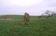
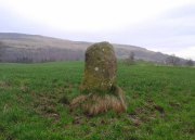
This little-known four-foot tall monolith standing alone in the fields northwest of Fintry, just above the River Endrick, is a fascinating little fella!  It stands at the western end of an elongated rise in the land, almost as if mimicking an ancient long barrow.  But more intriguingly (for me at least) are the cup-markings that adorn each of its four sides.

Cup-mark at base of the north side

Cup-mark at base of the north side

Cup-mark near top of west face

Cup-mark near top of west face

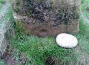
Upon first glance it seems that there are a number of such cup marks on the stone, but further inspection shows that only one occurs on each of the four faces.  Near the very bottom of the stone on its north and south sides a single large cup-mark has been etched; and on its east and western faces, the cup-mark has been carved further up towards the middle of the stone, with the east-facing side having a groove running from near the top and stopping at the cup-mark.  On top of the stone is a large ‘bowl’ (possibly natural, possibly man-made—it is difficult to say with any certainty) and a single cup-mark next to it.  When Nina, Paul and I visited here a few days ago, a palm-sized smooth stone was resting in the large bowl on top, akin to the healing and divination stones found placed in bullauns in Ireland and other parts of the world.

The first description of any length was cited in A.F. Hutchinson’s (1893) paper on the standing stones of Stirlingshire in which he wrote:

“This stone…is placed on the bank rising up from the river.  In shape it is approximately square—the two sides facing nearly east and west, measuring each 1ft 7in, the north face 1ft 6in, and the south 1ft 3in.  These dimensions are uniform from top to bottom.  The total girth is therefore 5ft 11in, while the height is 3ft 8 in.  Orientation 225º.  There are a number of cupmarks both on the top and side, as well as having several incised lines and other markings, some of which, however, give evidence of recent sculpture.”

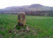
Knockraich stone, looking south at Dunmore hillfort

Knockraich stone, looking south at Dunmore hillfort

Cupmark, hollow & stone on top

Cupmark, hollow & stone on top

The more modern or “recent sculpture” was that of a human figure, now very faint, etched onto the most western face of the stone, beneath a large solitary cup-mark.  When the site was visited and described by the Royal Commission (1963) lads, they gave a lengthier description of the carved elements on the stone, telling us that:

“On the top, which has been brought to an irregularly rounded point, there is an almost circular hollow measuring 5½in to 6in across and 2½in in depth; it is difficult to suppose that this is other than artificial, although its bottom shows differential weathering.  The SE side of the stone shows several natural cavities, and a deep and wide vertical groove which is also presumably natural.  The NW face seems to have been flattened to a certain extent, a slight ridge which is visible along part of either margin probably representing a survival of the original surface.  On this face, 12in above the ground, a human figure has been outlined in pocked technique.  It is in full-face, the features being indicated by pocked marks; the arms are extended jut below the level of the shoulders and the legs are widely spread with the feet turned outwards.  The lower edge of a tunic or short kilt seems to be indicated by a single line between the legs.  The figure is 8in heigh and measures 7in in breadth between the hands and 7½in between the feet.  This face of the stone also shows a number of small natural cavities, together with a shallow cup which has a somewhat artificial appearance; this cup is in the centre of the face and 2ft 4½in above ground level, apparently at the upper margin of the flattened area.  The figure lacks any distinctive characteristics which might afford evidence of date, but it may be relatively modern…”

Folklore

Mr Hutchinson (1893) told that,

“The stone seems to have brought down through the ages a tradition of sanctity in connection with it, as there is a legend to the effect that any attempt to move it is attended by convulsions of Nature and evil consequences to the rash disturber.”

Whether the position of the water-worn smooth rock found in the bowl on top of this standing stone has any ancient tradition, records seem silent on the matter.

References:

  1. Hutchinson, A.F., “The Standing Stones of Stirling District,” in The Stirling Antiquary, volume 1, 1893.
  2. Royal Commission on the Ancient & Historical Monuments Scotland, Stirling – 2 volumes, HMSO: Edinburgh 1963.
  3. Royal Commission on the Ancient & Historical Monuments of Scotland, Archaeological Sites and Monuments of Stirling District, Central Region, Society of Antiquaries of Scotland 1979.
  4. Smith, H. Guthrie, Strathendrick and its Inhabitants from Early Times, James Maclehose: Glasgow 1896.

Acknowledgements:  Many thanks to Nina Harris and Paul Hornby for their help and attendance at this old stone.

© Paul BennettThe Northern Antiquarian

King’s Yett, St. Ninians, Stirlingshire

Cairn:  OS Grid Reference – NS 7373 8922

Also Known as:

  1. Canmore ID 45951

Getting Here

King's Yett cairn, from the track below

King’s Yett cairn, from the track below

Going west out of Stirling or St Ninians, you need to take the minor road/s that cross the M9 and head past the wooded hills, past Graystale and Wallstale.  A mile or so on, keep right when you hit the small road junction past Shielbrae.  A mile past here, where the edges of the road disappears into the moors and the forest grows to your right, park up where the small parking spot takes you down the track into the trees on the right-side.  Walk down here for a coupla hundred yards and keep yer eyes peeled for the rounded fairy-mound on the heaths about 30 yards above you.

Archaeology & History

When we visited this place a few weeks ago, the Dark was almost upon us when we arrived and the clouds were low with a deathly silent mist breathing from the trees and reaching up to meet the low clouds not far above.  It was a curious feeling, borne from the darkening landscape, feeling almost as if the dead were around us—which I suppose they were, in this prehistoric tomb at least.  At the clap of our hands, a great echo rang loudly from the misty silence and the land in which it lived.  Twas almost hypnotic in its lull…..

Looking to the NW

Looking to the NW

King's Yett cairn, looking NE

King’s Yett cairn, looking NE

This site isn’t always gonna have this feel to it of course.  If we’d have visited it on a nice clean blue-sky day, no such feelings would have greeted us—and the tomb would, perhaps, have been little more than an uninteresting-looking mound, overgrown with heather and grasses.  But Nature breathes and casts such entrancements to our central nervous system every now and then—and such states are as worthy of sincere attention as any intellect preys to insist otherwise…. and I should know!

The King’s Yett cairn has yet to be excavated, but it has all the hallmarks of a traditional Bronze Age signature in its structure.  When the Royal Commission  lads came here in 1954, after a report describing the mound, their brief account of it (1963:1) later told, simply:

“A cairn is situated on open moorland, a quarter of a mile W of King’s Yett, at an elevation of 950ft OD.  It consists of a grass-covered, stony mound which measures about 30ft in diameter and stands to a height of 4ft 6in.  A rectangular boulder which lies in the S arc of the base of the cairn, and which appears to be in situ, may have formed part of a peristalith.” (i.e., an encircling ring of stones, PB)

Adjacent circular mound nearby

Adjacent circular mound nearby

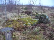
This singular fallen stone is now covered in vegetation and there is little evidence of any stone circle around the tomb.  But immediately west, 70 yards WNW on the other side of the forestry track, rises an even larger circular mound, deeply covered in heather and consisting of earth and stones beneath the surface.  It looks for all the world like another giant cairn (up to 6ft high and measuring about 26 yards (23.9m) E-W, by 27.5 yards (25.2m) N-S) upon which new trees have recently been planted.  It might not be, of course—but we’re gonna look at this again when She gives us more daylight and clearer skies…..just in case…

Locally there are various tales of the Sma’ Folk or little people, fallaciously ascribed by romantic intellectuals as ethereal spirits, but which were and are known to have been tribal people in these uplands; and although such stories excel in this area, we have nothing specific relating to the rounded mound of King’s Yett – yet!

References:

  1. Royal Commission on the Ancient & Historical Monuments Scotland, Stirling – volume 1, HMSO: Edinburgh 1963.
  2. Royal Commission on the Ancient & Historical Monuments of Scotland, Archaeological Sites and Monuments of Stirling District, Central Region, Society of Antiquaries of Scotland 1979.

© Paul BennettThe Northern Antiquarian


Ghost’s Knowe, St. Ninian’s, Stirlingshire

Tumulus:  OS Grid Reference – NS 7474 8574

1861 OS-map of site

1861 OS-map of site

Also Known as:

  1. Canmore ID 45953
  2. Craigengelt Cairn

Getting Here

West of Dunipace and the M9, go along the B818 for 3-4 miles until you hit the pub at the tiny crossroads of Carron Bridge. Take the lonely road up to your right and after several miles, just where the forest on your left finishes, a bend in the road takes you over a small river.  Stop here and walk up the track left, to Craigengelt.  Before you reach the farmhouse at the end, note a small clump of trees ahead of you.  Just before this, a seemingly natural rounded hillock in the field, just off the trackside, is where the monument used to be.

Archaeology & History

No trace remains of this once-important and seemingly impressive prehistoric ‘tomb’ or ritual death chamber, just off the trackside before old Craigengelt farmhouse.  The standard history of the site, repeated variously by Royal Commission (1963) and elsewhere, was first sourced in the New Statistical Account of the region in 1845:

“About two years ago the tenant was engaged in levelling and improving a field on the eastern extremity of Craigengelt in which there was a large cairn or mound, known in the country by the name of the “Ghost’s Knowe.” It was quite circular, exactly 300 feet in circumference at the base, and which was flanked around by twelve very large stones, placed at equal distances, and it was 12 feet high, with a slight inclination to one side, and fiat on top. On removing the turf and soil, it was found that the interior consisted of large and small stories built together with great care, which led the proprietor to think that it must have been a place of Druidical sepulture.

“About 6 feet from the centre, there stood four upright stones, each about 3 feet in height, describing an oblong figure like a bed. Within this a coffin was found, the length of which was about 7 feet, at broad, and at deep. The under part or bottom of the coffin was whin-flag, as was also the upper part or lid. Within this were found the remains of a human body of the ordinary size. The hones, except a very small part of the skull, were of the consistence of soft chalk, the body had been enveloped in something like a mixture of decayed vegetable matter and tar, which, when exposed to the atmosphere, emitted a strong odour.

“Strict orders were given to the labourers that if anything like a coffin should be found, they were not to open it until either the proprietor or tenant were present. But one of them, an old schoolmaster, who knew something of antiquities, went during the night, and carried off a variety of articles, the nature and number of which are not now likely ever to be ascertained. With reluctance, he gave up a stone axe of beautiful workmanship and a gold ring. The ring had had a jewel in it; but the jewel was out, and it was what is called “chased,” and must have been worn on a very small finger.  A labourer in the neighbourhood sold a variety of things of a rare description to a gentleman in whose possession, it is believed, they still are.  The axe and the ring were the only things obtained by the proprietor, J. Dick, Esq. of Craigengelt, and they are still in his possession.”

When Daniel Wilson (1851) visited the site a few years later, he discovered a little more about the valuable items discovered in the tomb:

“among which was a golden horn or cup, weighing fourteen ounces, and ornamented with chased or embossed figures. This interesting relic was purchased from one of the labourers by a gentleman in Stirling, and is believed to be still in existence, though I have failed, after repeated applications, in obtaining access to it.  The exact nature or value of the whole contents of this cairn is not likely ever to be ascertained.  The only articles secured by the proprietor, and now in his possession, are a highly polished stone axe or hammer, eight inches long, rounded at one end and tapering at the other; a knife or dagger of the same material, eighteen inches long, which was broken by one of the stones falling on it when opening the cist; and a small gold finger-ring, chased and apparently originally jewelled, though the settings have fallen out.”

The structure of the Ghost’s Knowe is similar in size and stature to another, large unrecorded round cairn or tumulus, 2.25 miles (3.62km) NNW of here, that still requires our full attention.

Folklore

Despite the name and the tale said by local people that “the place was haunted”, I can find no details that tell the story of the hauntings here.  Does anyone know?

References:

  1. Royal Commission on the Ancient & Historical Monuments Scotland, Stirling – volume 1, HMSO: Edinburgh 1963.
  2. Royal Commission on the Ancient & Historical Monuments of Scotland, Archaeological Sites and Monuments of Stirling District, Central Region, Society of Antiquaries of Scotland 1979.
  3. Wilson, Daniel, The Archaeology and Prehistoric Annals of Scotland, Sutherland & Knox: Edinburgh 1851.

© Paul BennettThe Northern Antiquarian


Garadh Ban Wood, Buchanan, Stirlingshire

Chambered Cairn:  OS Grid Reference – NS 45217 91907

Also Known as:

  1. Canmore ID 282019

Getting Here

The main stones in this ruined cairn

The main stones in this ruined cairn

On the B837 between Balmaha and Drymen at the hamlet called Milton of Buchanan, at the little road junction where the houses are on the right, go uphill for 1 mile (1.6km) until you reach the West Highland Way, where you need to go left (NW).  Keep walking for another half-mile (if you get to end of the forestry plantation, you’ve gone too far) where, on your left, a small widening valley appears.  Walk along the eastern edge of this, keeping your eyes peeled for a small upright stone and two large flat companions next to it.

Archaeology & History

This site is really only for the archaeological purists amongst you, as the forestry plantation has truly taken its toll on the site and very little of it remains.  It appears to have been described first of all in H.G. Smith’s (1896) masterful local history work—although popular tradition was not assigning the place as a prehistoric tomb of any sort.  Rather, it possessed a somewhat familiar folklore element, well-known to occult historians and antiquarians.  Smith told us:

“Not far off, in Garradh-ban Wood, is the ‘Deil’s foot mark stone‘.  It is a large flat stone, 7 feet long and 6 feet wide, with an impression on it not unlike a huge foot mark.  There is another stone close to it, 7 feet by 5 feet.  These stones were probably placed there for some purpose now unknown.”

Mr Smith’s dimensions of the stones correlate closely with the modern analysis taken up by the archaeologists who visited the site more than 100 years later.  Mainly comprising of two large stones on the ground with an accompanying upright monolith on the western side, the official Canmore account tells us:

“The cairn has been reduced to a low stony mound measuring 15m from N to S by 12m transversely and up to 0.5m in height. The chamber, which lies off-centre to the SW, comprises two upright stones and two displaced capstones. The overall plan of the chamber can no longer be determined, and the two upright stones are set splayed to one another; that on the W measures 0.53m by 0.25m and 0.15m in height, and that on the E is heavily laminated measuring 1m by 0.18m and 0.8m in height. The SE corner of one capstone rests on the smaller of the two uprights. It measures 2.1m by 2.03m and up to 0.3m in thickness, and has two fragments broken off at its NE corner. The second capstone lies immediately adjacent to the N, flush with the surface of the cairn, and measures 2.3m by 1.7m and 0.17m in thickness.”

When they assessed the site in 2006, archaeologists reported finding small pieces of quartz scattered over the surface of the cairn, but when we visited here last week, there was little trace of any.

The 'Deil's foot mark'

The ‘Deil’s foot mark’

Garadh Ban, looking west

Garadh Ban, looking west

I was hoping that the “Devil’s footmark” on the stone was going to be a cup-marking of some form, as found at some other sites (Kilneuair church, etc)—but it wasn’t to be.  Instead, it seems that the curvaceous indentation left by the ‘devil’ was simply a natural cavity.  The folktale behind the name, and its possible cultural function, seems to have been forgotten.

Although (perhaps) unrelated, H.G. Smith told us of other remains not too far from here, which remain elusive and not in any official record-books.  We had a quick meander over to see if there was anything to be seen, but daylight was fading fast and more searches are required.  It sounds intriguing:

“A little above these ruins (of Cul-an-Endainn farmhouse at NS 4453 9244 – PB), on the right of the burn, but considerably above it, is a curious structure built of turf.  It is quite round, and is 25 feet in diameter at the top and 15 feet at the bottom.  It has entrances at the south, east and west.  There are others of the same construction both above and below, but not so well defined.”

Recently, industrialists have gone onto this part of the countryside and have already began scarring the hillsides, perhaps even destroying these curious remains before we’ve had a chance to assess them.  Hopefully however, they will remain untouched and allow us site analysis before any real damage is done.

Folklore

Followers of the christian cult said this site was a place where the devil had been.

References:

  1. Smith, H. Guthrie, Strathendrick and its Inhabitants from Early Times, James Maclehose: Glasgow 1896.

Acknowledgements:  Many thanks to Aisha Domleo, Lara & Leo Domleo, Unabel Gordon, Nina Harris, Paul Hornby and Naomi Ross for their help and attendance in finding this ancient site. 

© Paul BennettThe Northern Antiquarian


Fairy Well, Logie, Stirlingshire

Sacred Well:  OS Grid Reference – NS 8135 9804

Also Known as:

  1. Canmore ID 47123
  2. Hielantman’s Well
  3. Highlandman’s Well
  4. Holy Well

Getting Here

Fairy Well, emerging from wall

Fairy Well, emerging from wall

From Stirling, take the A9 to Bridge of Allan, turning right at the roundabout along the A907 for less than a mile, then turning left at the next roundabout up the A91.  A half-mile down, at the small roundabout, bear left and first right, up to Logie Church.  Keep going all the way up this steep winding road, turning right at the junction.  Go along here for a quarter of a mile and park up at the roadside.  Walk along a bit further where the road has a bittova sharp bend.  The sound of the stream coming out of the small glen is obvious.  Walk past this and, on the right-hand side of the road, past the stream, you’ll find a water source emerging from the boscage of an overgrown wall.  Keep looking.  It’s damn close!

Archaeology & History

In the 1792 Statistical Account of this northeastern edge of Stirling, moving into the ancient parish of Logie, we were given an early brief account of this all-but-forgotten sacred water source which, thankfully, still runs fine water to this day.  It was described in tandem with the ancient Hill of the Picts called Dunmyatt, more than a mile to the east; but,

“About half-a-mile from the foot of this hill…is a very fine well, which issues from more than sixty springs, that rise through the sand and channel.  It is called the Holy Well, and is said to have been much resorted to by the Roman Catholics.”
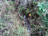
Close-up of the running waters

Close-up of the running waters

In R.M. Menzies (1905) magnum opus on the parish of Logie, he told that it “was popularly known as ‘the Heilantman’s Well’, a possible reminiscence of the ’15 where the battle of Sheriffmuir was fought nearby.”  This tradition is echoed by several local historians; though Angus Watson (1995) wonders whether it’s ‘Highlandman’s Well’ name (and its variants) is “perhaps more likely to the use of the well by Highland drovers.”  It’s in the perfect spot too!

When the Royal Commission (1963) lads visited the place in 1952, they described the well to have “been filled up.”  Thankfully today, the old well emerges out of the overgrown remains of an old wall, the waters of which still run fast and free and into the larger stream ahead of it.  The waters are fine and clear, and tasted cold and refreshing when I drank some a few days ago.  It’s an excellent spot to quench the thirst after a day out in the Ochils.

Folklore

Of the various titles given to this old water source, the more popular choice in recent years has been to call it the Highlandman’s Well.  However, local lore had always known it to be a place where the little people had acquaintance and it seems more vital to maintain its old folk-name.  In R.M. Menzies (1912) rare work on the folklore of the region, he told us the story behind the name:

“Once upon a time, when people took life more leisurely, and when the wee folk frequented the glens and hills of Scotland, there was one little fairy whose duty it was to look after certain wells renowned for their curative properties.  This fairy was called Blue Jacket, and his favourite haunt was the Fairy Well on the Sheriffmuir Road, where the water was so pure and cool that nobody could pass along without taking a drink of the magic spring.  A draught of this water would have such a refreshing effect that the drinker could go on his journey without feeling either thirsty or hungry.  Many travellers who had refreshed themselves at the Fairy Well would bless the good little man who kept guard over its purity, and proceed upon their way dreaming of pleasant things all the day long.

“One warm day in June, a Highland drover from the Braes of Rannoch came along with a drove of Highland cattle, which he was taking to Falkirk Tryst, and feeling tired and thirsty he stopped at the Fairy Well, took a good drink of its limpid water, and sat down beside it to rest, while his cattle browsed nearby.  The heat was very overpowering, and he fell into a dreamy sleep.

“As he lay enjoying his noonday siesta, Blue Jacket stepped out from among the brackens and approaching the wearied drover, asked him whence he came.  The drover said:

“‘I come from the Highland hills beside the Moor of Rannoch; but I have never seen such a wee man as you before.  Wha’ may you be?’

“‘Oh,’ said the fairy, ‘I am Blue Jacket, one of the wee folk!’

“‘Ay, ay man, ye have got a blue jacket, right enough; but I’ve never met ony o’ your kind before. Do ye bide here?’

“‘Sometimes; but I am the guardian of the spring from which you have just been drinking.’

“‘Weel, a’ I can say is that it is grand water; there is no’ the likes o’t frae this to Rannoch.’

“‘What’s your name?’ asked the fairy.

“‘They ca’ me Sandy Sinclair, the Piper o’ Rannoch,’ was the reply.

“‘Have you got your pipes?’ asked Blue Jacket.

“‘Aye, my mannie, here they are.  Wad ye like a tune?  Ye see there’s no’ a piper like me in a’ Perthshire.’

“‘Play away then,’ said Blue Jacket.

“Sandy Sinclair took up his pipes and, blowing up the bag, played a merry Highland reel.  When he finished, he was greatly surprised to see above the well a crowd of little folk, like Blue Jacket, dancing to the music he had been playing.  As he stopped they clapped their little hands and exclaimed, ‘Well done Sandy! You’re the piper we need.’

“Thereupon Blue Jacket blew a silver whistle, which he took from his belt, and all the wee folk formed themselves into a double row.  Blue Jacket then took the Highland piper by the hand, led him to the front of the procession, and told him to play a march.  Sandy felt himself unable to resist the command of the fairy, and, putting the chanter into his mouth, blew his hardest and played his best, marching at the head of the long line of little people, who tripped along, keeping time to the strains of the bagpipes.  Blue Jacket walked in front of the piper, leading the way in the direction of the Fairy Knowe.

“Sandy Sinclair never marched so proudly as he did that day, and the road, though fairly long, seemed to be no distance at all; the music of the pibroch fired his blood and made him feel as if he was leading his clansmen to battle.   When the Fairy Knowe was reached, the wee folk formed themselves into a circle round the little hill, and sang a song the sweetest that ever fell upon the ears of the Highlandman.  Blue Jacket once more took his whistle and, blowing three times upon it, held up his hand, and immediately the side of the knoll opened.  Bidding the piper to play on, Blue Jacket led the procession into the interior; and when all were inside, the fairies formed themselves into sets, and the piper playing a strathspey, they began dancing with might and main.

“One dance succeeded another, and still Sandy played on, the wee folk tripping it as merrily as ever.  All thoughts of Sandy’s drove had gone quite out of his head, and all he thought of now was how best to keep the fairies dancing: he had never seen such nimble dancers, and every motion was so graceful and becoming as made him play his very best to keep the fun going.  Sandy Sinclair was in Fairyland, and every other consideration was forgotten.

“Meanwhile his cattle and sheep were following their own sweet will, the only guardian left to take care of them being his collie dog.  This faithful animal kept watch as well as he could, and wondered what had become of his master.  Towards evening another drover came along with his cattle for the same tryst.  He knew the dog at once, and began to pet the animal, saying at the same time, ‘Where’s your master, Oscar? What’s become o’ Sandy?’

“All the dog would do was to wag his bushy tail, and look up with a pleading air, as if to say, ‘I don’t know; will you not find him?’

“‘My puir wee doggie, I wonder what’s come over Sandy?  It’s no like him to leave his cattle stravaiging by the roadside.  Ay ay man; and at the Fairy Well too!  Indeed, this looks unco bad.’

“The newcomer, who was also a Highlander, made up his mind to spend the night with his own drove and that of Sandy Sinclair, thinking that the missing man would turn up in the morning.  But when the morning came there was no sign of Sandy.

“Taking Sandy’s collie and leaving his own dog in charge of the combined droves, he said, ‘Find master, Oscar!’  The wise beast sniffed around for a little and then trotted off in the direction taken the day before by Sandy Sinclair and the fairies.  By and by they reached the Fairy Knowe; but there was nobody there as far as the drover could see.  The dog ran round and round the knoll, barking vigorously all the time, and looking up into the face of the drover as if to say, ‘This is where he is; this is where he is.’  The drover examined every bit of the Fairy Knowe, but there was no trace of Sandy Sinclair.  As the drover sat upon the top of the Fairy Knowe, wondering what he should do next, he seemed to hear the sound of distant music.  Telling the faithful dog to keep quiet, he listened attentively, and by-and-by made out the sound of the pibroch; but whether it was at a long distance or not, he could not be certain.  In the meantime, the dog began to scrape at the side of the mound and whimper in a plaintive manner.  Noticing this, the drover put his ear to the ground and listened.  There could be no mistake this time: the music of the pibroch came from the centre of the Fairy Knowe.

“‘Bless my soul!’ exclaimed Sandy’s friend. ‘He’s been enticed by the fairies to pipe at their dances.  We’ll ne’er see Sandy Sinclair again.’

“It was as true as he said.  The Piper of Rannoch never returned to the friends he knew, and the lads and lasses had to get another piper to play their dance music when they wished to spend a happy evening by the shore of the loch.  Long, long afterwards, the passers-by often heard the sound of pipe music, muffled and far away, coming from the Fairy Knowe; but the hidden piper was never seen.  When long absent friends returned to Rannoch and enquired about Sandy Sinclair, they were told that he had gone to be piper to the wee folk and had never come home again.”

The Fairy Knowe is the large prehistoric burial mound, neolithic in origin, found 1.08 miles (1.74km) west of the Fairy Well, above Bridge of Allan—and an absolute must to visit for any lovers of fairy lore!

References:

  1. Fergusson, R. Menzies, Logie: A Parish History – volume 1, Alexander Gardner: Paisley 1905.
  2. Fergusson, R. Menzies, The Ochil Fairy Tales, David Nutt: London 1912.
  3. Royal Commission on the Ancient & Historical Monuments Scotland, Stirling – volume 2, HMSO: Edinburgh 1963.
  4. Watson, Angus, The Ochils – Placenames, History, Tradition, Perth & Kinross District Libraries 1995.

© Paul BennettThe Northern Antiquarian


Echo Stone, Mugdock, Stirlingshire

Legendary Rock (destroyed):  OS Grid Reference – NS 5493 7710

Also known as:

  1. Historic Environment Record Stirling 3745

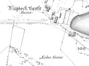
Echo Stone on 1865 Map

Echo Stone on 1865 Map

Archaeology & History

A recent communication to us from Alan McBride (2021), the historian for the Mugdock Country Park, has given us an accurate appraisal of this site which has, sadly, passed into the Realm of the Lost.  The following paragraphs are what Mr McBride has discovered in his personal exploration looking at the history of this once legendary stone.  He writes:

“As the name suggests, one would stand at, or on, the Echo Stone facing Mugdock Castle and upon shouting the voice would reverberate off the high walls of the castle and come back as a long clear echo.  It was a feature on Montrose’s estate, but when it came into existence is unknown.  Historical maps give an idea of when it disappeared though.  The Ordnance Survey map of 1860 shows the Echo Stone adjacent to Mugdock Castle in open ground (now woodland) close to the boundary of Mugdock Wood at the steep crag.  The Ordnance Survey map revision of 1896 shows the Echo Stone and in brackets (site of) and the area planted as woodland.

“Put into historical context, the map of 1860 was produced not long after Archibald McLellan’s tenancy at Mugdock Castle, at which point the old Georgian house was still standing. By the time the revised map of 1896 was produced, John Guthrie-Smith was the tenant of Mugdock Castle.  He was responsible for demolishing the old Georgian house and building the Victorian mansion in its place.  He was also responsible for the design and planting of many trees in the areas surrounding Mugdock Castle and Loch, one of these areas being where the Echo Stone was located.  It is believed by local historians that the stone, decorated with engravings, was either stolen during the time the castle and estate was vacant after McLellan’s death, that it was pushed over the crag into Mugdock Wood where it remains buried under vegetation, or that it was removed during the planting of the area by Guthrie-Smith.”

Of particular interest to myself (PB) is the mention of it being “decorated with engravings.”  My first response (obviously!) was that such carvings may be prehistoric.  A short distance east of here—and also lost—was the Loch Ardinning cup-and-ring stone, so our Echo Stone may have been a carved compatriot.  When I enquired about this, Mr McBride told me,

“Regarding the stone being decorated with engravings, this was a local historian who told me this many years ago. He had been told himself, when he was younger, that the Echo Stone would have been a feature seen from the castle and therefore had decorative features on it.  He has since passed away and it is the only reference I’ve had to it being decorative.  It would make sense though.”

An early literary record of the stone can be found in Hugh MacDonald’s (1854) work, in which he wrote:

“There is an echo of considerable local celebrity at Mugdock, the reverberative powers of which are frequently put to the test by visitors. The spot from which the echo is most distinctly heard is a slightly projecting rock, on a verdant declivity, about a hundred yards to the south of the castle. A person standing on this, looking towards the edifice, and speaking pretty loudly, will hear his words, or even short sentences uttered by him, repeated with startling distinctness, as if from some mimic at the old tower. Of course, we give the echo sundry specimens of our vocality, and to its credit we must say that it flings them back with amazing fidelity. Paddy Blake’s echo, which on the question being put to it of ‘How are you?’ invariably answered ‘Pretty well, I thank you!’ was unmistakeably a native of the land of Bulls. The Mugdock one must be as decidedly Scottish, as it answers each question put to it by asking another. If there were any doubt on this subject, however, we might mention, in support of our supposition, that it is quite au fait at the Gaelic, as we proved to the entire satisfaction of a cannie bystander, who, after listening in silence for some time to our mutual interrogations in that classic tongue, at length exclaimed, ‘Od, man, that’s curious! Wha wad hae thocht that a Lawlan’ echo could hae jabbered Gaelic?'”

Samuel Lewis, writing before 1846, told us that,

“At a distance of about 300 yards from this castle is a remarkable echo, which distinctly reverberates a sentence of six monosyllables, if uttered in a loud tone; and this not till a few seconds after the sentence is completed”.

We can only speculate as to how people in distant times reacted to this echo, and it is interesting how MacDonald’s Gaelic-speaking friend reacted, almost as if he believed it to be a living organism which he did not expect to reply in his own language.

References:

  1. McBride, Alan, Personal Communication, April 15, 2021
  2. MacDonald, Hugh, Rambles Round Glasgow, Descriptive, Historical & Traditional, John Smith & Son: Glasgow 1854 & 1910.
  3. Lewis, Samuel, A Topographical Dictionary of Scotland – 2 volumes, S Lewis & Co.: London 1846

Links:

  1. Mugdock Country Park

Acknowledgements:  Huge thanks to Alan McBride for the revisions and corrections regarding this site profile.

© Paul Bennett, Paul T. Hornby & Alan McBride, The Northern Antiquarian 2016