Cunnel Fold Well, Marsett, Bainbridge, North Yorkshire

Healing Well:  OS Grid Reference – SD 88727 85543

Archaeology & History

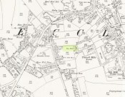
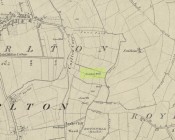
Cunnel Fold Well on 1856 map

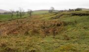
Found high on the moors several miles south of Hawes, this is a small almost insignificant water source that I sat with, drinking in both the landscape and the waters many moons ago in a daydreaming amble.  It’s history is only remembered in the name it was given, no doubt by some local to the Ordnance Survey lads in their own, albeit more focussed assessment on these hills.  Its name puzzled me for a long while and I wondered if some untold story lay behind it.  Sadly that doesn’t appear to be the case.  Although there are doubtless many tales that could be told of the people who, through the centuries, have sat and drank the waters here, we know none.

Its name very probably derives from the misapprehended dialect word ‘cannel’ which, as Mr Wright (1898) explains, is simply “a ditch…gutter, watercourse,” which seems appropriate here.  Of the place-names shown on the 1856 OS-map, it seems the most likely solution to the word.

As for a place to sit and have a drink, it’s very refreshing after the rains have fallen.  All too often nowadays, as with many of the old hilltop watercourses, their life-blood is falling back to Earth…

References:

  1. Wright, Thomas (ed.), English Dialect Dictionary – volume 1, Henry Frowde: London 1898.

© Paul BennettThe Northern Antiquarian


Boskenna Cross, St Buryan, Cornwall

Wayside Cross:  OS Grid Reference – SW 42579 24266

Also Known as:

  1. Historic England Grade II Listed Building No. 1007955

Boskenna Cross on 1887 map

Getting Here

Travelling along the B3315 from Penzance to Lands End, the Cross is on the south side of the road at the junction with the minor road to St Buryan, past the Merry Maidens stone circle.

Archaeology & History

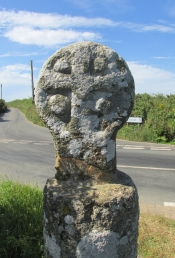
Arthur Langdon (1896), in his magnum opus on Cornish Crosses, describes this wheel-headed wayside cross:

Sketch from Langdon’s 1896 book

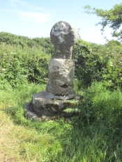
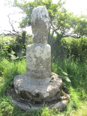
The only ancient part of the monument is the little cross at the top, which is mounted on a base made up of an extraordinary collection of apparently disused circular granite stones. Immediately beneath the cross is a cylindrical piece, the upper edge of which is roughly rounded off. Beneath this comes a short drum, about two inches wider than the piece above and nine inches deep. The next two stones are much wider but not so deep as the last, the bottom one consisting of the lower portion of an old cider-press, with its surrounding channel and lip !

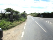
Its roadside position.

There is a good deal to admire in the feeling which prompted this effort to once and for all preserve so ancient a relic, and the care bestowed in the erection of this curious substructure goes far to remove its incongruity.

Front — The figure of our Lord here sculptured is quite the best example in which He is represented wearing the tunic; the expanded sleeves are especially apparent, as well as the outline of the garment above the knees. The feet are very large, and turn outwards at right angles.

The Crucifixion face

Back — On the head is a cross with expanded limbs, flush with the surface of the stone. The four triangular sinkings, or recesses, which form the background are not of uniform size, the lower being considerably larger than those above, thus making the lower limb the longest. The inner portion of each sinking is raised, forming bosses in low relief.

Dimensions — Total height of the monument, 6 ft. 10 in; height of the cross, 2 ft. 4 in; width of head, 1 ft. 8 in; width of shaft, 12½ in.

The cross has had a chequered history. It is not known when it was demolished.  Langdon, once more, takes up the story:

The opposite face.

Mr. J. H. Johns, landlord of the “King’s Arms”, St. Buryan, informed me of the circumstances connected with the discovery of this cross. It appears that formerly one of the angles at the intersection of these roads was so sharp and awkward for traffic that, in 1869, the local authorities decided to ease this corner by rounding off the hedge, which was then about ten feet thick. Mr. Johns’ father was one of the men employed on this work, and shortly after commencing he found the cross buried in the hedge. By the advice of His Honour Charles Dacres Bevan, County Court Judge of Cornwall, and then residing at Boskenna Mansion House, the cross was erected on the triangular piece of grass in the middle of the roads, a spot on which it is extremely likely it originally stood.

Side view from the east.

In 1941 and 1942, the Cross was demolished by road vehicles, whereupon the council removed it to its present roadside position. It was again hit by a vehicle in 1992. And in 2002 there was another incident, reported by Meyn Mamvro:

..In February the top of the cross was found lying by the roadside. It is not known whether this was the result of deliberate vandalism or a road traffic accident, but local village witch Cassandra Latham acted quickly in alerting Cornwall Archaeological Unit, who took it away for repair and restoration…

References:

  1. Langdon, Arthur G., Old Cornish Crosses, Truro, Joseph Pollard, 1896.
  2. Langdon, Andrew, Stone Crosses in West Penwith, The Federation of Old Cornwall Societies, 1997.
  3. Meyn Mamvro, No 49, Autumn 2002, p. 4

© Paul T. Hornby 2018


Denoon Law, Glamis, Angus

Hill Fort: OS Grid Reference – NO 35464 44395

Also Known as:

  1. Canmore ID 32139
  2. Law of Denoon

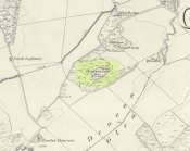
Denoon Law on 1865 map

Getting Here

Travelling north through Balkeerie on the Newtyle/Glamis road, turn right onto the Denoon road and follow it to the T-junction.  Turn right and, a few hundred yards on to your left, the large hillfort of Denoon Law rises up to your left.  You can’t really miss it!

Archaeology & History

Denoon Law from Murleywell

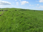
Denoon Law is an impressively lush and green hill fort hidden away in the Sidlaw Hills, in the Denoon Glen, parallel to the Vale of Strathmore. It can be entered froma gap in the ramparts on the north side. Be careful of the precipitous drop from the south east side!

In the County Angus survey by the Royal Commission on the Ancient & Historical Monuments of Scotland (1983), they describes it thus:

This fort crowns the summit of Denoon Law, a steep-sided volcanic plug on the NW side of Denoon Glen, a narrow valley at the N end of the Sidlaw Hills. The fort is roughly D-shaped on plan with the chord of the D formed by a long straight rampart that stands above the precipitous SE flank of the hill. It measures 105m from NE to SW by 55m transversely within a rampart that measures up to 17m in thickness and over 5m in external height but is clearly of more than one phase. Where the differentiation is clear, the latest phase of rampart measures about 6m in thickness and overlies the remains of a much thicker earlier rampart. Intermittently visible at the SW end of the fort is an outer face to the later rampart, comprising drystone walling that has, in places, been displaced downslope by the weight of core material behind. This outer face comprises no more than four or five courses of thin sandstone slabs and, although what is currently visible will only be the top of the surviving wall-face, a wall constructed of such material cannot have stoodto  any great height and what we see today is likely to be the remains of some form of comparatively low revetment. In both the earlier and later ramparts there is very little evidence of stone within the core and it appears that the material (boulder clay) for both has largely been derived from several large quarries within the interior of the fort. At the SW corner of the fort most of the rampart has been removed, leaving only the lower part of the outer talus. The fort, or at least its latest phase, had two entrances, one on the NE and another on the NW, both of which are crossed by the remains of a narrow, later, wall that runs around the entire circuit of the fort and may be associated with at least some of the buildings within the interior.

Outwith the main rampart there is a series of three outer ramparts, again with very little evidence for the use of stone in their construction, which run from the edge of the very steep slope at the NE end of the fort, around the N side to the entrance on the NW. All three lines of defence have been reduced to little more than terraces, though there is no evidence for them ever having been cultivated. At the entrance on the NW, the terminals of these ramparts (on both sides of the entrance) are obscured below outwash deposits from the slope above. To the SW of the entrance it is not at all clear what the relationship is between the defences of the fort and the enclosure that occupies the rocky and extremely uneven SW flank of the hill. This enclosure, which has an entrance on the W, could be some form of annexe or it could represent the SW end of an enclosure that once took in both this area and the rest of the summit.

Within the interior of the fort there are the remains of at least nine rectangular buildings, two of them large and open-ended and each overlain by a smaller, later structure. The freestanding buildings are represented by the footings of walls with inner and outer stone faces; close to the entrance on the NE, however, there are two buildings represented by simple rectangular platforms cut into the rear scarp of one of the prehistoric quarries in one case and the hollow of the entrance passage in another. On the N flank of the hill, overlying the outer defences, there are a number of structures, either taking the form of subrectangular structures with walls (and in one case an entrance) or simple scoops into the slope.’

Entrance from the NW

David Dorward’s definition of the name Denoon is from the Gaelic:

‘dun obhainn (+ Scots law) – [hill of the] fort of the streamlet.’

The streamlet is the Ewnie Burn flowing south-east of the Law.

The lush green centre

Folklore

James Cargill Guthrie, in his The Vale of Strathmore: Its Scenes And Legends, gives the following story from an,

early time, weird-like, a legend’s muffled chime ‘.

The Hill of Denoon was at that remote period accounted sacred or haunted ground. It was the mythical abode of the elfins and fairies, and formerly a fitting haunt for their midnight revelries.

When the silvery moonbeams lovingly slept in dreamy beauty on the green slopes of the enchanted Hill, and the blue bells and the purple heather were wet with the dew of angels’ tears, arrayed in gossamer robes of bespangled gold, with wands of dazzling sheen and lances of magical bright-ness, would the troops of elfins flauntingly dance to the music of the zephyrs, until the shrill cry of the chanticleer put an end for the time to their mystical enchantments.

Suddenly, as in blue clouds of vapour, they noiselessly vanished away, no sound remaining to break the oppressive stillness, save that of the mountain rivulet, as it fretfully leapt from crag to crag, as if piteously regretting the mysterious departure of its ethereal visitors.
South-east rampart

Having forsworn the presence and companionship of the terrestrial inhabitants of earth, it was a sacred dictum in the code of the fairies that no habitation for human beings should be permitted to be built within the hallowed precincts of the enchanted ground. Unable of themselves to guard against such sacrilegious encroachment, they had recourse to the aid of, and formed a secret compact with the demons, or evil spirits, whose sole avocation consisted in doing mischief, and bringing trouble and misfortune on those under the ban of their displeasure. By this compact these evil spirits became solemnly bound to prevent any human habitation whatever from being erected on the hill, and to blast in the bud any attempts whensoever and by whomsoever made to break this implacable, unalterable decree.

It was about this time the alarm-note was sounded, as the Queen of the Fairies, who, with an eye more observant than the rest of her compeers, observed one evening in the moon-light, certain indications of the commencement of a human habitation. Horror and dismay were instantly pictured on the fair countenances of the masquerading troops of merry dancers as the awful truth was ominously revealed to them by the recent workmanship of human hands.

The sheer slope to the south-east

A council of war was immediately held, when it was determined to summon at once the guardian spirits to their aid and protection.

“By our sacred compact,” cried the Queen, “I command the immediate attendance of all the demons and evil spirits of the air, to avenge the insult now offered to the legions of Fairyland, and to punish the sacrilegious usurpers who dare infringe the sanctity of their mystical domains.”

These demons instantly obeyed the haughty summons, and, in the presence of those they had sworn to protect, they in a twinkling demolished the structure, hurling the well-proportioned foundations over the steep rock into the vale beneath !

The builder, doubtless very much surprised and chagrined when he returned to his work in the early dawn of the following morning, was sorely puzzled to account for the entire disappearance of the solid foundations of the great castle he intended to be erected on the Hill. He did not, however, waste much time, or use much philosophic argument, on the matter, and gave orders to prepare new foundation of even a more durable character.

The demons, to show their invincible power, and for the sake of more effect, allowed the new foundations to rise a degree higher than the former, before they gave out their fiat of destruction. In an instant, however, they were again demolished, and the builder this time gravely assigning some fatal shock of Nature as the cause of the catastrophe quietly resolved to repair the damage by instantly preparing new and still more solid foundations.

Additional and more highly skilled workmen were engaged, and everything for a time went favourably on, the walls of the castle rising grandly to view in all the solidity and beauty of the favourite architecture of the period.

Biding their time, the demons again ruthlessly swept away as with a whirlwind every vestige of the spacious halls, razing the solid massy foundations so effectually that not one stone was left upon another !

Things were now assuming a rather serious aspect for the poor builder, who, thinking that he had at last hit upon the true cause of these successive disasters, attributed his misfortunes to the influence of evil spirits. A man of courage and a match, as he imagined, for all the evil spirits of Pandemonium, supposing they were let loose at once against him by the Prince of Darkness, he unhesitatingly resolved to keep watch and ward on the following night, and to defy all the hosts of hell to prevent him rebuilding the projected edifice. The night expected came ; but, alas, alas !

His courage failed when on the blast
A demon swift came howling past,
Loud screeching wild and fearfully,
This ominous, dark, prophetic cry
“Build not on this enchanted ground !
‘Tis sacred all these hills around ;
Go build the castle in a bog,
Where it will neither shake nor shog !”‘

So, if you are planning to visit Denoon Law – remember: RESPECT THE FAERIES!

References:

  1. Guthrie, James Cargill, The Vale of Strathmore: Its Scenes And Legends, Edinburgh, William Patterson, 1875.
  2. Royal Commission on the Ancient and Historical Monuments of Scotland. The archaeological sites and monuments of Central Angus, Angus District, Tayside Region, The archaeological sites and monuments of Scotland series no 18. Edinburgh, 1983.
  3. Dorward, David, The Sidlaw Hills, Forfar, The Pinkfoot Press, 2004.

©Paul T Hornby 2018
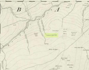

Lady Well, Tibbermore, Perthshire

Holy Well (destroyed):  OS Grid Reference – NO 05190 23479

Also Known as:

  1. Canmore ID 26862
  2. St Mary’s Well

Getting Here

Lady Well on 1866 map

Approaching Tibbermore from Huntingtower, turn left in the village and the site of the Lady Well is visible in fields on the left, just to the north of a bush growing on the north-south boundary fence on the east side of the roadside paddock before you get to the church.

Archaeology & History

On the day of my site visit I wasn’t able to get close to the site, owing to the subdivision of the roadside paddock by wire fences and the presence of horses. Growing crops barred access from the east. But it appears that all physical traces of the well have been destroyed, and the actual site of the well as shown on old OS maps now shows no evidence of it, but a large bush a few yards south may indicate the present site of any vestigial spring.

The site of the Well to the left of the bush

Hew Scott, in Fasti Ecclesiae Scoticanae wrote that the church at Tibbermore was dedicated to St Mary, and that there was a Well of St Mary. Tibbermore was a mensal parish of the Bishop of Dunkeld – i.e., its parish revenues etc, were accrued to the Bishop, who maintained a residence in the parish prior to the Reformation.  Pennant wrote in 1772 that the church of Tibbir-moor took its name from a holy well dedicated to the Virgin Mary.

John Inglis in the Old Statistical Account wrote that the name Tibbermore was understood to be compounded of two Gaelic words, tuber and more, which signify a large well—referring probably to a plentiful spring of water immediately adjoining to the church-yard.

Watson, in his Celtic Place Names writes:

Tibbermore or -muir near Perth is supposed to mean ‘big well’ from a fine spring near the churchyard, but as this used to be called “the lady well”, the meaning may be ‘Mary’s well’, tiobar Moire, like Tobar Mhoire, Tobermory in Mull.

Can it be inferred from this that the spring was historically of great importance; firstly to have given its name to the parish and village and secondly to have been named after the Virgin Mary rather than a ‘lesser’ saint, and to have been a pre-Christian place of veneration and pilgrimage? Adding to this speculation is the presence of several cup marked stones within a mile or so of the holy well, which may possibly indicate a very ancient sacred landscape.

References:

  1. Pennant, Thomas, A Tour In Scotland 1772, London, Benjamin White, 1776.
  2. Inglis, John, Old Statistical Account for Tibbermore, Perthshire, 1791-99.
  3. Scott, Hew, Fasti Ecclesiae Scoticanae, Vol. IV, Edinburgh, Oliver & Boyd, 1923.
  4. Watson, W.J., The Celtic Place-Names Of Scotland, Revised Edition, Edinburgh, Birlinn, 2004. (originally published 1926).

© Paul T. Hornby 2018


Chapel Well, Berryhill, Bankfoot, Perthshire

Holy Well (destroyed):  OS Grid Reference – NO 02179 34749

Also Known as:

  1. Beltane Well
  2. Canmore ID 27045

Getting Here

The reeds mark the spot

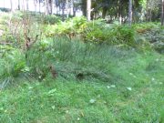
I accessed the site by parking up at Little Tullybelton, walking up the hill and crossing into the field on the left just north of the wood, then walking due west (crossing barbed wire fences) until dropping down into the valley of the Ordie Burn and following the track into the wood, then, noting where the burn crosses south of the old stone wall. The site of the well is marked by some tussocks of cotton grass. Don’t confuse with a patch of nettles and docks 2-300 hundred yards east where you enter the wood.

Archaeology & History

This well was destroyed about 170 years ago and the site of it is quite hard to find as the land has been turned over to forestry. It was near a chapel and burial ground that were also destroyed by the farmer of the time. The old wall formed part of the boundary of the detached portion or enclave of the neighbouring parish of Methven.

The Reverend Thomas Nelson, Minister of the Parish of Auchtergaven, has this to say in the New Statistical Account of 1845:

‘Superstition formerly invested St Bryde’s, and Chapel Well, and perhaps some others, with a sacred character, and made then places of resort for pious purposes.

‘On the south march of Berryhill Farm, in the same lands of Tullybeagles, there is the site of.. a chapel, where there was a burying-place, where human bones have been recently dug up; and, till of late, the people in the neighbourhood used, on the first Sabbath of May, to drink out of the Holy Well there. This sacred place is on the banks of the Ordie.’

The OS Name Book has the following entry regarding the Well:

‘The site of a Holy Well which has been traditionally associated with the adjacent chapel. The water of this well is now carried by a covered drain into the adjacent stream, and the well filled in‘.

And this regarding the Chapel:

‘The site of an ancient chapel on the north bank of the Ordie Burn, the chapel was demolished and the graveyard rooted up some years ago by the present tenant of the farm, who has pointed out the site, the dedicatory name is not known‘.

Site shown on 1867 map
Ancient track to chapel & well

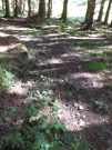
I could find no evidence of the culvert which discharges the waters of the Well into the Burn. What does seem to have been missed is the survival of part of the ancient sunken roadway or pilgrim path to the site, which is still clearly visible.  The fact that it was visited by locals on the first Sabbath in May would point to it having originally been a Beltane well, and therefore of pre-Christian origin.

References:

  1. The New Statistical Account for Auchtergaven, Perthshire, 1845
  2. Ordnance Survey Name Books for Perthshire, 1859-6

© Paul T Hornby 2018
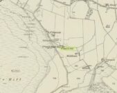

Tun Well, Eccleshill, Bradford, West Yorkshire

Healing Well:  OS Grid Reference – SE 1822 3593

Also Known as:

  1. Tunny Well

Archaeology & History

Tun Well, on 1893 map

First mentioned in local history accounts from 1618—as the Tunwells—it was highlighted on the first OS-map of Eccleshill in 1851.  Located on the aptly-named Tunwell Lane, it was a deep well covered by a large flat slab of stone, at the back-end the old Victorian mill.  The stone was put there to prevent children falling into it.  Some old locals thought the name of the place derived from a ‘tun’, or hundred, meaning it to be a hundred feet deep; although as A.H. Smith (1961) tells, tun could equally relate it to be one of Eccleshill’s town wells, of which there were several.  It used to be one of the principal drinking supplies for the village and was said to rarely run dry.  In William Ranger’s (1854) survey, he told this to be one of the sites to which local people relied in times of drought, where the land-owner allowed local folk to collect their supplies.

Folklore

The old cobbled Tunwell Lane was long ago supposed to be the haunt of a phantom black dog: a visionary precursor of death and Underworld guardian. Its spirit came and went into the deep well.  I remember hearing tales of this when I was a young lad, as the old women who worked in the adjacent mills spoke of it.  The ghost of a so-called ‘white lady’ was also said to walk along Tunwell Lane.

In more recent times, Val Shepherd (2002) included this in her short survey of wells in the area as being on “an alignment” with Eccleshill’s Moor Well and Holy Well.  She thought “it may be part of a ley line”, but her alignment is inaccurate and doesn’t hit the spots.

References:

  1. Crapp, H.C. & Whitehead, Thomas, History of the Congregational Church at Eccleshill, Watmoughs: Idle 1938.
  2. Ranger, William, Report to the General Board of Health on a Preliminary Inquiry into the Sewerage, Drainage, and Supply of Water, and the Sanitary Condition of the Inhabitants of the Township of Eccleshill, George Eyre: London 1854.
  3. Shepherd, Val, Holy Wells of West Yorkshire and the Dales, Lepus: Bradford 2002.
  4. Smith, A.H., The Place-Names of the West Riding of Yorkshire – volume 3, Cambridge University Press 1961.

© Paul BennettThe Northern Antiquarian


Tammie Blair’s Well, Dunblane, Stirlingshire

Healing Well (destroyed):  OS Grid Reference – NN 780 010

Archaeology & History

Which one is Tammie Blair’s Well?

It’s difficult to work out the exact position of this lost well, even from Alexander Barty’s (1944) description of the place.  There are several unnamed ‘Wells’ on the early OS-maps very close to where this one was said to be, but in the end I’m relying on (sort of) educated guesswork regarding its precise location.  Please forgive my ineptitude here…

That aside, it’s another water source that has long since gone and is only remembered thanks to Mr Barty’s excellent local history research in the first-half of the 20th century.  He told us:

“This well stood beside the path which leads from the Bridgend up the right bank of the Allan to the Haugh.  A drawer of water at one time had to go down about 15 steps to the well.  It may have been constructed after the making of the railway, as previously a little burn flowed from the Bridgend west of the railway down to the Allan, the lower part of which is still open next Willowbank House.  This well may therefore have been made by the Railway Company to supply dwellings in Bridgend.  It took its name from a man, Blair, who had charge of the railway gates there prior to the erection of the iron footbridge over the railway line.”

It may be the ‘Well’ marked lower-centre on the above 1863 OS-map above.  But I aint sure.

References:

  1. Barty, Alexander B., The History of Dunblane, Eneas Mackay: Stirling 1944.

Acknowledgements:  Huge thanks to the staff at Dunblane Library for their help.

© Paul BennettThe Northern Antiquarian


Swithins Well, Rothwell, West Yorkshire

Healing Well (destroyed):  OS Grid Reference – SE 3442 2686

Also Known as:

  1. St. Swithin’s Well

Archaeology & History

Swithins Well on 1854 map

Highlighted in the fields on the south-side of Rothwell village on the 1854 OS-map, Swithin’s Well was, according to historian Andrea Smith (1982), previously known as a holy well, dedicated to the obscure Saxon saint of the same name.  Although no ‘well’ relating to St Swithin comes from any early texts, the field and farmhouse of ‘Swithins’ were cited in records from the Cartulary of Nostell Priory in 1270 CE; then subsequently in a variety of records throughout the 14th, 15th and 16th centuries.  According to Miss Smith (1982),

“The first recording of St Swithin’s Well, Rothwell…was on an estate map of 1792 (‘Plan of St. Clement’s lands in the parish of Rothwell in the County of York, two-third part of the tithes of corn and grain of which belong to the King in right of His Ducky of Lancaster’, PB), and the field-names arising from it—Swithin’s, Swithin’s Barn, Swithin’s Lane Close—serve to give an indication of the well’s past importance as a local landmark.”

When she visited the site around 1980, she reported finding,

“several wet patches running in a line westwards downhill, but the farmer’s wife seemed certain that this was a broken drain and nothing else could be seen in that field or neighbouring ones, which could have been the well.”

Very recently, the Wakefield pagan and antiquarian Steve Jones went to see if the well or any remains of it could still be seen and told us:

“We went looking for the well down a footpath but it was obviously filled in when a colliery was nearby in the early 20th century and (there is) no trace of any spring now.”

Another one’s bitten the dust, as they say…..

But we must note that the grand place-name authority, A.H. Smith (1962) found no references to St. Swithin here and instead suggested the name derived from the old Norse word, sviðinn, ‘land cleared by burning’, which is echoed in the old local dialect word swithen, ‘moorland cleared by burning’ (Smith 1956), and similarly echoed in Joseph Wright’s (1905) magnum opus, where—along with meaning ‘crooked, warped’—it means “to burn, superficially, as heather, wool, etc.”   There is also a complete lack of any mention to the saintly aspects of this place in John Batty’s (1877) primary history book on Rothwell parish, and yet he cites numerous other springs and wells in the region that have fallen out of history.

References:

  1. Batty, John, The History of Rothwell, privately printed: Rothwell 1877.
  2. Jones, Steve, Personal communication, Facebook 27.08.2018.
  3. Rattue, James, “The Wells of St Swithun,” in Source, Summer 1995.
  4. Smith, Andrea, “Holy Wells Around Leeds, Bradford & Pontefract,” in Wakefield Historical Journal 9, 1982.
  5. Smith, A.H., The Place-Names of the West Riding of Yorkshire – volume 2, Cambridge University Press 1961.
  6. Smith, A.H., English Place-Name Elements – volume 2, Cambridge University Press 1956.
  7. Wright, Joseph, English Dialect Dictionary – volume 5, Henry Frowde: Oxford 1905.

Acknowledgements:  Many thanks to Steve Jones of Wakefield for his informing us about the status of this site.

© Paul BennettThe Northern Antiquarian


St. Patrick’s Well (1), Dunruchan, Muthill, Perthshire

Holy Well:  OS Grid Reference – NN 77905 17365

Getting Here

St Patricks Well on 1863 map

Take the B827 road between Comrie and Braco. If you’re coming via Comrie, going uphill for 3.1 miles (5.1km); but if from Braco Roman Camp go along and eventually downhill for 6.6 miles (10.6km), watching out for the track to Middleton Farm by the roadside.  Walk along for 125 yards, keeping your eyes peeled for the boggy ground below on your left. You’re there!

Archaeology & History

Immediately east of the prodigious megalithic complex of Dunruchan, bubbling up amidst the usual Juncus conglomeratus reeds, are the boggy remnants of St. Patrick’s Well—one of two such sacred wells dedicated to the early Irish saint in Muthill parish. We’re at a loss as to why this Irish dood has such sites in his name in this area.  No doubt some transitional shamanic character was doing the rounds in this glorious landscape, muttering words of some neo-christian animism, eventually settling a mile from the great megalithic complex, perhaps hoping—and failing—to convert our healthy heathen populace into ways unwise.

The shallow boggy waters
The site of St Patricks Well

Whatever he may have been up to, a small stone chapel was built hereby and, it was said, even a christian graveyard, to tempt folk away from the ancient plain of cairns whence our ancestors had long since buried their dead.  But the christian’s chapel and graveyard has long since gone; and when historians before me had visited the place, St Patrick’s Well had also fallen back to Earth in the drier summers, taking the blood of the Earth back into Her body.  The heathen megaliths still remain however, standing proud on the moorland plain in clear sight from these once healing waters, whose mythic history, on the whole, has long since been disregarded….

Folklore

St Patrick’s day on March 17—”a date very near the Spring Equinox,” as Mrs Banks (1939) reminded us—may have been the dates when the waters here were deemed particularly efficacious, although we have nothing in written accounts to tell us for sure. But in the 19th century Statistical Account we find that the site was “much frequented once, as effectual in curing the hooping cough.”  E.J. Guthrie (1885) told of an ancient rite regarding the drinking of the waters for effect of the cure, saying:

“In the course of this century a family came from Edinburgh, a distance of nearly sixty miles, to have the benefit of the well. The water must be drunk before sunrise or immediately after it sets and that out of a “quick cow’s horn”, or a horn taken from a live cow, and probably dedicated to this saint.”

Also in Muthill parish, Guthrie told, St Patrick’s memory was held in such veneration that farmers and millers did not work on his day.

References:

  1. Banks, M. MacLeod, British Calendar Customs: Scotland – volume 2, Folk-lore Society: Glasgow 1939.
  2. Booth, C. Gordon, “St Patrick’s Well (Muthill Parish),” in Discovery & Excavation, Scotland, New Series volume 1, 2000.
  3. Guthrie, E.J., Old Scottish Customs, Thomas D. Morison: Glasgow 1885.
  4. MacKinlay, James M., Folklore of Scottish Lochs and Springs, William Hodge: Glasgow 1893.
  5. Morris, Ruth & Frank, Scottish Healing Wells, Alethea: Sandy 1982.

© Paul BennettThe Northern Antiquarian


St. Bride’s Well, London, Middlesex

Holy Well (covered):  OS Grid Reference – TQ 3157 8111

Archaeology & History

St Brides Well on 1896 map

Close to the centre of that corporate money-laundering place of homo-profanus that is the City of London, was once a site that represents the antithesis of what it has become.  Tacked onto the southeastern side of St. Bride’s church along the appropriately-named Bride Lane, the historian Michael Harrison (1971) thought the Holy Well here had Roman origins.  It “was almost certainly,” he thought,

“in Roman times, the horrea Braduales, named after the man who probably ordered their construction: Marcus Appius Bradua, Legate of Britain under Hadrian, and the British Governer in whose term of office the total walling of London was, in all likelihood, begun.”

This ‘Roman marketplace of Bradua’ that Harrison describes isn’t the general idea of the place though.  Prior to the church being built, in the times of King John and Henry III, the sovereigns of England were lodged at the Bridewell Palace, as it was known.  Mentioned in John Stow’s (1720) Survey of London, he told:

“This house of St. Bride’s of later time, being left, and not used by the Kings, fell to ruin… and only a fayre well remained here.”

The palace was eventually usurped by the building of St. Bride’s church.  The most detailed account we have of St. Bride’s Well is Alfred Foord’s (1910) magnum opus on London’s water supplies.  He told:

“The well was near the church dedicated to St. Bridget (of which Bride is a corruption; a Scottish or Irish saint who flourished in the 6th century), and was one of the holy wells or springs so numerous in London, the waters of which were supposed to possess peculiar virtues if taken at particular times.  Whether the Well of St. Bride was so called after the church, or whether, being already there, it gave its name to it, is uncertain, more especially as the date of the erection of the first church of St. Bride is not known and no mention of it has been discovered prior to the year 1222.  The position of the ancient well is said to have been identical with that of the pump in a niche in the eastern wall of the churchyard overhanging Bride Lane.  William Hone, in his Every-Day Book for 1831, thus relates how the well became exhausted: ‘The last public use of the water of St. Bride’s well drained it so much that the inhabitants of the parish could not get their usual supply.  This exhaustion was caused by a sudden demand on the occasion of King George IV being crowned at Westminster in July 1821.  Mr Walker, of the hotel No.10 Bridge Street, Blackfriars, engaged a number of men in filling thousands of bottles with the sanctified fluid from the cast-iron pump over St. Bride’s Well, in Bride Lane.”  Beyond this there is little else to tell about the well itself, but the spot is hallowed by the poet Milton, who, as his nephew, Edward Philips records, lodged in the churchyard on his return from Italy, about August 1640, “at the house of one Russel a taylor.”

In Mr Sunderland’s (1915) survey, he reported that “the spring had a sweet flavour.”

Sadly the waters here have long since been covered over.  A pity… We know how allergic the city-minds of officials in London are to Nature (especially fresh water springs), but it would be good if they could restore this sacred water site and bring it back to life.

Folklore

Bride or Brigit has her origins in early British myth and legend, primarily from Scotland and Ireland.  Her saint’s day is February 1, or the heathen Imbolc (also known as Candlemas).  Although in christian lore St. Bride was born around 450 AD in Ireland and her father a Prince of Ulster, legend tells that her step-father (more probably a teacher) was a druid and her ‘saintly’ abilities as they were later described are simply attributes from this shamanic pantheon. Legends—christian and otherwise—describe Her as the friend of animals; possessor of a magickal cloak; a magickian and a healer; and whose ‘spirit’ or genius loci became attached to ‘sacred sites’ in the natural world, not the christian renunciation of it.  St Bride was one of the primal faces of the great prima Materknown as the Cailleach: the Gaelic deity of Earth’s natural cycles, whose changing seasons would also alter her names, faces and clothes, as Her body moved annually through the rhythms of the year.  Bride was (and is) ostensibly an ecological deity, with humans intrinsically a part of such a model, not a part from it, in contrast to the flawed judaeo-christian theology.

References:

  1. Foord, Alfred Stanley, Springs, Streams and Spas of London: History and Association, T. Fisher Unwin: London 1910.
  2. Gregory, Lady, A Book of Saints and Wonders, Colin Smythe: Gerrards Cross 1971.
  3. Harrison, Michael, The London that was Rome, Allen & Unwin: London 1971.
  4. McNeill, F. Marian, The Silver Bough – volume 2, William MacLellan: Glasgow 1959.
  5. Morgan, Dewi, St Bride’s Church, Fleet Street, in the City of London, Blackfriars: Leicester 1973.
  6. o’ Hanlon, John, Life of St. Brigid, Joseph Dollard: Dublin 1877.
  7. Sunderland, Septimus, Old London Spas, Baths and Wells, John Bale: London 1915.

© Paul BennettThe Northern Antiquarian