Tumulus (destroyed): OS Grid Reference – SE 6803 8695
Also Known as:
- Robin Hood’s Howl
Archaeology & History
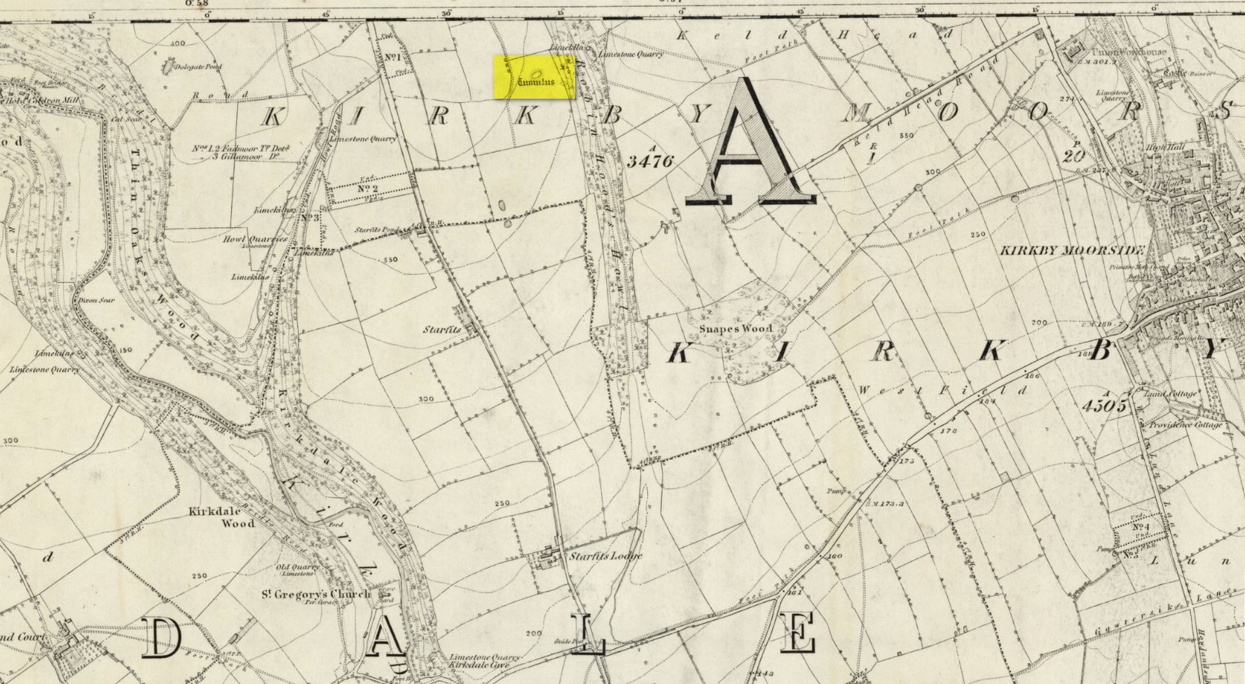
There once stood a very impressive prehistoric burial mound here, a few hundred yards east of the roadside, just above the wooded valley known curiously as Robin Hood’s Howl. Highlighted on the 1856 Ordnance Survey map as an elongated structure, it was suggested in McDonnell’s (1963) work to have been a long barrow, measuring roughly 70 feet long by 50 feet across and more than six feet in height. It was seemingly written about for the first time by William Eastmead (1824) in his lengthy history of the area and was, he told,
“a tumulus of considerable dimensions (that) was lately opened at a place called the Hag, about a mile northwest of Kirkby-Moorside, in which was found an urn… Great numbers of human bones were also dug out…; and from the immense size of it, a great number of bodies appear to have been burnt indiscriminately, and the ashes of some particular person deposited in the urn.”
The urn would seem to have been either lost or destroyed—as has the tumulus. It was apparently still intact, albeit very denuded, twenty years ago, but has since been ploughed out.
References:
- Eastmead, William, Historia Rievallensis: containing the history of Kirkby Moorside, R. Peat: Thirsk 1824.
- McDonnell, J. (ed.), History of Helmsley, Rievaulx and District, Stonegate: York 1963.
Acknowledgements: Huge thanks for use of the Ordnance Survey map in this site profile, reproduced with the kind permission of the National Library of Scotland.
© Paul Bennett, The Northern Antiquarian
The map could not be loaded. Please contact the site owner.