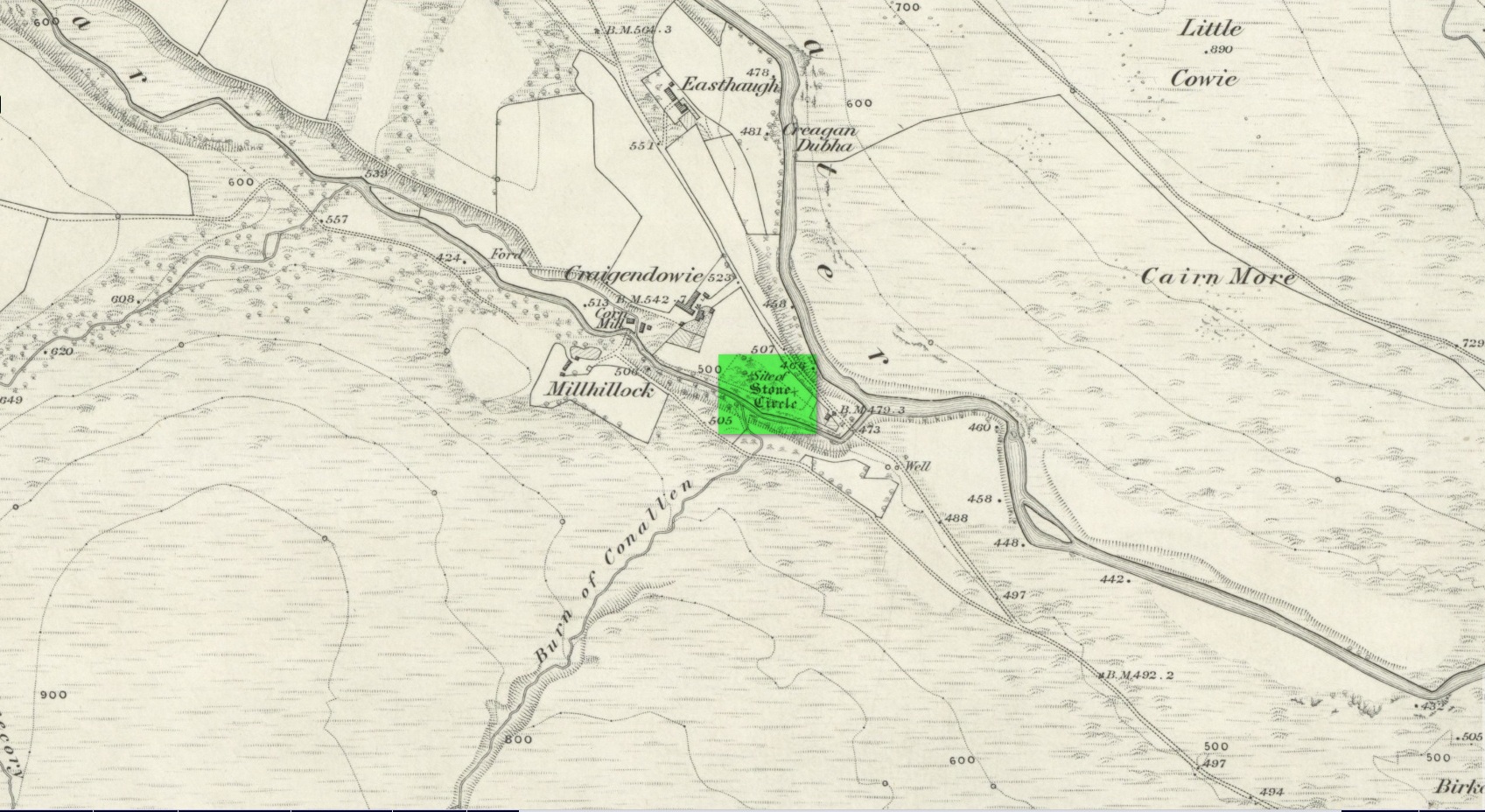
Stone Circle (destroyed): OS Grid Reference – NO 5225 6924
Archaeology & History
All remains of this stone circle have long since bitten the dust. It was already described in the past tense when Alexander Gardner wrote his summary of the parish in the New Statistical Account in 1843 where he told that, “there are the remains of two or three small Druidical temples, one at Newbigging, one at Blairno, and one said to have been at Craigendowie, but now demolished.”
A few years later Andrew Jervise (1853), in his classic tome on the Mearns, gave us the best description of the place, based either on his own personal visit here, or one given to him by a local when he was surveying the history of the area. He wrote:
“In the vicinity of Craigendowie … among the mass of artificial-looking cairns (which are said to be the graves of warriors), there was a small circle, composed of a quantity of stones about the same size, and ranged in the same manner, as those at Fernybank…. Unlike the latter, this circle was never thoroughly explored, even at the time of its removal more than forty years ago, and if as old as prehistoric times, it cannot now be said in how far it may have been a place of sepulture. Craigendowie has, perhaps, its true etymon in the Gaelic Craigandubh, or “the black rock,” for the craig is an immense black rock close by the river-side; but, according to a truer etymology, as well as popular story, it implies the “rock of the funeral cairn,” or perhaps the “craig of battle or mischief;” and, if any reliance can be placed on the tales regarding the malicious actions of the kelpie in the dark pool beside it, or in the story of warriors having fallen in the neighbourhood, the latter rendering may not be altogether inept!”
When the Ordnance Survey lads wrote about it their Name Book (1861) they told simply of its memory, saying,
“There is now nothing remaining to mark the site except a portion of the ground being still uncultivated, nor is there any person who recollects seeing any remains. It is supposed to have been demolished in making an old road through it, the track of which is still plain.”
And, later still in Cruikshank’s (1899) major work on Lethnot township he added little extra information other than saying that “it was situated in the field in front of the farmhouse (but) is entirely destroyed.”
References:
-
Cruikshank, F., Navar and Lethnot: The History of a Glen Parish in the North-east of Forfarshire, Black & Johnston: Brechin 1899.
- Jervise, Andrew, The History and Traditions of the Land of the Lindsays in Angus and Mearns, Sutherland and Knox: Edinburgh 1853.
- Royal Commission on the Ancient and Historical Monuments of Scotland, The Archaeological Sites & Monuments of Central Angus, Angus District, Tayside Region, HMSO: Edinburgh 1983.
- Warden, Alex J., Angus or Forfarshire: The Land and People – Descriptive and Historical – volume 4, Charles Alexander: Dundee 1884.
Acknowledgements: Huge thanks for use of the Ordnance Survey map in this site profile, reproduced with the kind permission of the National Library of Scotland.
© Paul Bennett, The Northern Antiquarian
The map could not be loaded. Please contact the site owner.