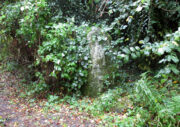
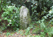
Standing Stone: OS Grid Reference – NO 1883 1610
Also Known as:
Getting Here

Along the main A913 Perth Road that runs round the northern edge of Abernethy village, as you approach the village from the western side, go right at the mini-roundabout up the Main Street into the village. However, just where this roundabout is, there’s a footpath into the trees known as the Castlelaw. Walk up here, keeping to the left-side of the burn (don’t cross over onto the right-hand side!) and after about 200 yards or so, keep your eyes peeled for a large upright stone, almost overgrown in dark vegetation on your left.
Archaeology & History
An intriguing standing stone in a most unusual position: a small wooded glen with a steep slope on its immediate eastern side, very enclosed. It’s quite a big thing too, standing some six-feet high with the usual worn rounded crown, typical of olde stones.

In the very brief account of this site by Hallyburton & Brown (2000) they describe this “previously unrecorded /lost standing stone and possible ruinous stone circle.” This is also echoed in Canmore’s description. A standing stone we certainly have, but in several visits here there was no evidence of any stone circle either side of the burn. It was suggested that the “circle” may once have been atop of the slope immediately above this stone, but again there is no evidence at all to suggest this and old maps show nothing. I’m extremely doubtful of any megalithic ring here (I’d love to be wrong though).
References:
- Hallyburton, I. & Brown, R., “Abernethy Den (Abernethy Parish),” in Discovery & Excavation Scotland, New Series – volume 1, 2000.
© Paul Bennett, The Northern Antiquarian
The map could not be loaded. Please contact the site owner.