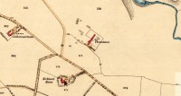
Standing Stones (destroyed): OS Grid Reference – NS 6957 4524
Archaeology & History
It seems that nothing remains of the three standing stones that gave rise to the place-name of Threestane Farm, at the top of Threestane Lane, on the northwestern outskirts of Strathaven. We have no details on the size and form of the stones, nor when they were destroyed, but can presume that it was sometime prior to the Ordnance Survey lads coming here in 1858.
One local antiquarian, Maggie Overett, told that, “Slightly to the north east of Threestanes farm and near to the A726 Strathaven to East Kilbride road used to stand a farm called Westfield(still currently shown on my Google Earth) it was demolished over a year ago. Just behind what was the farm is a slight incline with what appears to be a standing stone. I have not been able to gain access to the site because of barriers put up by whoever owns the plot…… But it’s close enough to tie in the Threestanes estate…….and only a short distance from the known Strathaven Stane.”
Any further information about these lost monoliths would be greatly appreciated.
References:
- Bryson, J.M., Handbook to Strathaven and Vicinity, Townehead: Strathaven n.d.
© Paul Bennett, The Northern Antiquarian
The map could not be loaded. Please contact the site owner.
