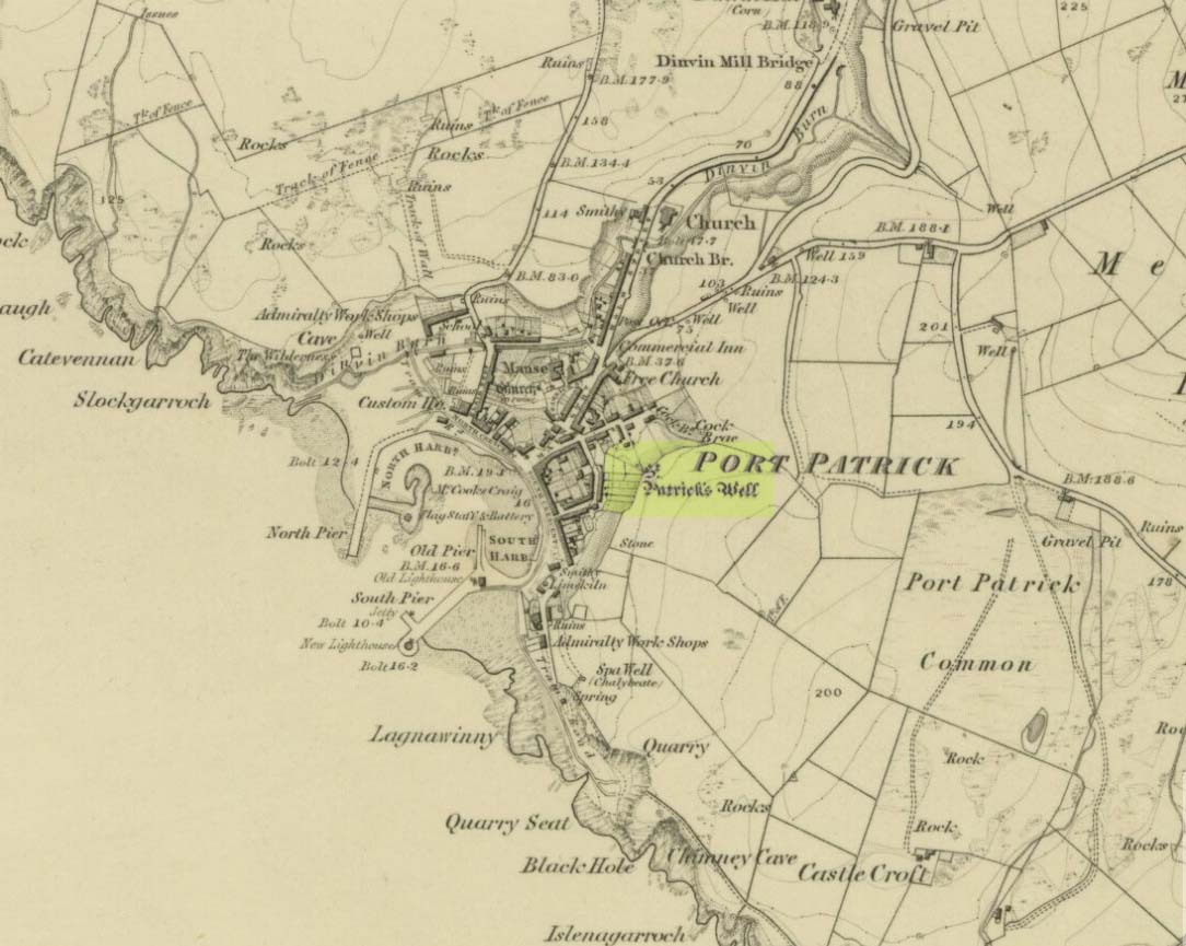
Holy Well (destroyed): OS Grid Reference – NX 0010 5412
Also Known as:
Archaeology & History

This long-lost holy well was located on the southeast side of the town. It was highlighted on the first OS-map in 1849, but its waters were disrupted shortly after this. Daniel Conway (1882) told that,
“It flowed where there was a quarry used for the harbour works. The writer of this notice heard from two men, John Mulholland and Owen Graham, dwelling at Portpatrick in 1860, that they had seen on the rock beside the well what tradition said was the impression of the knees and left hand of St. Patrick.”
When the holy wells writer E.M.H. M’Kerlie (1916) came to visit this site, it was “no longer to be seen.” He wrote:
“The water which issued from a rock on the south side of the village is now diverted by means of pipes into another course.”
References:
- Agnew, Andrew, The Agnews of Lochnaw: The History of the Hereditary Sheriffs of Galloway, A. & C. Black: Edinburgh 1864.
- Agnew, Andrew, The Hereditary Sheriffs of Galloway – volume 1, David Douglas: Edinburgh 1893.
-
Conway, Daniel, “Holy wells in Wigtonshire,” in Archaeological & Historical Collections Relating to Ayr & Wigton, volume 3, 1882.
- Harper, Malcolm MacLachan, Rambles in Galloway, Edmonston & Douglas: Edinburgh 1876.
- M’Kerlie, E.M.H., Pilgrim Spots in Galloway, Sands: Edinburgh 1916.
- MacKinlay, James M., Folklore of Scottish Lochs and Springs, William Hodge: Glasgow 1893.
- Morris, Ruth & Frank, Scottish Healing Wells, Alethea: Sandy 1982.
-
Royal Commission Ancient & Historical Monuments of Scotland, Inventory of Monuments and Constructions in Galloway – County of Wigtown, HMSO: Edinburgh 1912.
- Walker, J. Russel, “‘Holy Wells’ in Scotland,” in Proceedings of the Society of Antiquaries of Scotland, vol.17 (New Series, volume 5), 1883.
© Paul Bennett, The Northern Antiquarian
The map could not be loaded. Please contact the site owner.
Reblogged this on Irish history, folklore and all that.