Legendary Rocks (destroyed): OS Grid Reference – NO 3813 5496
Archaeology & History
Like many rocking stones across the British Isles that were written about by early 18th and 19th century authors, the ones at Kirriemuir have fallen prey to the vandalism of those people (christians, Industrialists and other self-righteous fools) that has so blighted our heritage, and ancestral history, with an intolerance of indigenous beliefs and remarkable geological formations. But, I suppose, at least we have a record of them, which at least in some way gives us the ability to add further our knowledge of the traditional practices of our peasant ancestors and their perception of the landscape.


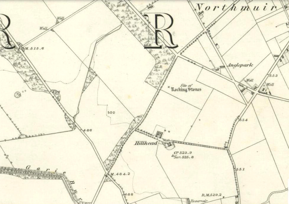
The exact location of the legendary rocks were highlighted on early Ordnance Survey maps, thankfully; and there were in fact two rocking stones here, very close to each other by the sound of it. Mentioned only in passing by E.S. Valentine (1912), the place was best described in A.J. Warden’s (1884) massive history work on the region. He told that:
“On the top of the Hillhead, Kirriemuir, there were two fine specimens of these interesting memorials, upon which the dwellers in the district looked with wonder and awe. These time honoured monuments of a long past age were, in 1843, blasted with gunpowder, and the shattered pieces used in building dykes and forming drains, to the deep regret of antiquarians, and of the inhabitants of the district. …These stone memorials of a remote age are thus described by the Rev., T. Easton, D.D., in the new Statistical Account of the parish — ‘The one of them is a block of whinstone, nearly oval, and is three feet three inches in height, and four feet ten inches in breadth. The other, of Lintrathen porphyry, is two feet in height, eight feet in length, and five feet in breadth.’ He gives no description of the bases upon which the magic pivots moved, or other details of them.”
About a half-mile east you would have looked across at the large standing stone on Kirriemuir Hill, which legend asserts was once a stone circle (it too, destroyed). If anyone has any further information about these old stones, please let us know…
References:
- Valentine, E.S., Forfarshire, Cambridge University Press 1912.
- Warden, Alex J., Angus or Forfarshire: The Land and People – Descriptive and Historical – volumes 1 & 4, Charles Alexander: Dundee 1880-1884.
© Paul Bennett, The Northern Antiquarian
The map could not be loaded. Please contact the site owner.