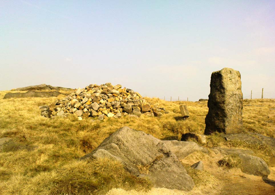
‘Standing Stone’: OS Grid Reference – SD 97329 17069
From Littleborough, take the Ripponden and Halifax A58 road up-uphill till you get to the White House pub near the very top. From here, cross the road and walk along the track below the disused quarry for a coupla hundred yards till you meet with the straight uphill track. Go up here and, near the very top, you’ll see the upright stone right beside the footpath on your left.
Archaeology & History

This ancient boundary stone has long been an etymological oddity. It aint a prehistoric stone by any means (soz…), though its nature has never truly been decided for sure. Some have posited it as Roman in origin, others that it’s merely a waymarker (in case y’ get lost in the fog up here), others that it’s a milestone, and the more common notion is that it’s a boundary marker of the counties of Yorkshire and Lancashire (it’s position in the landscape presently sits it in Lancashire). As far as I’m concerned, the stone’s late-medieval in nature…
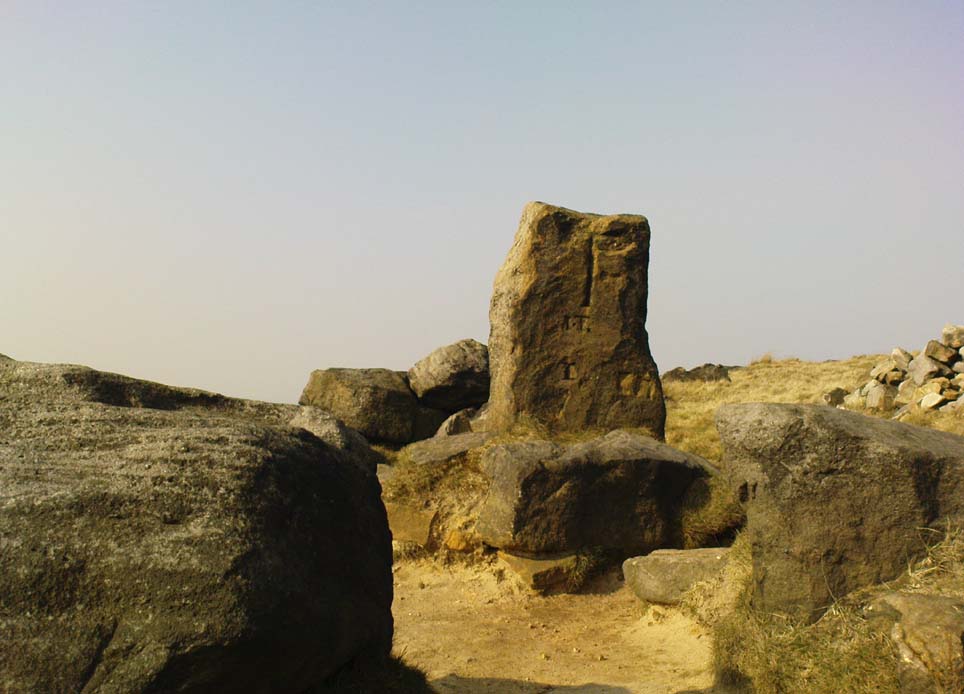
Standing by the old Roman road a short distance from the very top of these high Pennine hills on the Yorkshire-Lancashire border, a faint old Latin cross, plus the letters “I.T.” are etched onto its sides. In the 1930s the stone was found laid in the moorland heather, but was thankfully resurrected in 1933. Since then however, it’s been knocked over a couple more times, but presently stands proudly upright — until the day comes when some other halfwits decide to knock it down again! In its earlier days, James Maxim (1965) described the stone thus:
“It is an irregular block of gritstone 7 feet long, tapering from 2 feet 6 inches to 2 feet wide and it is about 10 inches thick. On one bedding face and a few inches from the top is an incised cross with the ends of the arms slightly expanded. This is 1 foot 4 inches long and 10 inches wide, the horizontal bar crossing the vertical at about 5 inches from its upper end.”

First highlighted on an engineer’s map from 1800, Herbert Collins (1950) assumes Aiggin to be “a corruption of Agger”, being a Latin word meaning, “a pile, heap, mound, dike, mole, pier – in Roman antiquity, an earthwork or other artificial mound or rampart.” Due to the monolith’s proximity to the supposed Roman road there is great likelihood in it being as such, plus “agger” can also mean a Roman road or military way. Collins cites other possibilities: aggerere, “to bear to a place, to heap up,” or “that which is gathered to form an elevation above a surface” – which is certainly applicable here! James Maxim (1965) thought,
“The name ‘Aiggin’ suggests a pronunciation resembling either ‘edge’ or ‘hedge’ and thus it might mean ‘Edge Stone’. Alternatively it could be derived from the French ‘aguille’, meaning a needle or sharp-pointing rock.”
The view from here is truly excellent — though if you walk to the rocky crags of Blackstone Edge a half-mile to the south (y’ can’t miss ’em from here) and sit by Robin Hood’s Bed, it gets even better! A smaller, possible standing stone can be seen just 200 yards northwest of our Aiggin Stone; with the top of the stone seemingly knocked off in bygone years. Not far from here are the remains of some old hut circles, emerging from beneath the old landscape.
References:
- Collins, Herbert C., The Roof of Lancashire, J.M. Dent: London 1950.
- Maxim, James L., A Lancashire Lion, J.L. Maxim Trustees: Leeds 1965.
Links:
© Paul Bennett, The Northern Antiquarian
The map could not be loaded. Please contact the site owner.