Standing Stones: OS Grid Reference – SD 9954 2199
Also Known as:
-
Turley Holes Moor Standing Stones
Getting Here

Get right to the top of the valley, past the end of the tree-line where the moor opens up ahead of you. Keep going till you reach the farmhouse on the left (there are usually sheepdogs outside, barking their heads off!). Take the track on the right, making sure y’ close the gate (the farmer here is infamous – so please shut the gate!). Cross the yummy stream at the bottom & double-back on y’self. If or when y’ reach the derelict house (an old shooting house), drop down the small valley, over the stream and stick to the bottom edge of the slope. (if y’ don’t reach the house, just cross the stream and keep to the contours) Keep walking for about 200 yards, keeping your eyes peeled for some uprights!
Archaeology & History
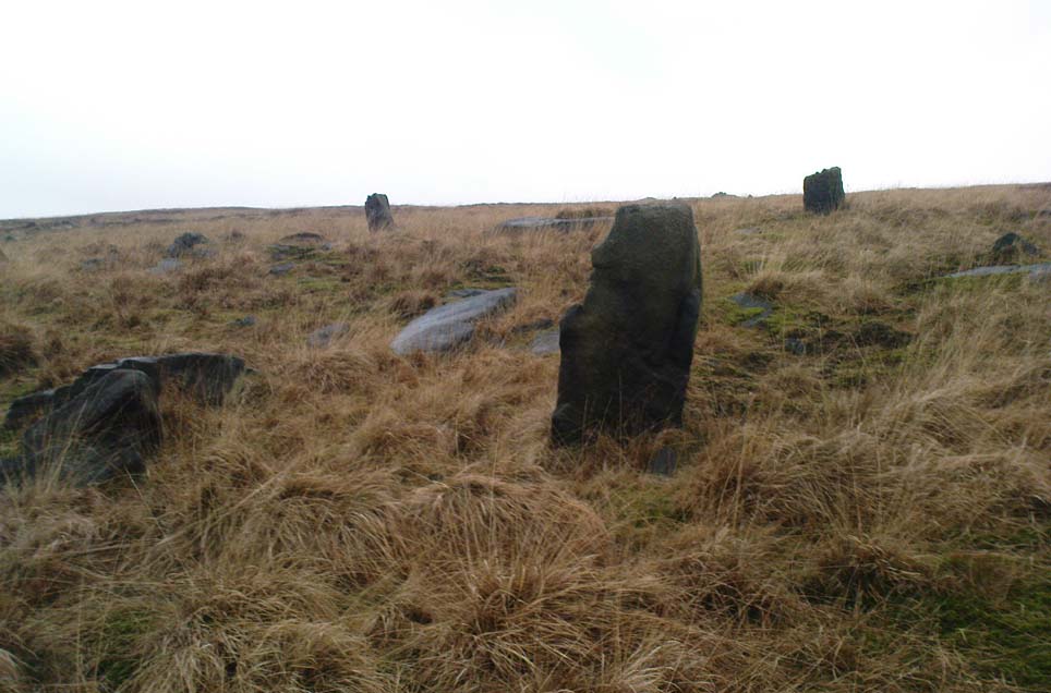
As with the Turvin Stone a half-mile southwest of here, this too is a very peculiar site. ‘Peculiar’ inasmuch as no-one really seems to be able to make head or tails what the place actually was. As you’re approaching the place, it looks like some decent ‘four-poster’ stone circle is ahead of you; but once you reach the place there are a veritable number of other earthfast rocks and tumbled stones all round, making your initial appraisal of the place suddenly grind to a halt! Added to this is the oddity of finding the standing stones on a considerable geological slope, unlike most other megalithic sites in the region (and elsewhere for that matter!).

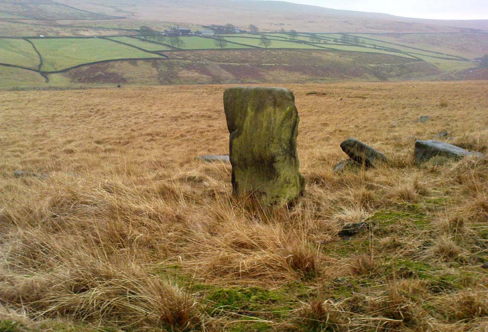
The tallest, easternmost of the three stones (SD 99547 21992) is more than five-feet tall and is lower down the slope than the other uprights here. Almost ‘surrounded’ by some denuded stone enclave (a large robbed cairn perhaps?), this is the most visually impressive of the stones here. Up the slope from here 15 yards (13.56m) away is what may, or may not, be a simple earthfast boulder (at SD 99535 21999): but it’s upright, about 3 feet tall, and due to proximity gives the impression that it was part of whatever monument this site once was. Due west of the tallest standing stone nearly 20 yards (17.6m) away, is a more rounded stone of ‘female’ character, less than 4 feet tall (at SD 99528 21993). That’s the general gist of the place.
If you visit here you’ll notice another smaller upright a short distance further down the slope in the green, less than three feet tall And there’s possibly another one of similar stature more than 200 yards SSE. But what is this place? Is it prehistoric? Was it built in the Dark Ages? Medieval times? Does anyone have a clue!?
References:
- Bennett, Paul, The Old Stones of Elmet, Capall Bann: Milverton 2001.
- Burl, Aubrey, Four Posters: Bronze Age Stone Circles of Western Europe, BAR 195: Oxford 1988.
© Paul Bennett, The Northern Antiquarian
The map could not be loaded. Please contact the site owner.