Settlement: OS Grid Reference – SE 003 652
Also known as:
- The Circus
- Druid’s Altar
- Druid’s Circle

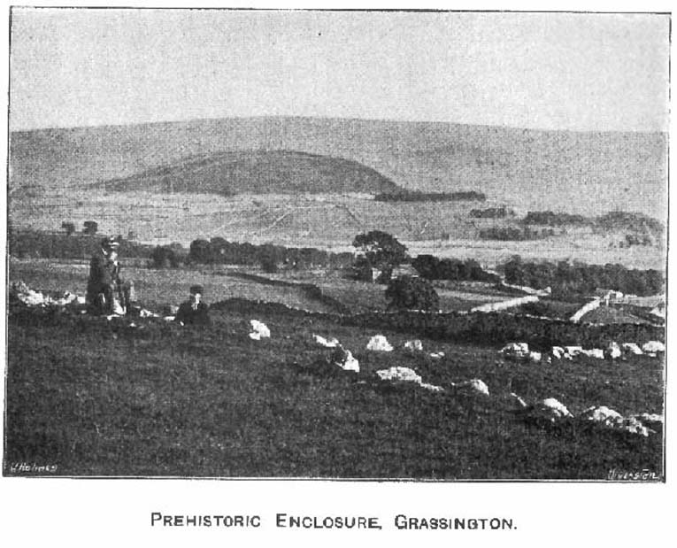
Easy enough to locate. In Grassington go up the main street a coupla hundred yards, turning left up past the small church, taking the footpath on your right heading up to the fields that stretch to the north. Don’t mistake the remains of the medieval village that you’ll pass for the Iron Age and Romano-British site that we’re heading for, another coupla hundred yards up. You’ll notice a lot of old low walling structures on the slopes heading up above you. That’s the stuff!
Archaeology & History
Despite the industrial devastation of the landscape on the hills around here, this entire area still teems with prehistoric archaeological remains, making you wonder just how much more once existed in this region. In bygone days Prof Anne Ross thought this region to be the capital of northern England in Iron Age days. She could be right: in just about every nook and cranny of small valleys and rivulets we find evidence of ancient people everywhere for miles around, settlement upon settlement in every direction you take. The remains found here at High Close Pasture typifying the examples any ardent antiquarian will come across in this region of upper Wharfedale.


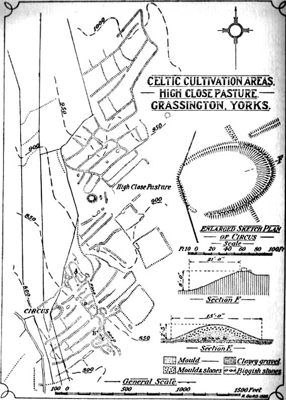
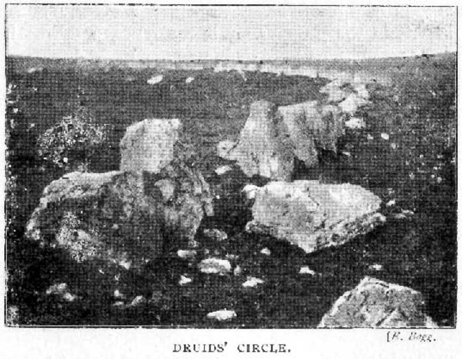
The settlement remains and ancient cultivations at High Close have been described by various writers over the last hundred years, with Edmund Bogg (1902) calling the most notable of the remains here the ‘Druid’s Altar’ (not to be confused with the other Druid’s Altar at nearby Bordley); a title that was similarly described as “The Druid’s Circle” when Eliot Curwen surveyed the area. It is also locally known as ‘The Circus’, after it being a place where celebrated events once took place. This Druid’s Circle section is,
“an oval area 150 feet long by 75 feet wide. It consists of a bank surmounted by a single or double-row of flat-topped stones about one-and-half feet high by 2 feet wide… This may have been a communal meeting place of the Iron Age folk, who cultivated these fields, and who lived in isolated huts.” (Elgee & Elgee 1933)
The notion of the circle being a communal meeting place was echoed by Mr Curwen (1928) in his slightly more detailed description of this place. He told that the interior of the Druid’s Circle had been levelled:
“It lies eight feet below the surrounding banks to the northeast and east, to which it rises with a gradient of 8 in 21. The bank to the north is less high, while to the south and west the arena, while seperated from it by the bank, is above the level of the sloping hillside. The encircling bank is surmounted by a single (and) double row of stones for three-fourths of its extent. These are apparent to the east and south, but are less so to the west, as along this side a stone wall has been built actually along the bank of the Circus; the stones belonging to this bank are, however, quite clear below the footings of the wall. From northeast round by south to southwest the row of stones is double. Those in the inner row, forty-six in number, stand some eighteen inches high; they are about two feet wide and are flat-topped, the line is almost continuous, and in parts the stones are placed edge to edge. A second row of smaller stones backs the larger ones. Entrance is obtained to the central level area by a gap to the southwest. No fosse surrounds this earthwork. To the southeast, a lynchet four feet high runs off it, while to the north a low stoney bank runs off in a NW direction, and one of the larger stony banks approaches to within a few feet of the northwest.”
In the fields above, particularly on the east and north of this notable ruined stone ring, the extensive “cultivation pastures” as they’ve been called, are evident all over the place. Hut circles and copious other antiquities can all be found within a square mile of this spot. If you like your Iron Age archaeology, this area will knock yer socks off!
…to be continued…
References:
- Bogg, Edmund, Higher Wharfeland, James Miles: Leeds 1904.
- Charlesworth, Miss D., ‘Iron Age Settlements and Field Systems,’ in Archaeological Journal, volume 125, 1968.
- Curwen, Eliot, ‘Ancient Cultivations at Grassington,’ in Antiquity, June 1928.
- Elgee, Frank & Harriett, The Archaeology of Yorkshire, Methuen: London 1933.
- Raistrick, Arthur & Chapman, S.E., ‘The Lynchet Groups of Upper Wharfedale, Yorkshire,’ in Antiquity, June 1929.
- Speight, Harry, Upper Wharfedale, Elliott Stock: London 1900.
© Paul Bennett, The Northern Antiquarian
The map could not be loaded. Please contact the site owner.
Superb work Paul
We shall be doing a new survey of this site in November – will post-up our findings in FORUM
Keep up the good work
john