Cairns: OS Grid Reference – SE 166 512
Get here before the heather grows back! From the Askwith Moor parking spot, walk up the road (north) and turn left on the moorland track, past the triangulation pillar, then the ranger’s hut on the edge of the hill, and head WNW along and down the gradual slope. You’ll get to a row of grouse butts after a few hundred yards and, if you’re lucky to find it, an old OS trig-marked arrow carved on one of the low-lying stones. This stone is about 10 yards away from the cairn!
Archaeology & History
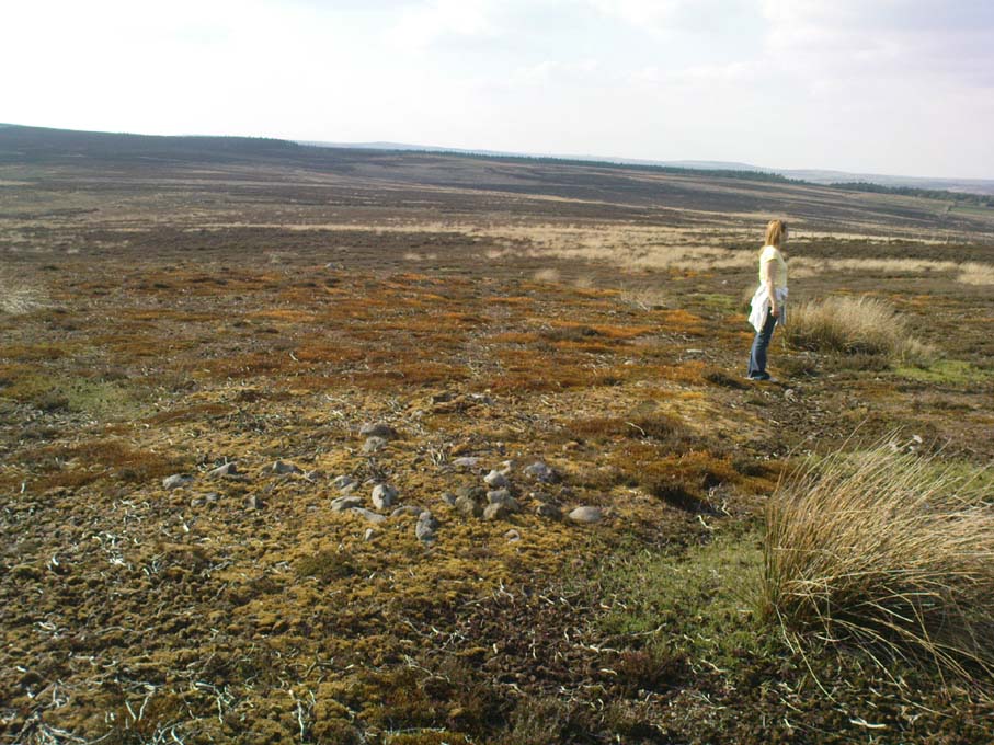
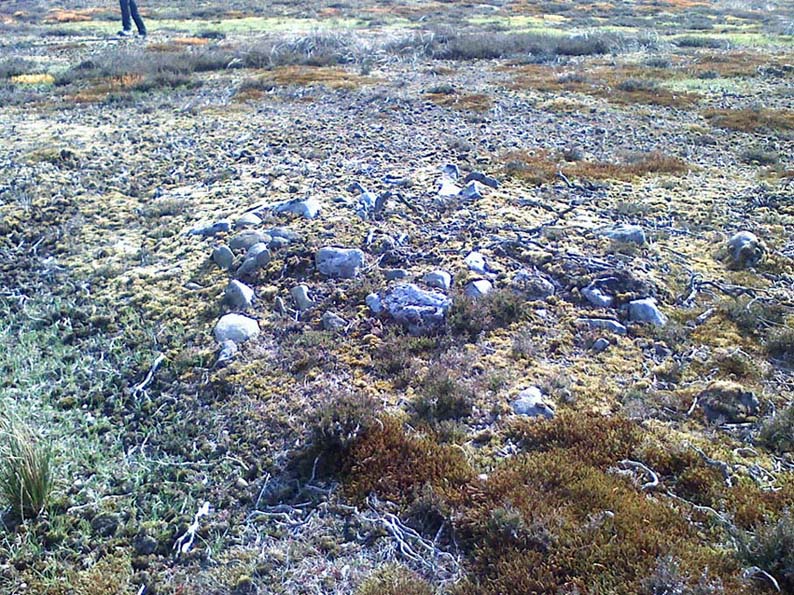
There are no previous references to this site. It was discovered by the hardworking Keighley volunteer, Michala Potts of Bracken Bank, on May 20, 2010, and was the most visible of at least three prehistoric cairns on the sloping edge of this hill. The main one illustrated here is about 3 yards in diameter and only a foot or two high. Typical of the many Bronze Age cairns scattering the moors north and south of here, several others are in close attendance. It seems as if some of the stone from this cairn has been robbed to build some of the grouse-butts that stretch across the moors hereby.


About 50 yards away from the main cairn shown in the photos are a couple of others of the same size and nature. And if we walk over the other side of the nearby rounded hill immediately south, a couple of other cairns are in evidence. However, we didn’t spend too much time here getting any images, as other sites on the moor were beckoning and we were running out of good daylight!
The name of this area seems a little odd: “High Low” — and our old place-name masters say little about it in the Yorkshire directories. The name is shown in the earliest large-scale OS-maps, but the contradiction of a high low ridge probably derives from the word originally being lowe, or “hlaw”: which as A.H. Smith (1956) said,
“In (old english) the common meaning in literary contexts is ‘an artificial mound, a burial mound,'”

which is exactly what we have found here — or several of them scattered about. This tumulus derivation is echoed by modern place-name authorities like Margaret Gelling (1988), etc. Gelling told how the word hlaw, or low, and its variants, “was used of burial mounds over a wide area, from the south coast to the West Riding.” Much as we’ve found on this hill at Askwith Moor! We’ve yet more exploring to do in and around this area in the coming weeks. God knows what else we’ll find!
References:
- Cowling, Eric T., Rombald’s Way: A Prehistory of Mid-Wharfedale, William Walker: Otley 1946.
- Gelling, Margaret, Signposts to the Past, Phillimore: Chichester 1988.
- Smith, A.H., English Place-Name Elements – volume 1, Cambridge University Press 1956.
© Paul Bennett, The Northern Antiquarian
The map could not be loaded. Please contact the site owner.