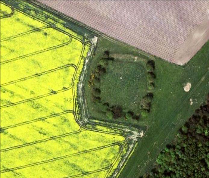
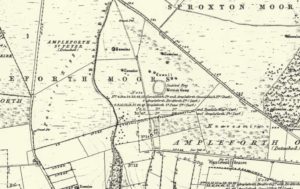
Enclosure / Settlement: OS Grid Reference — SE 58122 79855
Also Known as:
- Studford Ring

Pretty easy to find. From Ampleforth town centre, go left at the T-junction and 100 yards on a footpath takes you up into the sloping fields above the town. Follow the footpath up (avoiding the fall into the small wooded valley on your left) and keep going across the fields. Follow the path towards the point of the woodland on the level, then walk along its edge until you see a rounded copse of trees on your left, with a surrounding ditch. You’ve found it! (if you hit the road, turn back & walk 100 yards)
Archaeology & History
Thought to have been first constructed in the late Bronze Age period, in 1963 R.H. Hayes described this site as being “the finest enclosure type of earthwork in the district,” telling:
“It is roughly quadrangular, some 54 yards across, rampart to rampart, with internal ditch 12ft wide and in places still 4ft in depth. The rampart is 24-26ft wide and 9-10ft high above the bottom of the ditch. It is of earth and rubble with an entrance 9ft wide on the ESE. One gets the impression that the central area is a araised platform above the level of the surrounding moor.”

At the time of Hayes’ description, conclusions about the purpose of this site were difficult. He drew parallels between this and two other sites in northeast Yorkshire: one on Great Ayton Moor and another near Borrowby on Newton Mulgrave Moor.
On the outside of the ‘enclosure’ he described “a curious turf (?) bank 6ft wide and 2ft high which curves around the tumuli to the northeast, following the ditch of one of them, thence to another mound 32ft in diameter north of the Ring, whence it turns due west and runs towards a dewpond in the junction of three turf walls,” finally adding, “It could be connected with ancient cultivation.”
According to Eilert Ekwall (1922), the name Studfold probably derives from,
“‘Stodfalod’, which is a common name for old Roman (or other) enclosures. The name indicates that the Anglo-Saxons often used such old enclosures for horsefolds.”
Place-name master A.H. Smith (1956) reinforces this and tells us the dates of this name are even later; describing,
“stod-fald OE, ‘a stud-fold, a horse enclosure’; the word is often applied to ancient enclosures which the Anglo-Saxons used for horse-folds.”
Modern archaeo’s have added the etymologist’s notion of a ‘horse enclosure’ onto their summaries of the site in recent years.
…to be continued…
References:
- Ekwall, Eilert, The Place-Names of Lancashire, Manchester University Press 1922.
- Hayes, R.H. ‘Archaeology: Dikes and Earthworks,’ in J. McDonnell’s A History of Helmsley, Rievaulx and District, Stonegate Press: York 1963.
- Smith, A.H. English Place-Name Elements, II, Cambridge University Press 1956.
- White, Stanhope, The North York Moors: An Introduction, Dalesman: Clapham 1979.
Acknowledgements: Huge thanks to Martin Dawes for correcting my initial erroneous route to the site.
© Paul Bennett, The Northern Antiquarian
The map could not be loaded. Please contact the site owner.