Cup-and-Ring Stone: OS Grid Reference – SE 10887 51381

From the back of Moor End Farm on the south-side of Langbar village, follow the Long Ridge footpath up onto the moor. Walk along the path until its starts dipping down again, onto the moor proper and where another footpath crosses and goes down into the small valley of the Dryas Dike stream, follow it – though only for about 75 yards, heading diagonally into the heather slowly towards the stream. You’re getting close!
Archaeology & History

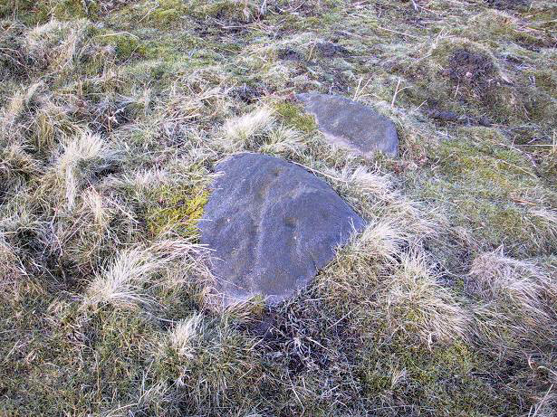
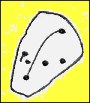
Yet another small carving found amidst a decent cluster of cup-and-rings and other archaeological remains near the top of Dryas Dike, this stone was first described in the Boughey & Vickerman (2003) survey. It’s located about 10 yards below Middleton Moor CR-440, above the stream of Dryas Dike. It’s a simple design, comprising of a central groove with a cup at either end and several other cups either side of this central line. (cheers to Richard Stroud for use of his photo).
References:
- Boughey, Keith & Vickerman, E.A., Prehistoric Rock Art of the West Riding, WYAS 2003.
© Paul Bennett, The Northern Antiquarian
The map could not be loaded. Please contact the site owner.
Just a few metres to the north east of this are two boulders either side of the path forming what looks like a natural gateway. The right stone has many small (1/2″) cups or drill marks in the vertical south-facing side. They’re quite well-defined, so may be relatively recent.