Cup-and-Ring Stone: OS Grid Reference – SE 10983 43368
Also Known as:
- Carving no.99 (Boughey & Vickerman)

From East Morton village, take the moorland road, east, and up the steep hill. Where the road levels out there’s a left turn where a trackway leads onto the moor. Go up here & keep walking till you hit a moorland ‘footpath’ signpost. Stop here and walk due west (your left) onto the gently sloping rise and into the mass of the Stanbury Hill enclosure system. Keep walking for 200 yards or so, where the land begins to slope down to the end of the spur; and just 50 yards before it drops down to the stream below you’ll find a cluster of carved rocks like the Lunar Stone, the Teaspoon Rock, Spotted Stone, etc, all scattered about. Near these, you’ll find this one!
Archaeology & History
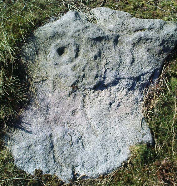
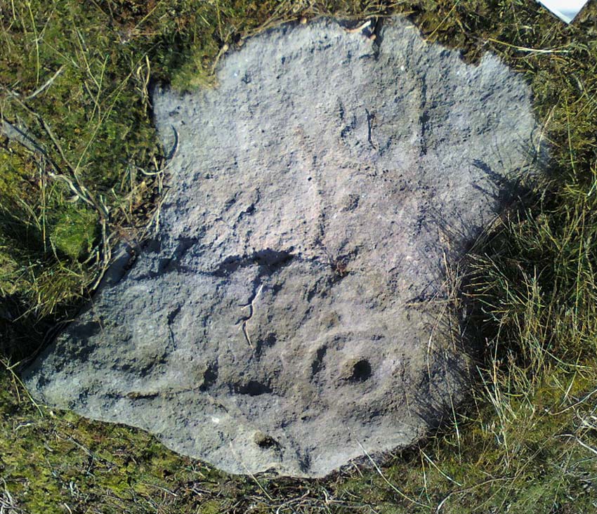
Not to be confused with the carving of the same name on the northern side of these moors (near the Green Crag Slack enclosure), this carved rock gets its name specifically from looking like a lay-out plan of some settlement or enclosure. It’s unlikely that this title or description has anything to do with the carving, but its the impression it gave me when I first saw it! But then once you look at the carving from another angle it takes on a different impression.

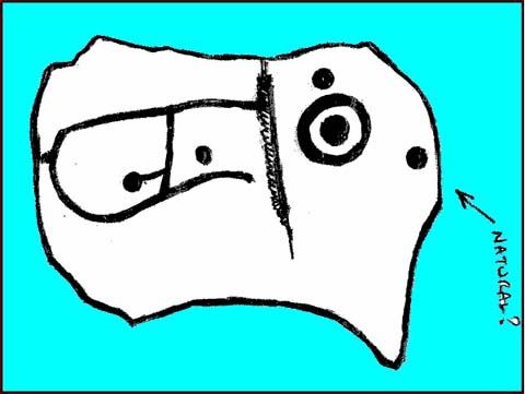
First thought to have been found by Stuart Feather in 1978, it is one of many carvings that occur in what seems to be an extensive prehistoric enclosure or settlement. There’s a complete cup-and-ring near the western end of the rock, with another distinct cup-marking by its side, and what looks to be a natural cup at the top-end of the stone. But it was the other section of the carving on the central and eastern side which intrigued me: a curious ‘enclosure’ of lines, with a cup-marking in each section. Cutting between the cup-and-ring and the enclosure lines is a natural long crack or fissure running roughly north-south through the rock. It seemed to me (though I could be wrong) that a line had been pecked running along this natural crack — although in Boughey & Vickerman’s (2003) drawing they don’t highlight this. It also seemed that the carved lines from ‘enclosure’ linked up to the pecked line that was carved along the natural fissure in the rock (as illustrated in my crap drawing!).

As with the Lunar Stone nearby: it appears that either this stone was carved at different periods; or else for a long period of time much of the stone was exposed to the elements, whilst a section of it remained covered. For the distinct cup-and-ring on the western-end is more worn, with more eroded evidence of pecking, than the extended lines on the eastern end of the rock. I need to go back here and get some better images — and certainly do a much better drawing!
References:
- Boughey, Keith & Vickerman, E.A., Prehistoric Rock Art of the West Riding, WYAS 2003.
- Hedges, John (ed.), The Carved Rocks on Rombalds Moor, WYMCC: Wakefield 1986.
© Paul Bennett, The Northern Antiquarian
The map could not be loaded. Please contact the site owner.