Tumulus: OS Grid Reference – SD 4596 6425
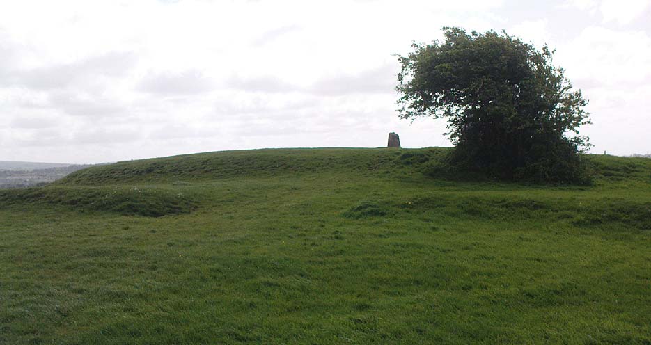
Various ways up this old hill, visible from all angles it seems. I came up via the housing estate near where us friend lives, near Bare Lane Station, through the houses and up the footpath. But you can just as easy (if not easier) walk up from the country lane and fields beneath its eastern side. Much nicer!
Archaeology & History

As many northerners will tell: gerrin information from the Lancashire archaeologists about prehistoric sites is troublesome (must be Southerners running the show!). There’s tons of stuff in this good county, but archaeo-info is pretty poor on the ground. This great old tomb for example, is designated as a “round barrow” on the Lancashire County Council monuments and records listing, but there’s no other info telling when it was dug, who by, the size of the tomb, what was found here, etc. Pretty poor to be honest (c’mon chaps – get yer fingers out!). The best info on-line comes from the more dedicated amateur enthusiasts.
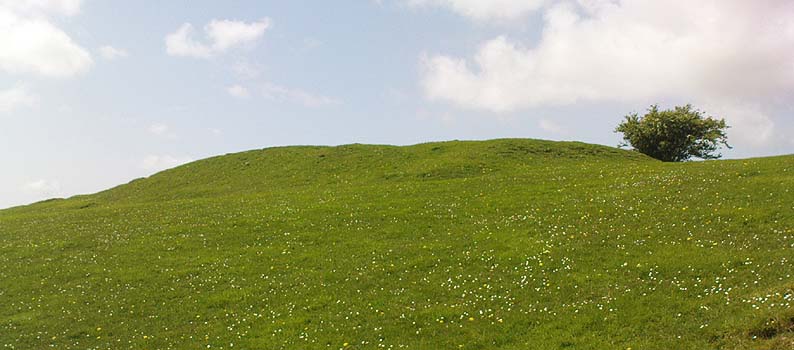
A local historian told us that there was nowt up here, but my nose told me otherwise — so up we tramped! It was pretty obvious once we’d got to the top here, that some ancient mound had been built up.
“This has all the hallmarks of a tomb,” I said.

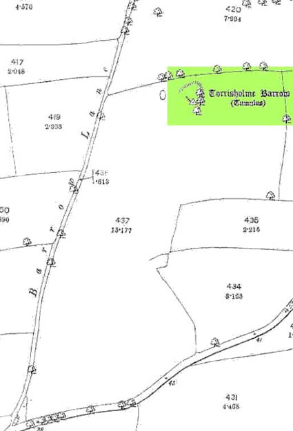
The spirit of the ancestor herein (whoever s/he was) had excellent views and flights to numerous important hills 360° all round here. A perfect place for a tomb! And when we returned into the Darklands of our Yorkshire abodes, we found this notion to be true. Marked on early OS-maps as a tumulus, next to the tell-tale giveaway route of Barrow Lane, there are passing mentions of it in a couple of old local history books I’ve come across, but I’ve yet to find much more about it. It’s a fine mound and of decent size, well worth checking out if you’re in the area. Once I get more details of the archaeological finds from here, I’ll add the data to TNA (but based on past performances and responses from Lancashire archaeo’s, I wouldn’t hold your breath…)
And for any Morecambe historians who might be able to find more: what — if anything — is known of the ‘Fartle Barrow’, now swallowed by the encroachment of the sea, just a few hundred yards west of here?
Folklore
In days of olde, this site was an old moot or meeting hill: one of the northern Law or council meeting hills. Quite how far back this gathering tradition up here goes, aint known. We do know however that there was a christian tradition enacted here, at Easter, of local church doods taking a cross up the top of the hill (does anyone know the story behind the old Cross Hill, half-a-mile south of here?). There’s obviously quite a lot more pre-christian activities occurrent round here than has been previously thought.
© Paul Bennett, The Northern Antiquarian

Visited this site yesterday (11*03*10, lovely setting and great views.
Inspected Roman floor And roofing tiles that had come from the side of the mound, now part of a feature in a nearby garden, along with an amount of Roman pottery. Some of the tiles bore stamp markings – ‘ALE SEBVSIA’ – Alae Sebosiana, a unit stationed at Lancaster in the mid-third century. The tiles were of local manufacture, poss’ Quernmore Roman kilns, SE of Lancaster.
There is a great deal of information about this site available from former Lancashire County Archaeologist, Ben J N Edwards, who now runs an Lancashire Archaeology Consultancy (LCC Quango).
There is a substantial fee for use of this service and to access their records.
So take a vaild Cretit or Debit card with you.
So it goes in these Consultancy times
I always wondered what buildings were originally in the woodland area. There is black & white tiles near the bottom quarter.
Hi Stev’
Let’s have another look at this site, What’d you say ?
Get in touch via this site (FORUM)
Best regards
john
I know what the building is in the woods – It’s the remains of a Victorian sanatorium – It also made a fantastic spot for campfires when we were kids 🙂
There doesn’t appear to have been that much excavation done on the site & it would be fantastic if there was – My parents live just around the corner from it & I have spent many hours on there wondering & now a number of the local pagans have started reclaiming it for use in ritual
Hi purpledragonslair and stevengbell… If you find any further details about the sanitorium in the woods please let me know… my Emaill address is: vmqbill@yahoo.co.uk
there used to be a sanitorium there. my nanna remembers it and my mum knows a bit about it too.
This site had a large wooden christian cross on it last year (at Easter, IIRR) for a week or so.
Fartle Barrow is marked on the 1:2,500 map as being a stonier area amongst the mud and sand below the HWM opposite the Town Hall, Morecambe, LA4 5AF.
I think I remember the building in the woods that is being called a sanatorium. We spent a lot of time there as children in the 50/60’s and if its the place I am thinking of it was used by the corporation to store the illuminations in during the months they were not used. The Church of Ascension in Torrisholme used to parade a huge cross through the village and put it on top of the Barrow each Easter.
I grew up here and still live in Torrisholme, originally on the original Hexham Road off BareLane
When they excavated for the foundation of the beginning of the next stage of Hexham , it was halted due to the finding of artefacts of historical interest , this was when I was around nine or ten maybe , 1968/9
My father made the original crosses , they used to put up three during the enactment of the Via Dolorosa , he was John
Pettigrew , a local joiner and undertaker
They are trying to build on the Barrows from the end of Fulwood drive ,oakmere homes .firtu stela , for now , it has been knocked back due to being a site of historical interest .
They have a.so sadly put in plans to build 600 houses alongside the bypass on the other side of hasty brow lane , so sad