Standing Stone: OS Grid Reference – SD 978 389
A bittova wander with not much to see, if truth be had. Best way here’s from the top Oakworth Road heading to the Lancashire border, right on the moor-edge. Go along the Hare Hill Edge road for a coupla miles till you hit the Pennine Way. Walk along it up onto the moor, following the dead straight walling for several hundred yards. Where the walling stops, all of a sudden, stop! (there’s a wooden post here) Now walk left (west) across the heath for less than 100 yards. You’ll find it…
Archaeology & History

I’ve found nothing of this site in archaeology records – but that’s likely down to me not looking hard enough! I’m not even sure that it’s prehistoric – but as there’s nowt written about it, and there are other sites which relate to this old stone, it’s certainly worthy of mention.
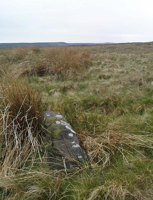
The stone lays in the grasses, some four-feet long, with a more recent 18th-19th century boundary stone laid a few feet away. It seems most likely that Old Bess had stood here much longer though. Old Bess seems to be the first in a row of at least 6 seemingly unrecognized boundary stones running northwest in a straight line up to the Wolf Stones, about half-a-mile from here. Neither the early, nor modern OS-maps show any of these stones, several of which are accompanied by earlier, more worn stones – two of which have the letters ‘C.C.’ or ‘G.C.’ carved on them.

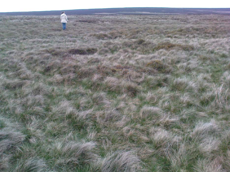
About 10 yards north of Old Bess are the remains of a very noticeable oval-shaped ‘hut circle’ – or something closely resembling such remains. About five yards across at the most, with stone walling making up the edge of the ring beneath the moorland grasses, an excavation here wouldn’t go amiss! Although it’s hard to see in this photo (it’s the roughly circular rise in the middle), when you’re on the moor it’s obvious. It looks and feels as if the remains were something from medieval times, or perhaps even later – but it’d be good to know for sure! The remains of an old delph 100 yards south may account for more of Old Bess and its accompanying hut circle than owt prehistoric.
From Old Bess, walk in a straight line towards the large rock outcrop of the Wolf Stones, northwest of here. After a short distance you’ll come across another large stone, cut and shaped in bygone centuries (not prehistoric though) laying in the boggy tussock grass and looking similar to Old Bess. Another 100 yards on from here, along the same straight line towards the Wolf Stones, you’ll find another cut stone of similar dimensions; and from here you’ll see another stone about the same distance again ahead of you. These would appear to be the lost medieval boundary stones which led to a boundary dispute between the counties of Yorkshire and Lancashire a few centuries ago. For those medieval historians amongst you, check ’em out: it would appear that these are the lost stones (pushed over, obviously) which led to the said dispute. How on earth no-one’s found ’em previously beggars belief!
Folklore
A little-known site with a spirit ancestor giving rise to its name. Surrounding it are tales of little people, for just above it is where the faerie lived at the Fairy Fold Dike. While a couple of hundred yards west lived an old hob (another faerie creature) who used to drink from an old well named after him, the Hob Ing Spring. Victorian lore tells of druidic folklore further up the moor by the old Wolf Stones, which is linked to Old Bess by virtue of the line of old boundary stones running from here.
© Paul Bennett, The Northern Antiquarian
The map could not be loaded. Please contact the site owner.
GC or CC stands for Gamel’s Cross or the corruption Camel’s Cross. Gamel was teh Anglo-Saxon Thegn who was Lord of the Manor at Oakworth (amongst other places). He was murdered by Tostig (brother of King Harold)and his death played a part in the run-up to the Battle of Hastings.
Gamel (b 995) was a son of the Dane, Orm of Cliviger and brother-in-law of Siward, Earl of Northumberland (1042-1055). Locally Gamel owned 15 carucates of land in Bradford, 10 in Carleton, 3 in Glusburn and 1 in Oakworth, in total 3,000 acres in addition to extensive lands across the North and Midlands.
Gamel was an officer in Harold’s army and a Northumbrian Nobleman, who had extensive lands in the Shires of York, Lincoln, Derby, Stafford, Salop, and Chester in addition to his extensive holdings in Craven. He had just one carucate and the Manor in Oakworth, albeit some distance from his principal manorial seat at Kirbymoorside.
Please note Old Bess is now upright [June 2014]
Took a walk up to Old Bess in September and it was not upright – unless I’m looking at the wrong stone! http://rblr.co/AilG
See photo on my blog
Old Bess is one of a number of stones erected to define the boundary between the manors of Oakworth and Keighley. The stone has the initials GC cut into it, which stand for George Cavendish who was the third son of the 4th Duke of Devonshire. He was granted the manor of Keighley by his father, probably in 1775 when he attained his majority. Under the Keighley Inclosure Act of 1780 George Cavendish was granted the land that is today known as Keighley Moor. Old Bess was probably marked GC at the time of the inclosure, along with at least two other stones which now lie recumbent some distance to the north west. It appears that Old Bess and the other two stones were deliberately pulled out of the ground and laid flat when they were replaced by a series of unmarked boundary stoops at the time of the Oakworth Inclosure in 1850. The unmarked 19th century enclosure stoops define the boundary between Oakworth and Keighley and Oakworth and Lancashire. Old Bess appears to have been a waymarker for the footpath now known as the Pennine Way and although now some distance from the footpath was re-erected in the Summer of 2014.