Cup-and-Ring Carving: OS Grid Reference – SE 1895 5099

Ellers Wood is at the very northern edge of the beautiful parish of Askwith and has a very particular ambience of its own. The small cluster of at least 5 cup-and-ring stones in this lovely little woodland gives you the impression that they stood out on their own, living here representing the genius loci of this luscious watery vale, all-but-hidden from all but the lucky few. It’s very likely that there are still more carvings hidden away nearby.
The best way to check them out is simply to walk down past the haunted Dobpark Lodge, where it turns into a footpath and where it crosses the lovely old packhorse bridge at the valley bottom, walk a few hundred yards up the river-side (at the bottom of the fields) until you reach Ellers Wood. Once there, look around. This one’s on the west side of the main stream, close by where it meets up with another small burn coming down from the western wooded slopes.
Archaeology & History

In the same region as the Ellers Wood 618 and other carvings and very close to the river, somehow this heavily cup-marked stone evaded the prying eyes of such notaries as Cowling, Stuart Feather and Sidney Jackson – all of whom ventured to look at the other petroglyphs in Ellers Wood. But with good fortune, Graeme Chappell and I re-discovered this fine-looking carving in our explorations in 1993-94 and gave it back the attention it truly deserves.
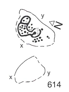
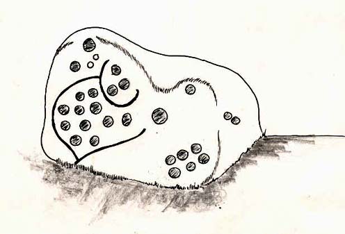
The main feature here is the clustering of cups into sections, as the drawing indicates. It is listed as “stone 614” in Boughey & Vickerman’s (2003) survey.
References:
- Boughey, K.J.S. & Vickerman, E.A., Prehistoric Rock Art of the West Riding, WYAS: Exeter 2003.
- Cowling, E.T., ‘A Classification of West Yorkshire Cup and Ring Stones,’ in Yorks. Arch. Journal 1940.
- Cowling, Eric T., Rombald’s Way, William Walker: Otley 1946.
- Cowling, E.T. & Hartley, C.A., ‘Cup and Ring Markings to the North of Otley,’ in Yorks. Arch. Journal 33, 1937.
- Grainge, William, The History and Topography of the Forest of Knareborough, J.R. Smith: London 1871.
- Grainge, William, History and Topography of the Townships of Little Timble, Great Timble and the Hamlet of Snowden, William Walker: Otley 1895.
© Paul Bennett, The Northern Antiquarian
The map could not be loaded. Please contact the site owner.